Downloaded 1,263 times
![Building a Spatial Database in PostgreSQL David Blasby Refractions Research [email_address] http://postgis.refractions.net](https://image.slidesharecdn.com/building-a-spatial-database-in-postgresql4543/85/Building-a-Spatial-Database-in-PostgreSQL-1-320.jpg)


![Questions David Blasby Refractions Research [email_address] http://postgis.refractions.net](https://image.slidesharecdn.com/building-a-spatial-database-in-postgresql4543/85/Building-a-Spatial-Database-in-PostgreSQL-52-320.jpg)
![Building a Spatial Database in PostgreSQL David Blasby Refractions Research [email_address] http://postgis.refractions.net](https://image.slidesharecdn.com/building-a-spatial-database-in-postgresql4543/75/Building-a-Spatial-Database-in-PostgreSQL-1-2048.jpg)


![Questions David Blasby Refractions Research [email_address] http://postgis.refractions.net](https://image.slidesharecdn.com/building-a-spatial-database-in-postgresql4543/75/Building-a-Spatial-Database-in-PostgreSQL-52-2048.jpg)

The document discusses building a spatial database in PostgreSQL using PostGIS. It provides an introduction to spatial data and databases, and explains why PostGIS was created - to provide an open source spatial extension for PostgreSQL that is compliant with OpenGIS standards. It covers key topics like spatial data types, spatial relationships, spatial indexing and functions, and implementing the OpenGIS specification in PostgreSQL.
Overview of PostGIS, a spatial extension for PostgreSQL, its compliance with OpenGIS standards, and developer information.
Key topics of discussion including spatial data, databases, and the addition of spatial extensions to PostgreSQL.
Reasons for PostGIS's necessity: lack of good open source alternatives, high costs of commercial options, and coding complexities.
Definition of spatial databases that store and manipulate spatial objects like traditional database objects.
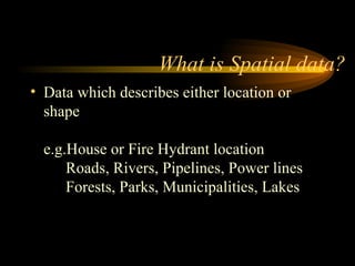
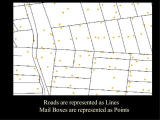
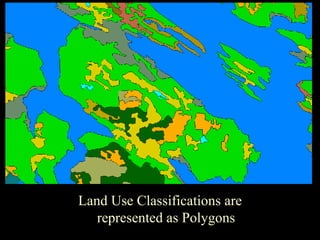
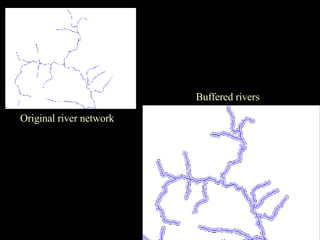
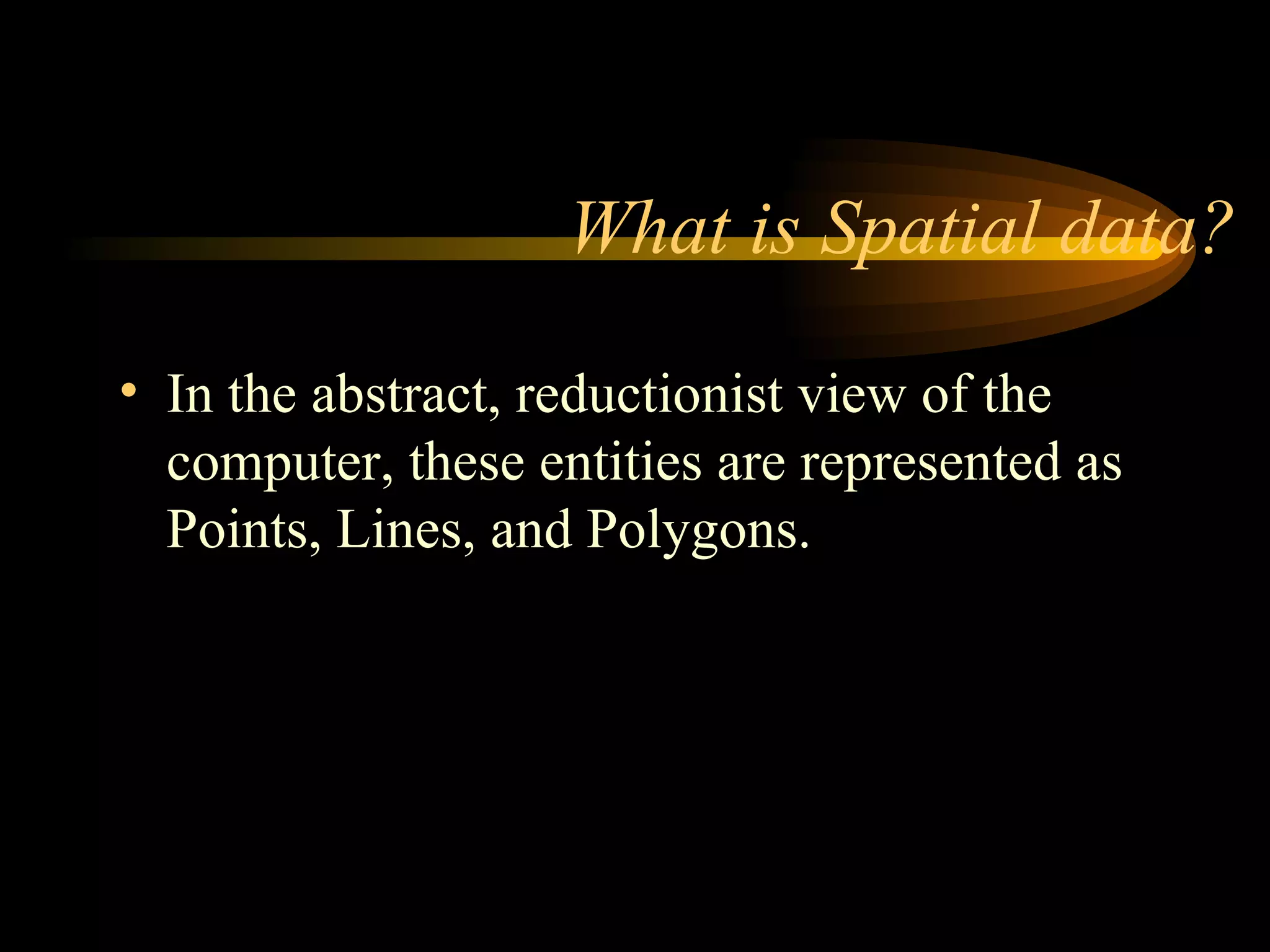
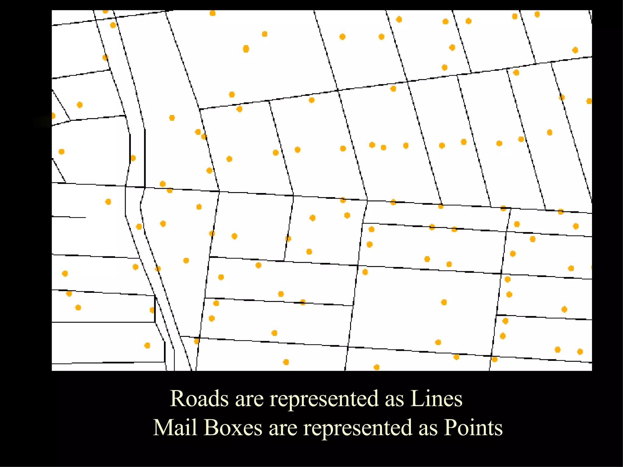
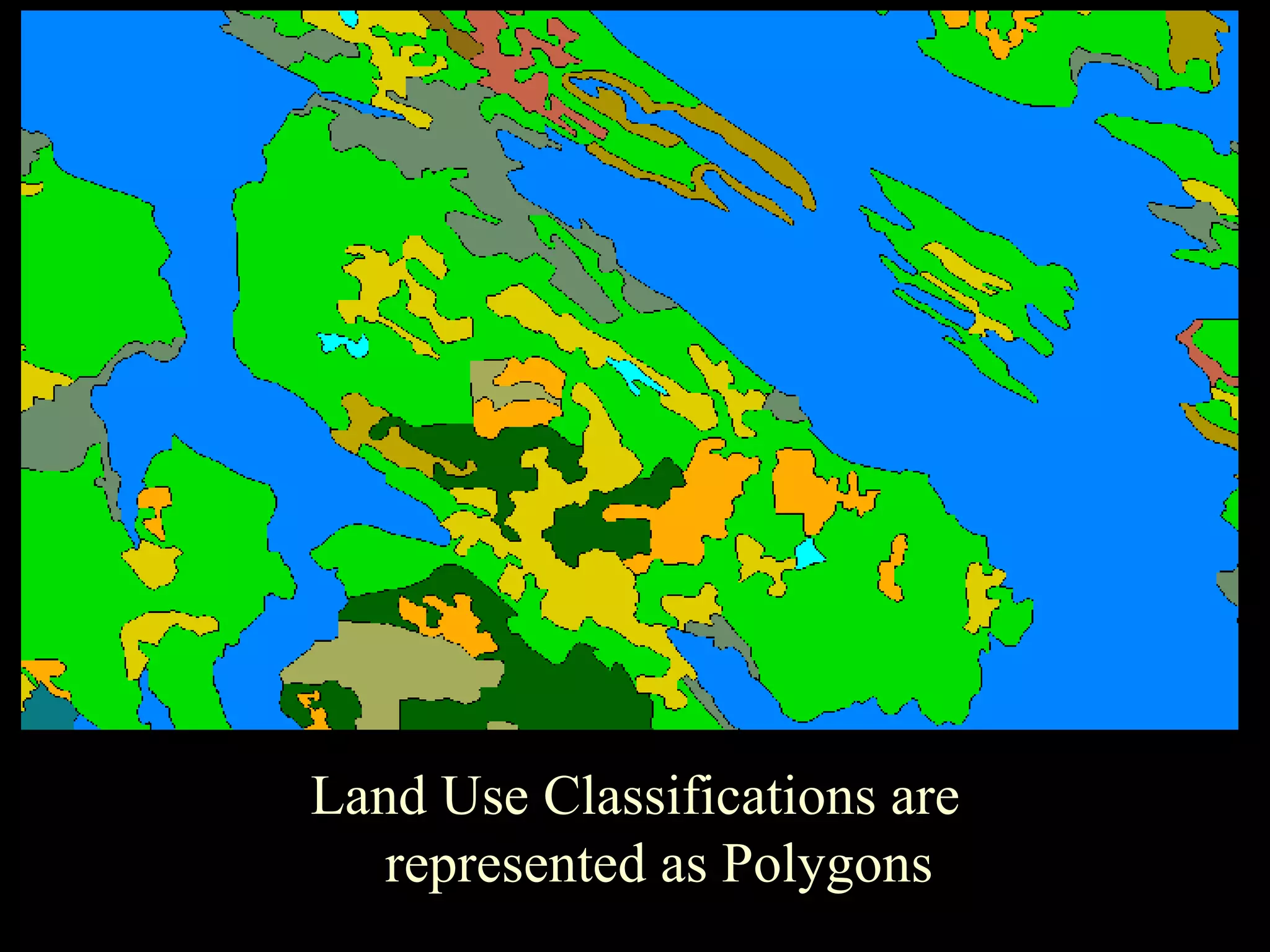
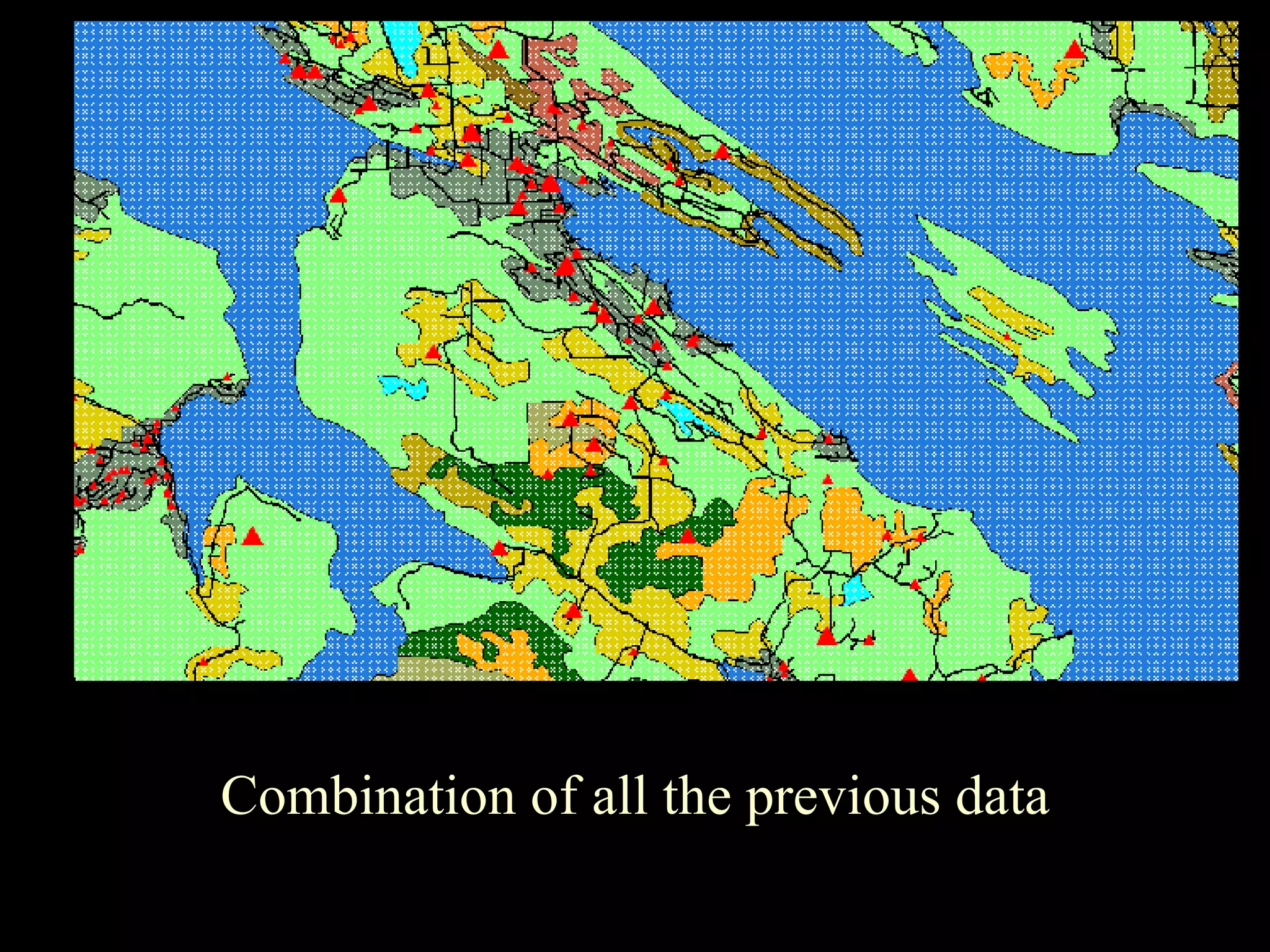
Definition and examples of spatial data, including points, lines, and polygons for entities like roads and land use.
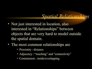
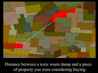
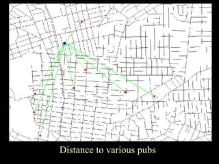
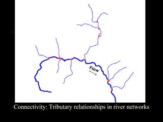
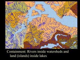
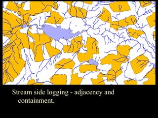
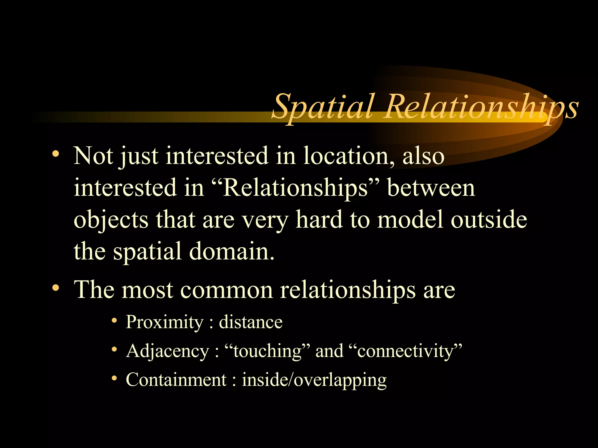
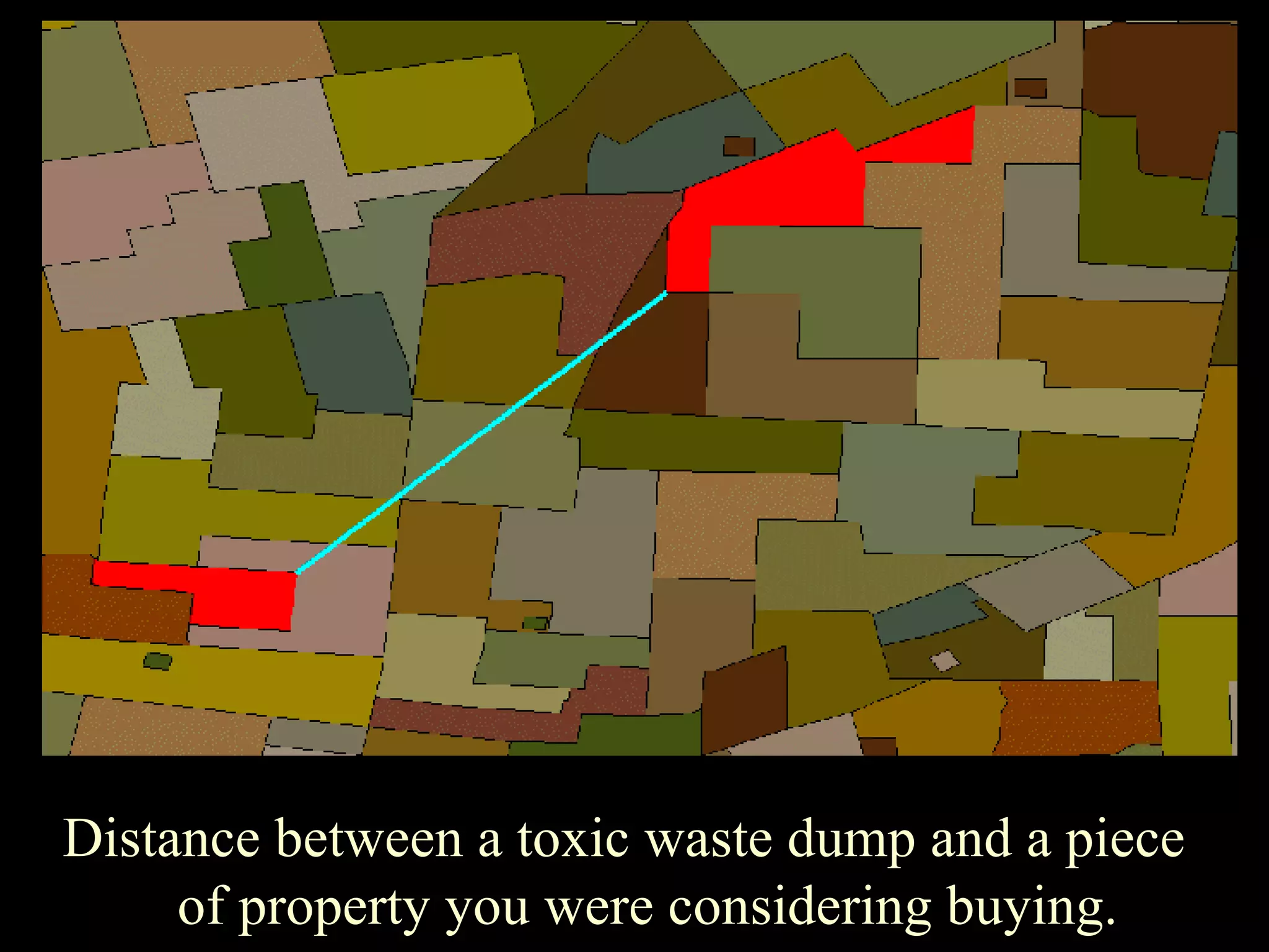
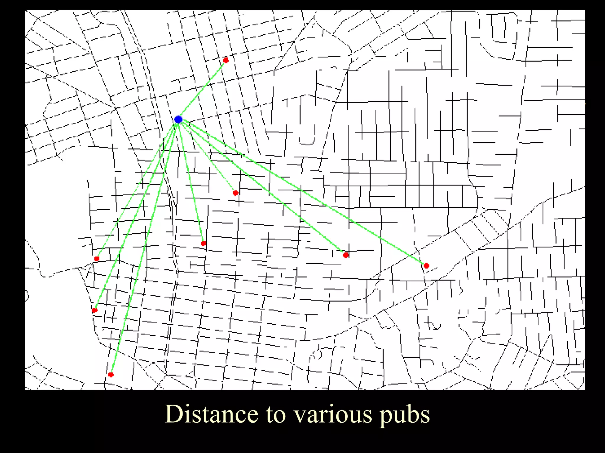
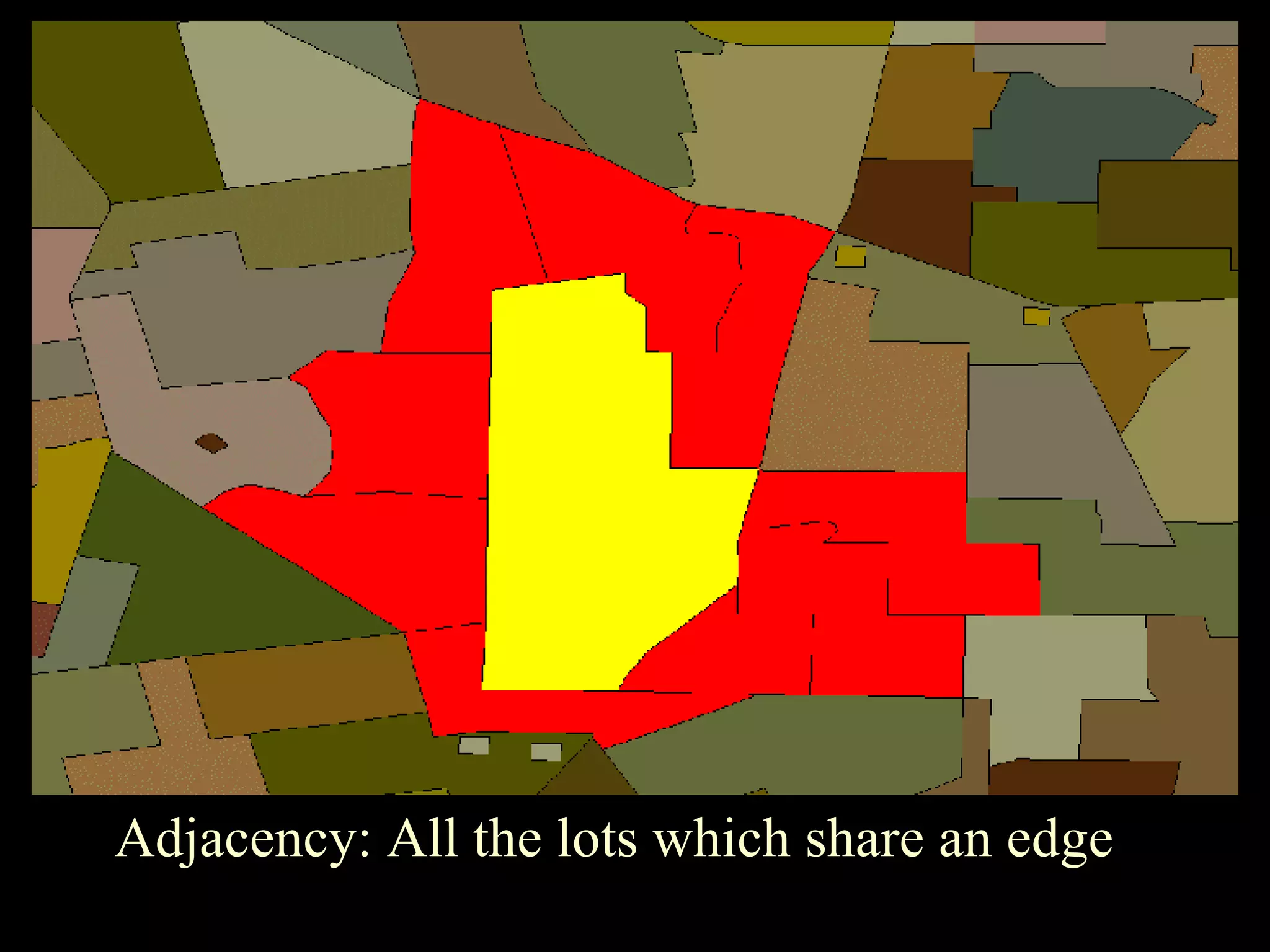
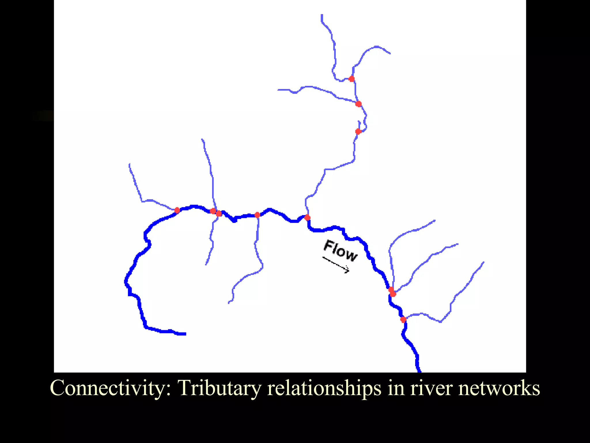
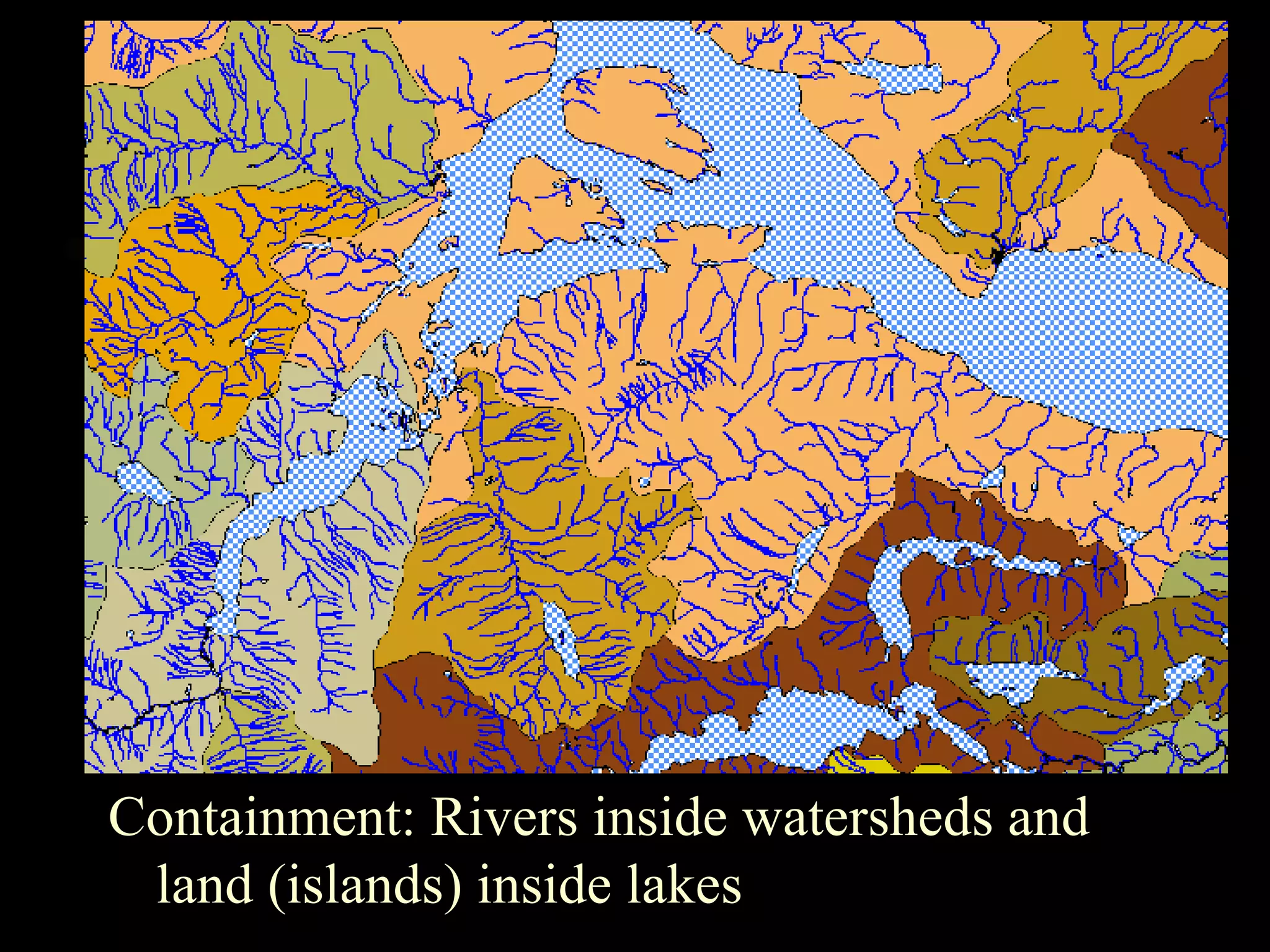
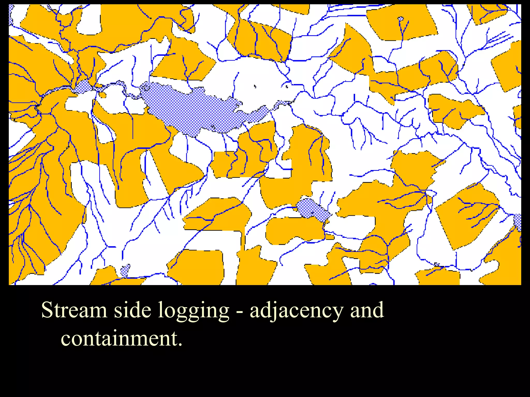
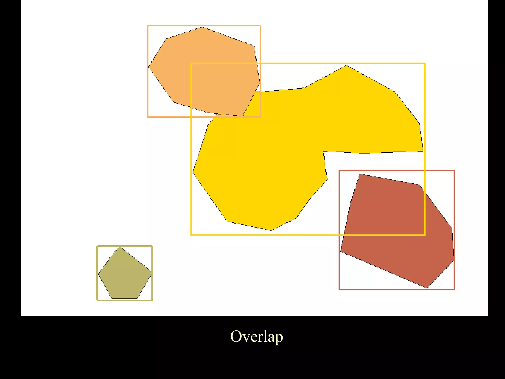
Introduction to spatial relationships including proximity, adjacency, connectivity, and containment with relevant examples.
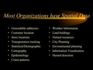
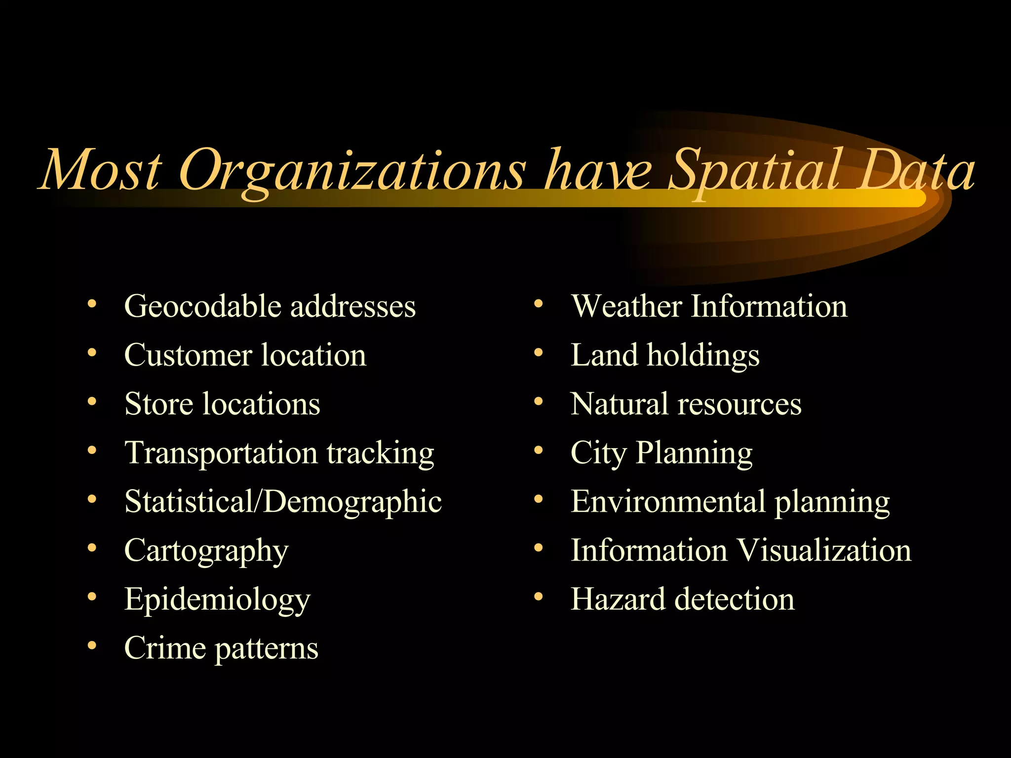
Common uses of spatial data in organizations like geocoded addresses, demographics, planning, and resource management.
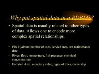
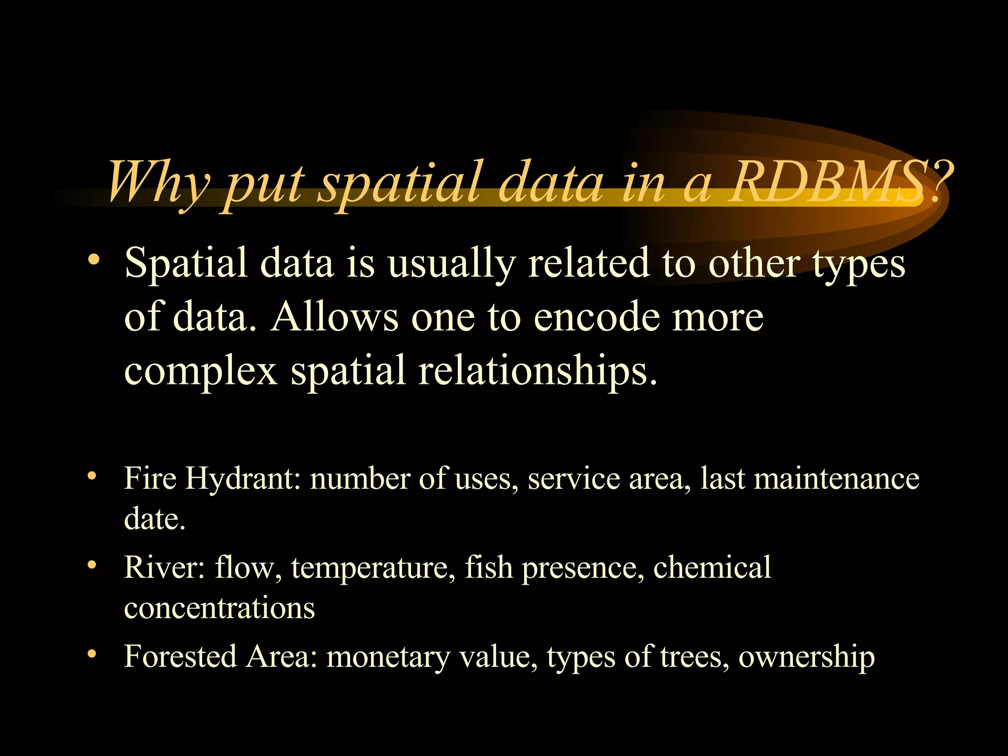
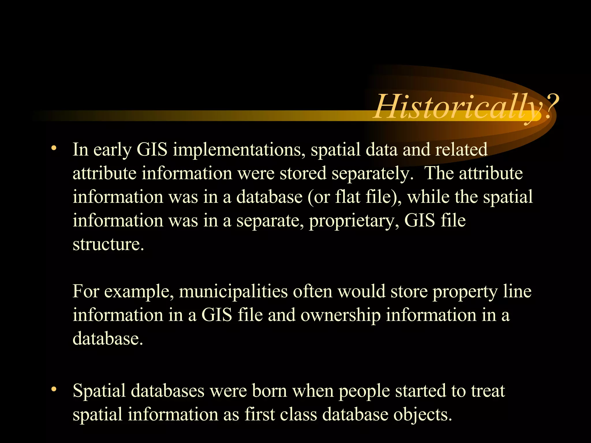
Advantages of integrating spatial data into RDBMS, the evolution of spatial databases from separated GIS data.
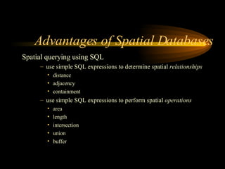
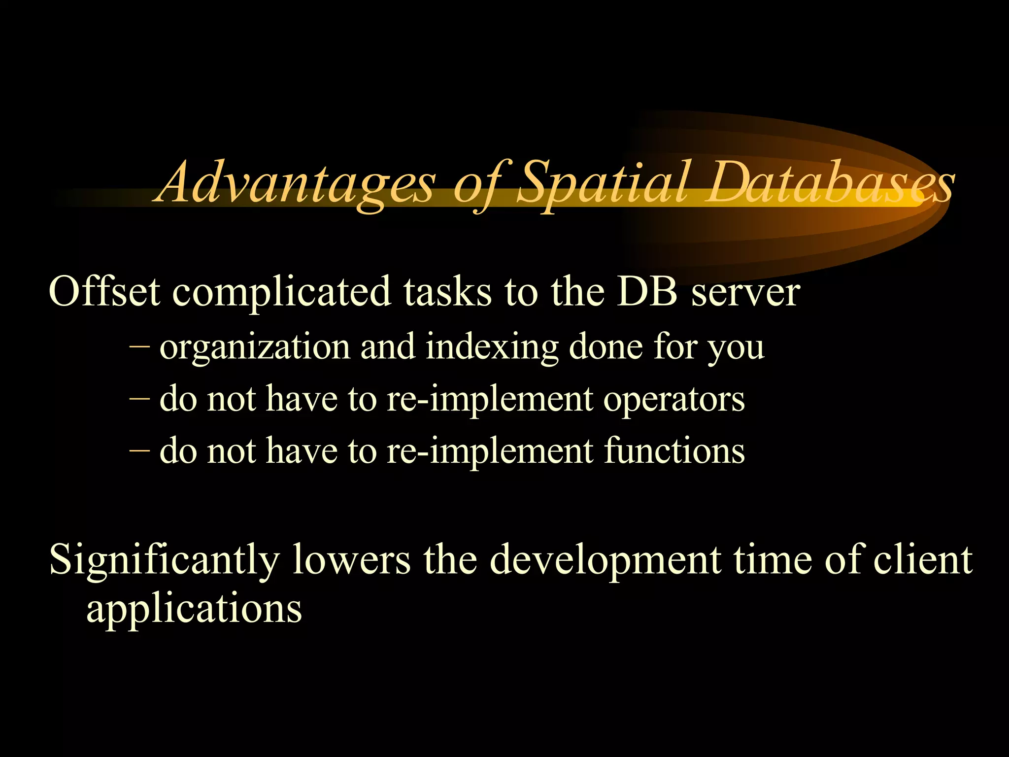
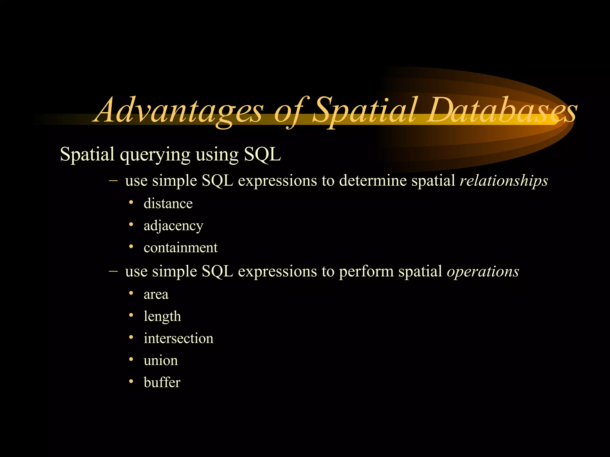
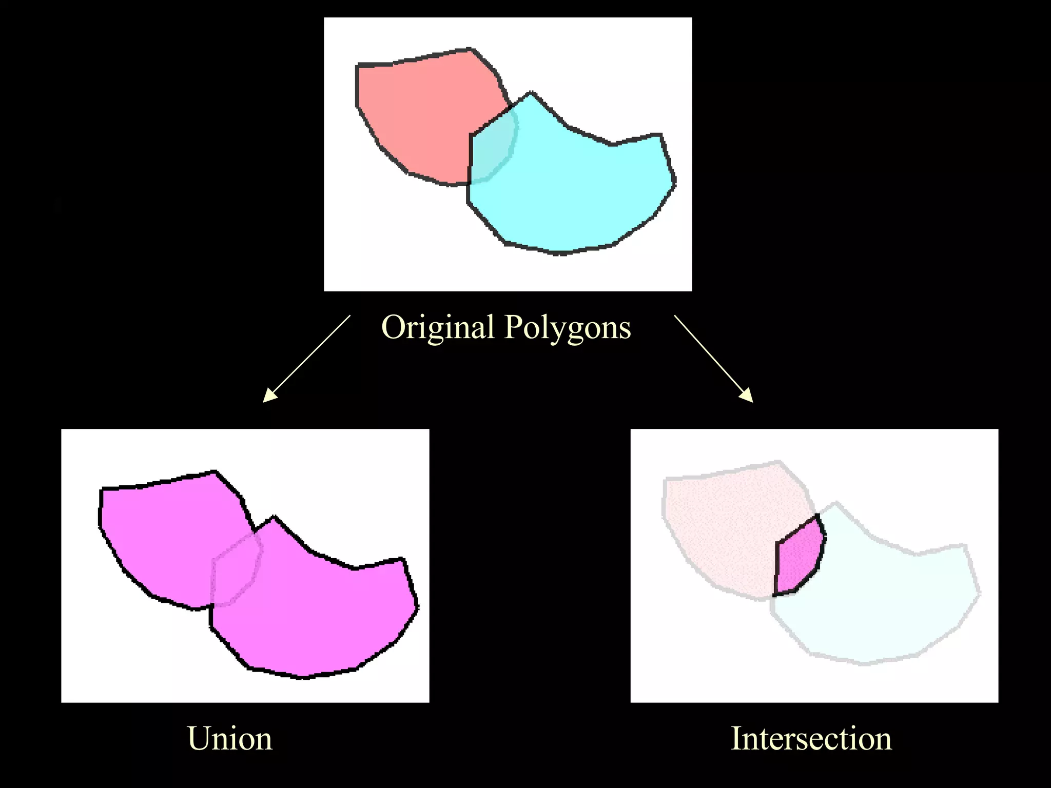
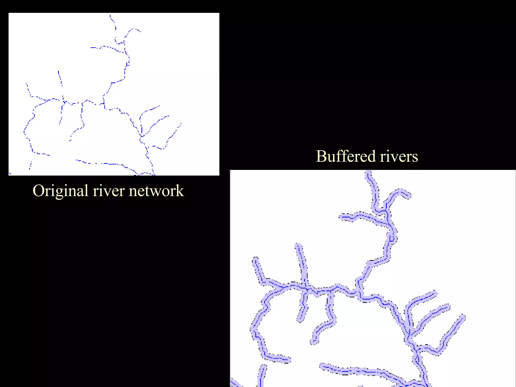
Key advantages include transaction handling, reduced redundancy, efficient querying with SQL, and easier spatial operations.
Disadvantages include high implementation costs, potential inflexibility, compatibility issues, and slower performance.
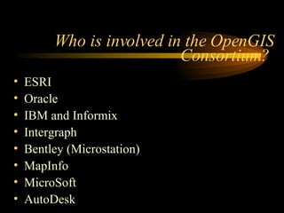
Overview of various spatial database offerings including PostGIS, ESRI, Oracle, and others.
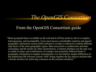
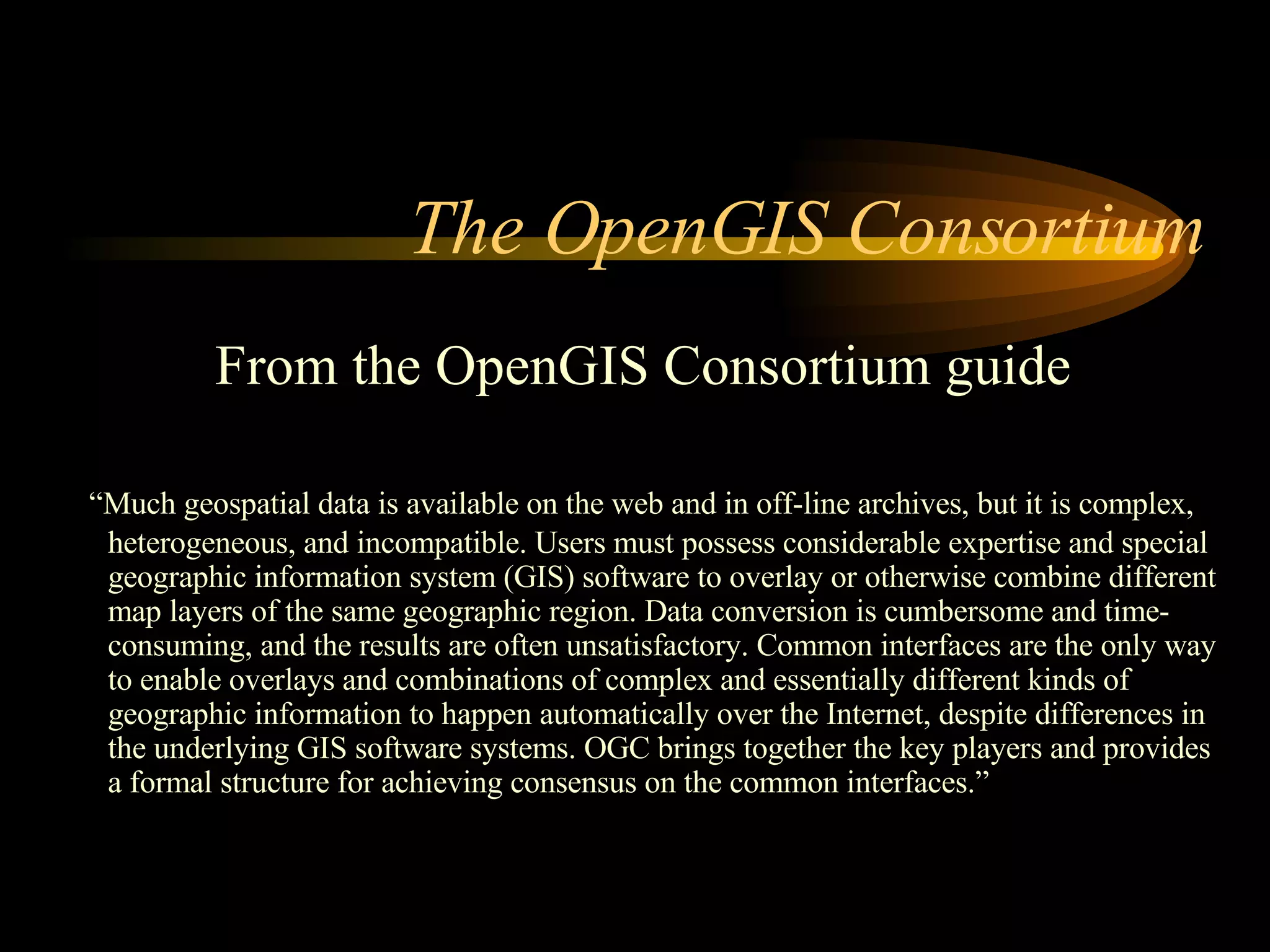
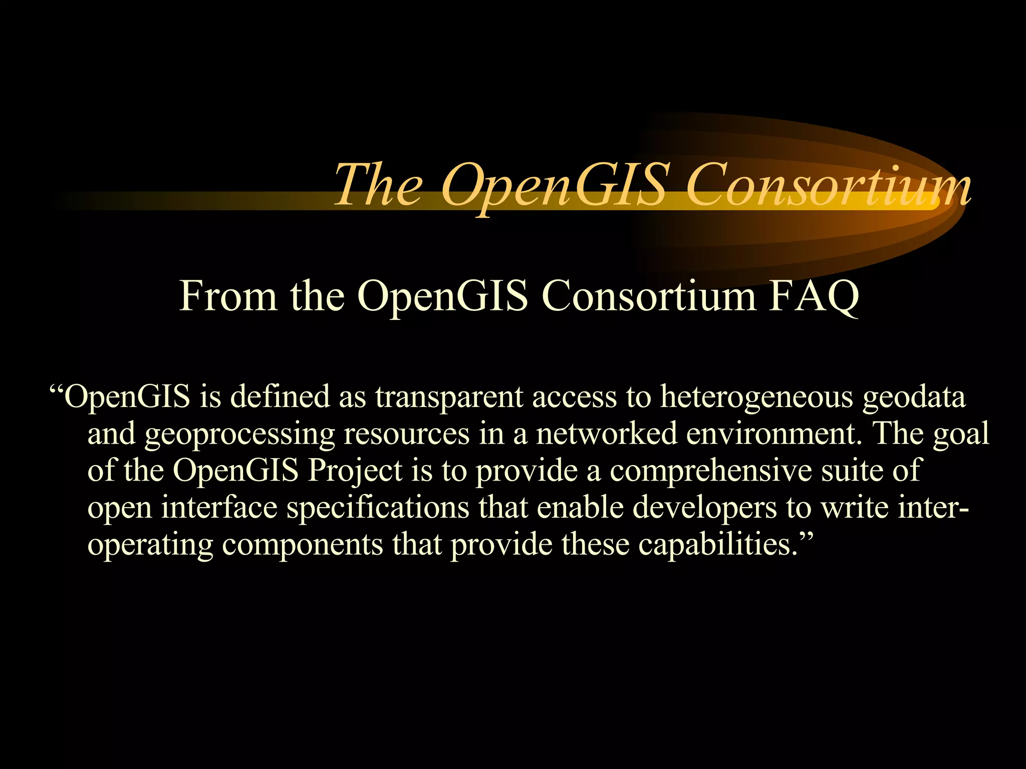
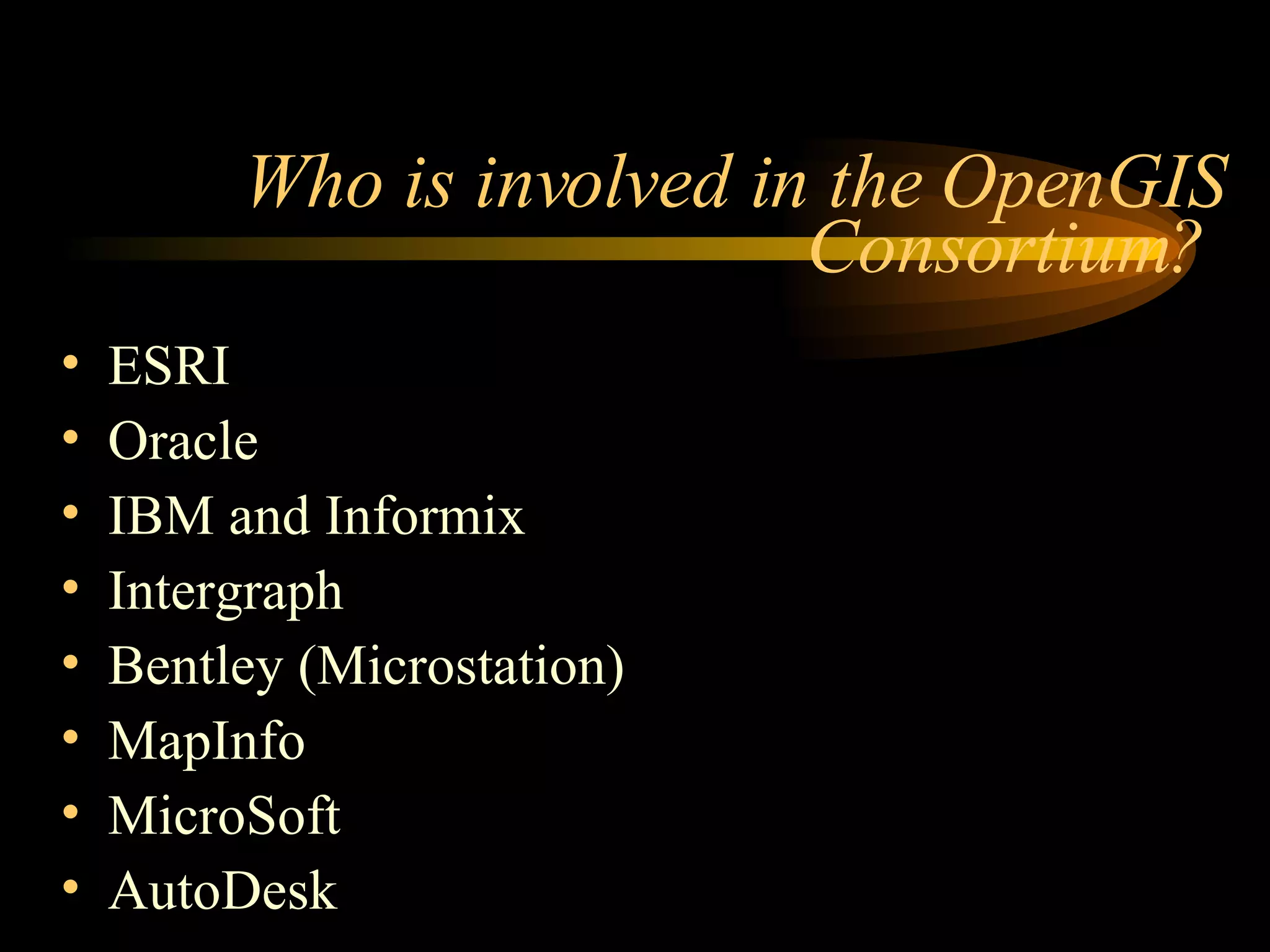
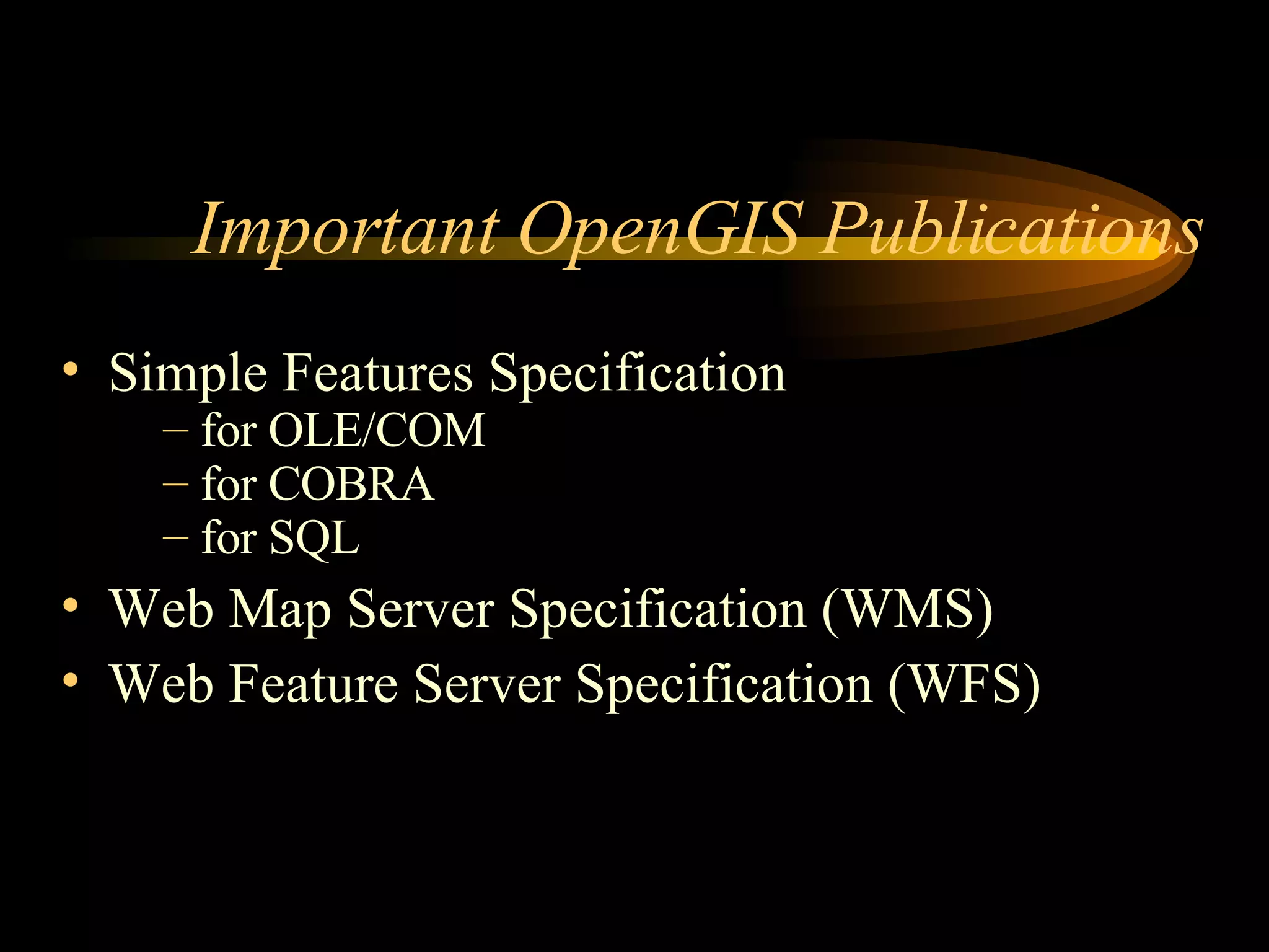
Information about the OpenGIS Consortium's goals, published specifications, and involved organizations.
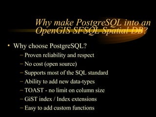
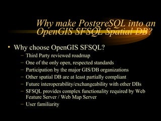
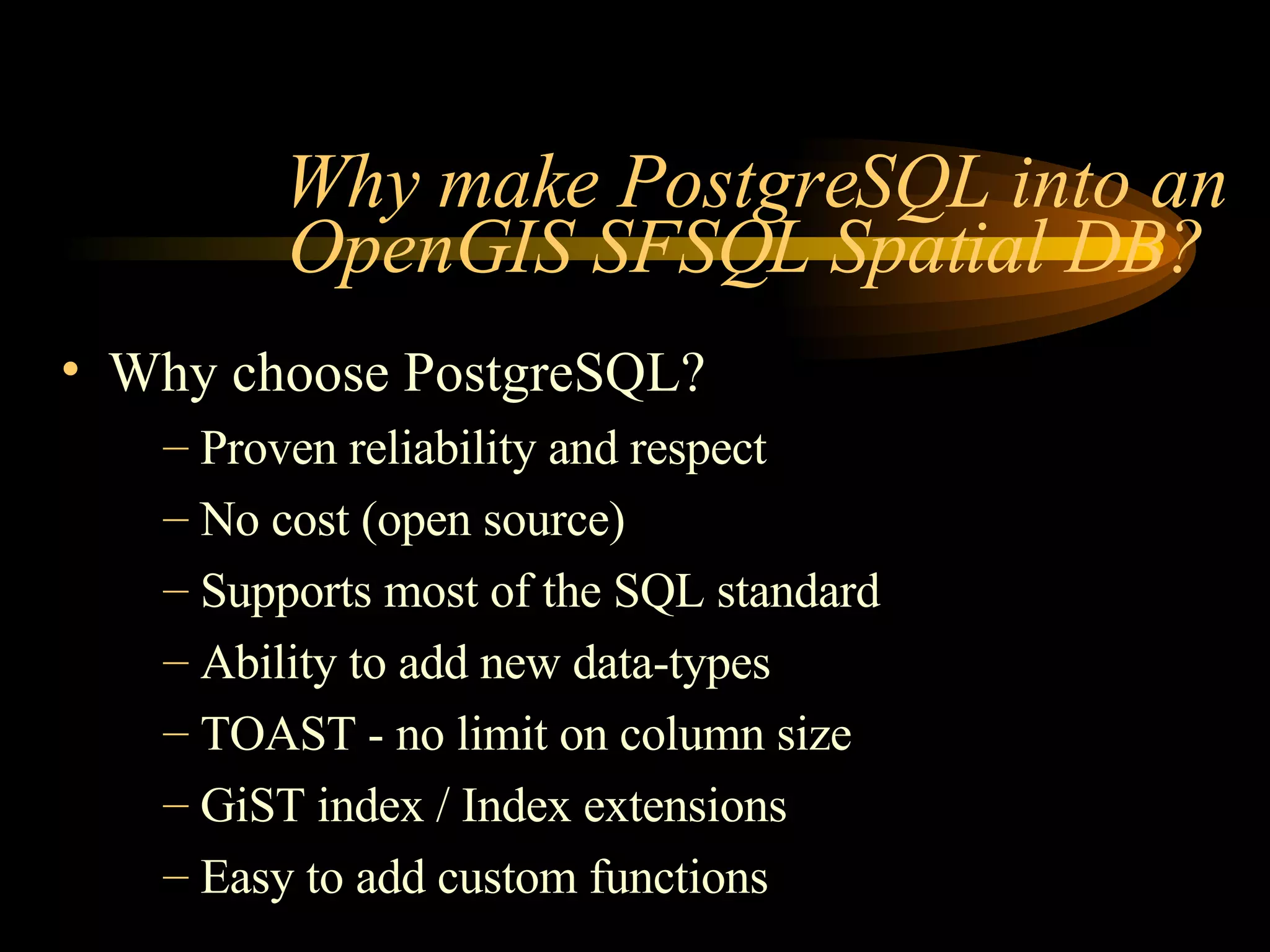
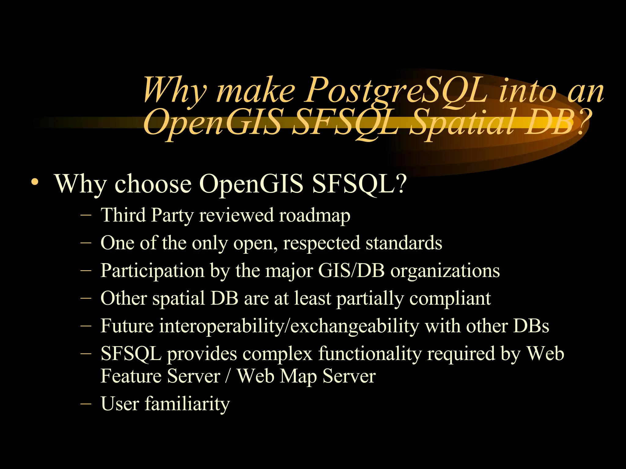
Reasons why PostgreSQL is chosen for OpenGIS SFSQL compliance, including its features and open-source nature.
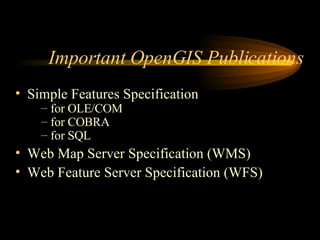
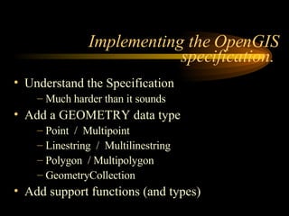
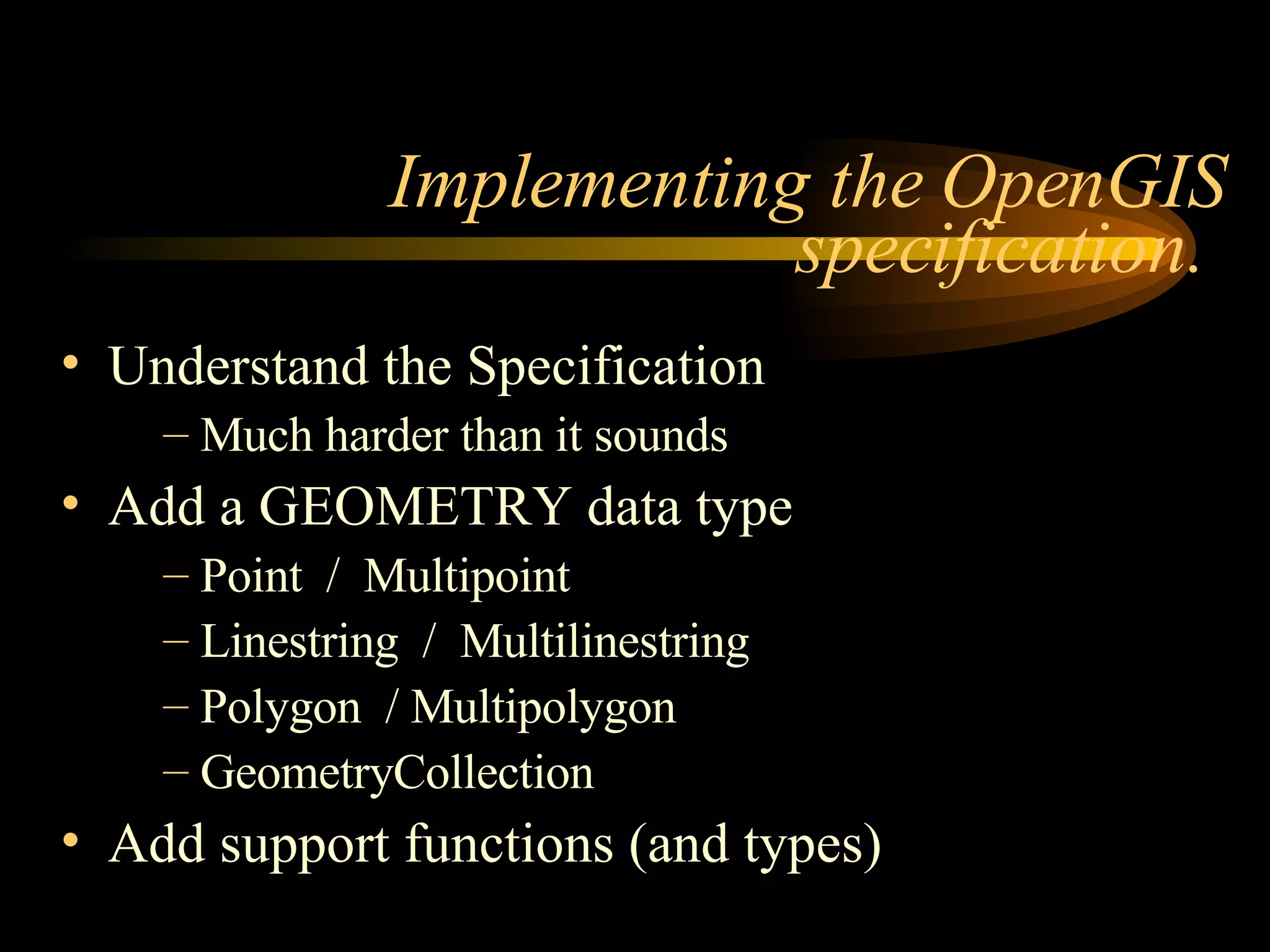
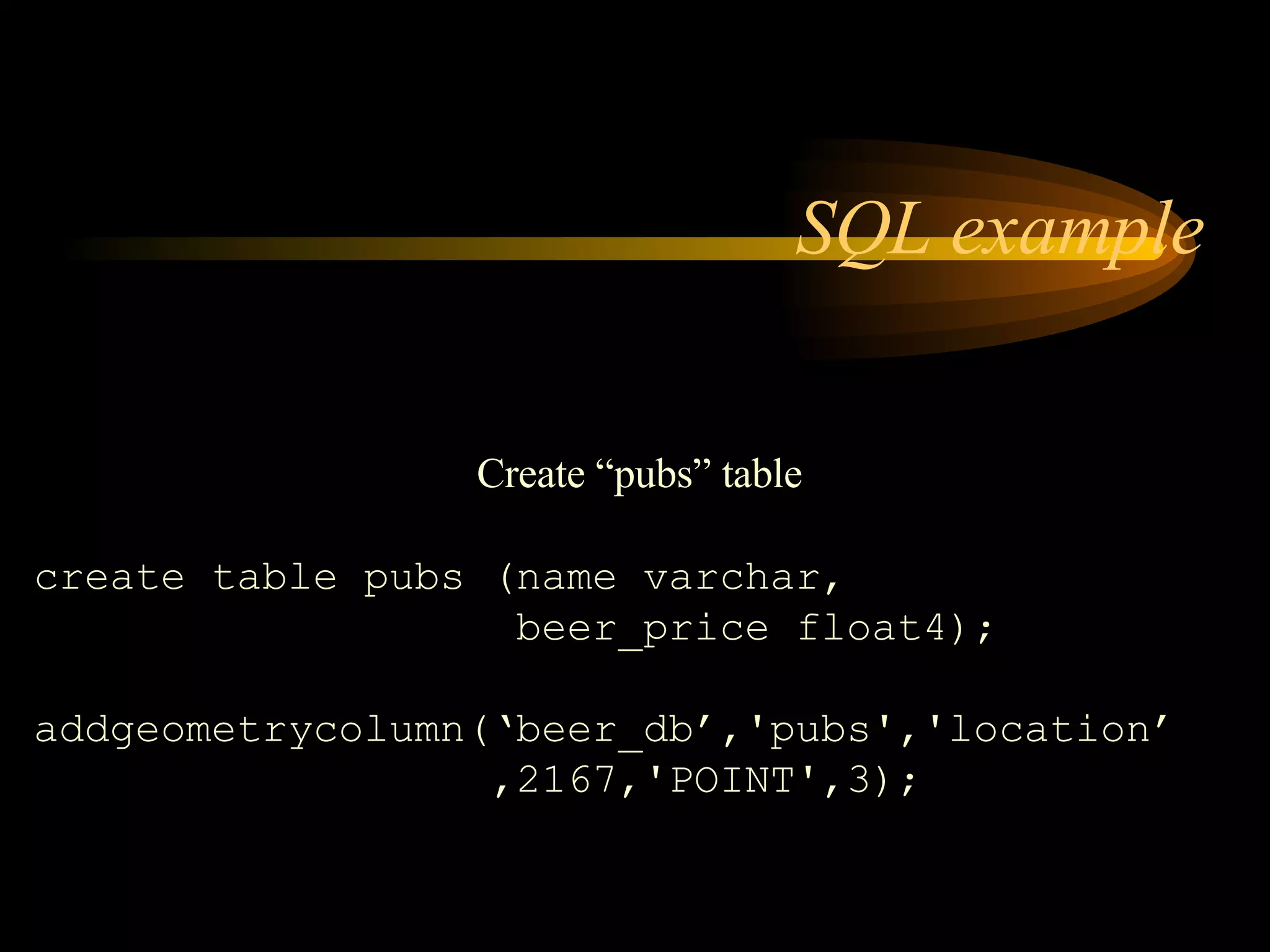
Steps to implement OpenGIS specifications in PostgreSQL, including geometry data types and functions.
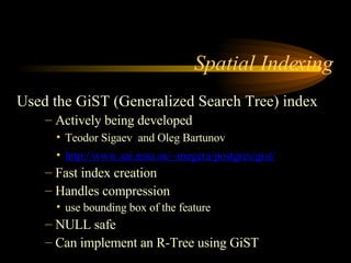
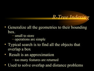
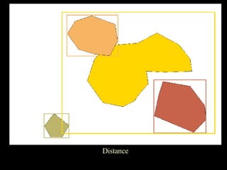
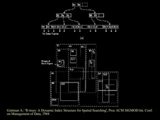
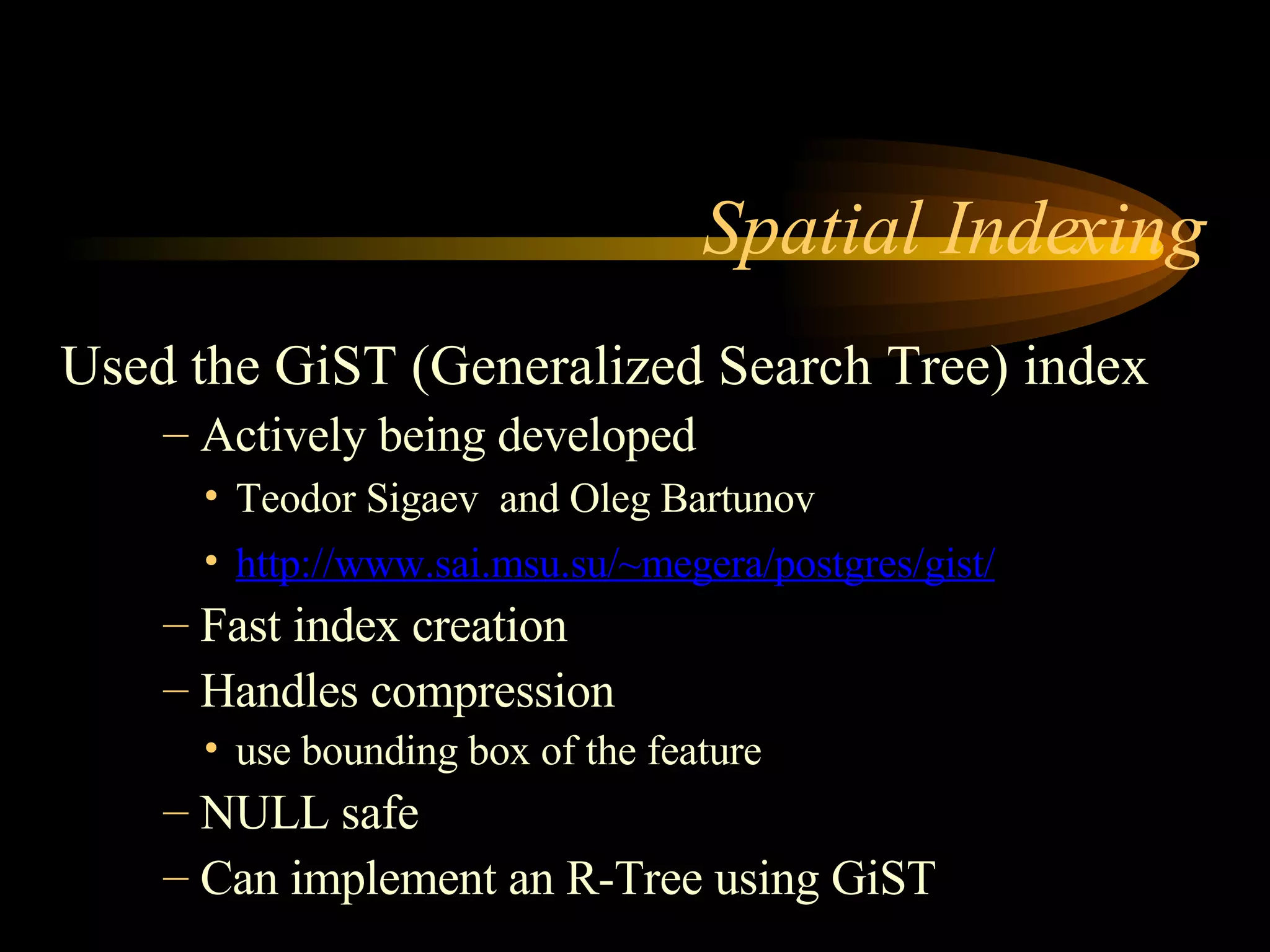
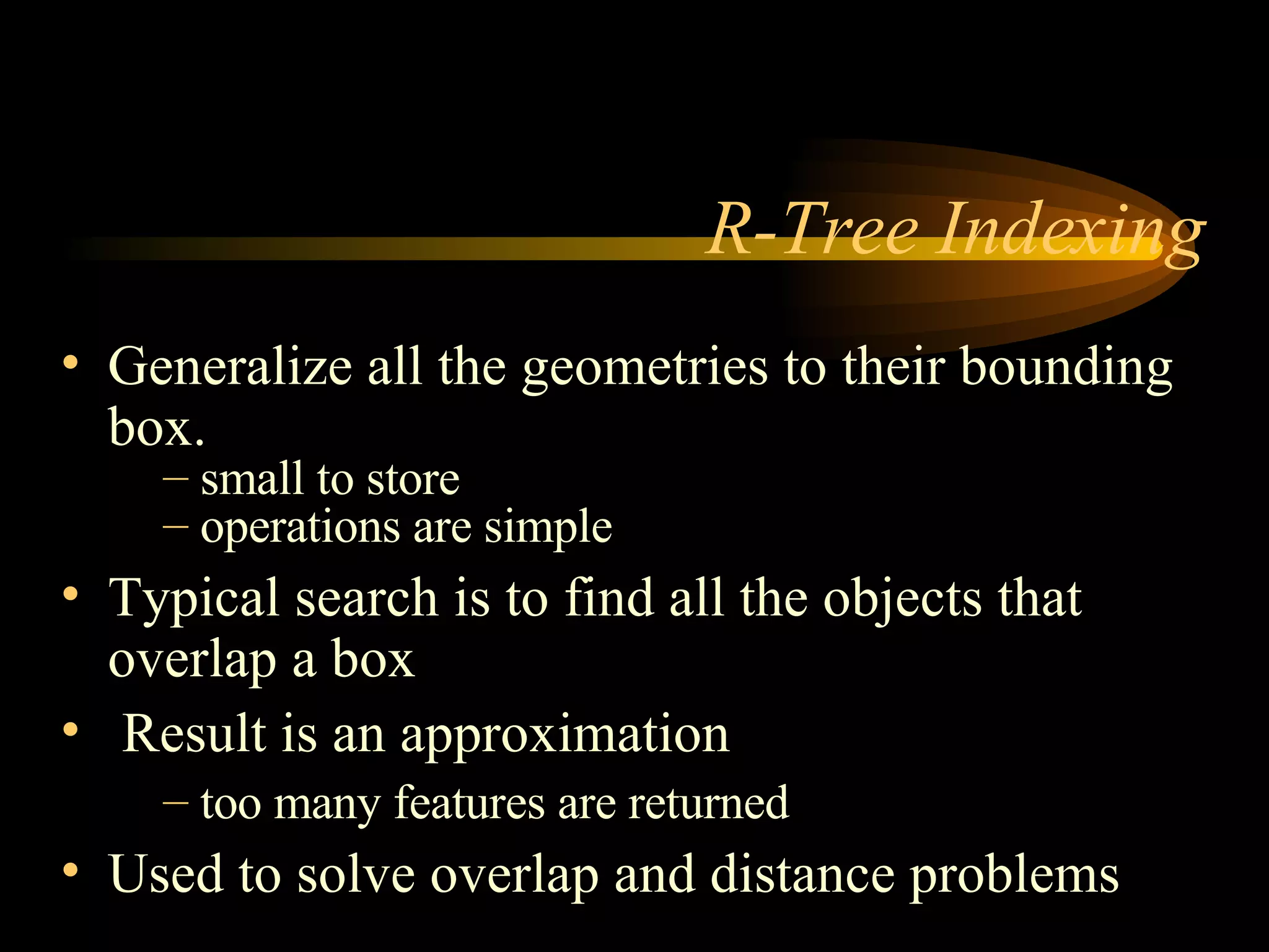
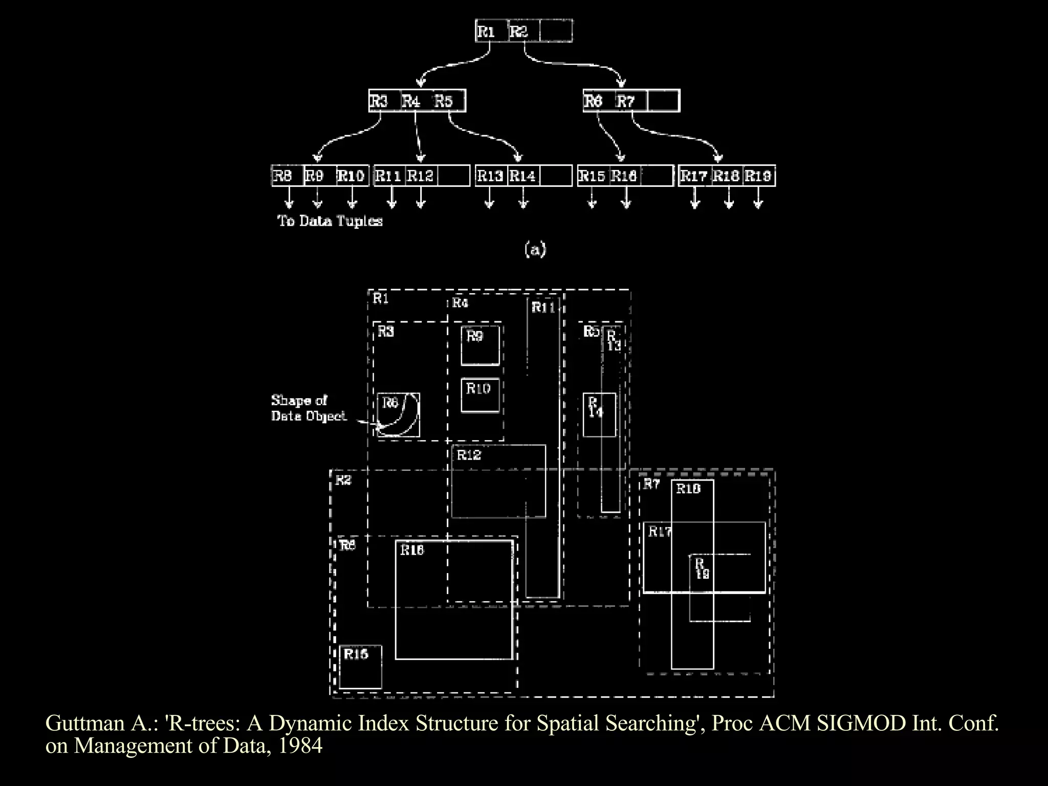
Introduction to GiST indexing for spatial data, R-Tree indexing for spatial searches, and related academic reference.
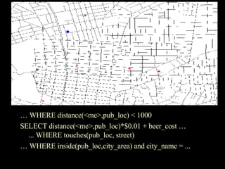
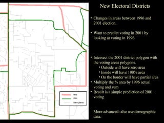
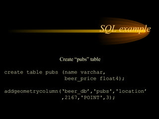
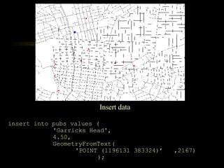
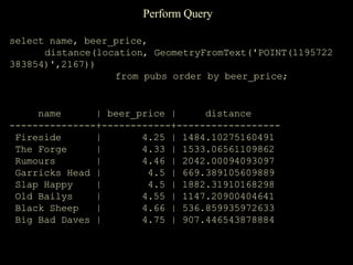
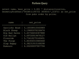
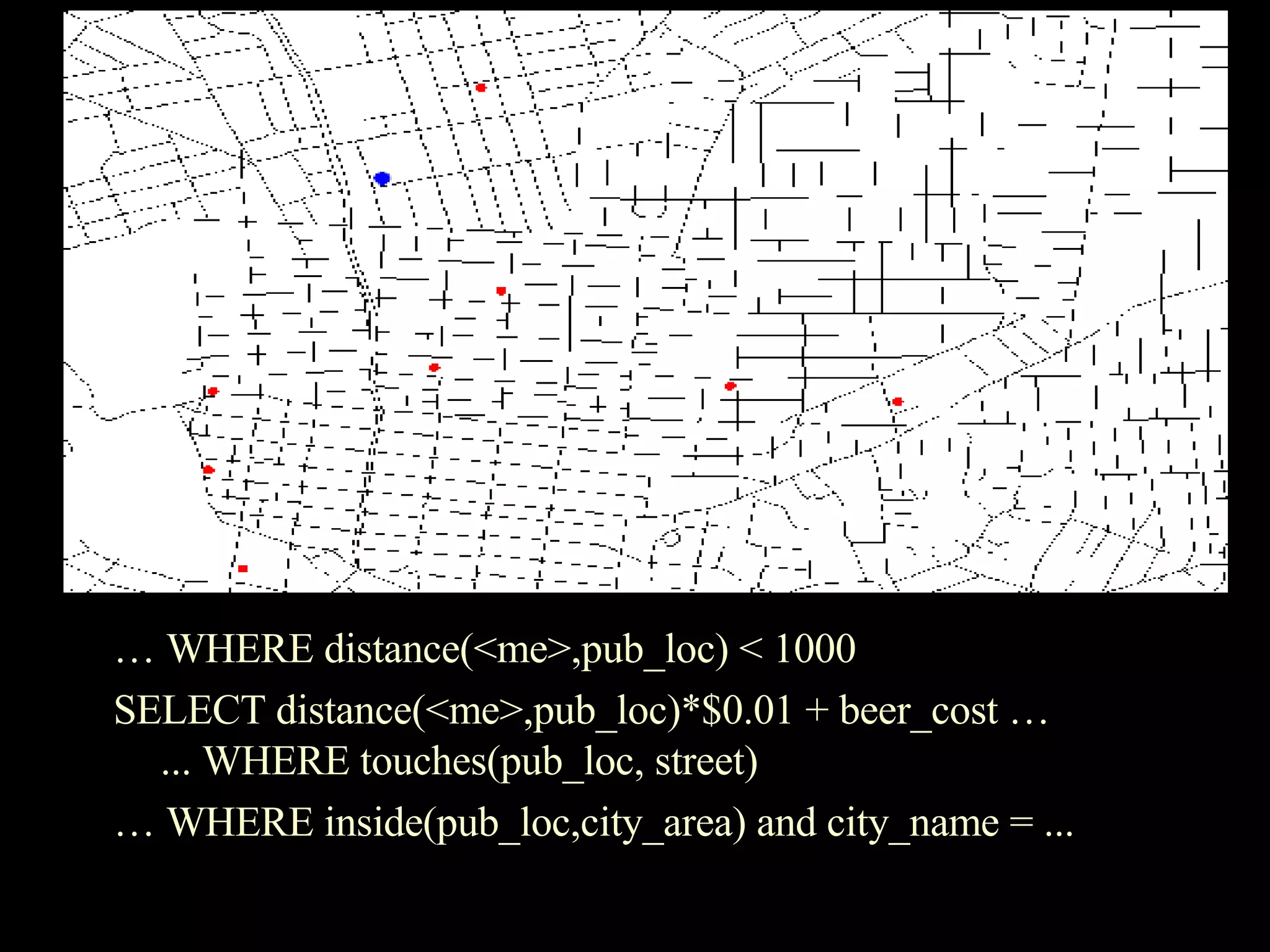
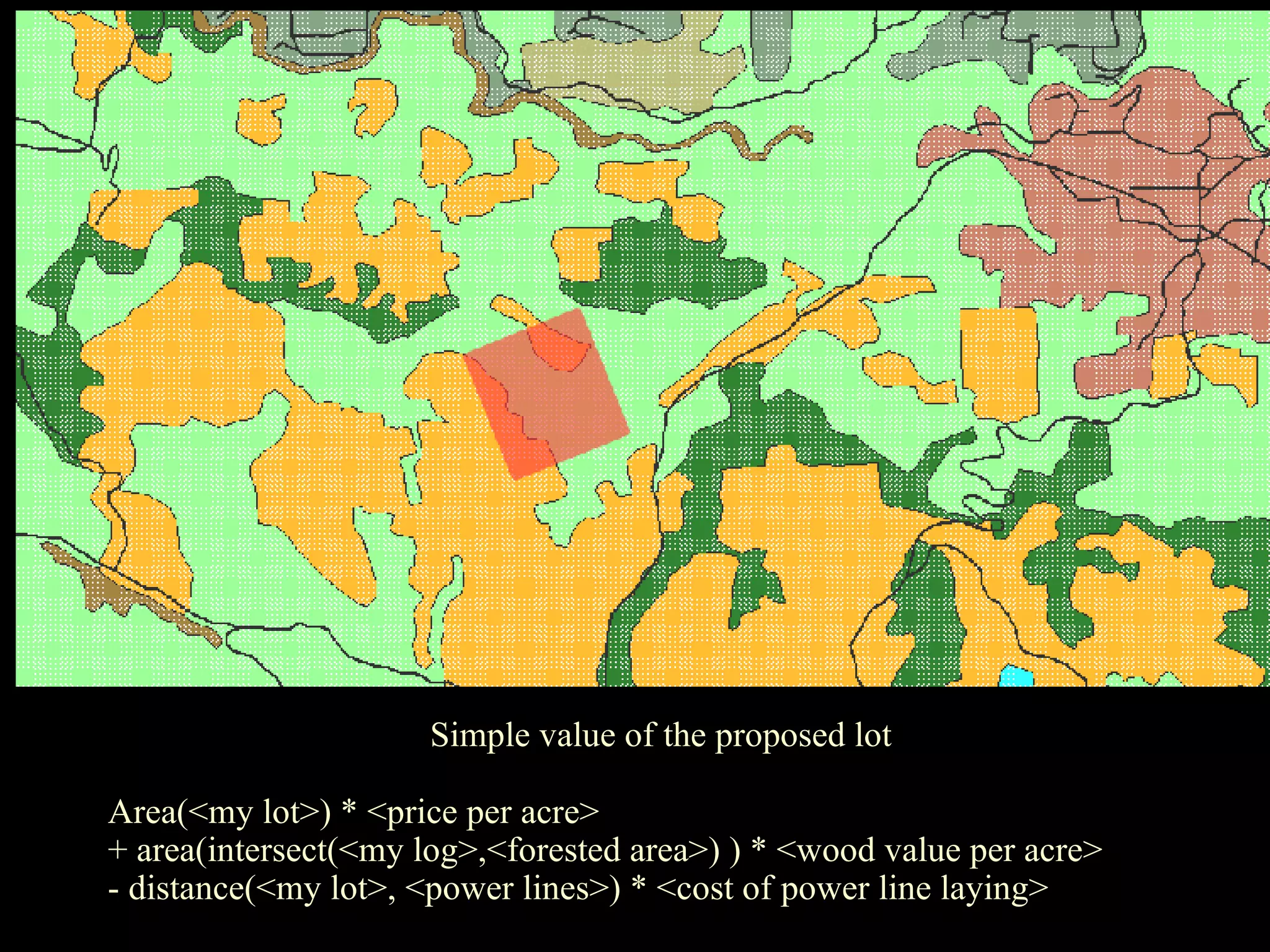
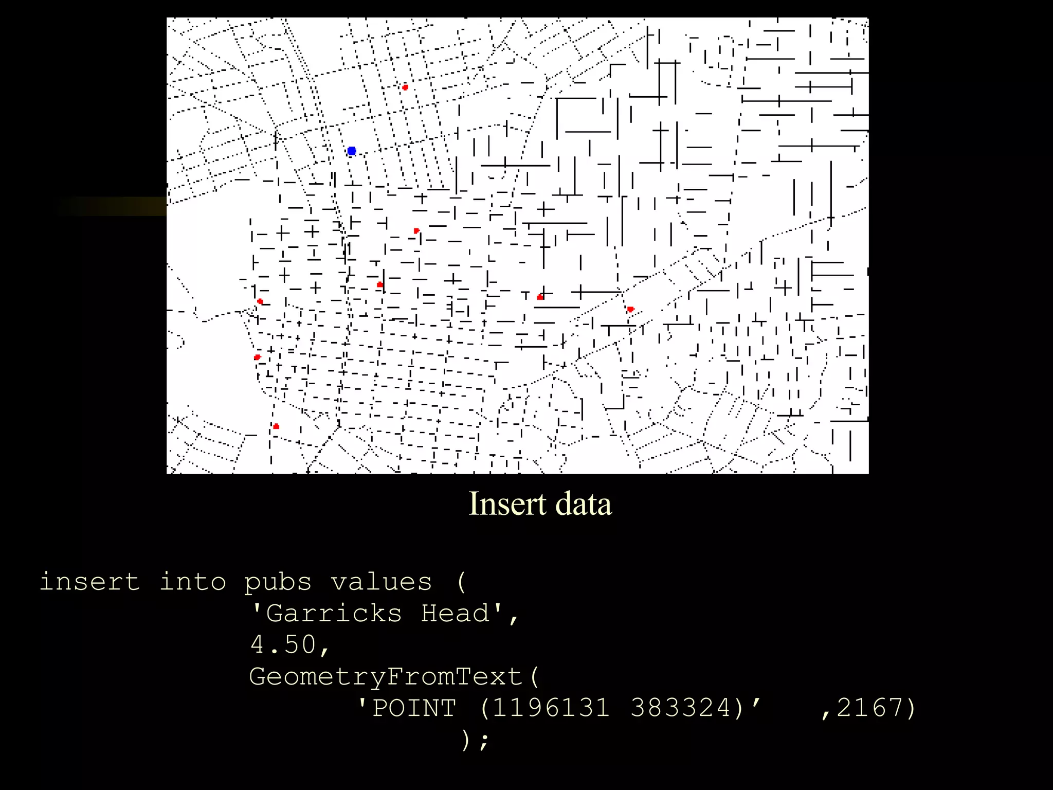
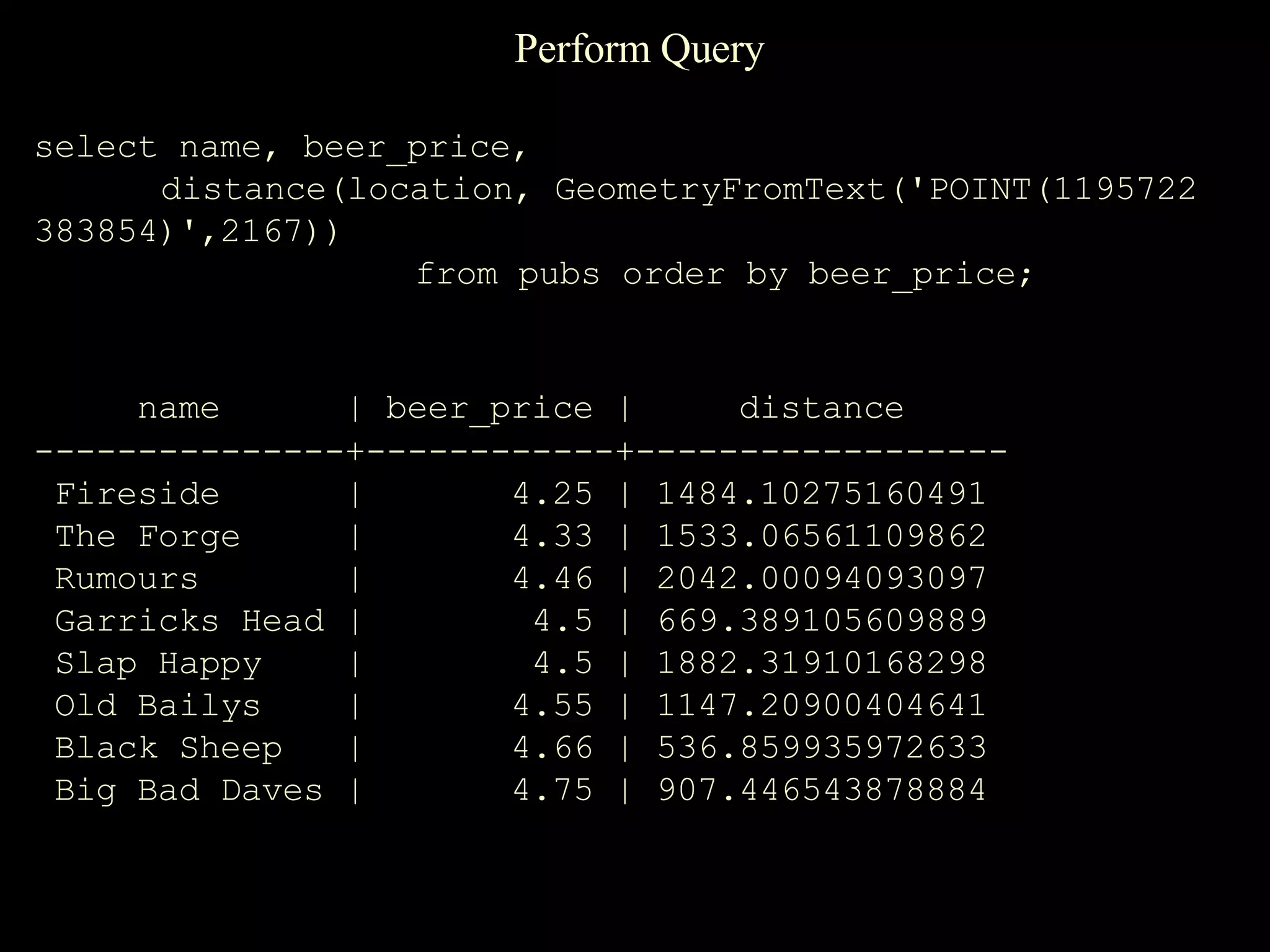
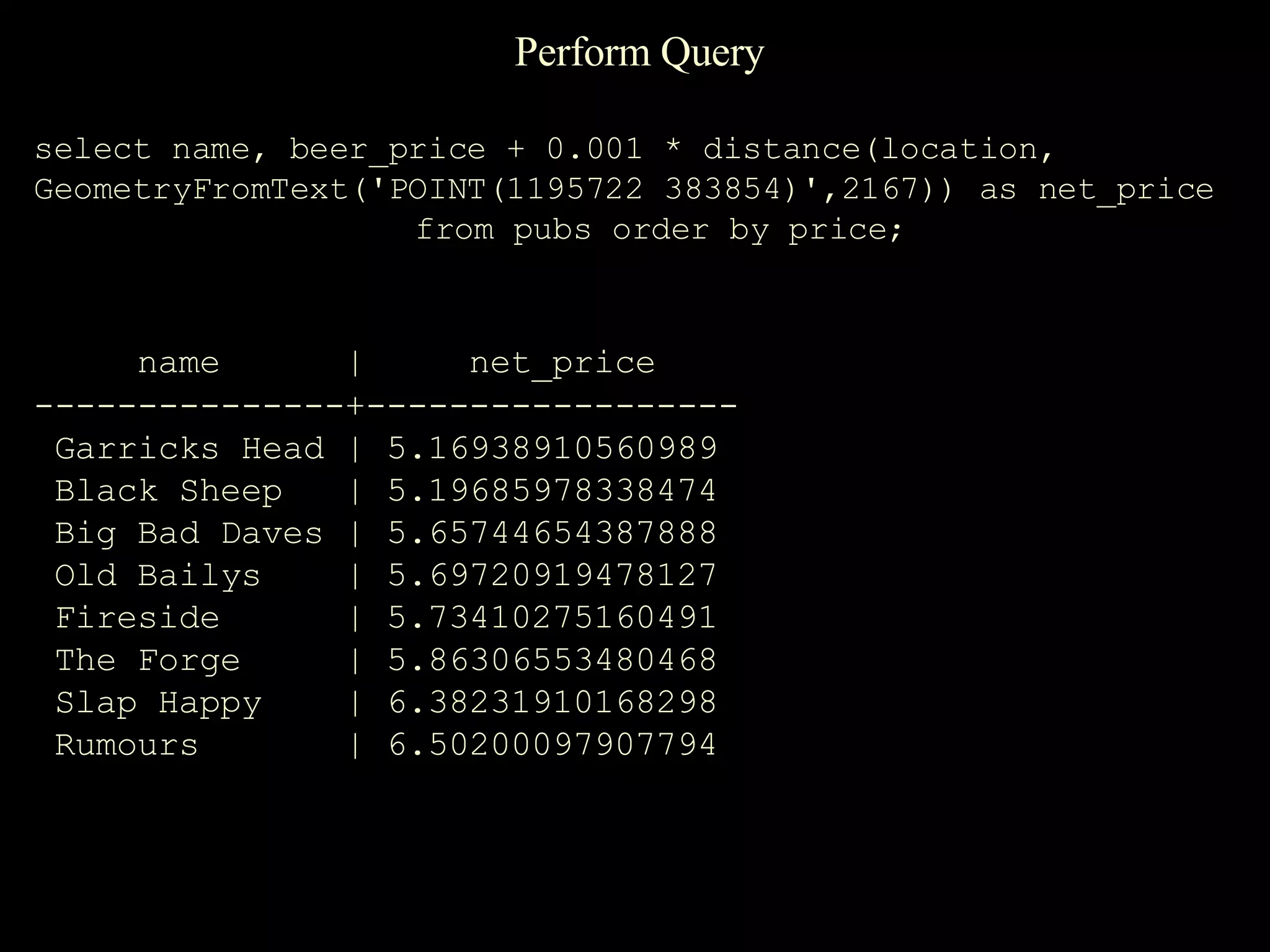
SQL examples for creating tables, inserting data, and performing spatial queries to analyze locations and pricing.
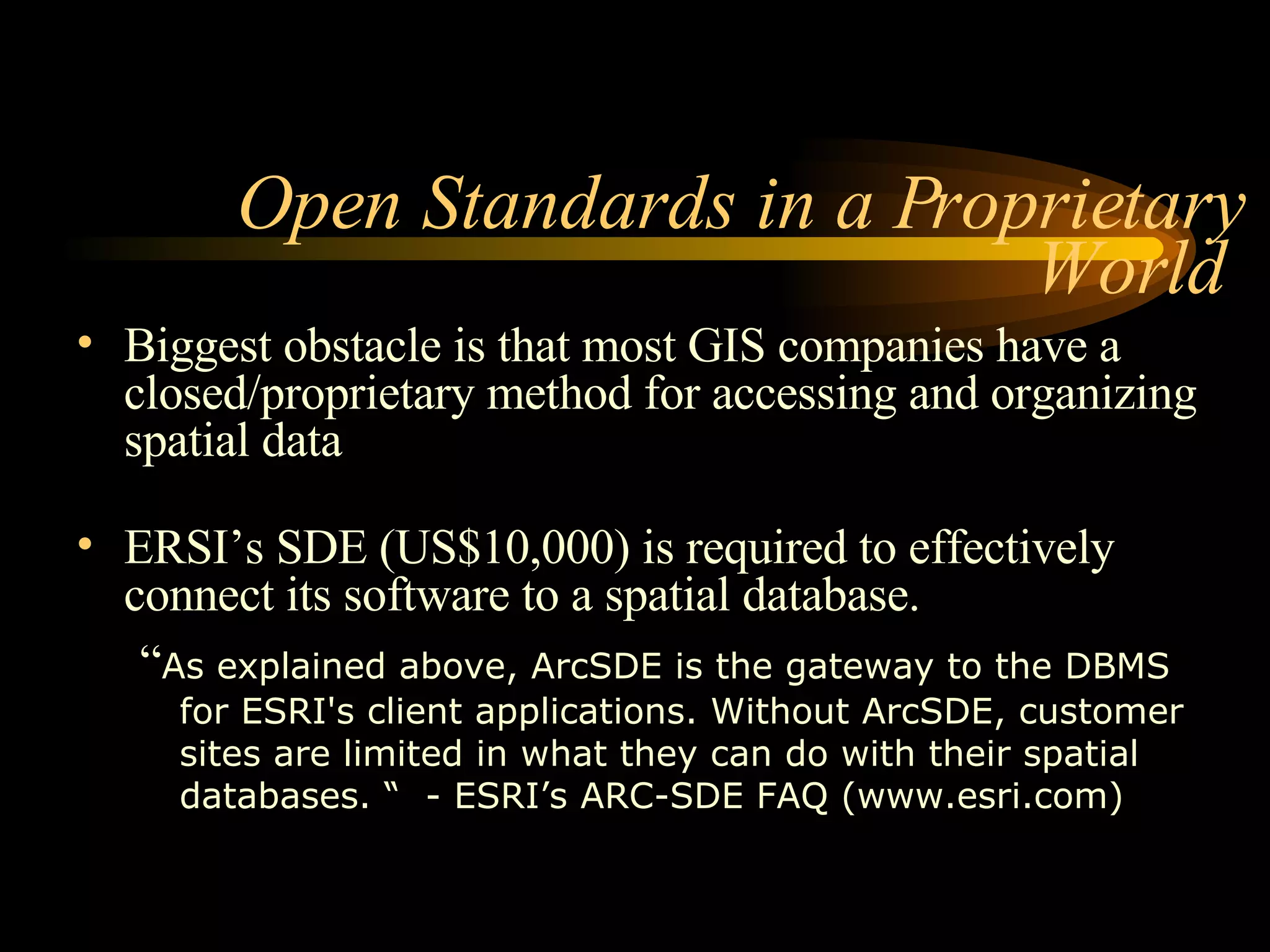
Discussion on barriers posed by proprietary GIS methods and the necessity for accessible spatial data solutions.
Current status of PostGIS development, recent release updates, and collaboration with Vivid Solutions for enhancements.
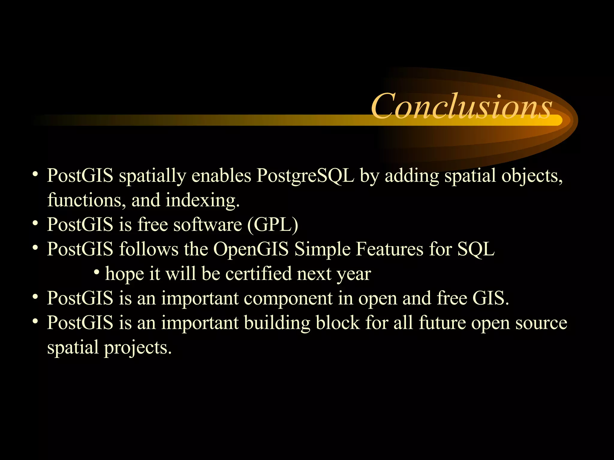
Final thoughts on PostGIS enabling spatial functionality in PostgreSQL, open-source contribution, and future implications.
Conclusion and opportunity for questions from the audience regarding the content presented.


![지리정보체계(GIS) - [1] GIS 데이터 유형, 구조 알기](https://cdn.slidesharecdn.com/ss_thumbnails/sugis2018c01-180902151613-thumbnail.jpg?width=600ounds&width=560&fit=bounds)


