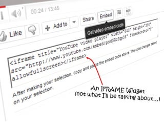
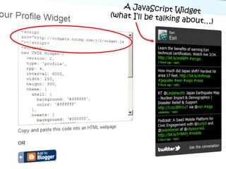
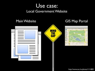
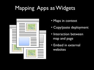
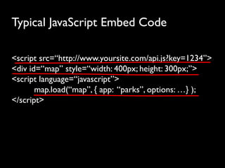
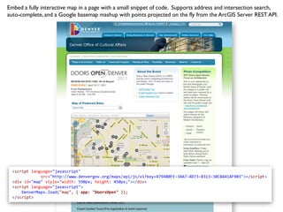
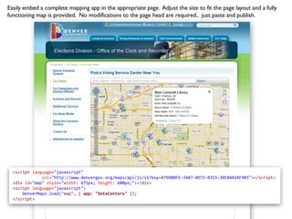
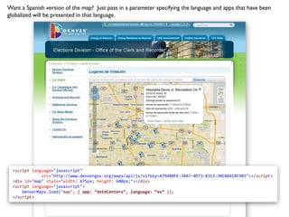
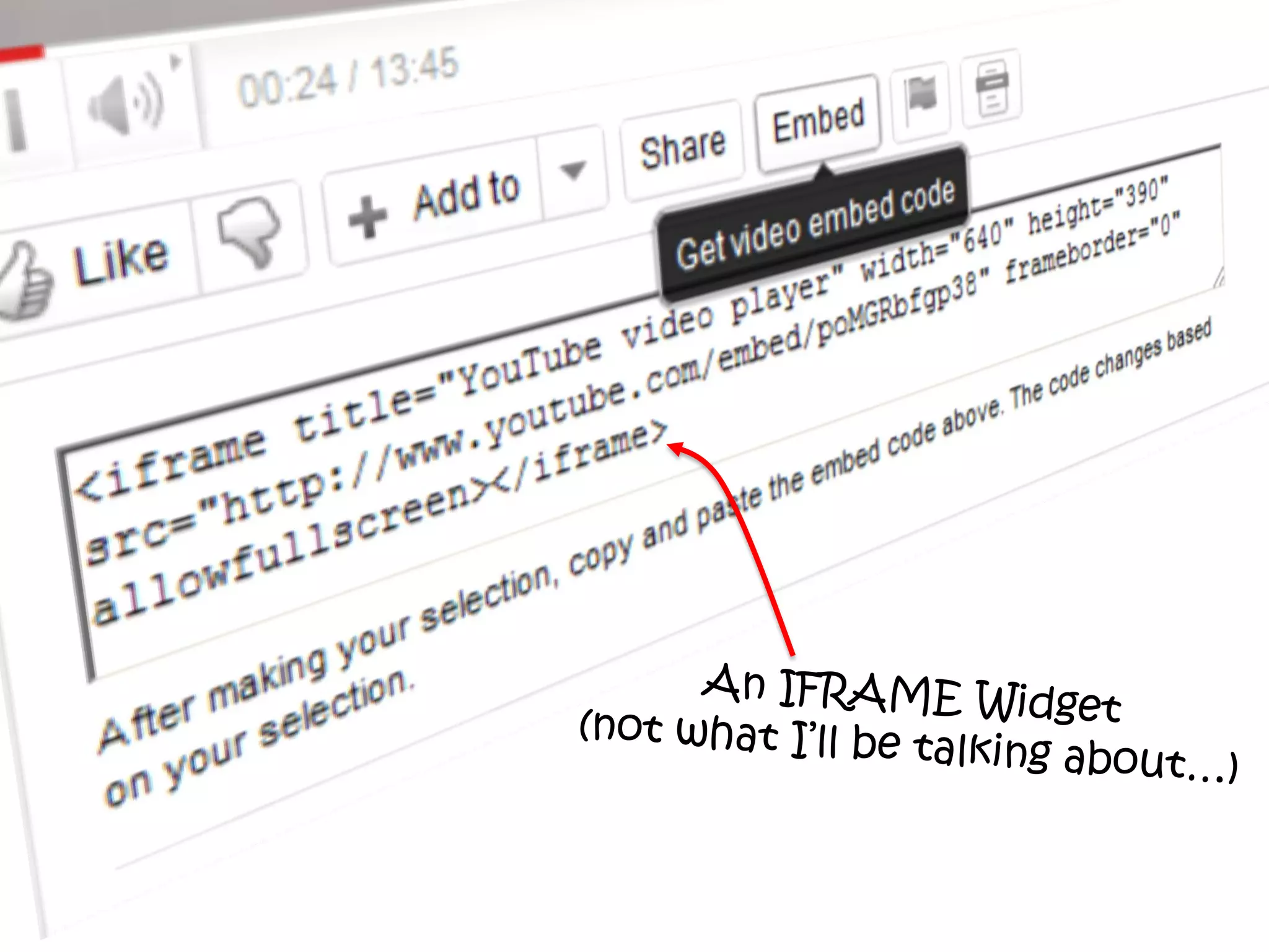
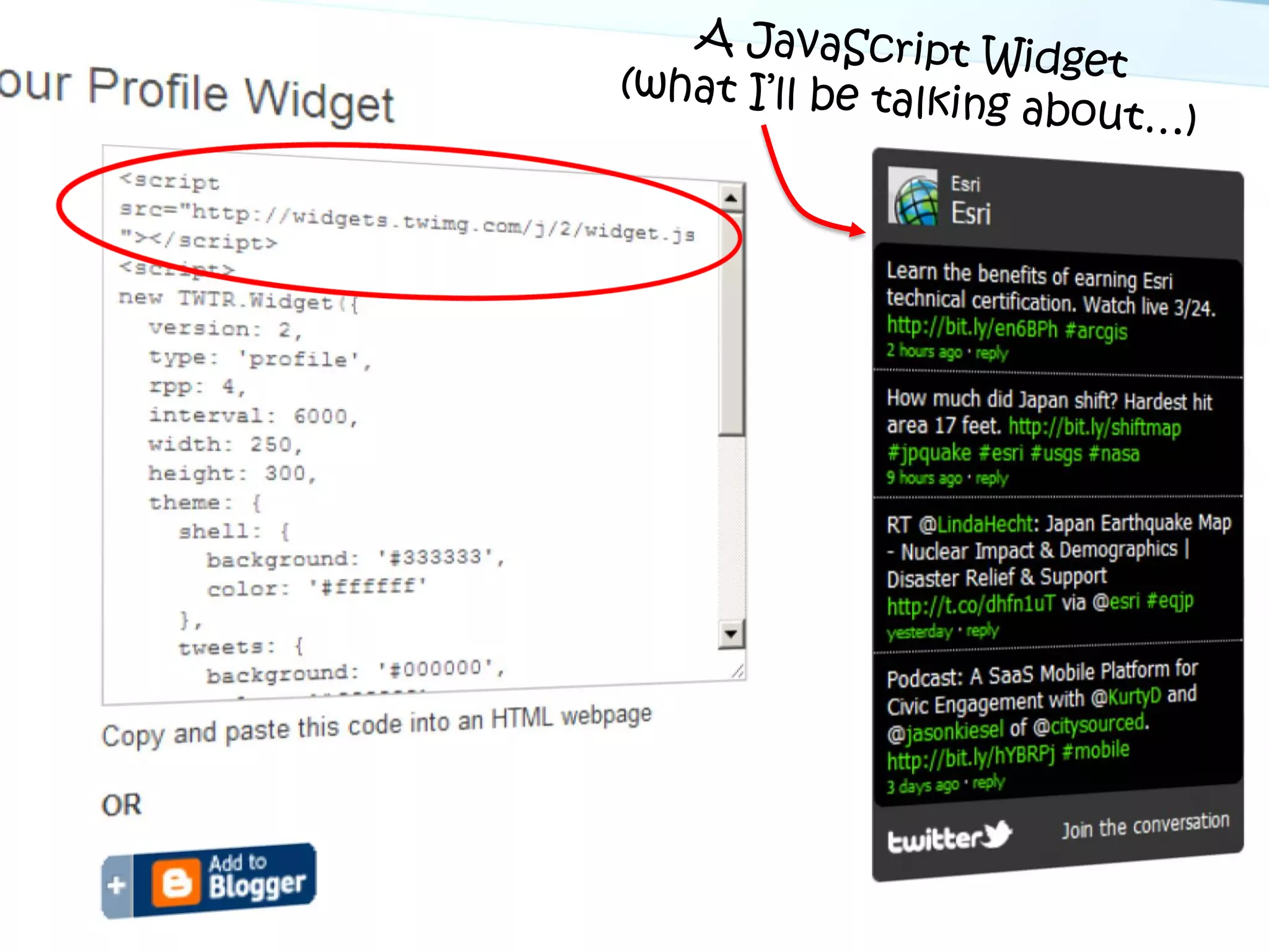
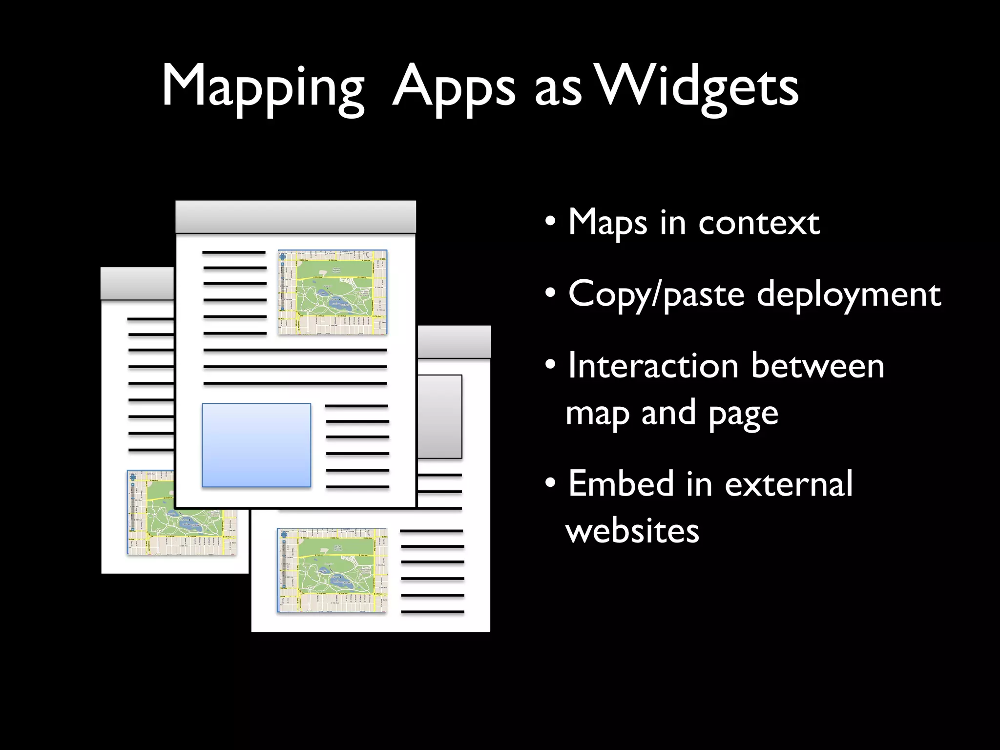
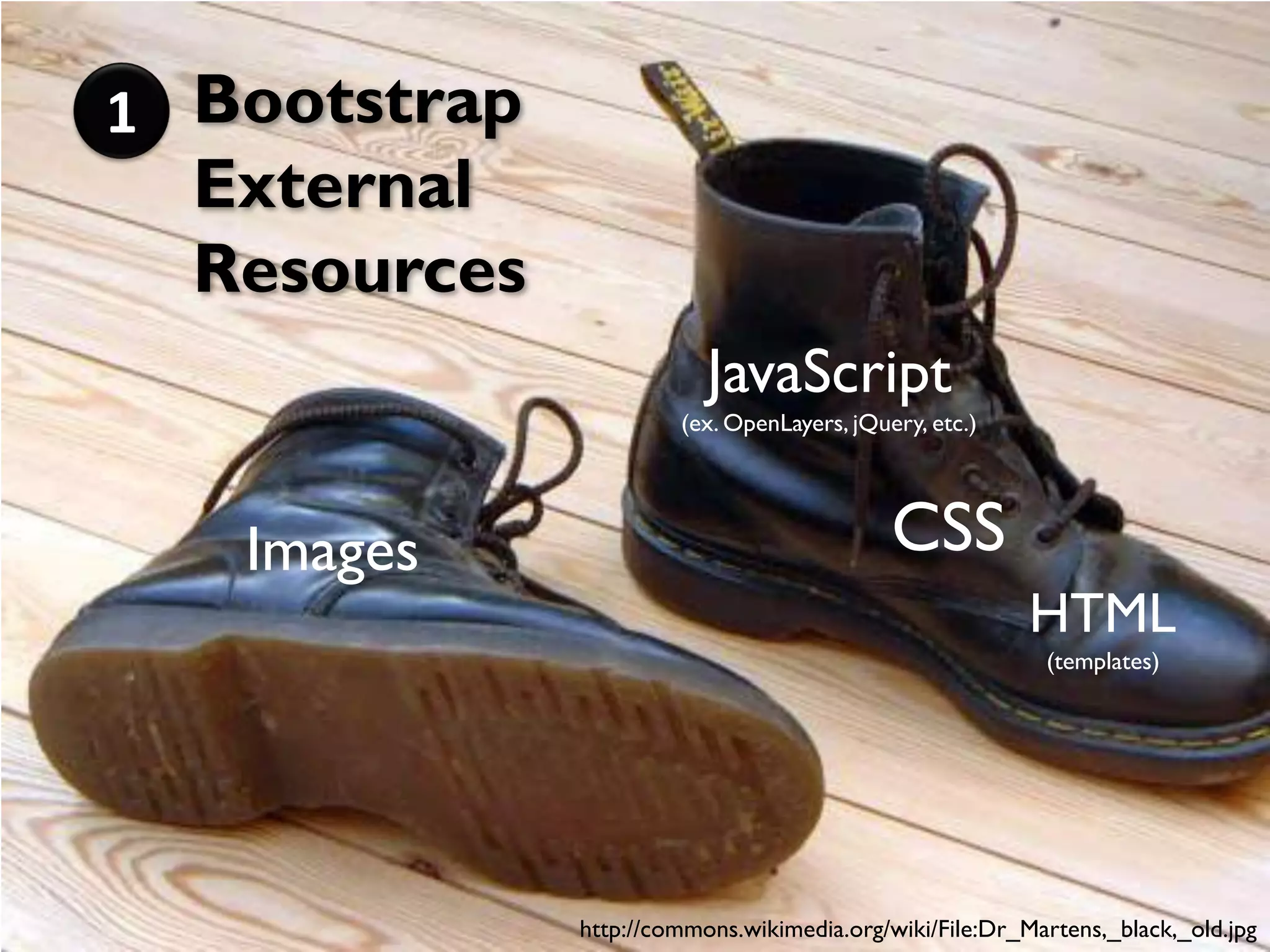
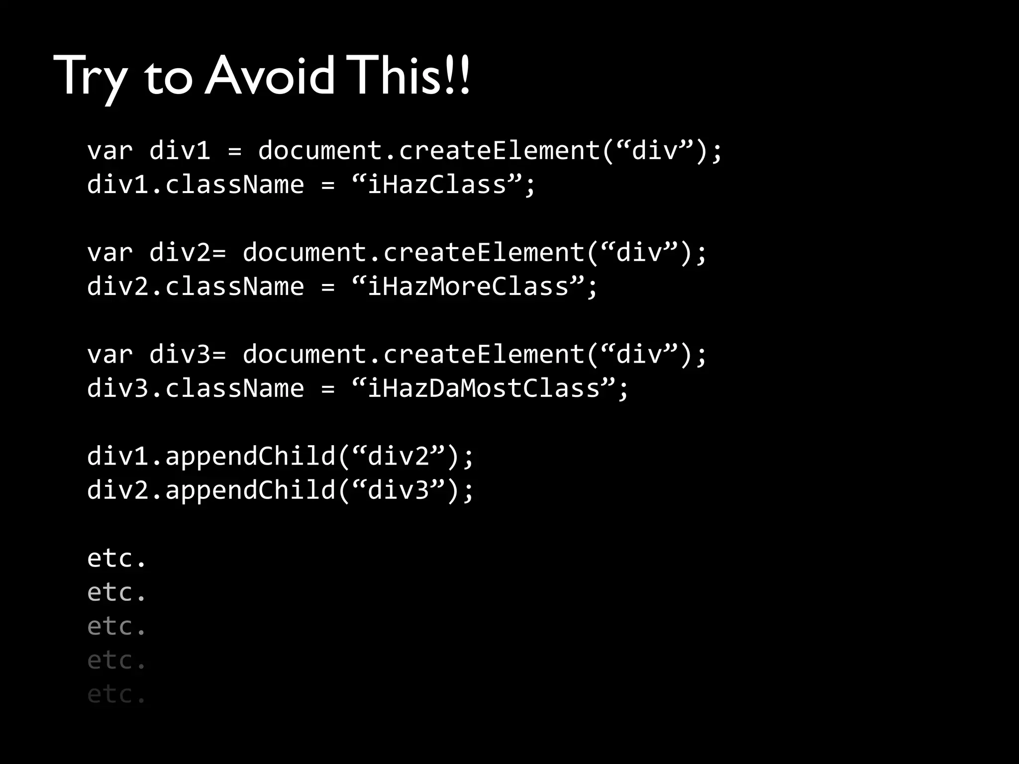
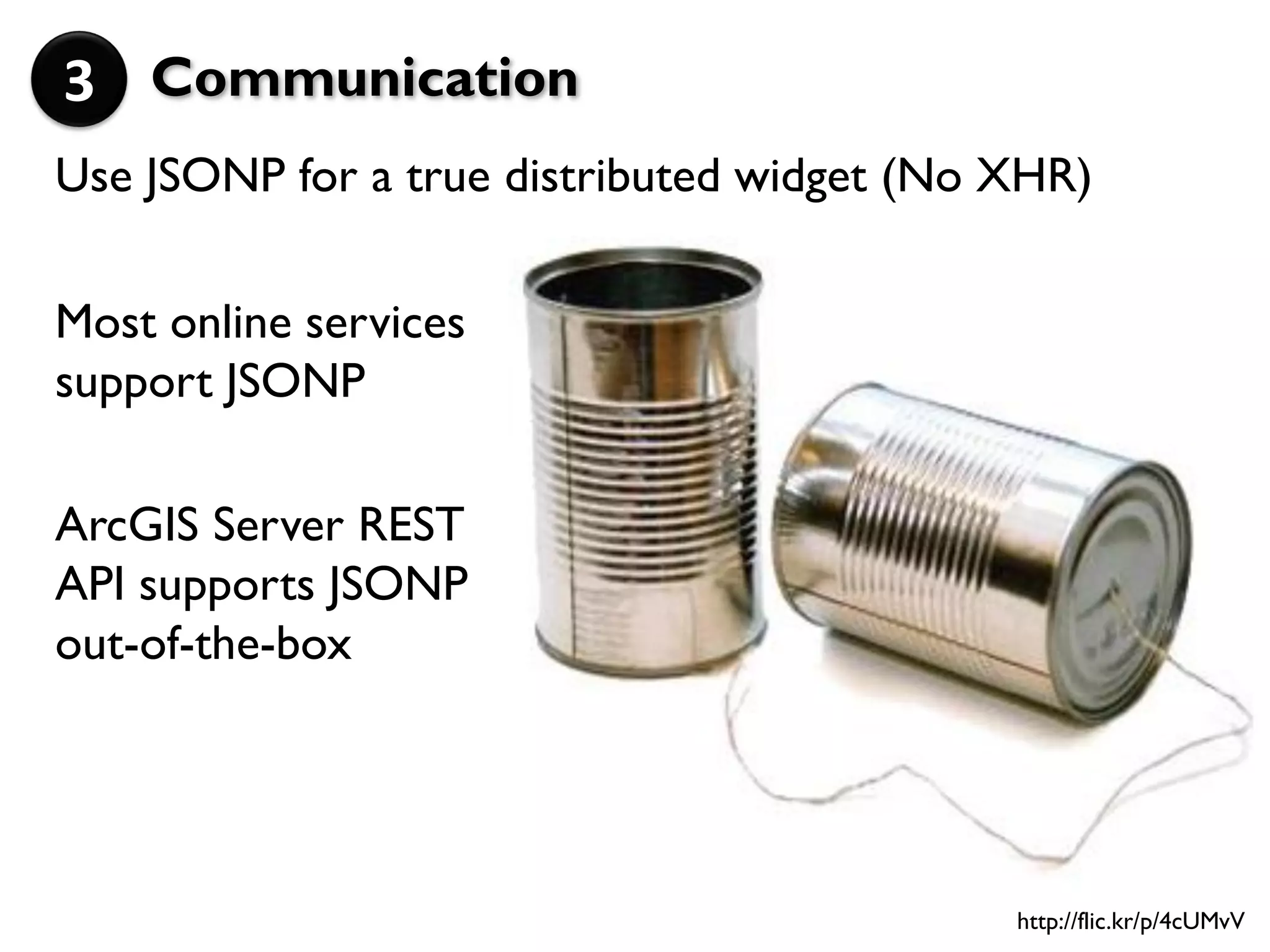
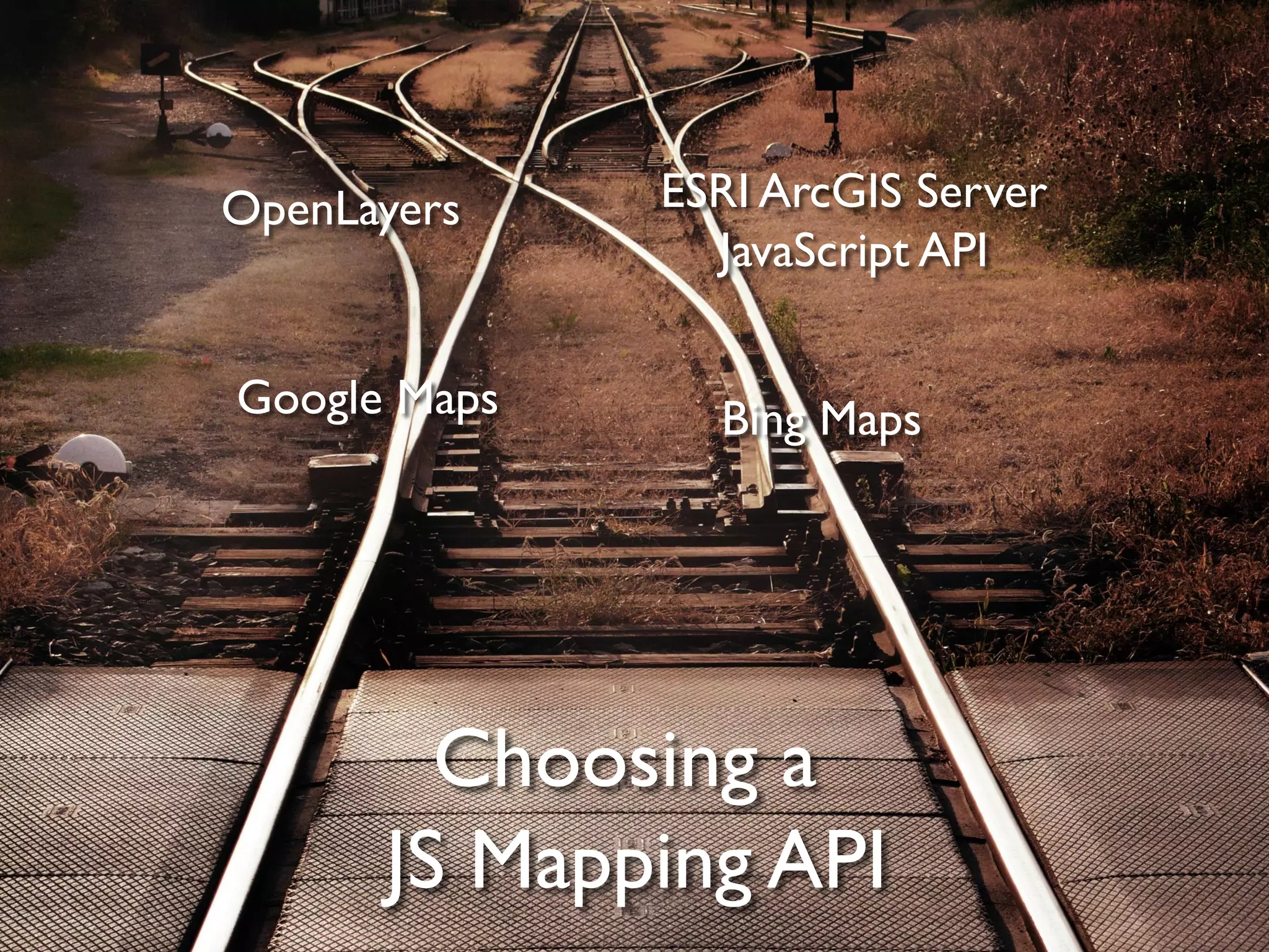
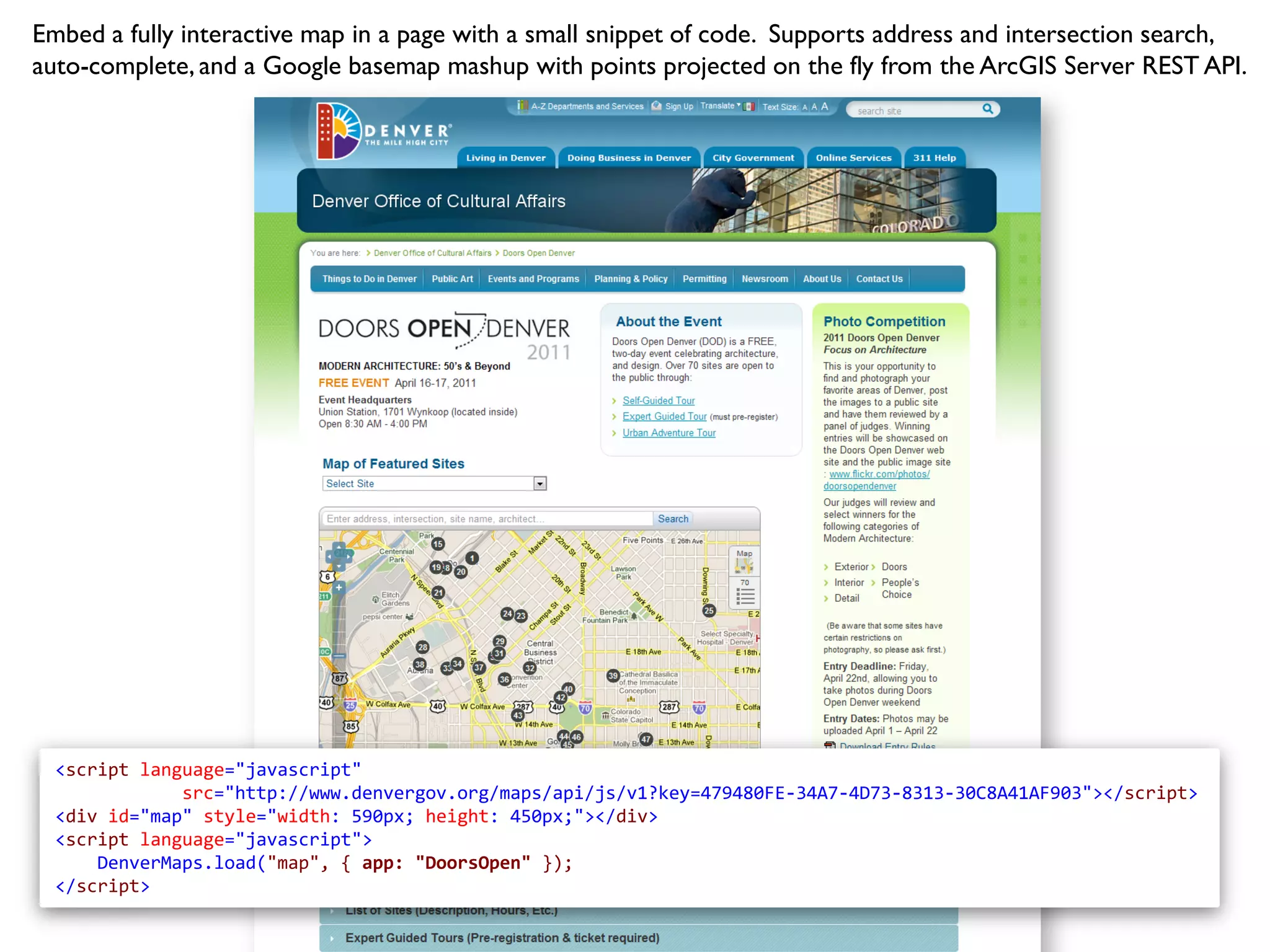
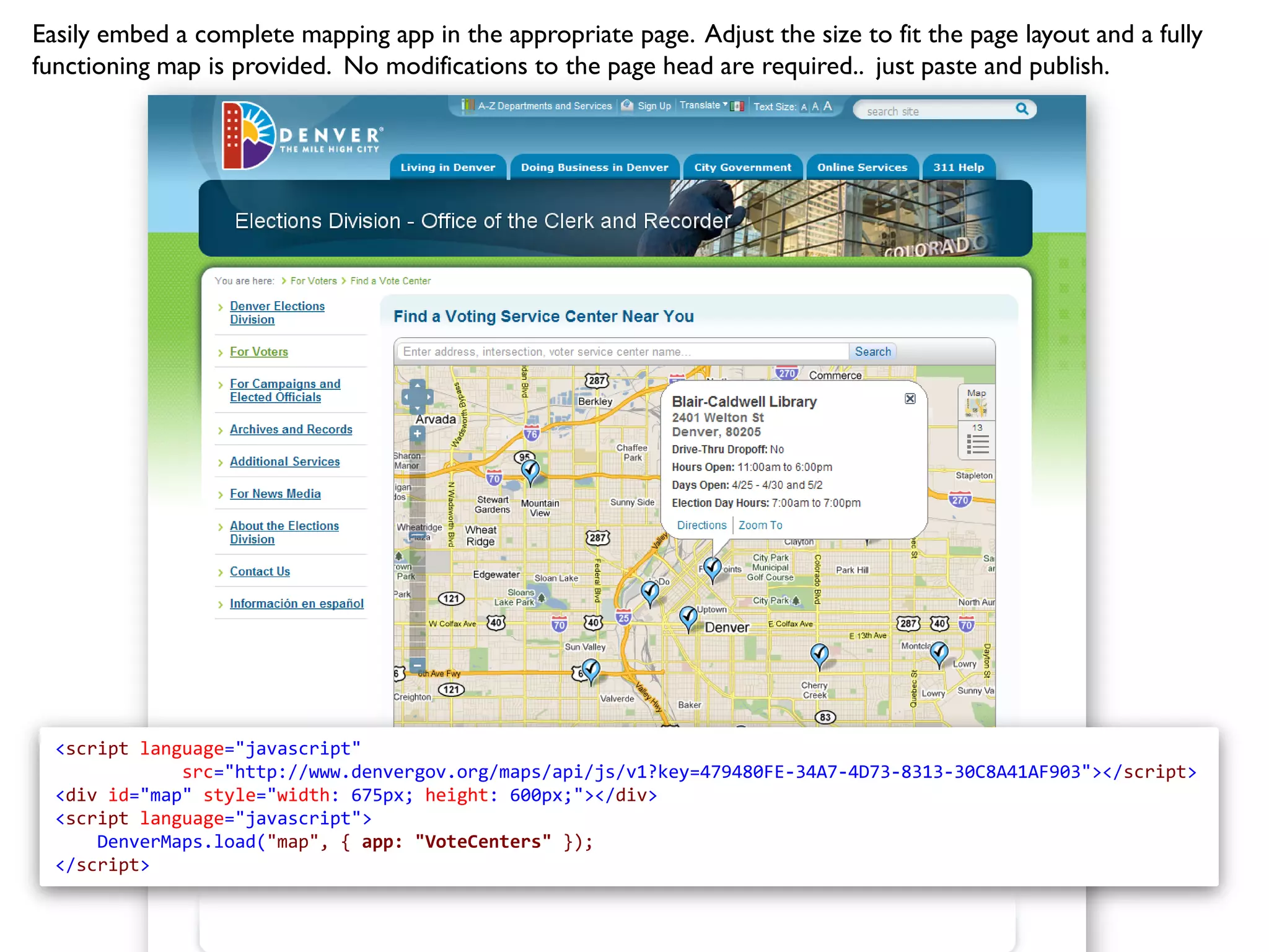
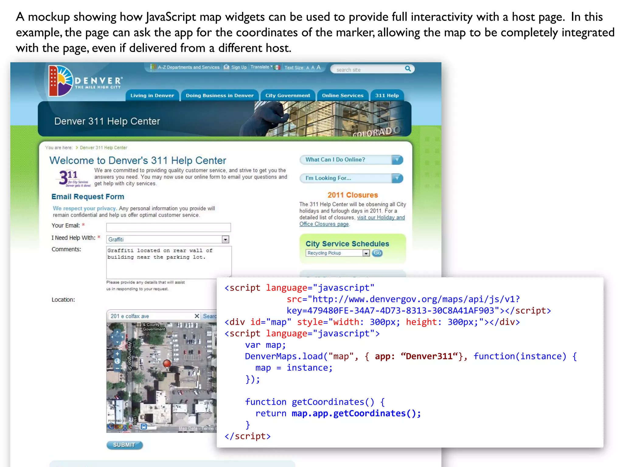
KEMBAR78
ESRI Dev Meetup: Building Distributed JavaScript Map Widgets | PDF
Building Distributed
JavaScript Map Widgets


            ESRI Dev Meetup, Denver - 3.29.2011
            Allan Glen, City and County of Denver
http://www.sxc.hu/photo/1281812
Use case:
      Local Government Website

Main Website                GIS Map Portal


                                 http://www.sxc.hu/photo/1114801
Mapping Apps as Widgets

             • Maps in context
             • Copy/paste deployment
             • Interaction between
               map and page
             • Embed in external
               websites
Typical JavaScript Embed Code

<script src=“http://www.yoursite.com/api.js?key=1234”>
<div id=“map” style=“width: 400px; height: 300px;”>
<script language=“javascript”>
       map.load(“map”, { app: “parks”, options: …} );
</script>
1 Bootstrap
  External
  Resources
                          JavaScript
                       (ex. OpenLayers, jQuery, etc.)


   Images                                   CSS
                                                         HTML
                                                          (templates)


              http://commons.wikimedia.org/wiki/File:Dr_Martens,_black,_old.jpg
Step 1: Bootstrapping
External Resources


                    http://commons.wikimedia.org/wiki/File:Dr_Martens,_black,_old.jpg
2 Build Out
  the
  DOM


              http://www.sxc.hu/photo/157966
Try to Avoid This!!
 var div1 = document.createElement(“div”);
 div1.className = “iHazClass”;

 var div2= document.createElement(“div”);
 div2.className = “iHazMoreClass”;

 var div3= document.createElement(“div”);
 div3.className = “iHazDaMostClass”;

 div1.appendChild(“div2”);
 div2.appendChild(“div3”);

 etc.
 etc.
 etc.
 etc.
 etc.
Then your web designer asks:
 “Hey, can we change up
 this layout? No big deal,
 right?“


                               http://www.sxc.hu/photo/1327383
Recommendation: jQuery Templates
• Can be remote loaded
• Easy to modify – just HTML
• Easy to bind with JSON objects and append to DOM
   $.tmpl(“Template”, features).appendTo(div)

• Templates client-side compiled for performance
3 Communication
Use JSONP for a true distributed widget (No XHR)

Most online services
support JSONP

ArcGIS Server REST
API supports JSONP
out-of-the-box


                                            http://flic.kr/p/4cUMvV
OpenLayers    ESRI ArcGIS Server
                JavaScript API

Google Maps     Bing Maps


        Choosing a
      JS Mapping API
Why We Chose OpenLayers
• Easy to bootstrap (single JS file)
• Custom build system – use only what you need
• Works great with the ArcGIS Server REST API
   • Geometry (not in core but easy to add)
   • Dynamic Services
   • Cached Map Services
• Map service neutral, not vendor or map service
  specific
There be crocodiles..


                 http://www.sxc.hu/photo/1088022
http://www.sxc.hu/photo/1209888
Nope. Must use a
            timeout..


http://www.sxc.hu/photo/708615
No access
  to the
page head
Cascading CSS Styles
    Use a CSS Reset block:
     Example: http://meyerweb.com/eric/tools/css/reset/


http://www.sxc.hu/photo/471235
Examples
Embed a fully interactive map in a page with a small snippet of code. Supports address and intersection search,
auto-complete, and a Google basemap mashup with points projected on the fly from the ArcGIS Server REST API.


  <script language="javascript"
              src="http://www.denvergov.org/maps/api/js/v1?key=479480FE-34A7-4D73-8313-30C8A41AF903"></script>
  <div id="map" style="width: 590px; height: 450px;"></div>
  <script language="javascript">
      DenverMaps.load("map", { app: "DoorsOpen" });
  </script>
Easily embed a complete mapping app in the appropriate page. Adjust the size to fit the page layout and a fully
functioning map is provided. No modifications to the page head are required.. just paste and publish.


  <script language="javascript"
              src="http://www.denvergov.org/maps/api/js/v1?key=479480FE-34A7-4D73-8313-30C8A41AF903"></script>
  <div id="map" style="width: 675px; height: 600px;"></div>
  <script language="javascript">
      DenverMaps.load("map", { app: "VoteCenters" });
  </script>
Want a Spanish version of the map? Just pass in a parameter specifying the language and apps that have been
globalized will be presented in that language.


  <script language="javascript"
              src="http://www.denvergov.org/maps/api/js/v1?key=479480FE-34A7-4D73-8313-30C8A41AF903"></script>
  <div id="map" style="width: 675px; height: 600px;"></div>
  <script language="javascript">
      DenverMaps.load("map", { app: "VoteCenters“, language: “es” });
  </script>
A mockup showing how JavaScript map widgets can be used to provide full interactivity with a host page. In this
example, the page can ask the app for the coordinates of the marker, allowing the map to be completely integrated
with the page, even if delivered from a different host.


                                       <script language="javascript"
                                                   src="http://www.denvergov.org/maps/api/js/v1?
                                                   key=479480FE-34A7-4D73-8313-30C8A41AF903"></script>
                                       <div id="map" style="width: 300px; height: 300px;"></div>
                                       <script language="javascript">
                                           var map;
                                           DenverMaps.load("map", { app: “Denver311“}, function(instance) {
                                             map = instance;
                                           });

                                           function getCoordinates() {
                                             return map.app.getCoordinates();
                                           }
                                       </script>
Thank You

ESRI Dev Meetup: Building Distributed JavaScript Map Widgets

  • 1.
    Building Distributed JavaScript MapWidgets ESRI Dev Meetup, Denver - 3.29.2011 Allan Glen, City and County of Denver
  • 4.
  • 5.
    Use case: Local Government Website Main Website GIS Map Portal http://www.sxc.hu/photo/1114801
  • 6.
    Mapping Apps asWidgets • Maps in context • Copy/paste deployment • Interaction between map and page • Embed in external websites
  • 7.
    Typical JavaScript EmbedCode <script src=“http://www.yoursite.com/api.js?key=1234”> <div id=“map” style=“width: 400px; height: 300px;”> <script language=“javascript”> map.load(“map”, { app: “parks”, options: …} ); </script>
  • 8.
    1 Bootstrap External Resources JavaScript (ex. OpenLayers, jQuery, etc.) Images CSS HTML (templates) http://commons.wikimedia.org/wiki/File:Dr_Martens,_black,_old.jpg
  • 9.
    Step 1: Bootstrapping ExternalResources http://commons.wikimedia.org/wiki/File:Dr_Martens,_black,_old.jpg
  • 10.
    2 Build Out the DOM http://www.sxc.hu/photo/157966
  • 11.
    Try to AvoidThis!! var div1 = document.createElement(“div”); div1.className = “iHazClass”; var div2= document.createElement(“div”); div2.className = “iHazMoreClass”; var div3= document.createElement(“div”); div3.className = “iHazDaMostClass”; div1.appendChild(“div2”); div2.appendChild(“div3”); etc. etc. etc. etc. etc.
  • 12.
    Then your webdesigner asks: “Hey, can we change up this layout? No big deal, right?“ http://www.sxc.hu/photo/1327383
  • 13.
    Recommendation: jQuery Templates •Can be remote loaded • Easy to modify – just HTML • Easy to bind with JSON objects and append to DOM $.tmpl(“Template”, features).appendTo(div) • Templates client-side compiled for performance
  • 14.
    3 Communication Use JSONPfor a true distributed widget (No XHR) Most online services support JSONP ArcGIS Server REST API supports JSONP out-of-the-box http://flic.kr/p/4cUMvV
  • 15.
    OpenLayers ESRI ArcGIS Server JavaScript API Google Maps Bing Maps Choosing a JS Mapping API
  • 16.
    Why We ChoseOpenLayers • Easy to bootstrap (single JS file) • Custom build system – use only what you need • Works great with the ArcGIS Server REST API • Geometry (not in core but easy to add) • Dynamic Services • Cached Map Services • Map service neutral, not vendor or map service specific
  • 17.
    There be crocodiles.. http://www.sxc.hu/photo/1088022
  • 18.
  • 19.
    Nope. Must usea timeout.. http://www.sxc.hu/photo/708615
  • 20.
    No access to the page head
  • 21.
    Cascading CSS Styles Use a CSS Reset block: Example: http://meyerweb.com/eric/tools/css/reset/ http://www.sxc.hu/photo/471235
  • 22.
  • 23.
    Embed a fullyinteractive map in a page with a small snippet of code. Supports address and intersection search, auto-complete, and a Google basemap mashup with points projected on the fly from the ArcGIS Server REST API. <script language="javascript" src="http://www.denvergov.org/maps/api/js/v1?key=479480FE-34A7-4D73-8313-30C8A41AF903"></script> <div id="map" style="width: 590px; height: 450px;"></div> <script language="javascript"> DenverMaps.load("map", { app: "DoorsOpen" }); </script>
  • 24.
    Easily embed acomplete mapping app in the appropriate page. Adjust the size to fit the page layout and a fully functioning map is provided. No modifications to the page head are required.. just paste and publish. <script language="javascript" src="http://www.denvergov.org/maps/api/js/v1?key=479480FE-34A7-4D73-8313-30C8A41AF903"></script> <div id="map" style="width: 675px; height: 600px;"></div> <script language="javascript"> DenverMaps.load("map", { app: "VoteCenters" }); </script>
  • 25.
    Want a Spanishversion of the map? Just pass in a parameter specifying the language and apps that have been globalized will be presented in that language. <script language="javascript" src="http://www.denvergov.org/maps/api/js/v1?key=479480FE-34A7-4D73-8313-30C8A41AF903"></script> <div id="map" style="width: 675px; height: 600px;"></div> <script language="javascript"> DenverMaps.load("map", { app: "VoteCenters“, language: “es” }); </script>
  • 26.
    A mockup showinghow JavaScript map widgets can be used to provide full interactivity with a host page. In this example, the page can ask the app for the coordinates of the marker, allowing the map to be completely integrated with the page, even if delivered from a different host. <script language="javascript" src="http://www.denvergov.org/maps/api/js/v1? key=479480FE-34A7-4D73-8313-30C8A41AF903"></script> <div id="map" style="width: 300px; height: 300px;"></div> <script language="javascript"> var map; DenverMaps.load("map", { app: “Denver311“}, function(instance) { map = instance; }); function getCoordinates() { return map.app.getCoordinates(); } </script>
  • 27.