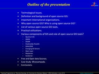
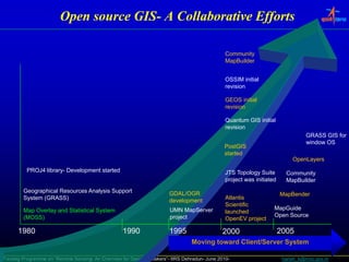
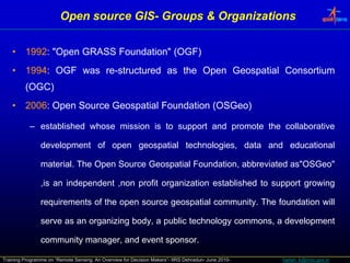
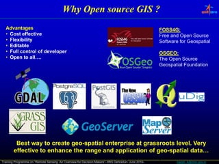
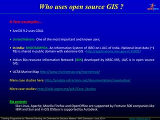
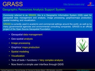
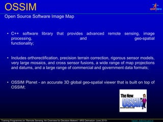
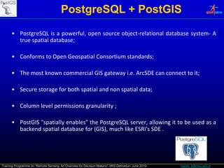
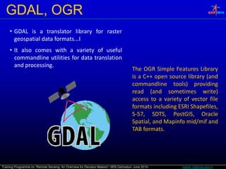
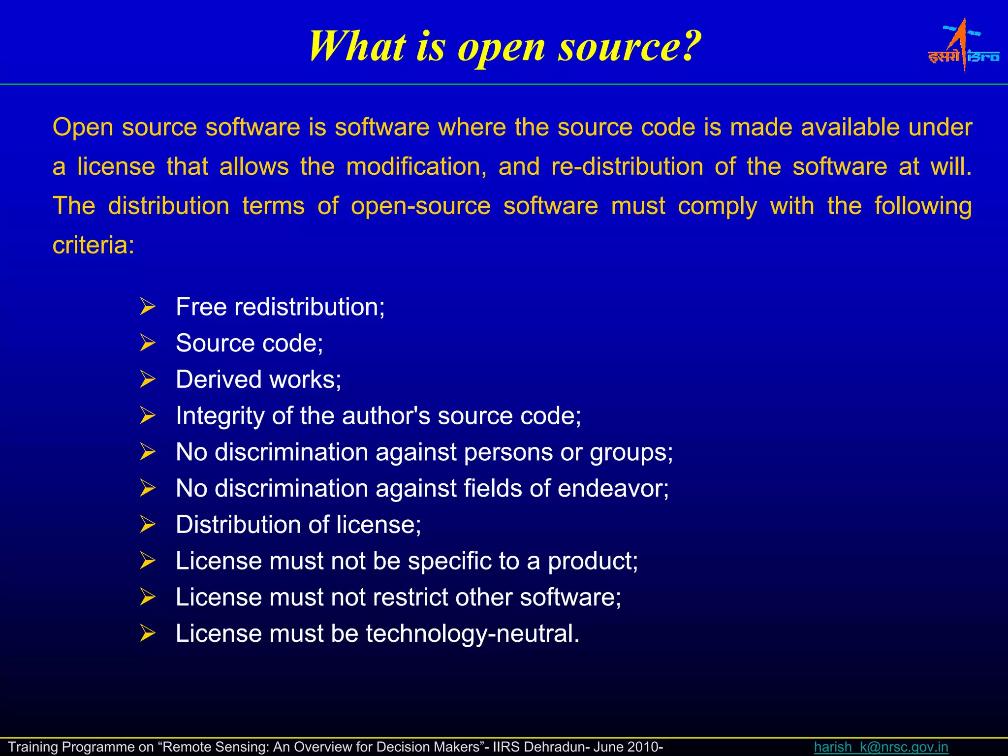
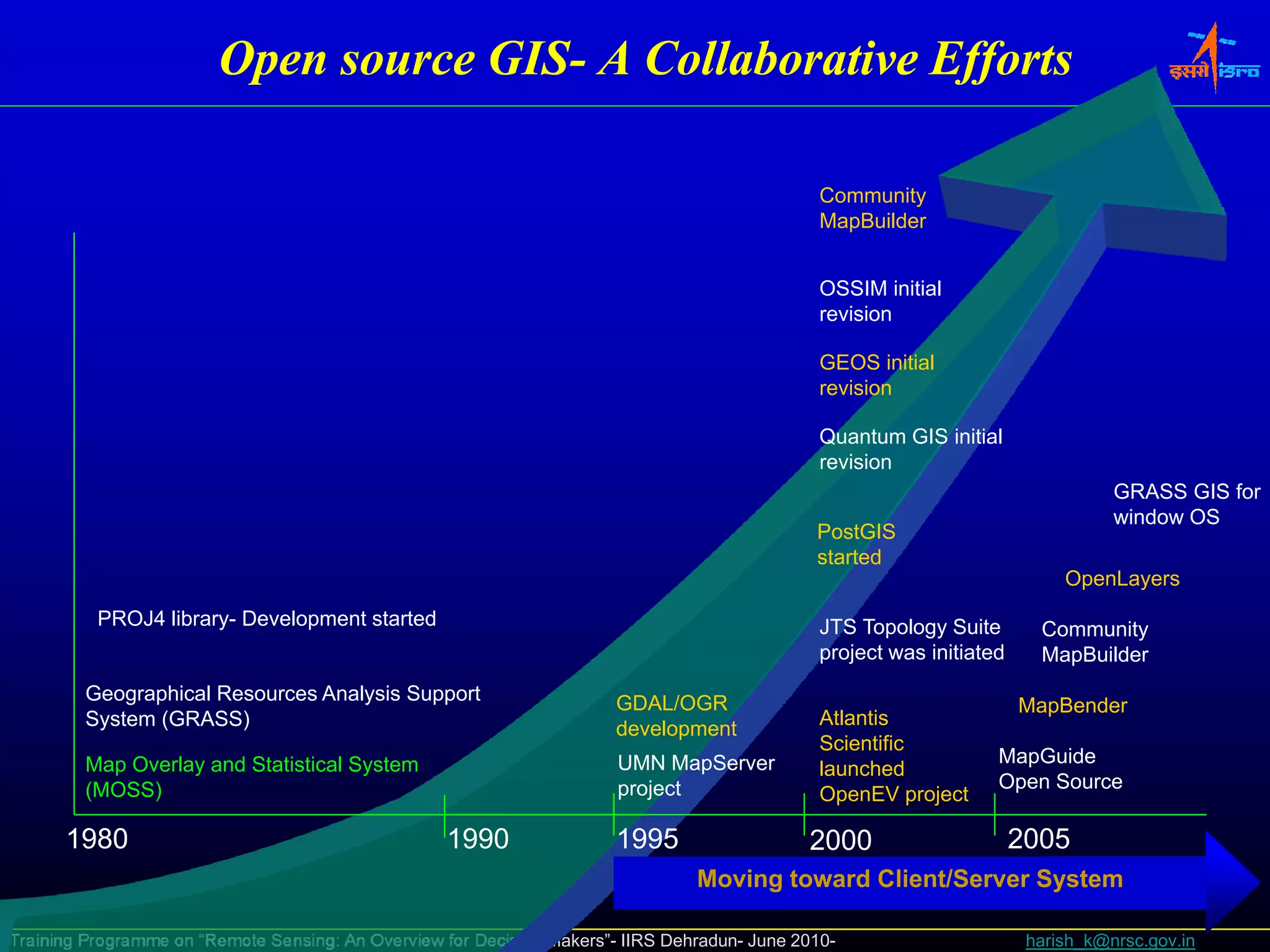
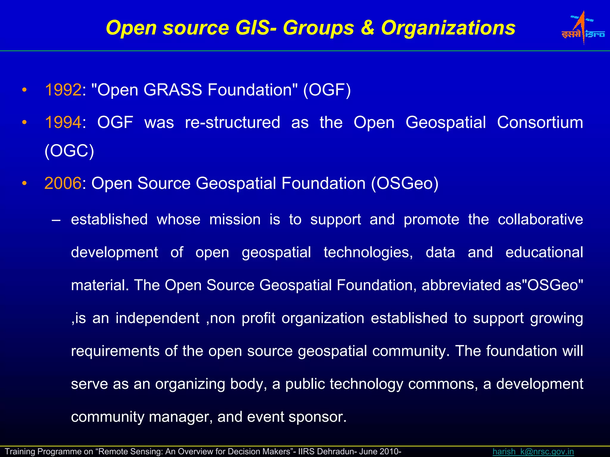
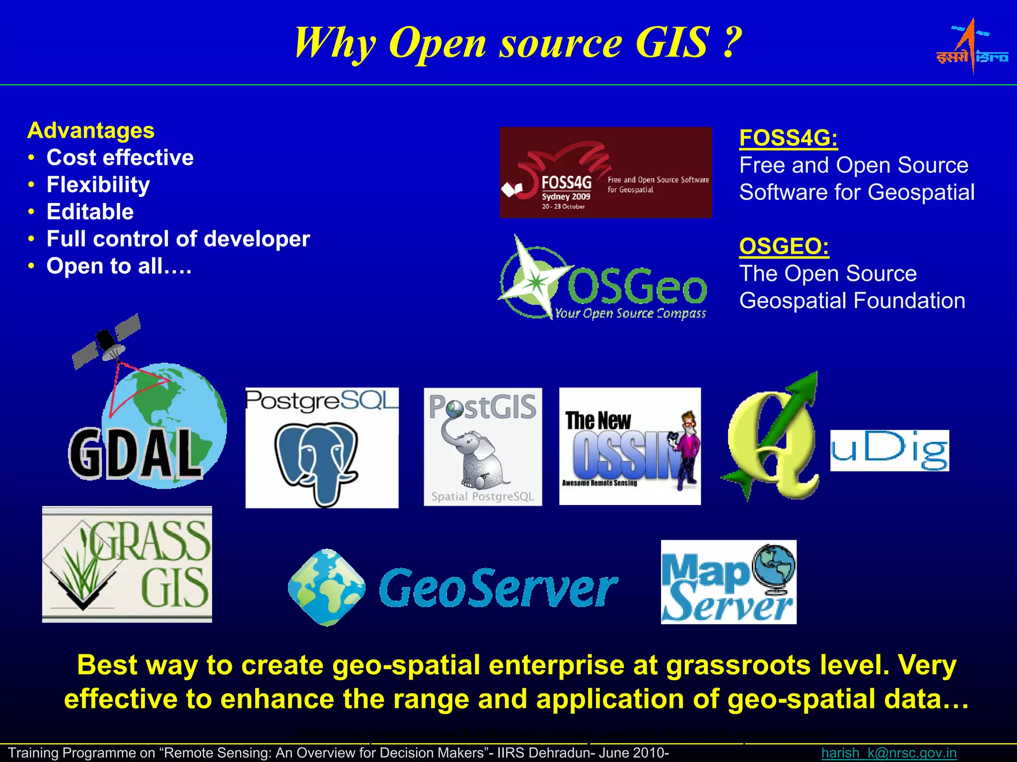
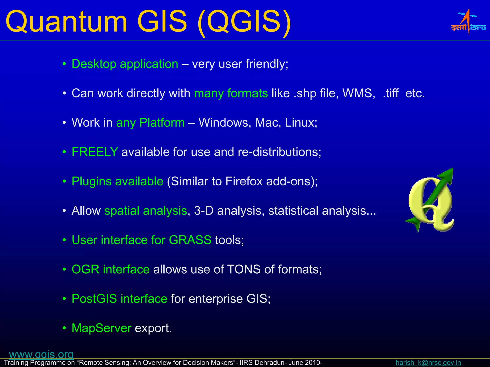
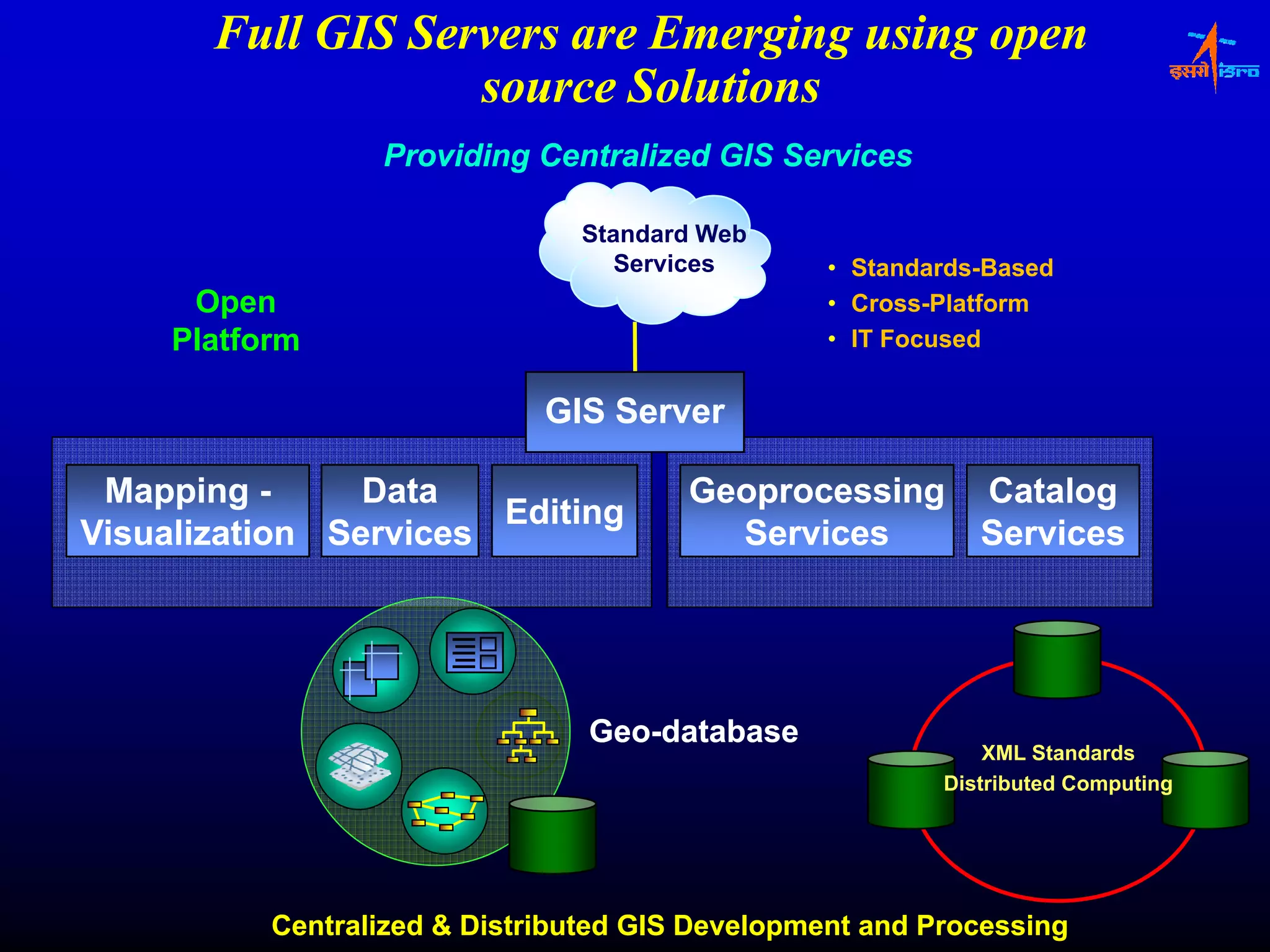
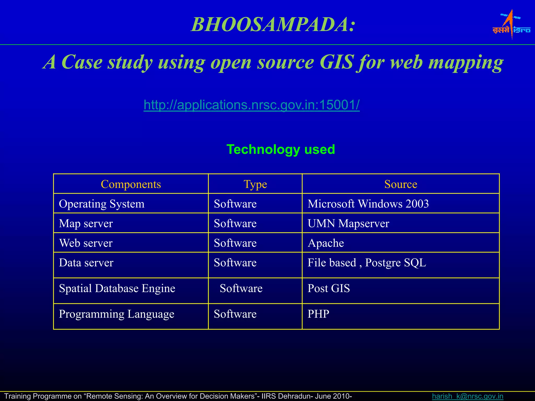
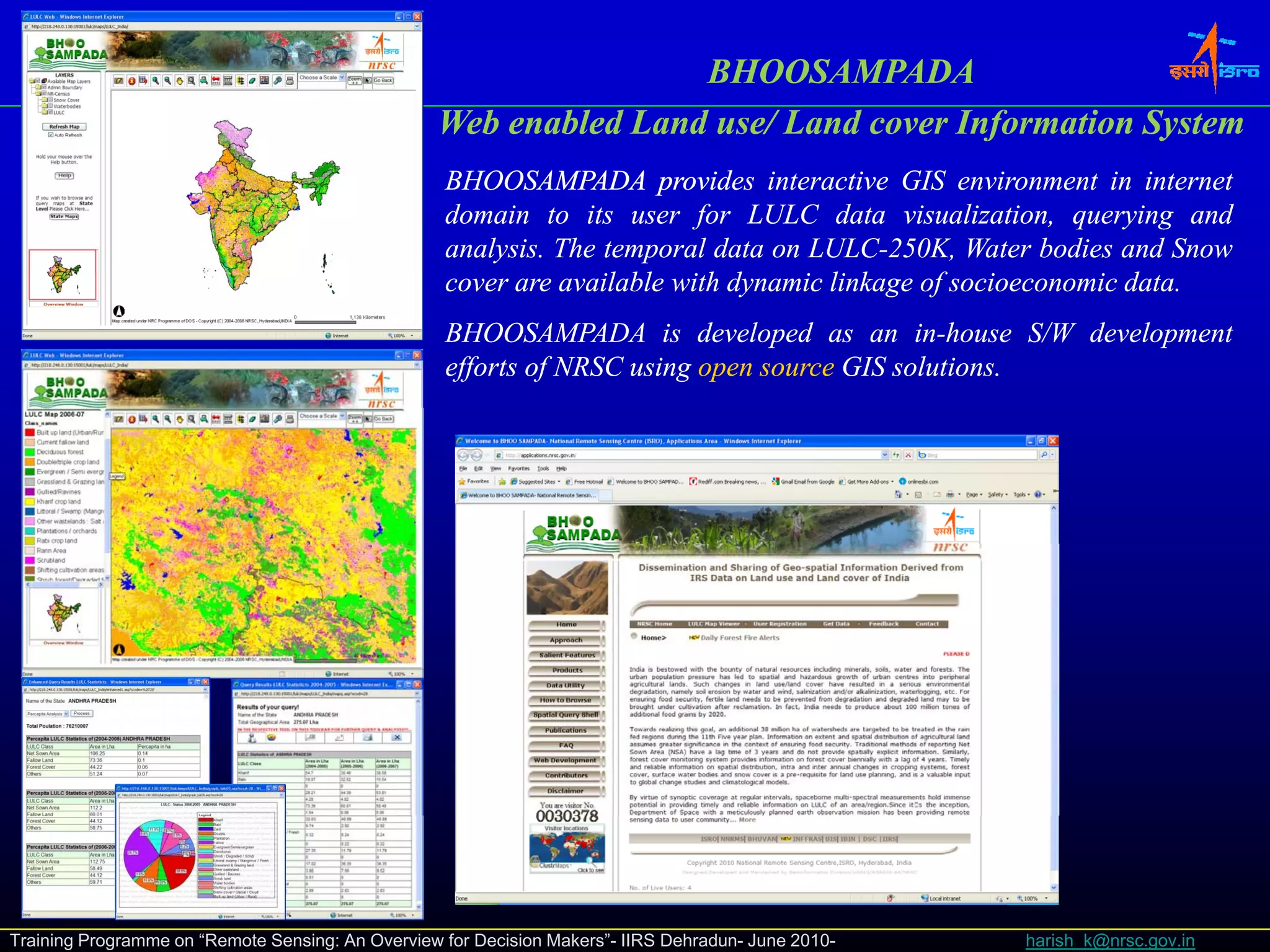
The document outlines a presentation about open source software solutions and data services for geographic information systems (GIS) domains. It discusses the definition and background of open source GIS, lists various open source GIS tools like Quantum GIS, GRASS, OSSIM, PostGreSQL+PostGIS, GDAL/OGR, and emerging GIS servers. It also covers free and open data sources and a case study of applying open source GIS to land records management in India. The presentation aims to explain why open source GIS is used, who the users are, and the advantages like being cost effective, flexible, and giving full control over development.

![Enabling Technologies
Data [
[Process] Information
] [
[Model]
] DSS/SDSS [
[Knowledge Discovery ( ) ] Expert System
g y (AI) p y
Faster Hardware
Open source solutions
l i
Distributed Computing
Mobile/Wireless GIS
Services Oriented Architecture Pervasive
Computing
Virtual reality‐3D modeling
reality‐
Large d t b
L database h dli
handling
Modeling‐
Modeling‐ DSS/SDSS
Knowledge Discover –ES
Capacity In 10 Years
• 100x Computing
• 1000x Storage
• 5000x Networks
Terabyte/second data communications
Training Programme on “Remote Sensing: An Overview for Decision Makers”- IIRS Dehradun- June 2010- harish_k@nrsc.gov.in](https://image.slidesharecdn.com/iirsopensourcesoftwarefordevelopmentofc-110307180531-phpapp02/85/Iirs-Opensources-software-solutions-and-Data-services-for-Domain-3-320.jpg)

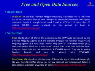
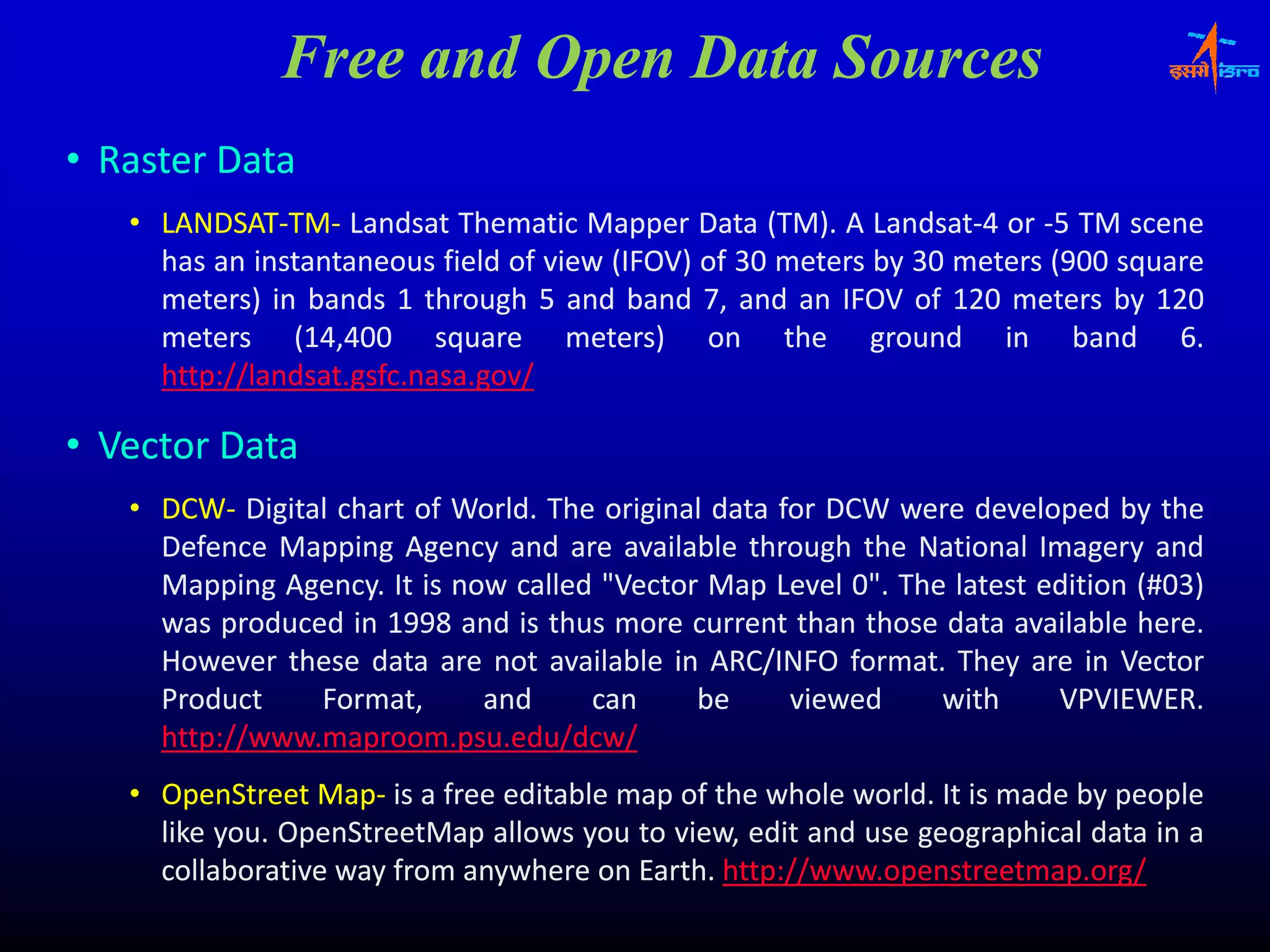
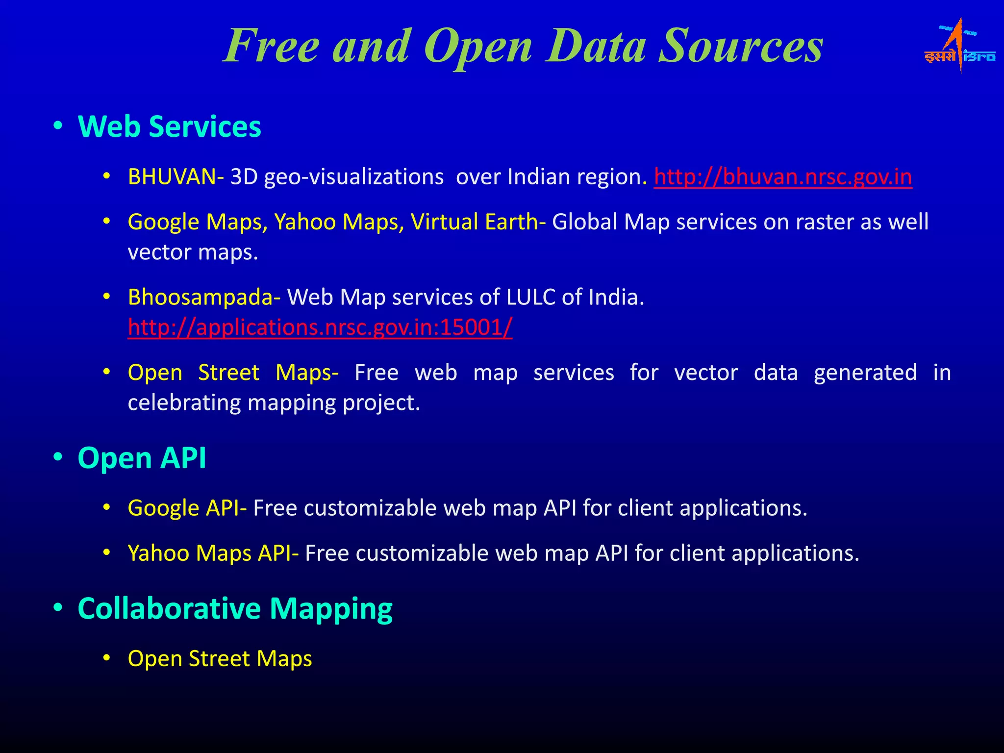
![Free and Open Data Sources
• Elevations Data
• SRTM‐The Shuttle Radar Topography Mission (SRTM) is an international research
SRTM‐
effort.
effort. The elevation models are arranged into tiles, each covering one degree of
g , g g
latitude and one degree of longitude, named according to their south western
corners.
corners. It follows that "n45e006" stretches from 45°N 6°E to 46°N 7°E and
"n45e006" 45° 46°
"s45w006"
"s45w006" from 45°S 6°W to 44°S 5°W. The resolution of the cells of the source
45° 44°
data is
d t i one arc second, b t 1" (
d but (approx. 30 meter) d t h
(approx. meter) data have only b
t l been released over
l d
United States territory; for the rest of the world, only three‐arc‐second (approx. 90‐
territory; three‐arc‐ approx. 90‐
meter) data are available.[3] Each one arc second tile has 3,601 rows, each
meter) available.
consisting of 3,601 16 bit bigendian cells. The dimensions of the three‐arc‐second
cells. three‐arc‐
tiles are 1201 x 1201.‐ http://www2.jpl.nasa..gov/srtm/ . For data‐ http://srtm.csi..cgiar..org/
1201. http://www2 jpl.nasa data‐ http://srtm.csi cgiar
• ASTER‐ On 29 June 2009, the Global Digital Elevation Model (GDEM) was released
ASTER‐ 2009,
to the public. A joint operation between NASA and Japan's Ministry of Economy,
public.
Trade and Industry (METI). It was created by compiling 1.3 million VNIR images
(METI).
taken by ASTER using single‐pass stereoscopic correlation techniques, with terrain
single‐
elevation measurements taken globally at 30 meter.
meter.
http://asterweb.jpl.nasa.gov/content/03_data/01_Data_Products/release_DEM_relative.htm
h // bj l / /03 d /01 d / l l i h](https://image.slidesharecdn.com/iirsopensourcesoftwarefordevelopmentofc-110307180531-phpapp02/85/Iirs-Opensources-software-solutions-and-Data-services-for-Domain-29-320.jpg)
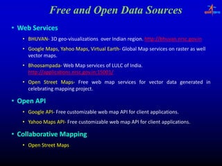

![Enabling Technologies
Data [
[Process] Information
] [
[Model]
] DSS/SDSS [
[Knowledge Discovery ( ) ] Expert System
g y (AI) p y
Faster Hardware
Open source solutions
l i
Distributed Computing
Mobile/Wireless GIS
Services Oriented Architecture Pervasive
Computing
Virtual reality‐3D modeling
reality‐
Large d t b
L database h dli
handling
Modeling‐
Modeling‐ DSS/SDSS
Knowledge Discover –ES
Capacity In 10 Years
• 100x Computing
• 1000x Storage
• 5000x Networks
Terabyte/second data communications
Training Programme on “Remote Sensing: An Overview for Decision Makers”- IIRS Dehradun- June 2010- harish_k@nrsc.gov.in](https://image.slidesharecdn.com/iirsopensourcesoftwarefordevelopmentofc-110307180531-phpapp02/75/Iirs-Opensources-software-solutions-and-Data-services-for-Domain-3-2048.jpg)


![Free and Open Data Sources
• Elevations Data
• SRTM‐The Shuttle Radar Topography Mission (SRTM) is an international research
SRTM‐
effort.
effort. The elevation models are arranged into tiles, each covering one degree of
g , g g
latitude and one degree of longitude, named according to their south western
corners.
corners. It follows that "n45e006" stretches from 45°N 6°E to 46°N 7°E and
"n45e006" 45° 46°
"s45w006"
"s45w006" from 45°S 6°W to 44°S 5°W. The resolution of the cells of the source
45° 44°
data is
d t i one arc second, b t 1" (
d but (approx. 30 meter) d t h
(approx. meter) data have only b
t l been released over
l d
United States territory; for the rest of the world, only three‐arc‐second (approx. 90‐
territory; three‐arc‐ approx. 90‐
meter) data are available.[3] Each one arc second tile has 3,601 rows, each
meter) available.
consisting of 3,601 16 bit bigendian cells. The dimensions of the three‐arc‐second
cells. three‐arc‐
tiles are 1201 x 1201.‐ http://www2.jpl.nasa..gov/srtm/ . For data‐ http://srtm.csi..cgiar..org/
1201. http://www2 jpl.nasa data‐ http://srtm.csi cgiar
• ASTER‐ On 29 June 2009, the Global Digital Elevation Model (GDEM) was released
ASTER‐ 2009,
to the public. A joint operation between NASA and Japan's Ministry of Economy,
public.
Trade and Industry (METI). It was created by compiling 1.3 million VNIR images
(METI).
taken by ASTER using single‐pass stereoscopic correlation techniques, with terrain
single‐
elevation measurements taken globally at 30 meter.
meter.
http://asterweb.jpl.nasa.gov/content/03_data/01_Data_Products/release_DEM_relative.htm
h // bj l / /03 d /01 d / l l i h](https://image.slidesharecdn.com/iirsopensourcesoftwarefordevelopmentofc-110307180531-phpapp02/75/Iirs-Opensources-software-solutions-and-Data-services-for-Domain-29-2048.jpg)


![[Day 3] Building Sustainable Communities](https://cdn.slidesharecdn.com/ss_thumbnails/3-7buildingsustainablecommunities-090415140540-phpapp02-thumbnail.jpg?width=600ounds&width=560&fit=bounds)


![[Day 3] Assessment Grid By Chris Nicholas](https://cdn.slidesharecdn.com/ss_thumbnails/4-1assessmentgridbychrisnicholas-090415140948-phpapp02-thumbnail.jpg?width=600ounds&width=560&fit=bounds)


