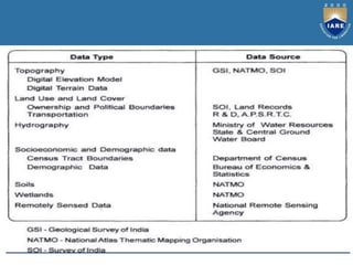
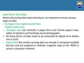
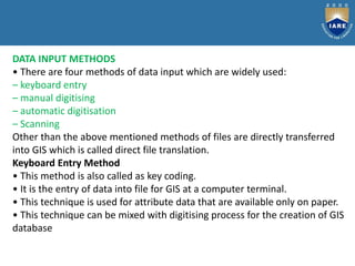
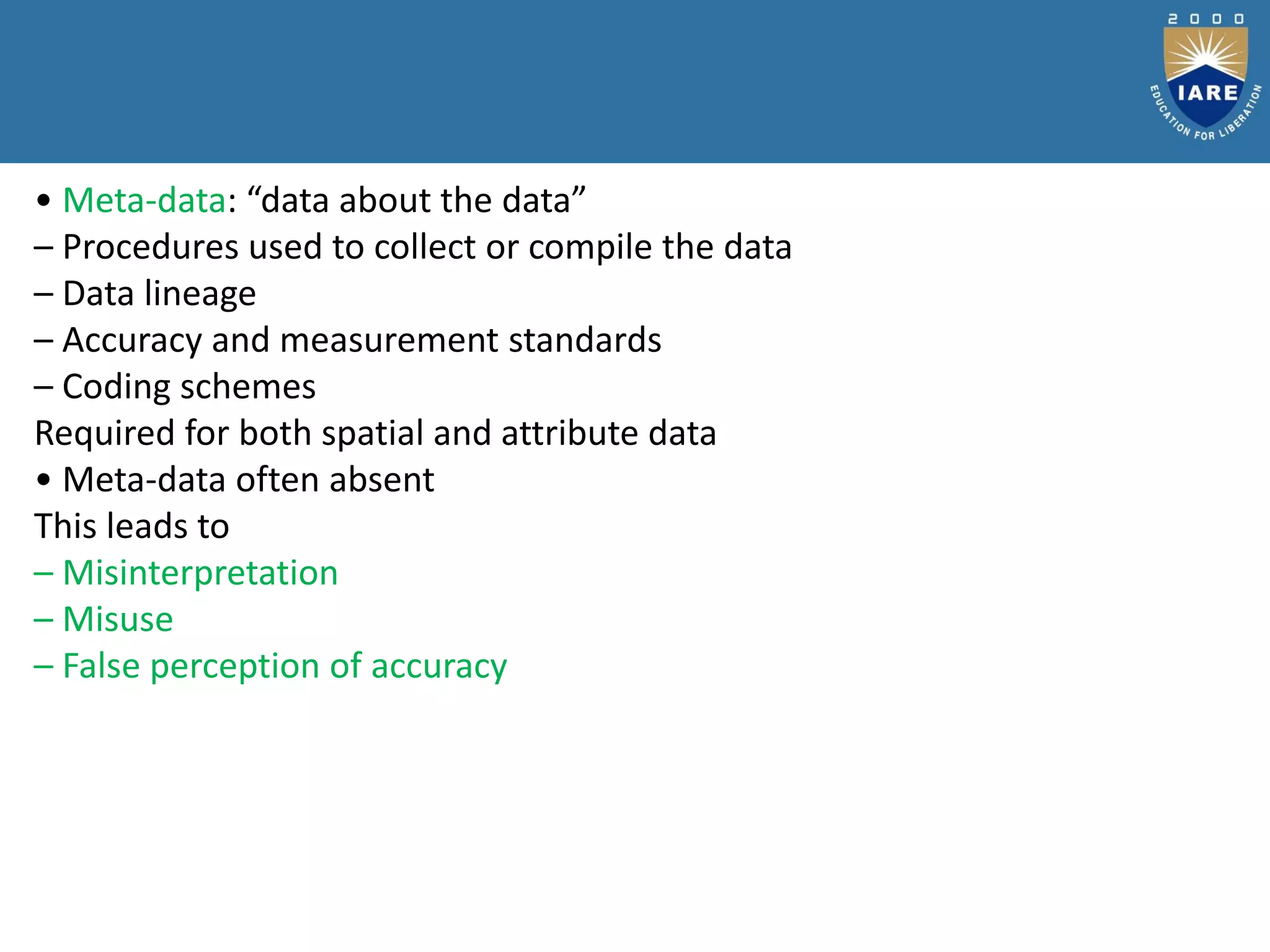
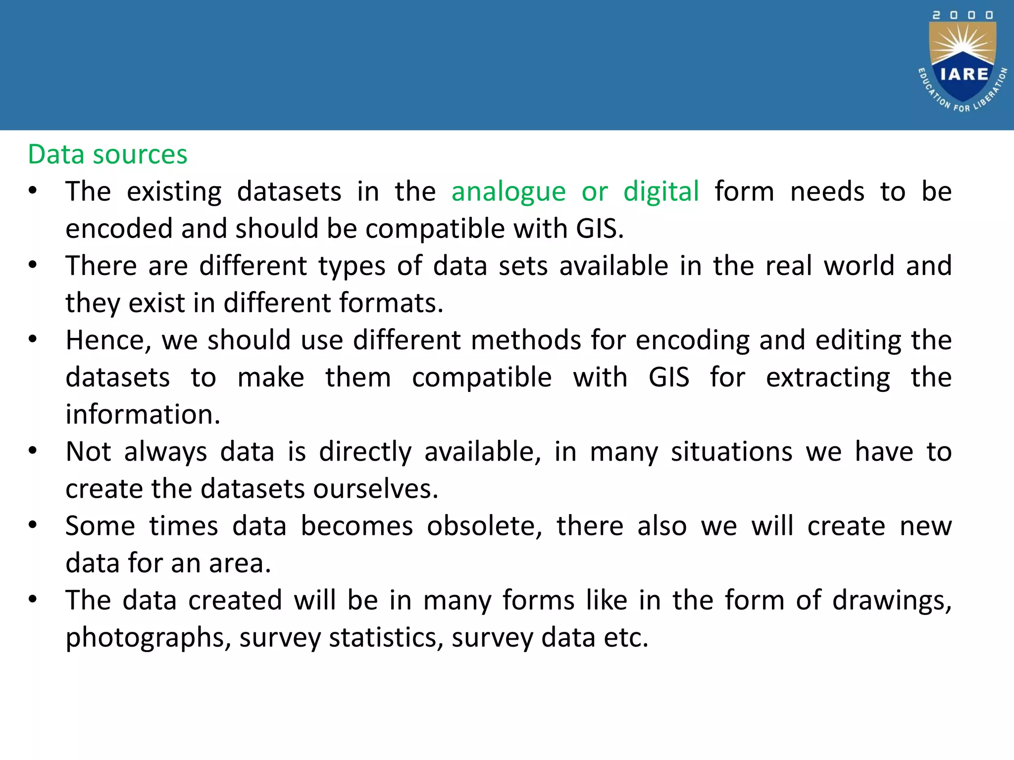
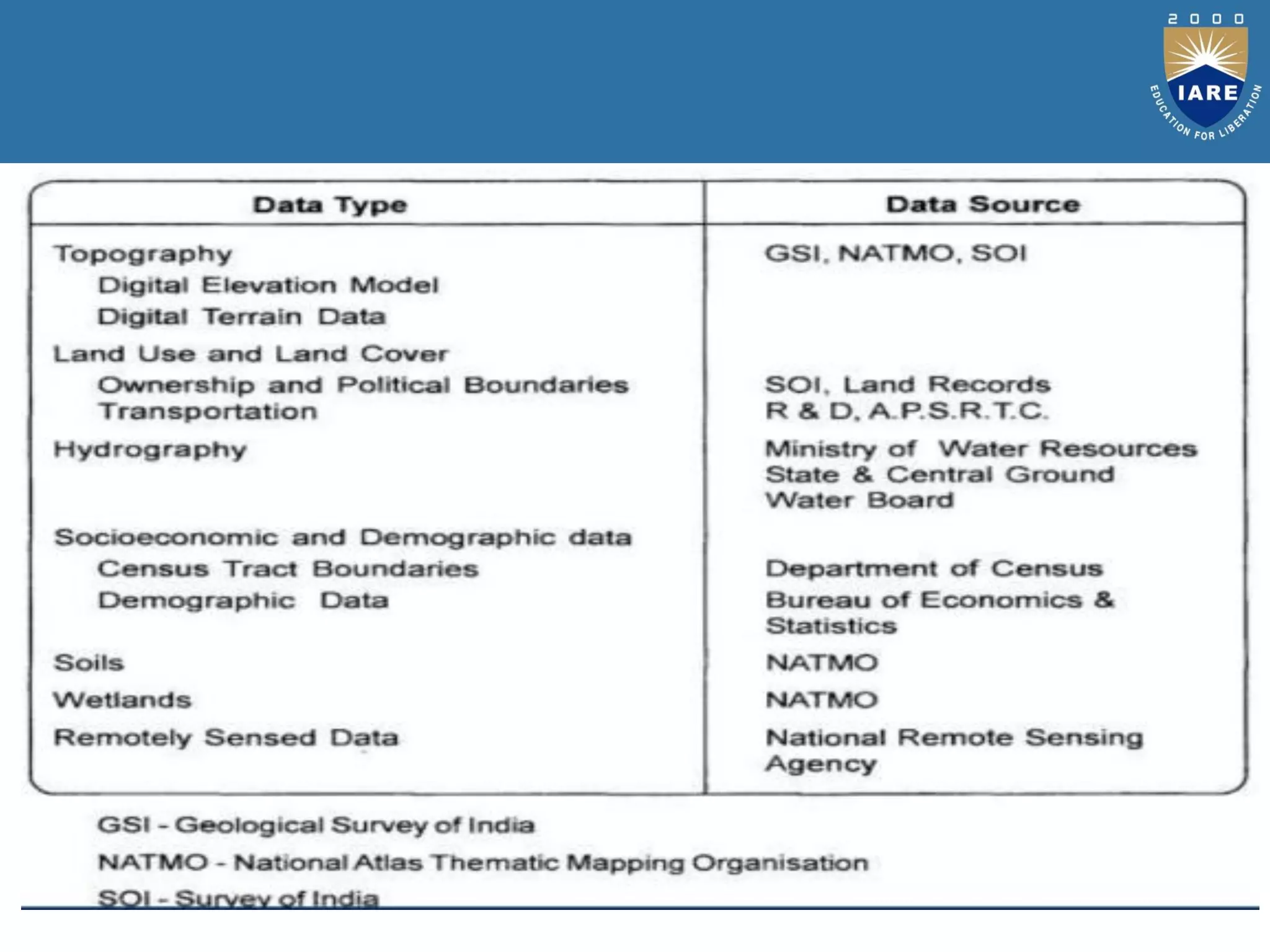
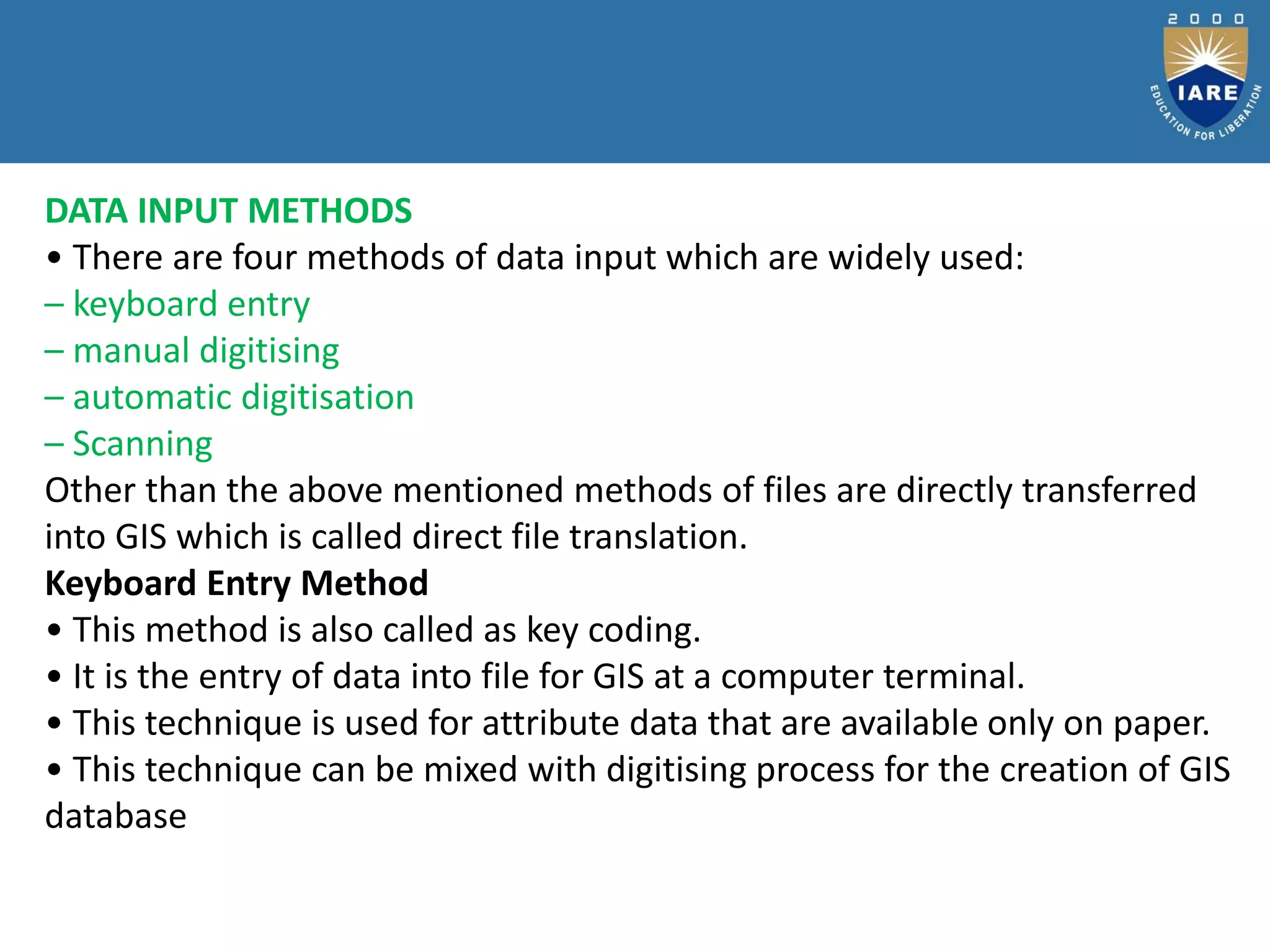
The document discusses various methods for collecting and inputting data into a GIS system. There are primary and secondary data sources, with primary data collected directly through field surveys and remote sensing, and secondary data obtained from existing maps and tables. Data can be input through keyboard entry of attributes, manual or automatic digitization of spatial features from paper maps, or scanning of maps. Methods like COGO use survey measurements of distances and bearings for data input. Proper metadata is also needed to understand the data being input into the GIS.


![Rs unit iii-gis--- [repaired]](https://cdn.slidesharecdn.com/ss_thumbnails/rsunit-iiigis-repaired-180305142705-thumbnail.jpg?width=600ounds&width=560&fit=bounds)
![Rs unit iii-gis--- [repaired]](https://cdn.slidesharecdn.com/ss_thumbnails/rsunit-iiigis-repaired-180305142425-thumbnail.jpg?width=600ounds&width=560&fit=bounds)


