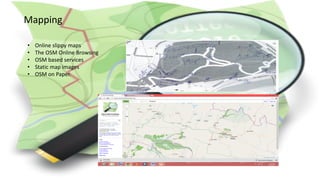
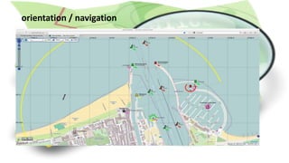
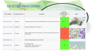
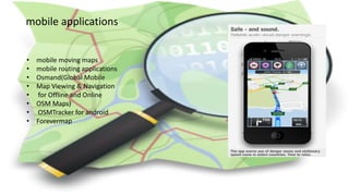
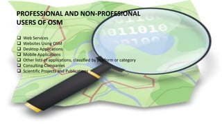
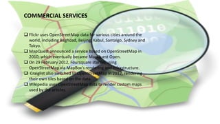
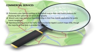
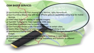
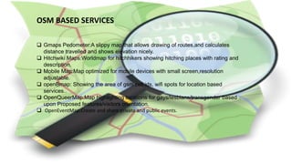
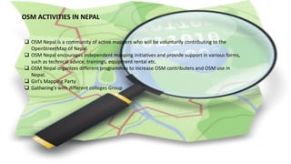
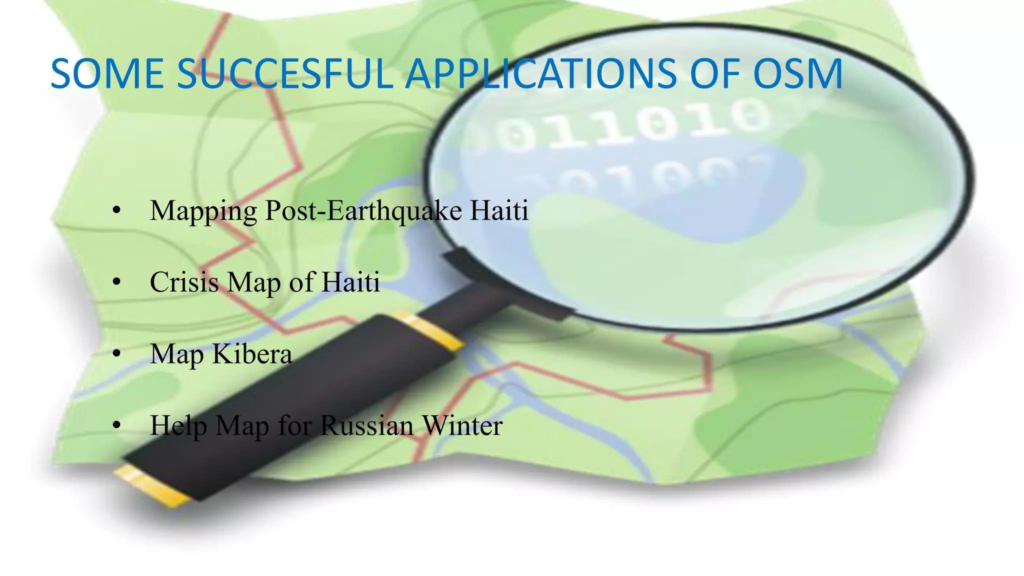
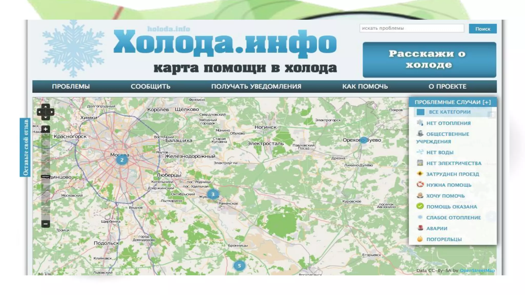
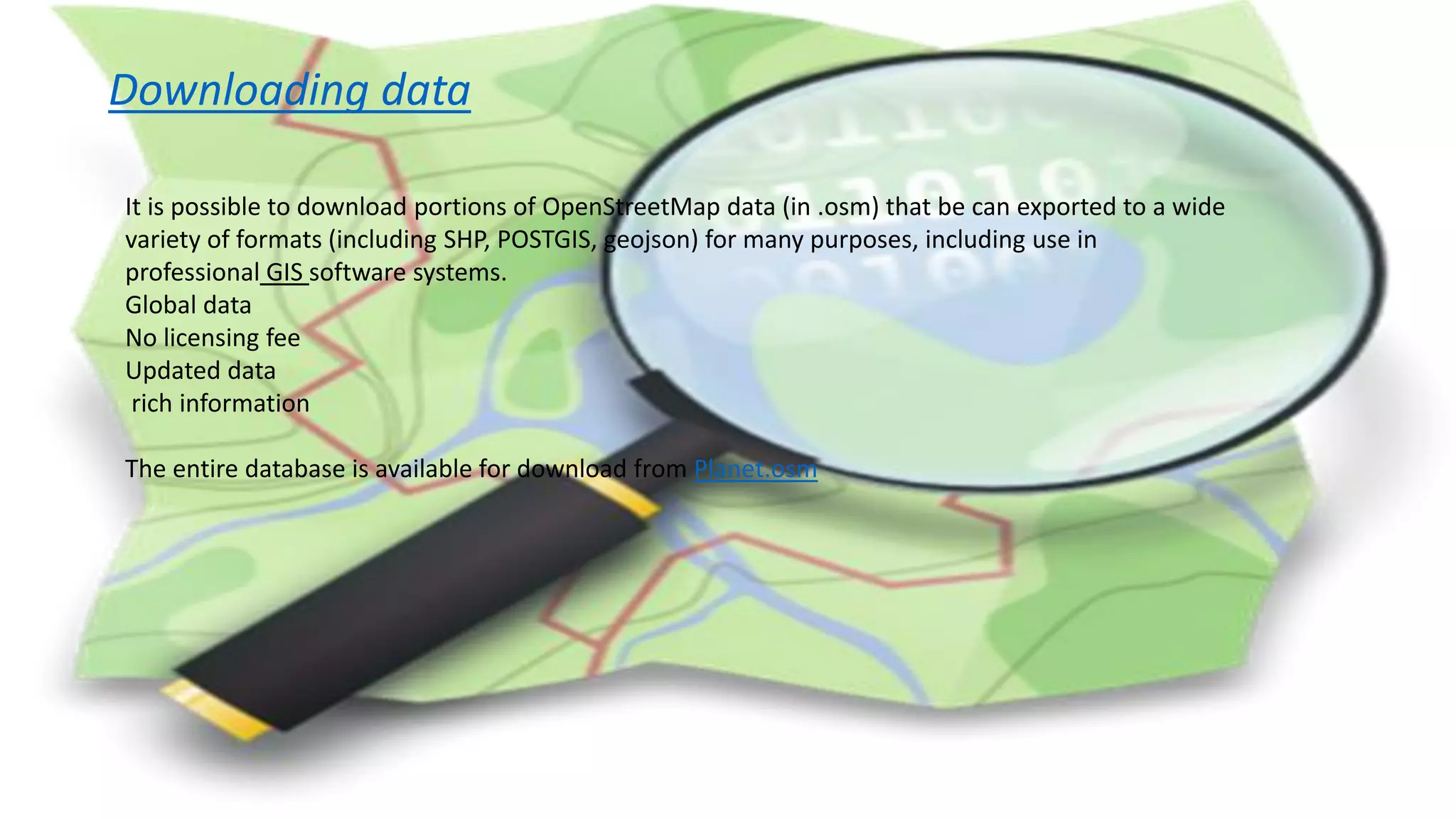
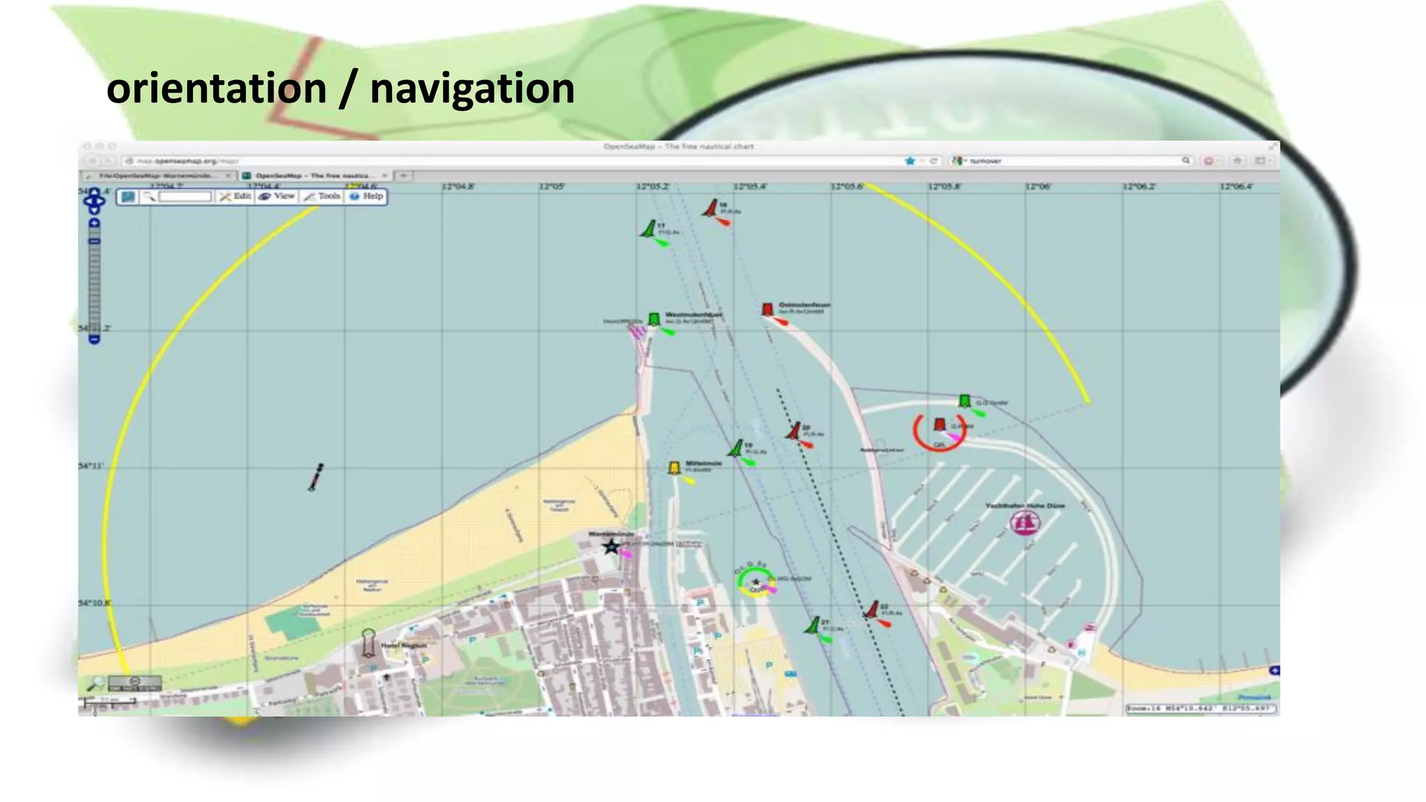
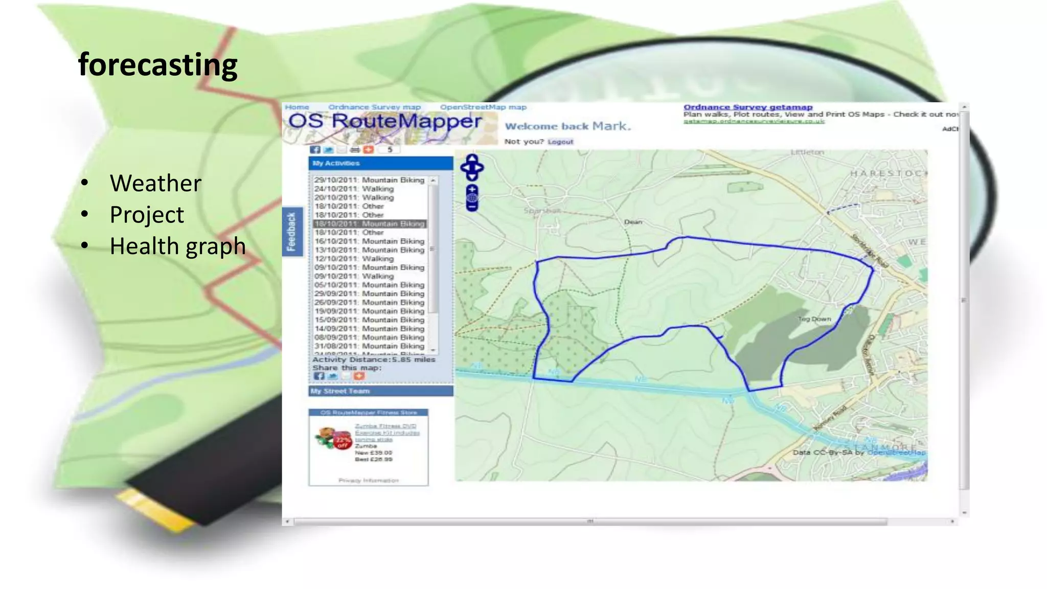
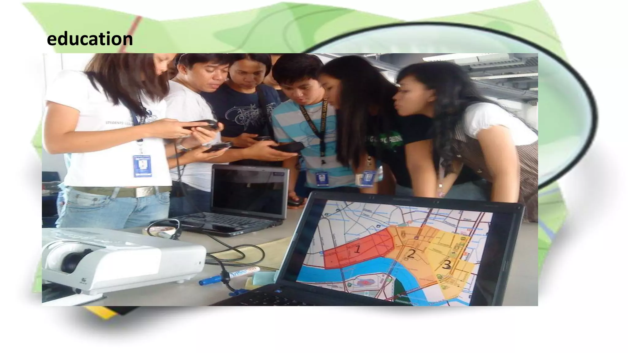
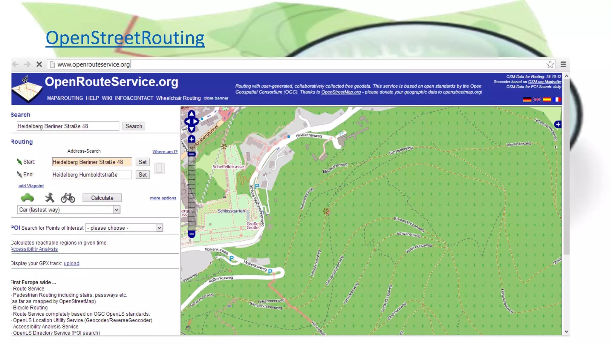
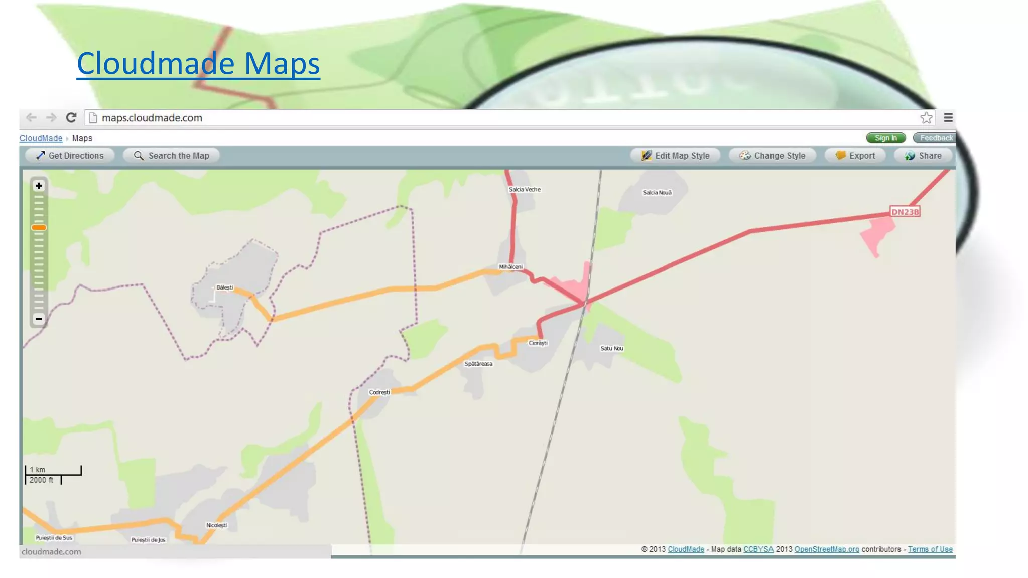
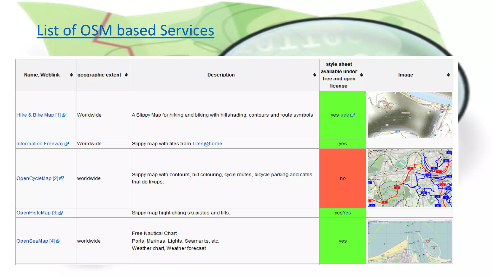
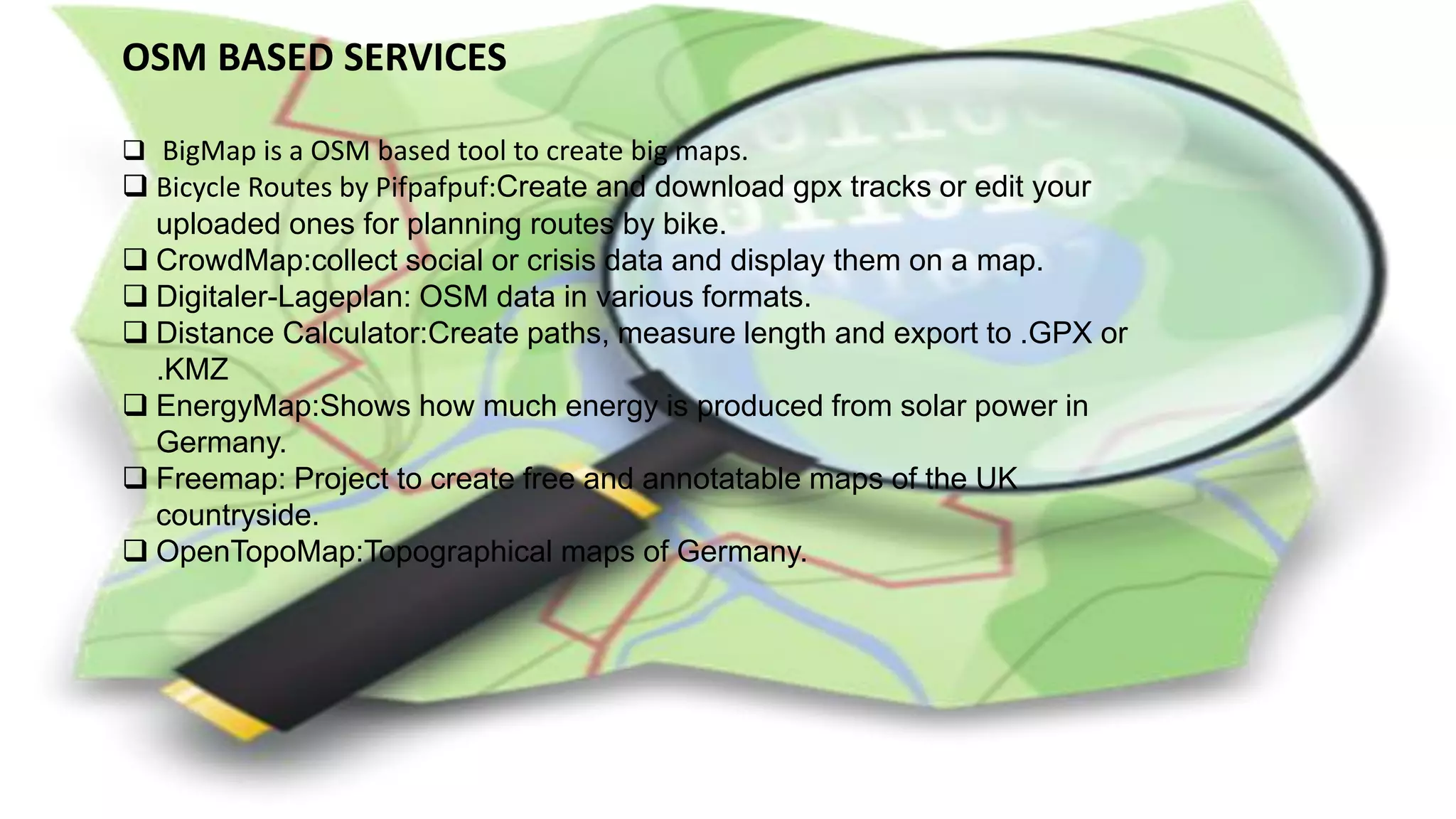
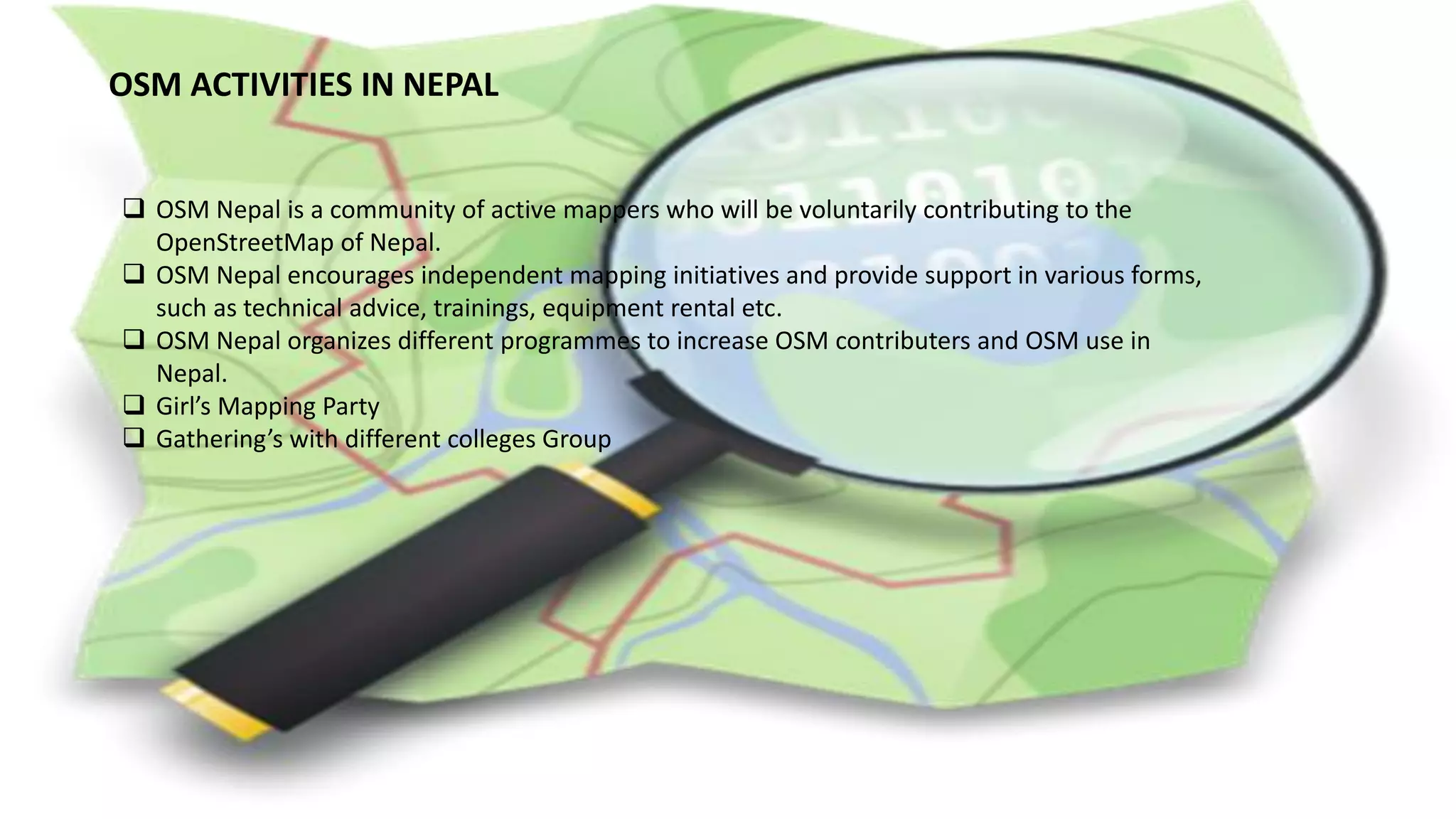
KEMBAR78
Osm application | PDF
OSM APPLICATION
GROUP MEMBERS:
Megha Shrestha
Dipesh Suwal
Bhagirath Bhatt
Sushmita Timilsina
Janak Parajuli
Why OSM?
• the open nature of OpenStreetMap makes it an ideal
platform for collaborative projects.
• free and editable map
SOME SUCCESFUL APPLICATIONS OF OSM
• Mapping Post-Earthquake Haiti
• Crisis Map of Haiti
• Map Kibera
• Help Map for Russian Winter
Downloading data
It is possible to download portions of OpenStreetMap data (in .osm) that be can exported to a wide
variety of formats (including SHP, POSTGIS, geojson) for many purposes, including use in
professional GIS software systems.
Global data
No licensing fee
Updated data
rich information
The entire database is available for download from Planet.osm
Mapping
• Online slippy maps
• The OSM Online Browsing
• OSM based services
• Static map images
• OSM on Paper.
orientation / navigation
forecasting
• Weather
• Project
• Health graph
education
Routing
• OpenRouteService
• OpenStreetRouting
• Cloudmade Maps
OpenStreetRouting
Cloudmade Maps
 Web Services
 Websites Using OSM
 Desktop Applications
 Mobile Applications
 Other lists of applications, classified by platform or category
 Consulting Companies
 Scientific Projects and Publications
List of OSM based Services
Research
• Using OSM for LBS( Location-based Services (LBS) a – an analysis of changes to
attributes of spatial objects(by Peter Mooney and Padraig Corcoran)
• http://www.cs.nuim.ie/~pmooney/websitePapers/LBS_2011-peter-v2.pdf
• OSM-GB Project Blog(Progress in quality assessment and improvement of OpenStreetMap
data for Great Britain)
• http://lgosmgb2.nottingham.ac.uk/blog/
mobile applications
• mobile moving maps
• mobile routing applications
• Osmand(Global Mobile
• Map Viewing & Navigation
• for Offline and Online
• OSM Maps)
• OSMTracker for android
• Forevermap
TOURIST MAP
RESOURCE MAP
PROFESSIONAL AND NON-PROFESIONAL
USERS OF OSM
 Web Services
 Websites Using OSM
 Desktop Applications
 Mobile Applications
 Other lists of applications, classified by platform or category
 Consulting Companies
 Scientific Projects and Publications
Application for Geomatics Engineering
• Data analysis
• Estimation and valuation
• Project feasibility
• Mapping
COMMERCIAL SERVICES
 Flickr uses OpenStreetMap data for various cities around the
world, including Baghdad, Beijing, Kabul, Santaigo, Sydney and
Tokyo.
 MapQuest announced a service based on OpenStreetMap in
2010, which eventually became MapQuest Open.
 On 29 February 2012, Foursquare started using
OpenStreetMap via MapBox's rendering and infrastructure.
 Craiglist also switched to OpenStreetMap in 2012, rendering
their own tiles based on the data.
 Wikipedia uses OpenStreetMap data to render custom maps
used by the articles.
COMMERCIAL SERVICES
 Pictometry uses OpenStreetMap as the default map in their web based products for
displaying their patented 3D aerial photography.
 Moovit uses maps based on OpenStreetMap in their free mobile application for public
transit navigation.
 OpenStreetMap is one of the many cited sources for Apple's custom maps iOS6, though
the majority of map data is provided by TomTom.
OSM BASED SERVICES
 BigMap is a OSM based tool to create big maps.
 Bicycle Routes by Pifpafpuf:Create and download gpx tracks or edit your
uploaded ones for planning routes by bike.
 CrowdMap:collect social or crisis data and display them on a map.
 Digitaler-Lageplan: OSM data in various formats.
 Distance Calculator:Create paths, measure length and export to .GPX or
.KMZ
 EnergyMap:Shows how much energy is produced from solar power in
Germany.
 Freemap: Project to create free and annotatable maps of the UK
countryside.
 OpenTopoMap:Topographical maps of Germany.
OSM BASED SERVICES
 OpenSeaMap:Nautical Chart showing Ports, Marinas ,Lights,Seamarks,etc.
 OpenTouchMap:Slippy map with basic IPhone gesture-capabilities using iol.js for mobile
devices.
 OSMT:Map Style for overlay on satellite imagery.
 TopOSM:Topographic maps based on OSM data.
 OpenMap:Worldwide map for public transport.
 OsmTransport:Shows public transport services at certain cities.
 Gastro-Map:Analyzing if a hotel,restaurant allows smoking or not.
 openMarkers:Rating OSM places for price and discover the best places for your
budget.
 OpenLayers Heat Map:Using OSM data for a heatmap in open layers.
 OpenFireMap:Worldwide map showing firestations and hydrants on different
backgrounds.
OSM BASED SERVICES
 Gmaps Pedometer:A slippy map that allows drawing of routes,and calculates
distance travelled and shows elevation nicely.
 Hitchwiki Maps:Worldmap for hitchhikers showing hitching places with rating and
description.
 Mobile Map:Map optimized for mobile devices with small screen,resolution
adjustable.
 openBmap: Showing the area of gsm cell ids, wifi spots for location based
services..
 OpenQueerMap:Map highlighting locations for gays/lesbians/transgender based
upon Proposed features/visitors orientation.
 OpenEventMap:Create and share private and public events.
OSM PROFESSIONAL USERS
 Today, OSM is a volunteer-only organization.
 This focus doesn’t always satisfy the needs of many users.
 OSM PLUS.
 OSM PLUS is new and focused on professional users of OSM data and
toolchains commercially, academically, in government and elsewhere.
 The OpenStreetMap Professional Large Users Summit is going to be held
just after SOTM US, on June 10th in San Francisco at the Marriott Union
Square.
OSM ACTIVITIES IN NEPAL
 OSM Nepal is a community of active mappers who will be voluntarily contributing to the
OpenStreetMap of Nepal.
 OSM Nepal encourages independent mapping initiatives and provide support in various forms,
such as technical advice, trainings, equipment rental etc.
 OSM Nepal organizes different programmes to increase OSM contributers and OSM use in
Nepal.
 Girl’s Mapping Party
 Gathering’s with different colleges Group
www.OpenStreetMap.org
Maharajgung Area:
Before and After
A Growing Community of Mappers
Recommendation
Data integrity
Recommendation
Error checking mechanism
Recommendation
More tags
Recommendation
adequate geotechnical investigations be conducted to verify
the location of the underground mine
Recommendation
Finally, OSM should consider developing national standards
, through rulemaking, which consider the consequences of
an impoundment breakthrough
REFERENCES
• http://wiki.openstreetmap.org/wiki/List_of_OSM_based_Services
• http://wiki.openstreetmap.org/wiki/DE:Useful_Internet_Links
• http://www.adyota.org/osm-nepal
• http://wiki.openstreetmap.org/wiki/Software/Desktop
• http://en.wikipedia.org/wiki/OpenStreetMap
• http://www.osmre.gov/resources/newsroom/News/Archive/2002/030402%20Report/conclusion
s.pdf
• http://www.openrouteservice.org/
• http://openstreetrouting.appspot.com/?mlat=27.701691866145573&mlon=85.32059669494629
&zoom=12
• wiki.openstreetmap.org/wiki/Applications
• https://sotm-eu.org/slides/50_SvenLeitinger_MobileApp.pdf

Osm application

  • 1.
    OSM APPLICATION GROUP MEMBERS: MeghaShrestha Dipesh Suwal Bhagirath Bhatt Sushmita Timilsina Janak Parajuli
  • 2.
    Why OSM? • theopen nature of OpenStreetMap makes it an ideal platform for collaborative projects. • free and editable map
  • 3.
    SOME SUCCESFUL APPLICATIONSOF OSM • Mapping Post-Earthquake Haiti • Crisis Map of Haiti • Map Kibera • Help Map for Russian Winter
  • 6.
    Downloading data It ispossible to download portions of OpenStreetMap data (in .osm) that be can exported to a wide variety of formats (including SHP, POSTGIS, geojson) for many purposes, including use in professional GIS software systems. Global data No licensing fee Updated data rich information The entire database is available for download from Planet.osm
  • 7.
    Mapping • Online slippymaps • The OSM Online Browsing • OSM based services • Static map images • OSM on Paper.
  • 8.
  • 9.
  • 10.
  • 11.
  • 12.
  • 13.
    Cloudmade Maps  WebServices  Websites Using OSM  Desktop Applications  Mobile Applications  Other lists of applications, classified by platform or category  Consulting Companies  Scientific Projects and Publications
  • 14.
    List of OSMbased Services
  • 16.
    Research • Using OSMfor LBS( Location-based Services (LBS) a – an analysis of changes to attributes of spatial objects(by Peter Mooney and Padraig Corcoran) • http://www.cs.nuim.ie/~pmooney/websitePapers/LBS_2011-peter-v2.pdf • OSM-GB Project Blog(Progress in quality assessment and improvement of OpenStreetMap data for Great Britain) • http://lgosmgb2.nottingham.ac.uk/blog/
  • 17.
    mobile applications • mobilemoving maps • mobile routing applications • Osmand(Global Mobile • Map Viewing & Navigation • for Offline and Online • OSM Maps) • OSMTracker for android • Forevermap
  • 18.
  • 19.
  • 20.
    PROFESSIONAL AND NON-PROFESIONAL USERSOF OSM  Web Services  Websites Using OSM  Desktop Applications  Mobile Applications  Other lists of applications, classified by platform or category  Consulting Companies  Scientific Projects and Publications
  • 21.
    Application for GeomaticsEngineering • Data analysis • Estimation and valuation • Project feasibility • Mapping
  • 22.
    COMMERCIAL SERVICES  Flickruses OpenStreetMap data for various cities around the world, including Baghdad, Beijing, Kabul, Santaigo, Sydney and Tokyo.  MapQuest announced a service based on OpenStreetMap in 2010, which eventually became MapQuest Open.  On 29 February 2012, Foursquare started using OpenStreetMap via MapBox's rendering and infrastructure.  Craiglist also switched to OpenStreetMap in 2012, rendering their own tiles based on the data.  Wikipedia uses OpenStreetMap data to render custom maps used by the articles.
  • 23.
    COMMERCIAL SERVICES  Pictometryuses OpenStreetMap as the default map in their web based products for displaying their patented 3D aerial photography.  Moovit uses maps based on OpenStreetMap in their free mobile application for public transit navigation.  OpenStreetMap is one of the many cited sources for Apple's custom maps iOS6, though the majority of map data is provided by TomTom.
  • 24.
    OSM BASED SERVICES BigMap is a OSM based tool to create big maps.  Bicycle Routes by Pifpafpuf:Create and download gpx tracks or edit your uploaded ones for planning routes by bike.  CrowdMap:collect social or crisis data and display them on a map.  Digitaler-Lageplan: OSM data in various formats.  Distance Calculator:Create paths, measure length and export to .GPX or .KMZ  EnergyMap:Shows how much energy is produced from solar power in Germany.  Freemap: Project to create free and annotatable maps of the UK countryside.  OpenTopoMap:Topographical maps of Germany.
  • 25.
    OSM BASED SERVICES OpenSeaMap:Nautical Chart showing Ports, Marinas ,Lights,Seamarks,etc.  OpenTouchMap:Slippy map with basic IPhone gesture-capabilities using iol.js for mobile devices.  OSMT:Map Style for overlay on satellite imagery.  TopOSM:Topographic maps based on OSM data.  OpenMap:Worldwide map for public transport.  OsmTransport:Shows public transport services at certain cities.  Gastro-Map:Analyzing if a hotel,restaurant allows smoking or not.  openMarkers:Rating OSM places for price and discover the best places for your budget.  OpenLayers Heat Map:Using OSM data for a heatmap in open layers.  OpenFireMap:Worldwide map showing firestations and hydrants on different backgrounds.
  • 26.
    OSM BASED SERVICES Gmaps Pedometer:A slippy map that allows drawing of routes,and calculates distance travelled and shows elevation nicely.  Hitchwiki Maps:Worldmap for hitchhikers showing hitching places with rating and description.  Mobile Map:Map optimized for mobile devices with small screen,resolution adjustable.  openBmap: Showing the area of gsm cell ids, wifi spots for location based services..  OpenQueerMap:Map highlighting locations for gays/lesbians/transgender based upon Proposed features/visitors orientation.  OpenEventMap:Create and share private and public events.
  • 27.
    OSM PROFESSIONAL USERS Today, OSM is a volunteer-only organization.  This focus doesn’t always satisfy the needs of many users.  OSM PLUS.  OSM PLUS is new and focused on professional users of OSM data and toolchains commercially, academically, in government and elsewhere.  The OpenStreetMap Professional Large Users Summit is going to be held just after SOTM US, on June 10th in San Francisco at the Marriott Union Square.
  • 28.
    OSM ACTIVITIES INNEPAL  OSM Nepal is a community of active mappers who will be voluntarily contributing to the OpenStreetMap of Nepal.  OSM Nepal encourages independent mapping initiatives and provide support in various forms, such as technical advice, trainings, equipment rental etc.  OSM Nepal organizes different programmes to increase OSM contributers and OSM use in Nepal.  Girl’s Mapping Party  Gathering’s with different colleges Group
  • 29.
  • 30.
  • 31.
  • 32.
  • 33.
  • 34.
  • 35.
    Recommendation adequate geotechnical investigationsbe conducted to verify the location of the underground mine
  • 36.
    Recommendation Finally, OSM shouldconsider developing national standards , through rulemaking, which consider the consequences of an impoundment breakthrough
  • 37.
    REFERENCES • http://wiki.openstreetmap.org/wiki/List_of_OSM_based_Services • http://wiki.openstreetmap.org/wiki/List_of_OSM_based_Services •http://wiki.openstreetmap.org/wiki/DE:Useful_Internet_Links • http://www.adyota.org/osm-nepal • http://wiki.openstreetmap.org/wiki/Software/Desktop • http://en.wikipedia.org/wiki/OpenStreetMap • http://www.osmre.gov/resources/newsroom/News/Archive/2002/030402%20Report/conclusion s.pdf • http://www.openrouteservice.org/ • http://openstreetrouting.appspot.com/?mlat=27.701691866145573&mlon=85.32059669494629 &zoom=12 • wiki.openstreetmap.org/wiki/Applications • https://sotm-eu.org/slides/50_SvenLeitinger_MobileApp.pdf