![Open GeoData, Open Geo Tools: An Introduction Richard Cantwell Senior GIS Consultant www.gamma.ie [email_address] Personal Blog: www.geographic.ie Personal Twitter: @GeoGraphicIE](https://image.slidesharecdn.com/ditmay72011-110506171329-phpapp02/85/Open-GeoData-Open-GeoTools-An-Introduction-1-320.jpg)


![Open GeoData, Open Geo Tools: An Introduction Richard Cantwell Senior GIS Consultant www.gamma.ie [email_address] Personal Blog: www.geographic.ie Personal Twitter: @GeoGraphicIE](https://image.slidesharecdn.com/ditmay72011-110506171329-phpapp02/75/Open-GeoData-Open-GeoTools-An-Introduction-1-2048.jpg)
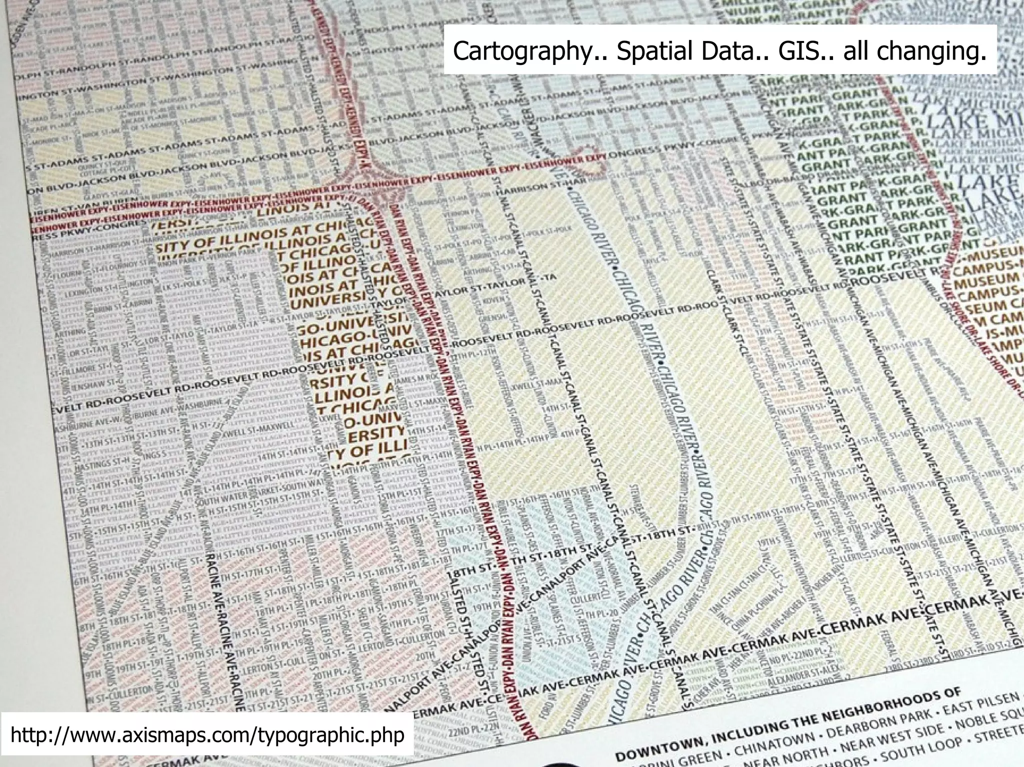
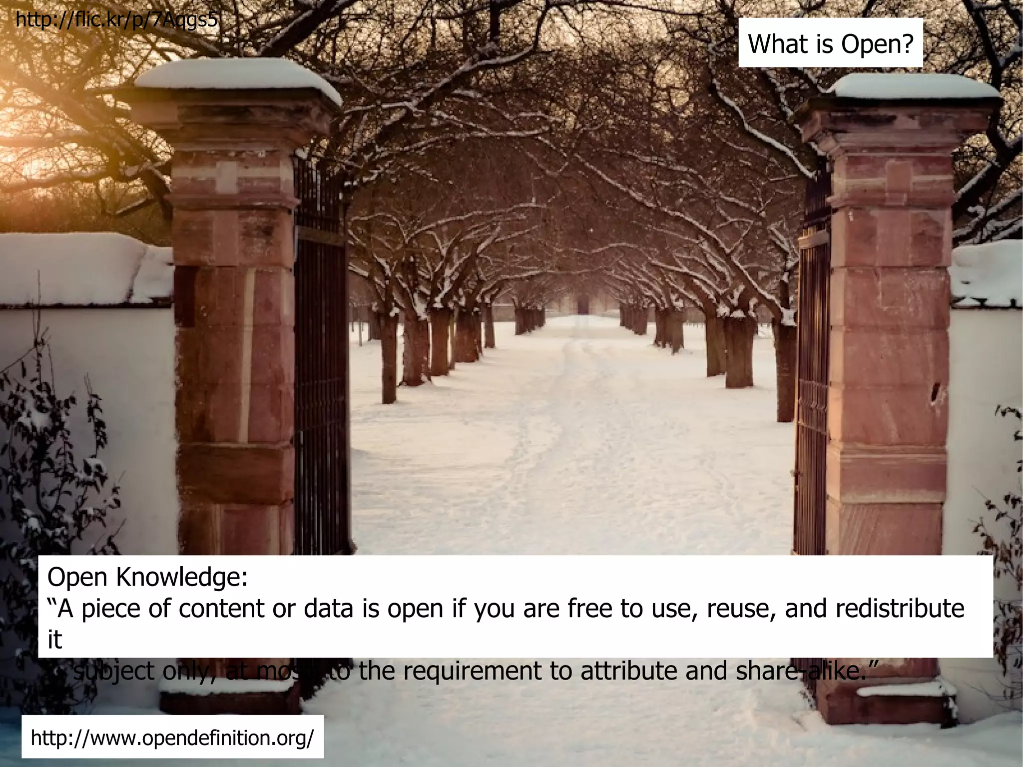
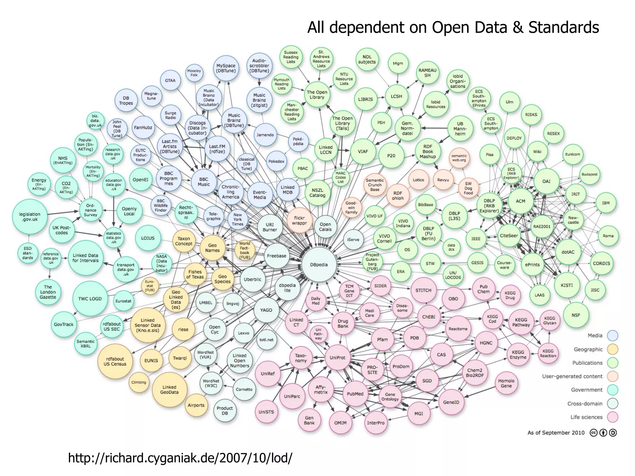
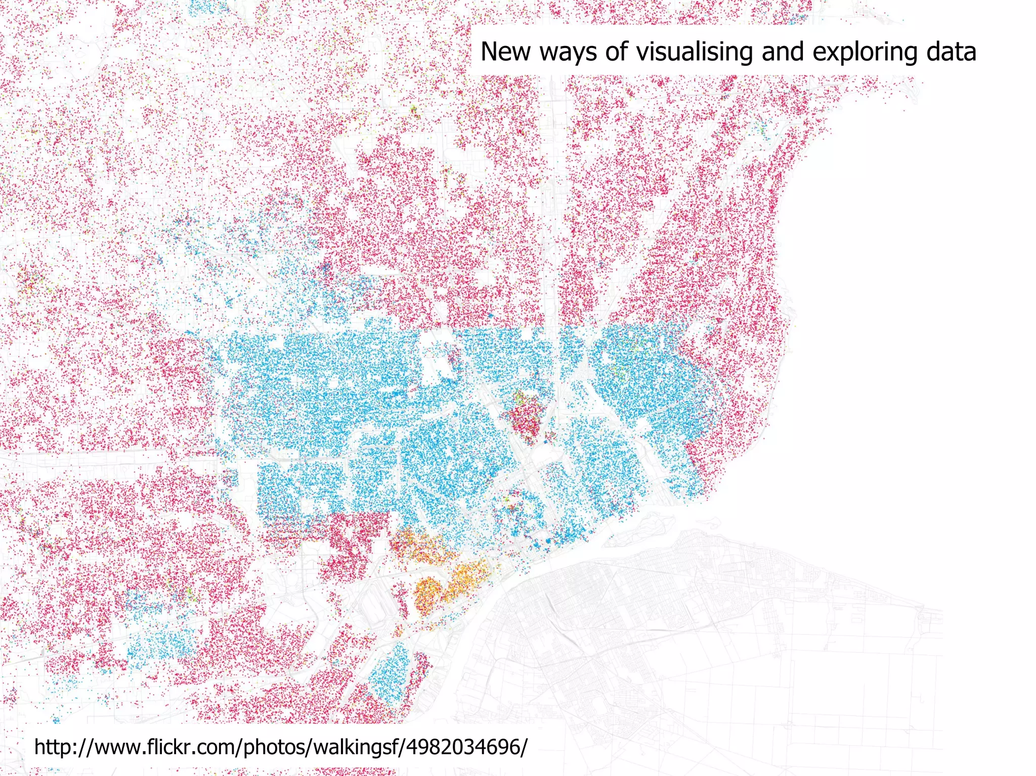
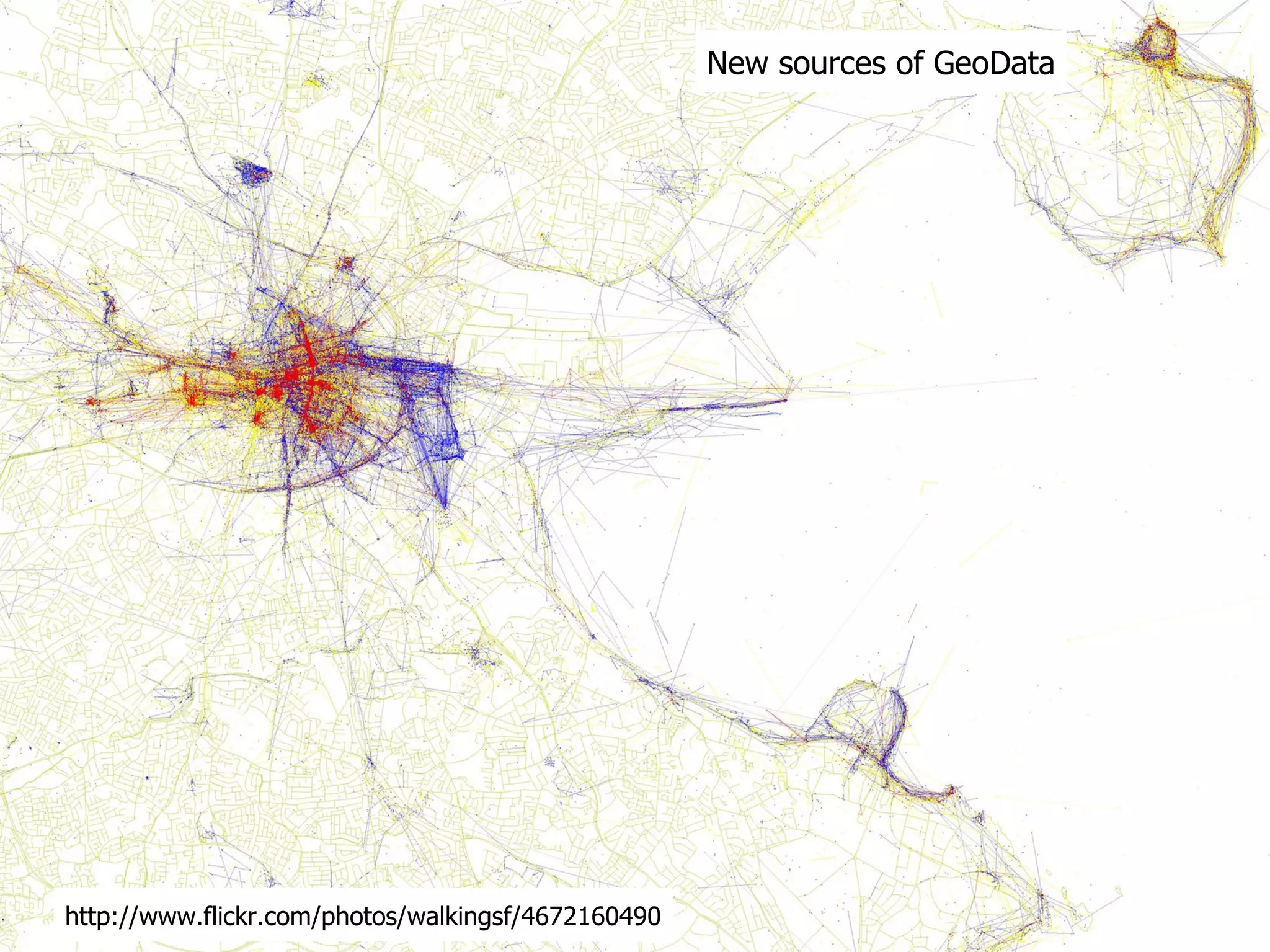
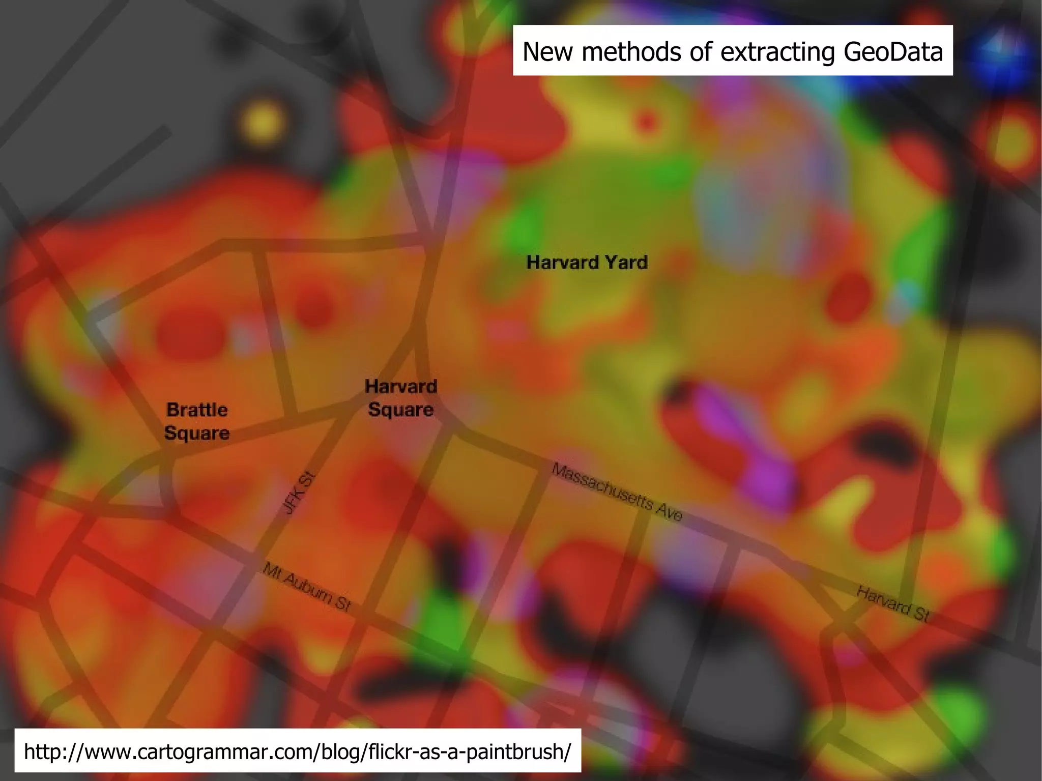
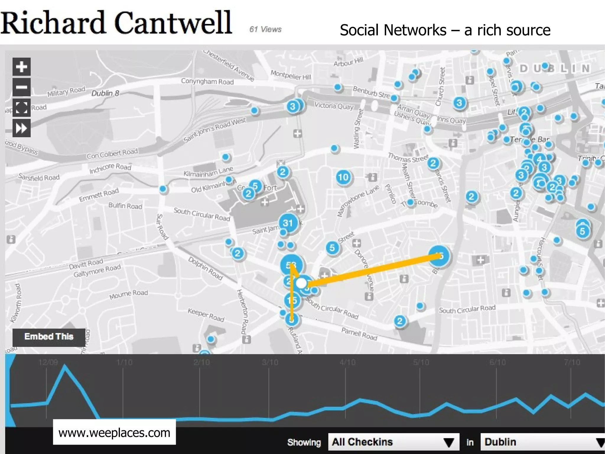
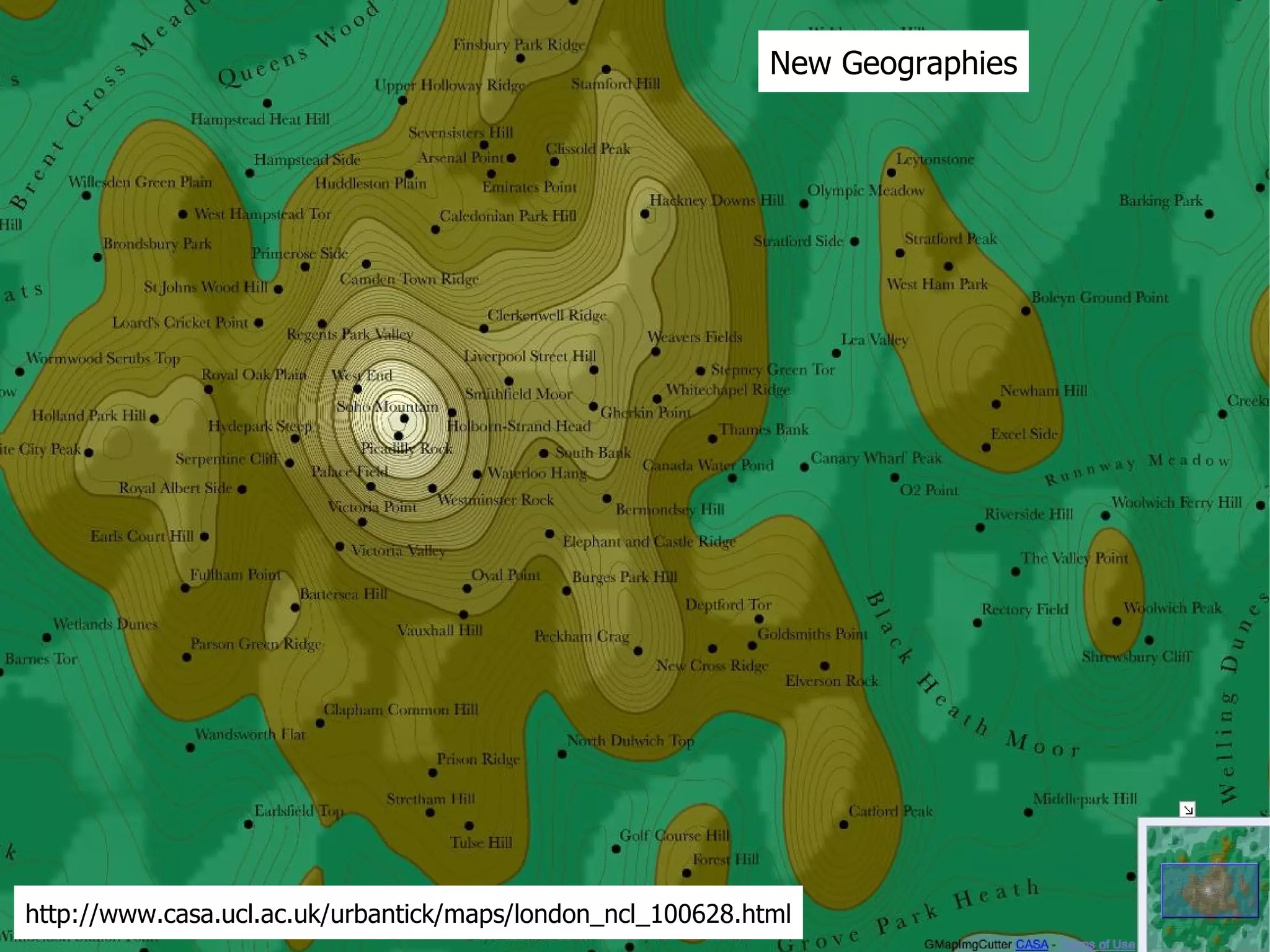


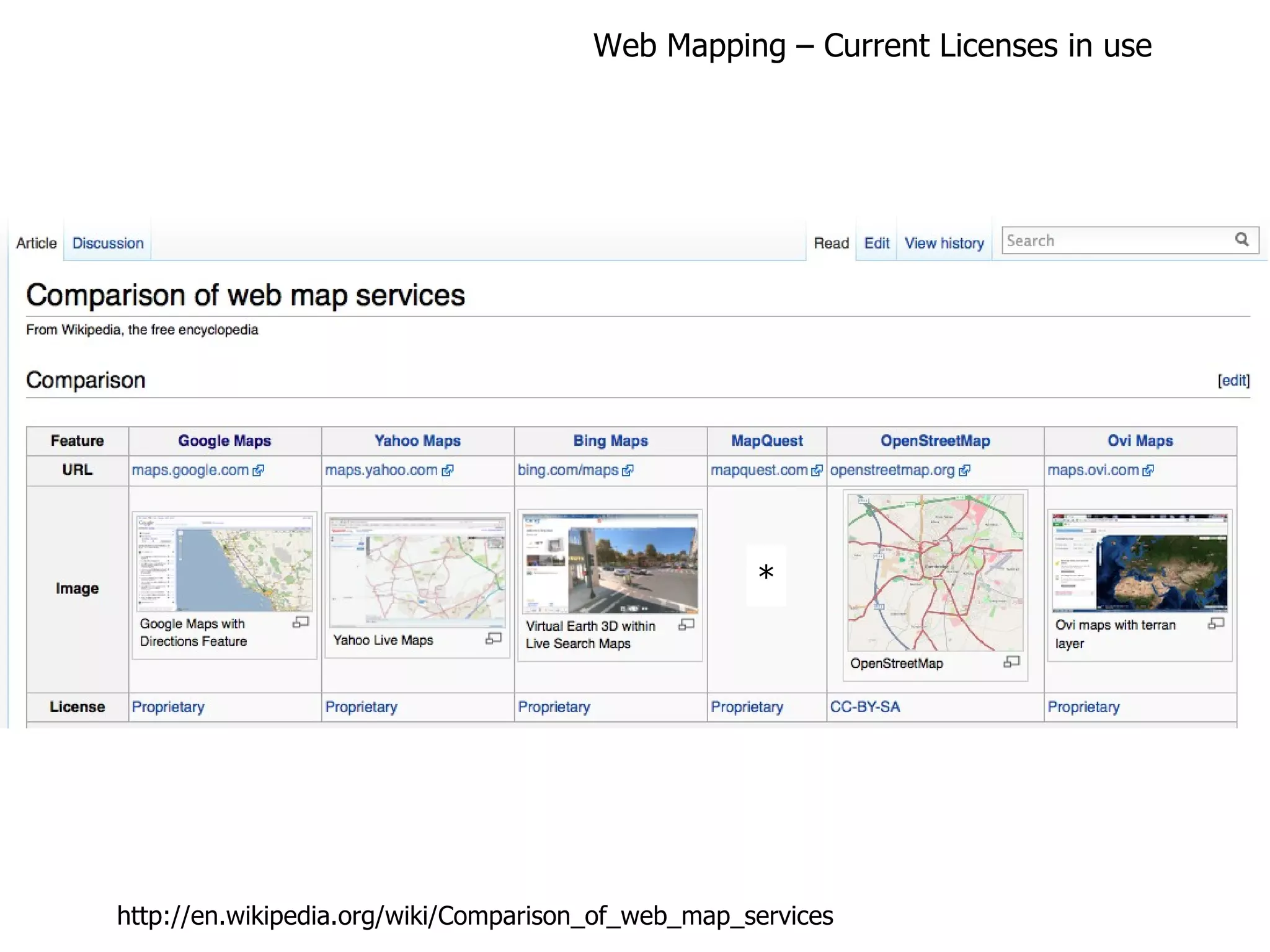
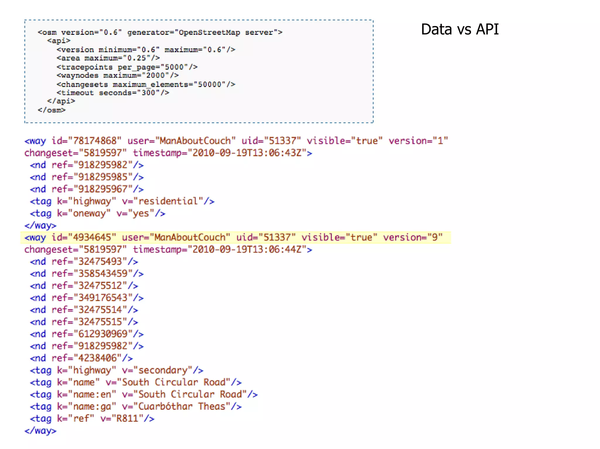
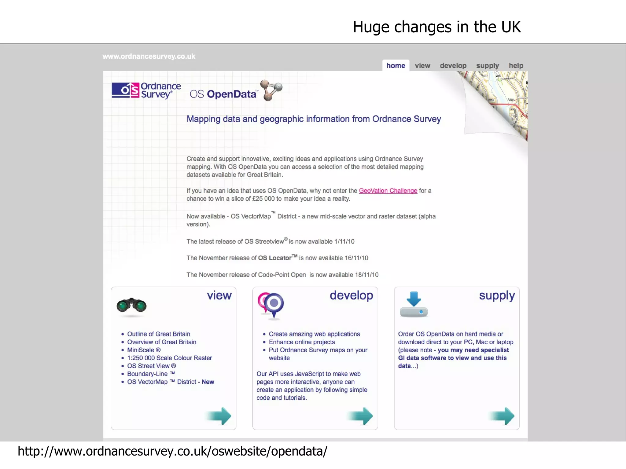
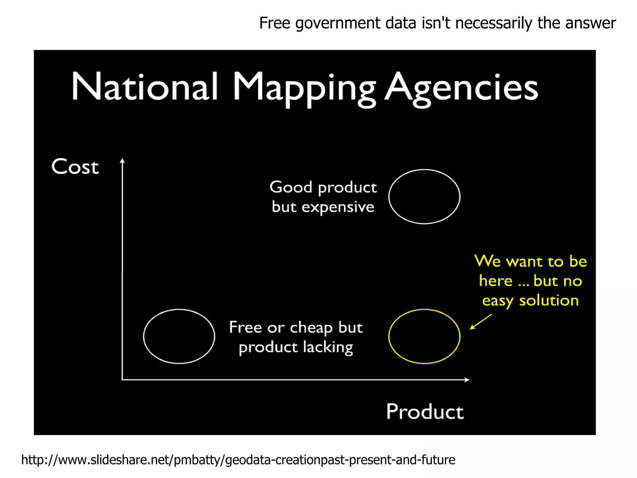


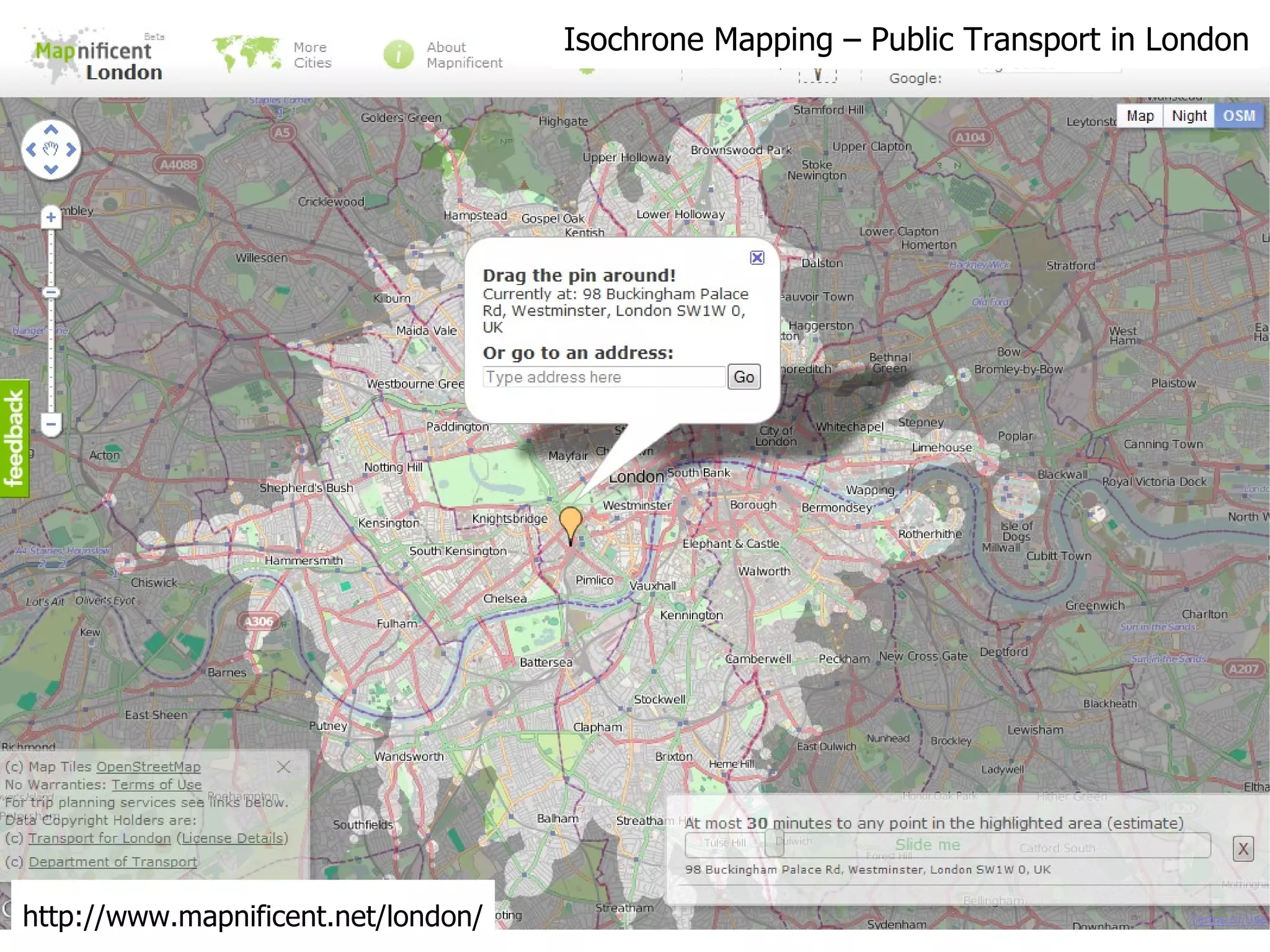

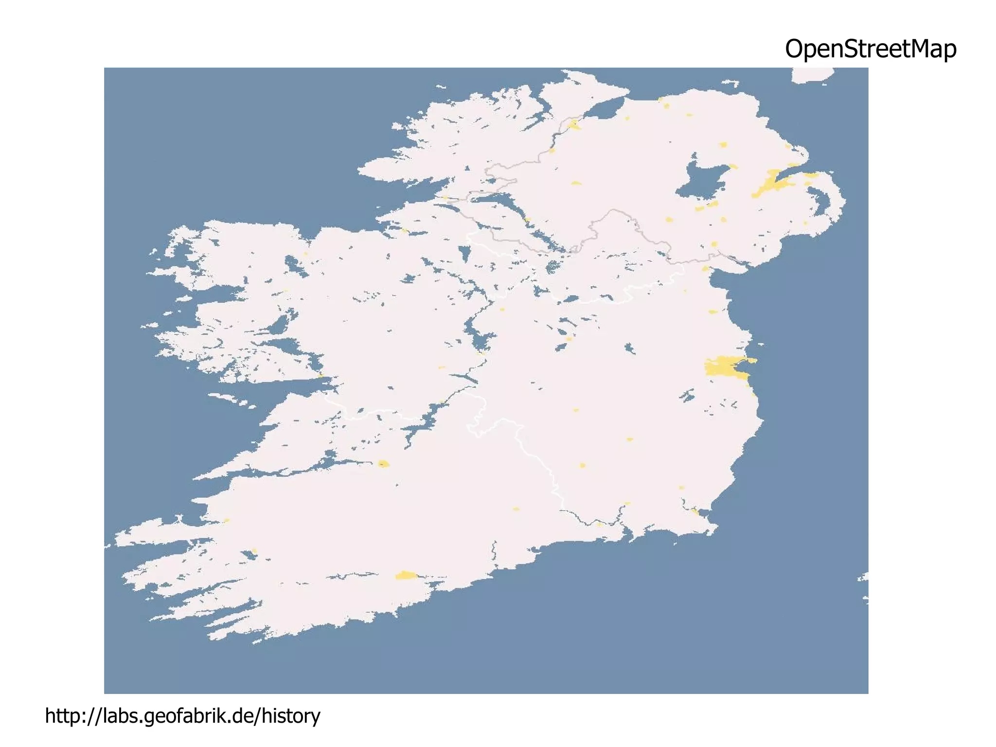
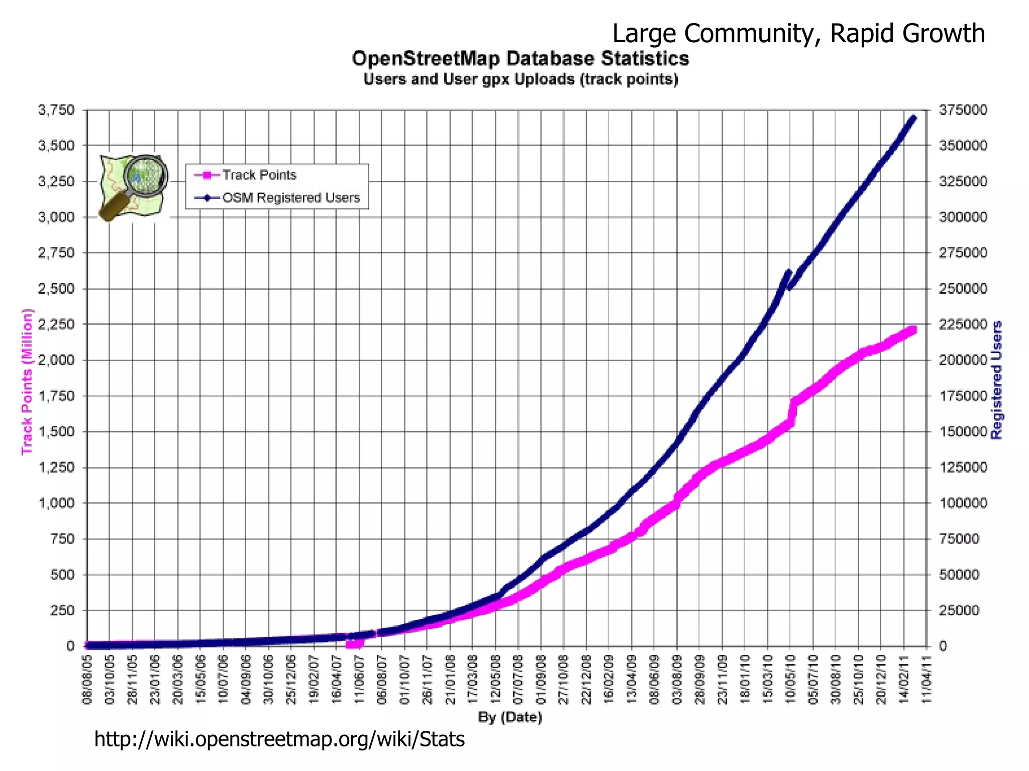

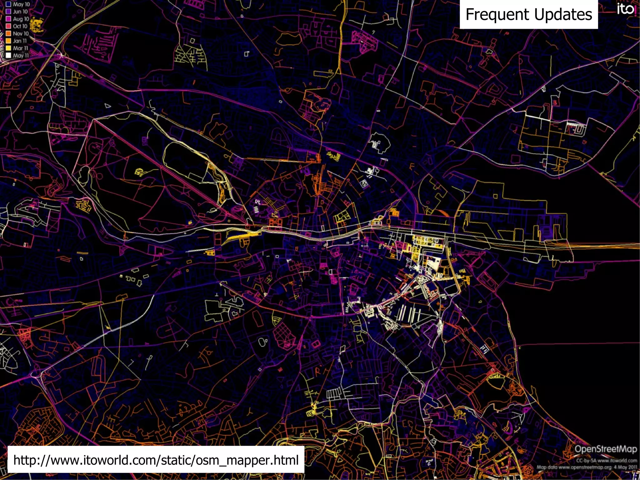
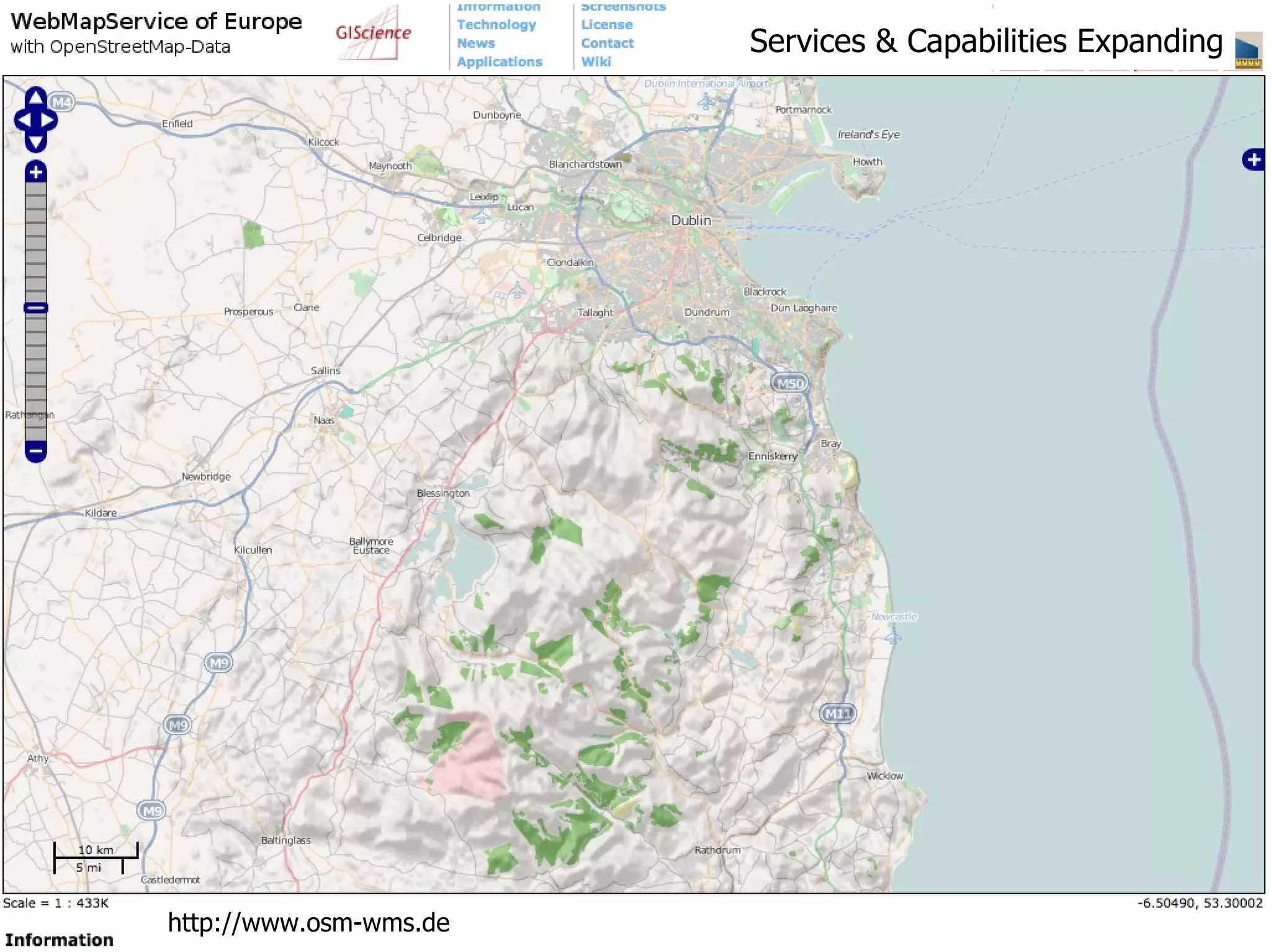
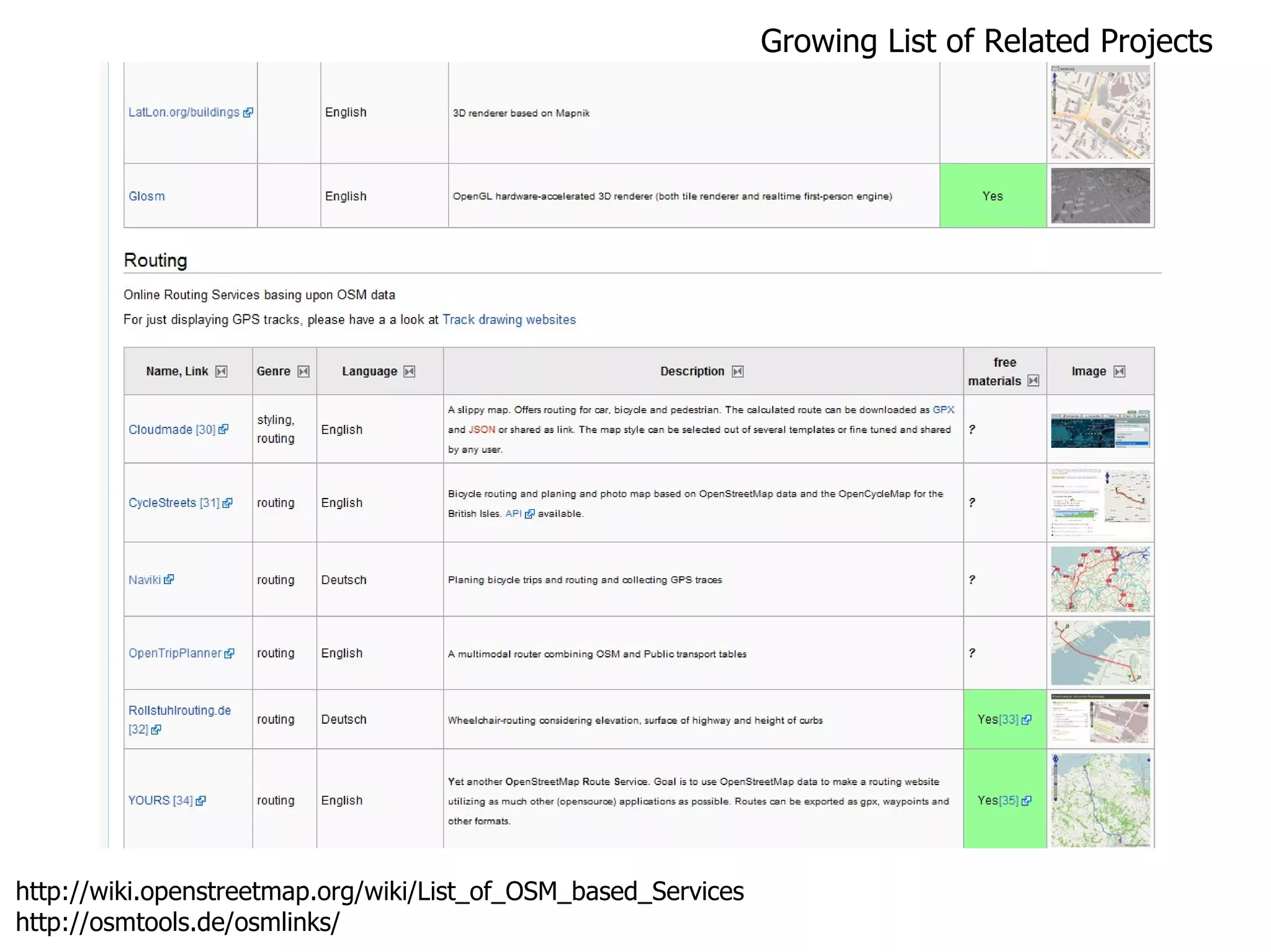
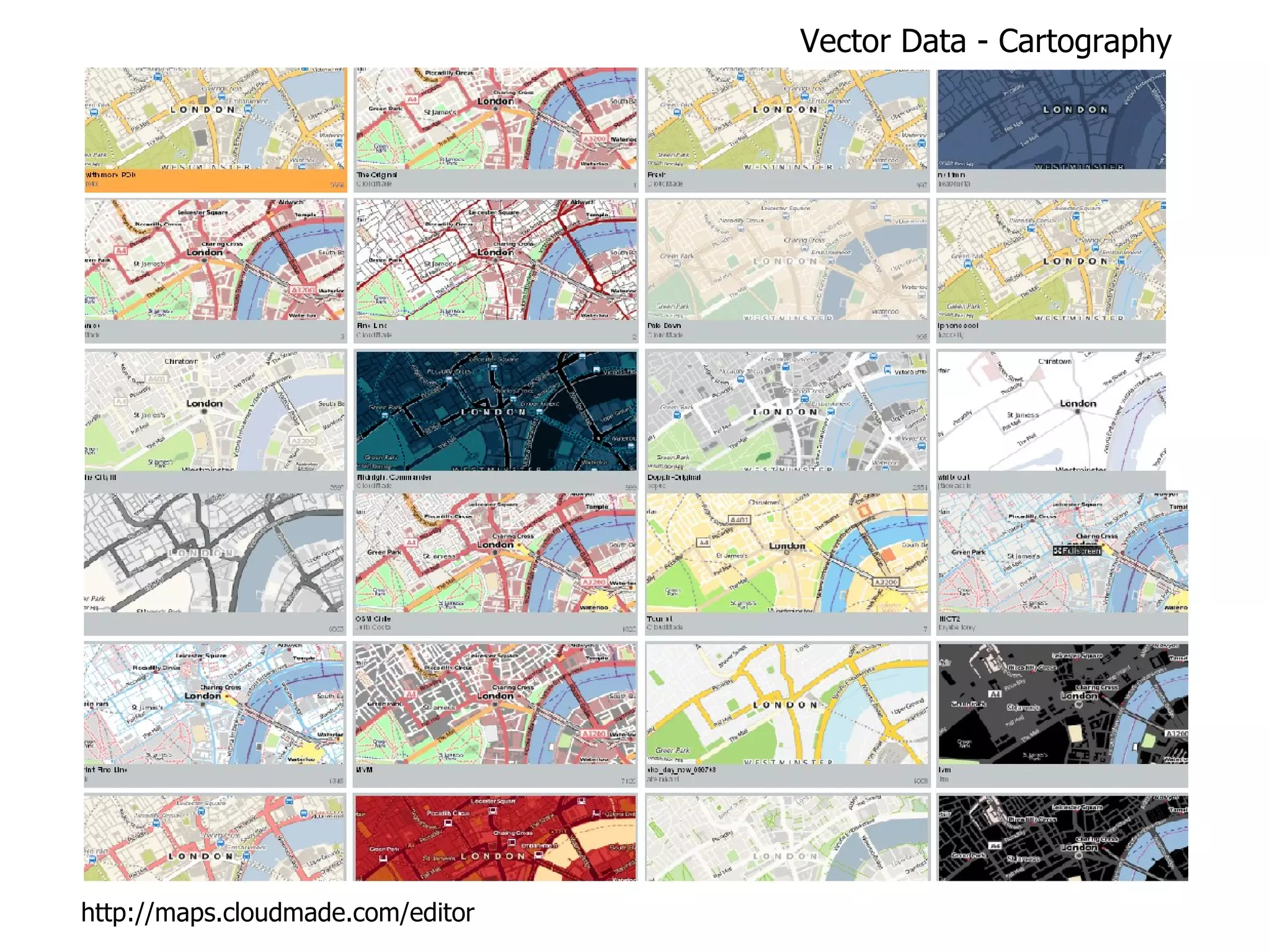


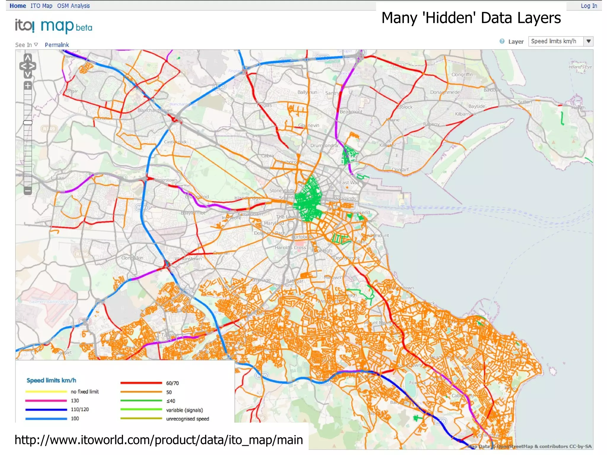

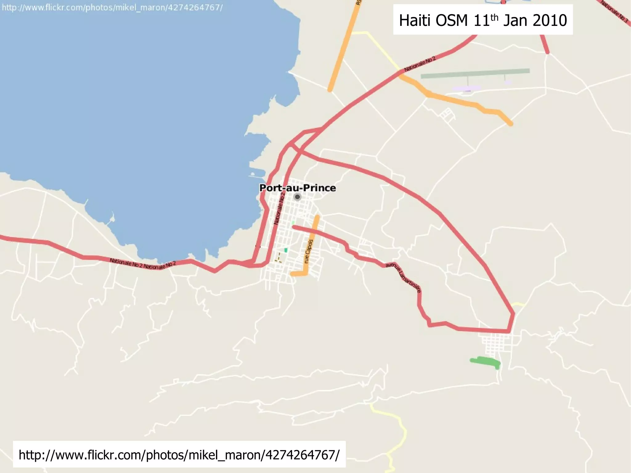
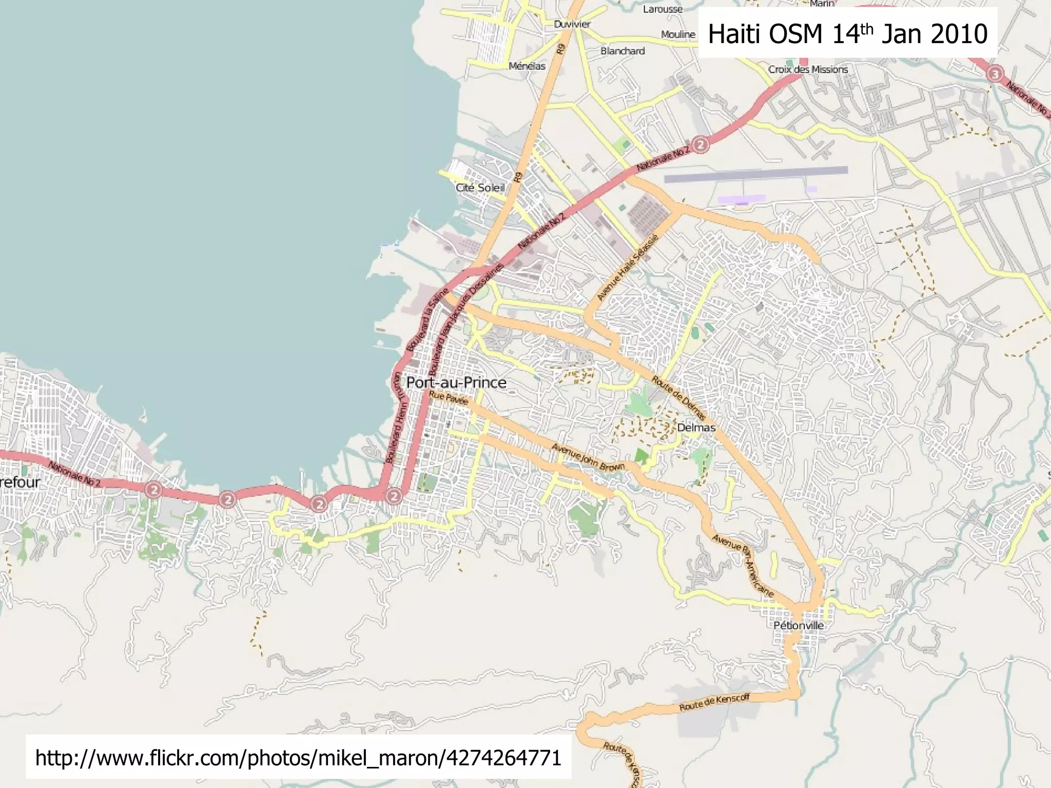
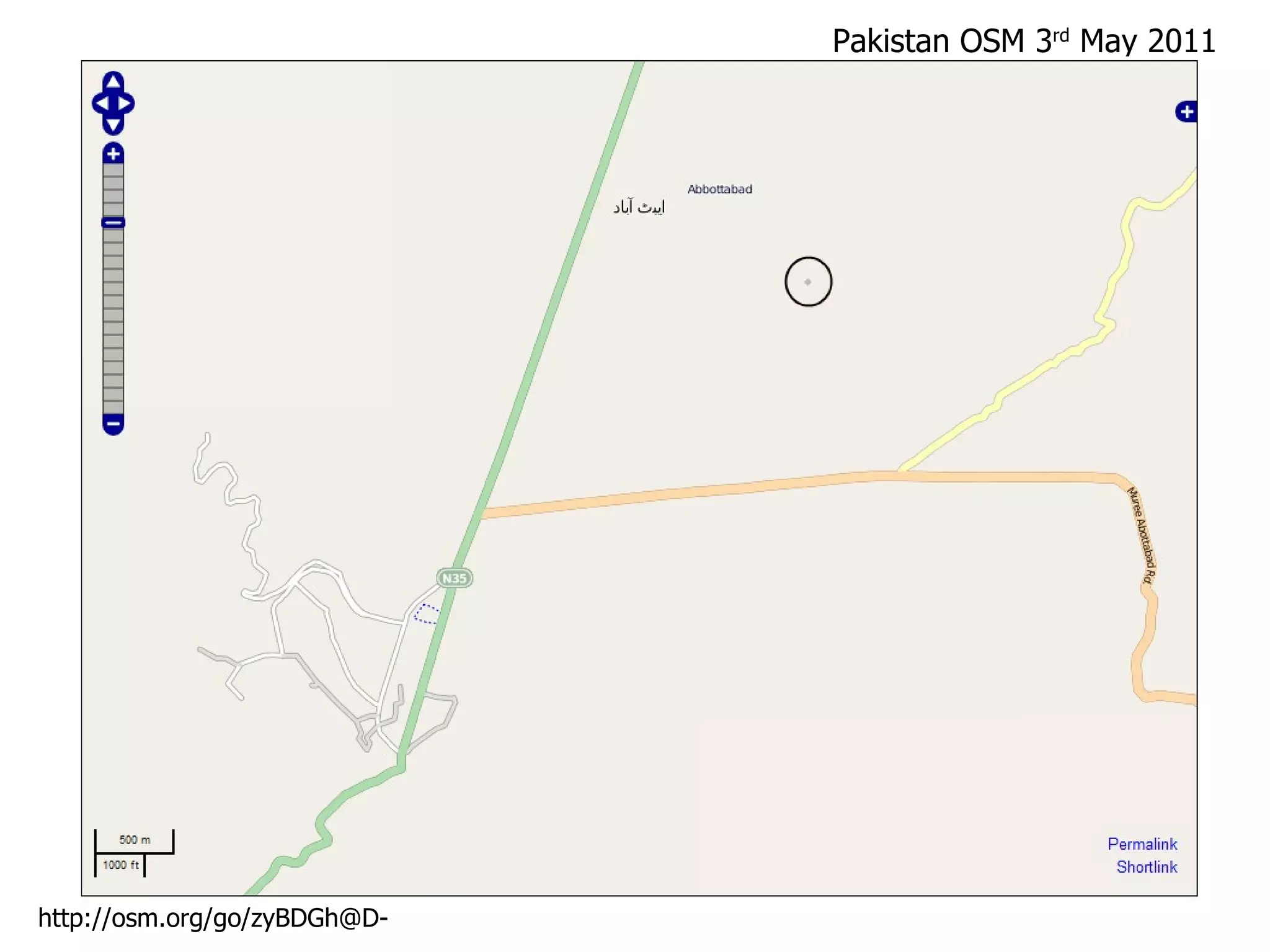
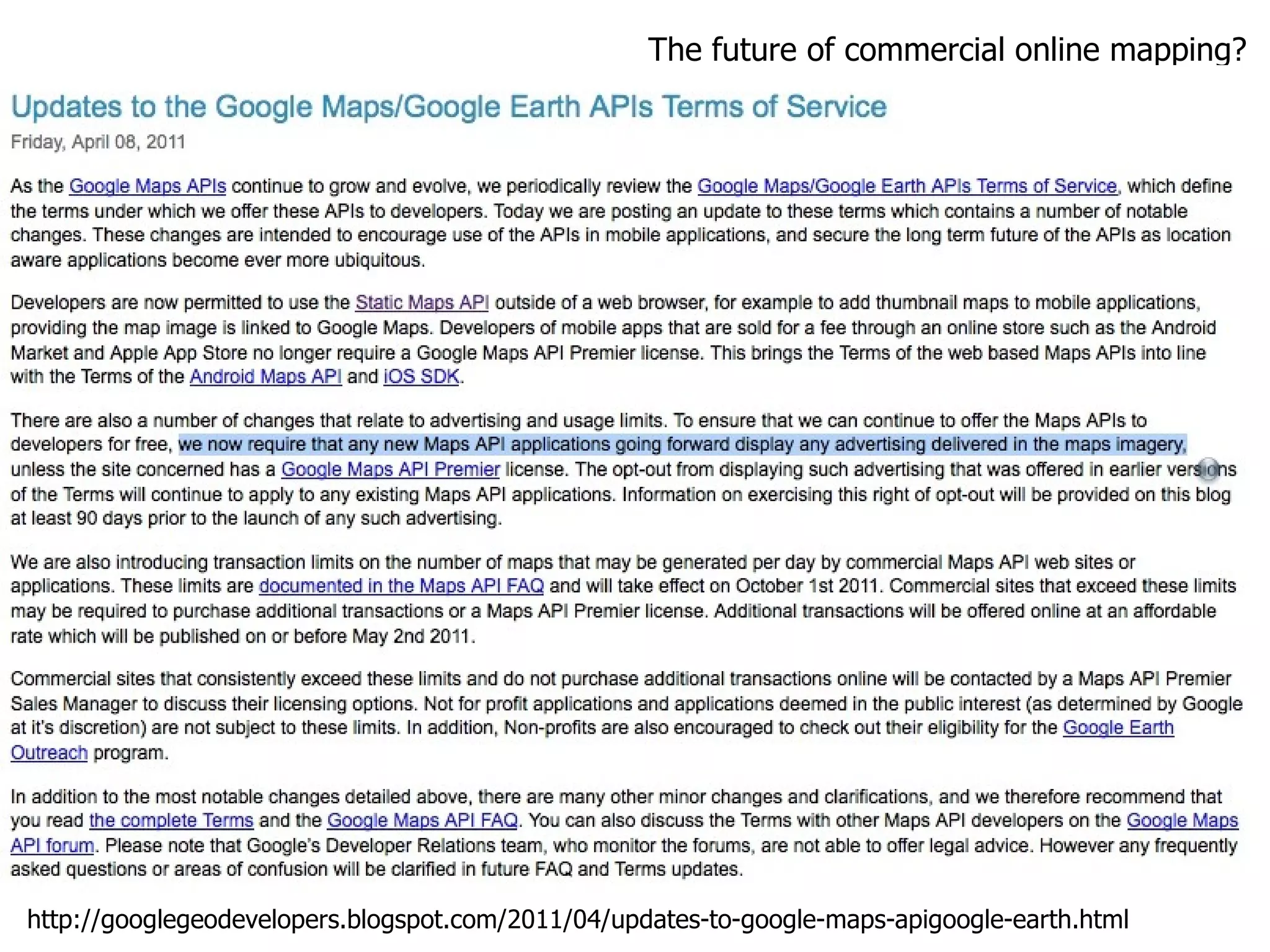

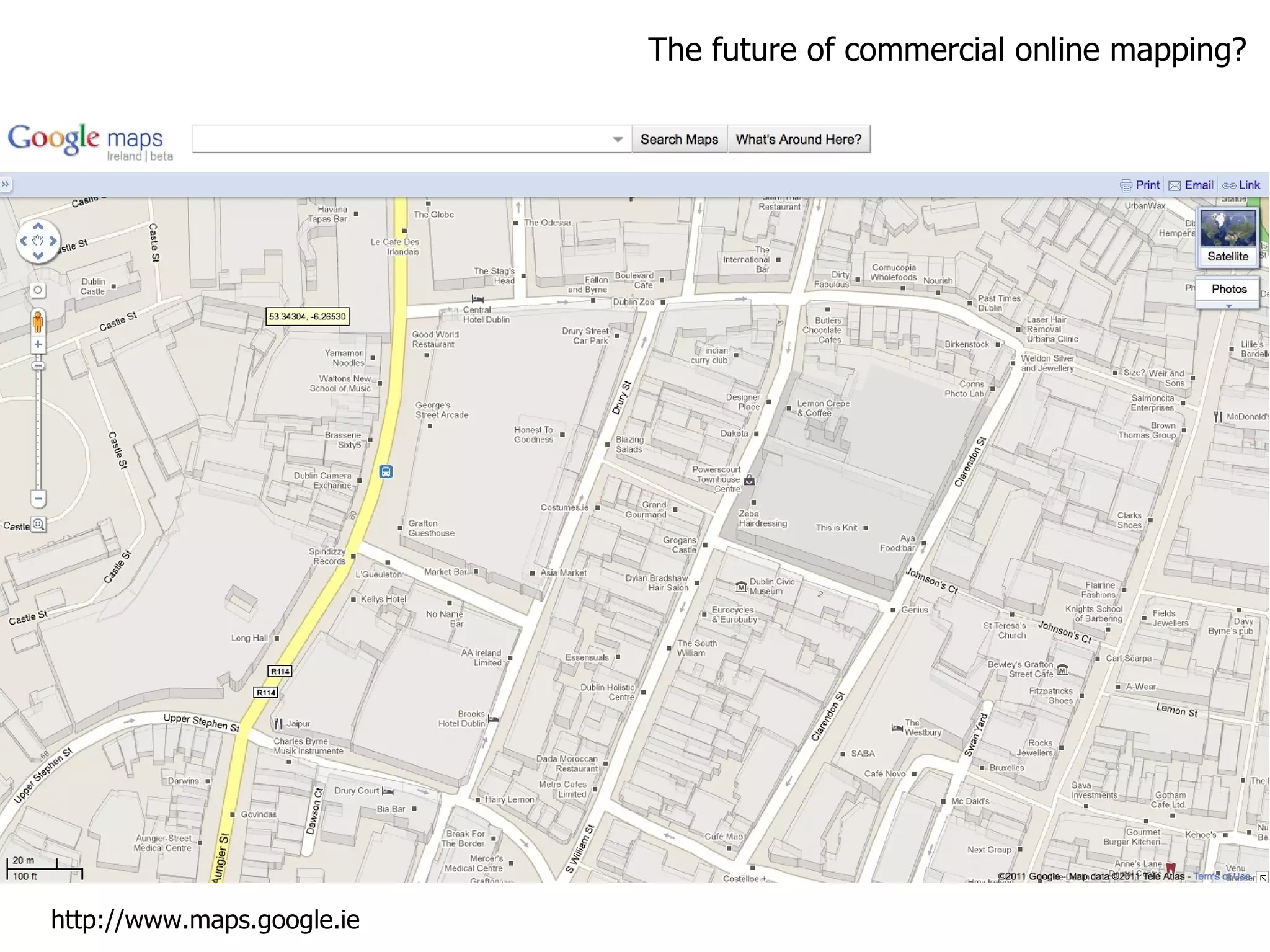
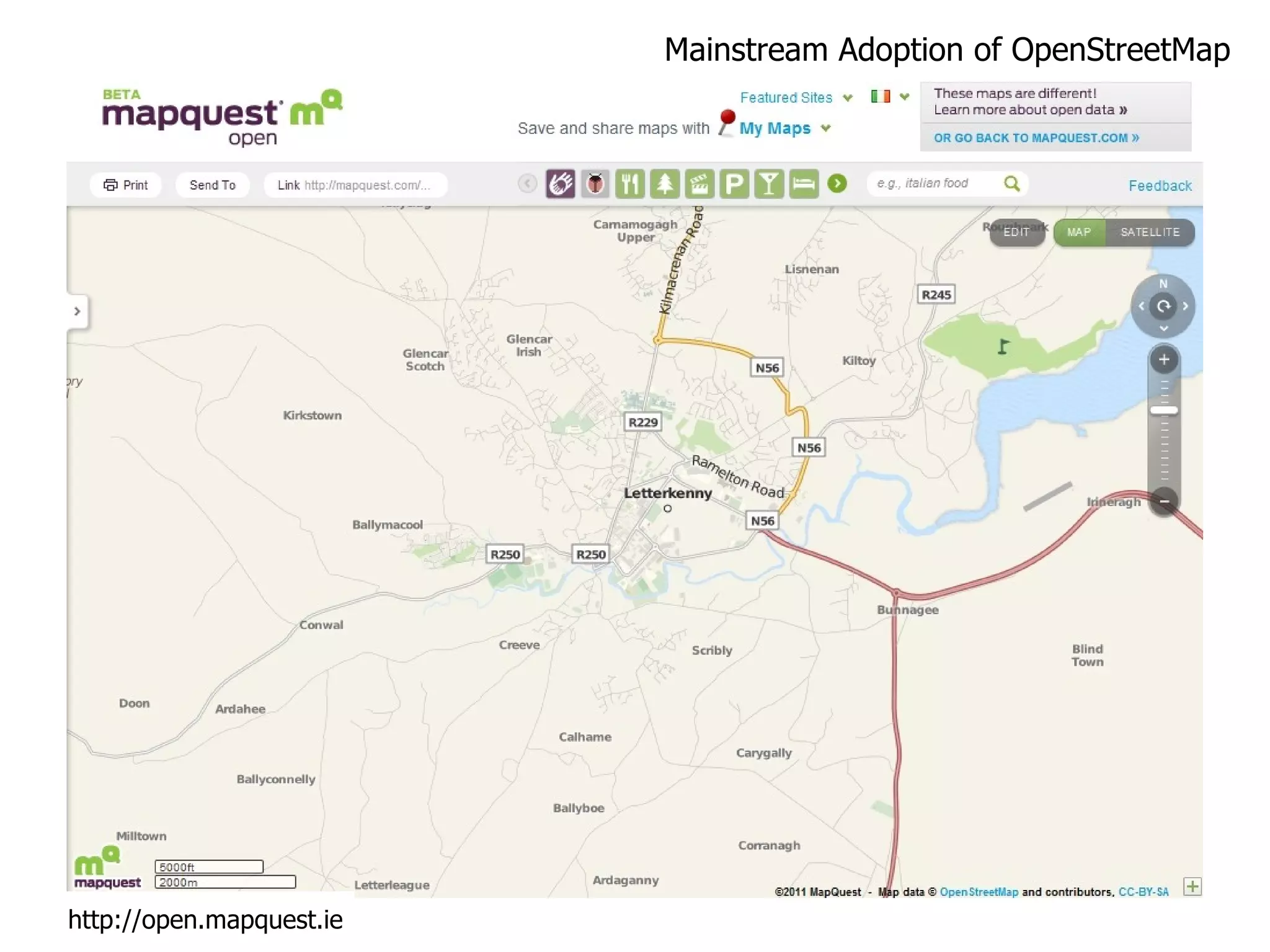

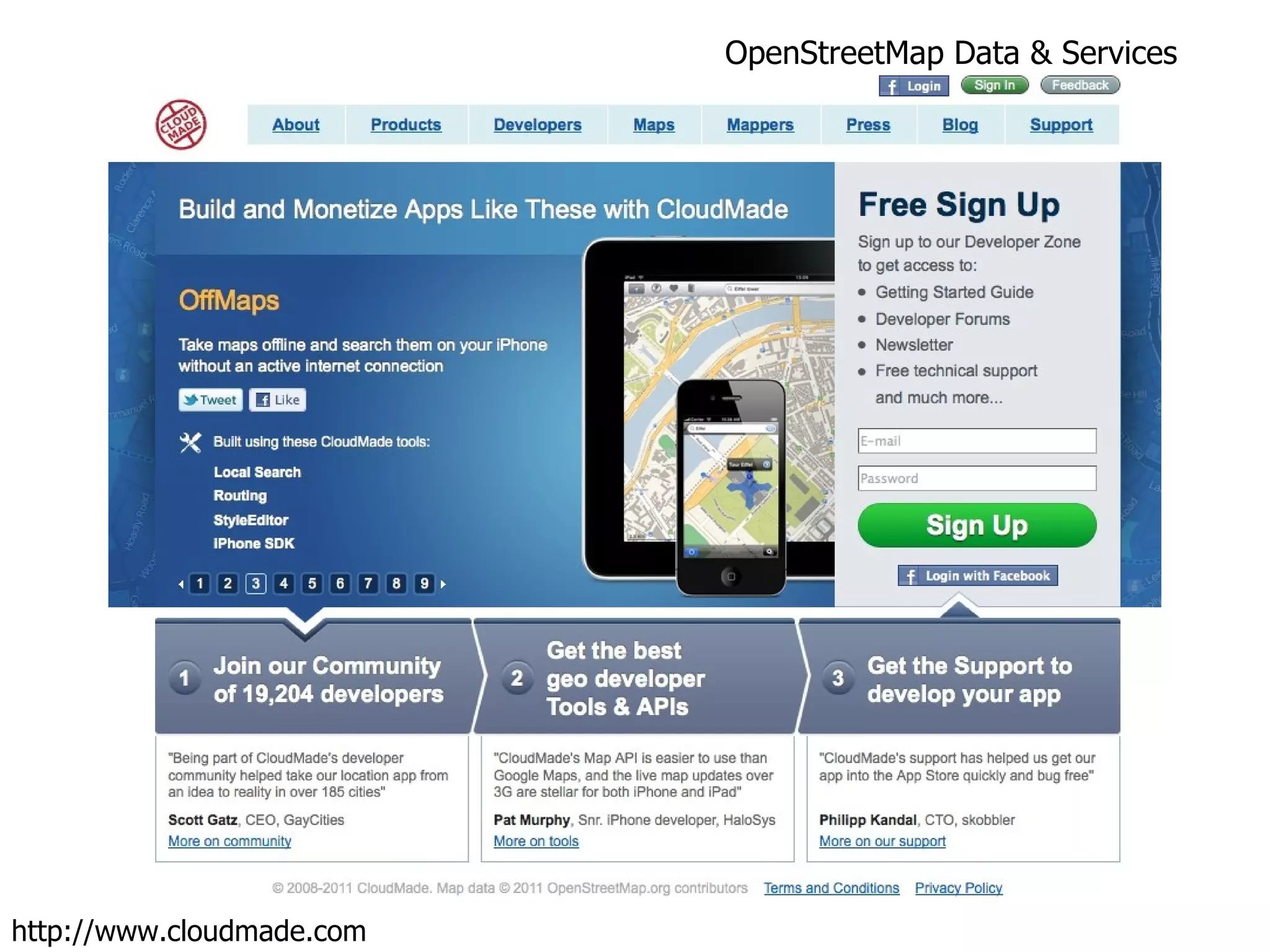
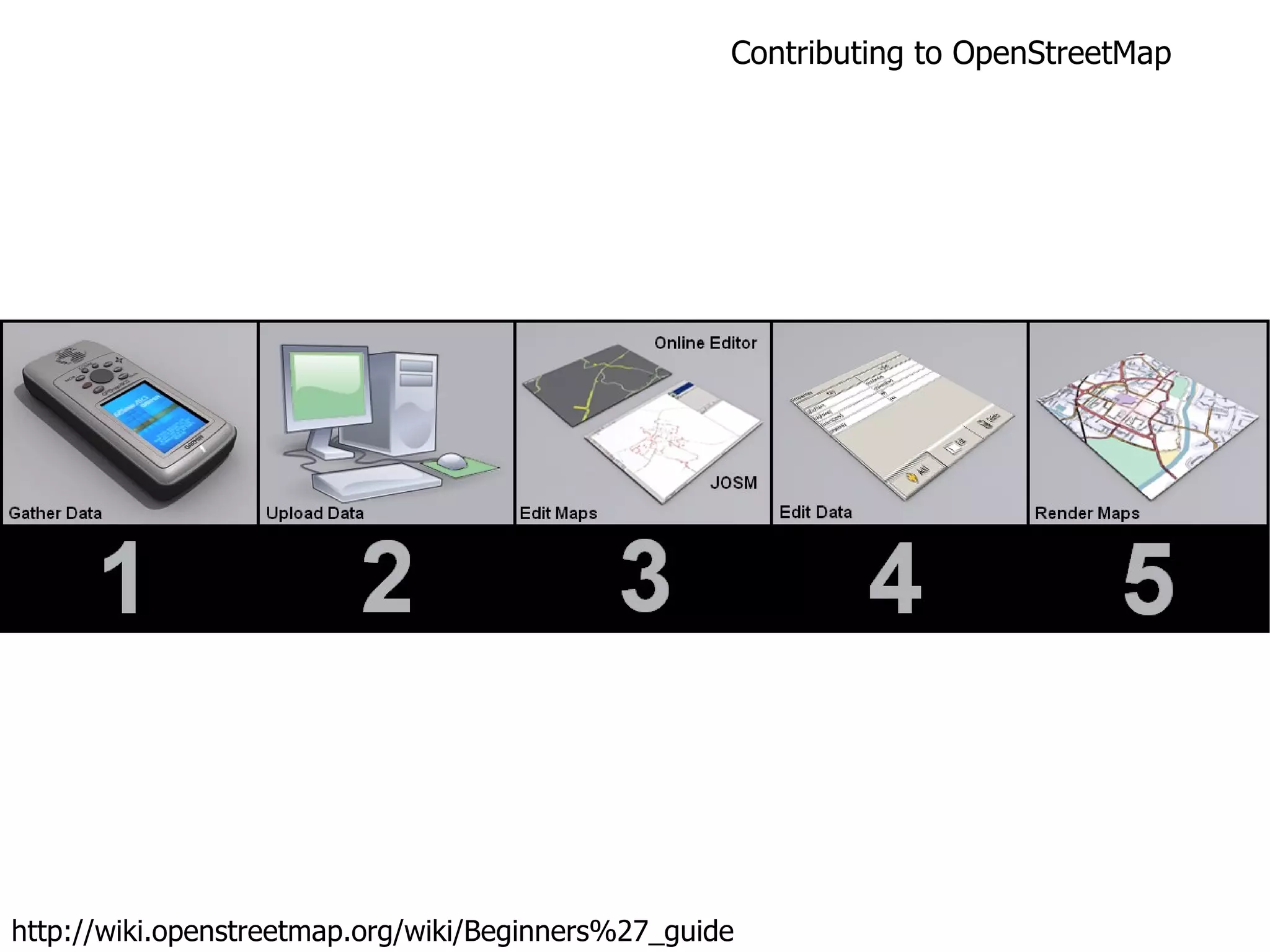
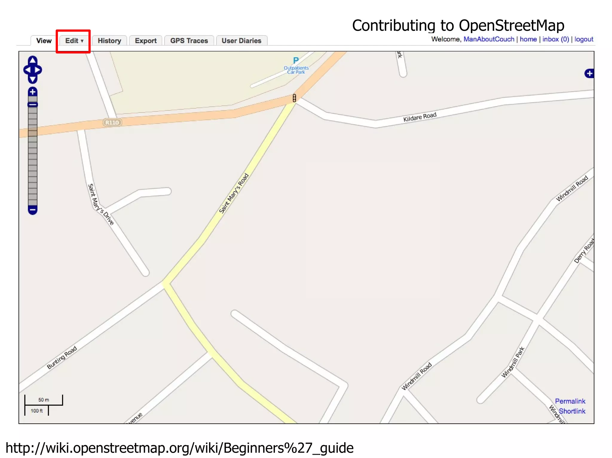
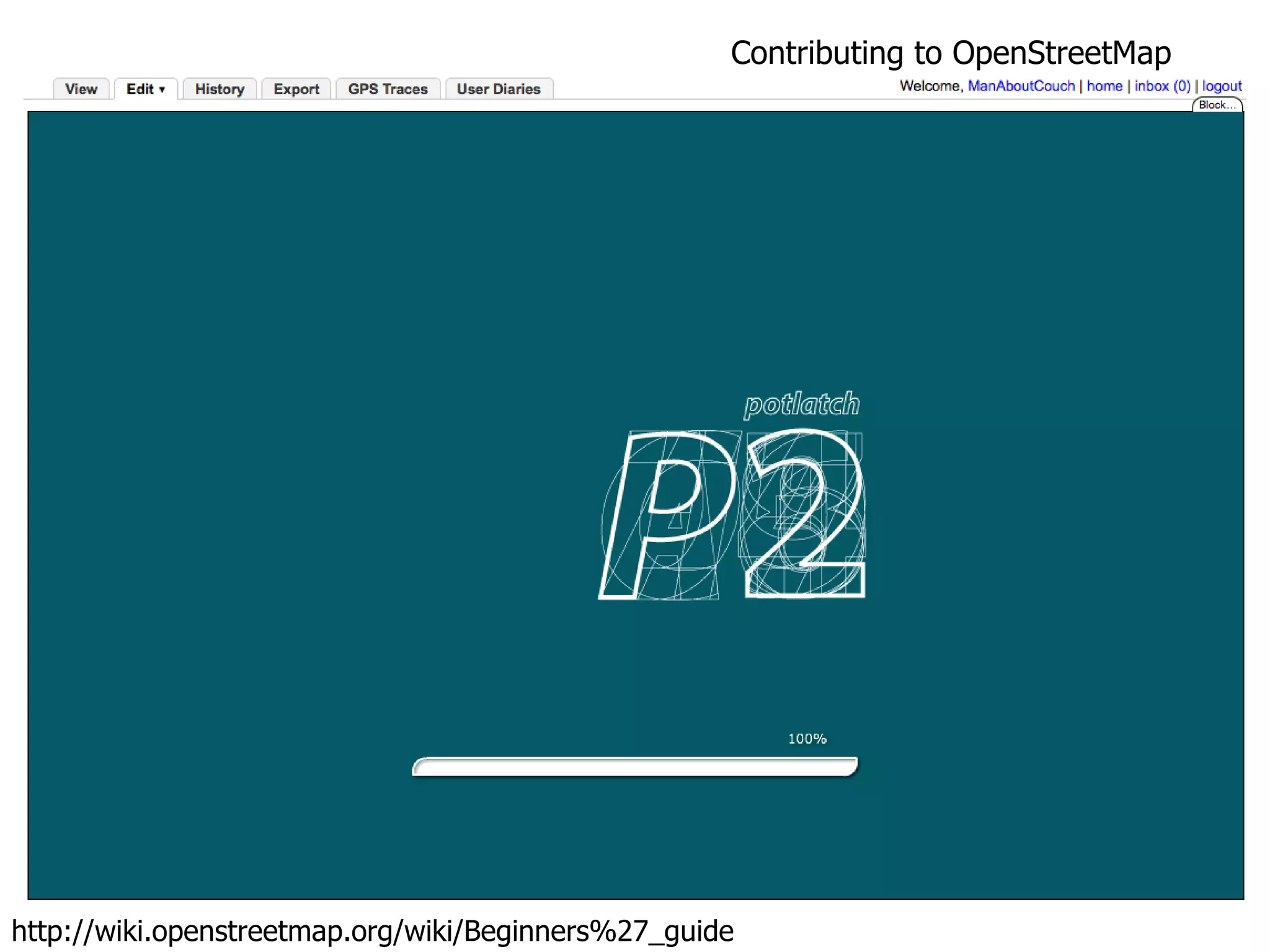
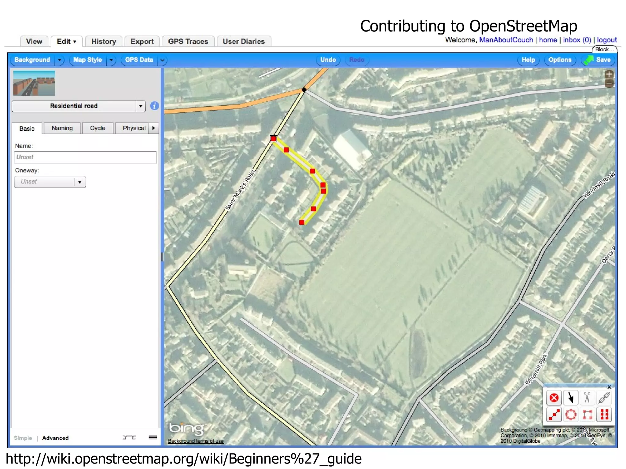
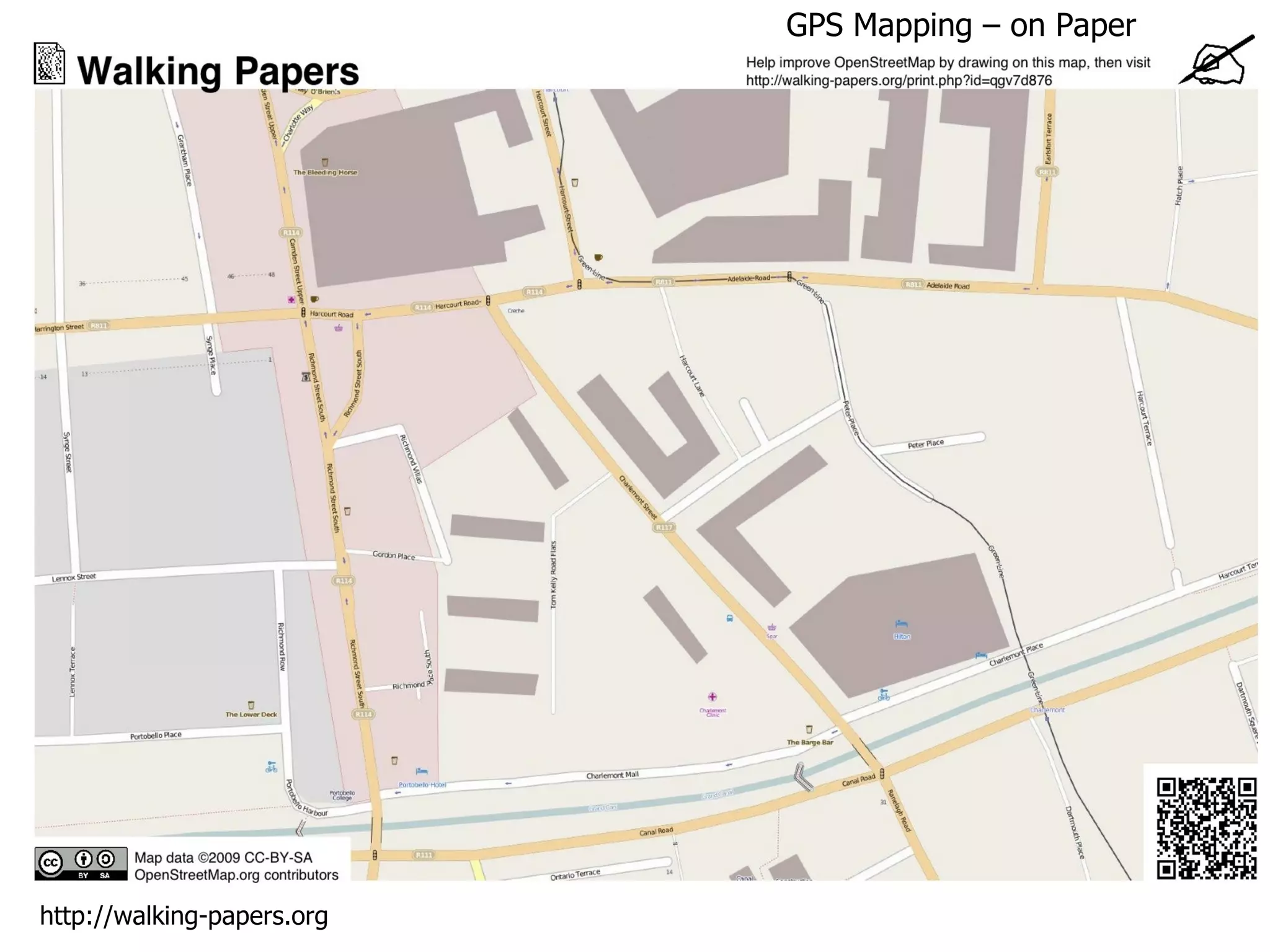


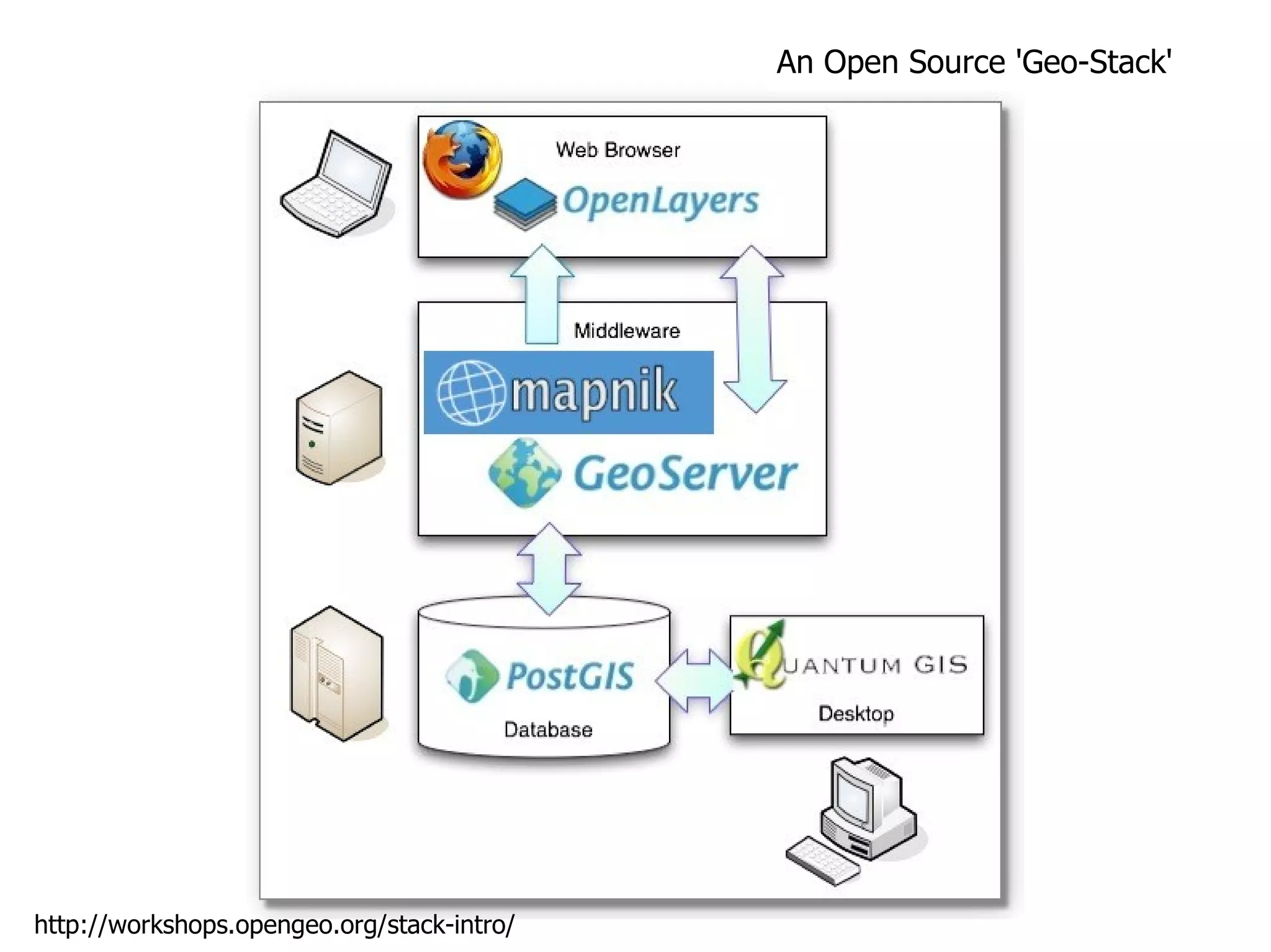
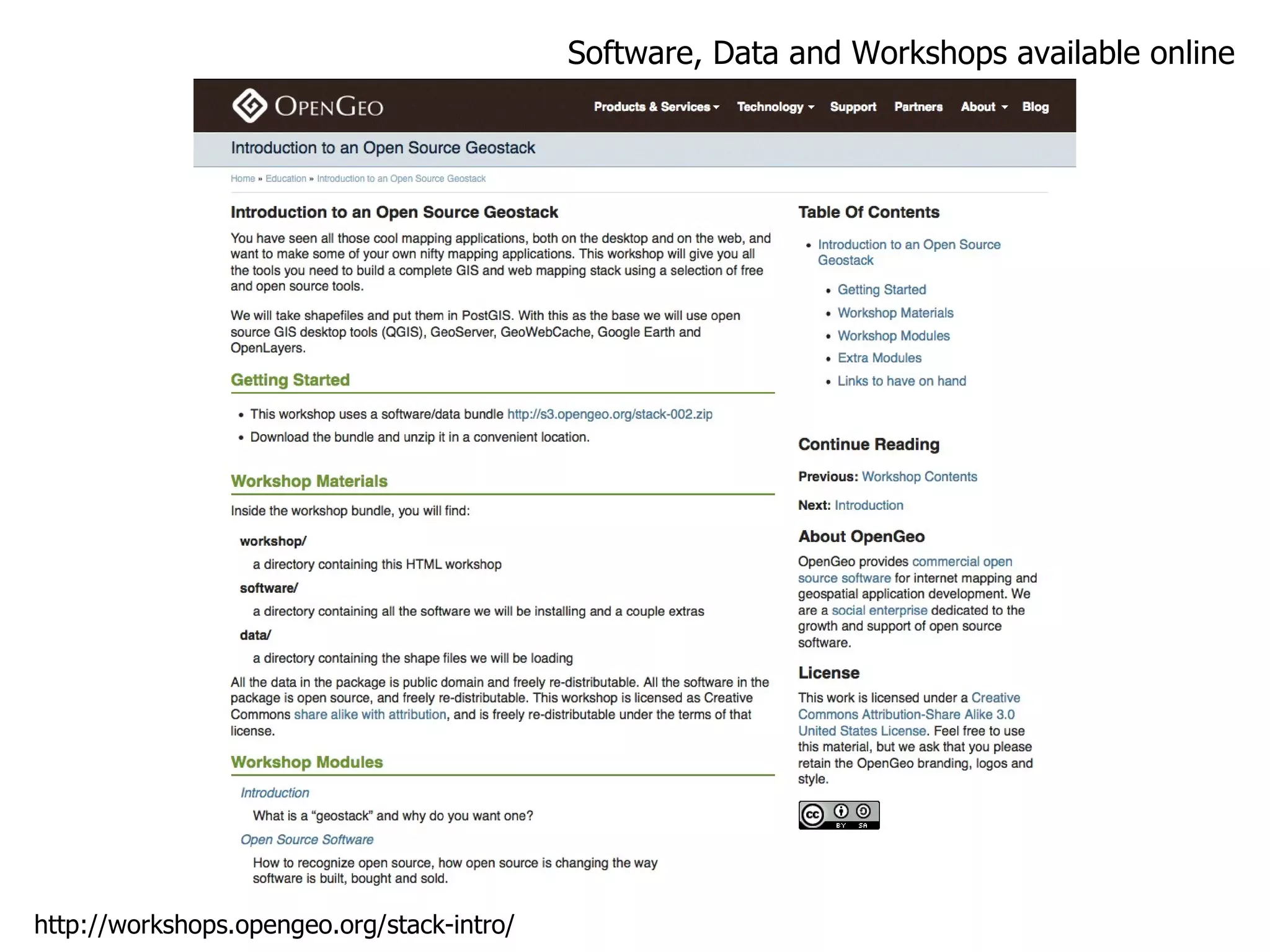

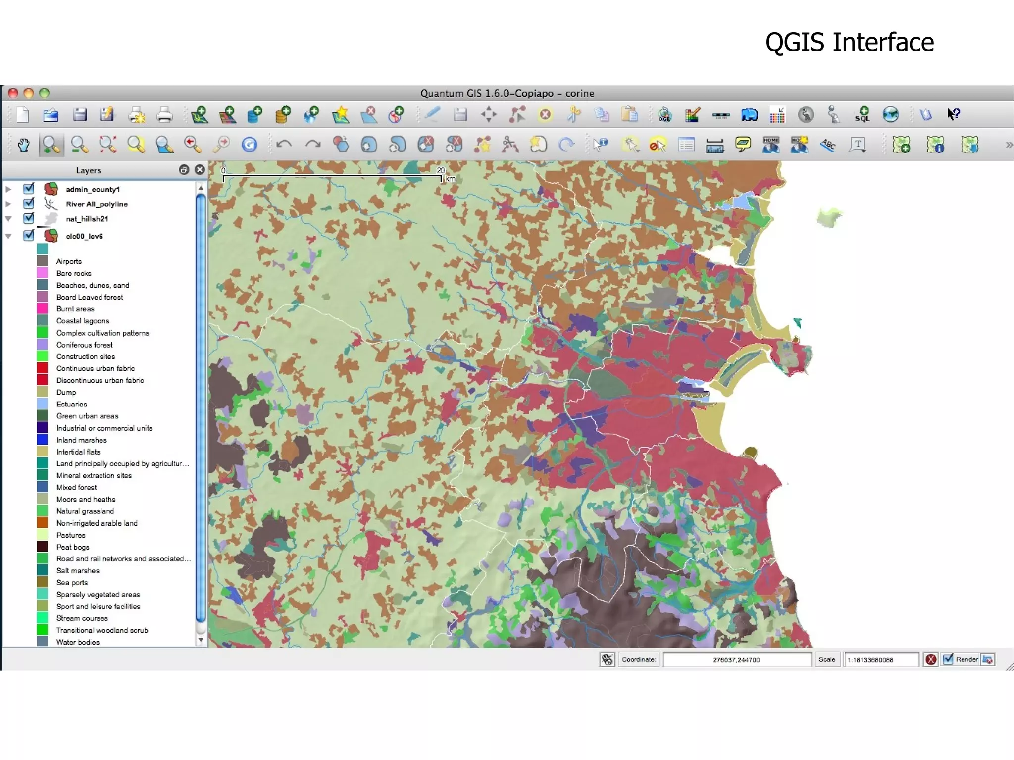


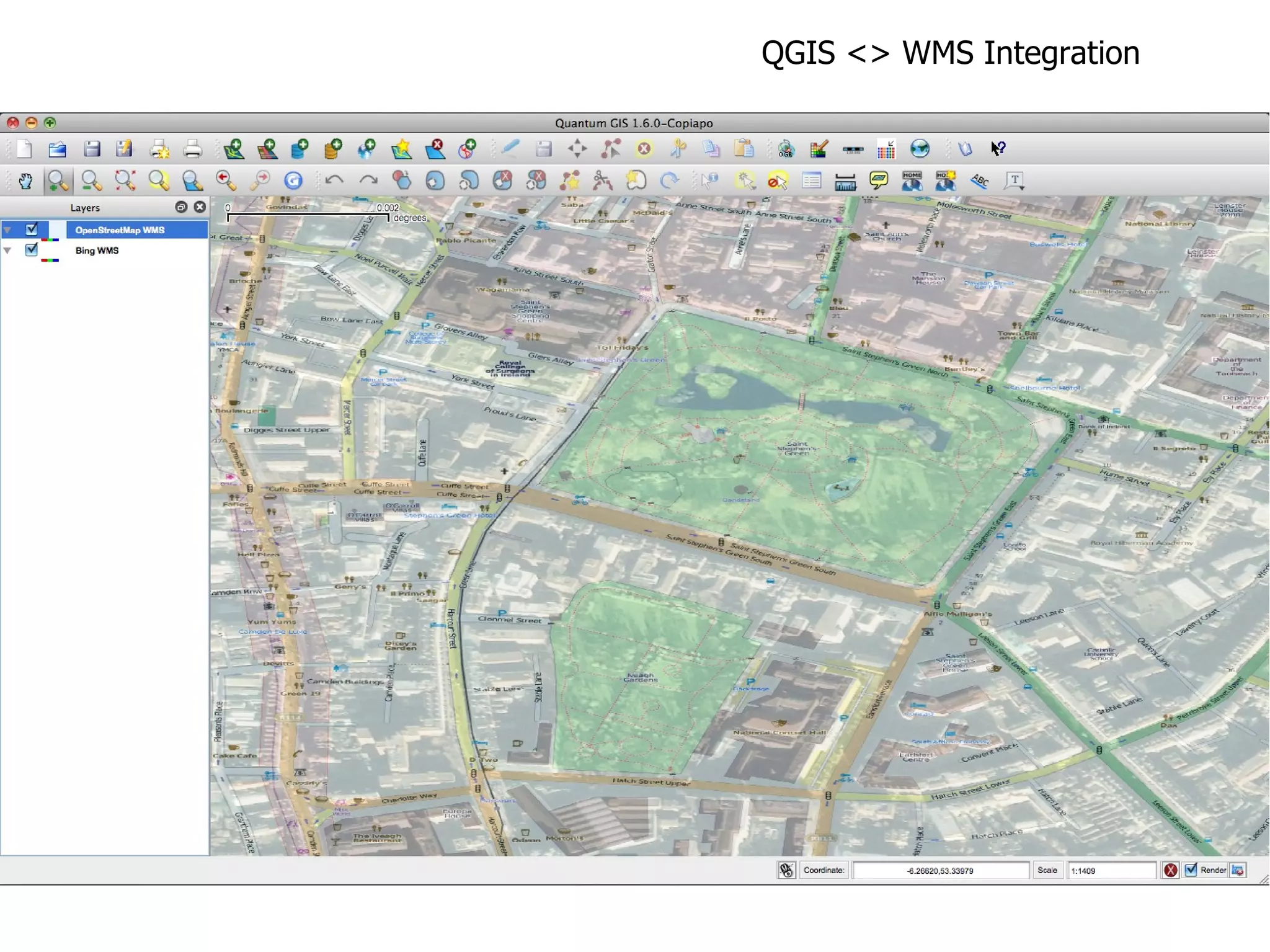

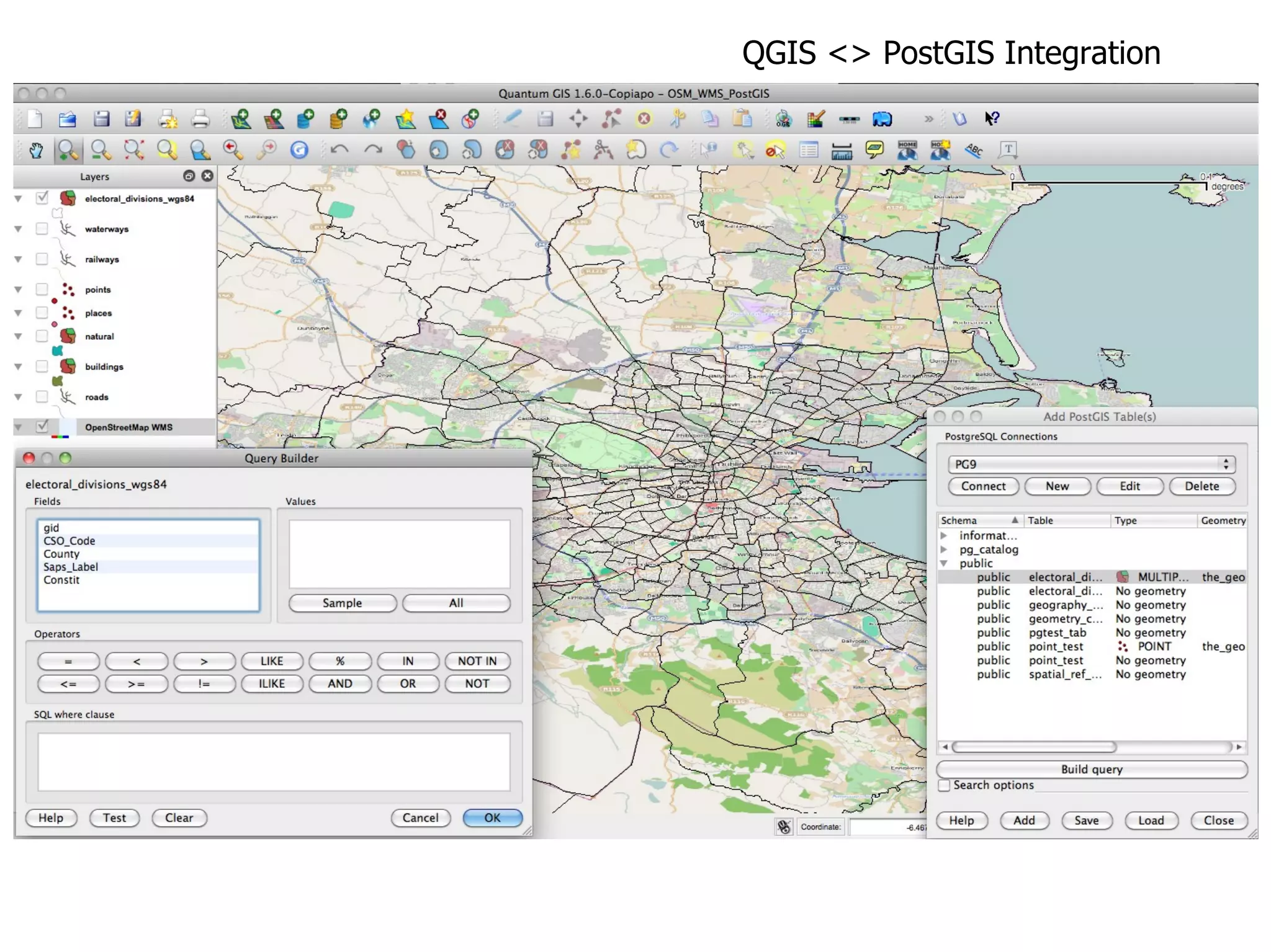
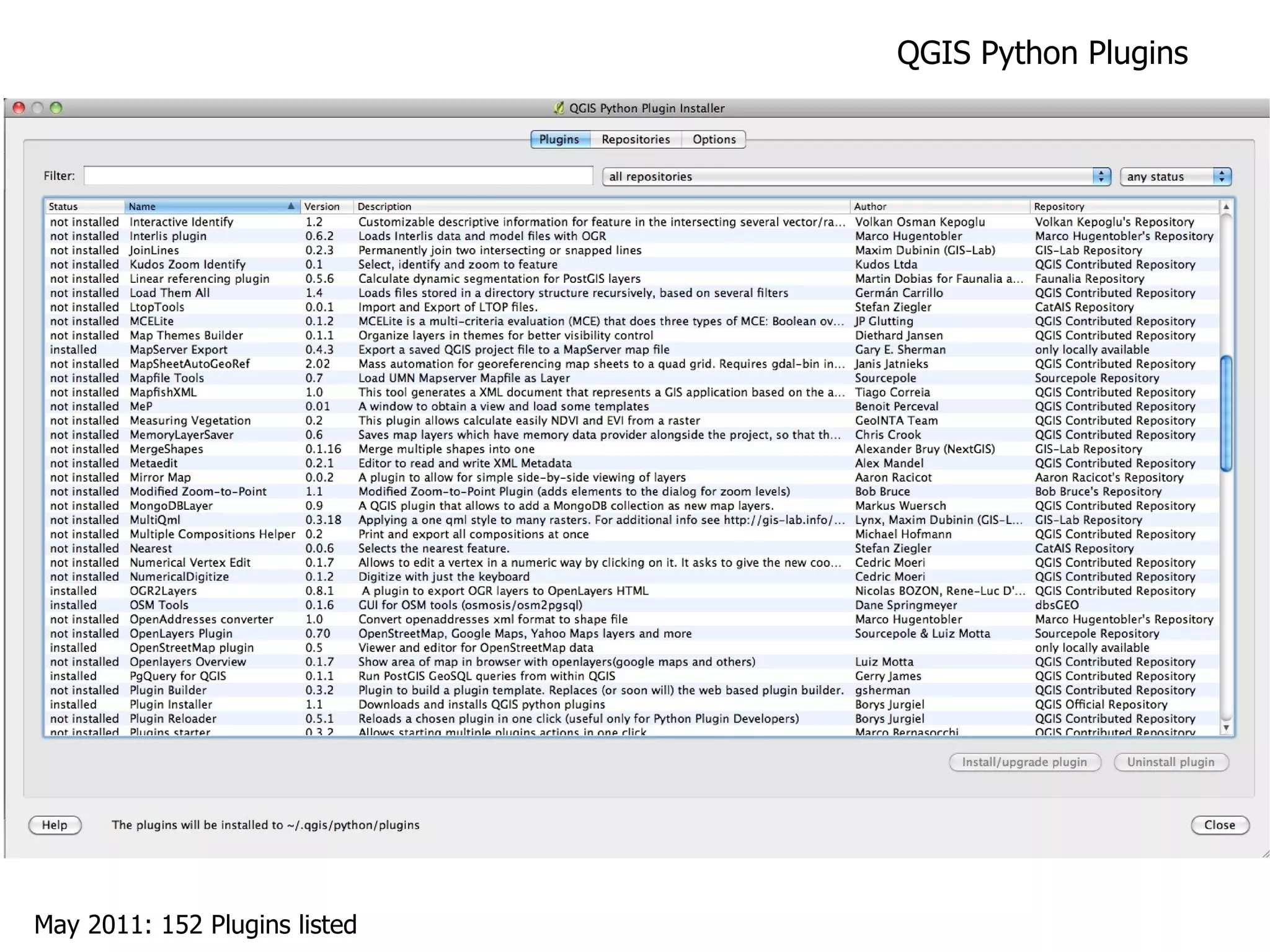
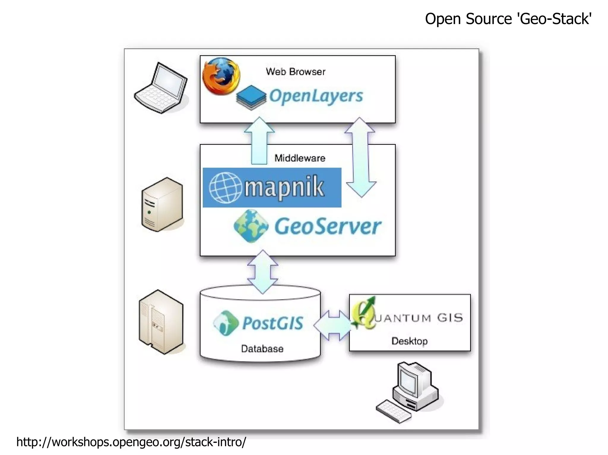
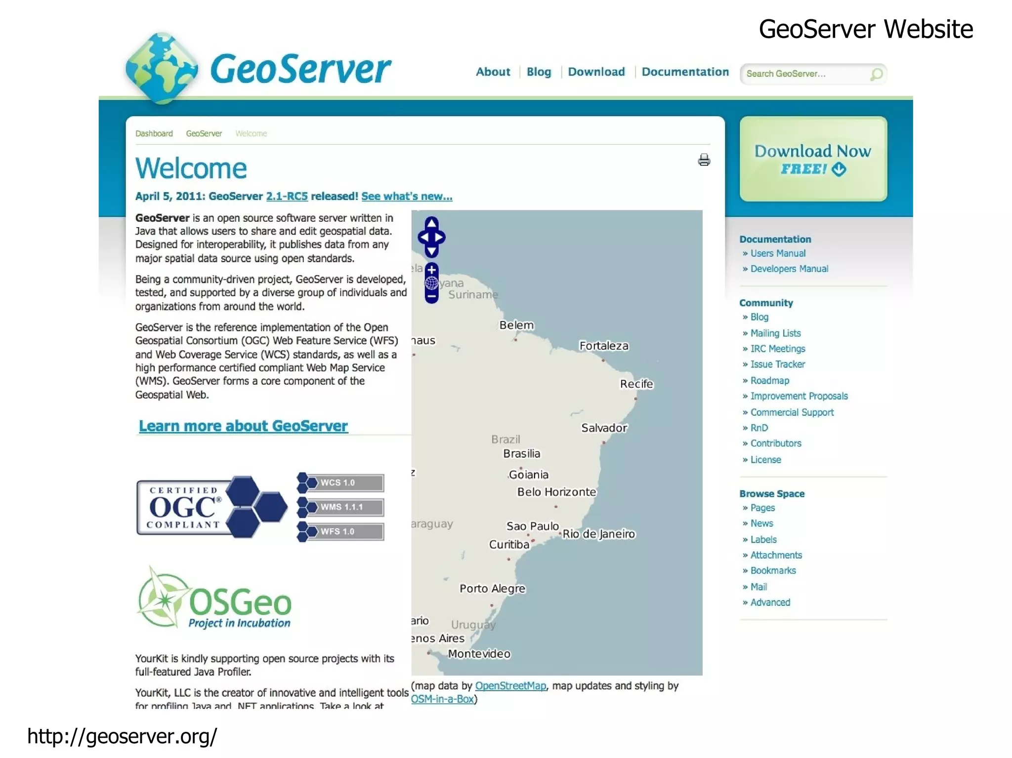
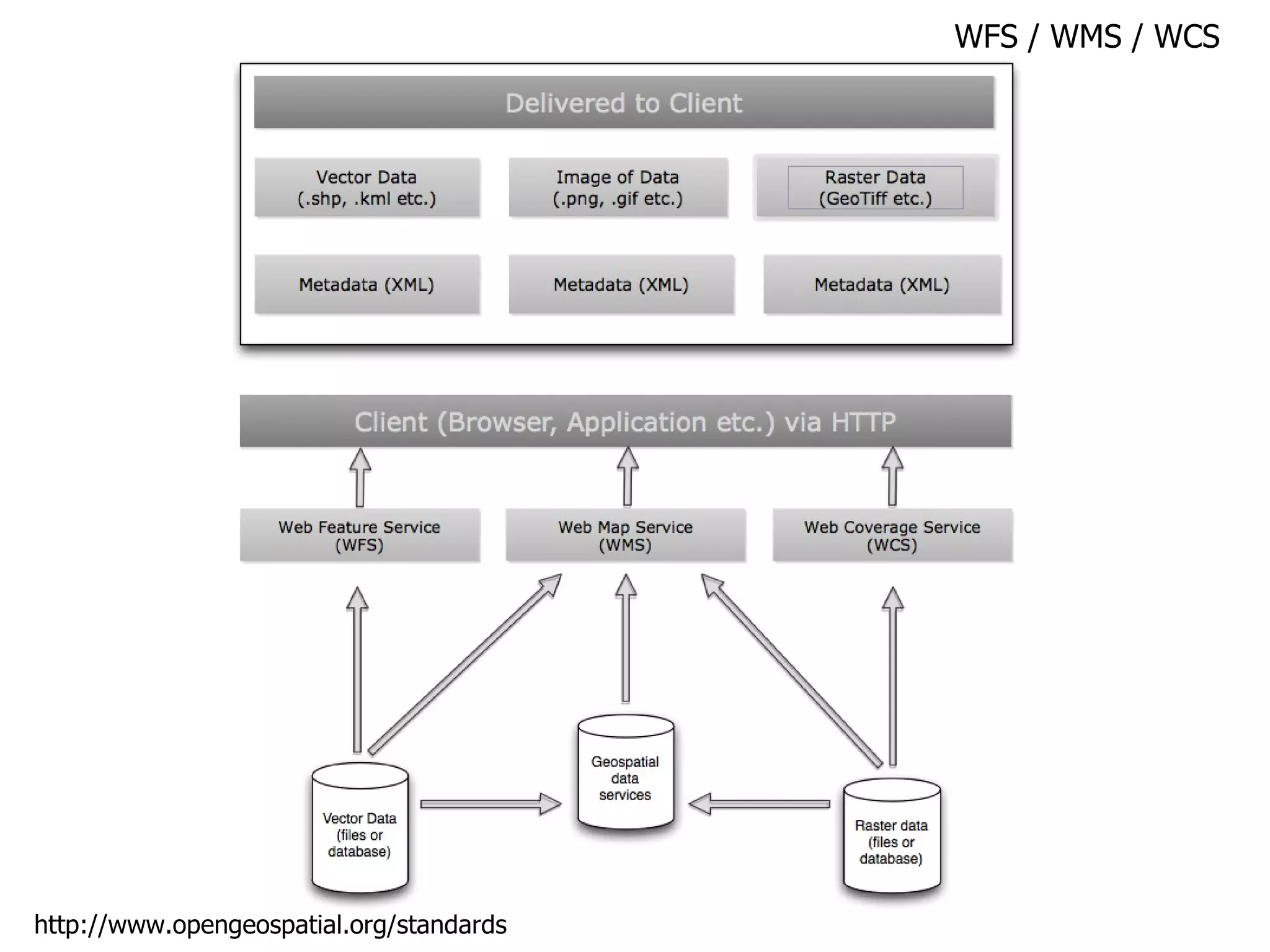

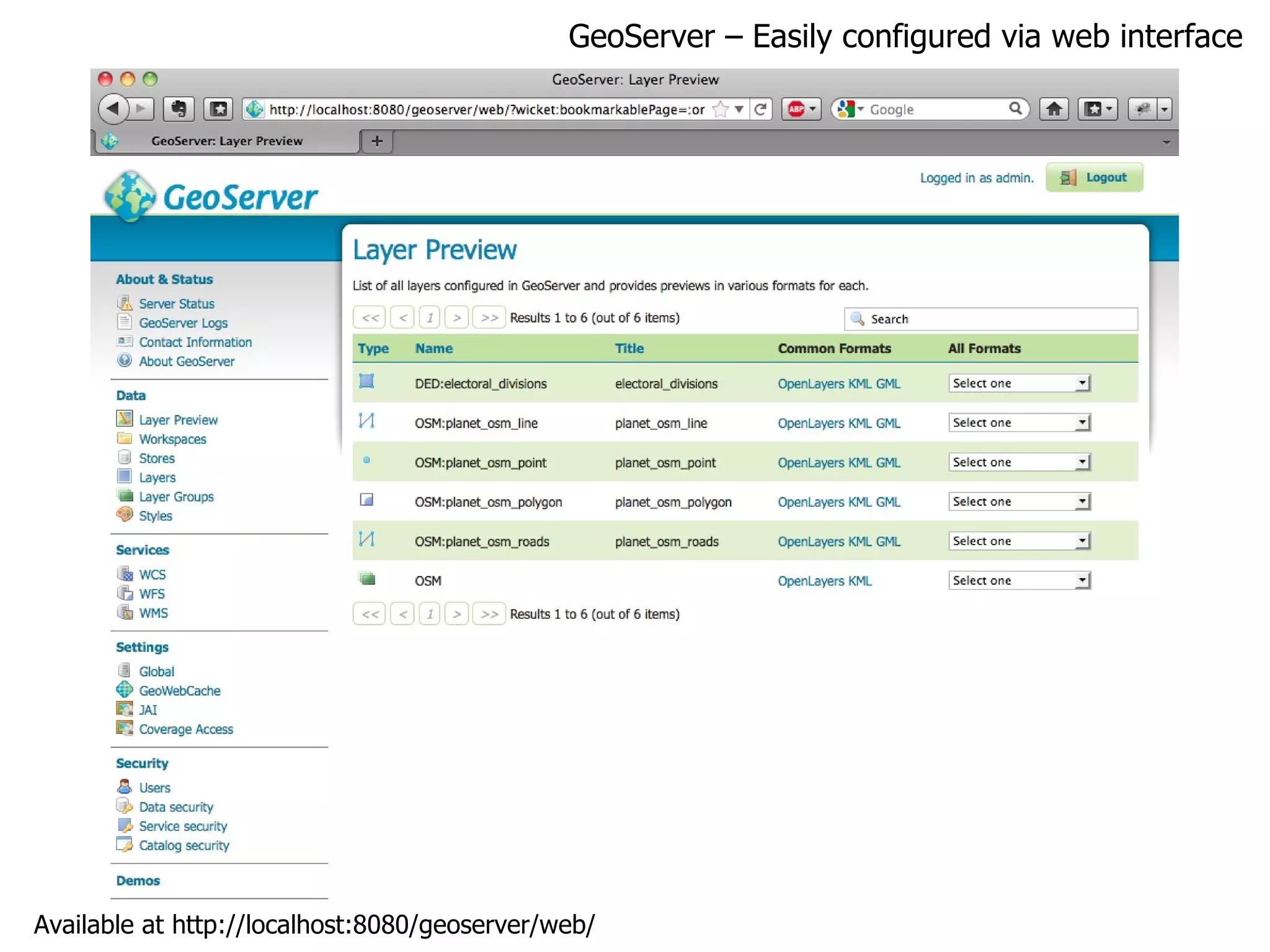
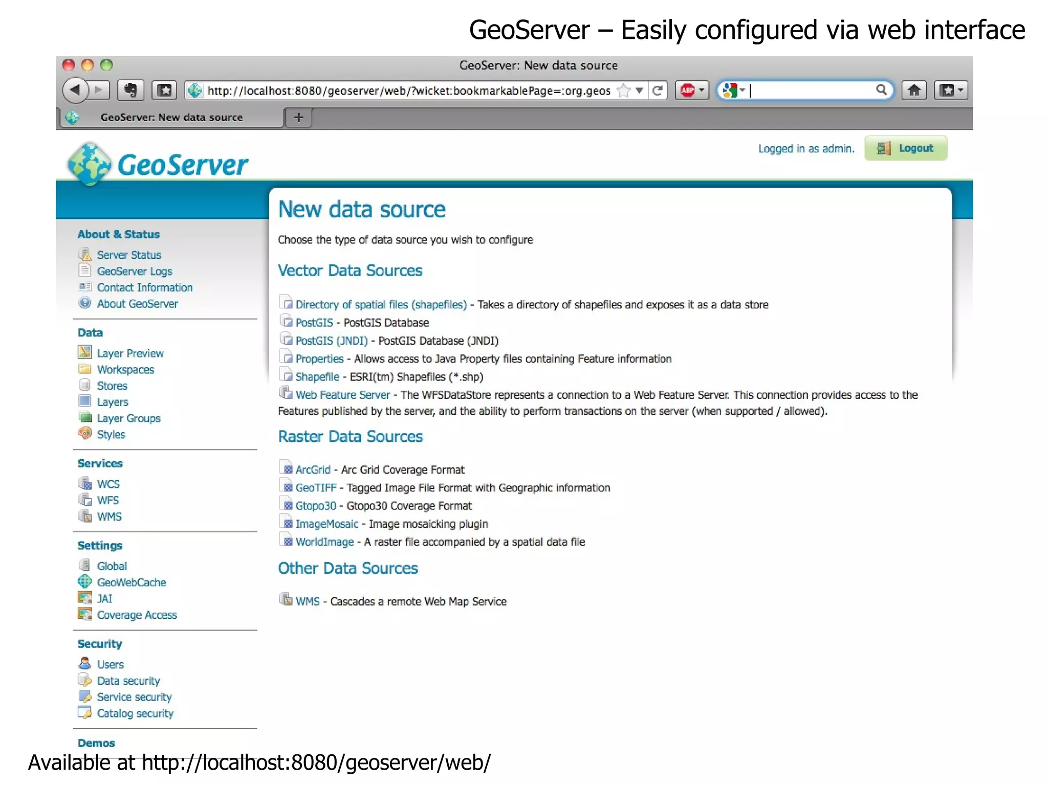
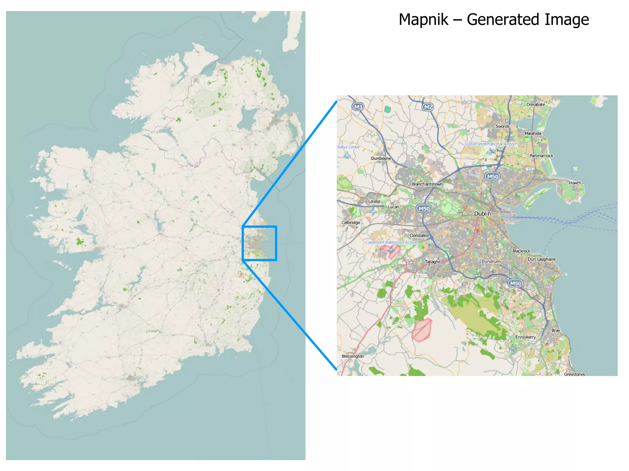

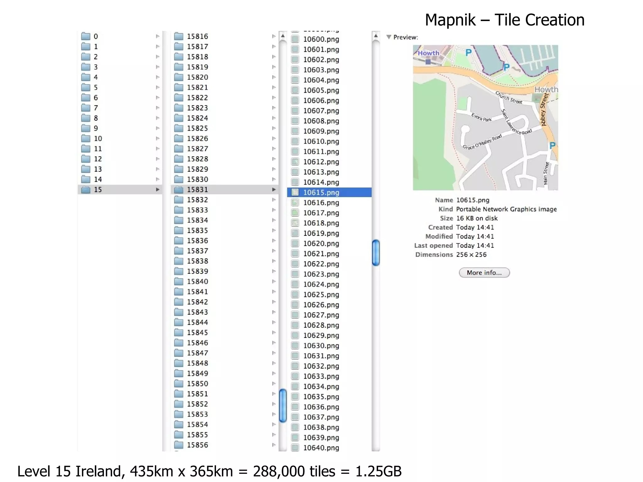
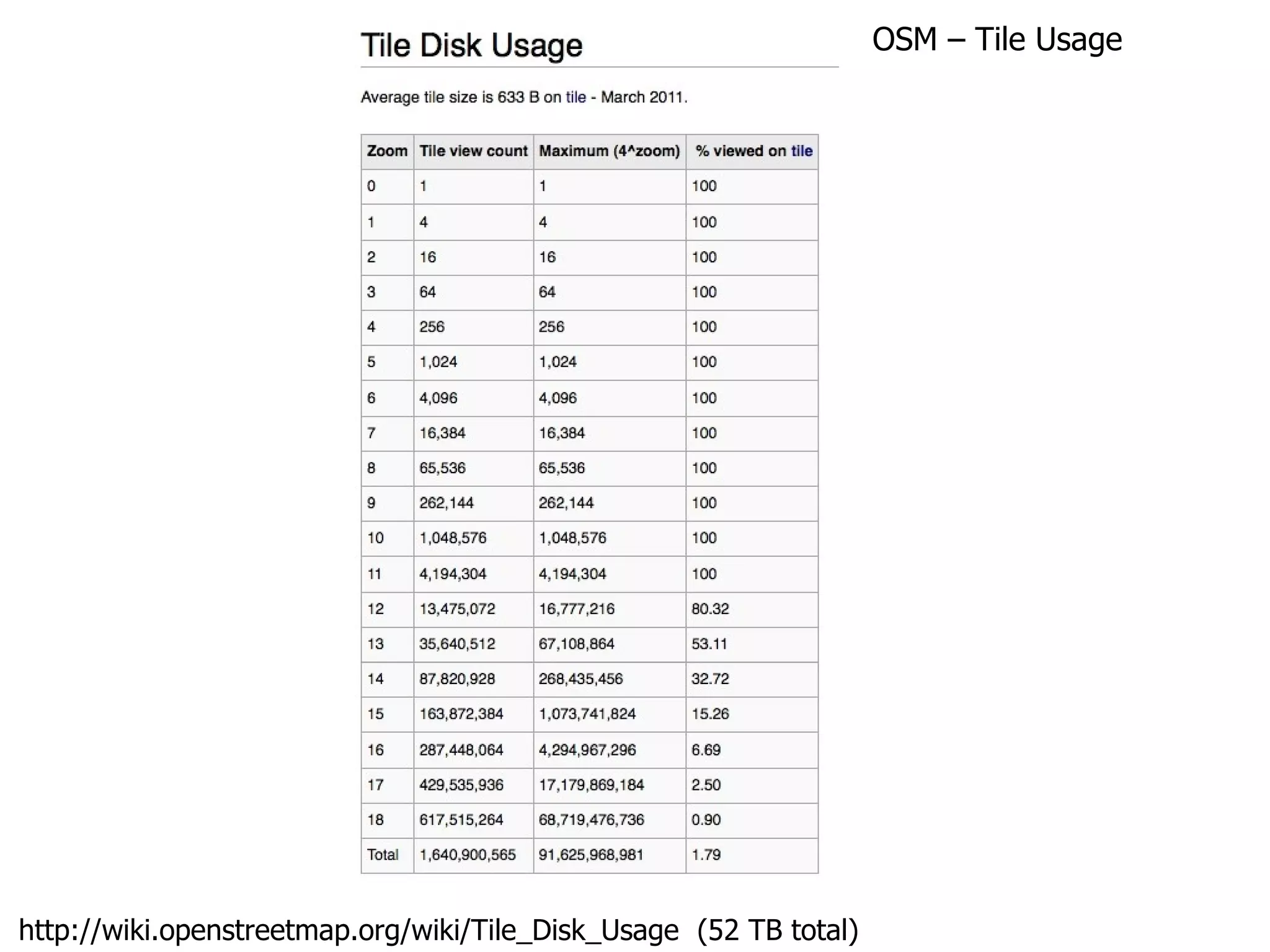


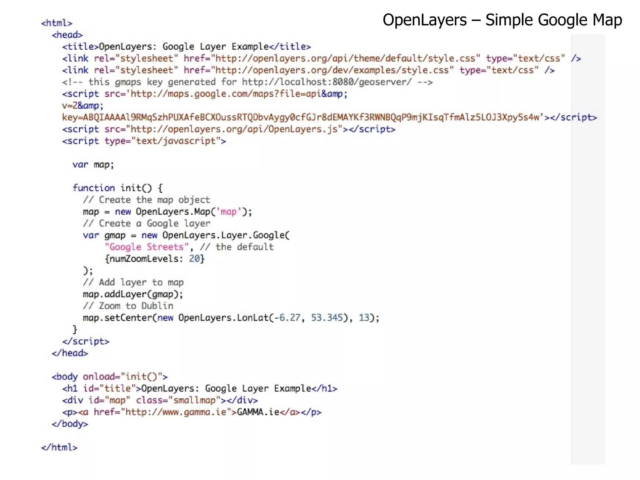
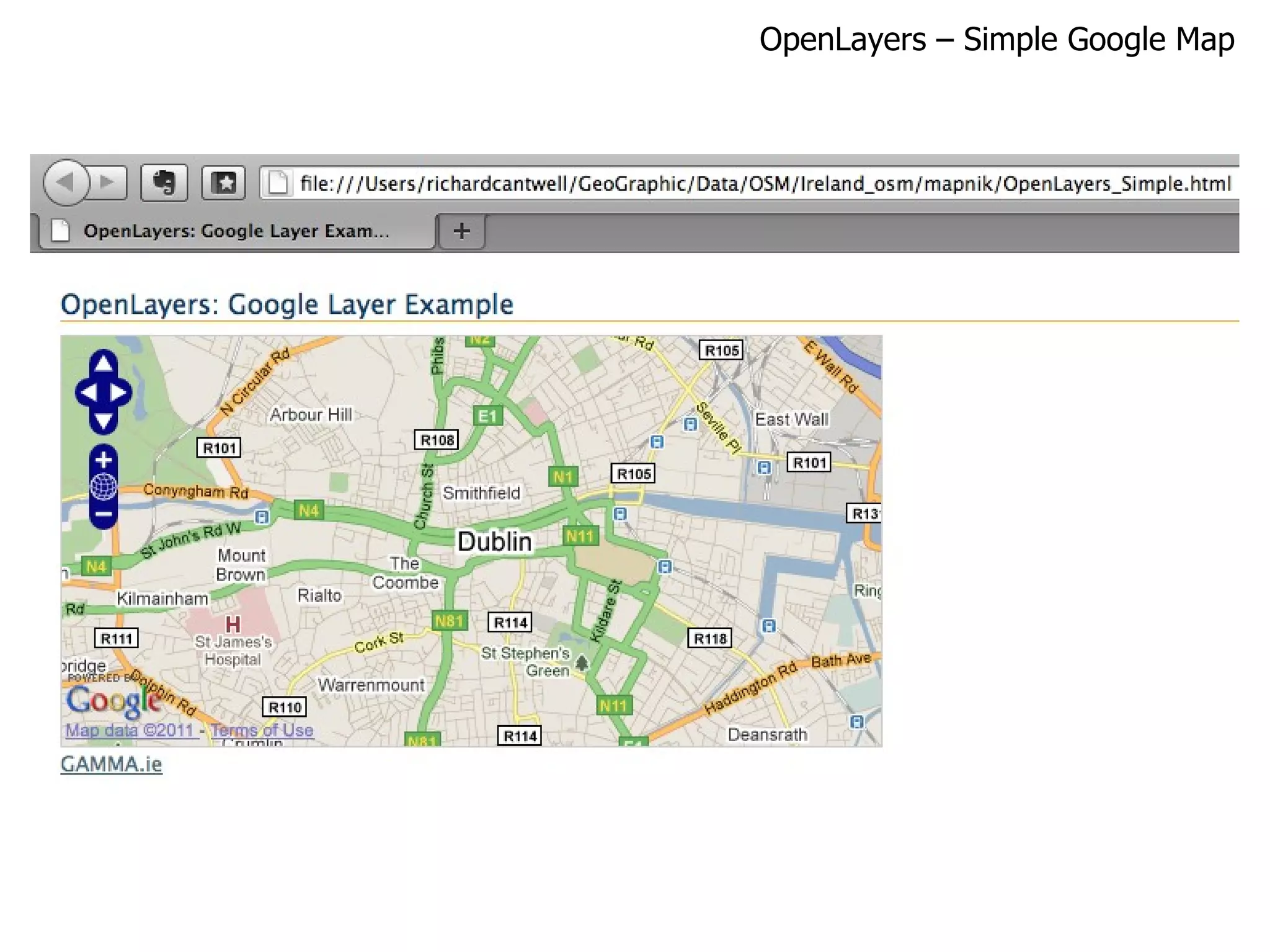
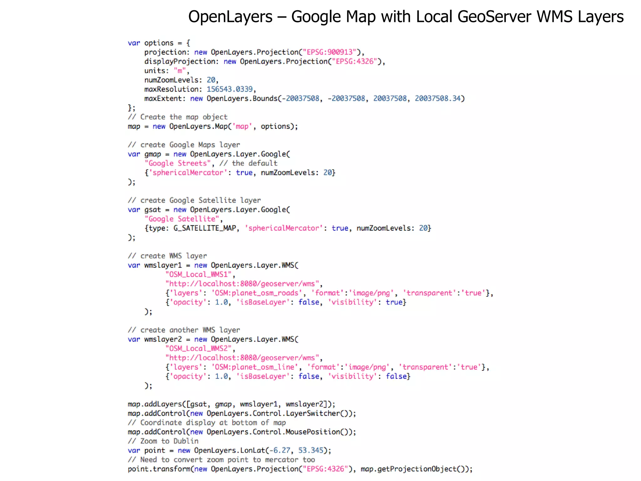

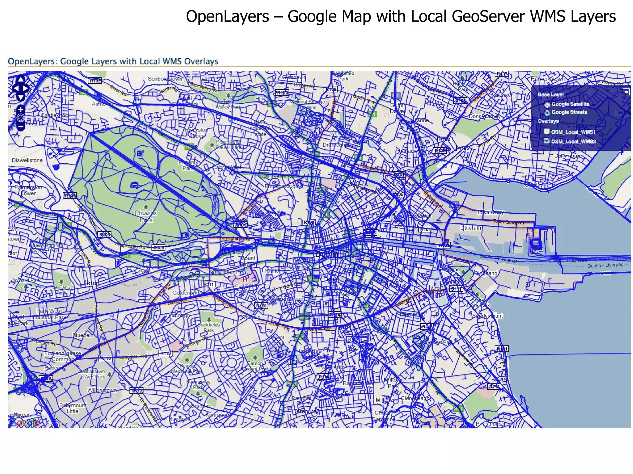
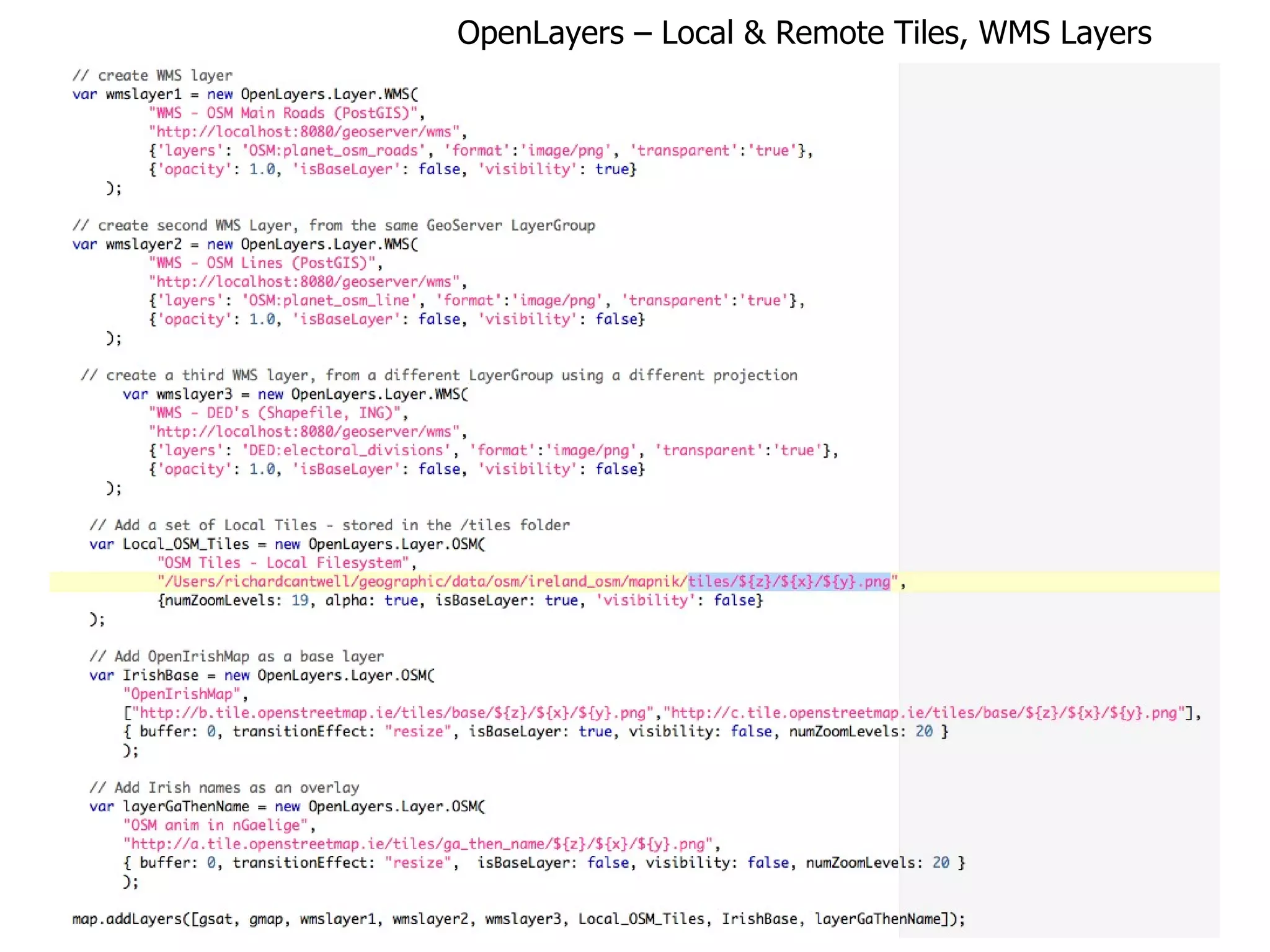
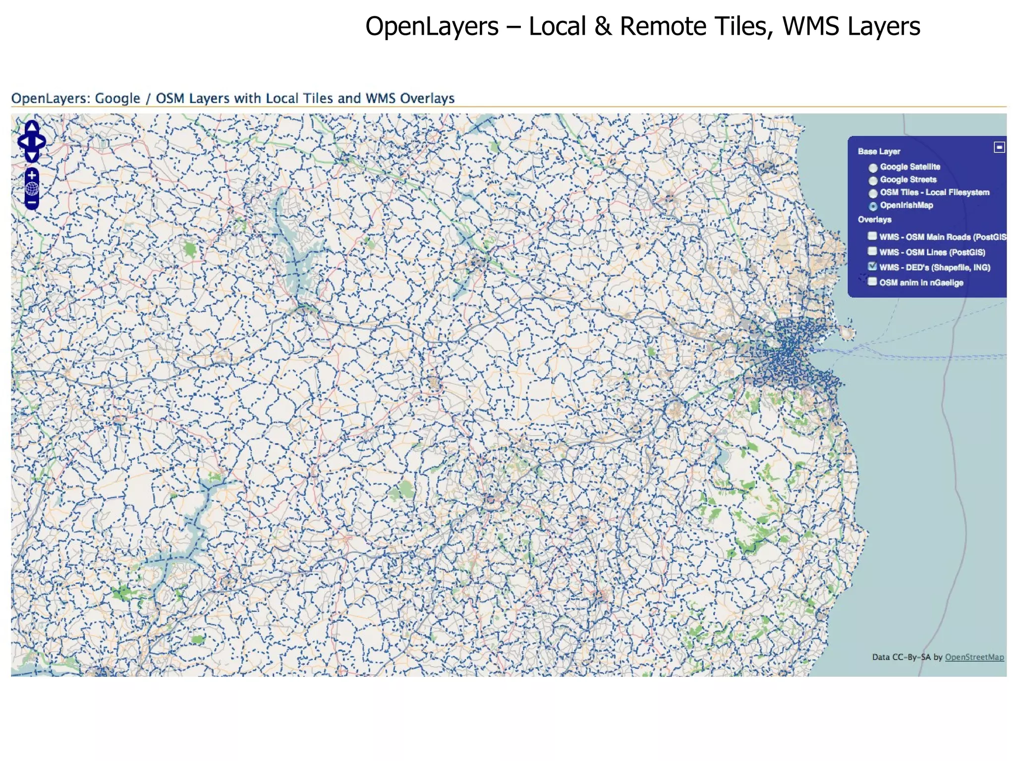
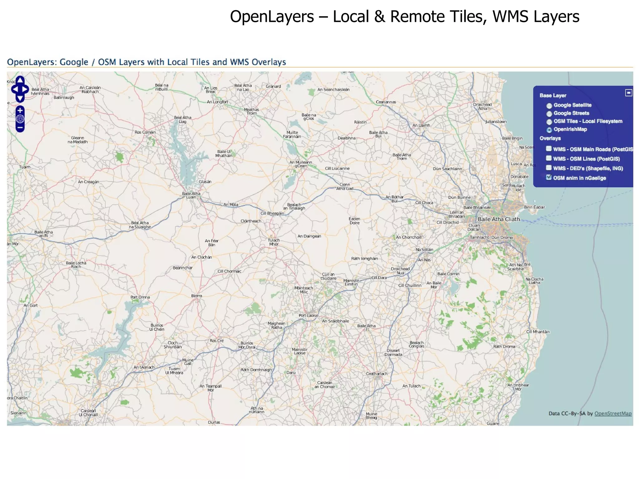
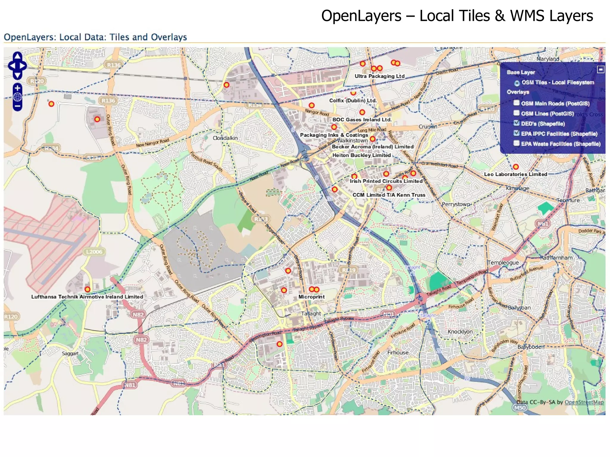
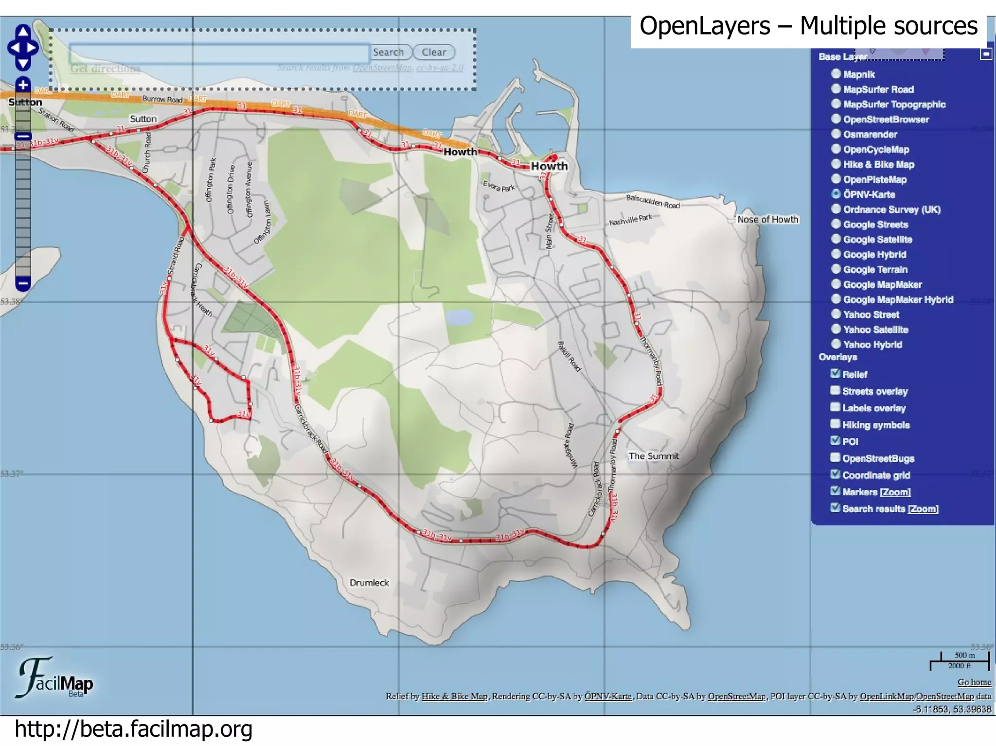

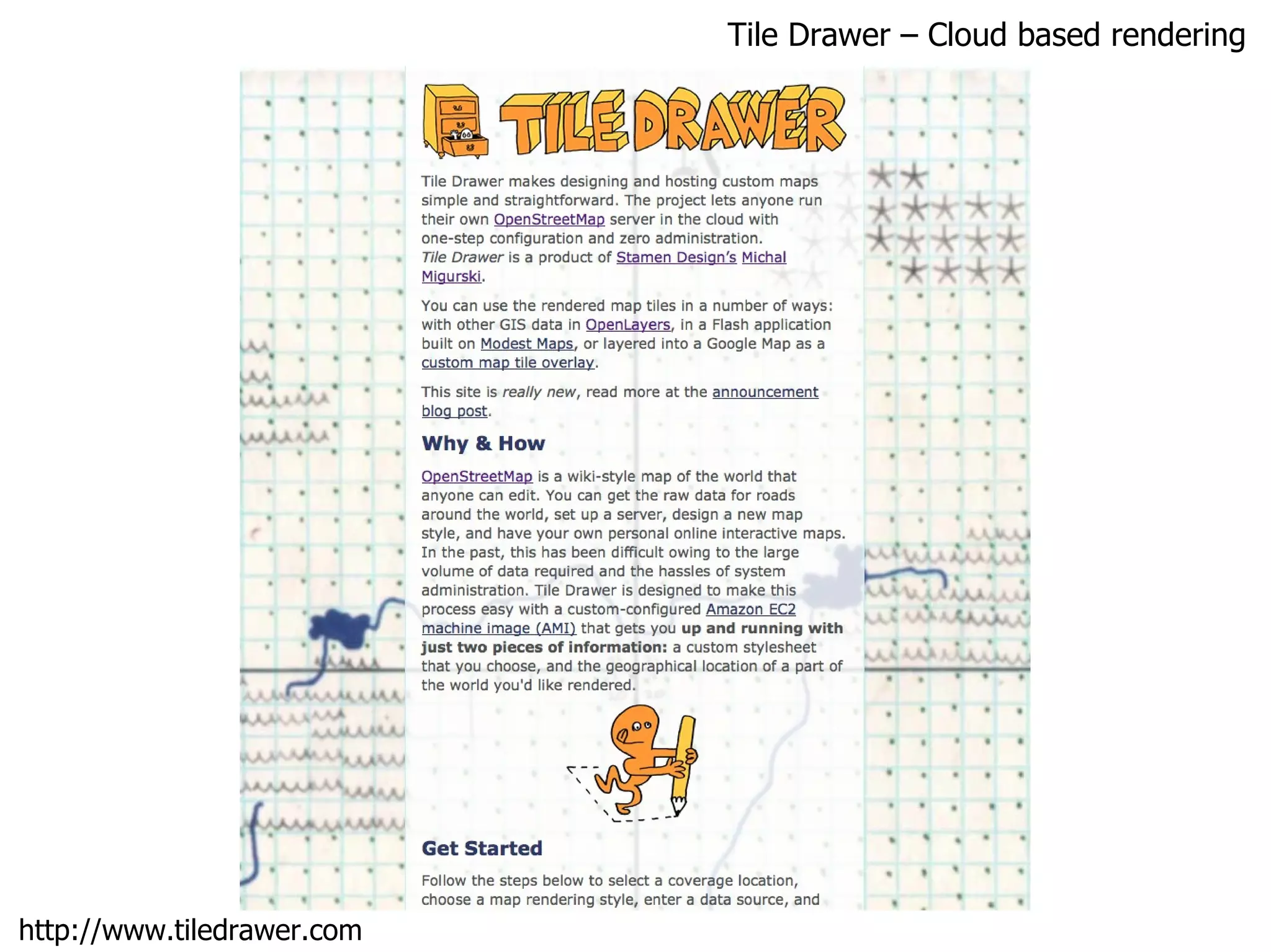
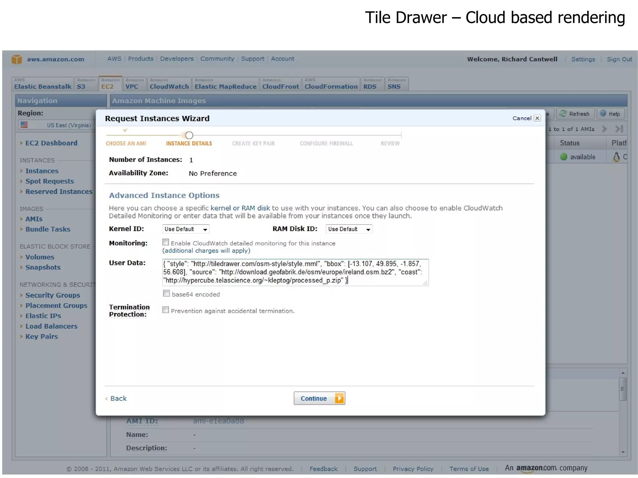
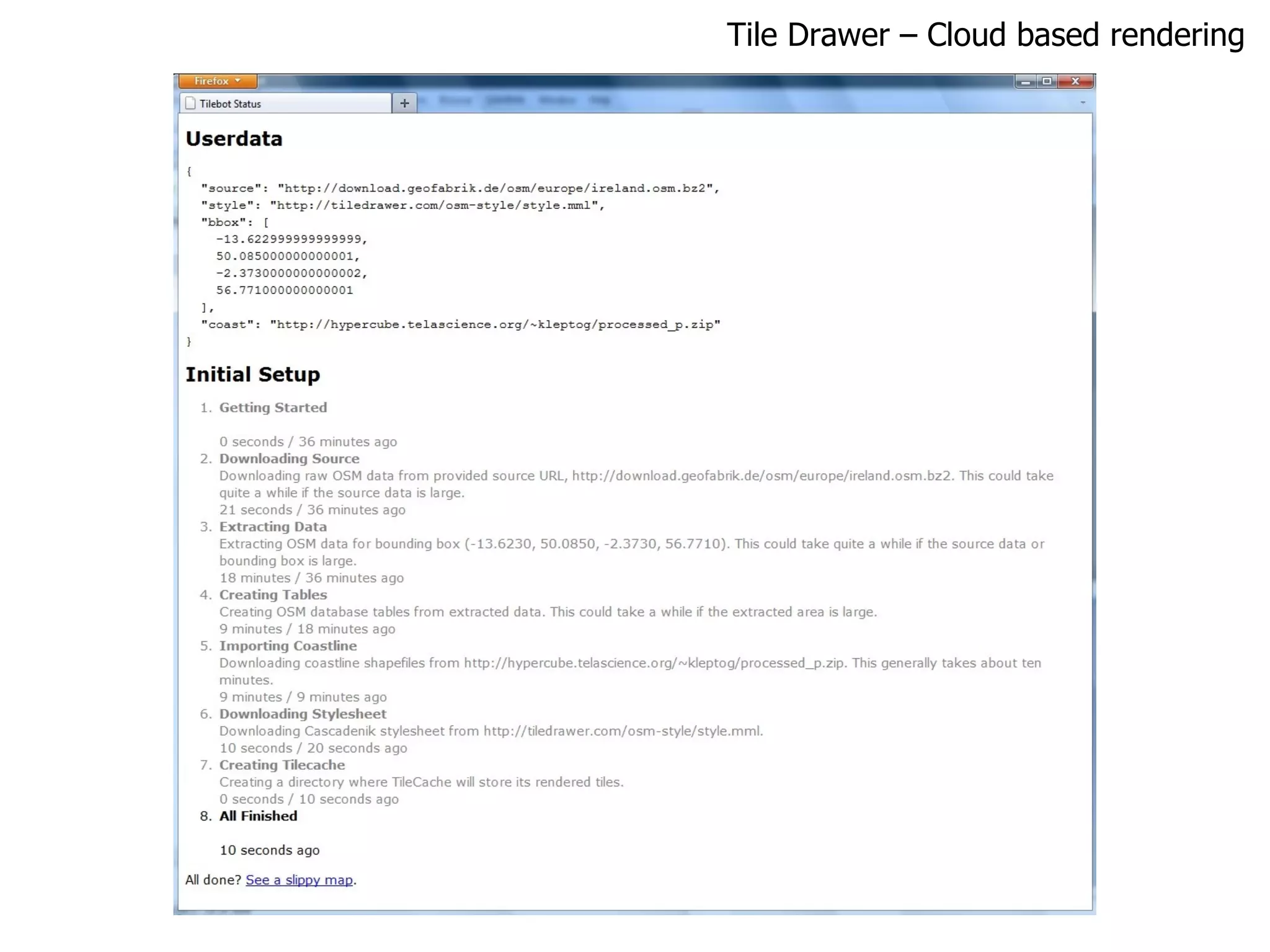
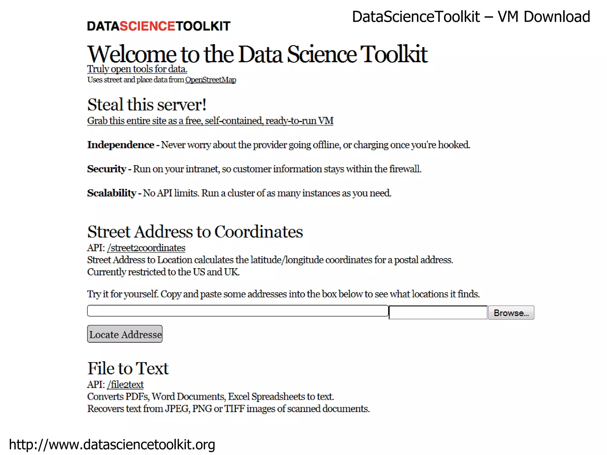
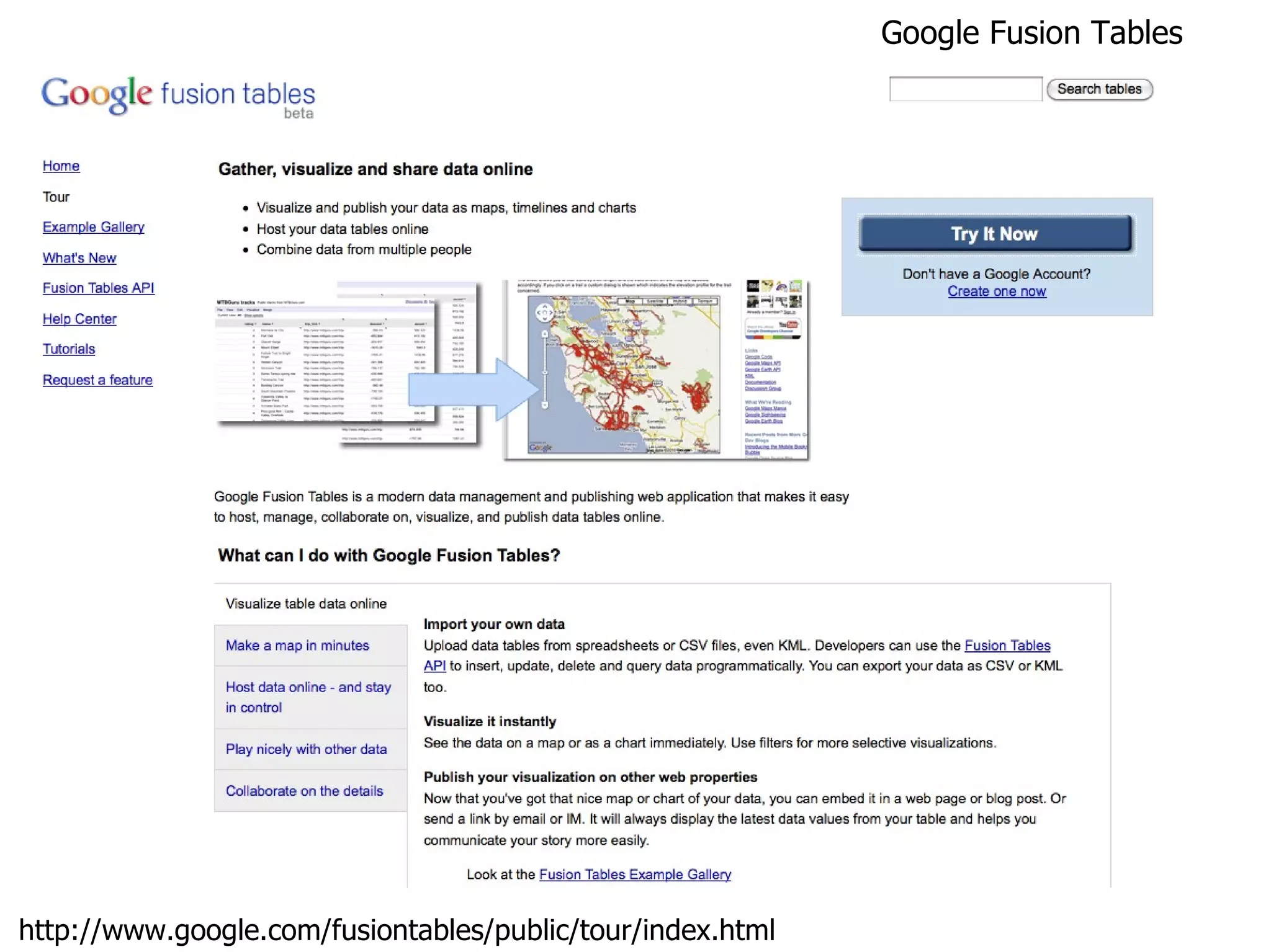
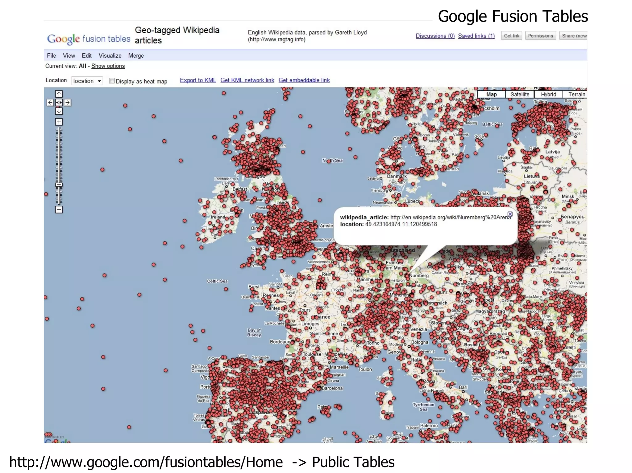

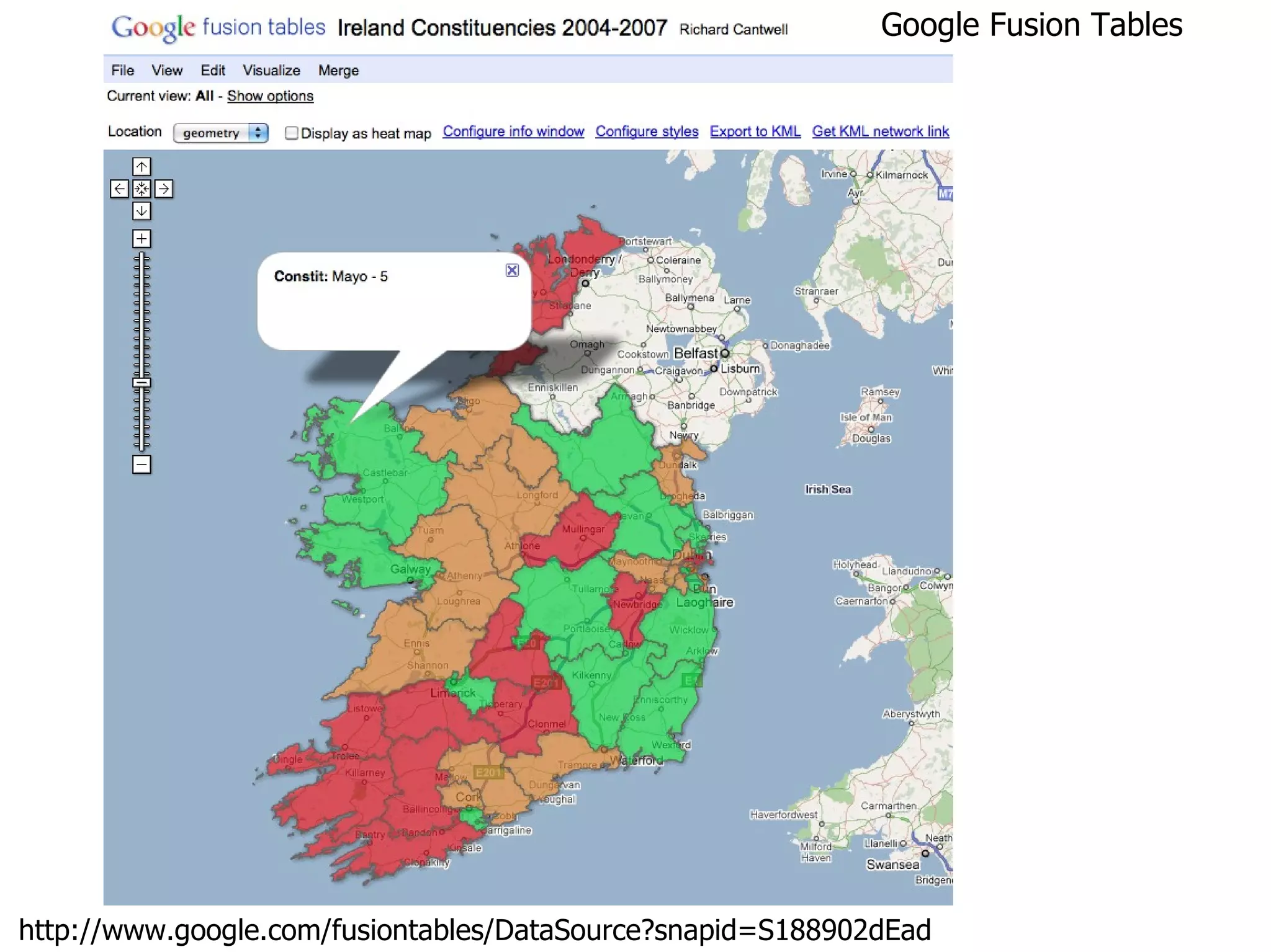
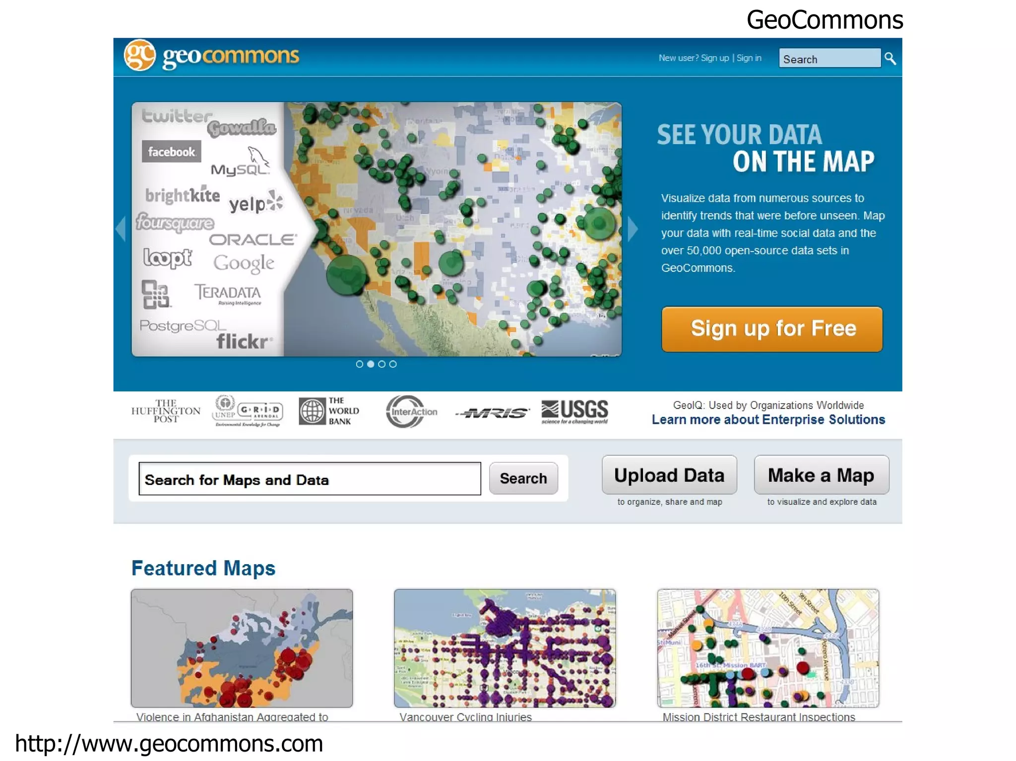

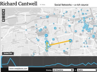
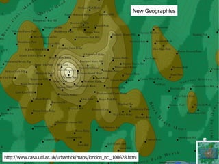
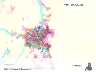
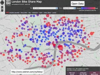
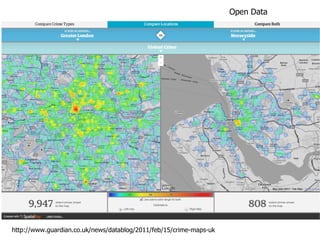
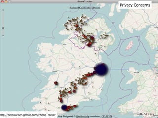
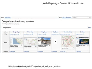
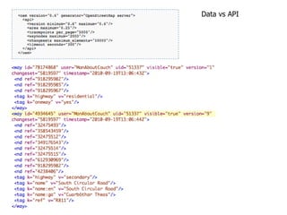
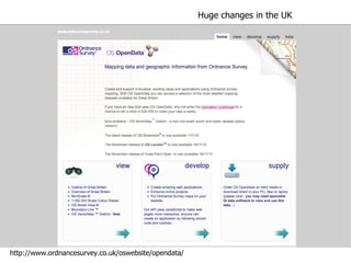
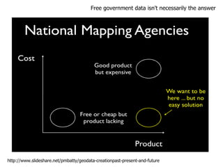
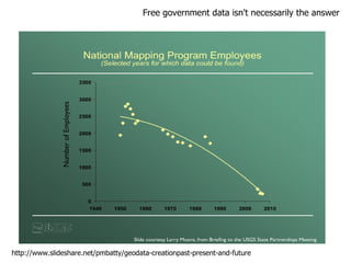
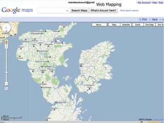
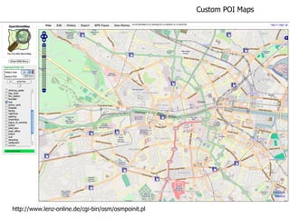
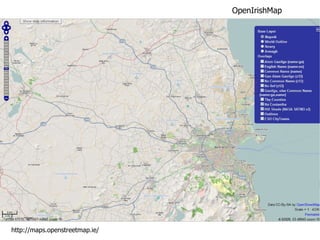
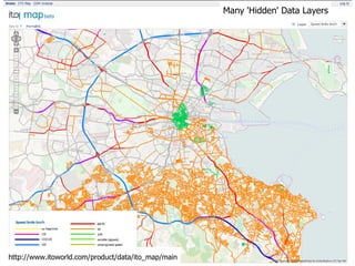
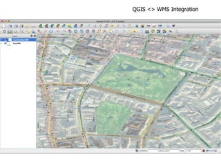
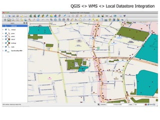
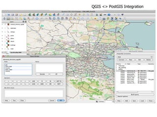
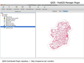
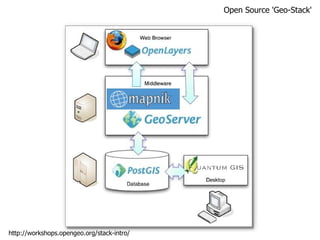
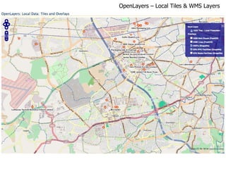
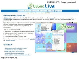
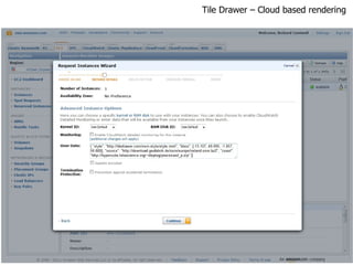
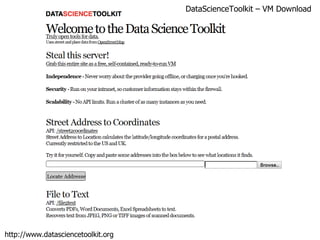
The document discusses the rise of open geospatial data and tools, noting new sources of freely available mapping data from projects like OpenStreetMap as well as open-source GIS software like QGIS and GeoServer that allow users to access, analyze and visualize spatial data. Examples are given of how open data is being used for mapping, as well as resources for learning about and accessing open geospatial data and tools.


