Download as PDF, PPTX


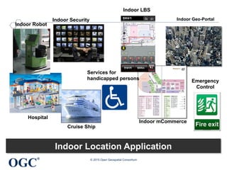
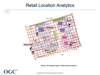
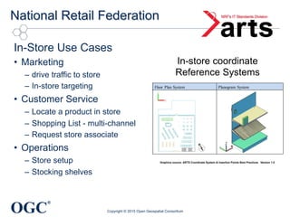

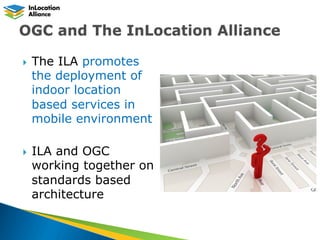
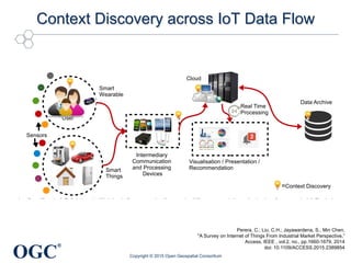

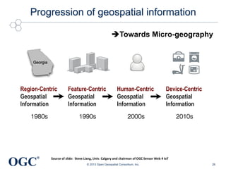


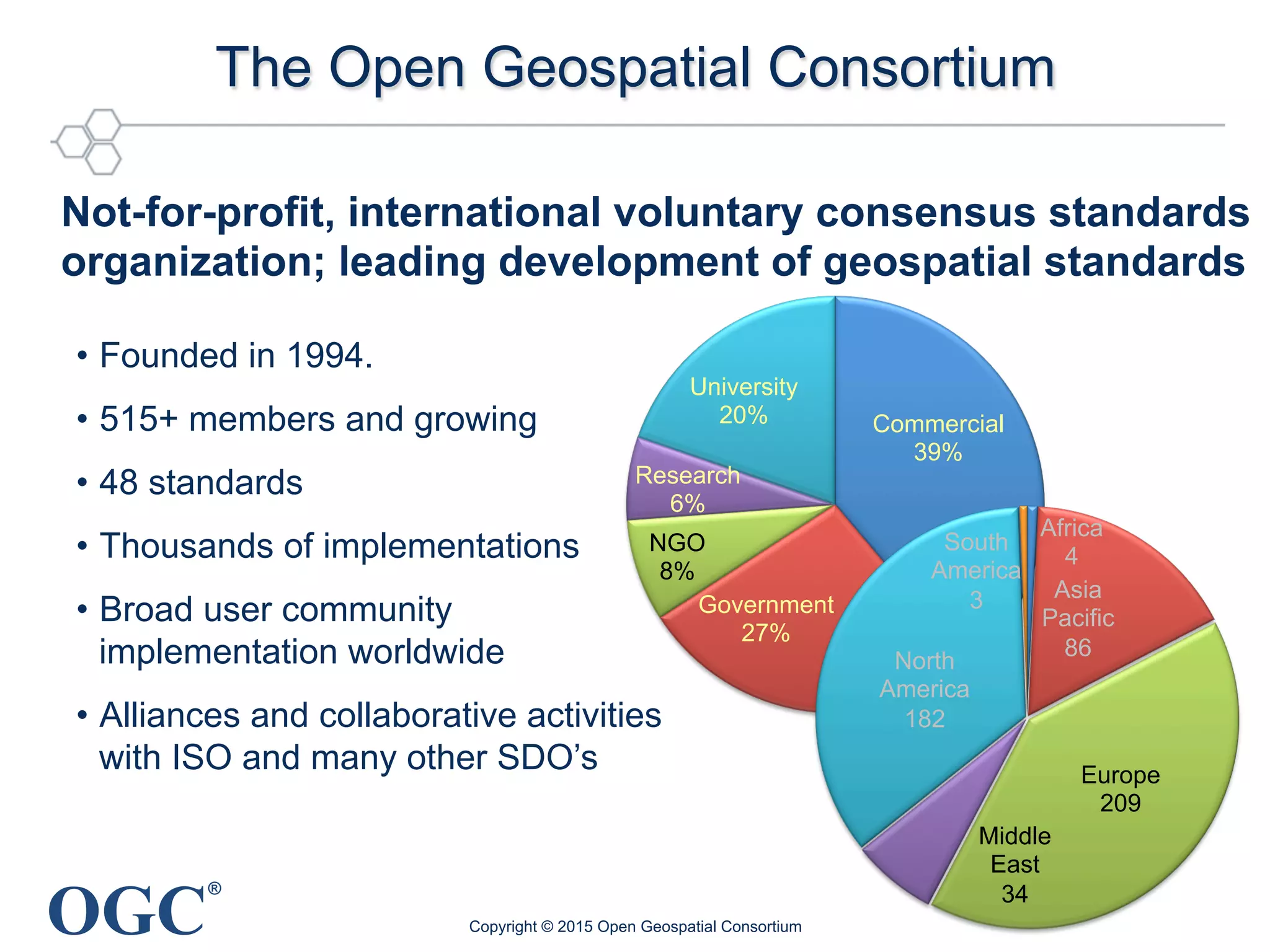


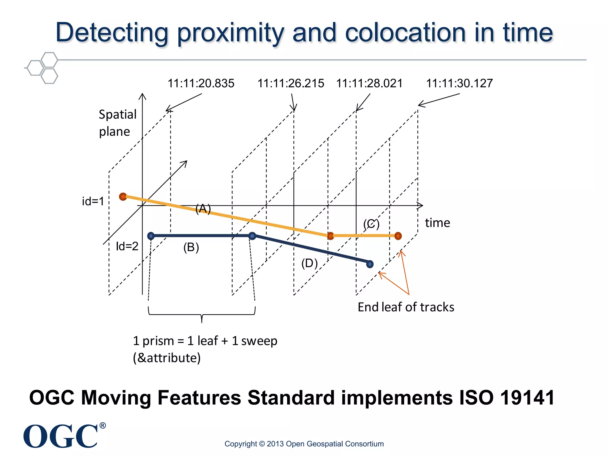
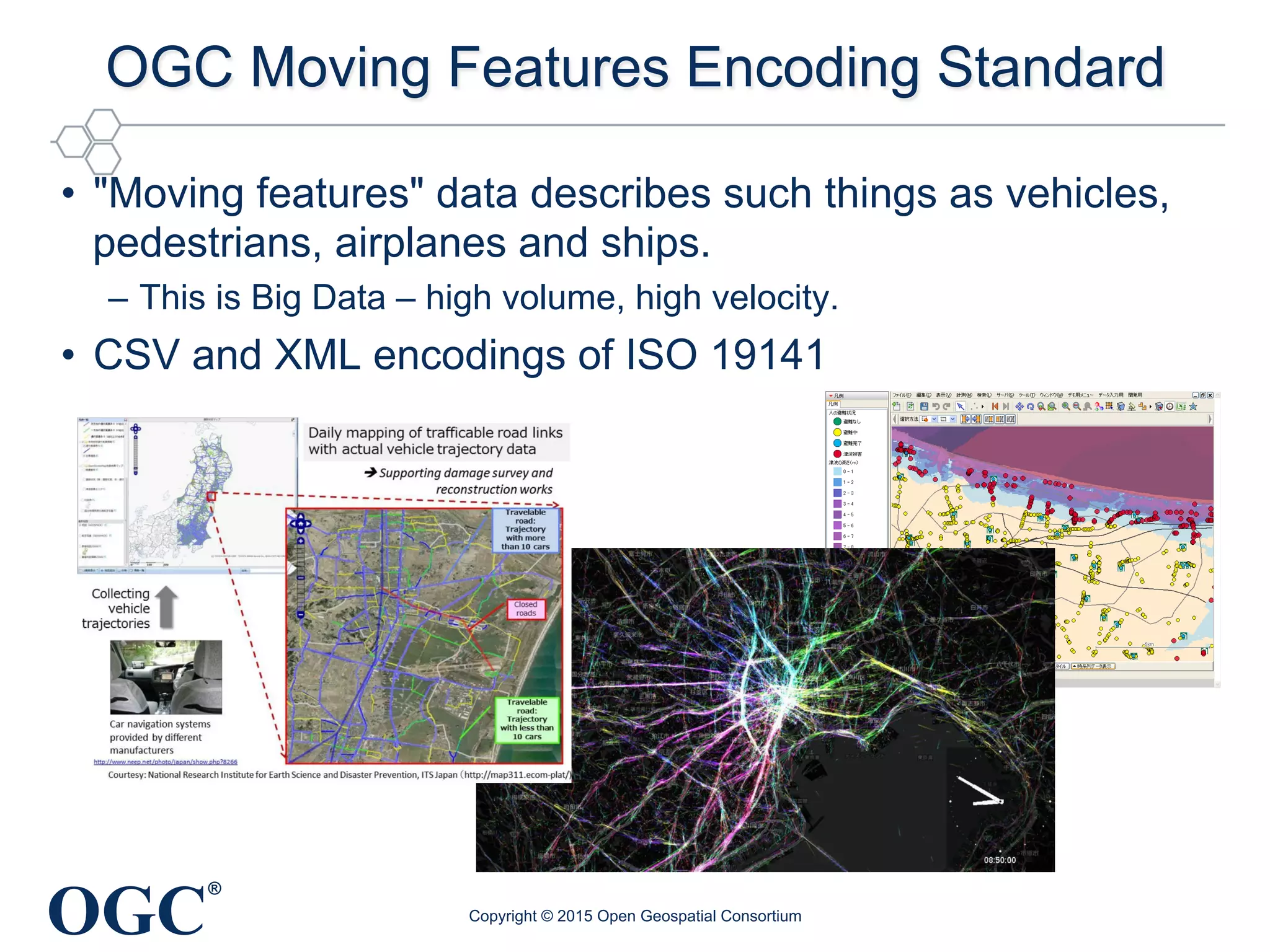
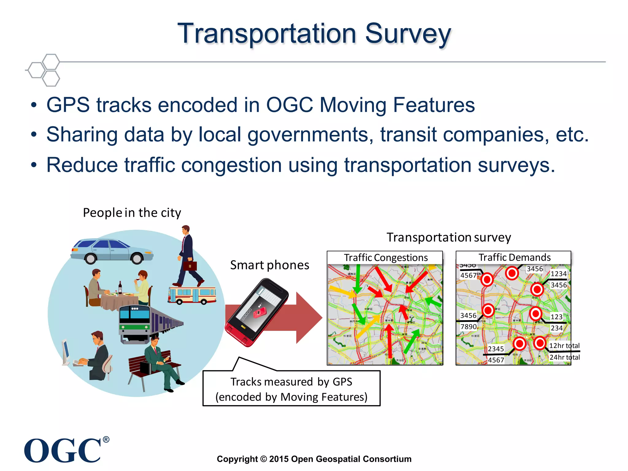
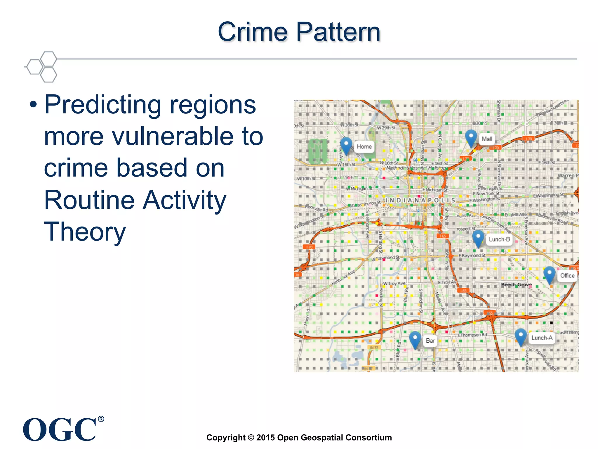
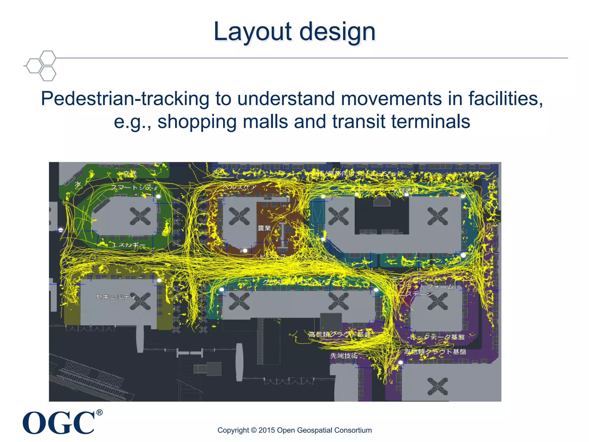
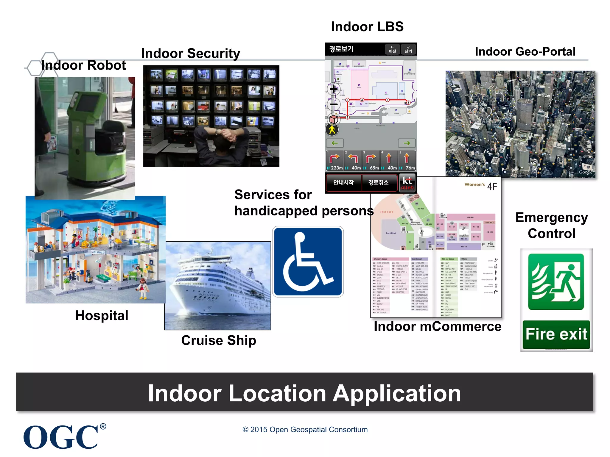
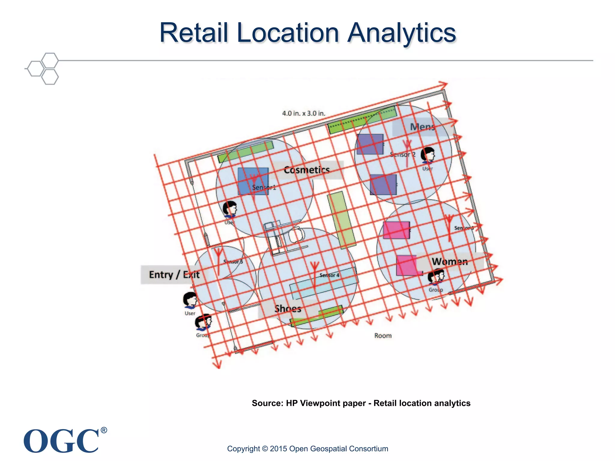
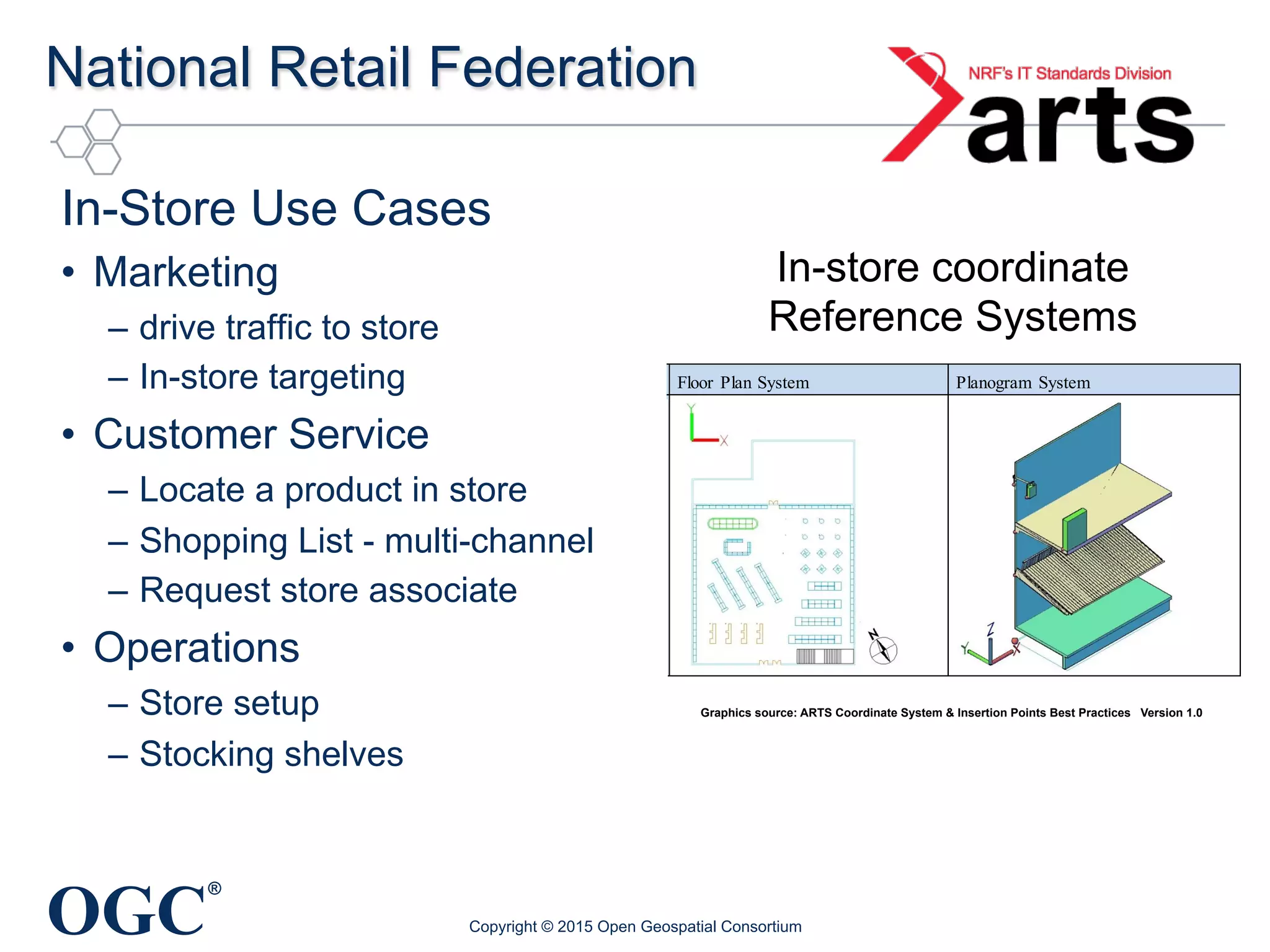
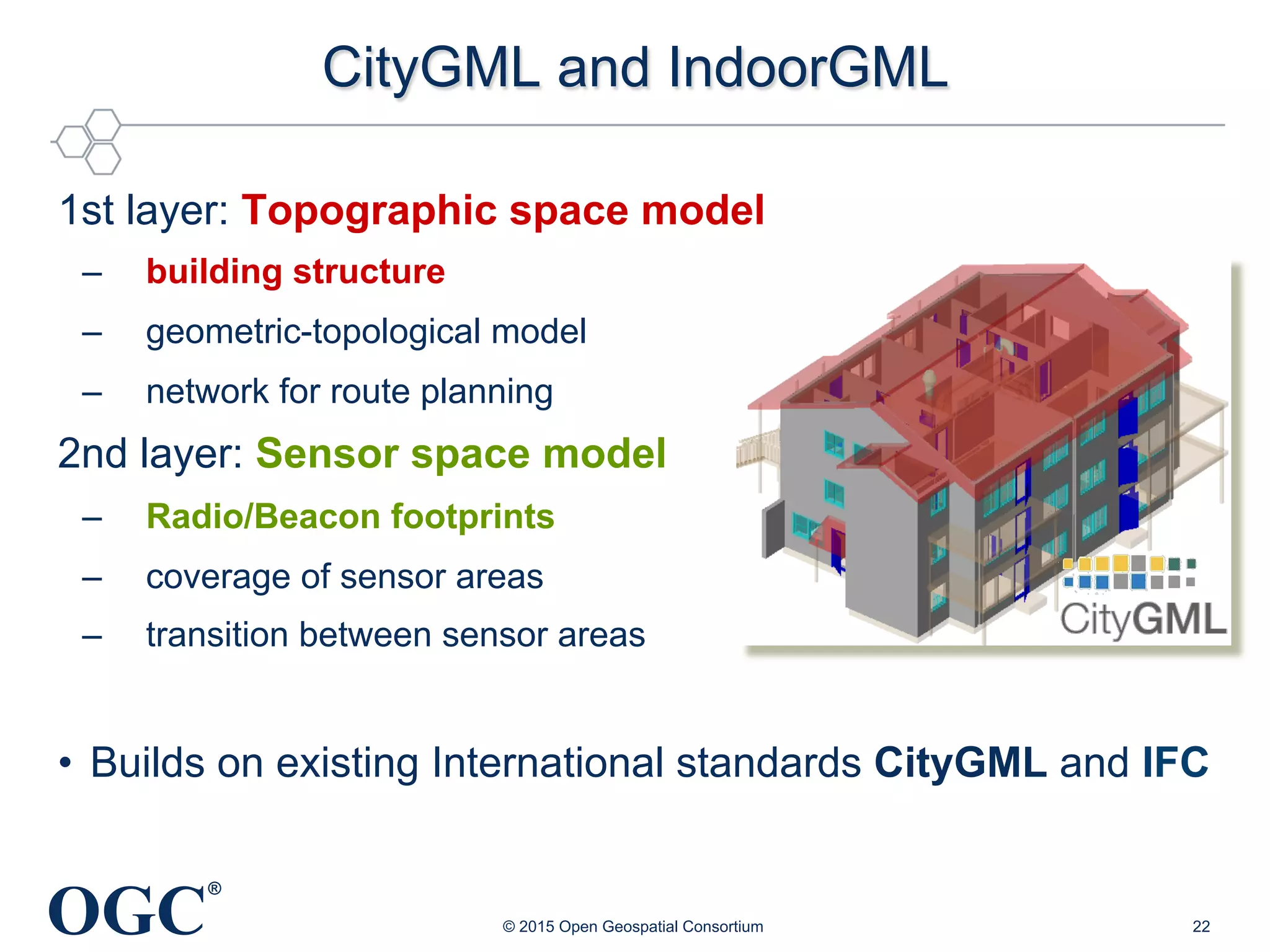
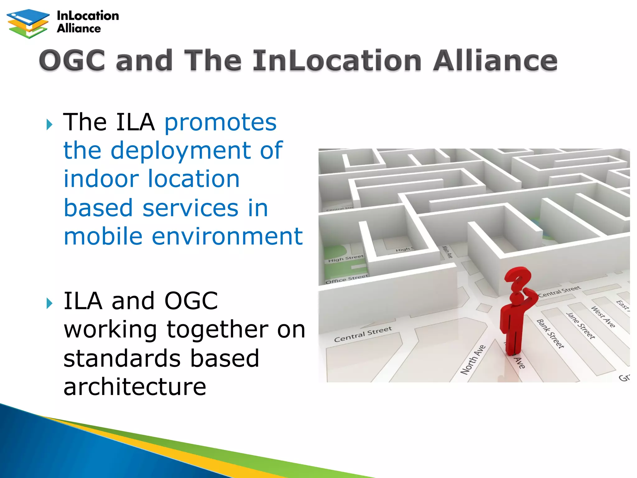
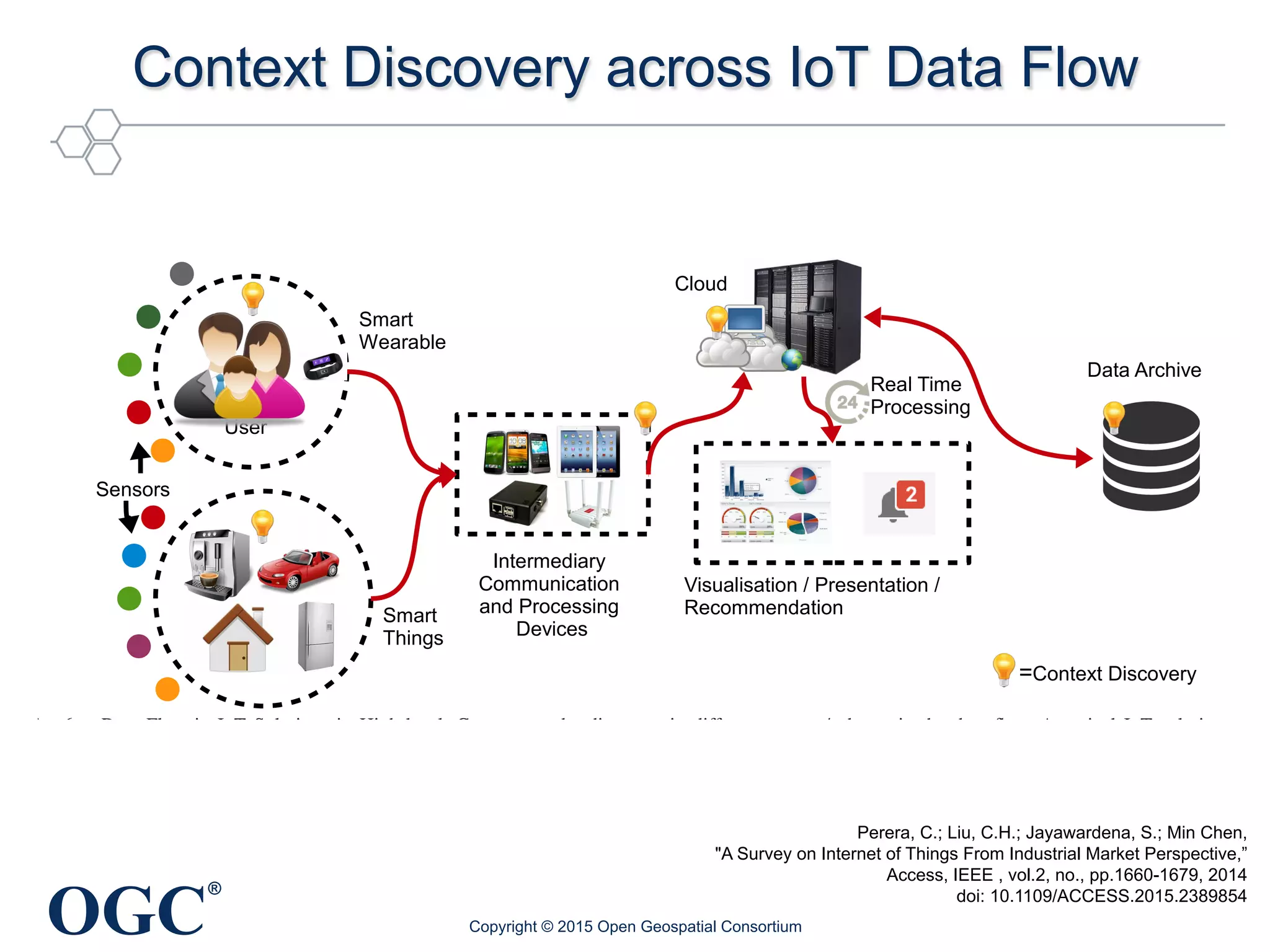


The document discusses the significance of big data and geospatial standards for understanding and predicting human mobility, marketing, risk analysis, and crime patterns. It highlights the role of the Open Geospatial Consortium (OGC) in developing geospatial standards and facilitating data interoperability for various applications including transportation, retail analytics, and indoor location services. Additionally, it covers advancements in technologies such as the Internet of Things (IoT) and how they are integrated with geospatial information to enhance context discovery and data flow.


