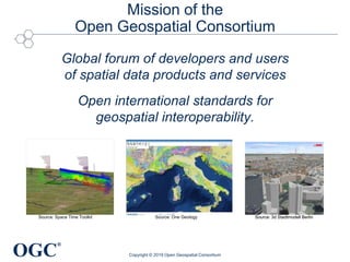
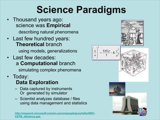
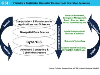
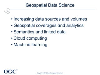
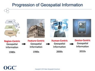
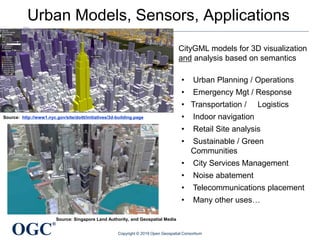
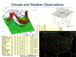
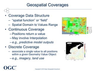
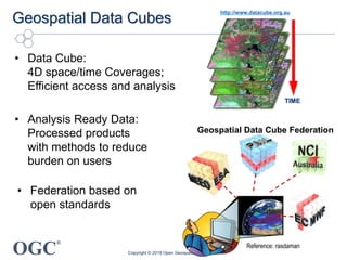
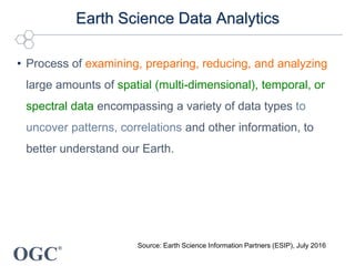
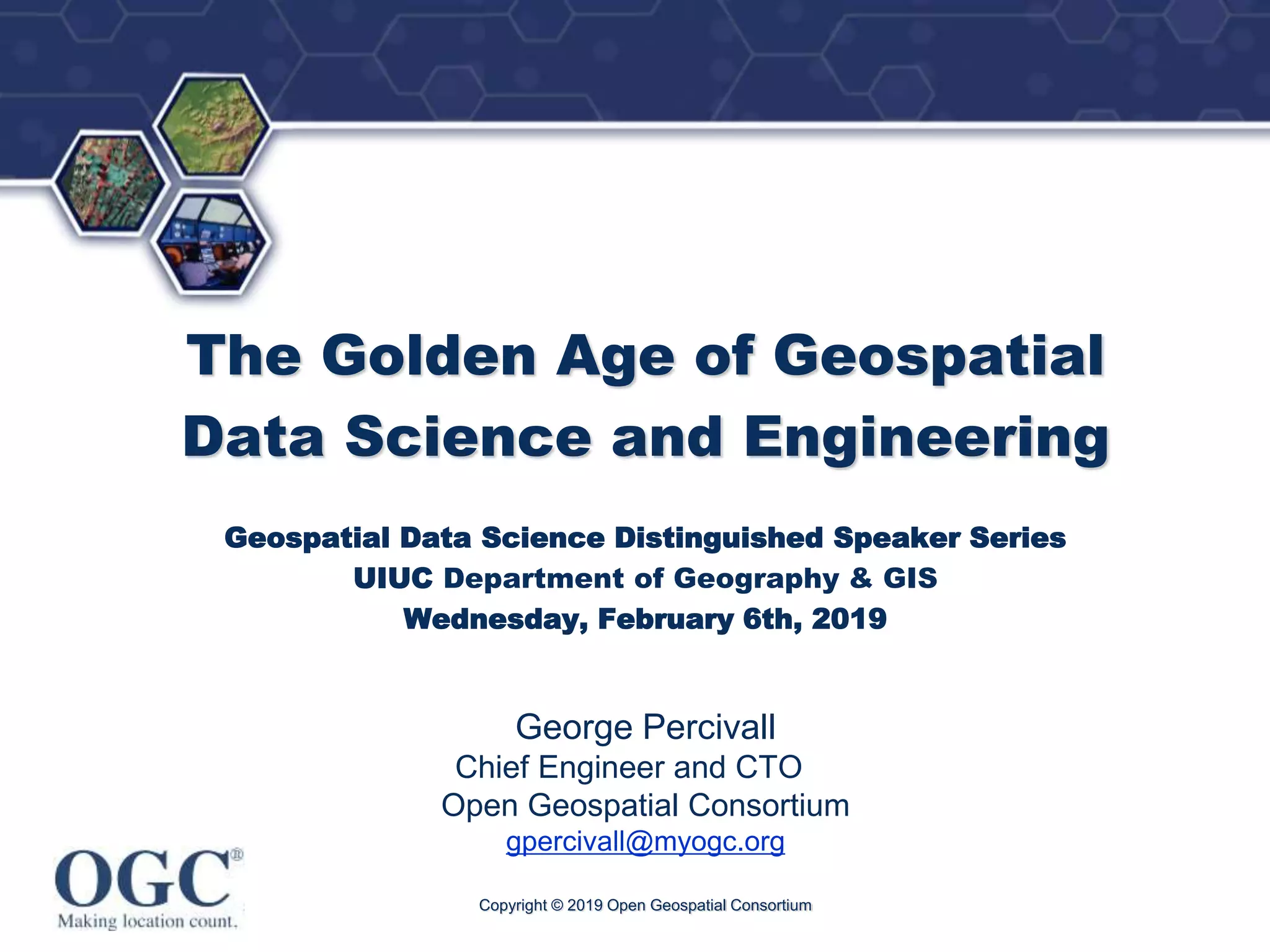
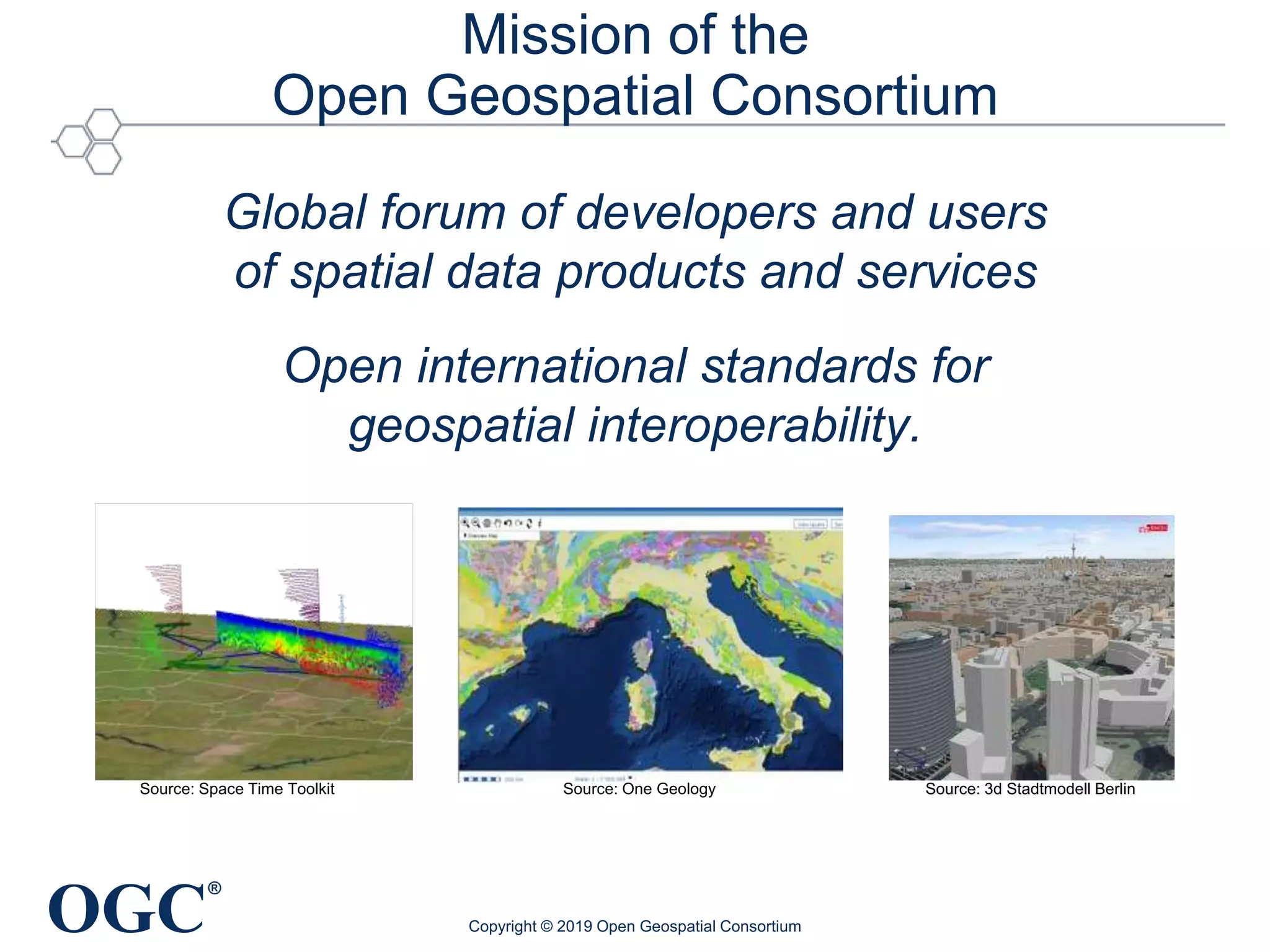
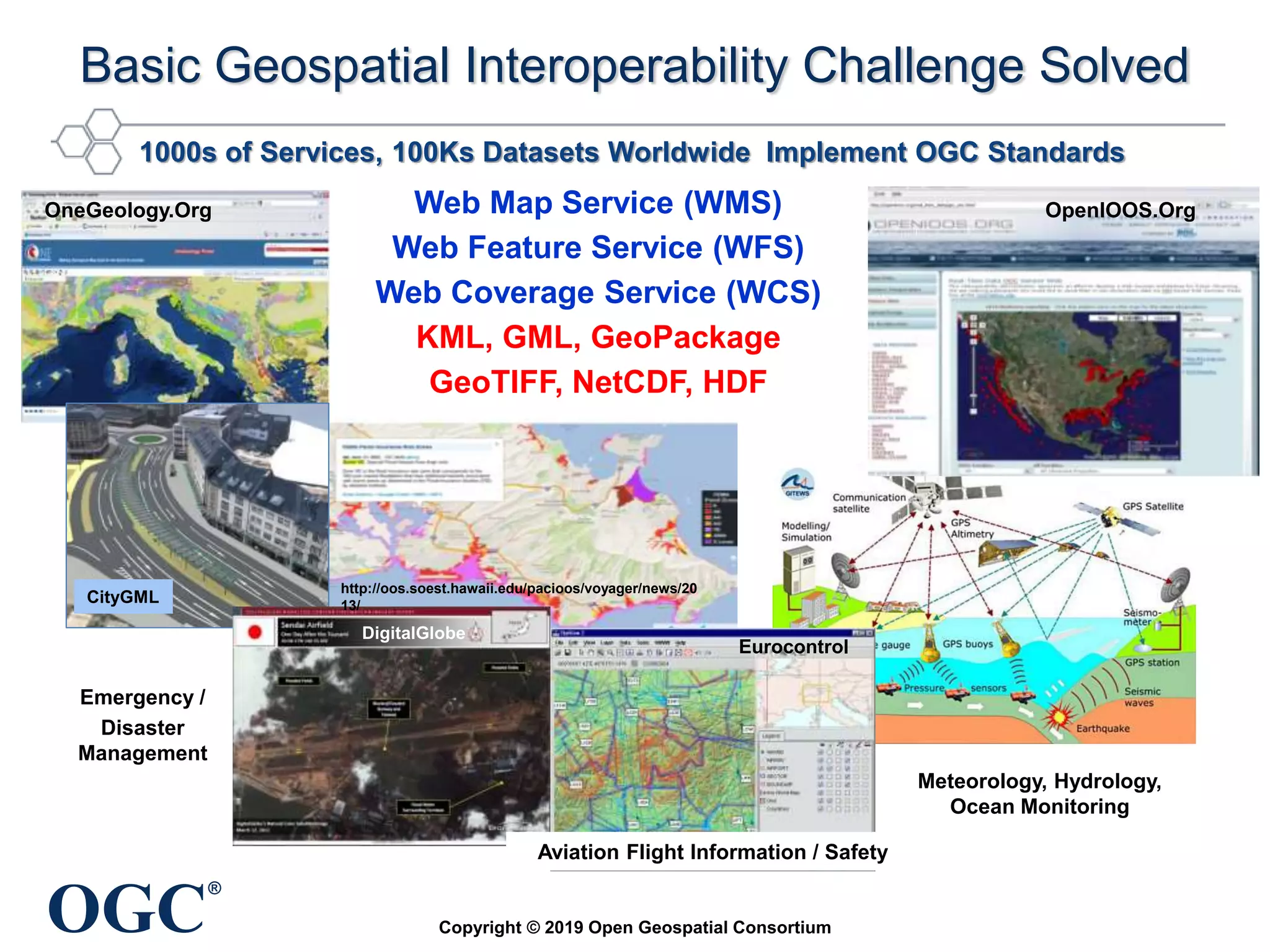
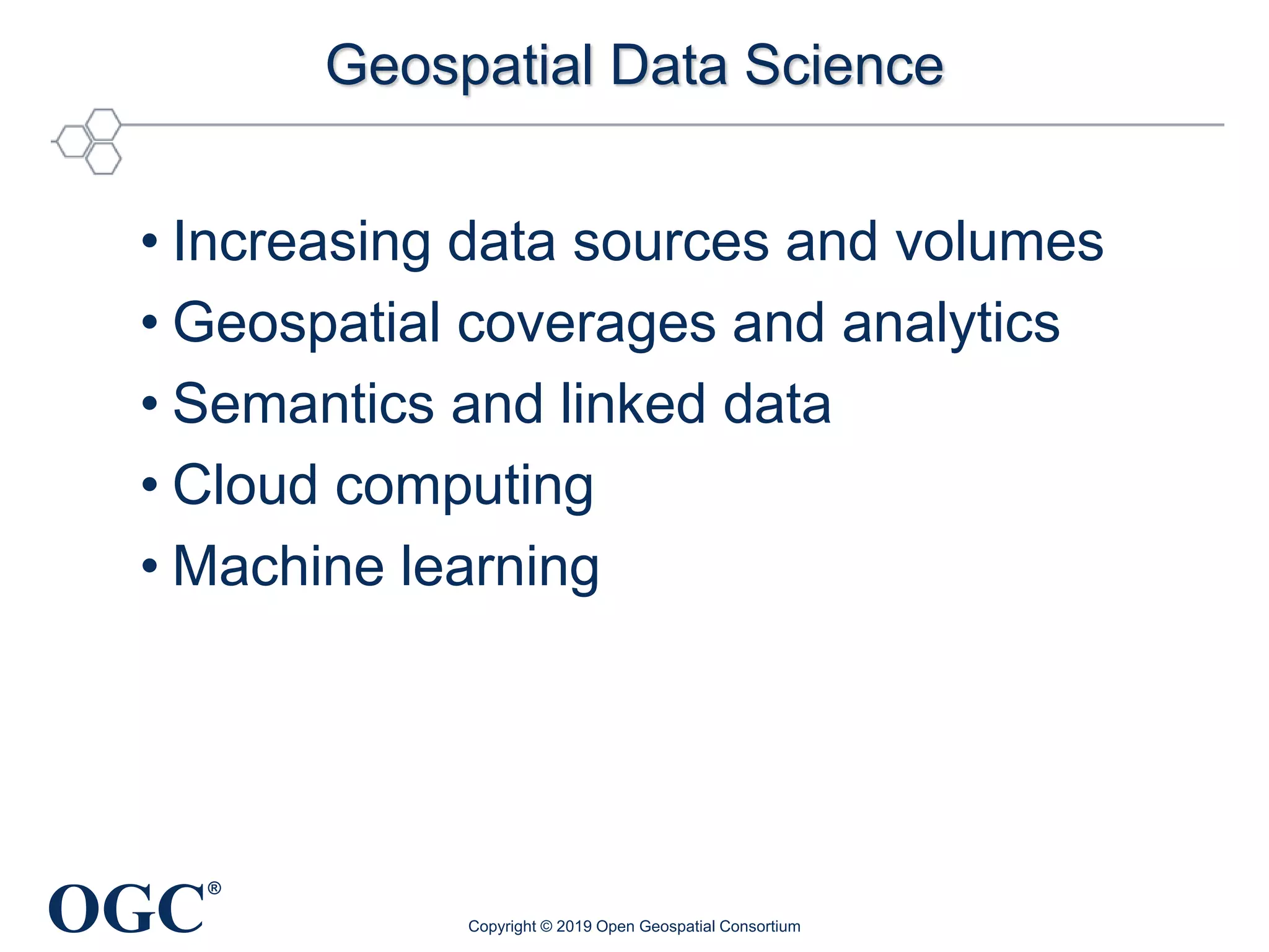
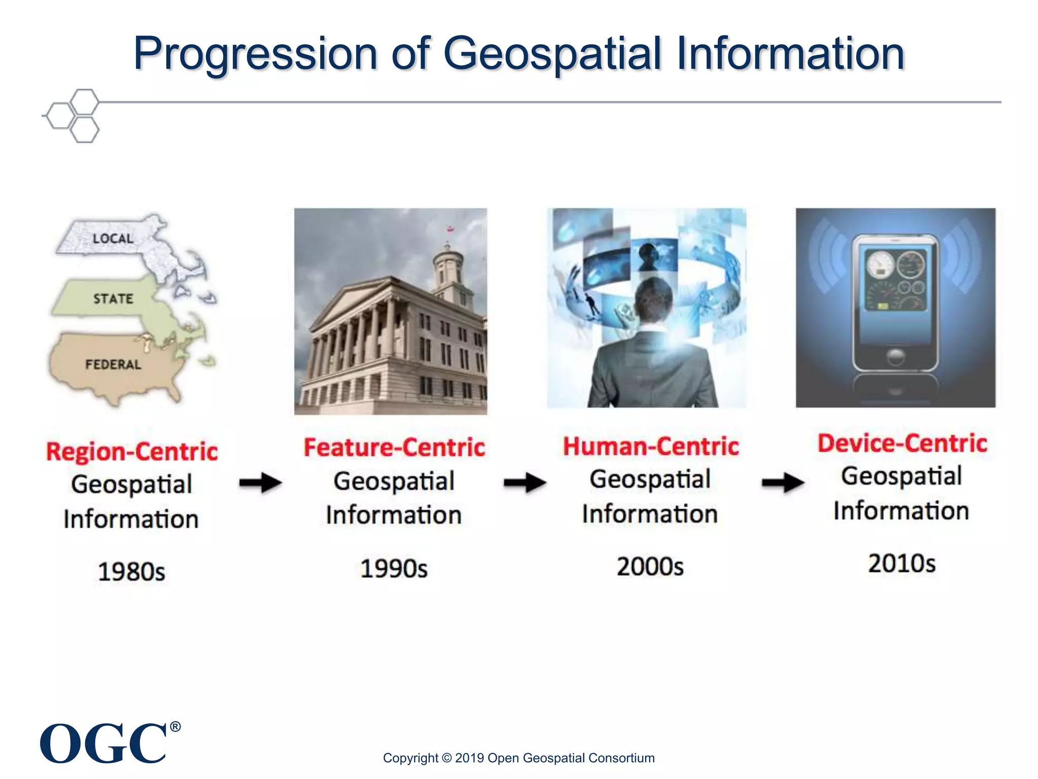
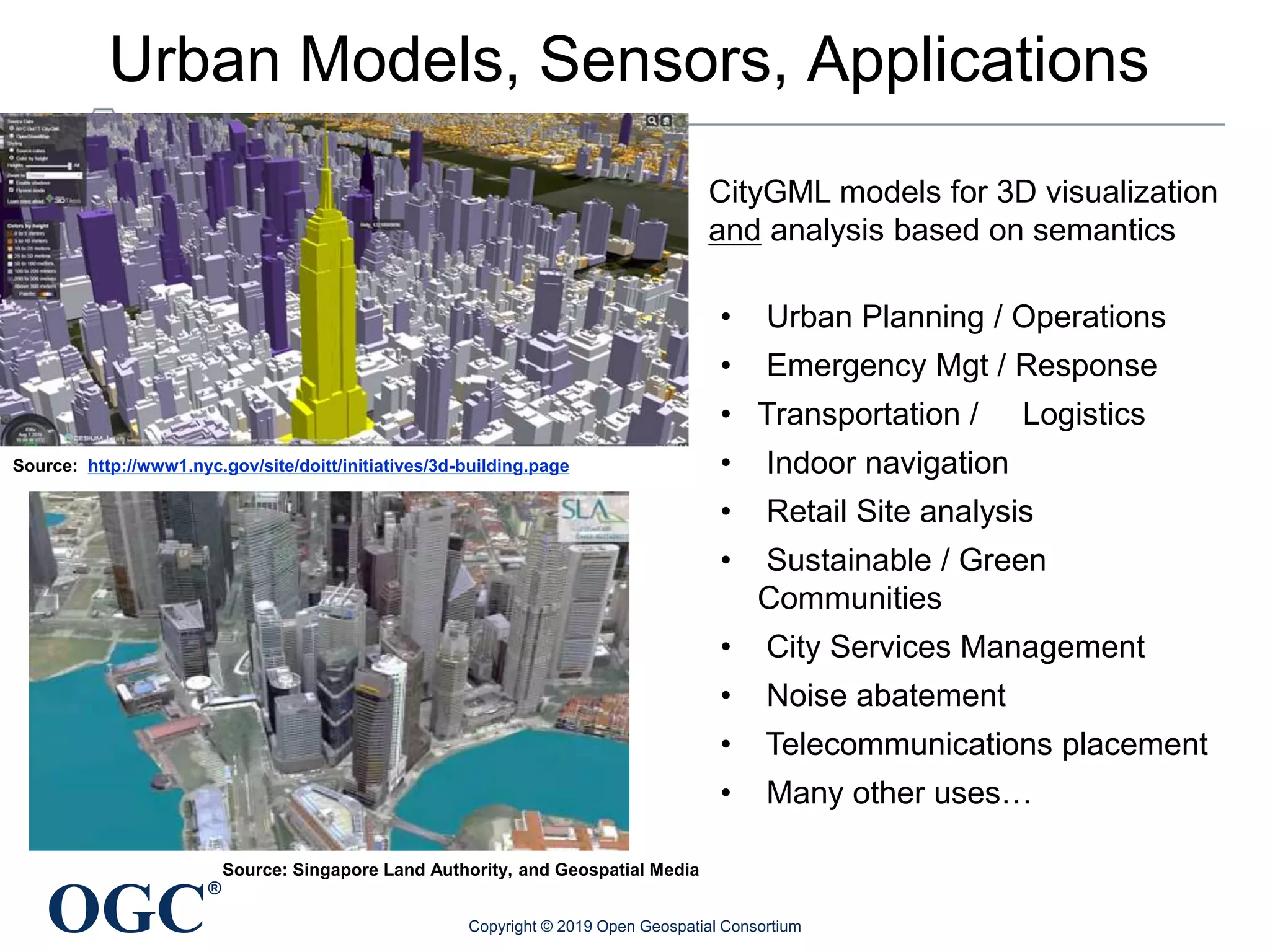
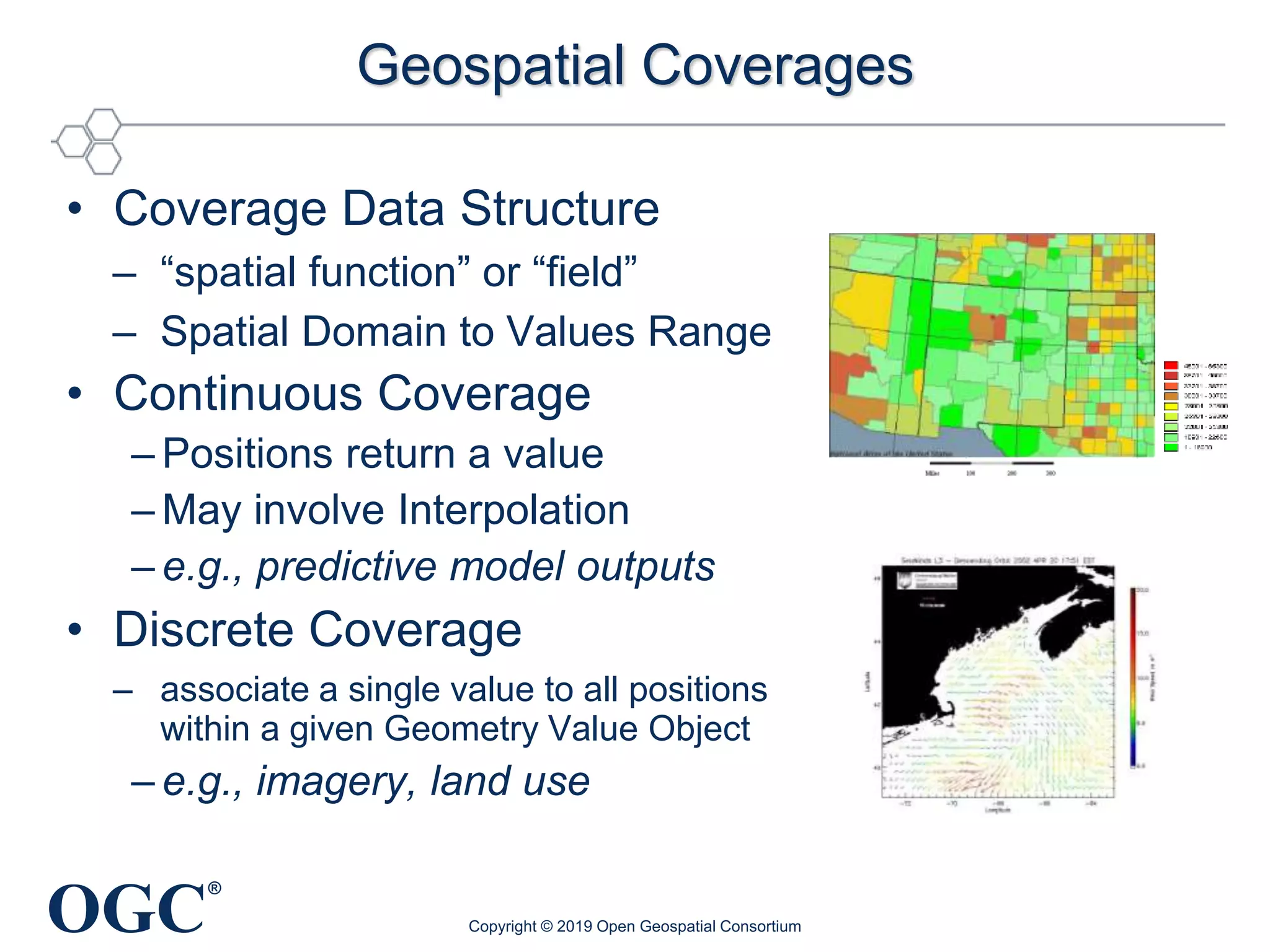
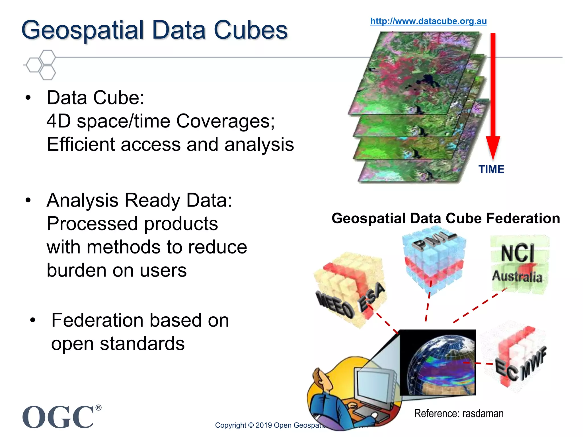
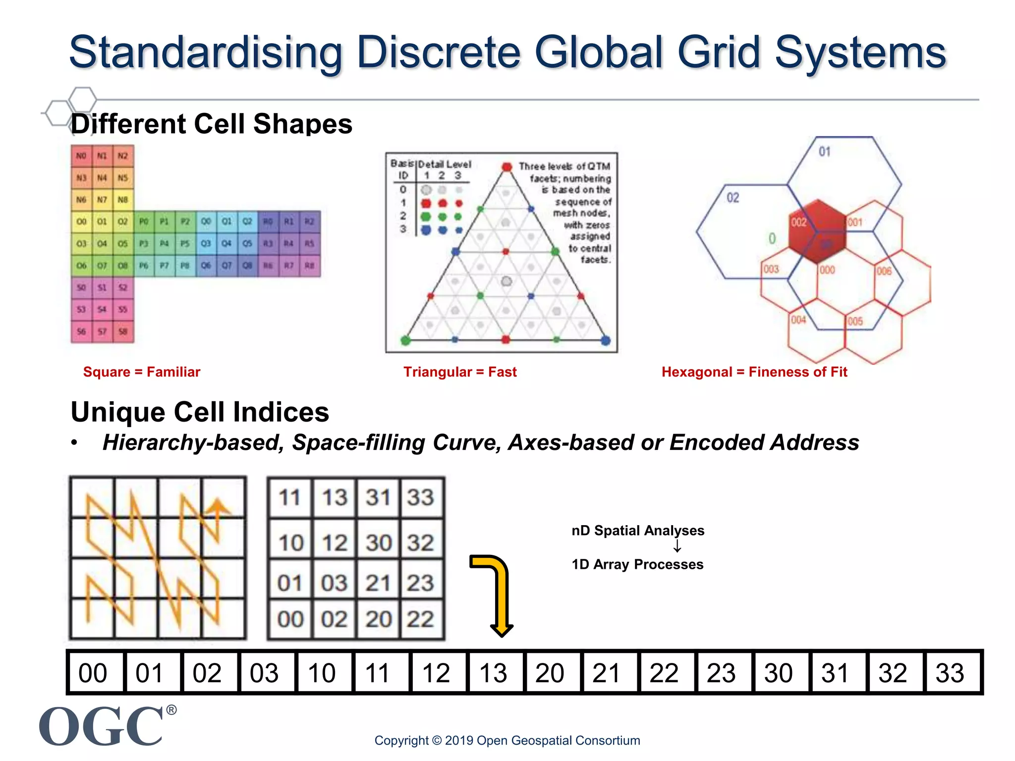
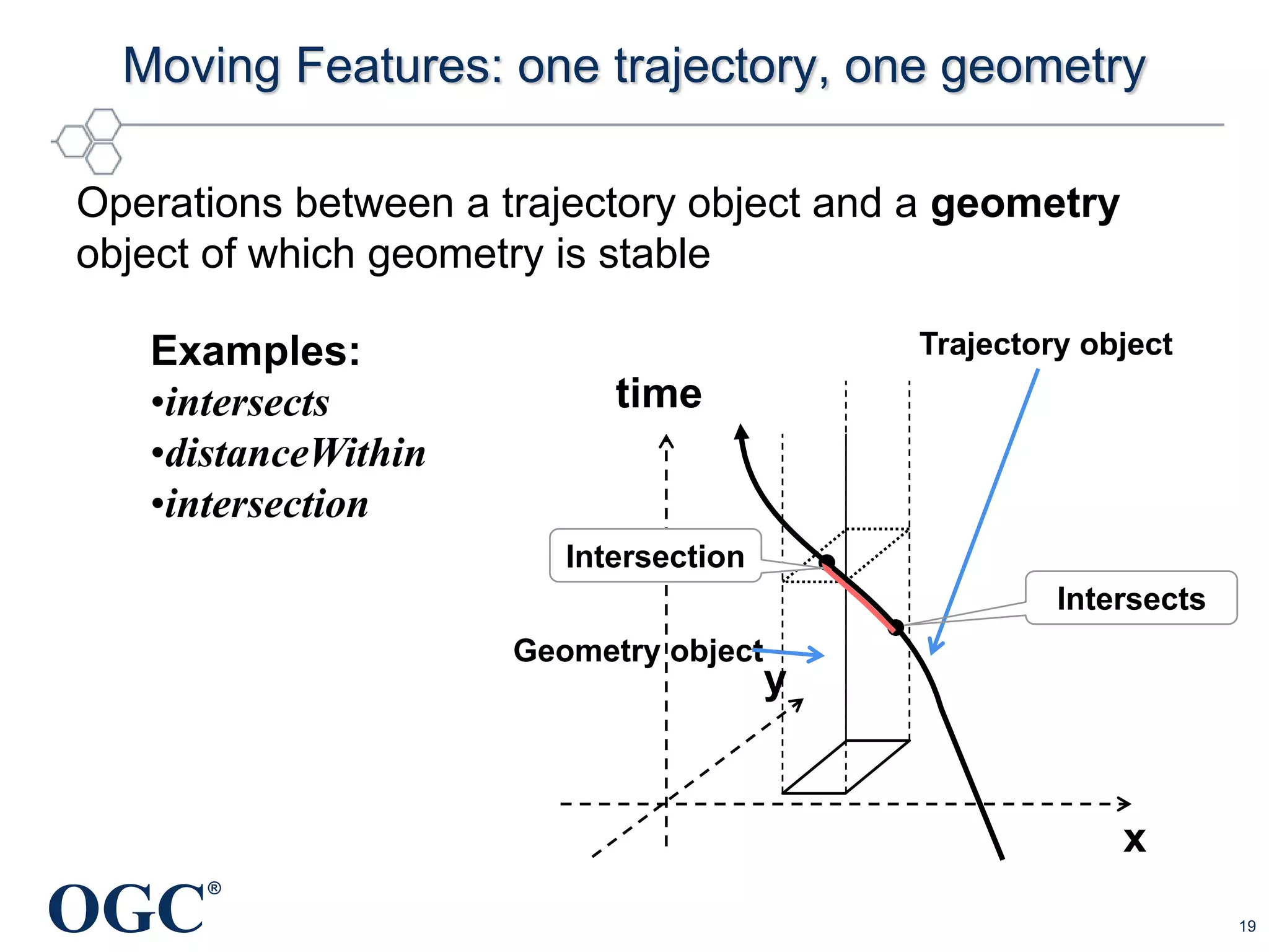
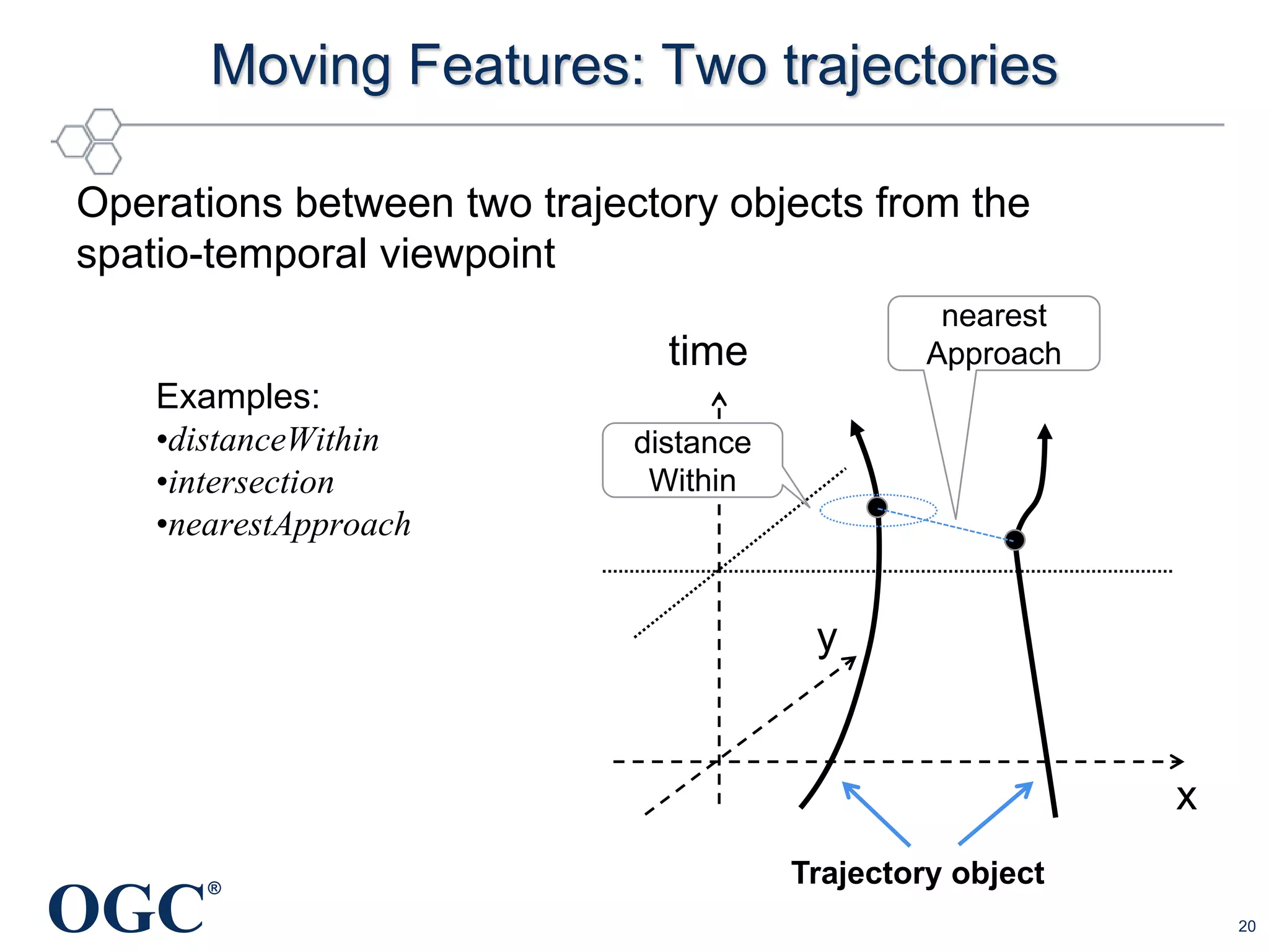
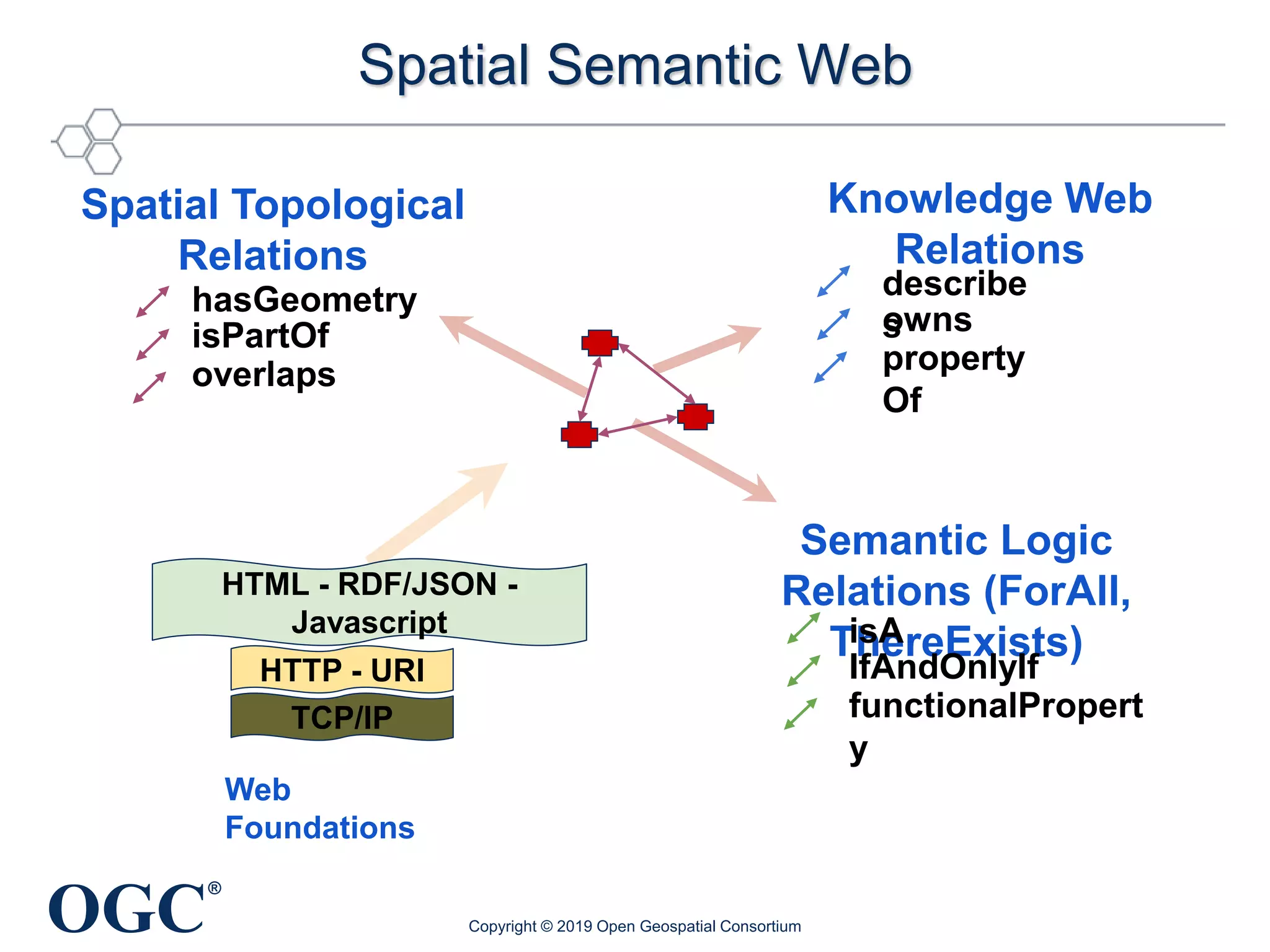
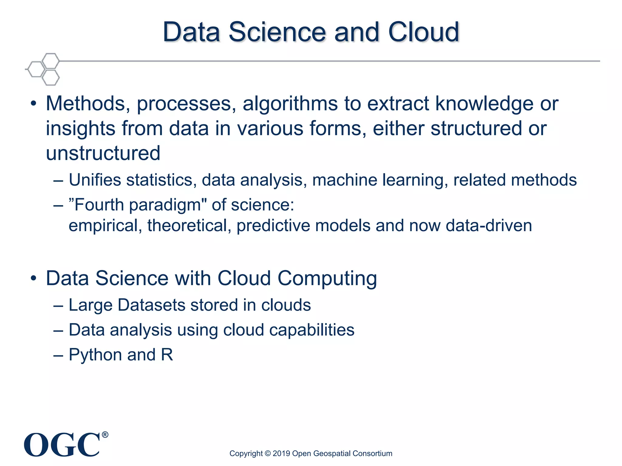
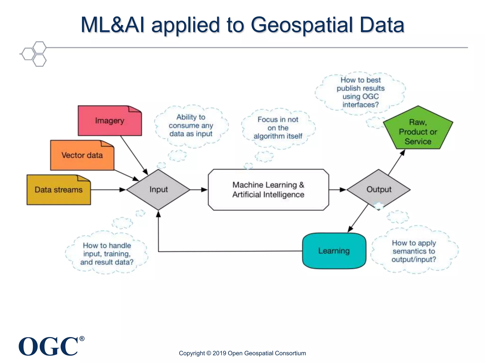
KEMBAR78
Golden Age of Geospatial Data Science | PPTX
Ā®
The Golden Age of Geospatial
Data Science and Engineering
Geospatial Data Science Distinguished Speaker Series
UIUC Department of Geography & GIS
Wednesday, February 6th, 2019
George Percivall
Chief Engineer and CTO
Open Geospatial Consortium
gpercivall@myogc.org
Copyright Ā© 2019 Open Geospatial Consortium
OGC
Ā®
My perspective
• Physics, remote sensing, systems engineering
• NASA weather satellite and information systems
• Standards for science and engineering
• OGC CTO
Copyright Ā© 2019 Open Geospatial Consortium
OGC
Ā®
Mission of the
Open Geospatial Consortium
Global forum of developers and users
of spatial data products and services
Open international standards for
geospatial interoperability.
Copyright Ā© 2019 Open Geospatial Consortium
Source: 3d Stadtmodell BerlinSource: One GeologySource: Space Time Toolkit
OGC
Ā®
Web Map Service (WMS)
Web Feature Service (WFS)
Web Coverage Service (WCS)
KML, GML, GeoPackage
GeoTIFF, NetCDF, HDF
Emergency /
Disaster
Management
Basic Geospatial Interoperability Challenge Solved
Copyright Ā© 2019 Open Geospatial Consortium
Eurocontrol
OneGeology.Org
CityGML
Aviation Flight Information / Safety
DigitalGlobe
Meteorology, Hydrology,
Ocean Monitoring
http://oos.soest.hawaii.edu/pacioos/voyager/news/20
13/
OpenIOOS.Org
1000s of Services, 100Ks Datasets Worldwide Implement OGC Standards
Copyright Ā© 2019 Open
Geospatial Consortium
Science Paradigms
• Thousand years ago:
science was Empirical
describing natural phenomena
• Last few hundred years:
Theoretical branch
using models, generalizations
• Last few decades:
a Computational branch
simulating complex phenomena
• Today:
Data Exploration
– Data captured by instruments
Or generated by simulator
– Scientist analyzes database / files
using data management and statistics
2
2
2
.
3
4
a
cG
a
a












http://research.microsoft.com/en-us/um/people/gray/talks/NRC-
CSTB_eScience.ppt.
Fostering a Sustainable Geospatial Discovery and Innovation Ecosystem
GeospatialSoftware
Science & Technology
Extreme-Scale Computing,
NSF XSEDE, ROGER, etc.
Spatial Computational
Theories & Methods
CyberGIS
Geospatial Data Science
Advanced Computing &
Cyberinfrastructure
Computation- & Data-Intensive
Applications and Sciences
Earth & Environment,
Emergency Management,
Food + Energy + Water
Nexus, Sustainability, etc.
Source: Professor Shaowen Wang, NSF GSI Incubator Workshop, July 2018
OGC
Ā®
Geospatial Data Science
• Increasing data sources and volumes
• Geospatial coverages and analytics
• Semantics and linked data
• Cloud computing
• Machine learning
Copyright Ā© 2019 Open Geospatial Consortium
OGC
Ā®
Progression of Geospatial Information
Copyright Ā© 2019 Open Geospatial Consortium
OGC
Ā®
Sensors Everywhere
(Things or Devices)
50 billions Internet-connected things by 2020
Slide source: Steve Liang, Univ. Calgary
Copyright Ā© 2019 Open Geospatial Consortium
OGC
Ā®
Urban Models, Sensors, Applications
Source: http://www1.nyc.gov/site/doitt/initiatives/3d-building.page
CityGML models for 3D visualization
and analysis based on semantics
• Urban Planning / Operations
• Emergency Mgt / Response
• Transportation / Logistics
• Indoor navigation
• Retail Site analysis
• Sustainable / Green
Communities
• City Services Management
• Noise abatement
• Telecommunications placement
• Many other uses…
Source: Singapore Land Authority, and Geospatial Media
Copyright Ā© 2019 Open Geospatial Consortium
OGC
Ā®
Climate and Weather Observations
Slide Source: Ben Domenico
Copyright Ā© 2019 Open Geospatial Consortium
OGC
Ā®
Geospatial Coverages
Copyright Ā© 2019 Open Geospatial Consortium
• Coverage Data Structure
– ā€œspatial functionā€ or ā€œfieldā€
– Spatial Domain to Values Range
• Continuous Coverage
– Positions return a value
– May involve Interpolation
– e.g., predictive model outputs
• Discrete Coverage
– associate a single value to all positions
within a given Geometry Value Object
– e.g., imagery, land use
OGC
Ā®
Geospatial Data Cubes
• Data Cube:
4D space/time Coverages;
Efficient access and analysis
• Analysis Ready Data:
Processed products
with methods to reduce
burden on users
TIME
http://www.datacube.org.au
Copyright Ā© 2019 Open Geospatial Consortium
Geospatial Data Cube Federation
Reference: rasdaman
• Federation based on
open standards
OGC
Ā®
Earth Science Data Analytics
• Process of examining, preparing, reducing, and analyzing
large amounts of spatial (multi-dimensional), temporal, or
spectral data encompassing a variety of data types to
uncover patterns, correlations and other information, to
better understand our Earth.
Source: Earth Science Information Partners (ESIP), July 2016
OGC
Ā®
Discrete Global Grid Systems
ā€œā€¦a spatial reference system that uses a hierarchical
tessellation of cells to partition and address the globe.
DGGS are characterized by the properties of their cell
structure, geo-encoding, quantization strategy and
associated mathematical functions.ā€
– OGC DGGS Standard
Copyright Ā© 2019 Open Geospatial Consortium
OGC
Ā®
Standardising Discrete Global Grid Systems
Copyright Ā© 2019 Open Geospatial Consortium
Different Cell Shapes
Square = Familiar Triangular = Fast Hexagonal = Fineness of Fit
00 01 02 03 10 11 12 13 20 21 22 23 30 31 32 33
nD Spatial Analyses

1D Array Processes
Unique Cell Indices
• Hierarchy-based, Space-filling Curve, Axes-based or Encoded Address
OGC
Ā®
OGC Moving Features Standard
"Moving features" data describes such things as
vehicles, pedestrians, airplanes and ships.
Copyright Ā© 2019 Open Geospatial Consortium
OGC
Ā®
Moving Features: one trajectory, one geometry
19
Operations between a trajectory object and a geometry
object of which geometry is stable
time
x
y
Trajectory object
Geometry object
Intersects
Intersection
Examples:
•intersects
•distanceWithin
•intersection
OGC
Ā®
Moving Features: Two trajectories
20
Operations between two trajectory objects from the
spatio-temporal viewpoint
time
x
y
nearest
Approach
distance
Within
Examples:
•distanceWithin
•intersection
•nearestApproach
Trajectory object
OGC
Ā®
Spatial Semantic Web
TCP/IP
HTTP - URI
HTML - RDF/JSON -
Javascript
Web
Foundations
Spatial Topological
Relations
Knowledge Web
Relations
Semantic Logic
Relations (ForAll,
ThereExists)
hasGeometry
isPartOf
overlaps
describe
sowns
property
Of
isA
IfAndOnlyIf
functionalPropert
y
Copyright Ā© 2019 Open Geospatial Consortium
OGC
Ā®
Observations and Measurements
• OGC SWE* defines
Observations,
relevant entities, and
their relationships
• Syntactic
interoperability and
Semantic
interoperability
Copyright Ā© 2019 Open Geospatial Consortium
*OGC Sensor Web Enablement (SWE) Standards
deployed in operational implementations for more than a decade
OGC
Ā®
Semantic Sensor Network Ontology
• An OWL-2 DL ontology
• Relationships between
sensors/ actuators/ sampling
and
observations/ actuations/samplings
• Modular architecture for judicious
use of "just enough" semantics for
diverse applications
• Aligned with OGC/ISO
Observations and Measurements
Copyright Ā© 2019 Open Geospatial Consortium
https://www.w3.org/TR/vocab-ssn/
https://portal.opengeospatial.org/files/74883
OGC
Ā®
Allen Temporal Interval Algebra
Copyright Ā© 2019 Open Geospatial Consortium
OGC
Ā®
Data Science and Cloud
• Methods, processes, algorithms to extract knowledge or
insights from data in various forms, either structured or
unstructured
– Unifies statistics, data analysis, machine learning, related methods
– ā€Fourth paradigm" of science:
empirical, theoretical, predictive models and now data-driven
• Data Science with Cloud Computing
– Large Datasets stored in clouds
– Data analysis using cloud capabilities
– Python and R
Copyright Ā© 2019 Open Geospatial Consortium
OGC
Ā®
Application
consumer
Application
developer
Cloud Computing
Copyright Ā© 2019 Open Geospatial Consortium
OGC
Ā®
Application
consumer
Dynamic registration of
new apps
Dynamic scaling of
cloud environment
Cloud Interoperability via
Open Standards
Consumers use their
own data
Minimize effort for app
developer
Application
developer
Copyright Ā© 2019 Open Geospatial Consortium
OGC
Ā®
Multiple Cloud
providers
WPS WPS
Cloud
Provider
Cloud
Provider
WFS
WCS
WMS
CSW
Application
consumer
Application
developer
Copyright Ā© 2019 Open Geospatial Consortium
OGC Web Services for Cloud Computing:
• to reduce data delivery: WFS, WCS
• server side portrayal: WMS, WMTS
• server-side processing: WPS, WCPS
Interoperability and portability between clouds using
OGC Web Services
OGC
Ā®
Machine Learning
Copyright Ā© 2019 Open Geospatial Consortium
Data + Rules
Classical
programming
Answers
Data + Answers
Machine
Learning
Rules
ImageNet
and CNNs
ImageNet Classification
with Deep
Convolutional Neural
Networks (CNNs)
Source: KSH, NIPS 2012
Programming vs. Machine Learning
OGC
Ā®
ML&AI applied to Geospatial Data
Copyright Ā© 2019 Open Geospatial Consortium
OGC
Ā®
Human-Machine Partnership
ā€œAn integrated domain where hunches, cut-and-try,
intangibles, and the human ā€˜feel for a situation’ usefully
co-exist with . . . high-powered electronic aids.ā€
– Douglas Engelbart, 1962
ā€œPerhaps no matter how fast computers progress,
artificial intelligence may never outstrip the intelligence
of the human-machine partnership.ā€œ
– Walter Isaacson, 2014
Copyright Ā© 2019 Open Geospatial Consortium
OGC
Ā®
The Innovators of the Digital Revolution
Copyright Ā© 2019 Open Geospatial Consortium
ā€œMost successful innovators had one
thing in common: they were ā€œproduct
peopleā€. They cared about, and
deeply understood, the engineering
and design.ā€
ā€œDigital age may seem revolutionary,
but it was based on expanding
ideas handed down from previous
generations.ā€
OGC
Ā®
Ā© 2018 Open Geospatial Consortium 33
OGC Tech Trends
Publicly Available at: https://github.com/opengeospatial/OGC-Technology-Trends
OGC
Ā®
OGC Geospatial Tech Trends Priorities
Ā© 2018 Open Geospatial Consortium
Disruptive
Ripe – High Near Ripe – Medium
Sustaining
Near Ripe – Medium Track – Low
Next After Next
3D Model Creation
Blockchain Quantum Computing
Edge and Fog Computing
Immersive Geo
Indoor position,
models, nav
Machine
Learning
Micro-geography
HD Maps for
Autonomous
Web of Data
Workflow/Provenance
Dynamic Datums
GEO Platform Scale
UAV / UAS
Mod, Sim, Predict
5G Cellular
2018-09-03
= Highest Priority
(MER 2018-11-08)
Publicly Available at: https://github.com/opengeospatial/OGC-Technology-Trends
OGC
Ā®
George Percivall
gpercivall at opengeospatial.org
@percivall
Copyright Ā© 2019 Open Geospatial Consortium
OGC
Ā®
For Details on OGC …
OGC Standards
– Freely available
– www.opengeospatial.org/standards
OGC Innovation Program
– http://www.opengeospatial.org/ogc/programs/ip
Copyright Ā© 2019 Open Geospatial Consortium

Golden Age of Geospatial Data Science

  • 1.
    Ā® The Golden Ageof Geospatial Data Science and Engineering Geospatial Data Science Distinguished Speaker Series UIUC Department of Geography & GIS Wednesday, February 6th, 2019 George Percivall Chief Engineer and CTO Open Geospatial Consortium gpercivall@myogc.org Copyright Ā© 2019 Open Geospatial Consortium
  • 2.
    OGC Ā® My perspective • Physics,remote sensing, systems engineering • NASA weather satellite and information systems • Standards for science and engineering • OGC CTO Copyright Ā© 2019 Open Geospatial Consortium
  • 3.
    OGC Ā® Mission of the OpenGeospatial Consortium Global forum of developers and users of spatial data products and services Open international standards for geospatial interoperability. Copyright Ā© 2019 Open Geospatial Consortium Source: 3d Stadtmodell BerlinSource: One GeologySource: Space Time Toolkit
  • 4.
    OGC Ā® Web Map Service(WMS) Web Feature Service (WFS) Web Coverage Service (WCS) KML, GML, GeoPackage GeoTIFF, NetCDF, HDF Emergency / Disaster Management Basic Geospatial Interoperability Challenge Solved Copyright Ā© 2019 Open Geospatial Consortium Eurocontrol OneGeology.Org CityGML Aviation Flight Information / Safety DigitalGlobe Meteorology, Hydrology, Ocean Monitoring http://oos.soest.hawaii.edu/pacioos/voyager/news/20 13/ OpenIOOS.Org 1000s of Services, 100Ks Datasets Worldwide Implement OGC Standards
  • 5.
    Copyright Ā© 2019Open Geospatial Consortium
  • 6.
    Science Paradigms • Thousandyears ago: science was Empirical describing natural phenomena • Last few hundred years: Theoretical branch using models, generalizations • Last few decades: a Computational branch simulating complex phenomena • Today: Data Exploration – Data captured by instruments Or generated by simulator – Scientist analyzes database / files using data management and statistics 2 2 2 . 3 4 a cG a a             http://research.microsoft.com/en-us/um/people/gray/talks/NRC- CSTB_eScience.ppt.
  • 7.
    Fostering a SustainableGeospatial Discovery and Innovation Ecosystem GeospatialSoftware Science & Technology Extreme-Scale Computing, NSF XSEDE, ROGER, etc. Spatial Computational Theories & Methods CyberGIS Geospatial Data Science Advanced Computing & Cyberinfrastructure Computation- & Data-Intensive Applications and Sciences Earth & Environment, Emergency Management, Food + Energy + Water Nexus, Sustainability, etc. Source: Professor Shaowen Wang, NSF GSI Incubator Workshop, July 2018
  • 8.
    OGC Ā® Geospatial Data Science •Increasing data sources and volumes • Geospatial coverages and analytics • Semantics and linked data • Cloud computing • Machine learning Copyright Ā© 2019 Open Geospatial Consortium
  • 9.
    OGC Ā® Progression of GeospatialInformation Copyright Ā© 2019 Open Geospatial Consortium
  • 10.
    OGC Ā® Sensors Everywhere (Things orDevices) 50 billions Internet-connected things by 2020 Slide source: Steve Liang, Univ. Calgary Copyright Ā© 2019 Open Geospatial Consortium
  • 11.
    OGC Ā® Urban Models, Sensors,Applications Source: http://www1.nyc.gov/site/doitt/initiatives/3d-building.page CityGML models for 3D visualization and analysis based on semantics • Urban Planning / Operations • Emergency Mgt / Response • Transportation / Logistics • Indoor navigation • Retail Site analysis • Sustainable / Green Communities • City Services Management • Noise abatement • Telecommunications placement • Many other uses… Source: Singapore Land Authority, and Geospatial Media Copyright Ā© 2019 Open Geospatial Consortium
  • 12.
    OGC Ā® Climate and WeatherObservations Slide Source: Ben Domenico Copyright Ā© 2019 Open Geospatial Consortium
  • 13.
    OGC Ā® Geospatial Coverages Copyright Ā©2019 Open Geospatial Consortium • Coverage Data Structure – ā€œspatial functionā€ or ā€œfieldā€ – Spatial Domain to Values Range • Continuous Coverage – Positions return a value – May involve Interpolation – e.g., predictive model outputs • Discrete Coverage – associate a single value to all positions within a given Geometry Value Object – e.g., imagery, land use
  • 14.
    OGC Ā® Geospatial Data Cubes •Data Cube: 4D space/time Coverages; Efficient access and analysis • Analysis Ready Data: Processed products with methods to reduce burden on users TIME http://www.datacube.org.au Copyright Ā© 2019 Open Geospatial Consortium Geospatial Data Cube Federation Reference: rasdaman • Federation based on open standards
  • 15.
    OGC Ā® Earth Science DataAnalytics • Process of examining, preparing, reducing, and analyzing large amounts of spatial (multi-dimensional), temporal, or spectral data encompassing a variety of data types to uncover patterns, correlations and other information, to better understand our Earth. Source: Earth Science Information Partners (ESIP), July 2016
  • 16.
    OGC Ā® Discrete Global GridSystems ā€œā€¦a spatial reference system that uses a hierarchical tessellation of cells to partition and address the globe. DGGS are characterized by the properties of their cell structure, geo-encoding, quantization strategy and associated mathematical functions.ā€ – OGC DGGS Standard Copyright Ā© 2019 Open Geospatial Consortium
  • 17.
    OGC Ā® Standardising Discrete GlobalGrid Systems Copyright Ā© 2019 Open Geospatial Consortium Different Cell Shapes Square = Familiar Triangular = Fast Hexagonal = Fineness of Fit 00 01 02 03 10 11 12 13 20 21 22 23 30 31 32 33 nD Spatial Analyses  1D Array Processes Unique Cell Indices • Hierarchy-based, Space-filling Curve, Axes-based or Encoded Address
  • 18.
    OGC Ā® OGC Moving FeaturesStandard "Moving features" data describes such things as vehicles, pedestrians, airplanes and ships. Copyright Ā© 2019 Open Geospatial Consortium
  • 19.
    OGC Ā® Moving Features: onetrajectory, one geometry 19 Operations between a trajectory object and a geometry object of which geometry is stable time x y Trajectory object Geometry object Intersects Intersection Examples: •intersects •distanceWithin •intersection
  • 20.
    OGC Ā® Moving Features: Twotrajectories 20 Operations between two trajectory objects from the spatio-temporal viewpoint time x y nearest Approach distance Within Examples: •distanceWithin •intersection •nearestApproach Trajectory object
  • 21.
    OGC Ā® Spatial Semantic Web TCP/IP HTTP- URI HTML - RDF/JSON - Javascript Web Foundations Spatial Topological Relations Knowledge Web Relations Semantic Logic Relations (ForAll, ThereExists) hasGeometry isPartOf overlaps describe sowns property Of isA IfAndOnlyIf functionalPropert y Copyright Ā© 2019 Open Geospatial Consortium
  • 22.
    OGC Ā® Observations and Measurements •OGC SWE* defines Observations, relevant entities, and their relationships • Syntactic interoperability and Semantic interoperability Copyright Ā© 2019 Open Geospatial Consortium *OGC Sensor Web Enablement (SWE) Standards deployed in operational implementations for more than a decade
  • 23.
    OGC Ā® Semantic Sensor NetworkOntology • An OWL-2 DL ontology • Relationships between sensors/ actuators/ sampling and observations/ actuations/samplings • Modular architecture for judicious use of "just enough" semantics for diverse applications • Aligned with OGC/ISO Observations and Measurements Copyright Ā© 2019 Open Geospatial Consortium https://www.w3.org/TR/vocab-ssn/ https://portal.opengeospatial.org/files/74883
  • 24.
    OGC Ā® Allen Temporal IntervalAlgebra Copyright Ā© 2019 Open Geospatial Consortium
  • 25.
    OGC Ā® Data Science andCloud • Methods, processes, algorithms to extract knowledge or insights from data in various forms, either structured or unstructured – Unifies statistics, data analysis, machine learning, related methods – ā€Fourth paradigm" of science: empirical, theoretical, predictive models and now data-driven • Data Science with Cloud Computing – Large Datasets stored in clouds – Data analysis using cloud capabilities – Python and R Copyright Ā© 2019 Open Geospatial Consortium
  • 26.
  • 27.
    OGC Ā® Application consumer Dynamic registration of newapps Dynamic scaling of cloud environment Cloud Interoperability via Open Standards Consumers use their own data Minimize effort for app developer Application developer Copyright Ā© 2019 Open Geospatial Consortium
  • 28.
    OGC Ā® Multiple Cloud providers WPS WPS Cloud Provider Cloud Provider WFS WCS WMS CSW Application consumer Application developer CopyrightĀ© 2019 Open Geospatial Consortium OGC Web Services for Cloud Computing: • to reduce data delivery: WFS, WCS • server side portrayal: WMS, WMTS • server-side processing: WPS, WCPS Interoperability and portability between clouds using OGC Web Services
  • 29.
    OGC ® Machine Learning Copyright ©2019 Open Geospatial Consortium Data + Rules Classical programming Answers Data + Answers Machine Learning Rules ImageNet and CNNs ImageNet Classification with Deep Convolutional Neural Networks (CNNs) Source: KSH, NIPS 2012 Programming vs. Machine Learning
  • 30.
    OGC Ā® ML&AI applied toGeospatial Data Copyright Ā© 2019 Open Geospatial Consortium
  • 31.
    OGC Ā® Human-Machine Partnership ā€œAn integrateddomain where hunches, cut-and-try, intangibles, and the human ā€˜feel for a situation’ usefully co-exist with . . . high-powered electronic aids.ā€ – Douglas Engelbart, 1962 ā€œPerhaps no matter how fast computers progress, artificial intelligence may never outstrip the intelligence of the human-machine partnership.ā€œ – Walter Isaacson, 2014 Copyright Ā© 2019 Open Geospatial Consortium
  • 32.
    OGC Ā® The Innovators ofthe Digital Revolution Copyright Ā© 2019 Open Geospatial Consortium ā€œMost successful innovators had one thing in common: they were ā€œproduct peopleā€. They cared about, and deeply understood, the engineering and design.ā€ ā€œDigital age may seem revolutionary, but it was based on expanding ideas handed down from previous generations.ā€
  • 33.
    OGC Ā® Ā© 2018 OpenGeospatial Consortium 33 OGC Tech Trends Publicly Available at: https://github.com/opengeospatial/OGC-Technology-Trends
  • 34.
    OGC Ā® OGC Geospatial TechTrends Priorities Ā© 2018 Open Geospatial Consortium Disruptive Ripe – High Near Ripe – Medium Sustaining Near Ripe – Medium Track – Low Next After Next 3D Model Creation Blockchain Quantum Computing Edge and Fog Computing Immersive Geo Indoor position, models, nav Machine Learning Micro-geography HD Maps for Autonomous Web of Data Workflow/Provenance Dynamic Datums GEO Platform Scale UAV / UAS Mod, Sim, Predict 5G Cellular 2018-09-03 = Highest Priority (MER 2018-11-08) Publicly Available at: https://github.com/opengeospatial/OGC-Technology-Trends
  • 35.
    OGC Ā® George Percivall gpercivall atopengeospatial.org @percivall Copyright Ā© 2019 Open Geospatial Consortium
  • 36.
    OGC Ā® For Details onOGC … OGC Standards – Freely available – www.opengeospatial.org/standards OGC Innovation Program – http://www.opengeospatial.org/ogc/programs/ip Copyright Ā© 2019 Open Geospatial Consortium