Download as PDF, PPTX

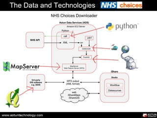
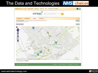
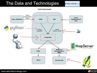
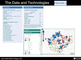
![The Data and Technologies
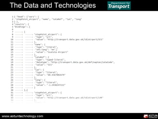
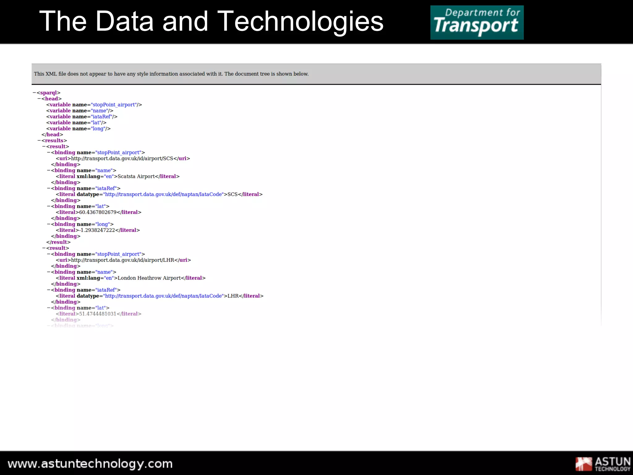
PREFIX naptan: <http://transport.data.gov.uk/def/naptan/>
PREFIX rdf: <http://www.w3.org/1999/02/22-rdf-syntax-ns#>
PREFIX skos: <http://www.w3.org/2004/02/skos/core#>
PREFIX geo: <http://www.w3.org/2003/01/geo/wgs84_pos#>
SELECT DISTINCT ?stopPoint_airport ?name ?iataRef ?lat ?long
WHERE {
?item a naptan:StopArea ;
naptan:administrativeArea <http://transport.data.gov.uk/id/administrative-
area/145> ;
skos:prefLabel ?name ;
geo:lat ?lat ;
geo:long ?long ;
naptan:stopPoint [ naptan:airport ?stopPoint_airport ] .
?stopPoint_airport naptan:iataRef ?iataRef .
}](https://image.slidesharecdn.com/aginortherngroup2012-120706090334-phpapp01/85/Consuming-open-and-linked-data-with-open-source-tools-8-320.jpg)


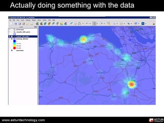


![The Data and Technologies
PREFIX naptan: <http://transport.data.gov.uk/def/naptan/>
PREFIX rdf: <http://www.w3.org/1999/02/22-rdf-syntax-ns#>
PREFIX skos: <http://www.w3.org/2004/02/skos/core#>
PREFIX geo: <http://www.w3.org/2003/01/geo/wgs84_pos#>
SELECT DISTINCT ?stopPoint_airport ?name ?iataRef ?lat ?long
WHERE {
?item a naptan:StopArea ;
naptan:administrativeArea <http://transport.data.gov.uk/id/administrative-
area/145> ;
skos:prefLabel ?name ;
geo:lat ?lat ;
geo:long ?long ;
naptan:stopPoint [ naptan:airport ?stopPoint_airport ] .
?stopPoint_airport naptan:iataRef ?iataRef .
}](https://image.slidesharecdn.com/aginortherngroup2012-120706090334-phpapp01/75/Consuming-open-and-linked-data-with-open-source-tools-8-2048.jpg)


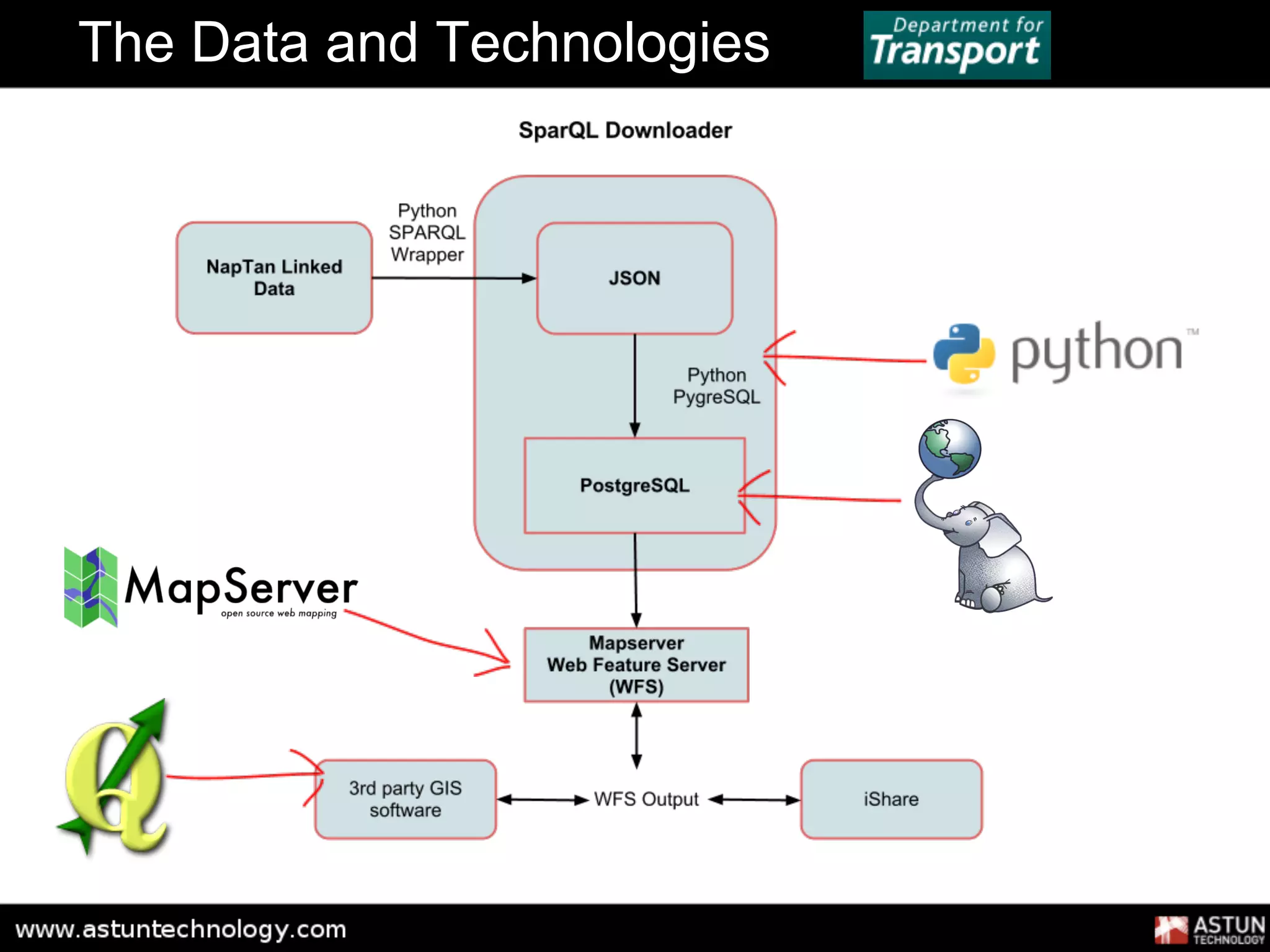
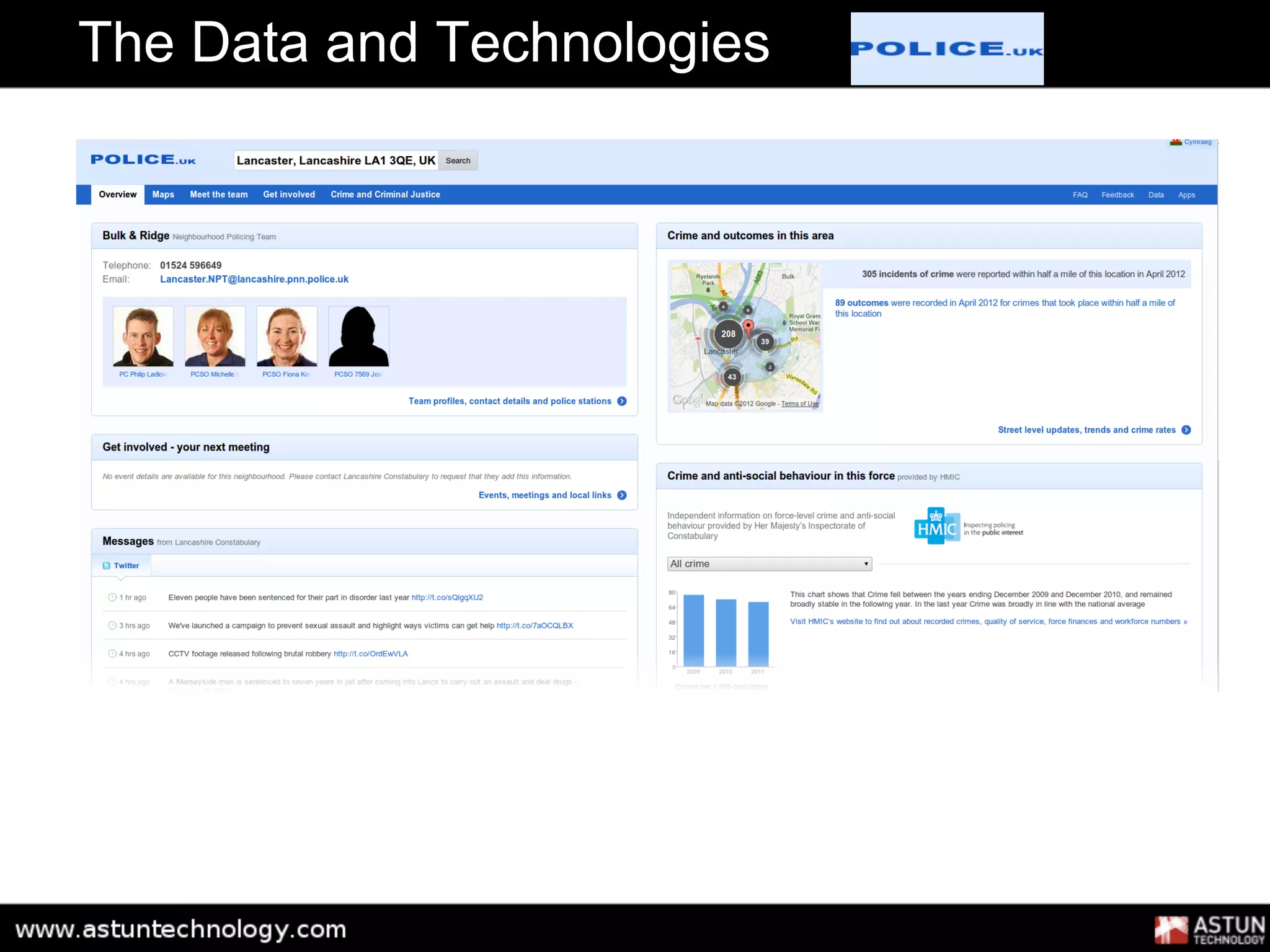
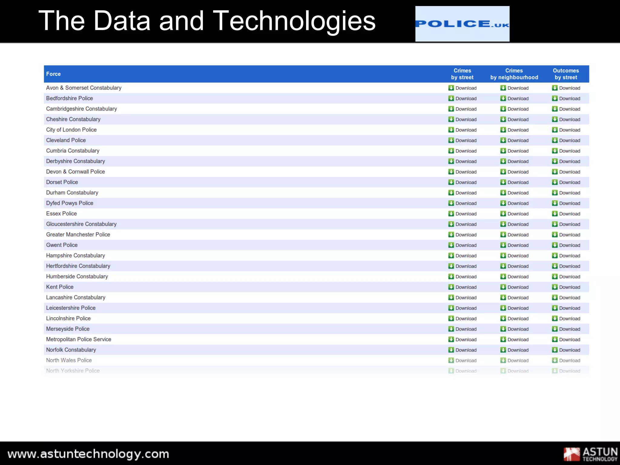
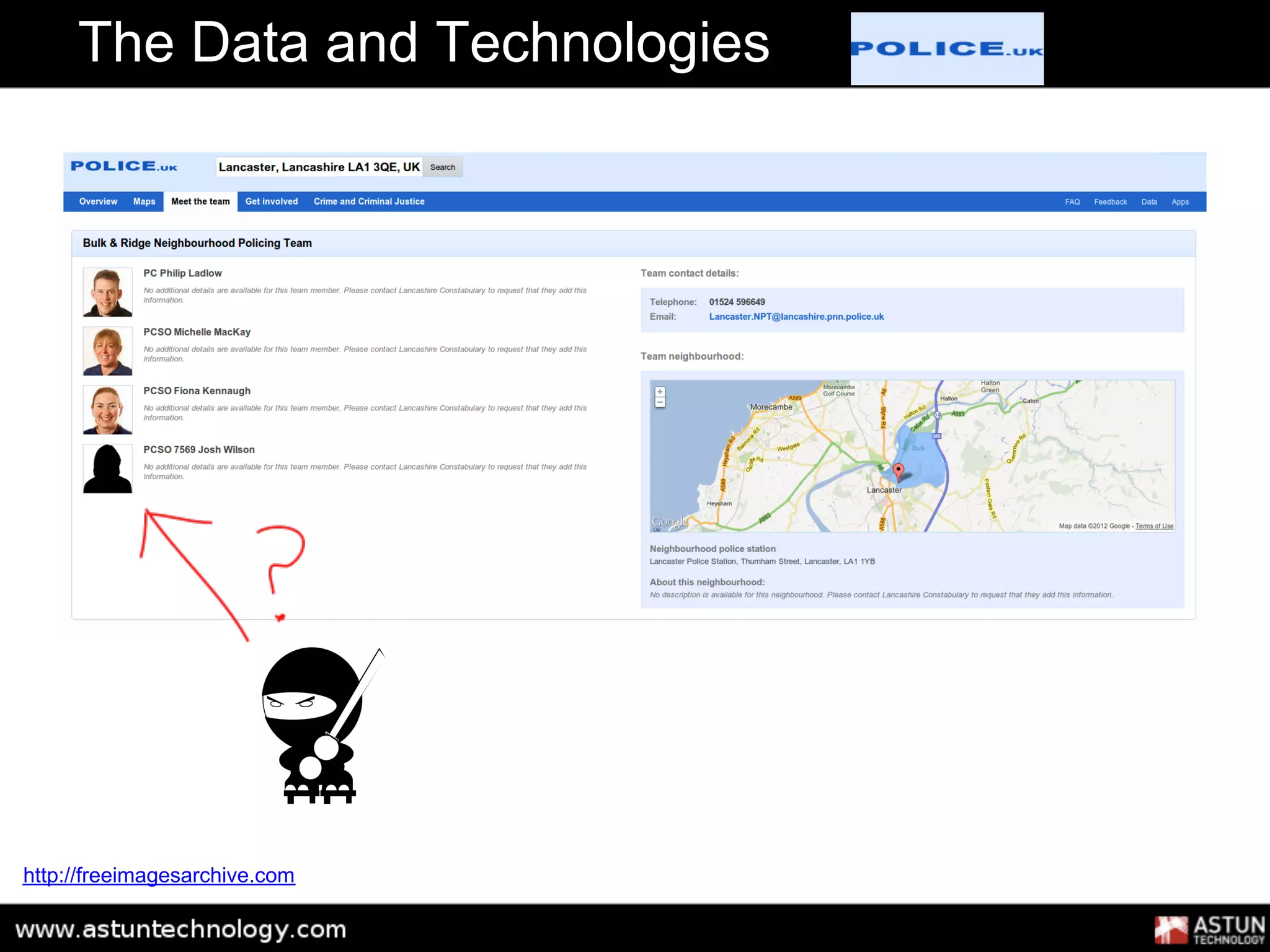
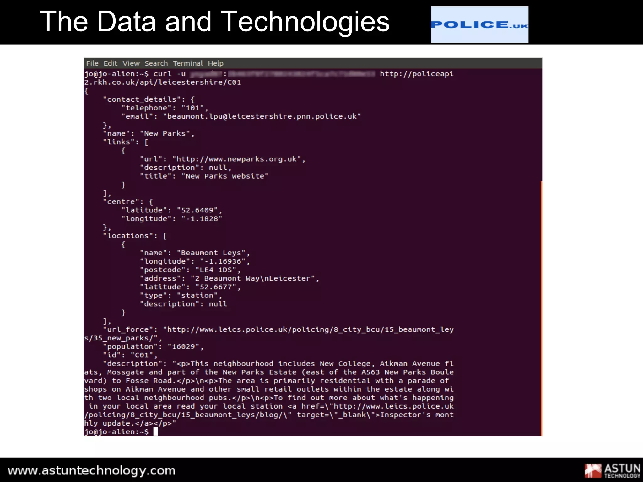

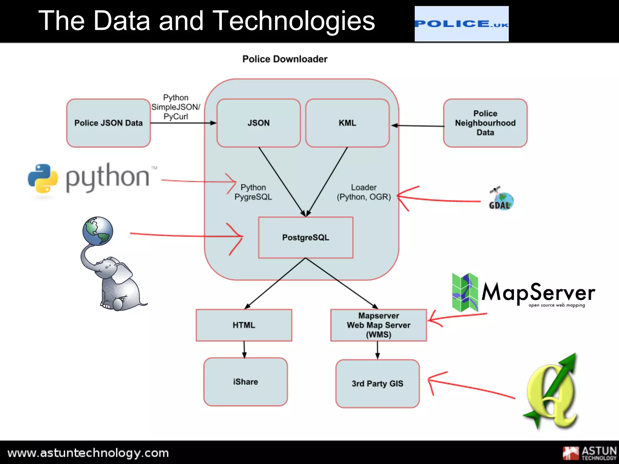
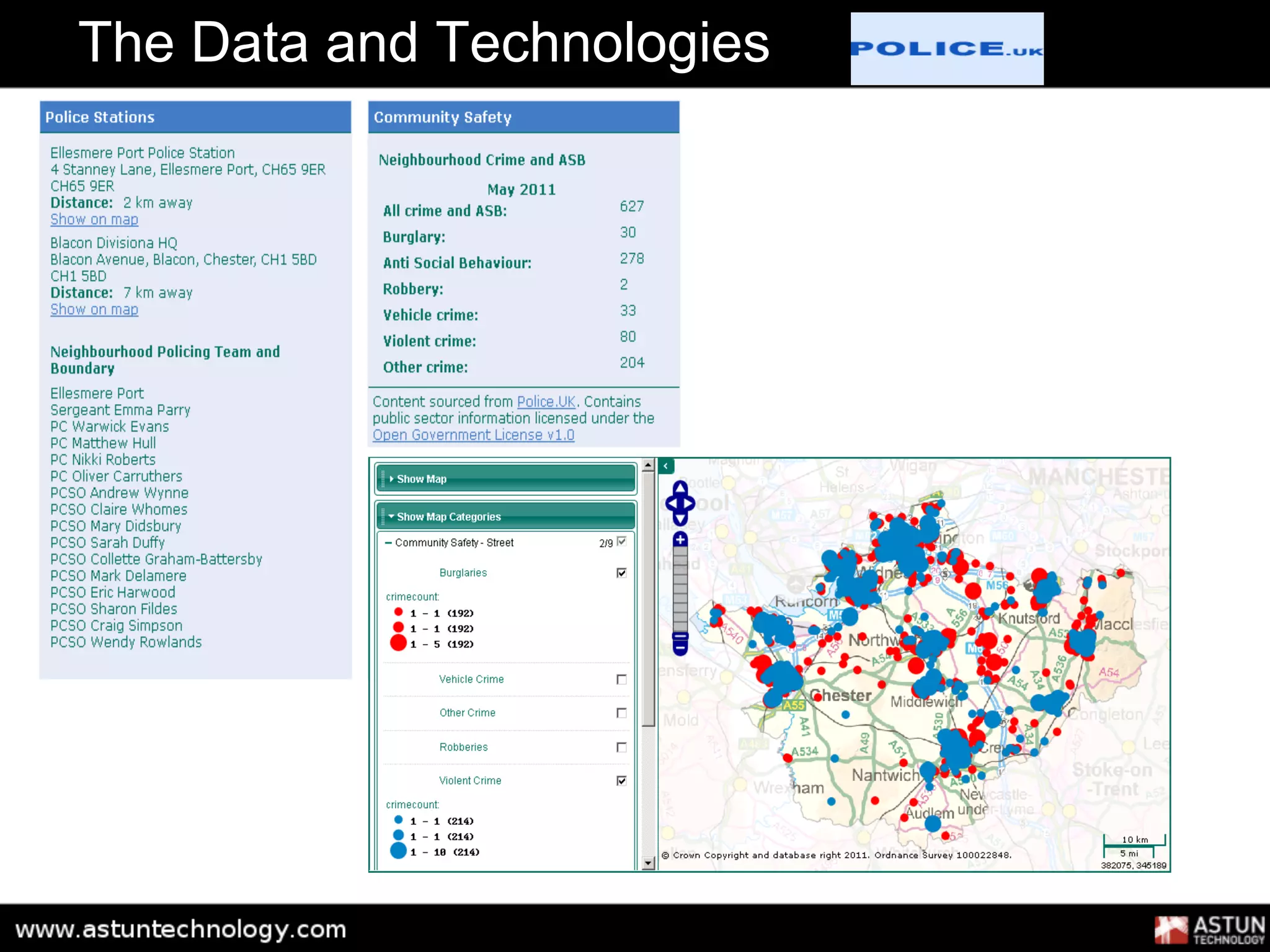
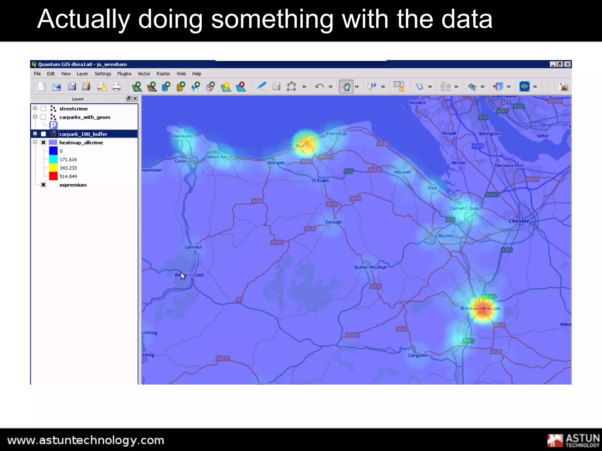
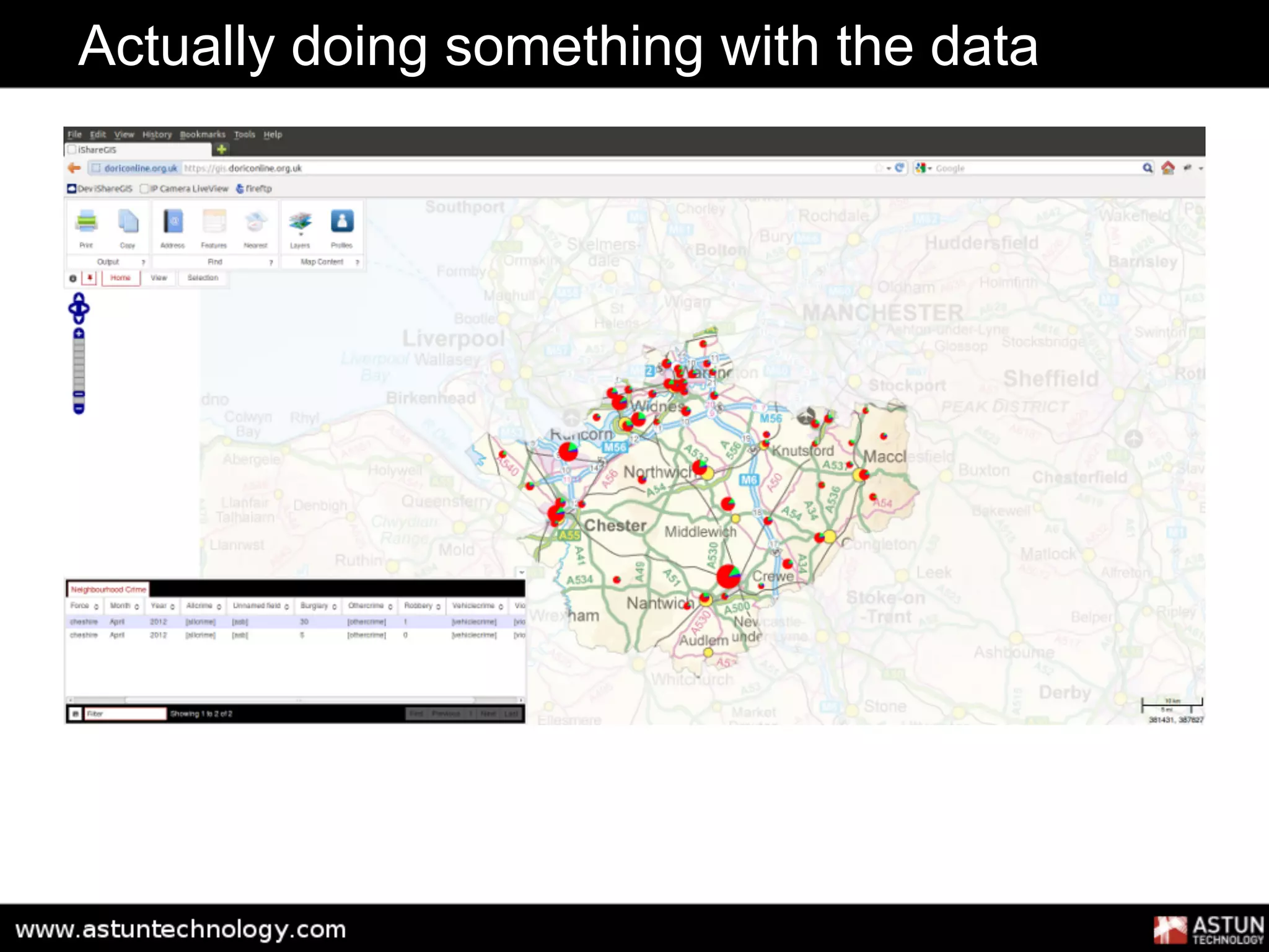


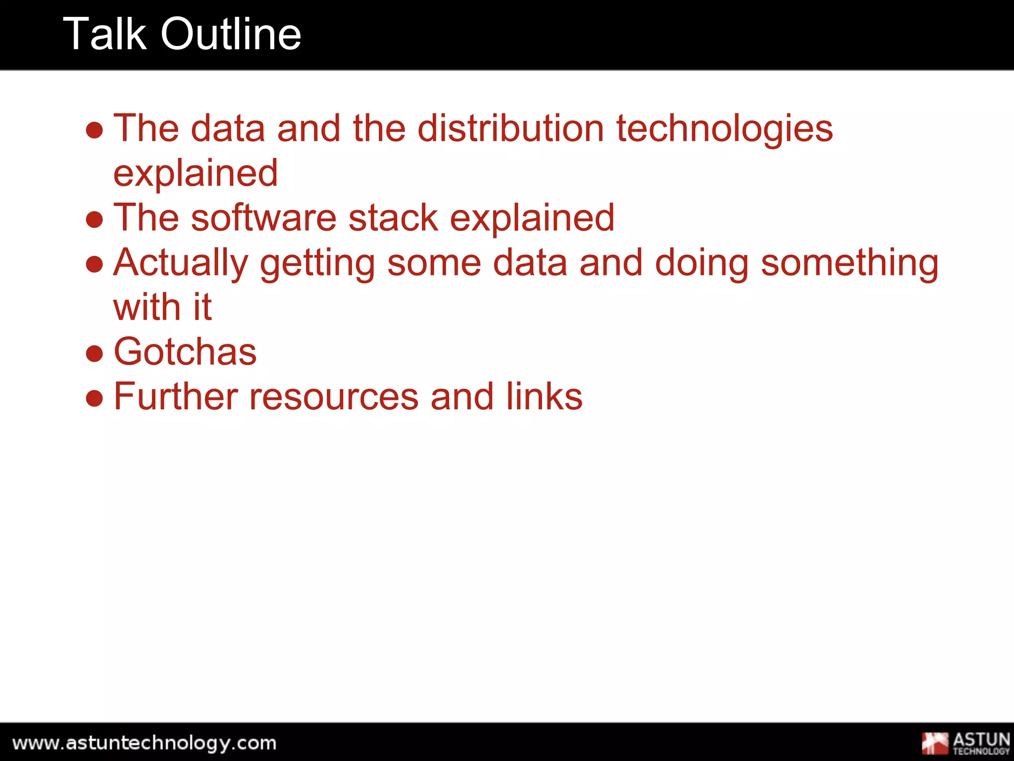
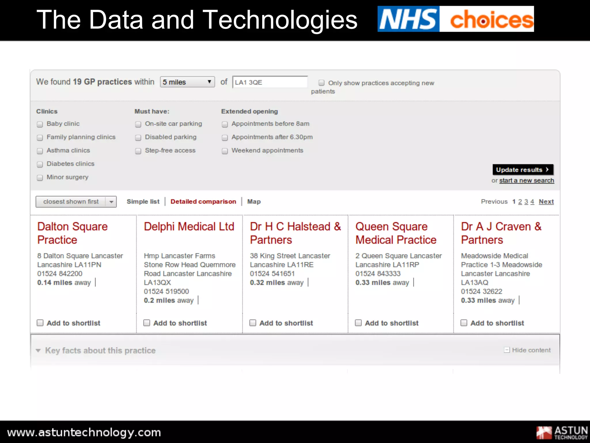
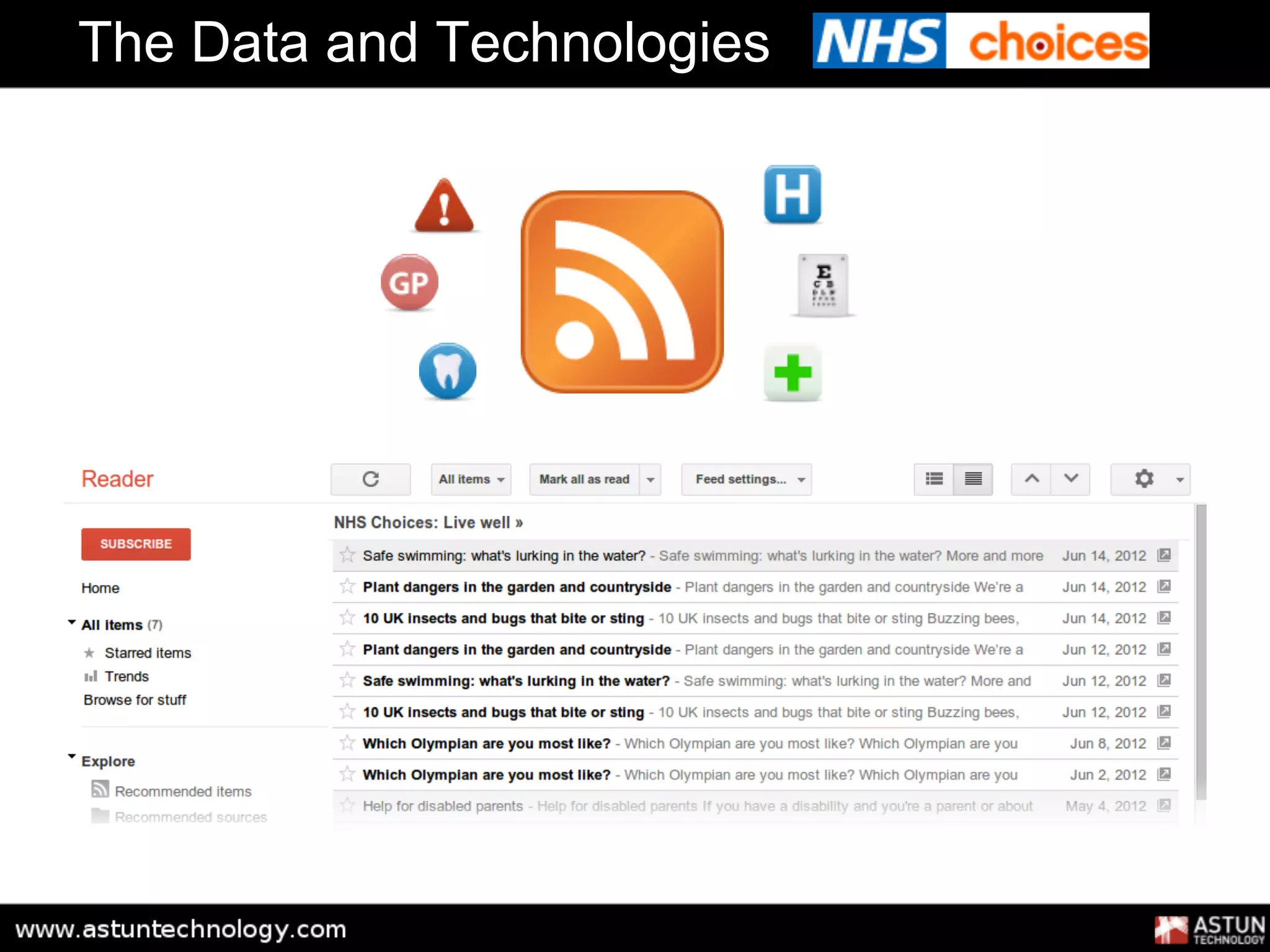
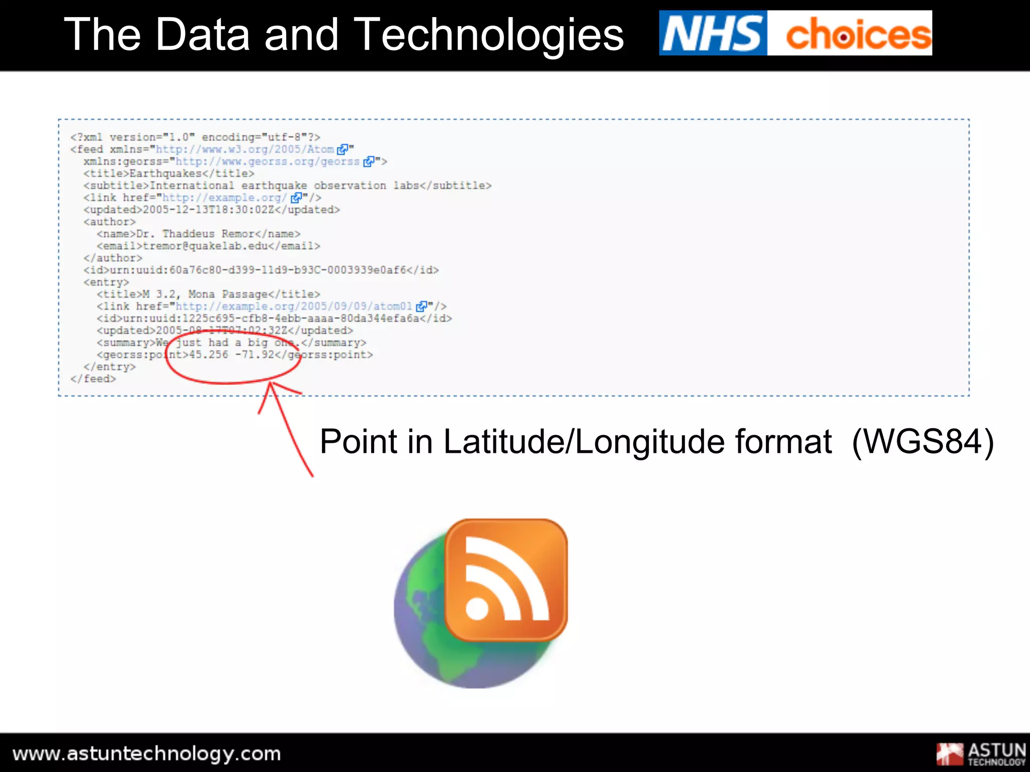
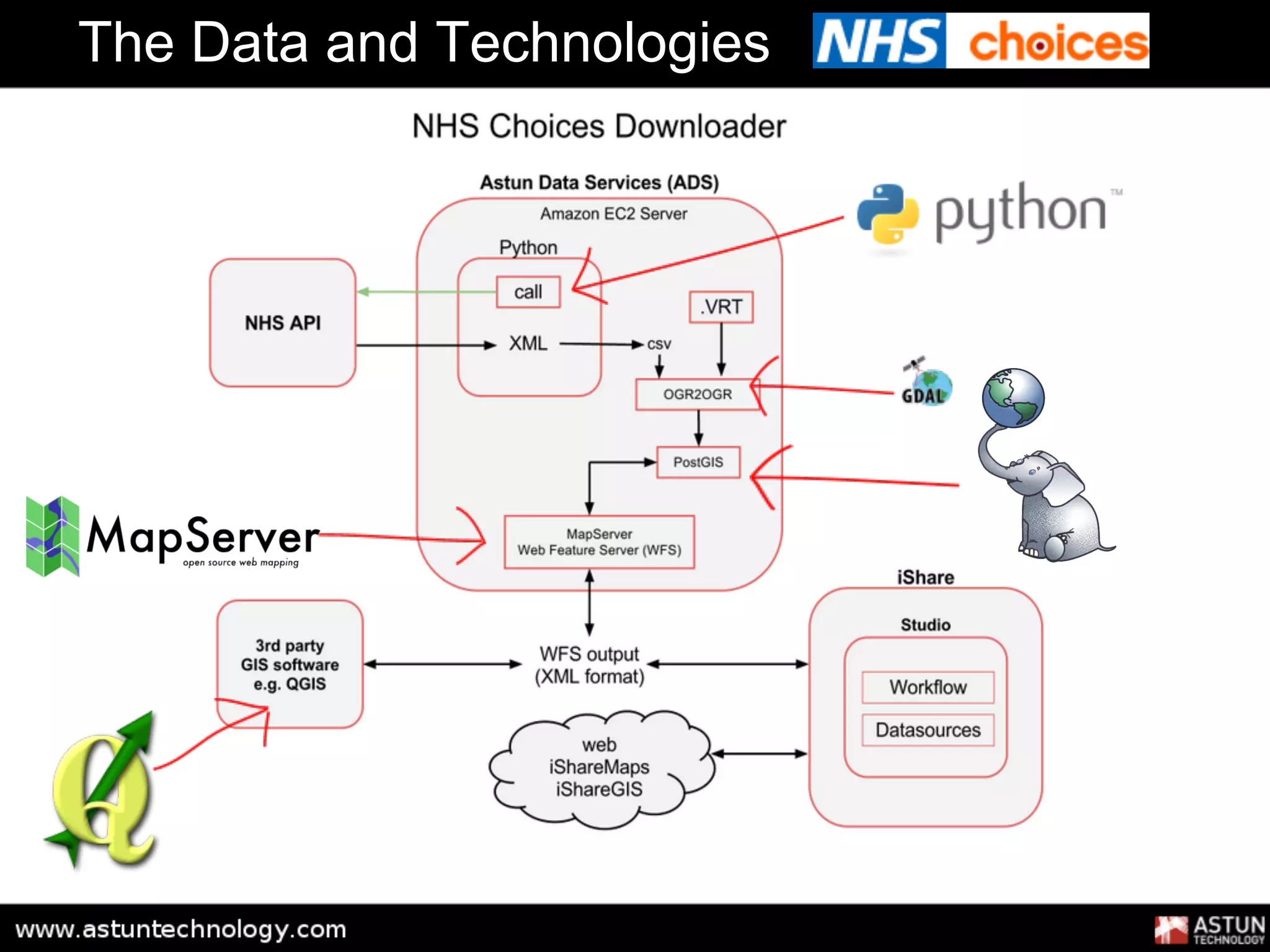
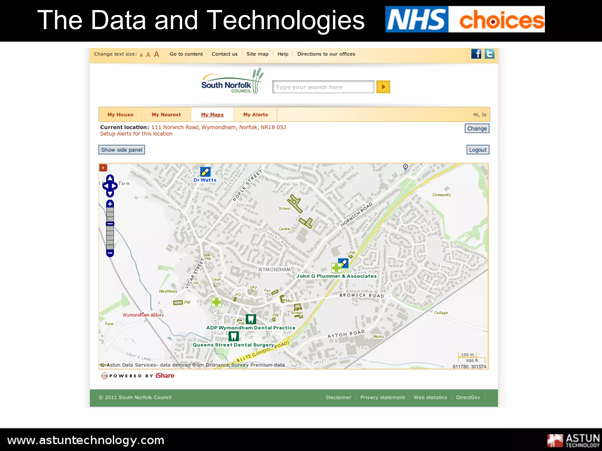
This document discusses consuming and using open and linked data with open source tools. It outlines the available data and distribution technologies like RDF, SPARQL and linked data. It then explains the typical software stack used including tools for querying, storing and visualizing the data. The document provides an example of actually retrieving data and doing something useful with it. It also notes some potential issues or "gotchas" and provides further resources for working with open data.


![UiPath Automation Suite Installation (Hands-On) [2/3]](https://cdn.slidesharecdn.com/ss_thumbnails/automationsuitecommunitysession2-251015095633-a6d862f1-thumbnail.jpg?width=600ounds&width=560&fit=bounds)


