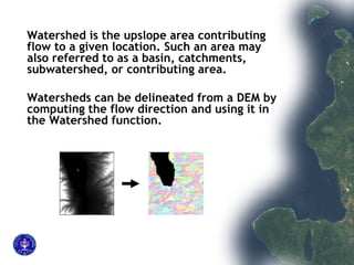
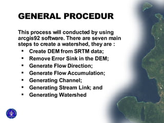
This document outlines the 7 main steps to delineate a watershed from a DEM using ArcGIS:
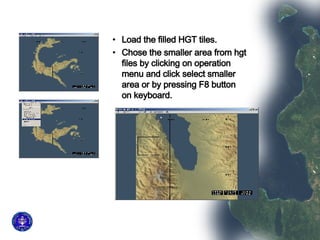
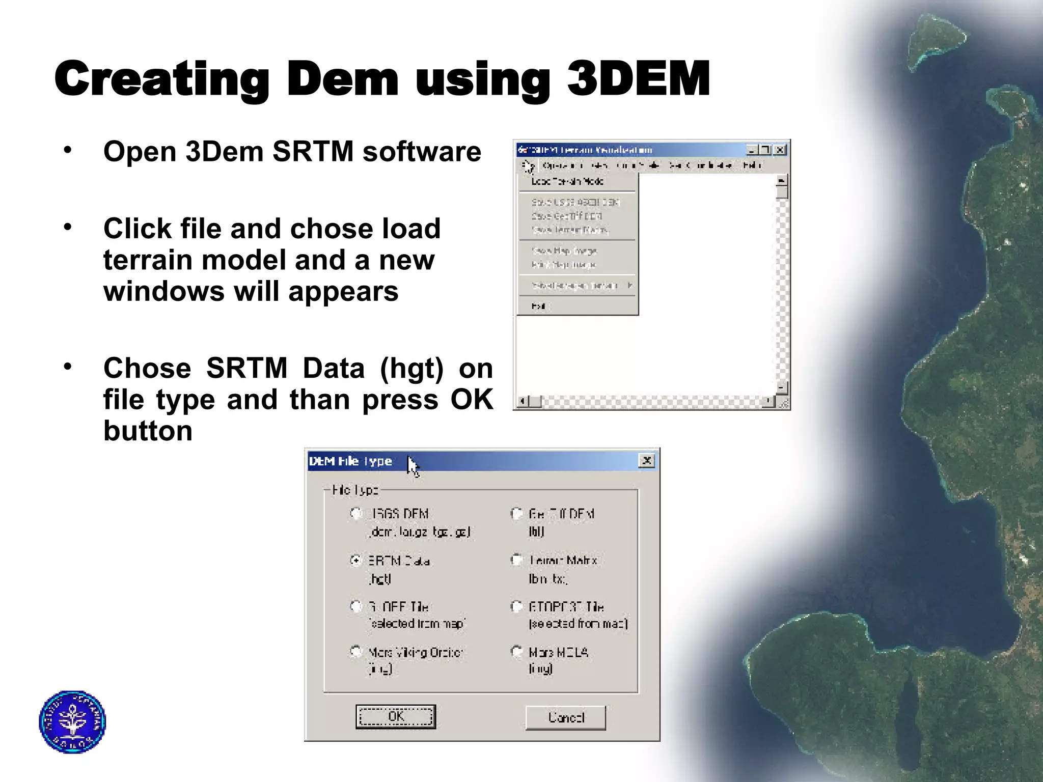
1) Create a DEM from SRTM data and reproject it to UTM.
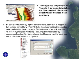
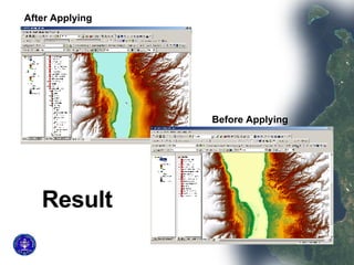
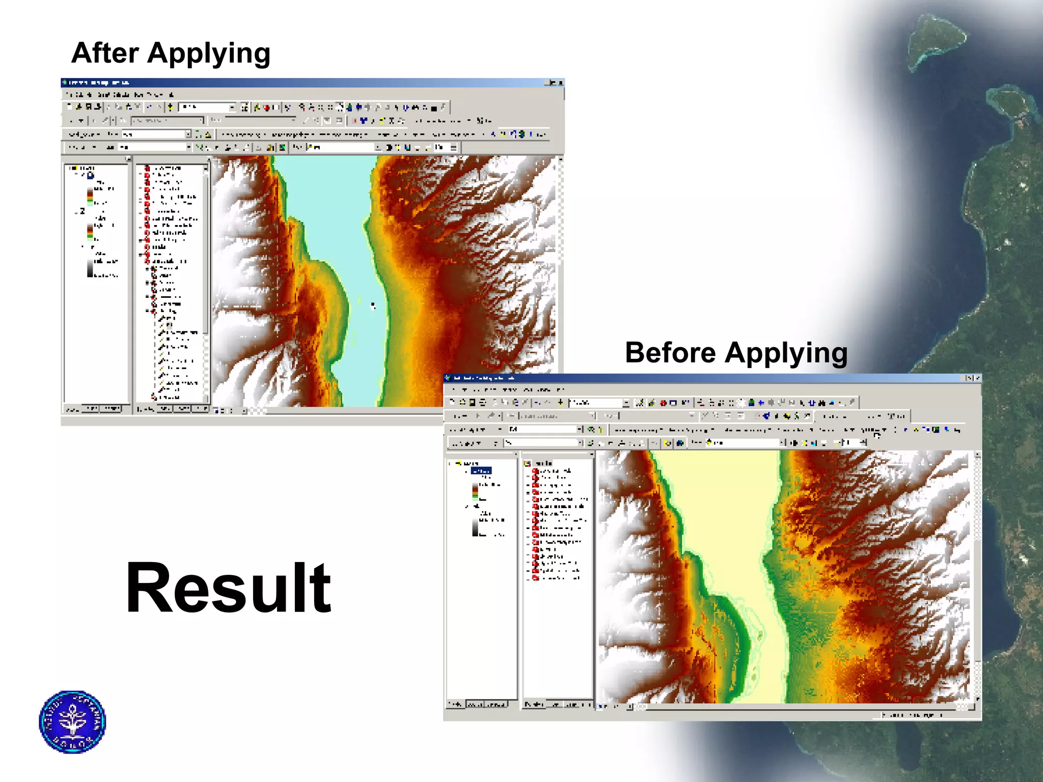
2) Remove sinks and errors from the DEM using the Fill tool.
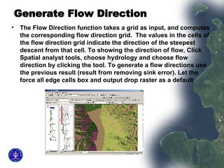
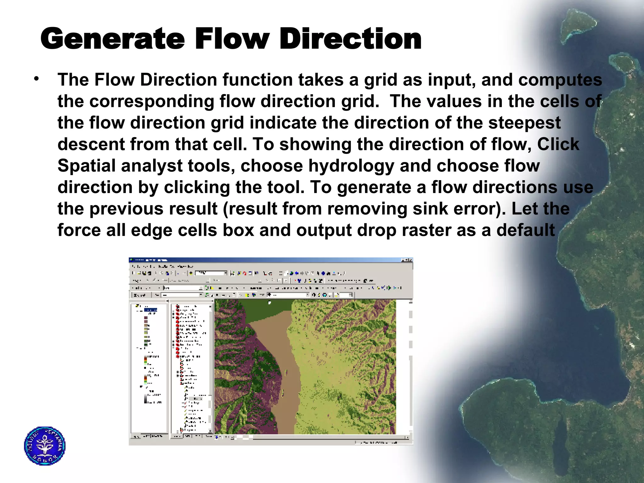
3) Generate a flow direction raster using the Flow Direction tool.
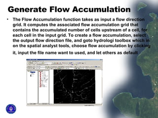
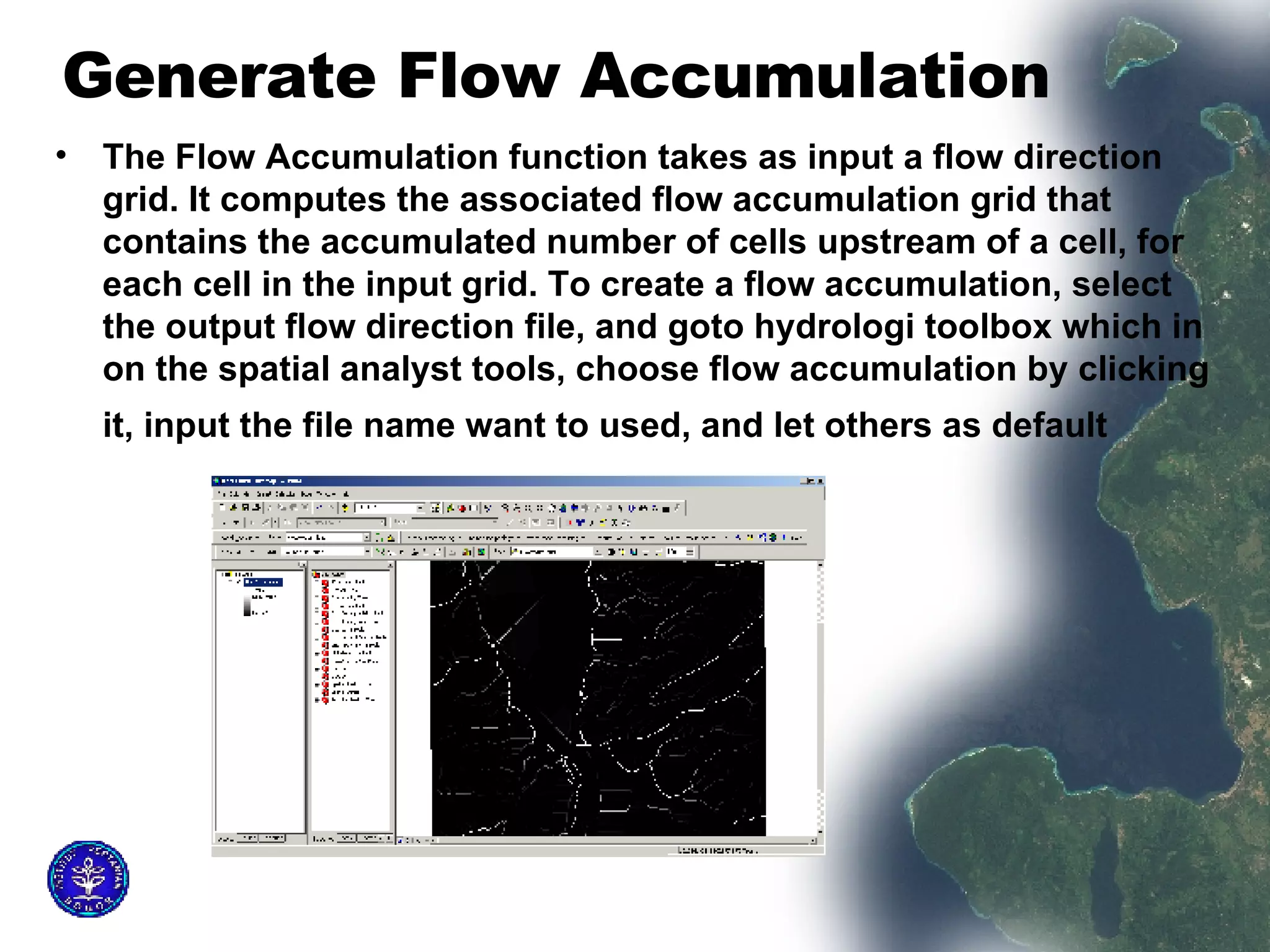
4) Generate a flow accumulation raster using the Flow Accumulation tool.
5) Map stream channels by selecting cells with over 400 upstream cells.
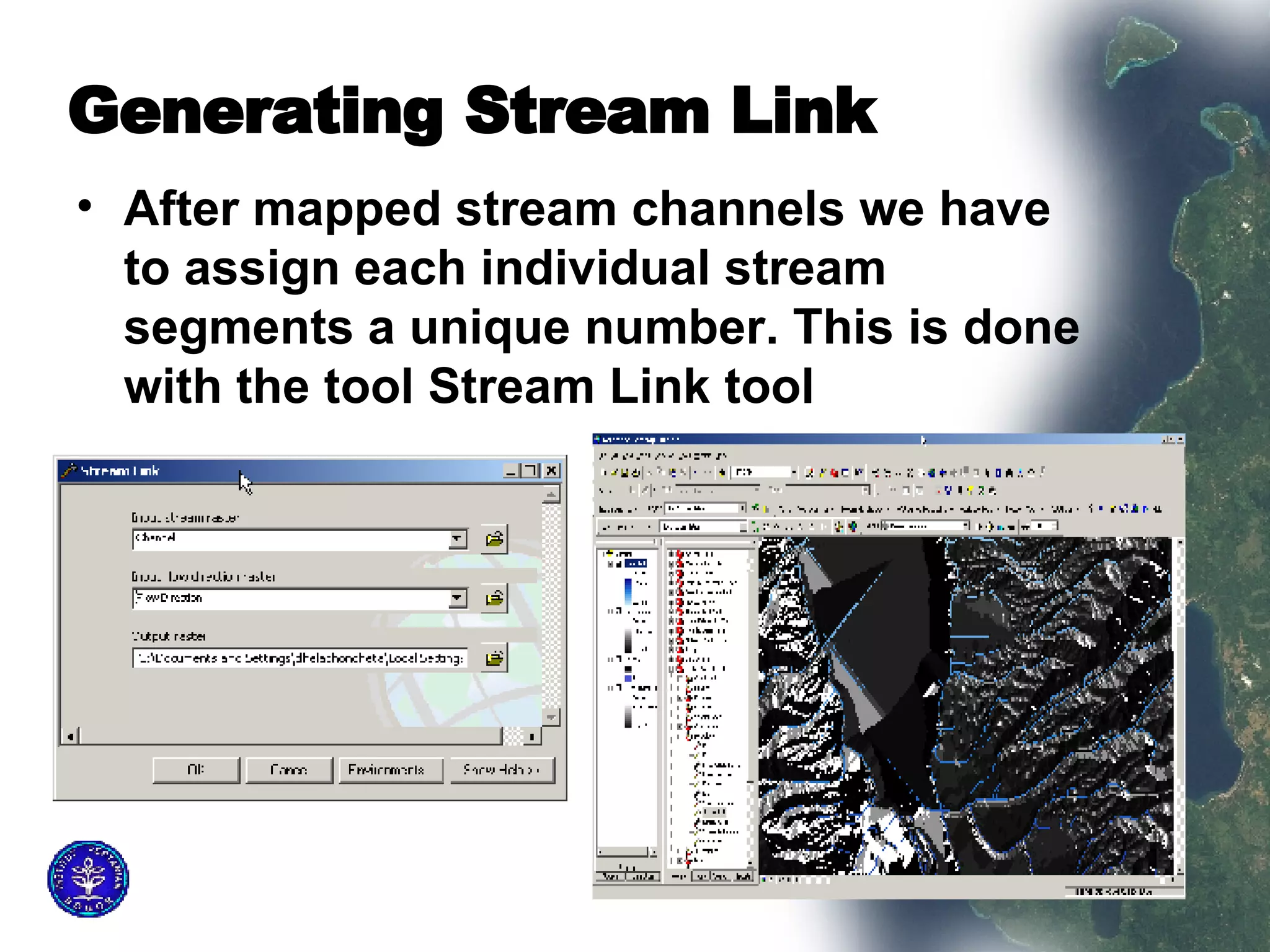
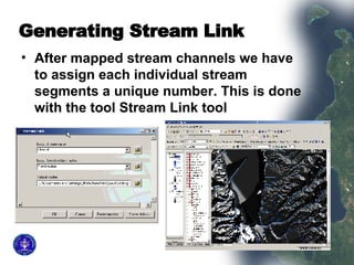
6) Assign each stream segment a unique number using the Stream Link tool.
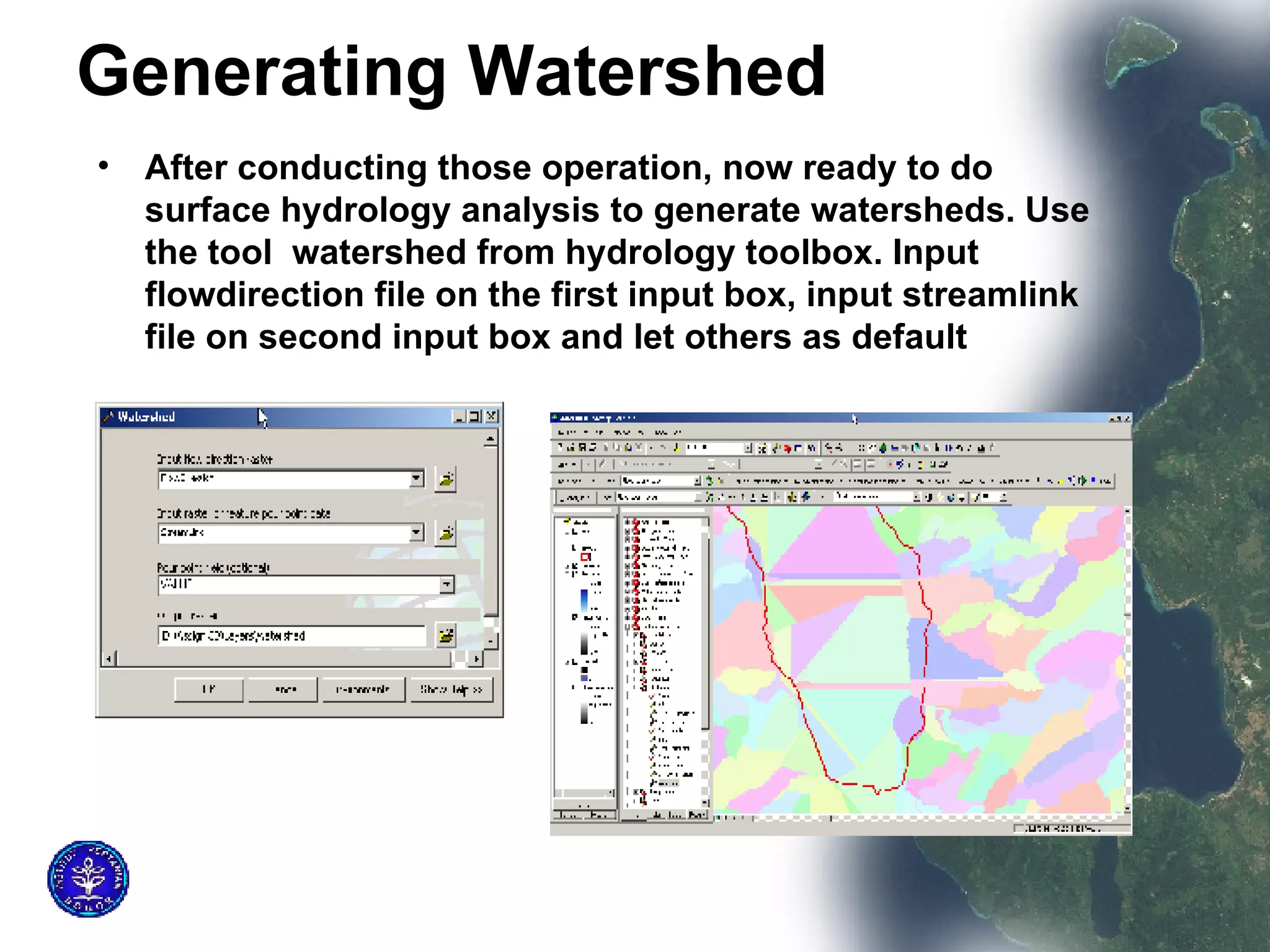
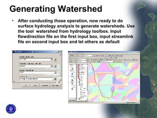
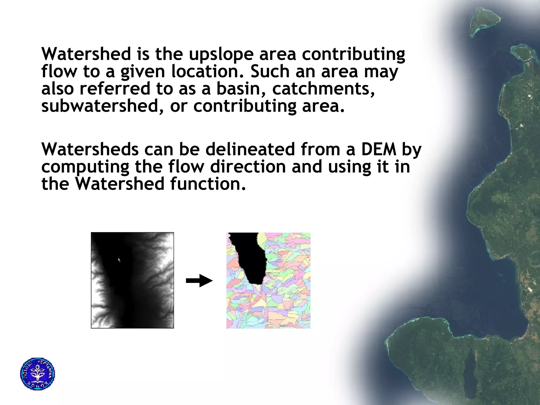
7) Generate the watershed boundaries using the Watershed tool.
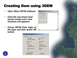
![Reproject the DEM to UTM by clicking on operation menu and choose change projection Write the data out as GeoTiff DEM by clicking file menu. The data is now ready to be added to ArcMap, but still there are negative values even though SRTMFill was used, and that Should be cleaned. It is necessary to replace these negative values. To remove negative values use Spatial Analyst raster calculator. Use the conditional statement : “ con([Palu.tif] < 0, 0, [Palu.tif]) ” This is a Visual Basic- like command and is interpreted as if the raster value of Pamong.tif is less than zero then replace the raster value with zero otherwise replace it with the original value.](https://image.slidesharecdn.com/creating-watershed-using-srtm-dem-15375/85/Creating-watershed-using-SRTM-DEM-7-320.jpg)
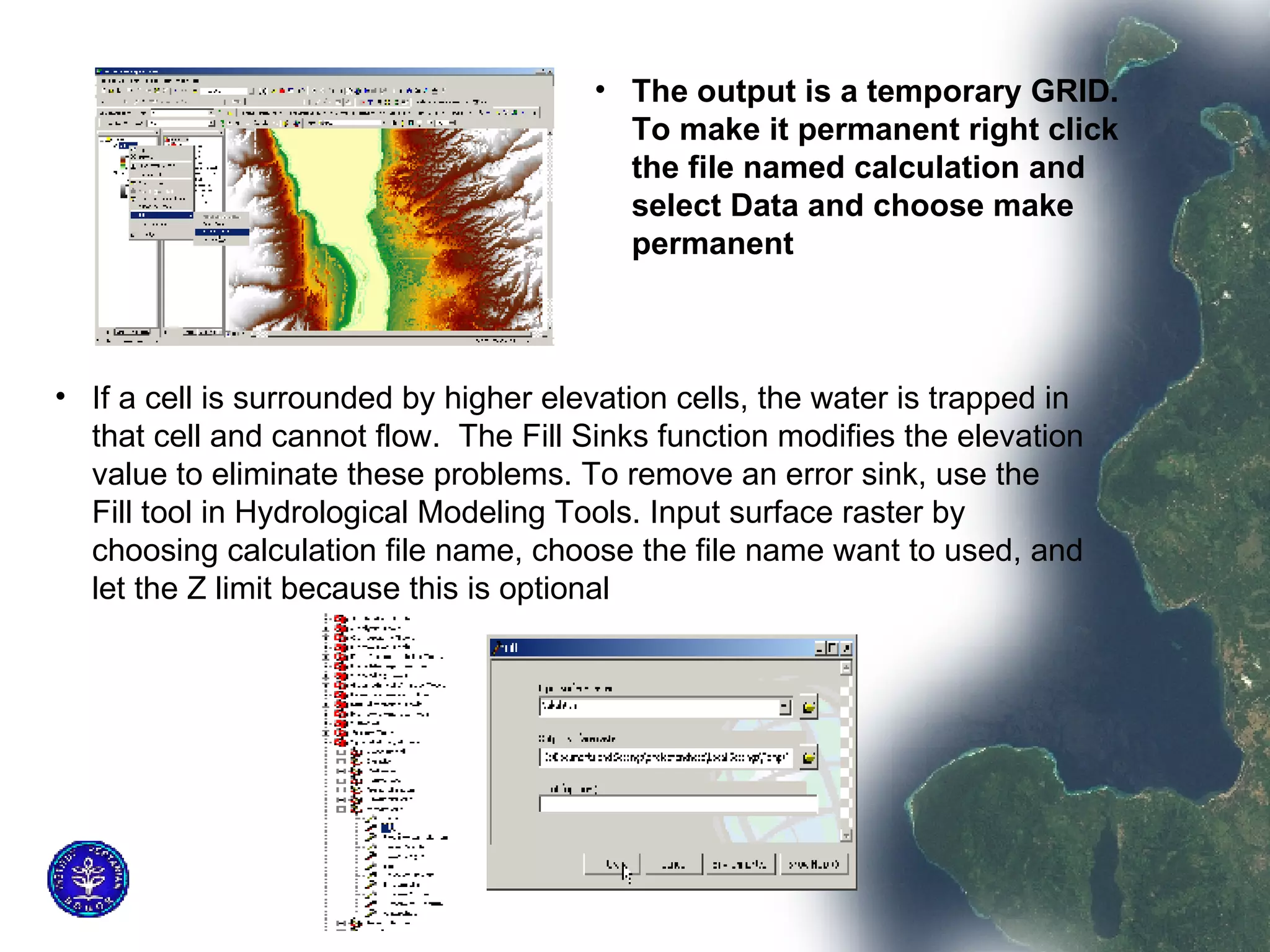
![Remove Error Sink in the DEM Before removing error sink, we should convert DEM type from floating point to integer Because elevation more dealing with integer number. Procedural steps for converting are Activate the spatial analyst extent ion, click on spatial analyst menu bar and chose raster calculator. Apply formula below “Int ([palu.tif])” and press evaluate button. The result will be automatically named by arcmap as Calculation, and store the information on folder Calc](https://image.slidesharecdn.com/creating-watershed-using-srtm-dem-15375/85/Creating-watershed-using-SRTM-DEM-8-320.jpg)
![Generating Channel Based on the flow accumulation, we can map stream channels where the water flows. This channel is based on the number of cells which flow into a specific cell. If we want large channels we use a larger number. For this Assignment will mappings all cells that has at least 400 cells that flow into it. Because the cell size is 90 m, these means we are mapping all cells that have a drainage area of at least 90 x 90 x 500 = 3.24 km2. This operation will done by choosing raster calculator and applying formula : ([FlowAccumulation]) >= 400.](https://image.slidesharecdn.com/creating-watershed-using-srtm-dem-15375/85/Creating-watershed-using-SRTM-DEM-13-320.jpg)


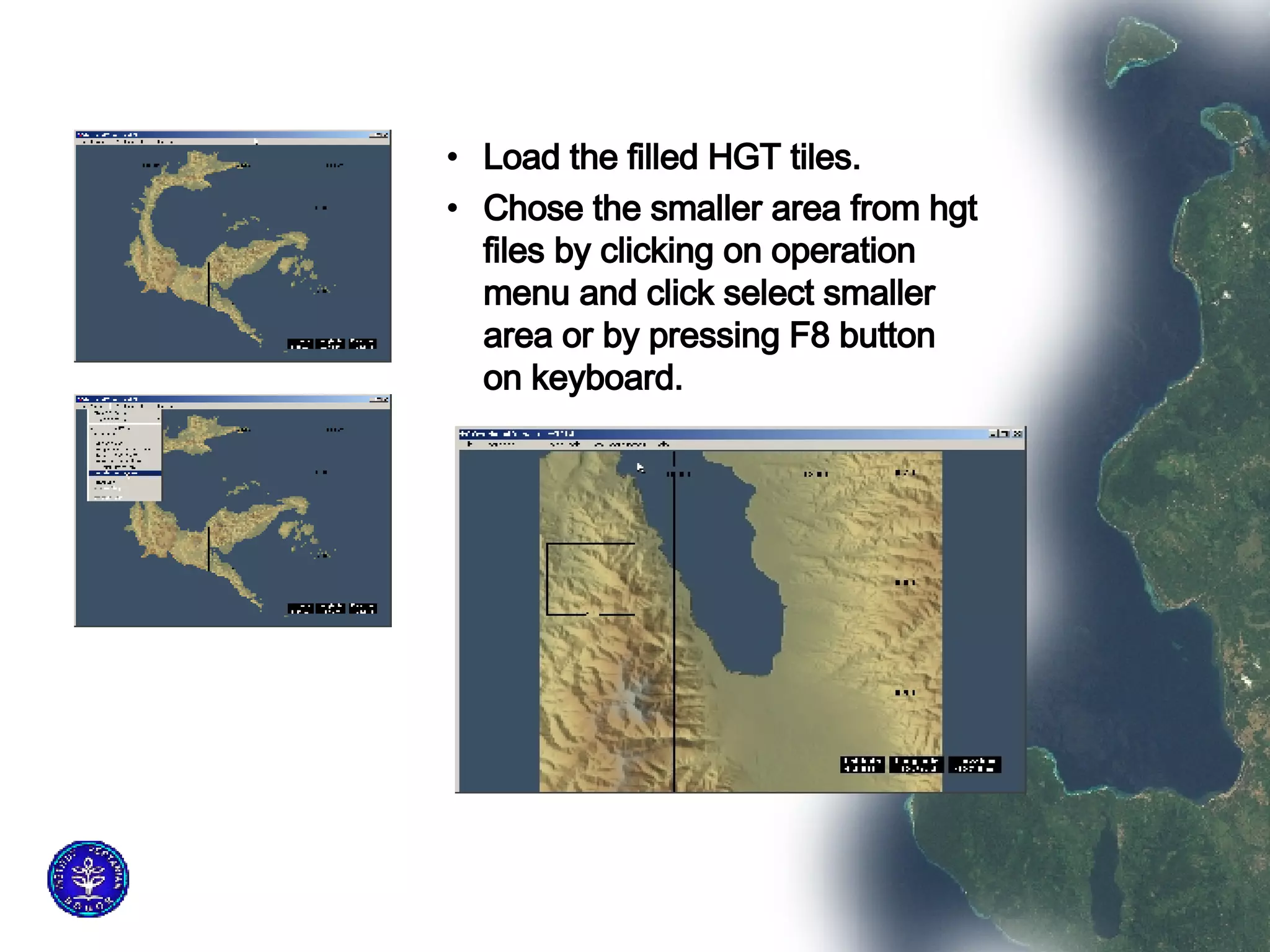
![Reproject the DEM to UTM by clicking on operation menu and choose change projection Write the data out as GeoTiff DEM by clicking file menu. The data is now ready to be added to ArcMap, but still there are negative values even though SRTMFill was used, and that Should be cleaned. It is necessary to replace these negative values. To remove negative values use Spatial Analyst raster calculator. Use the conditional statement : “ con([Palu.tif] < 0, 0, [Palu.tif]) ” This is a Visual Basic- like command and is interpreted as if the raster value of Pamong.tif is less than zero then replace the raster value with zero otherwise replace it with the original value.](https://image.slidesharecdn.com/creating-watershed-using-srtm-dem-15375/75/Creating-watershed-using-SRTM-DEM-7-2048.jpg)
![Remove Error Sink in the DEM Before removing error sink, we should convert DEM type from floating point to integer Because elevation more dealing with integer number. Procedural steps for converting are Activate the spatial analyst extent ion, click on spatial analyst menu bar and chose raster calculator. Apply formula below “Int ([palu.tif])” and press evaluate button. The result will be automatically named by arcmap as Calculation, and store the information on folder Calc](https://image.slidesharecdn.com/creating-watershed-using-srtm-dem-15375/75/Creating-watershed-using-SRTM-DEM-8-2048.jpg)
![Generating Channel Based on the flow accumulation, we can map stream channels where the water flows. This channel is based on the number of cells which flow into a specific cell. If we want large channels we use a larger number. For this Assignment will mappings all cells that has at least 400 cells that flow into it. Because the cell size is 90 m, these means we are mapping all cells that have a drainage area of at least 90 x 90 x 500 = 3.24 km2. This operation will done by choosing raster calculator and applying formula : ([FlowAccumulation]) >= 400.](https://image.slidesharecdn.com/creating-watershed-using-srtm-dem-15375/75/Creating-watershed-using-SRTM-DEM-13-2048.jpg)