Download as PDF, PPTX


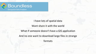

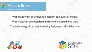
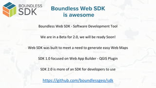
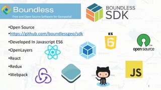
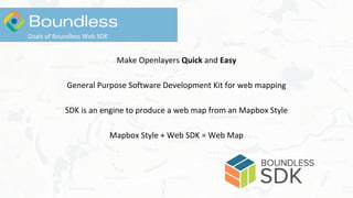
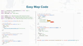
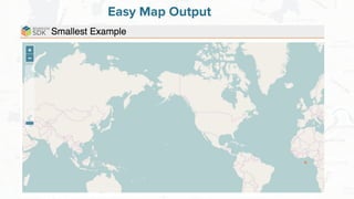
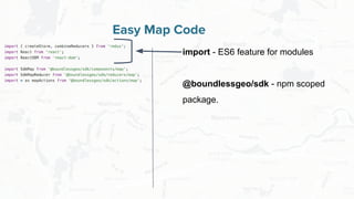
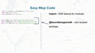
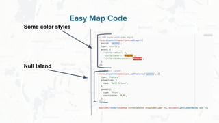
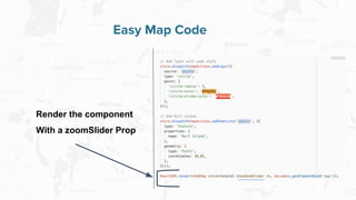
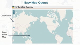
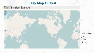
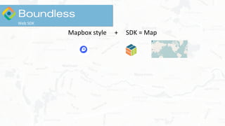

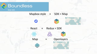
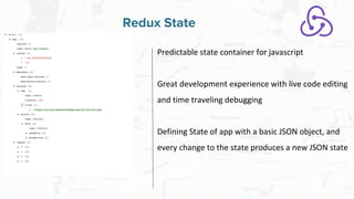
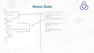
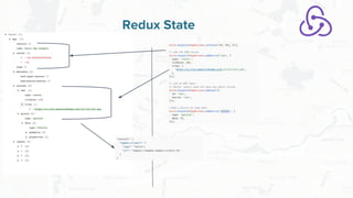
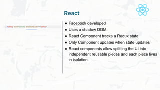
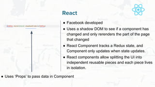

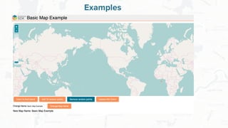
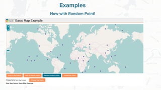
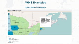

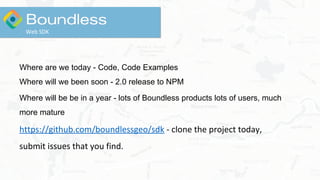
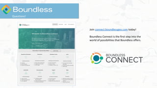

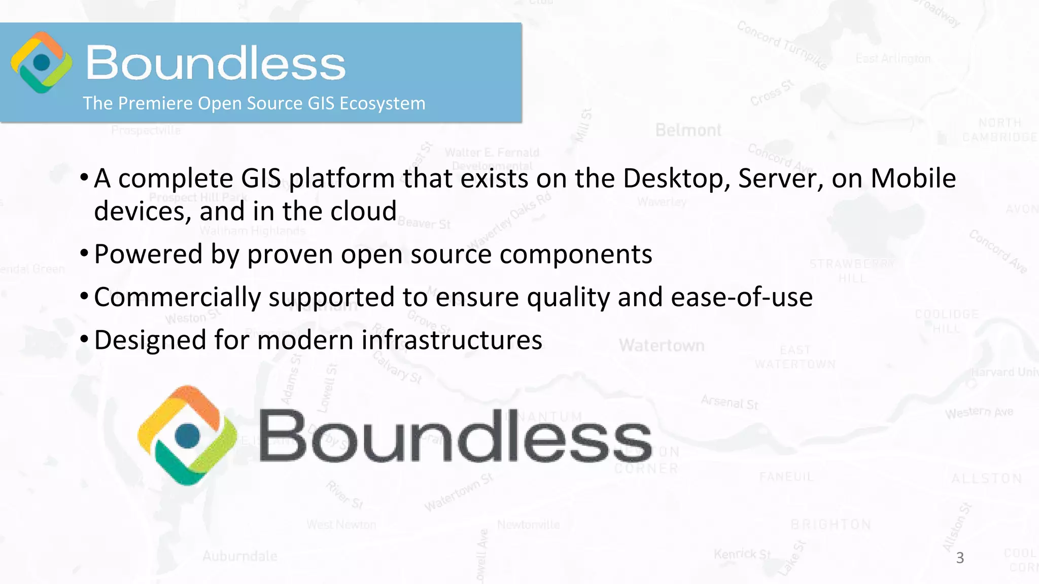
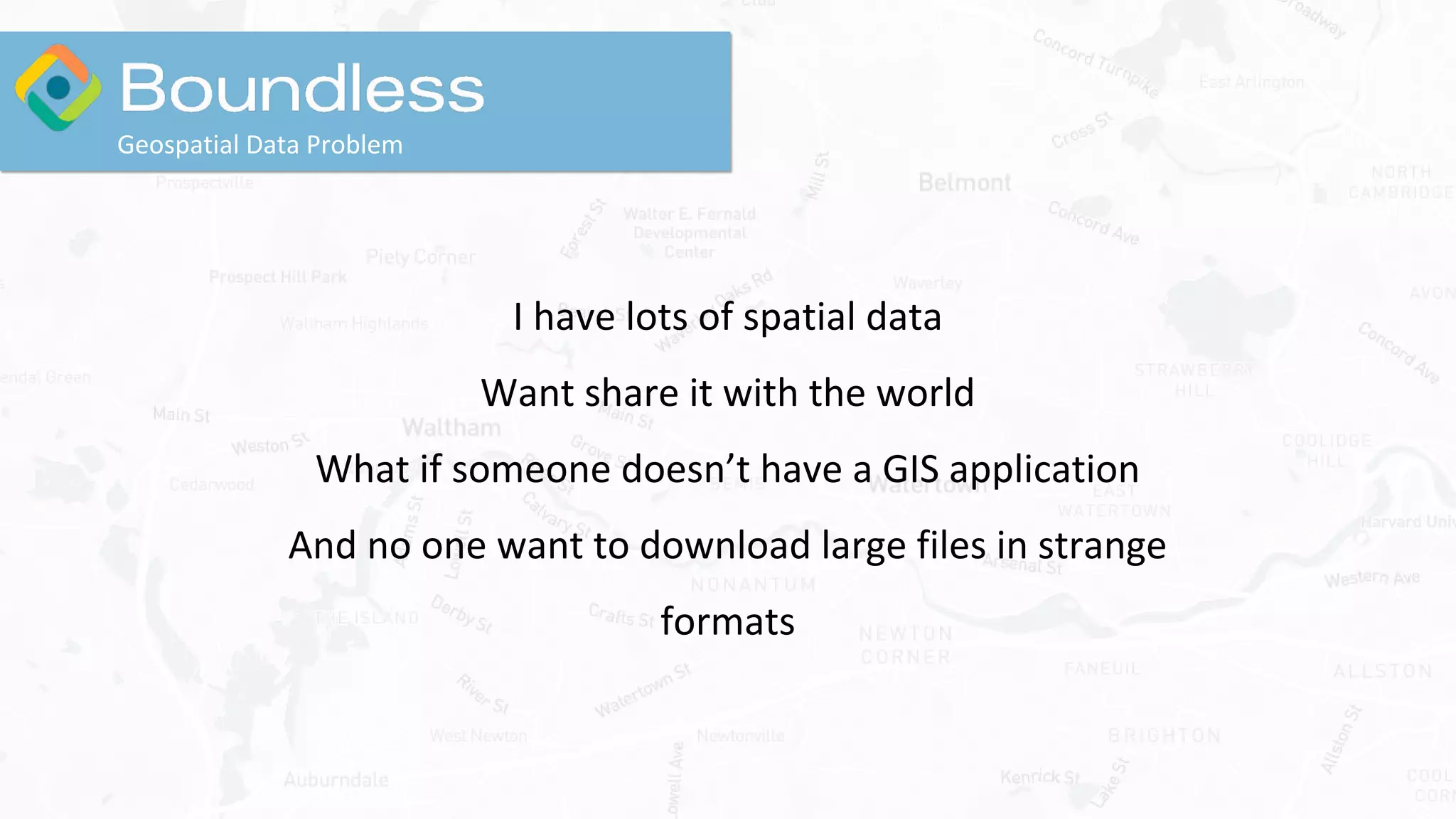
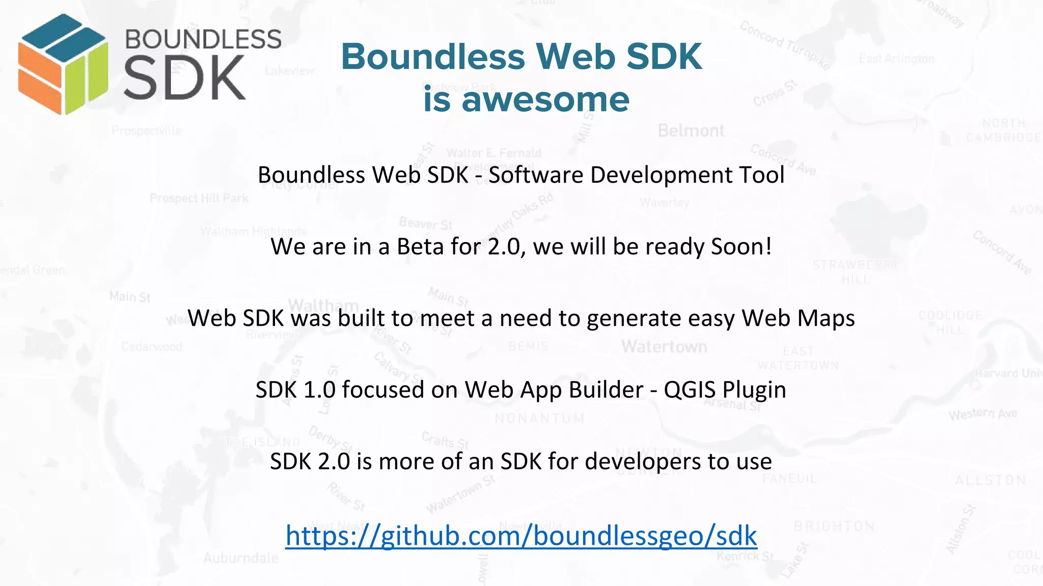
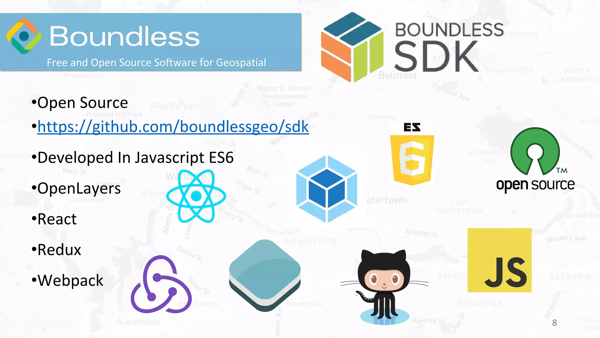
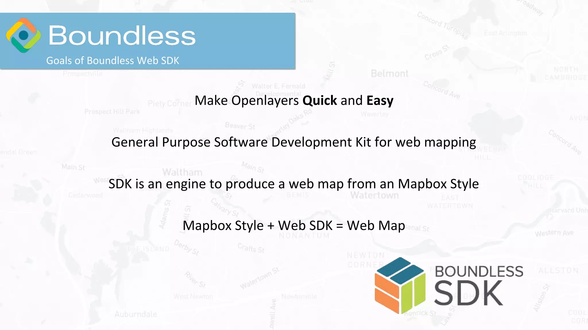
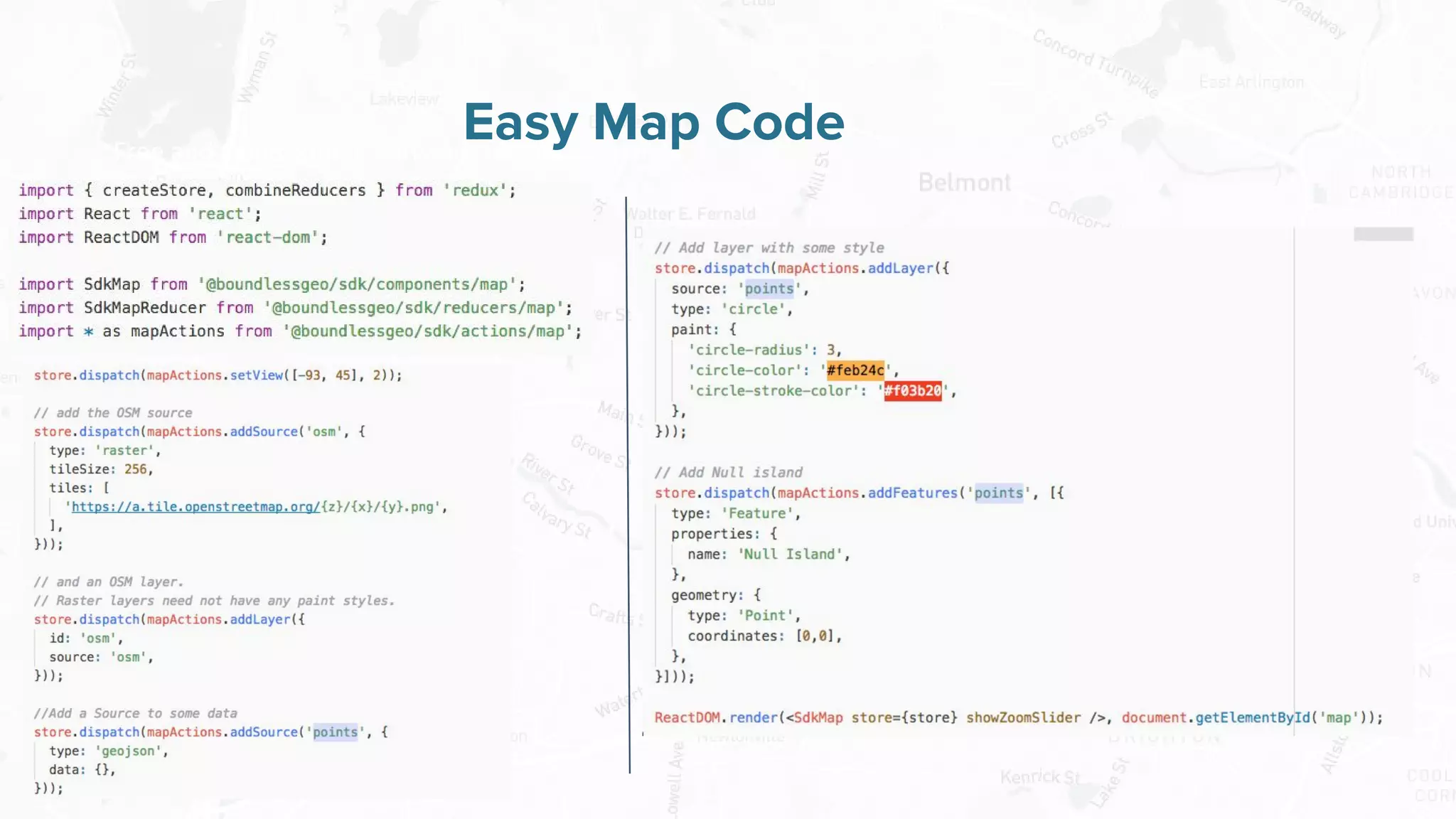
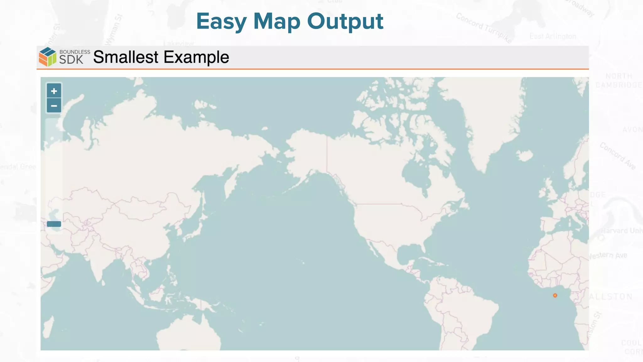
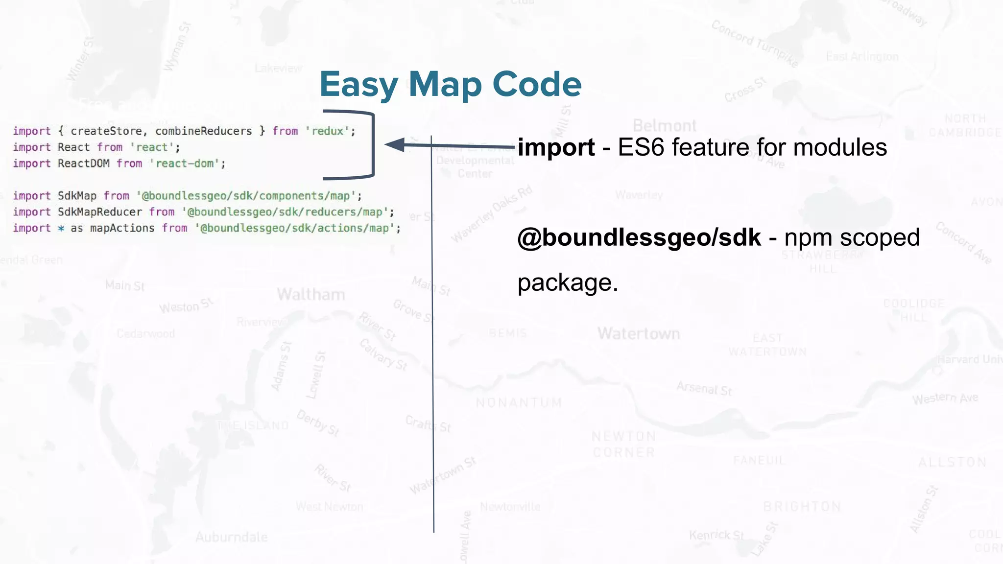
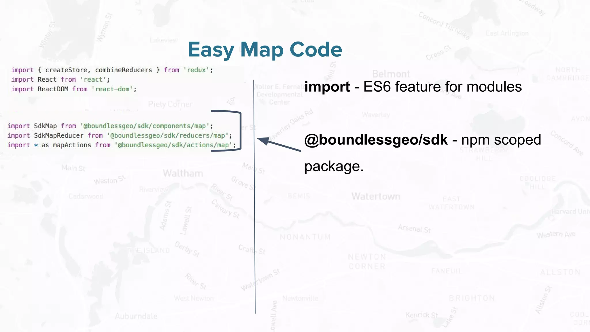
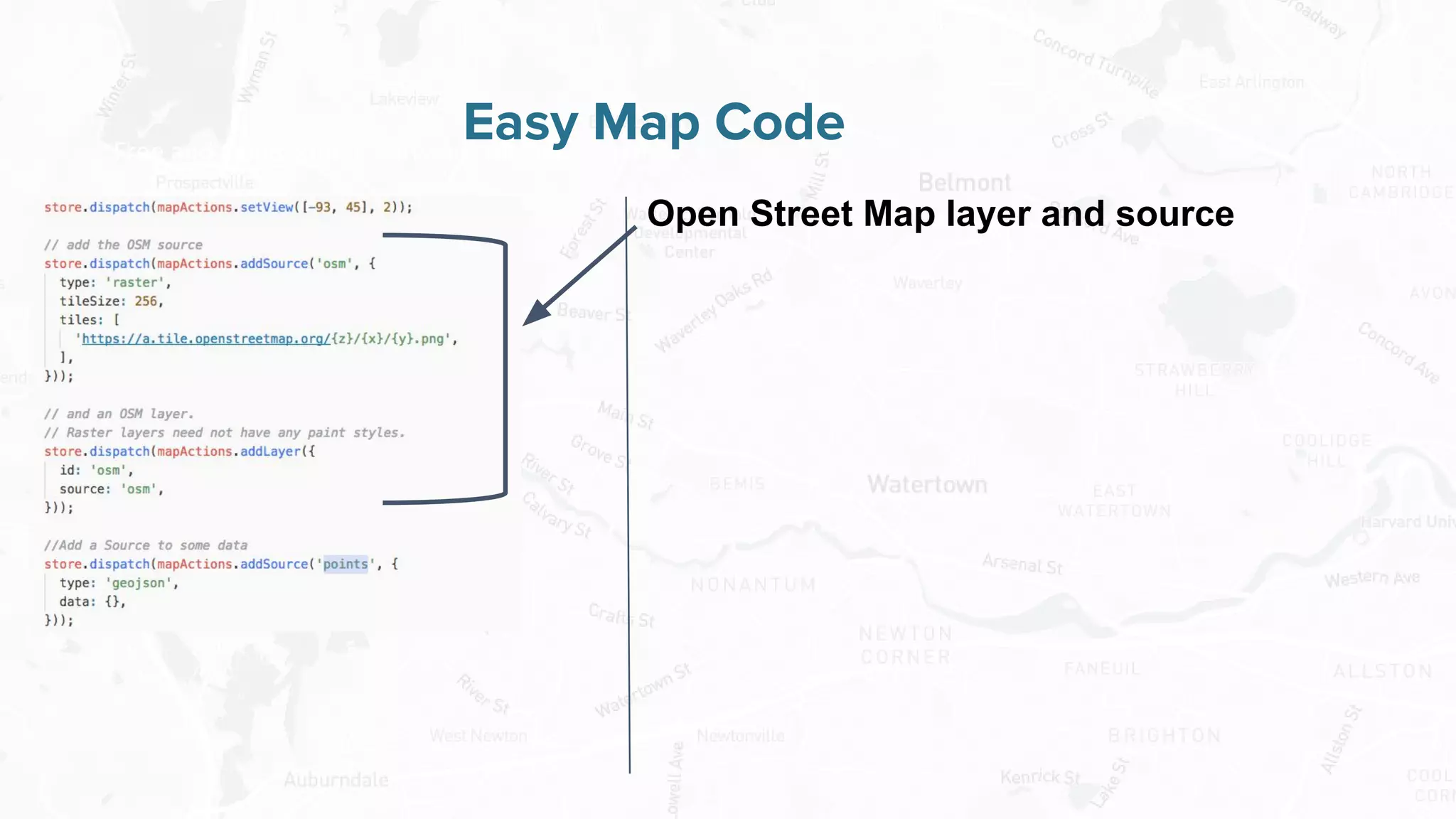
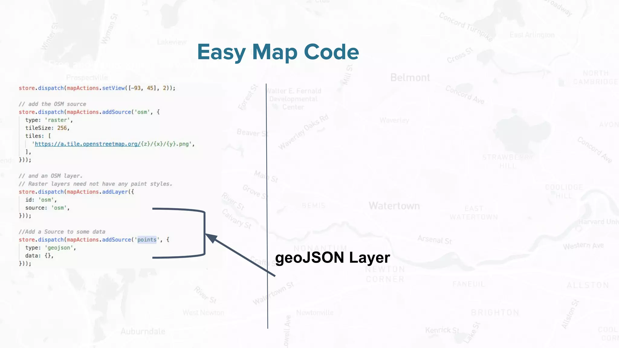
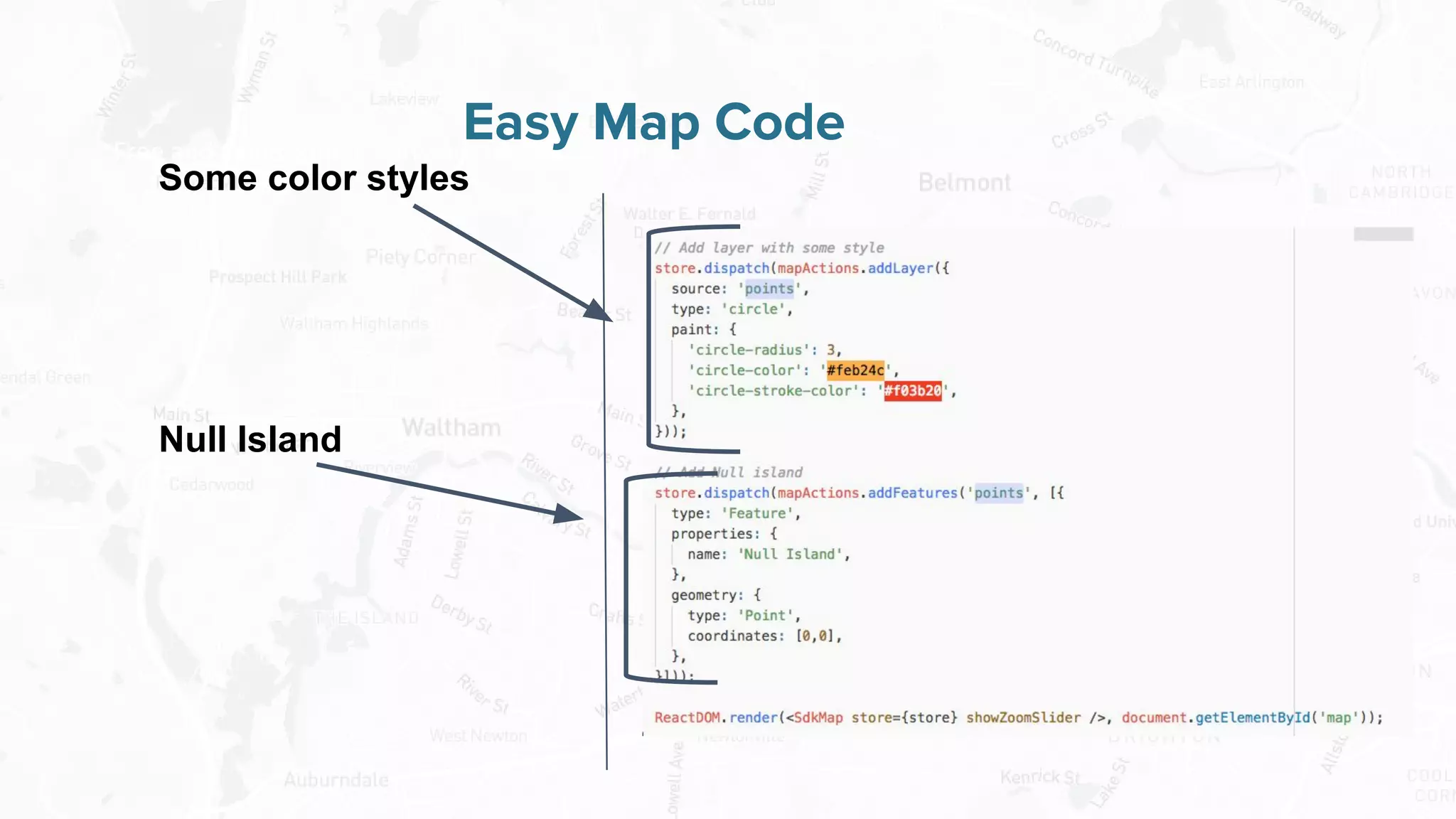
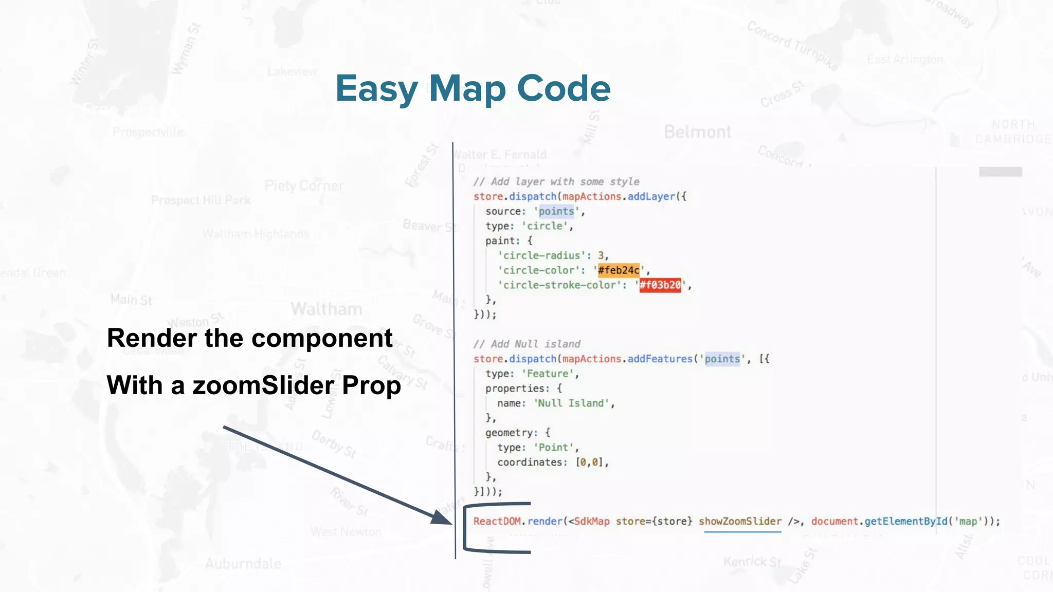
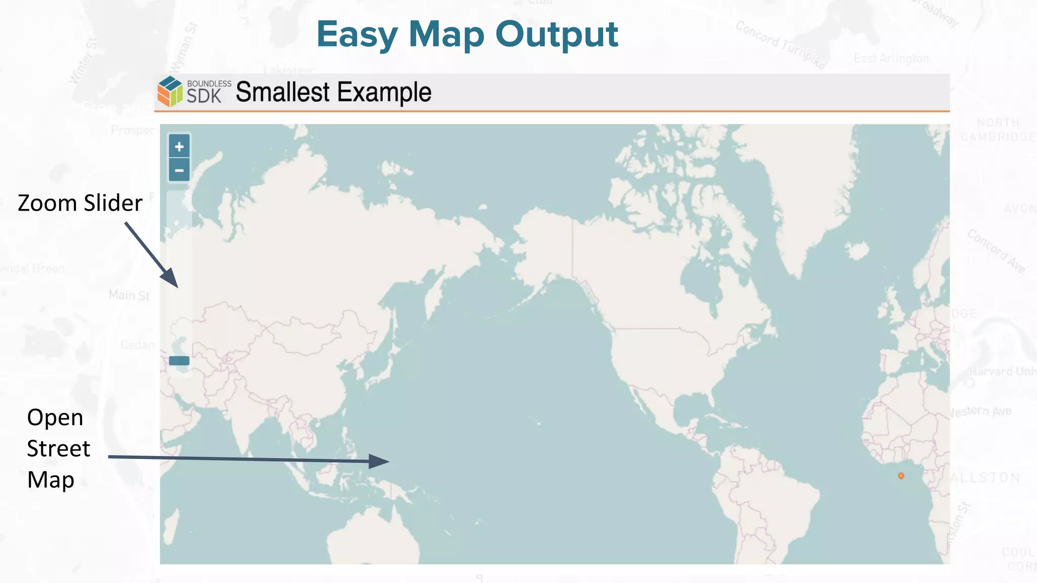
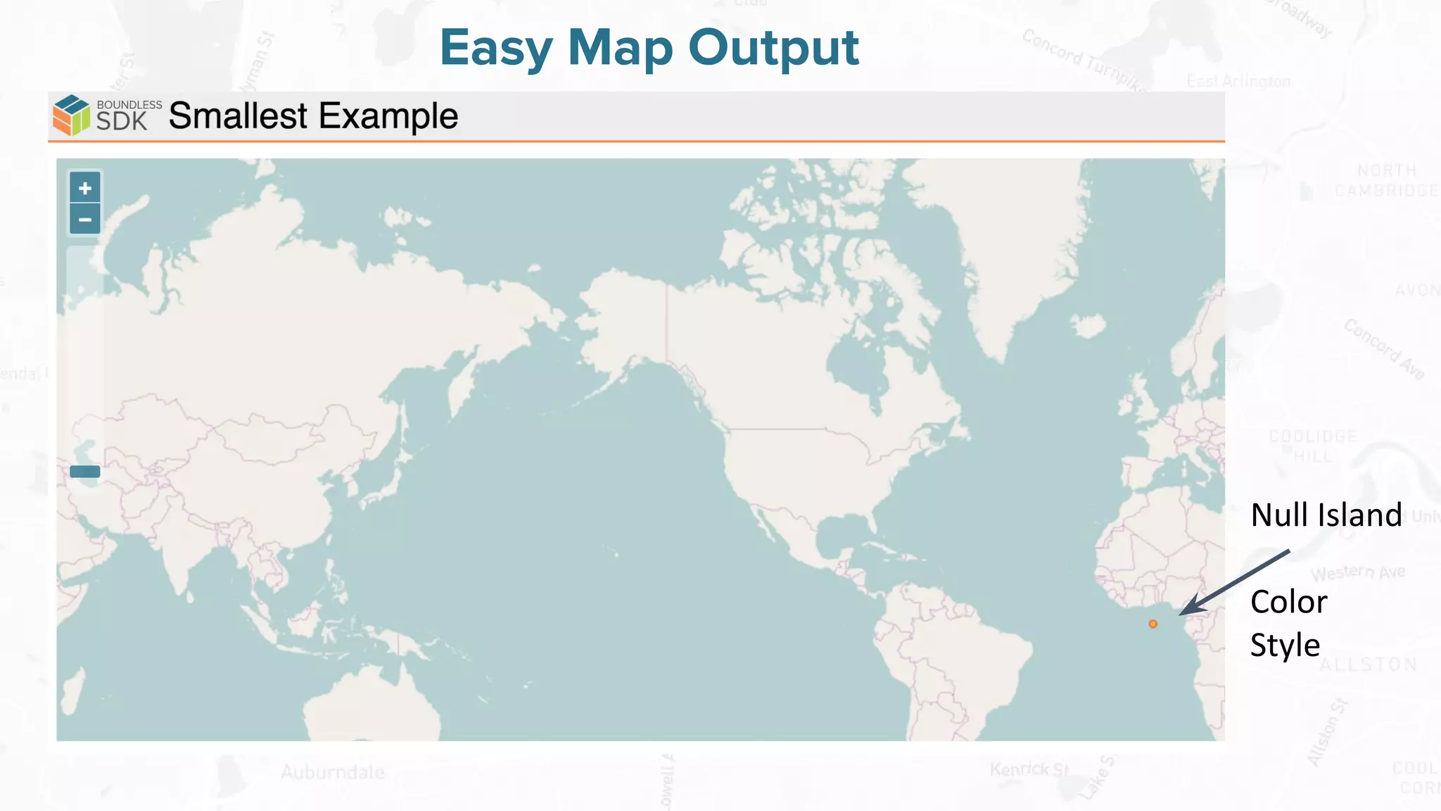

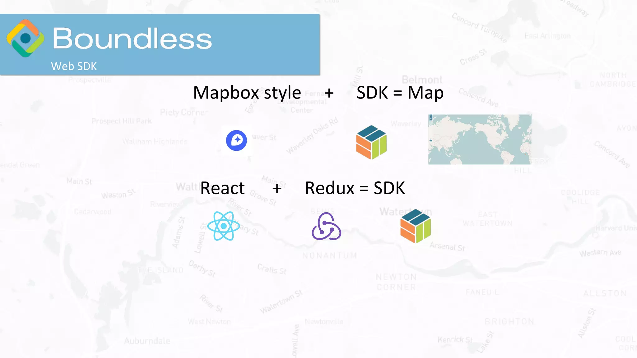
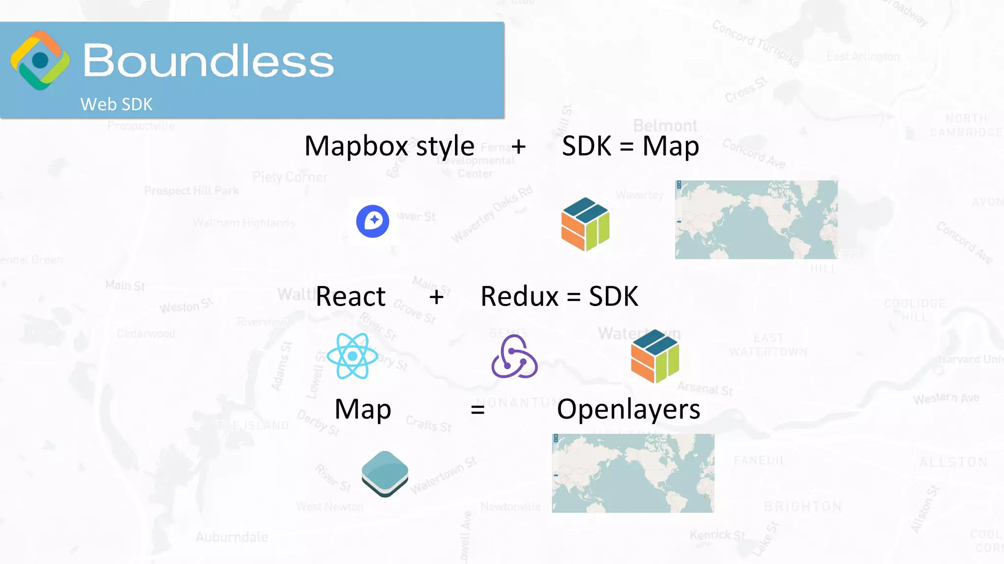
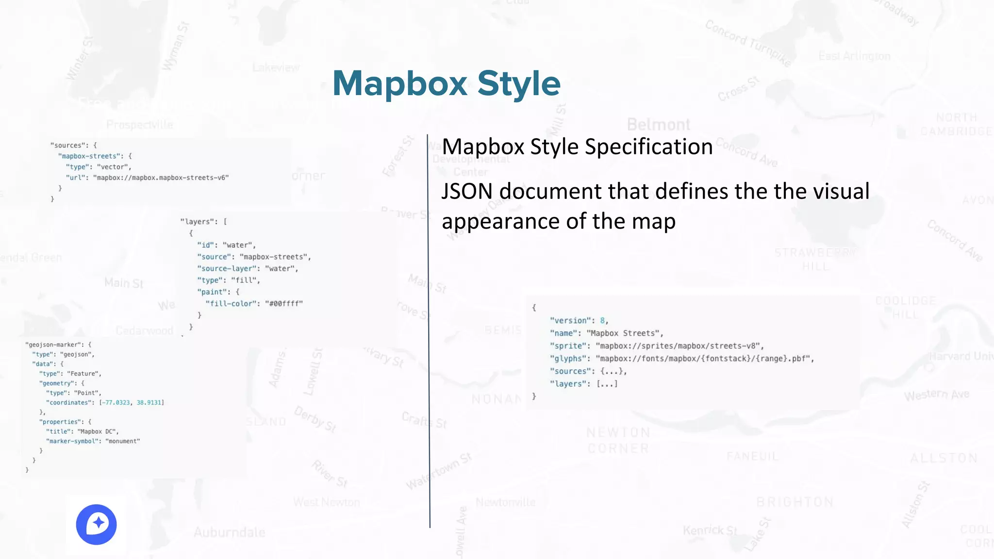
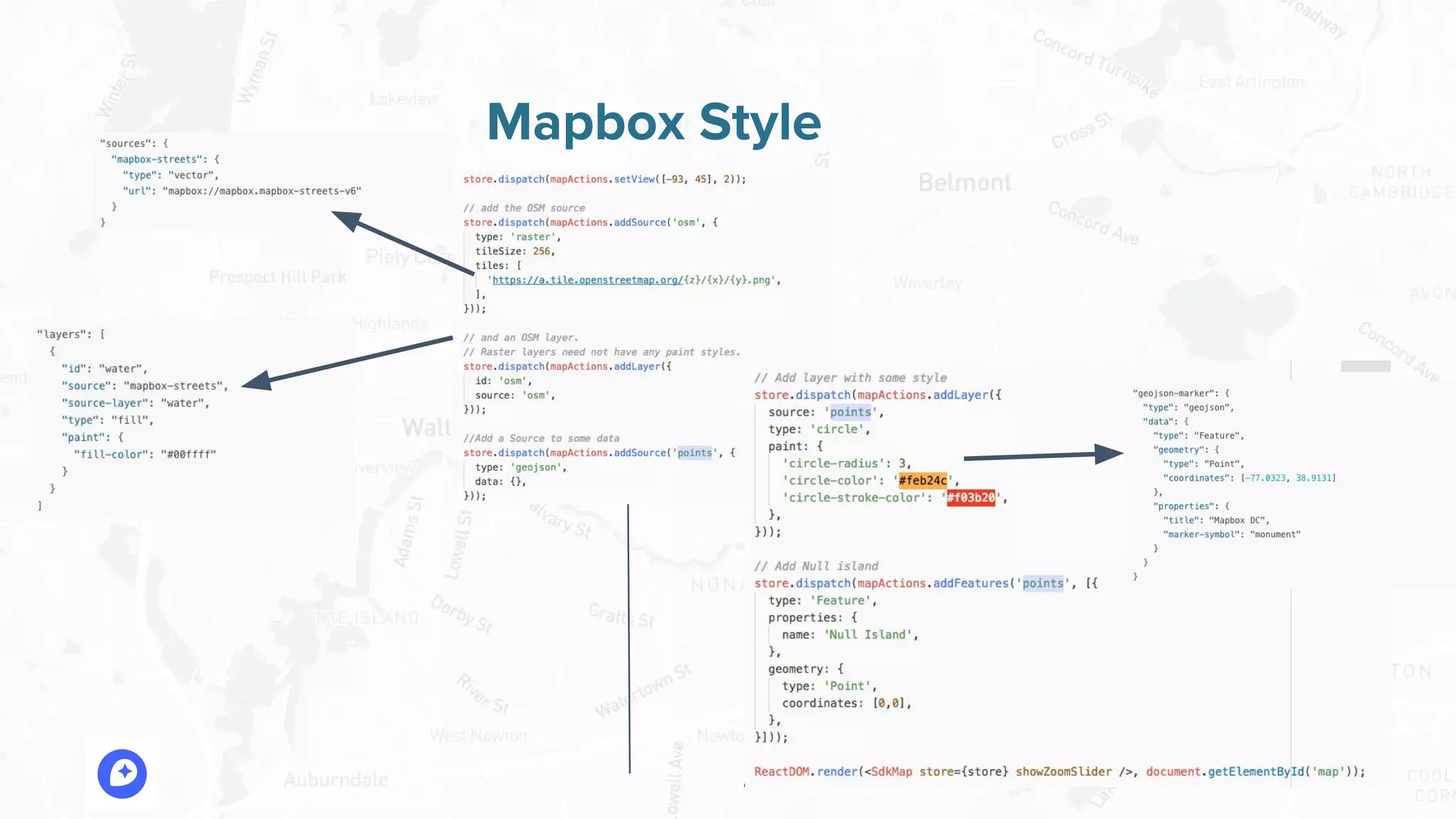
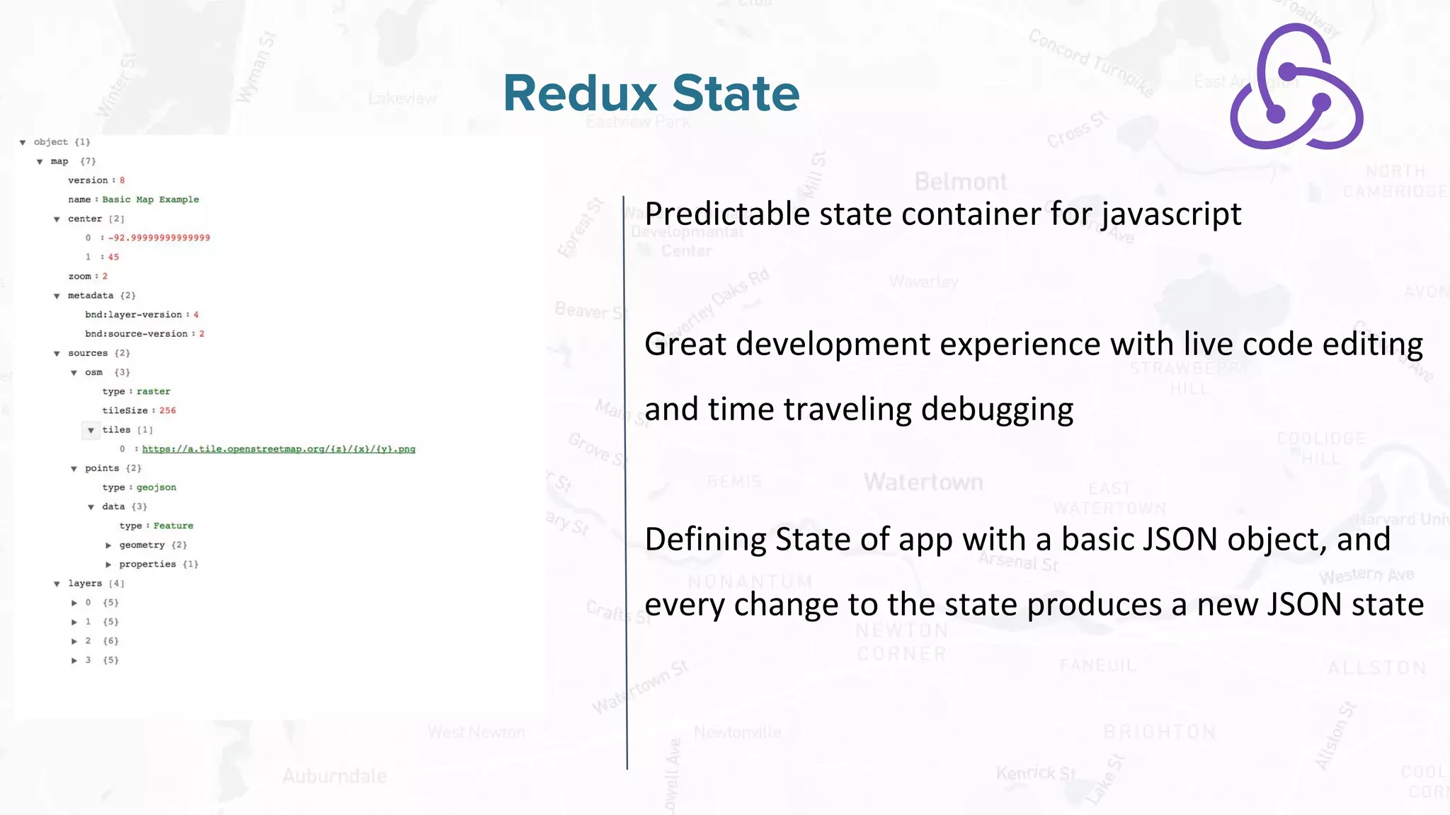
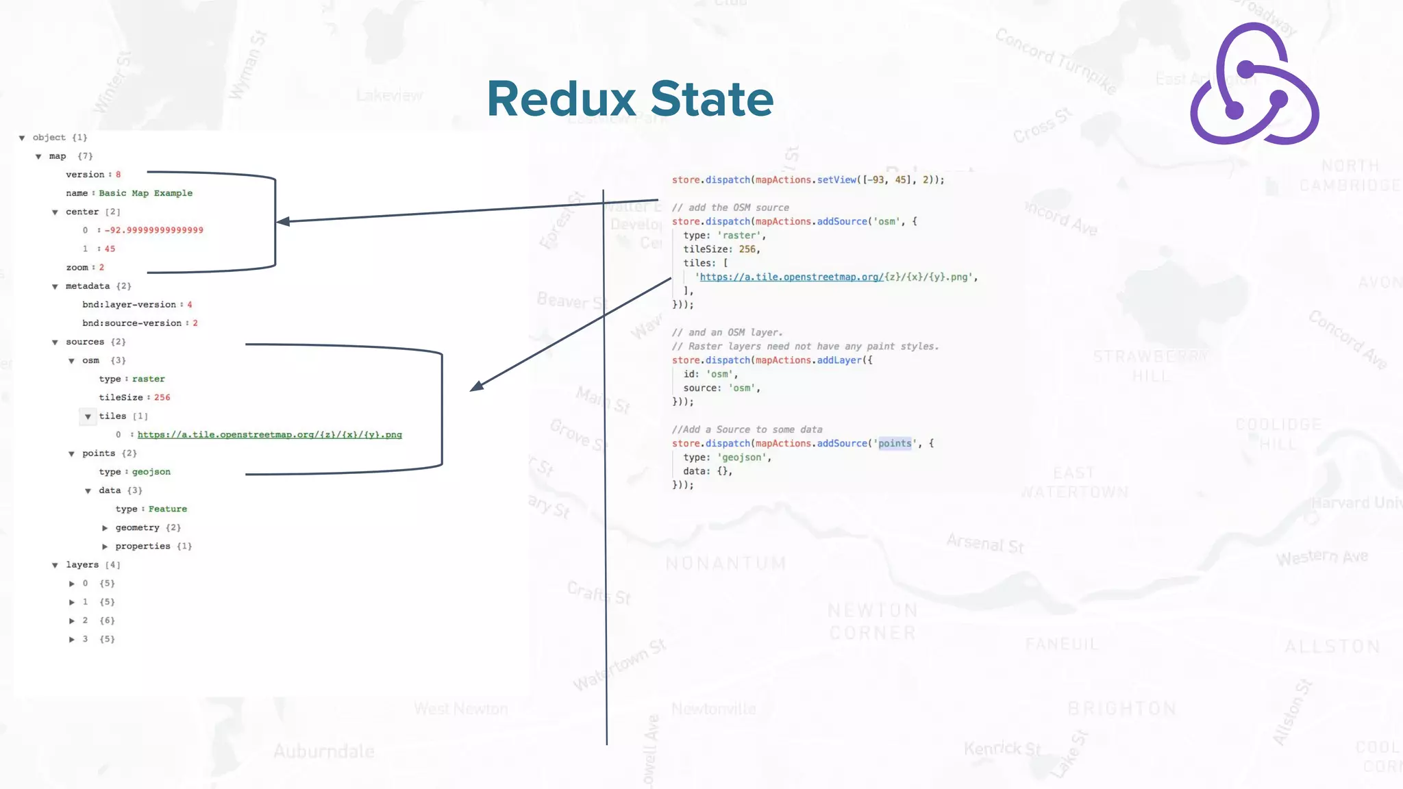
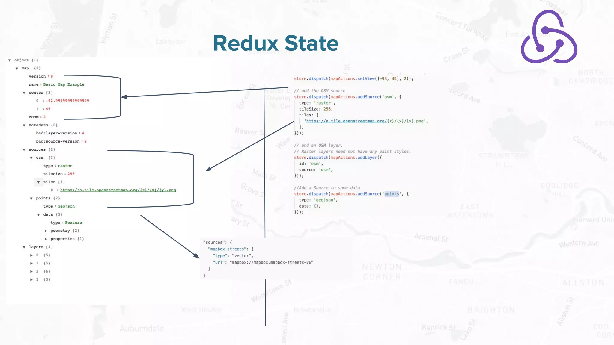
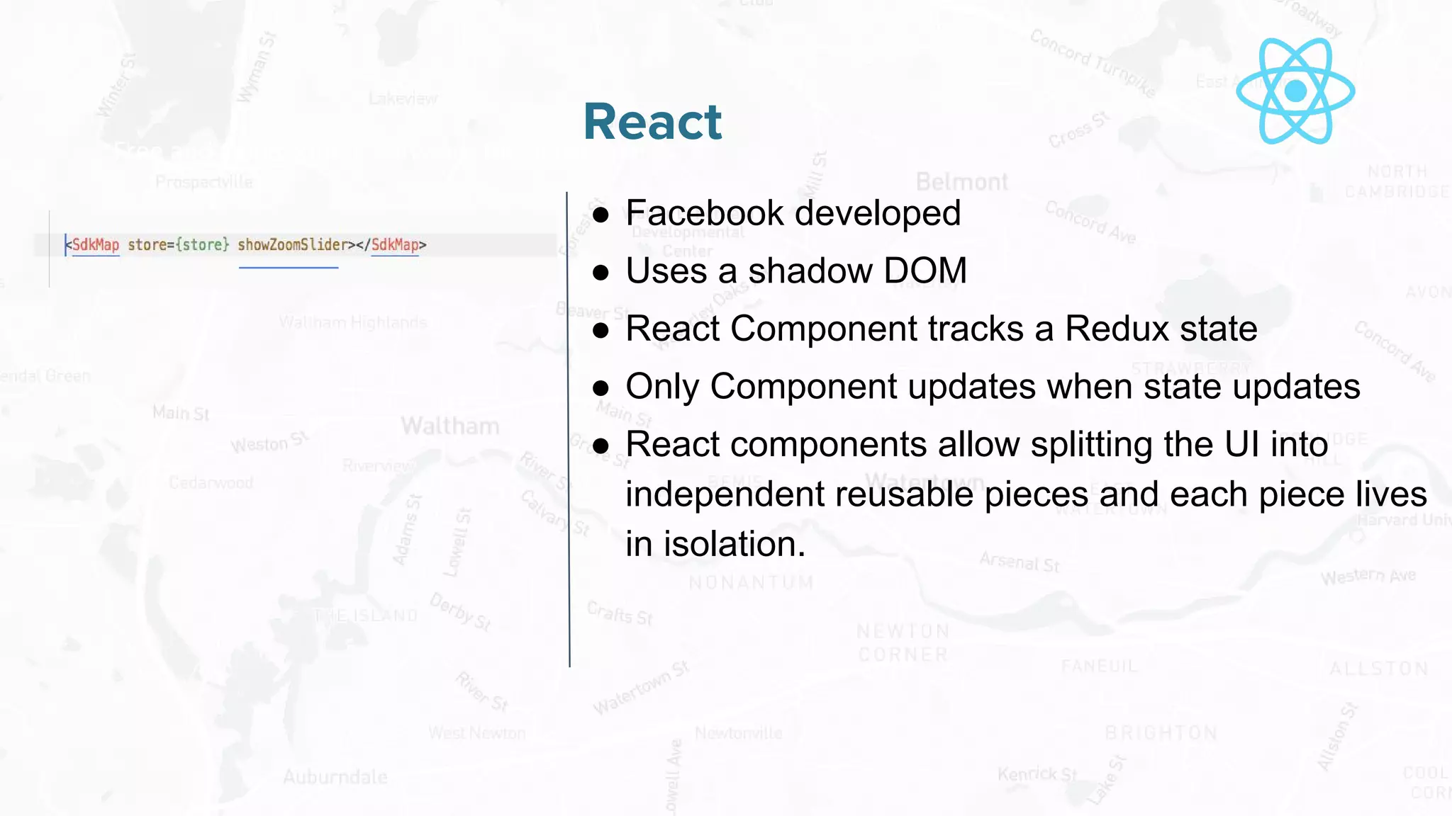
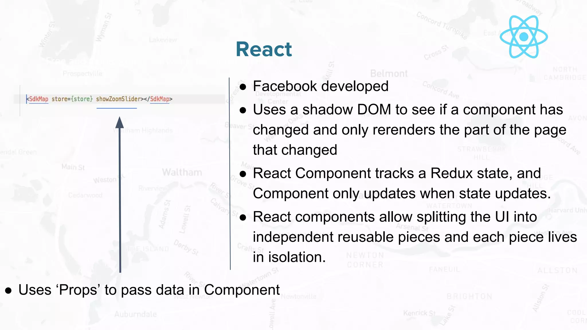
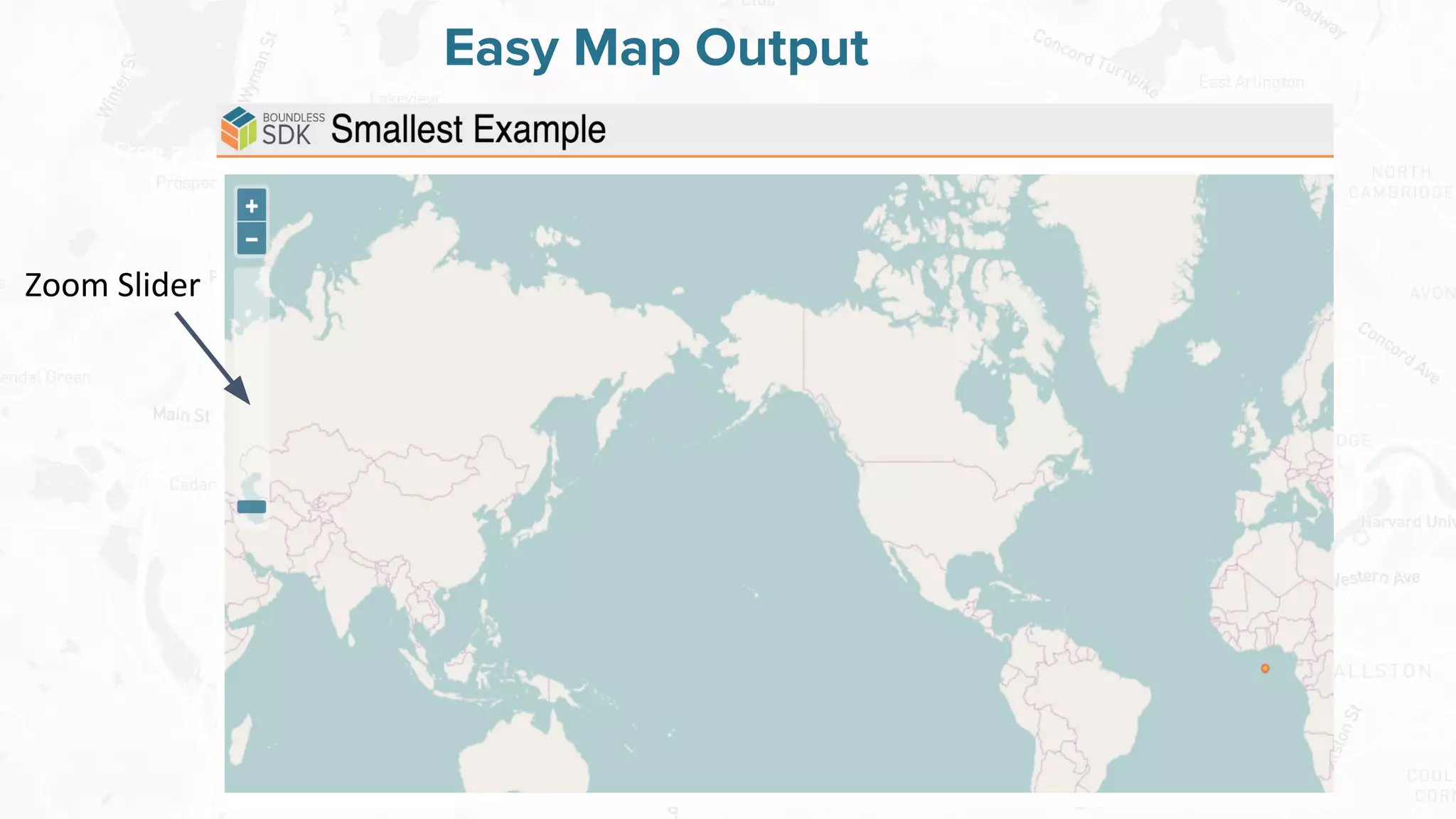

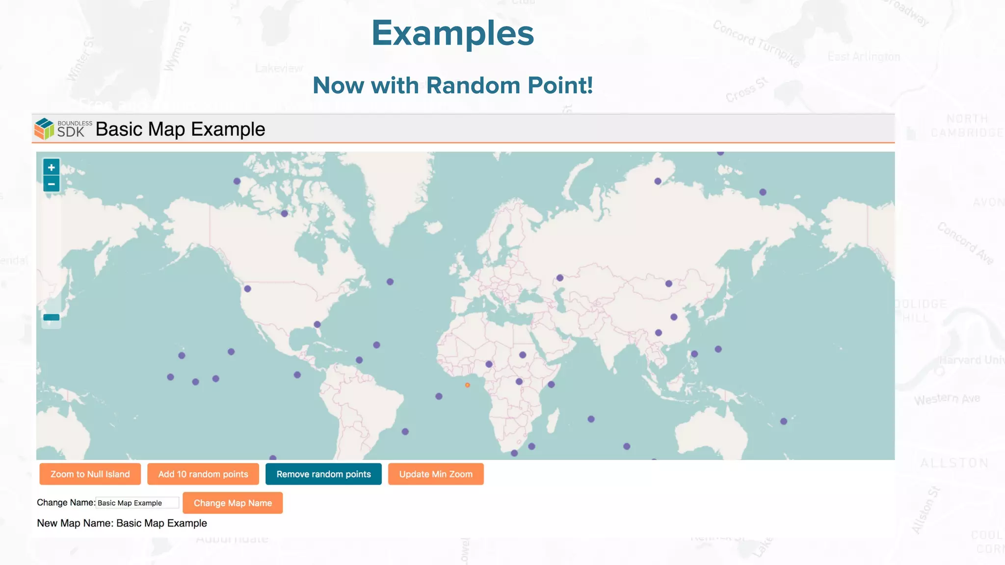
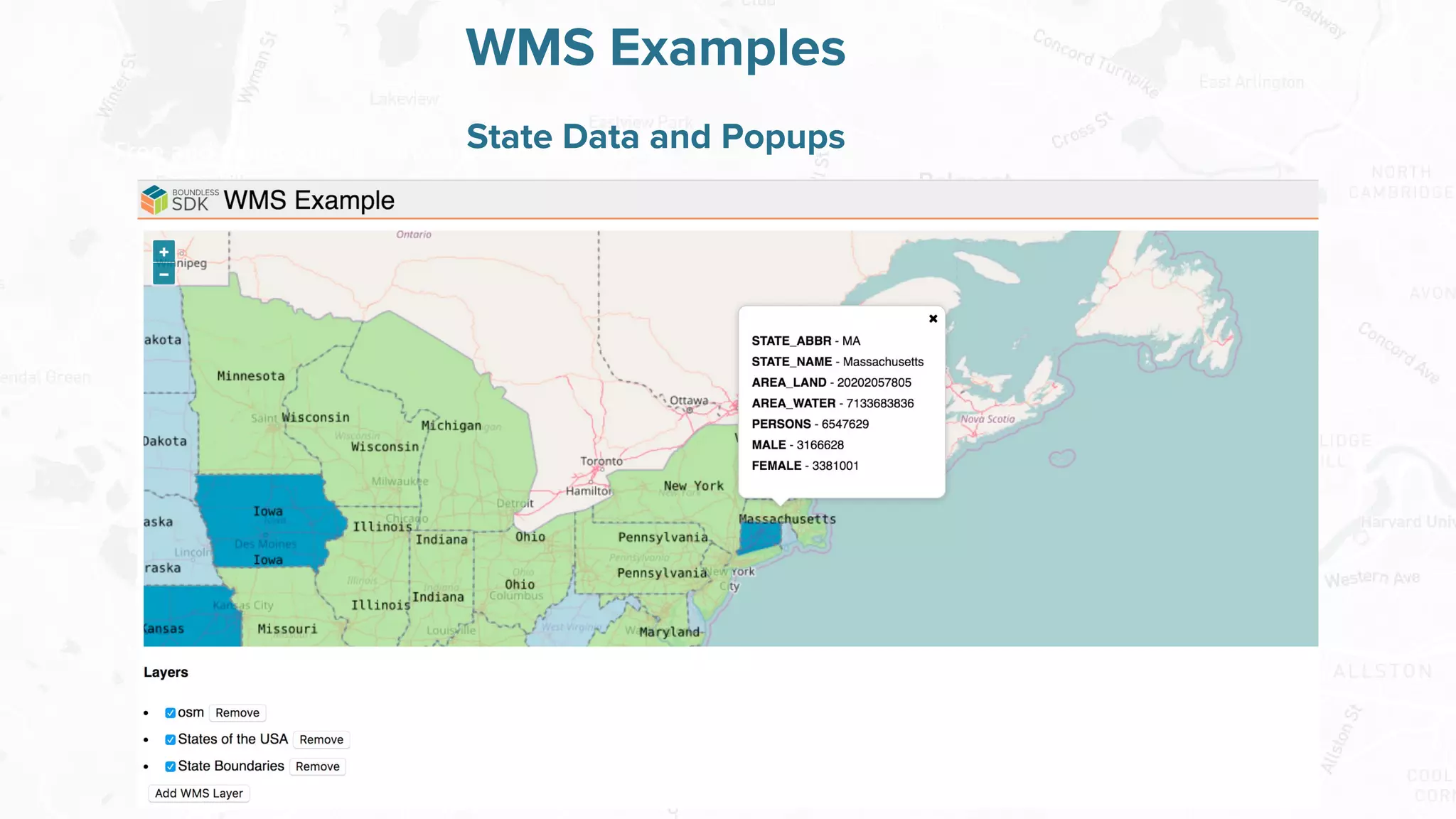
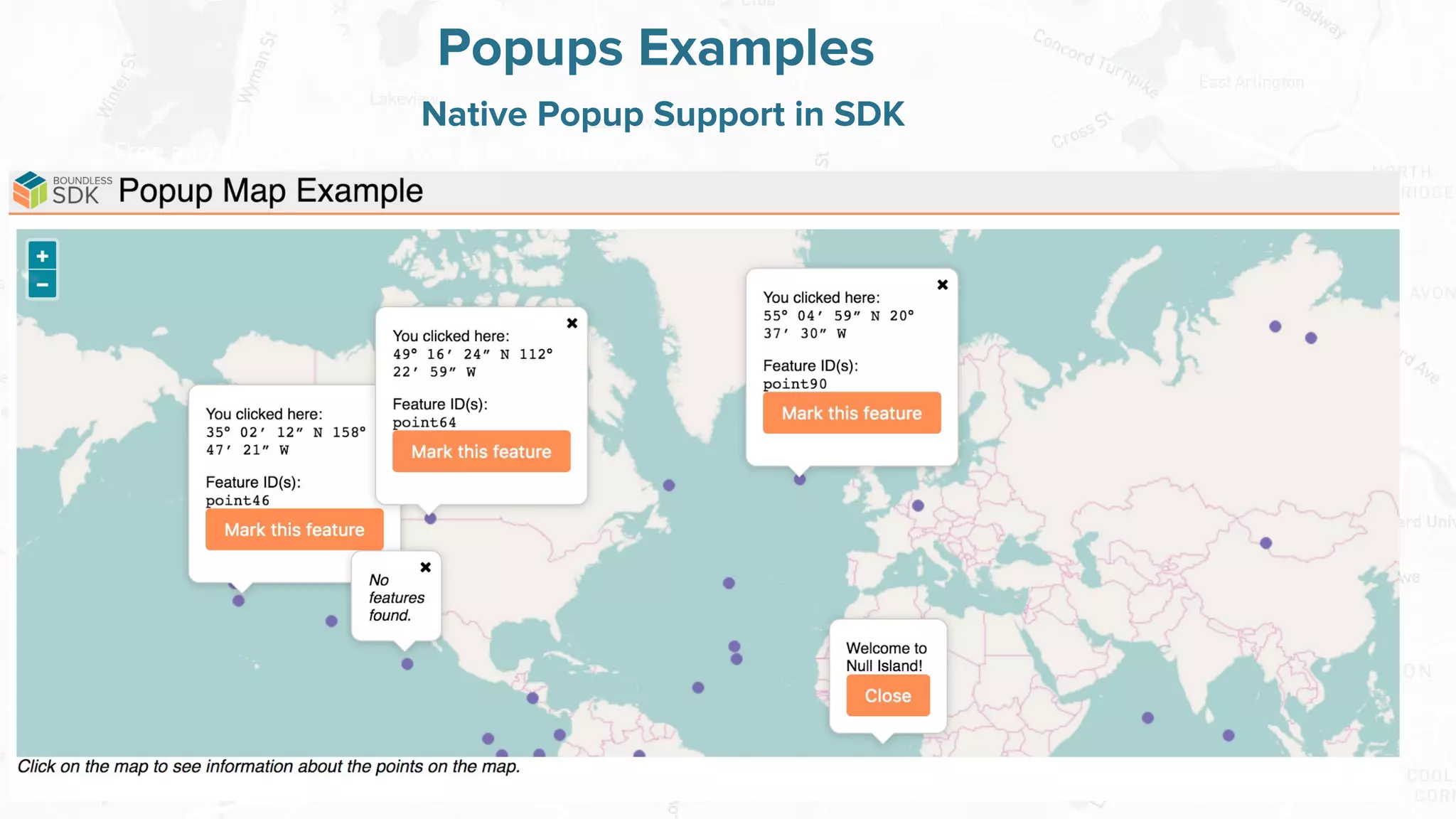


The document introduces the Boundless Web SDK, a tool for creating web maps using open source software and technologies like JavaScript, React, and Redux. It discusses the benefits of using web maps for sharing geospatial data easily and highlights features of the SDK, including code import and map styling. The document also invites developers to participate in the beta release and contribute to the open source project.


![[FOSS4G 2017 Boston]Development of an extension of Geoserver for handling 3D ...](https://cdn.slidesharecdn.com/ss_thumbnails/v2oglr9ztj6rozsfllyr-signature-7a758961d3f50ce339111f96a982ffa97fdeafa443a72eaf3f00f44b1d62f961-poli-170822063420-thumbnail.jpg?width=600ounds&width=560&fit=bounds)


