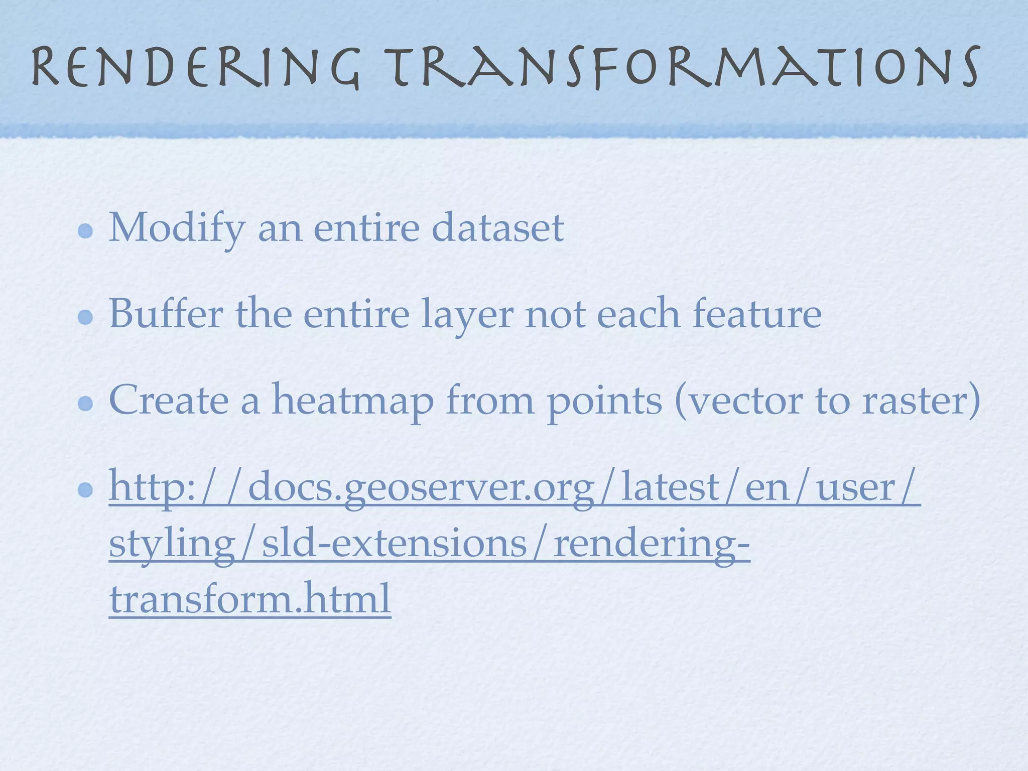
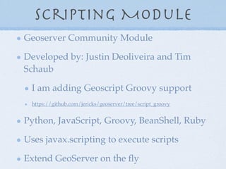
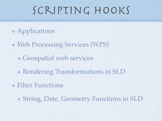
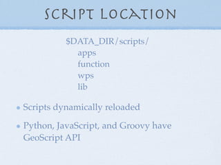
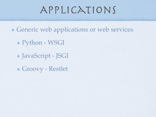
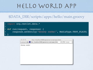
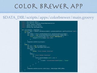
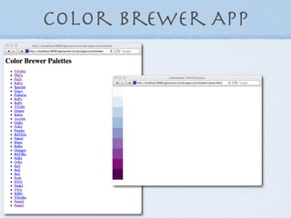
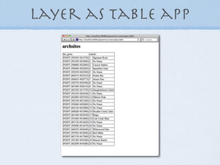
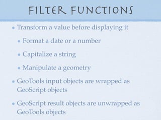
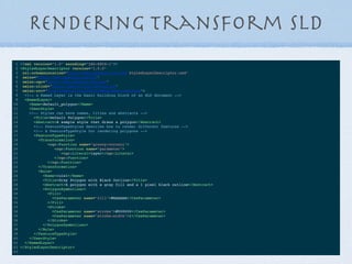
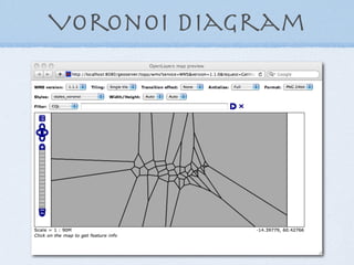
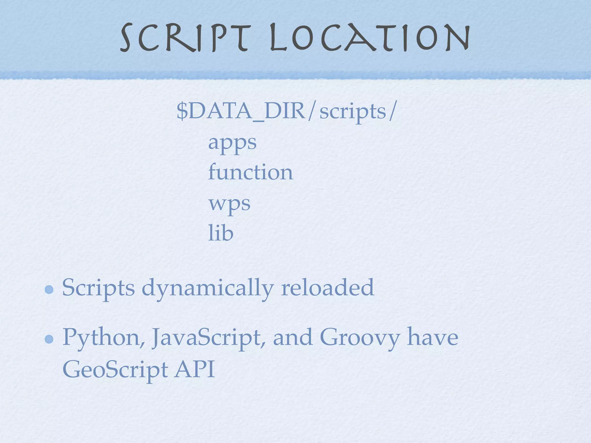
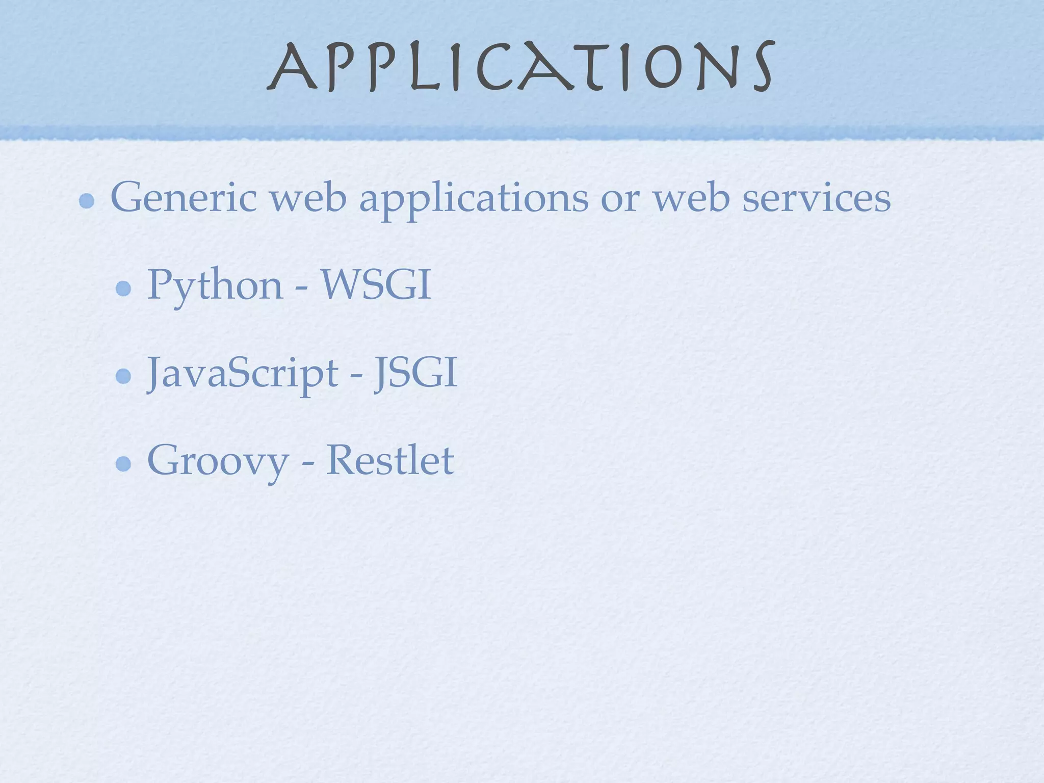
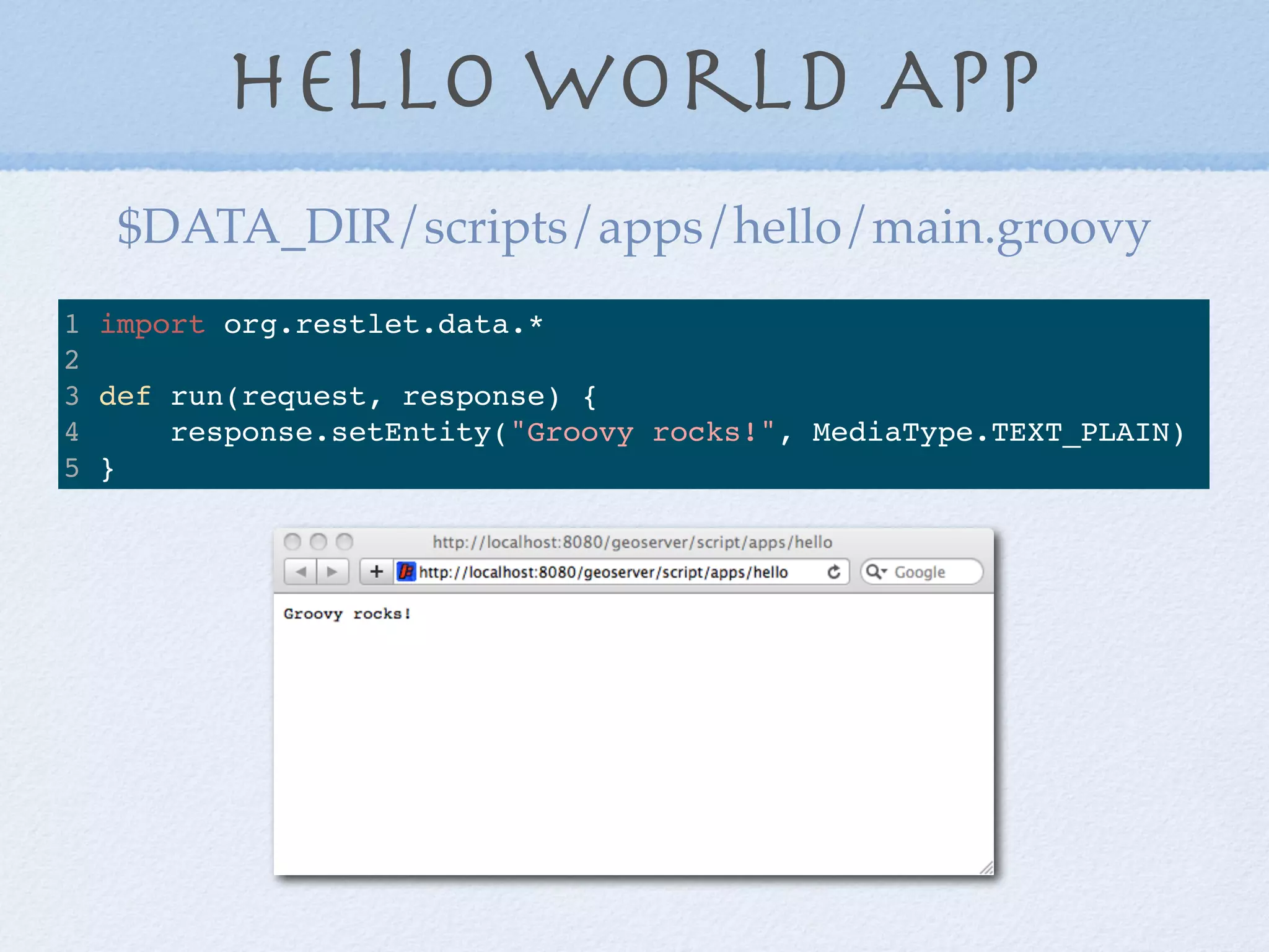
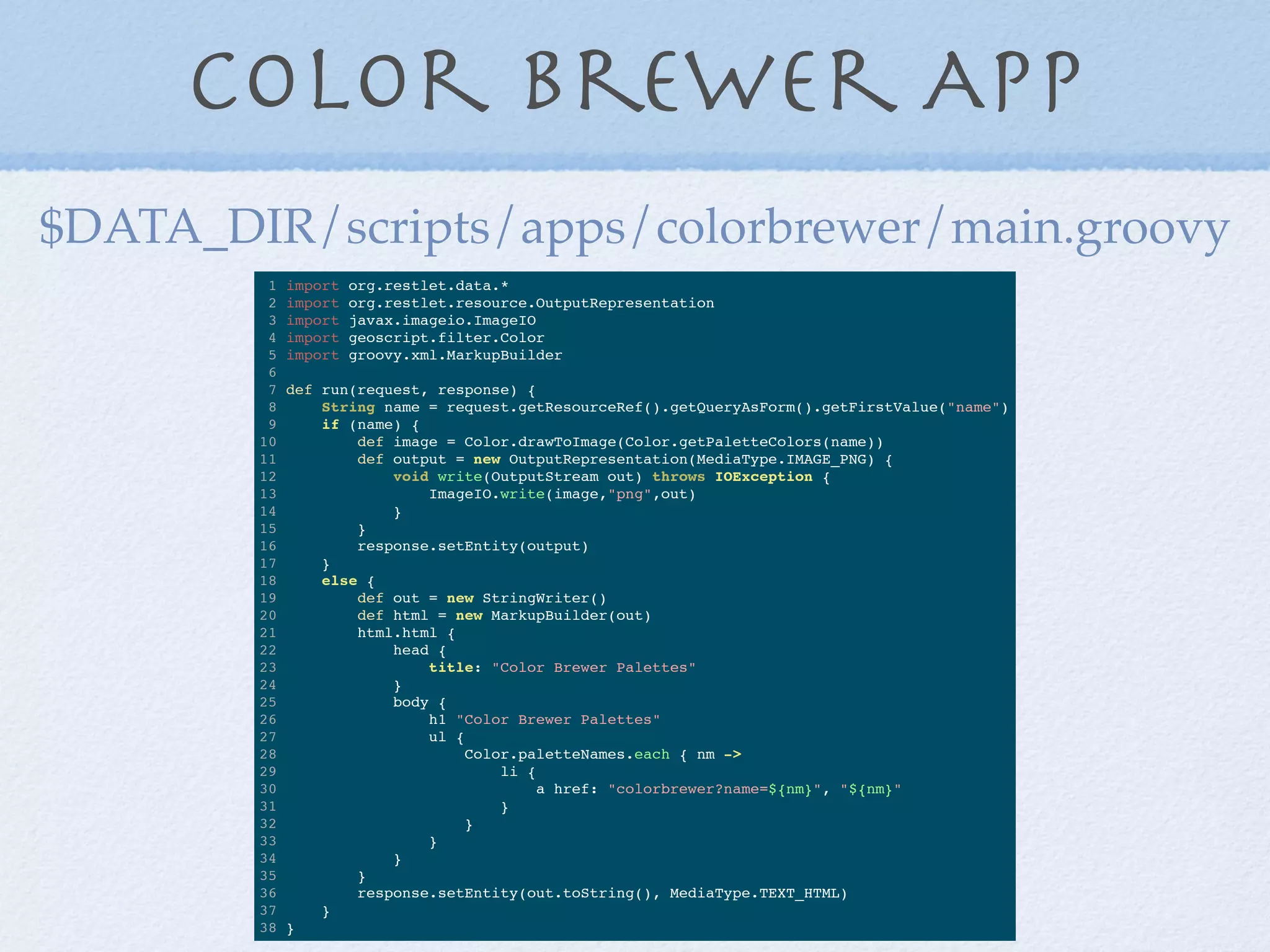
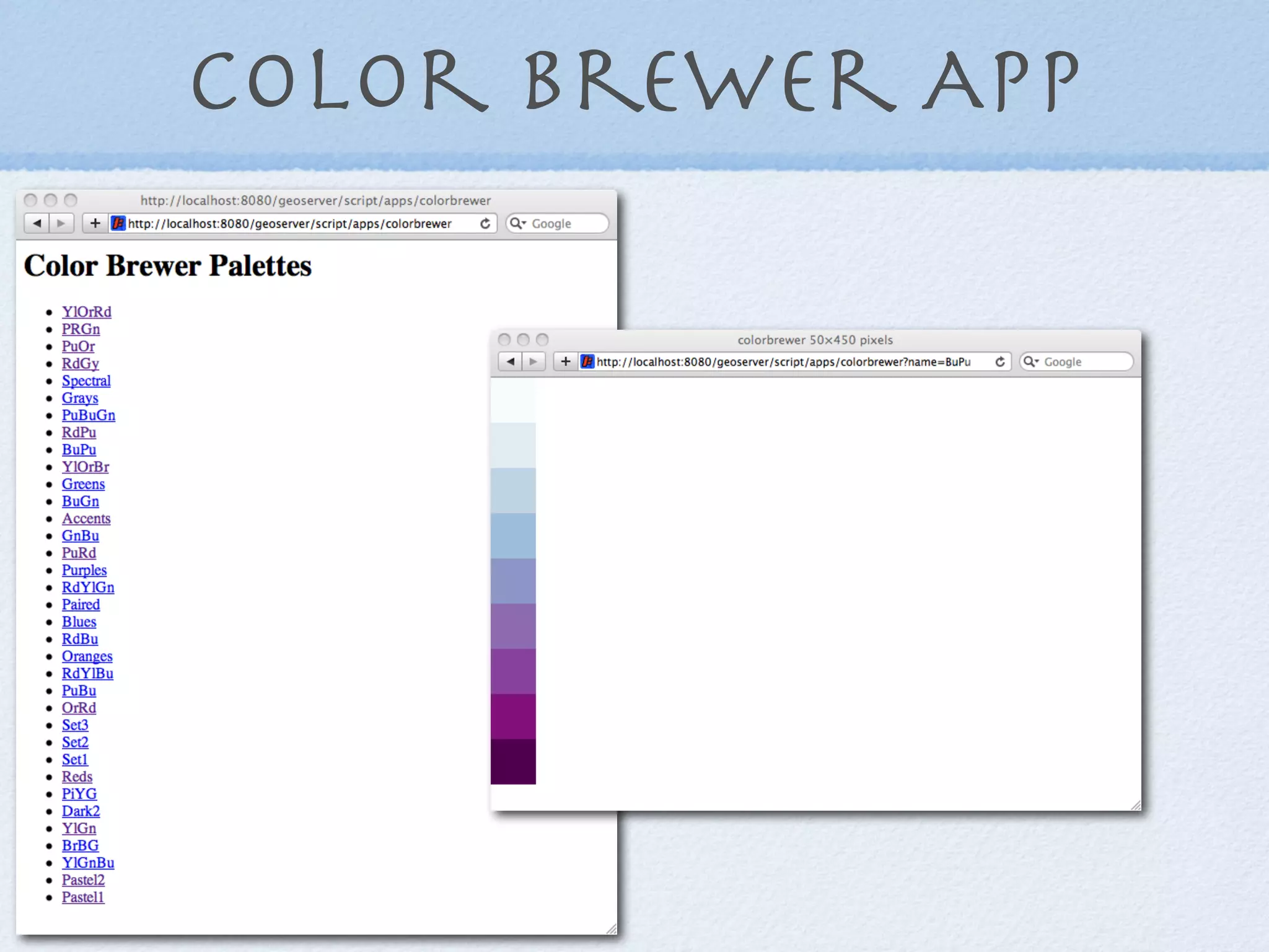
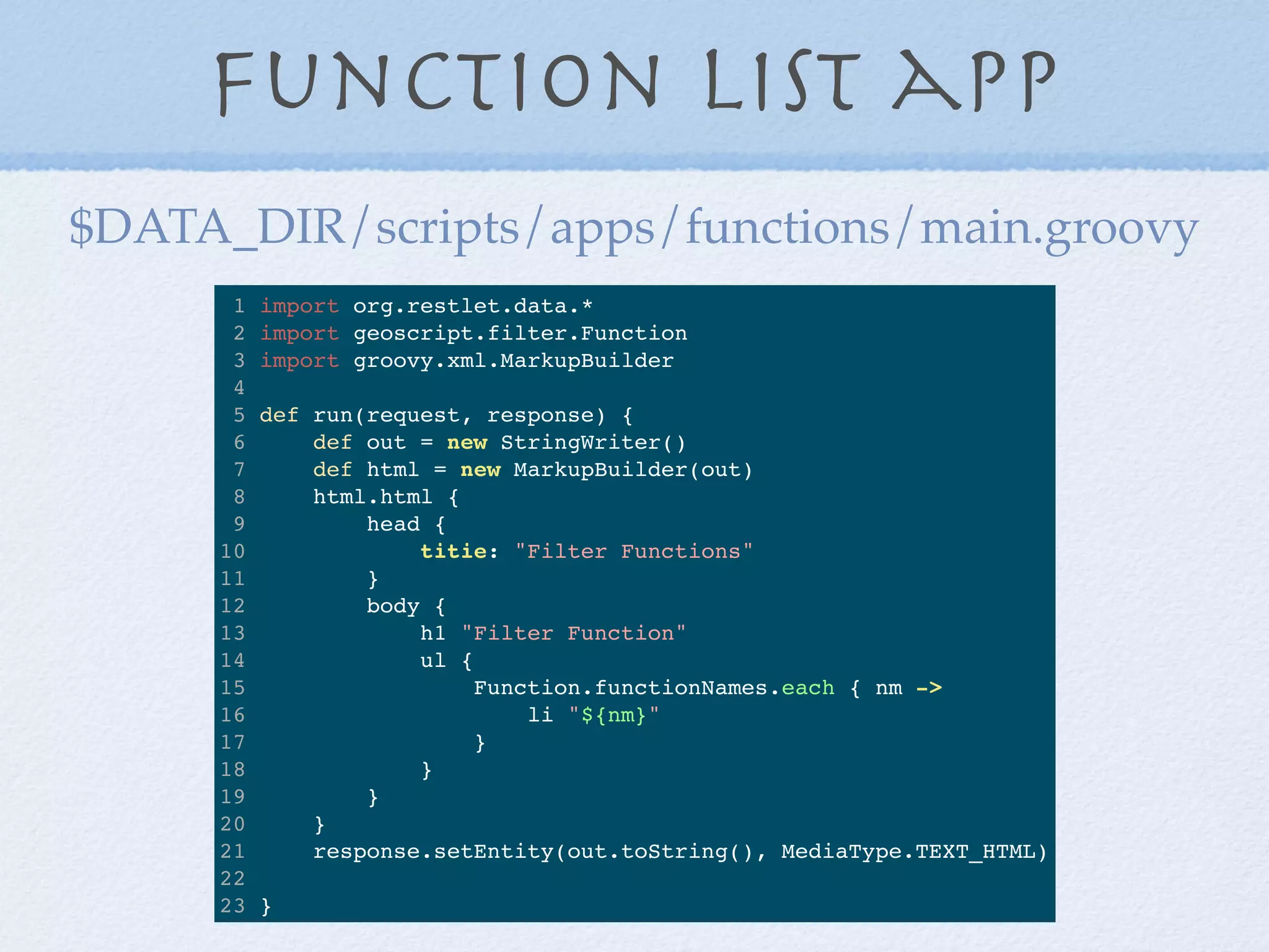
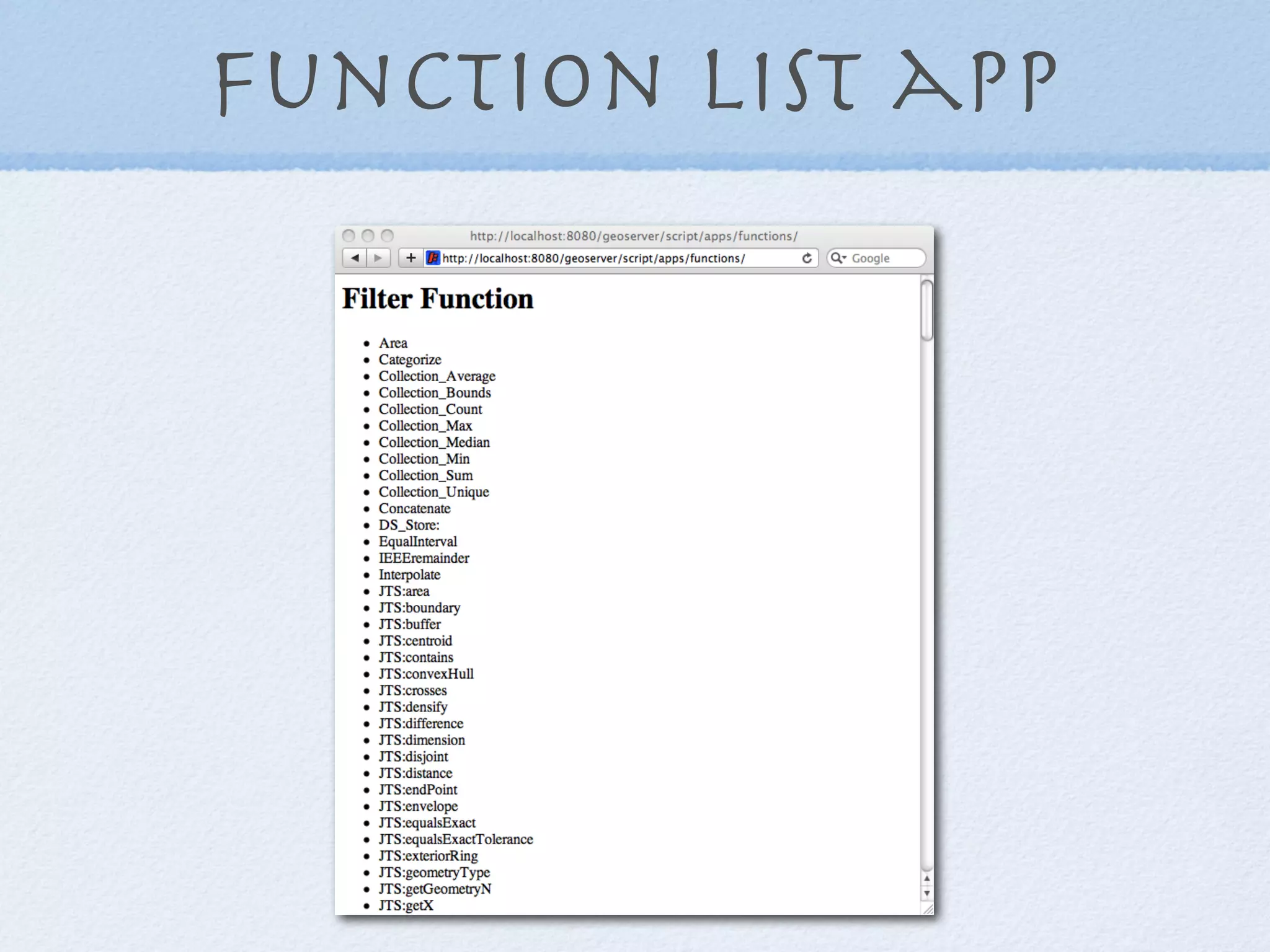
This document discusses how to extend GeoServer functionality through scripting. It describes a community module that allows scripts to be written in languages like Groovy, Python and JavaScript. These scripts can be used to create web applications and services, custom filter functions, and rendering transformations. Examples are provided of color brewer and layer display apps, geometry buffer functions, and a Voronoi diagram WPS process built with scripts.


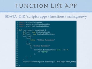
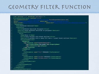
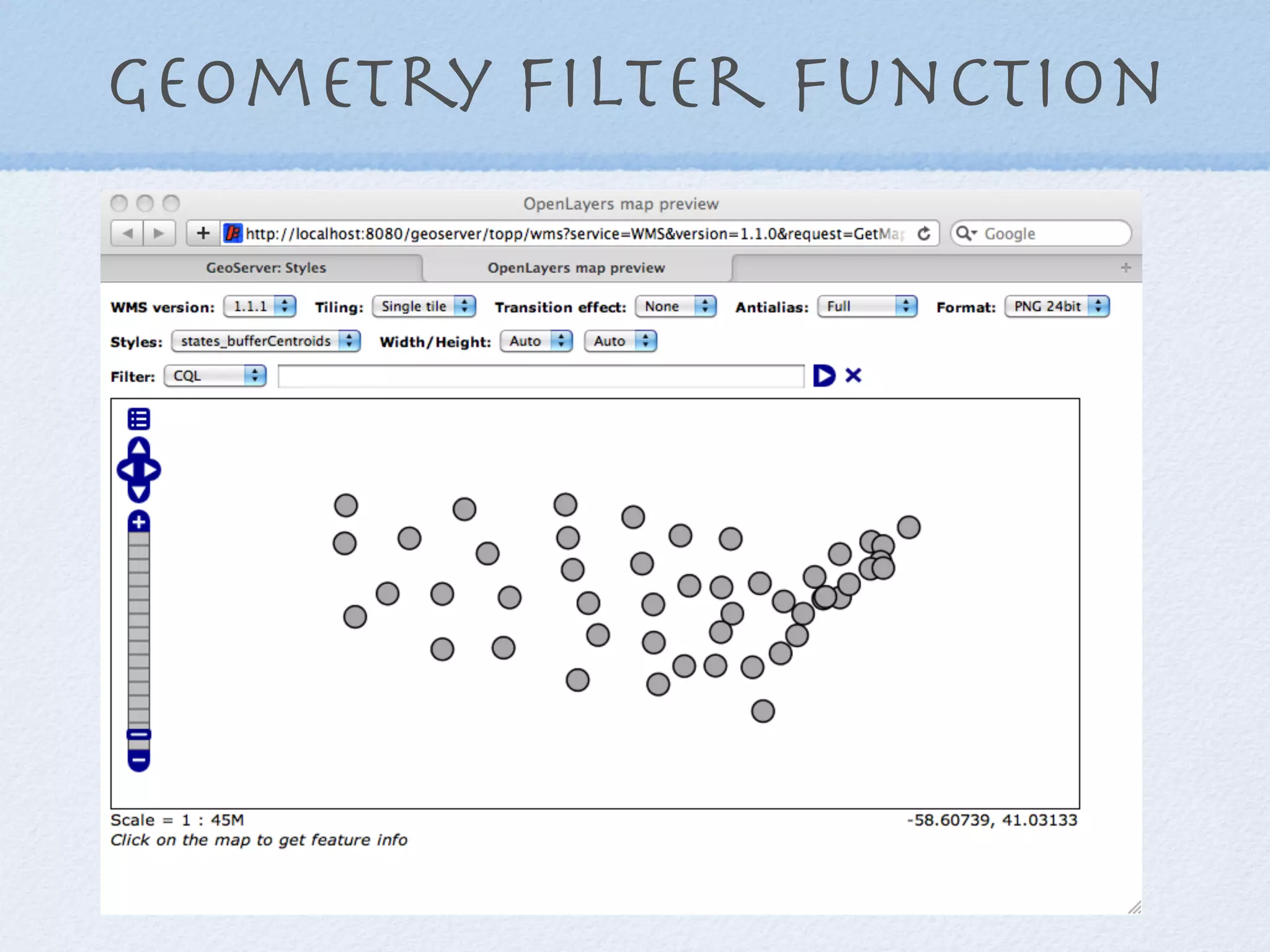
![Filter Function
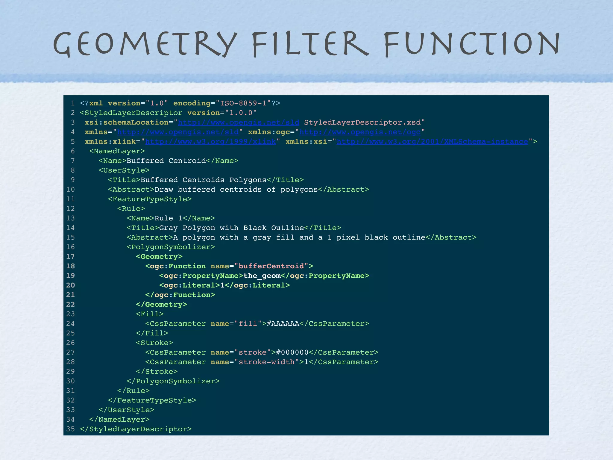
1 /**
2 * Convert a Geometry into a buffered centroid
3 * @param value The Feature
4 * @param args A List of arguments
5 * args[0] is the Geometry
6 * args[1] is the buffer distance
7 */
8 def run(value, args) {
9 args[0].centroid.buffer(args[1] as double)
10 }
$DATA_DIR/scripts/function/bufferCentroid.groovy](https://image.slidesharecdn.com/scriptinggeoserver-130910223049-phpapp01/85/Scripting-GeoServer-16-320.jpg)
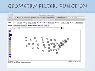
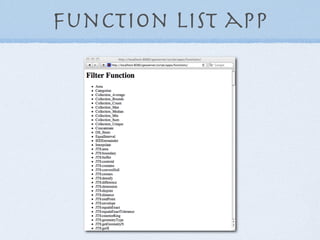
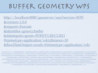
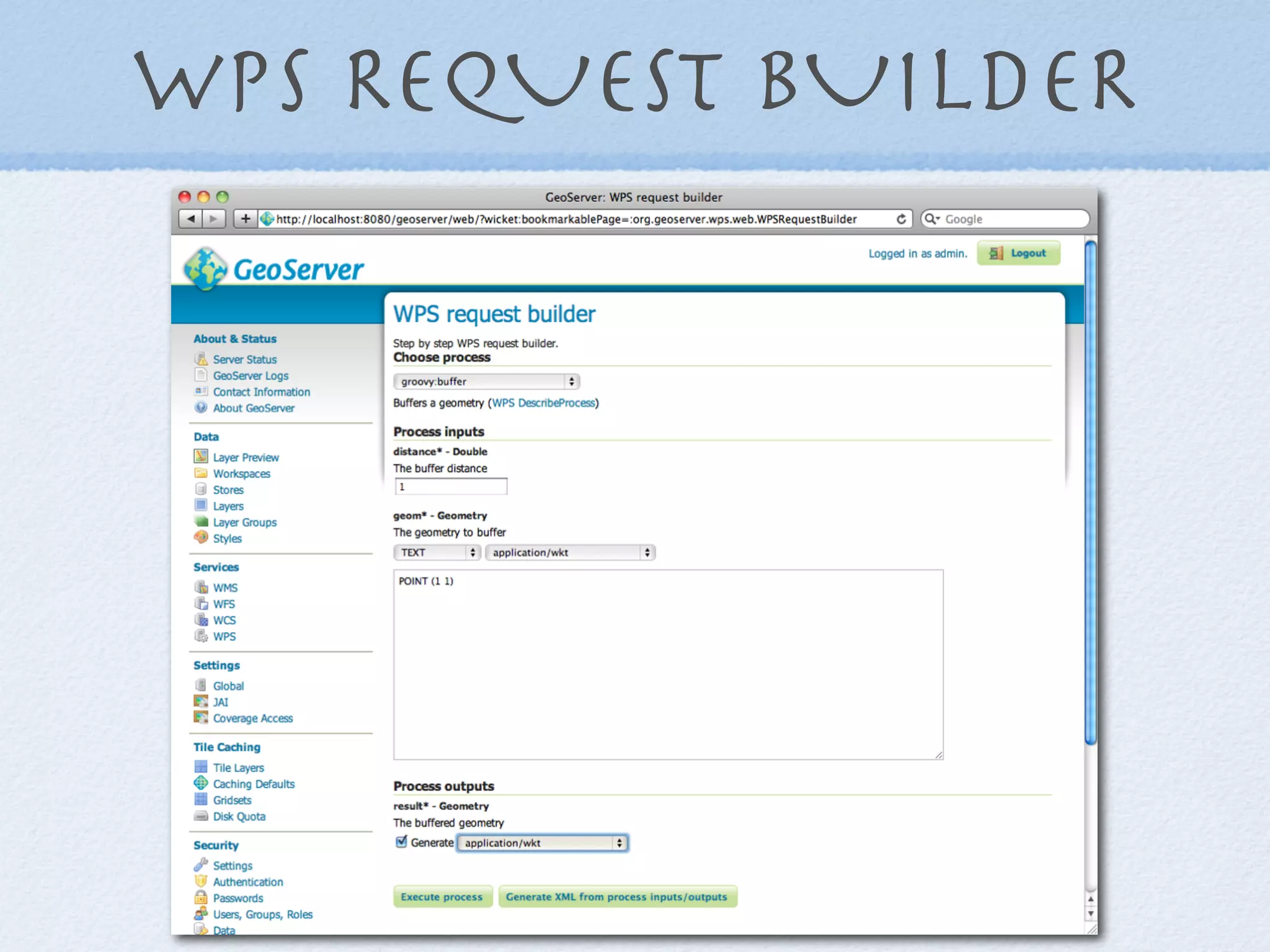
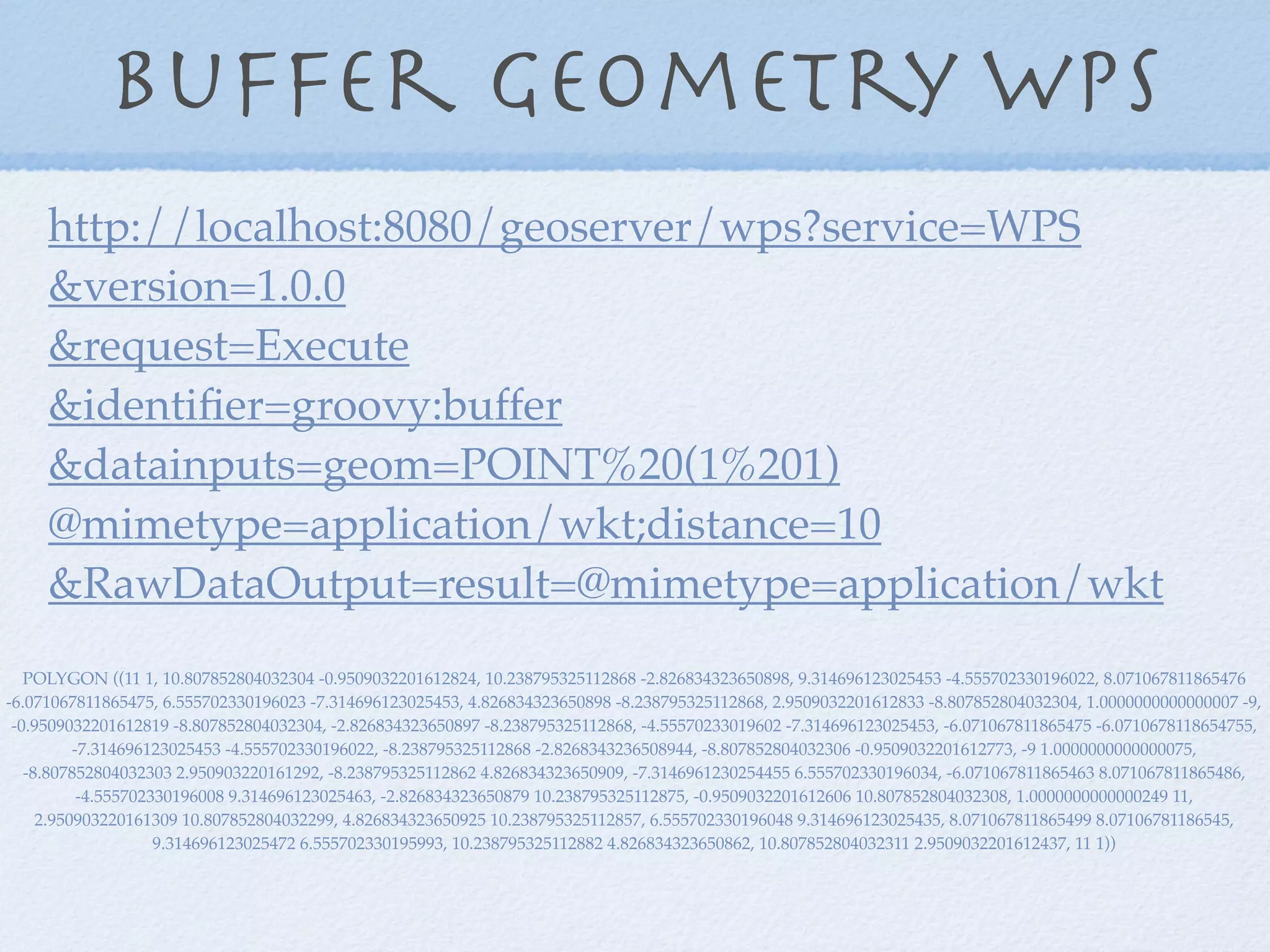
![Geometry Buffer WPS
1 import geoscript.geom.Geometry
2
3 title = 'Buffer'
4 description = 'Buffers a geometry'
5
6 inputs = [
7 geom: [name: 'geom', title: 'The geometry to buffer', type: Geometry.class],
8 distance: [name: 'distance', title: 'The buffer distance', type: Double.class]
9 ]
10
11 outputs = [
12 result: [name: 'result', title: 'The buffered geometry', type: Geometry.class]
13 ]
14
15 def run(input) {
16 [result: input.geom.buffer(input.distance as double)]
17 }
18
$DATA_DIR/scripts/wps/buffer.groovy](https://image.slidesharecdn.com/scriptinggeoserver-130910223049-phpapp01/85/Scripting-GeoServer-20-320.jpg)

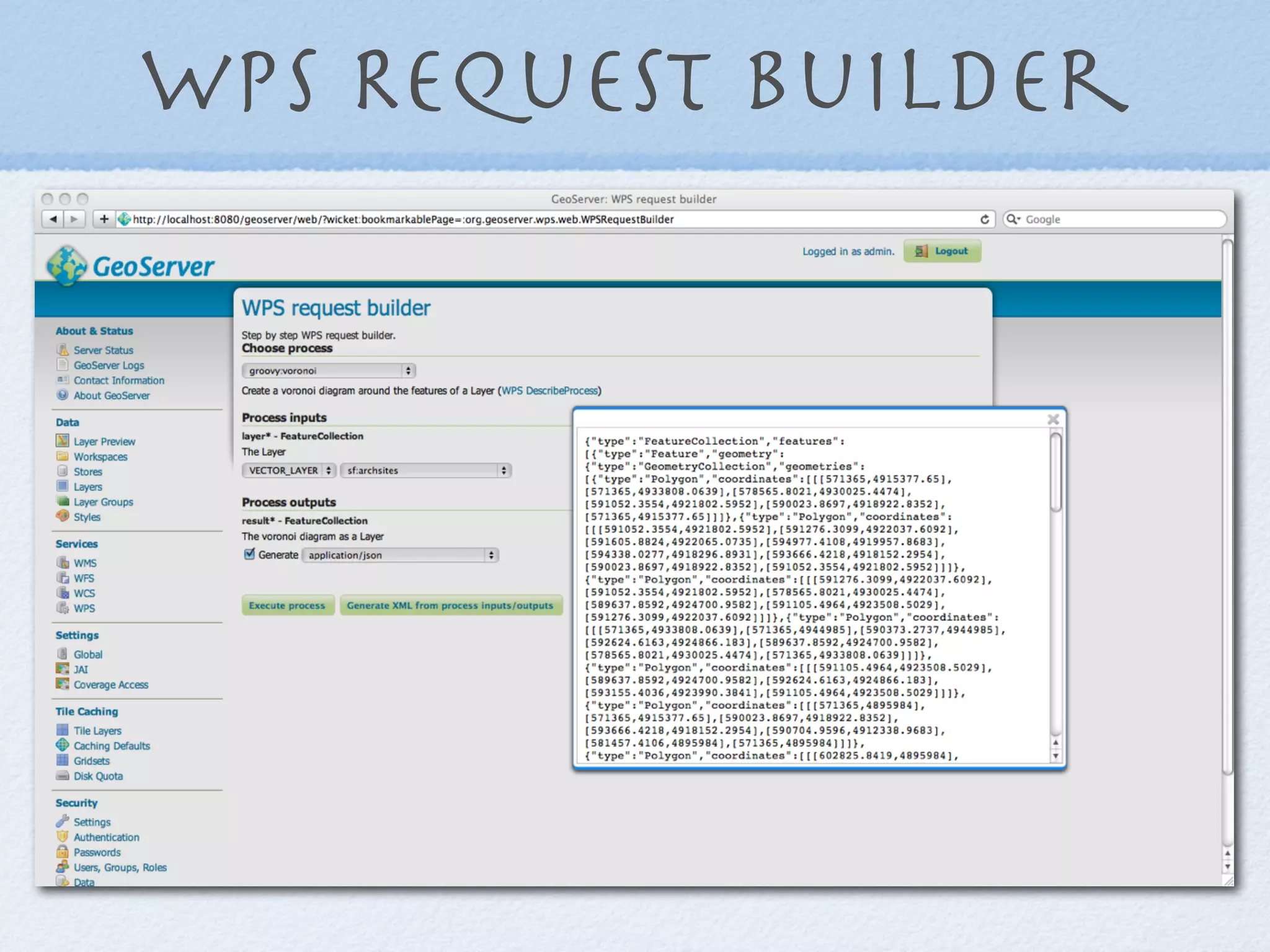
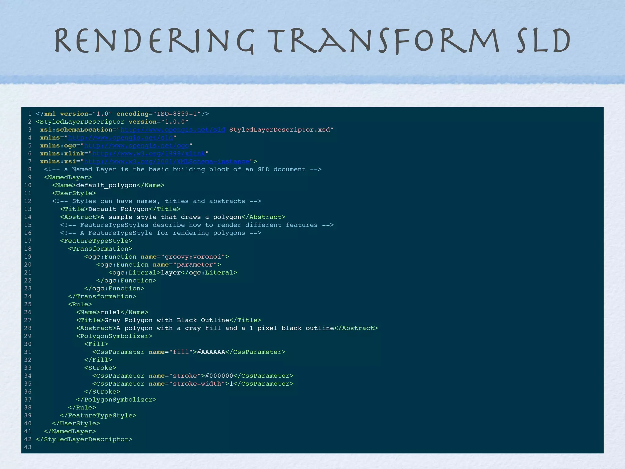
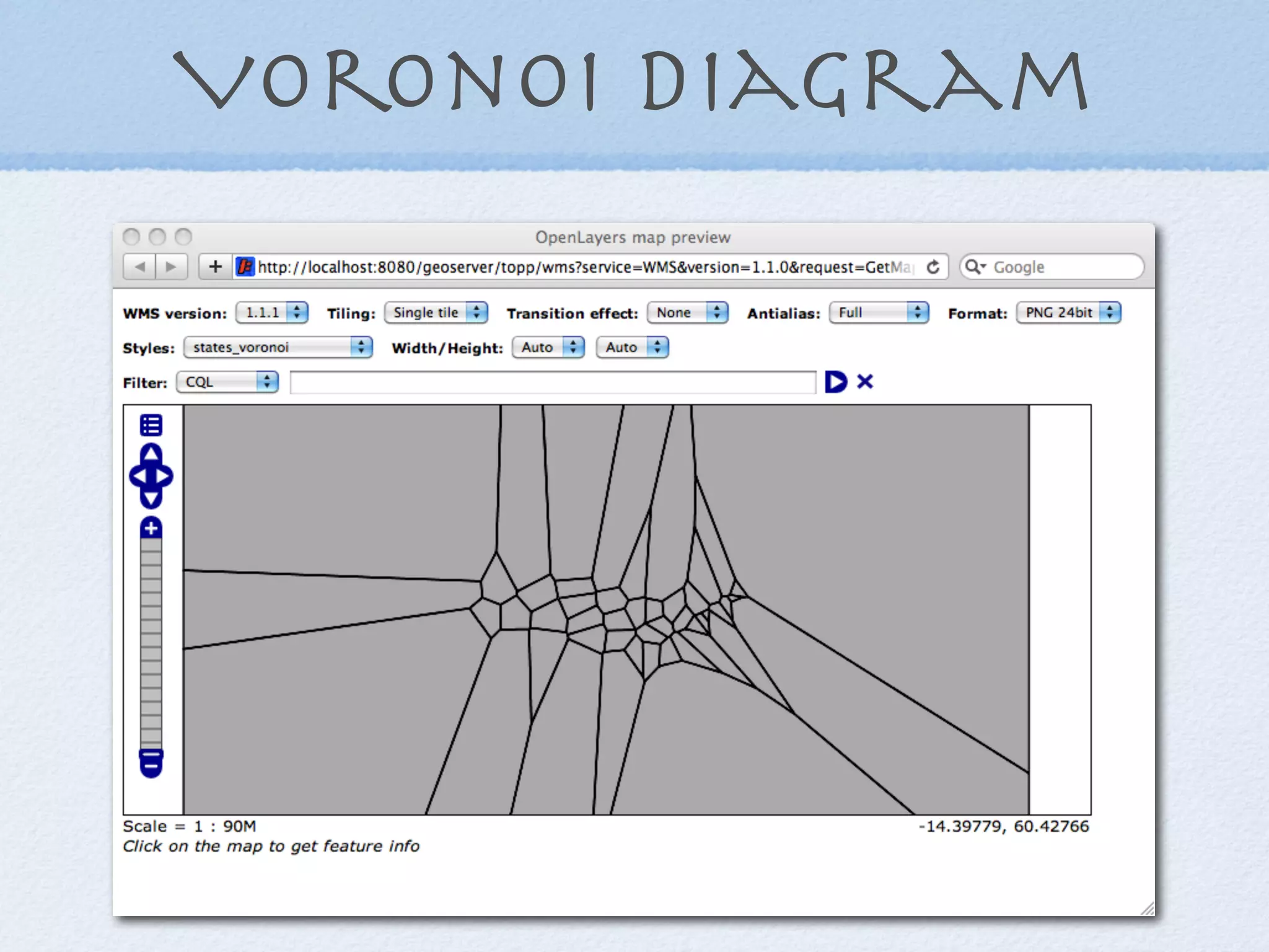
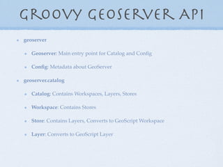
![Voronoi Layer WPS
1 import geoscript.geom.*
2 import geoscript.layer.*
3
4 title = 'VoronoiLayer'
5 description = 'Create a voronoi diagram around the features of a Layer'
6
7 inputs = [
8 layer: [name: 'layer', title: 'The Layer', type: Layer.class],
9 ]
10
11 outputs = [
12 result: [name: 'result', title: 'The voronoi diagram as a Layer', type: Layer.class]
13 ]
14
15 def run(input) {
16 def geoms = new GeometryCollection(input.layer.features*.geom.centroid)
17 def output = new Layer()
18 output.add([geoms.voronoiDiagram])
19 [result: output]
20 }
21
$DATA_DIR/scripts/wps/voronoi.groovy](https://image.slidesharecdn.com/scriptinggeoserver-130910223049-phpapp01/85/Scripting-GeoServer-23-320.jpg)


![Filter Function
1 /**
2 * Convert a Geometry into a buffered centroid
3 * @param value The Feature
4 * @param args A List of arguments
5 * args[0] is the Geometry
6 * args[1] is the buffer distance
7 */
8 def run(value, args) {
9 args[0].centroid.buffer(args[1] as double)
10 }
$DATA_DIR/scripts/function/bufferCentroid.groovy](https://image.slidesharecdn.com/scriptinggeoserver-130910223049-phpapp01/75/Scripting-GeoServer-16-2048.jpg)
![Geometry Buffer WPS
1 import geoscript.geom.Geometry
2
3 title = 'Buffer'
4 description = 'Buffers a geometry'
5
6 inputs = [
7 geom: [name: 'geom', title: 'The geometry to buffer', type: Geometry.class],
8 distance: [name: 'distance', title: 'The buffer distance', type: Double.class]
9 ]
10
11 outputs = [
12 result: [name: 'result', title: 'The buffered geometry', type: Geometry.class]
13 ]
14
15 def run(input) {
16 [result: input.geom.buffer(input.distance as double)]
17 }
18
$DATA_DIR/scripts/wps/buffer.groovy](https://image.slidesharecdn.com/scriptinggeoserver-130910223049-phpapp01/75/Scripting-GeoServer-20-2048.jpg)
![Voronoi Layer WPS
1 import geoscript.geom.*
2 import geoscript.layer.*
3
4 title = 'VoronoiLayer'
5 description = 'Create a voronoi diagram around the features of a Layer'
6
7 inputs = [
8 layer: [name: 'layer', title: 'The Layer', type: Layer.class],
9 ]
10
11 outputs = [
12 result: [name: 'result', title: 'The voronoi diagram as a Layer', type: Layer.class]
13 ]
14
15 def run(input) {
16 def geoms = new GeometryCollection(input.layer.features*.geom.centroid)
17 def output = new Layer()
18 output.add([geoms.voronoiDiagram])
19 [result: output]
20 }
21
$DATA_DIR/scripts/wps/voronoi.groovy](https://image.slidesharecdn.com/scriptinggeoserver-130910223049-phpapp01/75/Scripting-GeoServer-23-2048.jpg)