Download to read offline
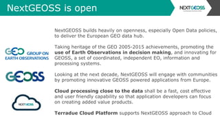

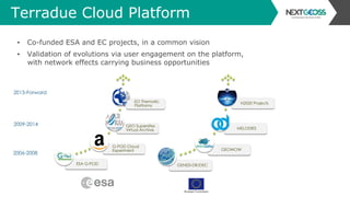
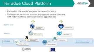
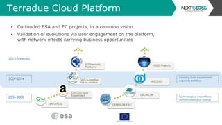
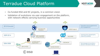


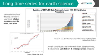
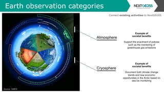
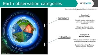
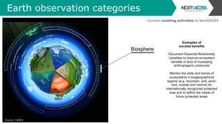


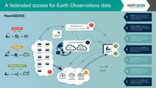
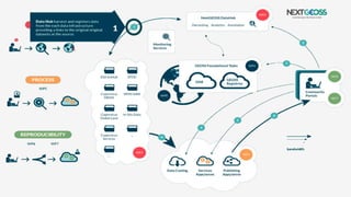
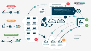
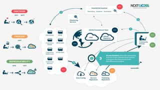
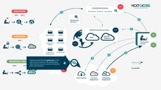
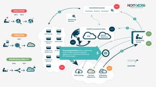
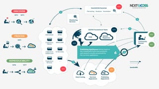
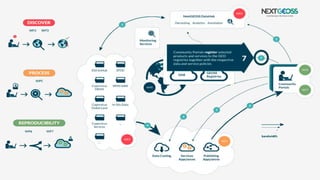
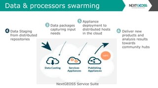
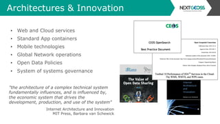


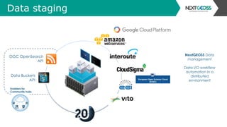

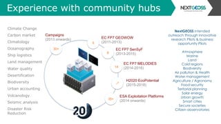

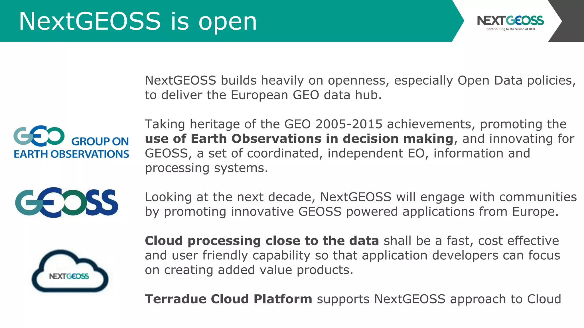
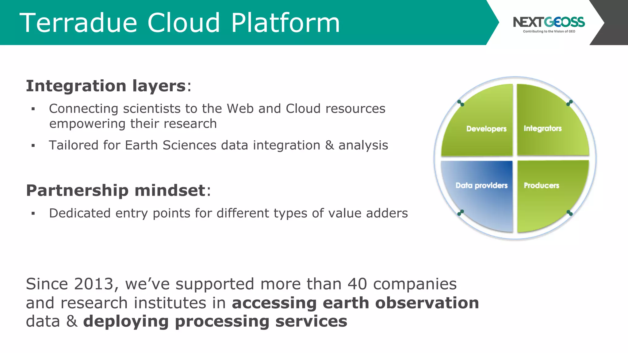
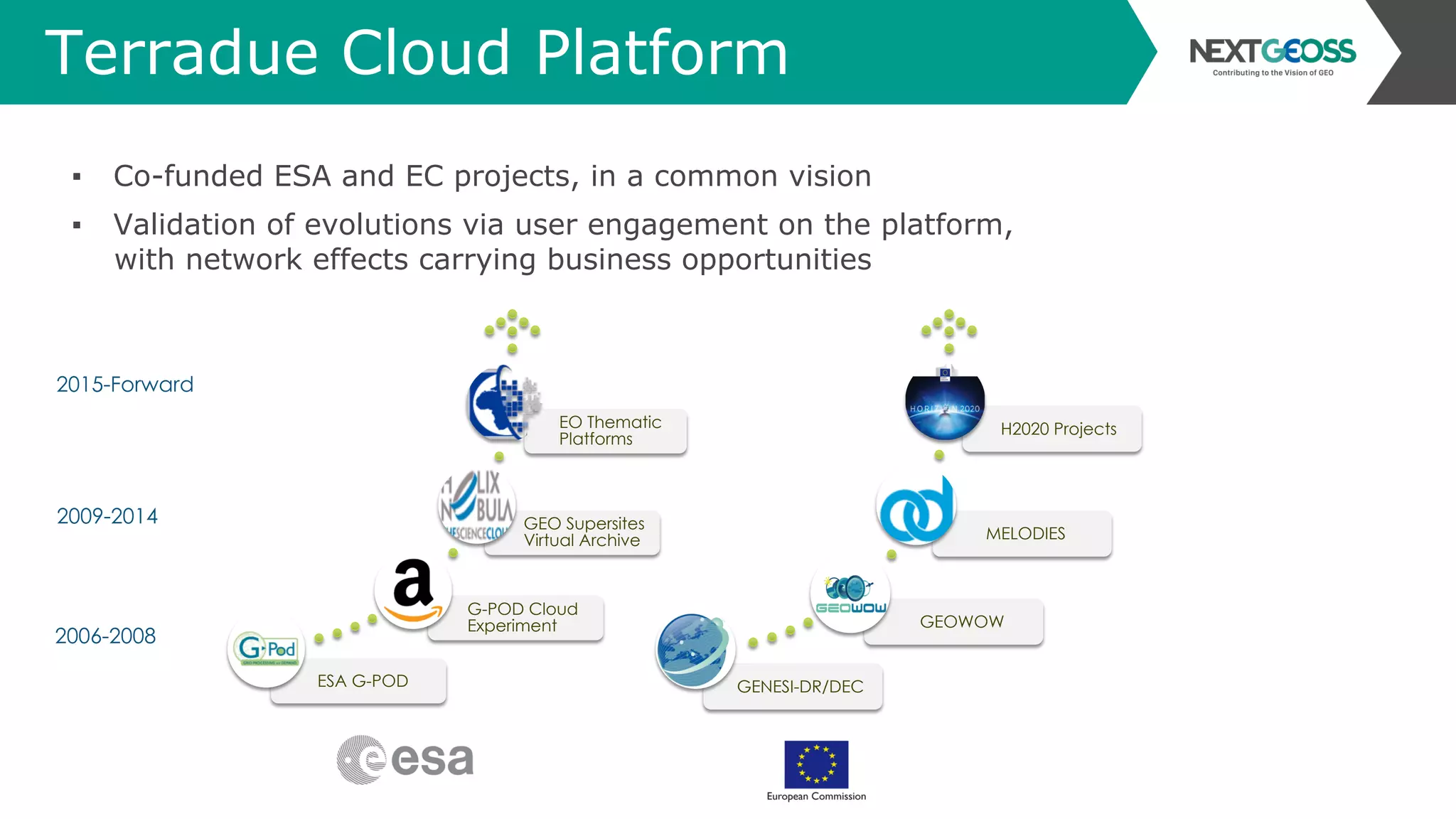


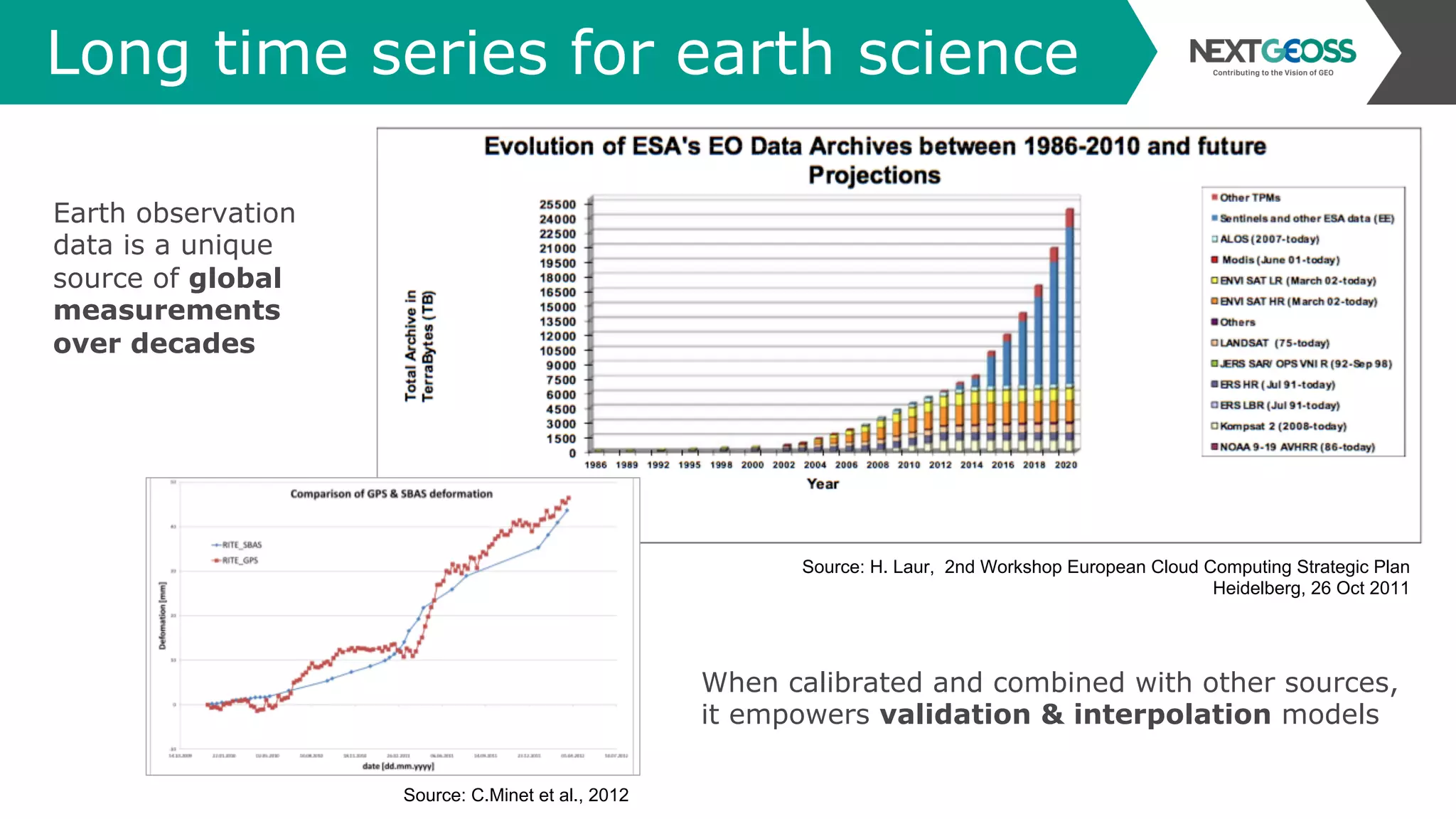
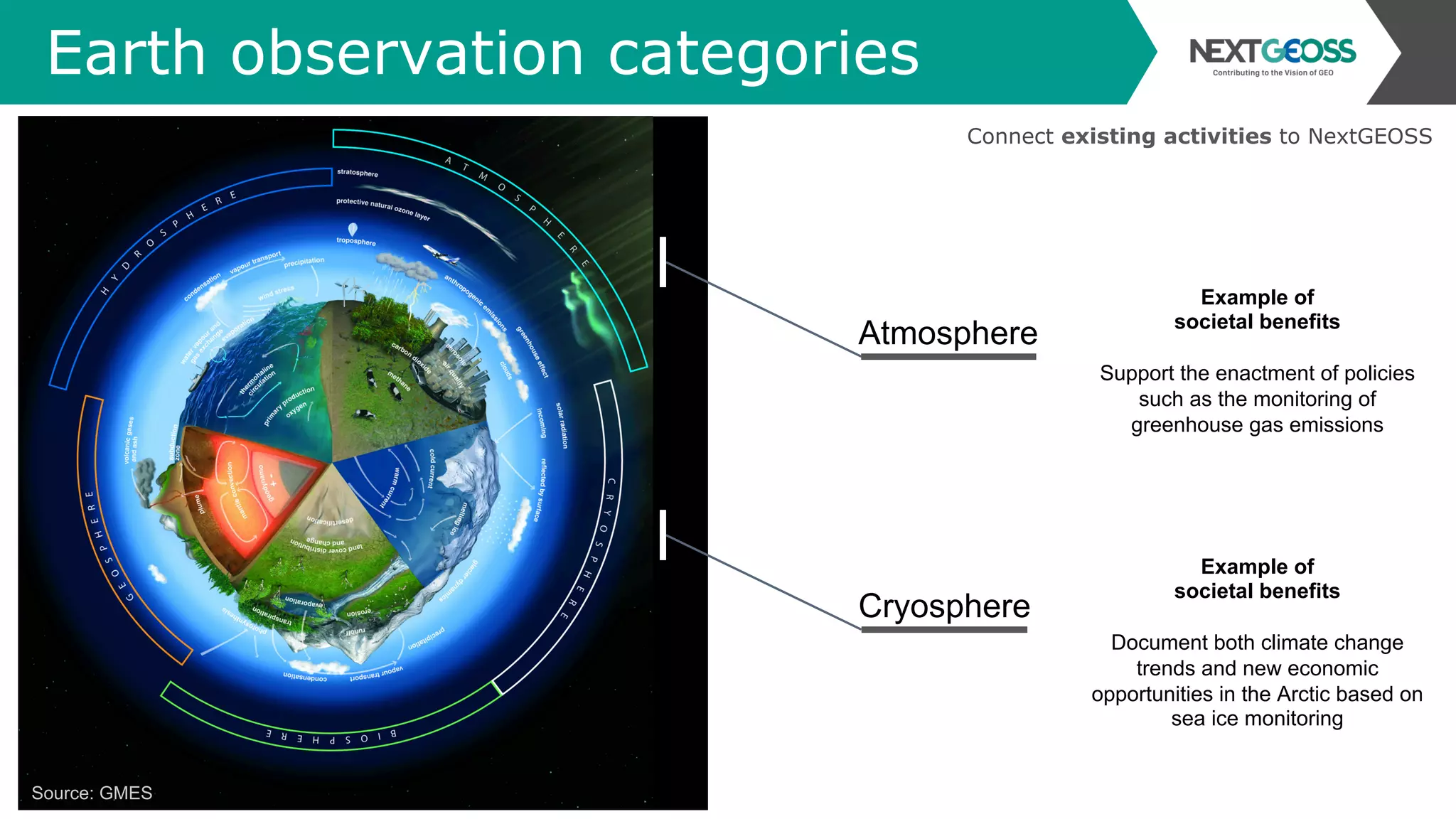

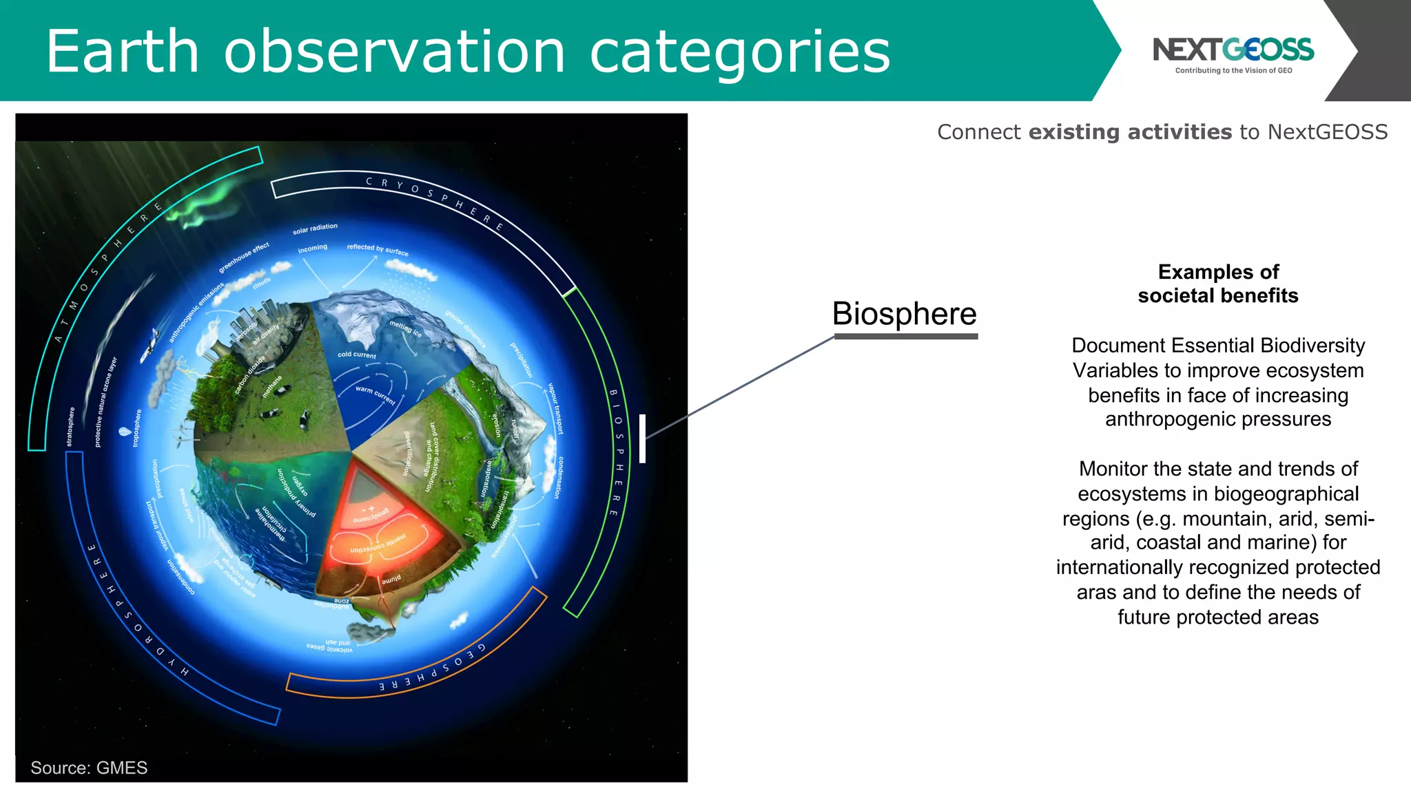

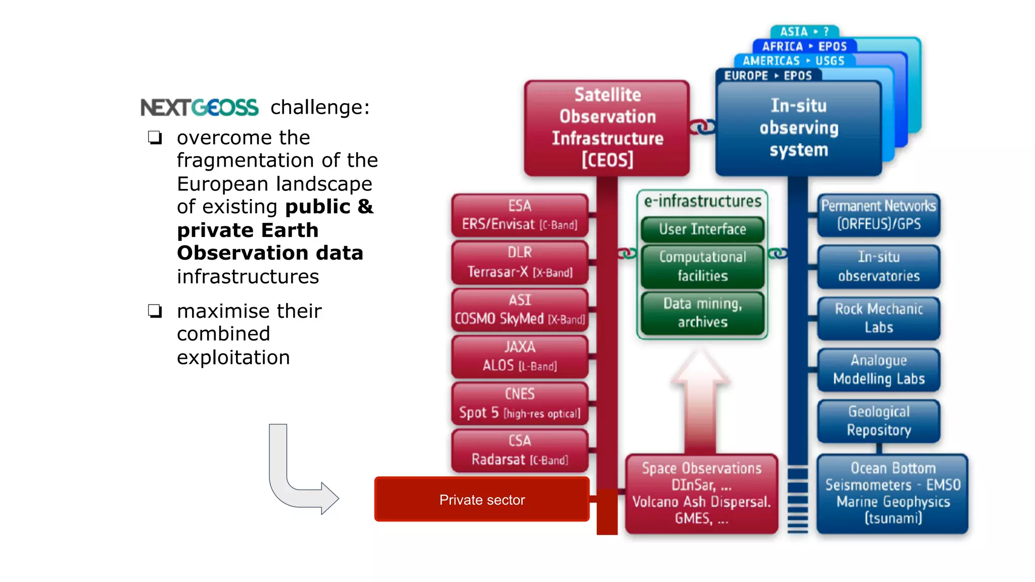
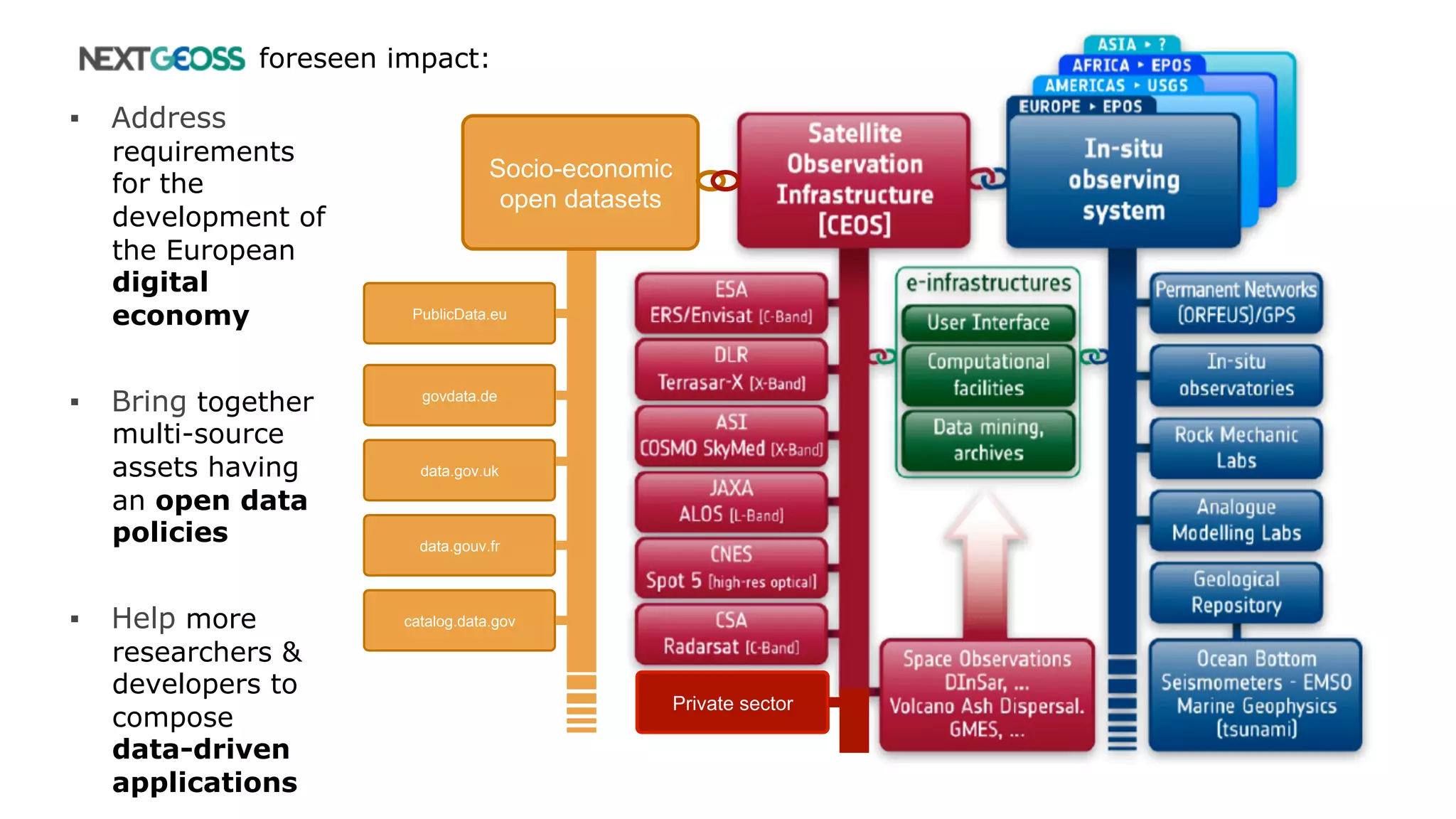

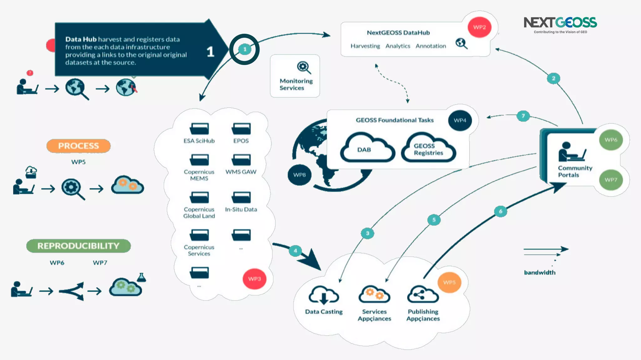

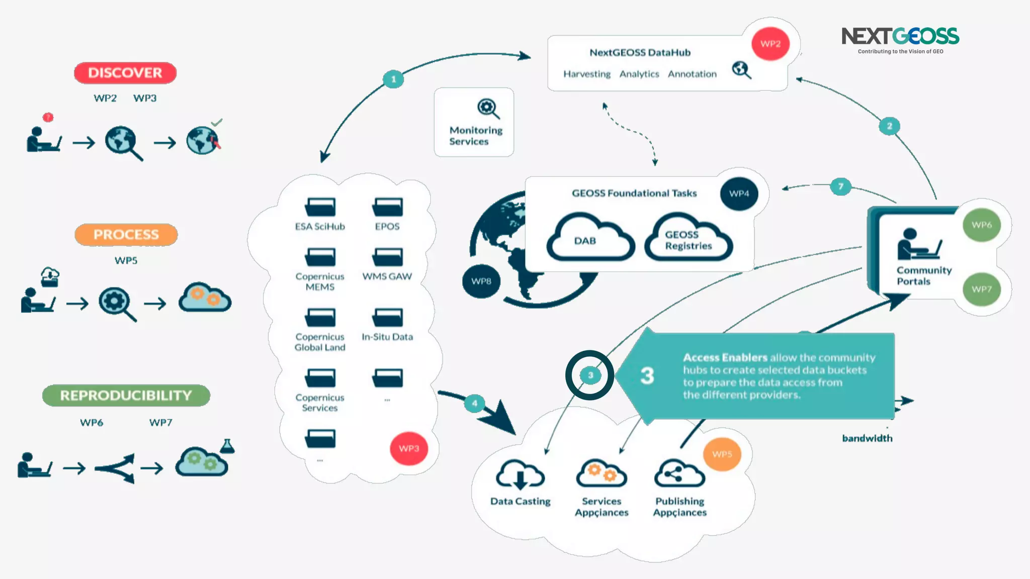
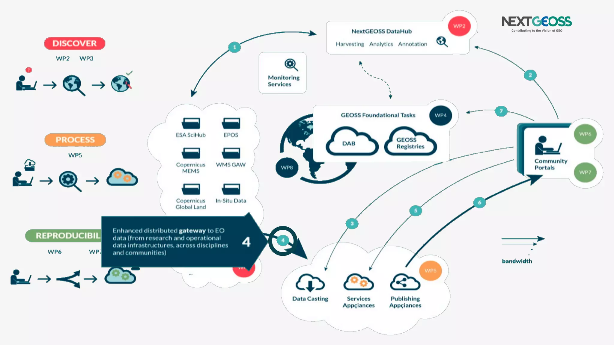
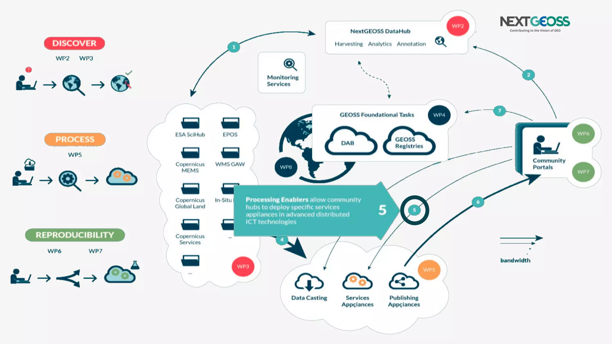
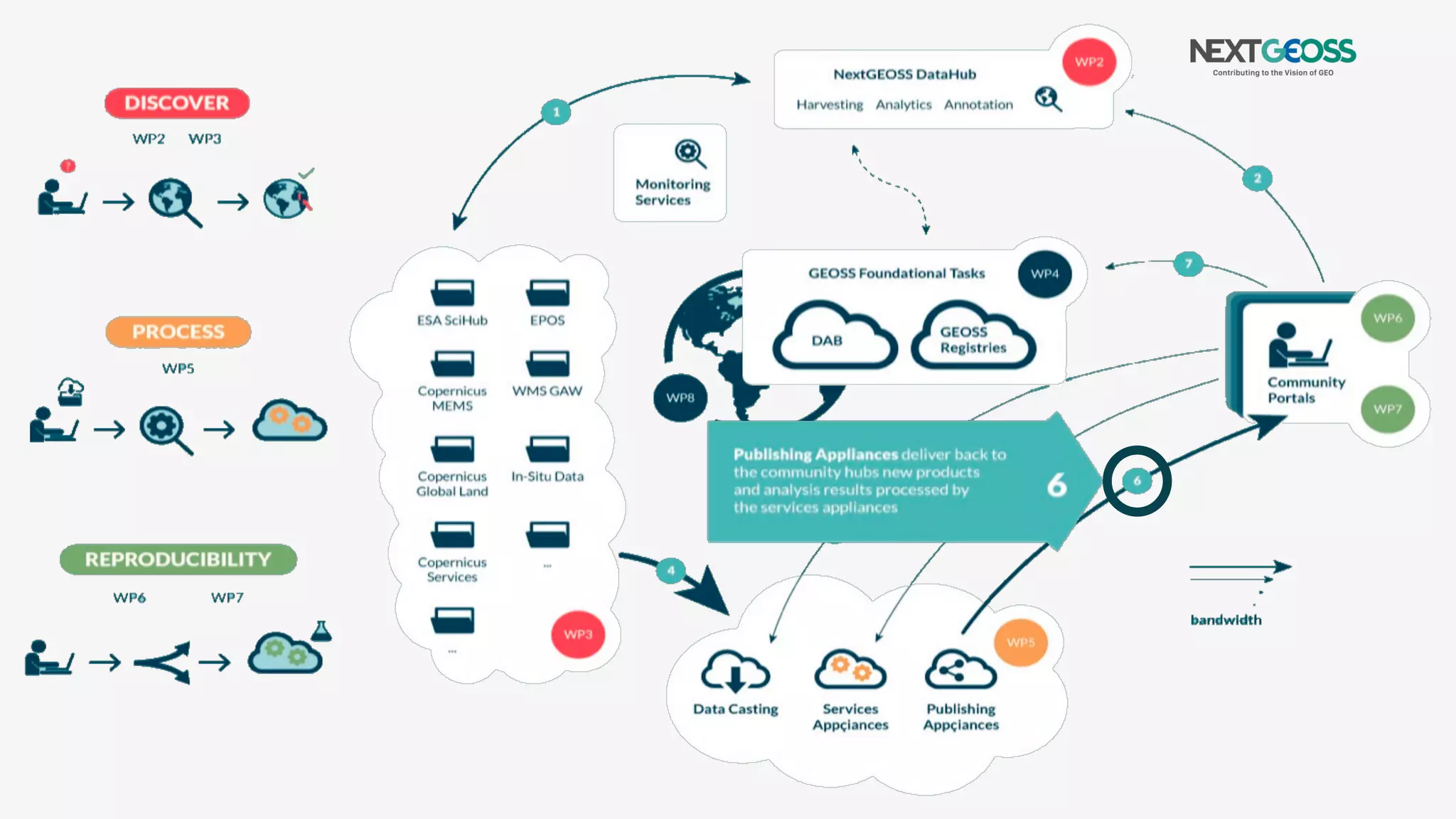
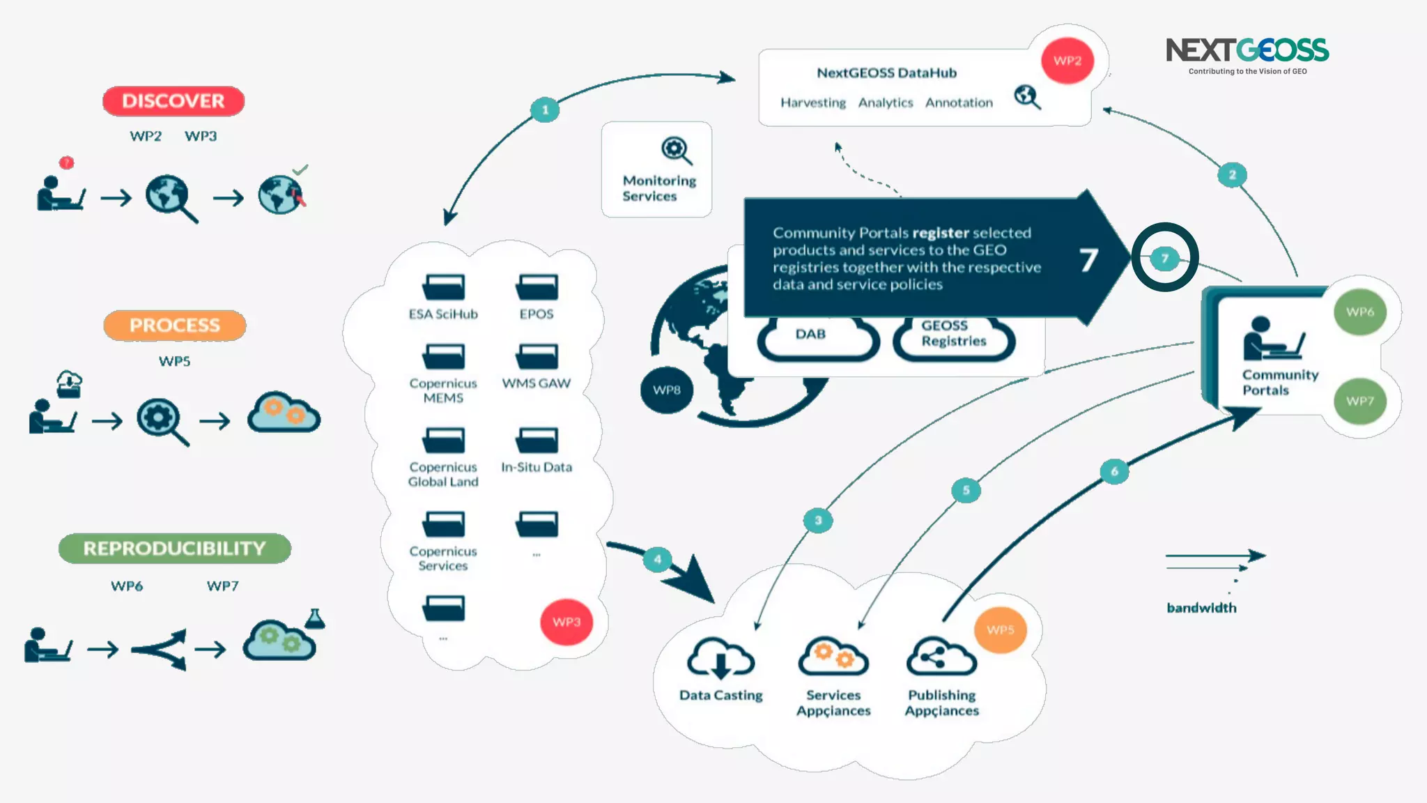


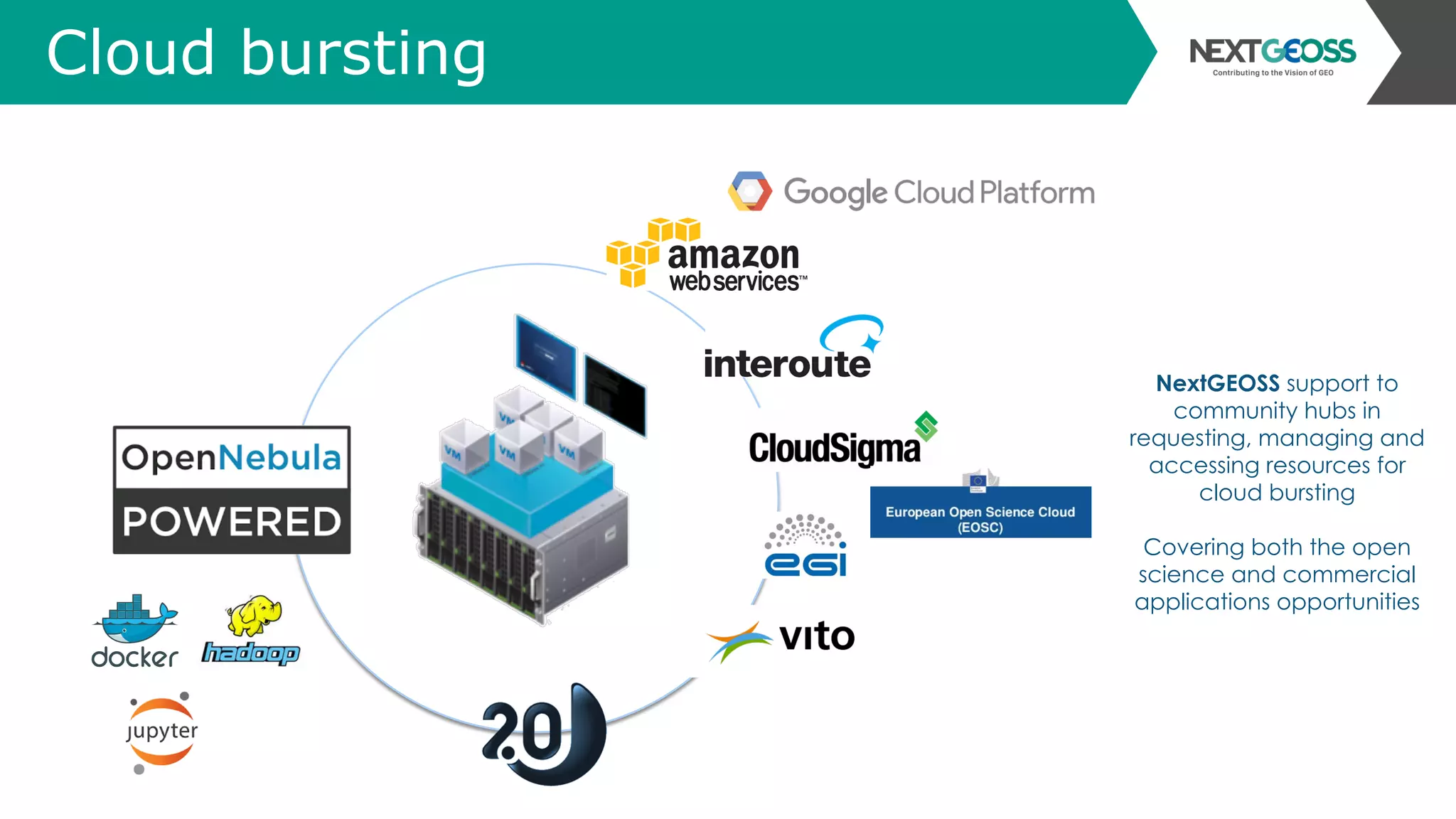
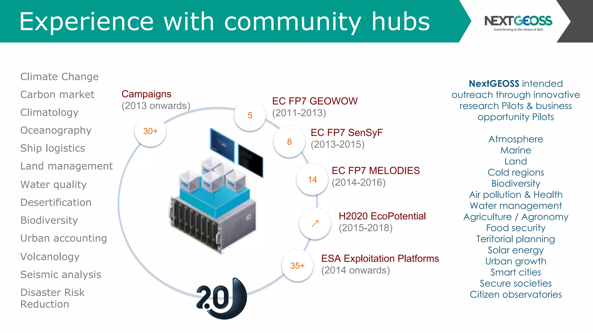


The document discusses the NextGEOSS initiative, aimed at improving access to Earth observation data through cloud processing and open data policies to support research and societal applications. It highlights the importance of long-term earth observation data in addressing challenges such as climate change, biodiversity loss, and resource management, while emphasizing collaboration among public and private sectors. The initiative focuses on creating a federated data hub, empowering users with advanced tools for data access, analysis, and application development.


![Agentic Systems and Compliance - A brief intro [1.2]](https://cdn.slidesharecdn.com/ss_thumbnails/agenticsystemsandcompliace-1-251018025303-958a42ec-thumbnail.jpg?width=600ounds&width=560&fit=bounds)


