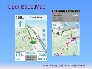
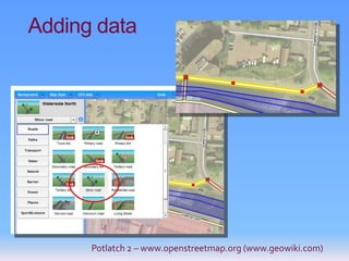
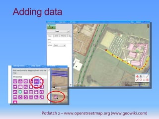
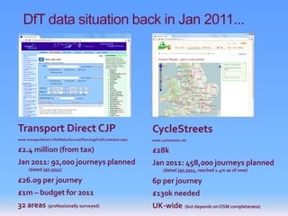
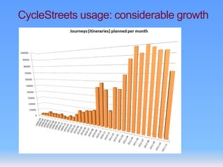
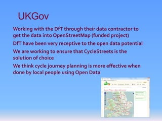
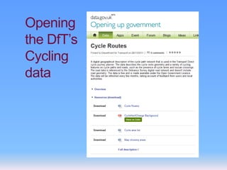
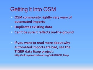
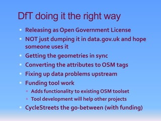
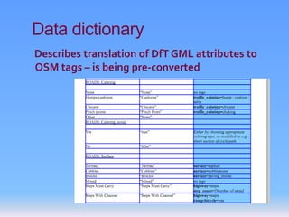
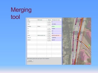
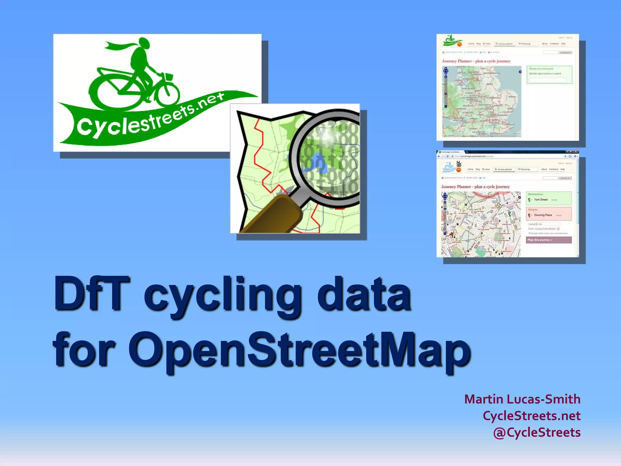
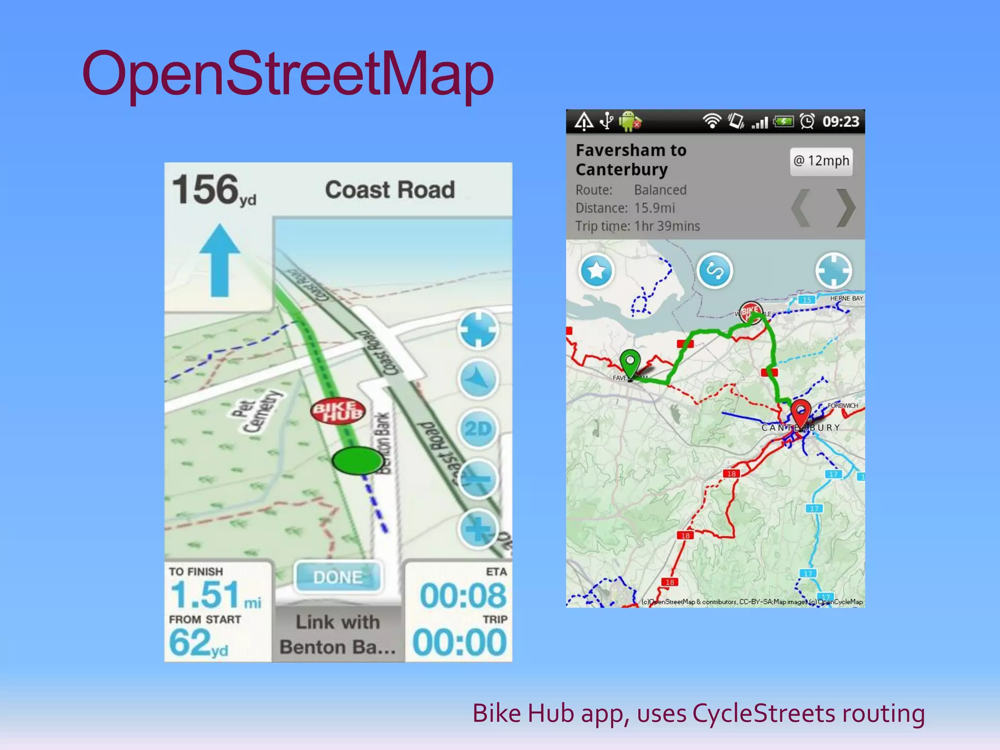
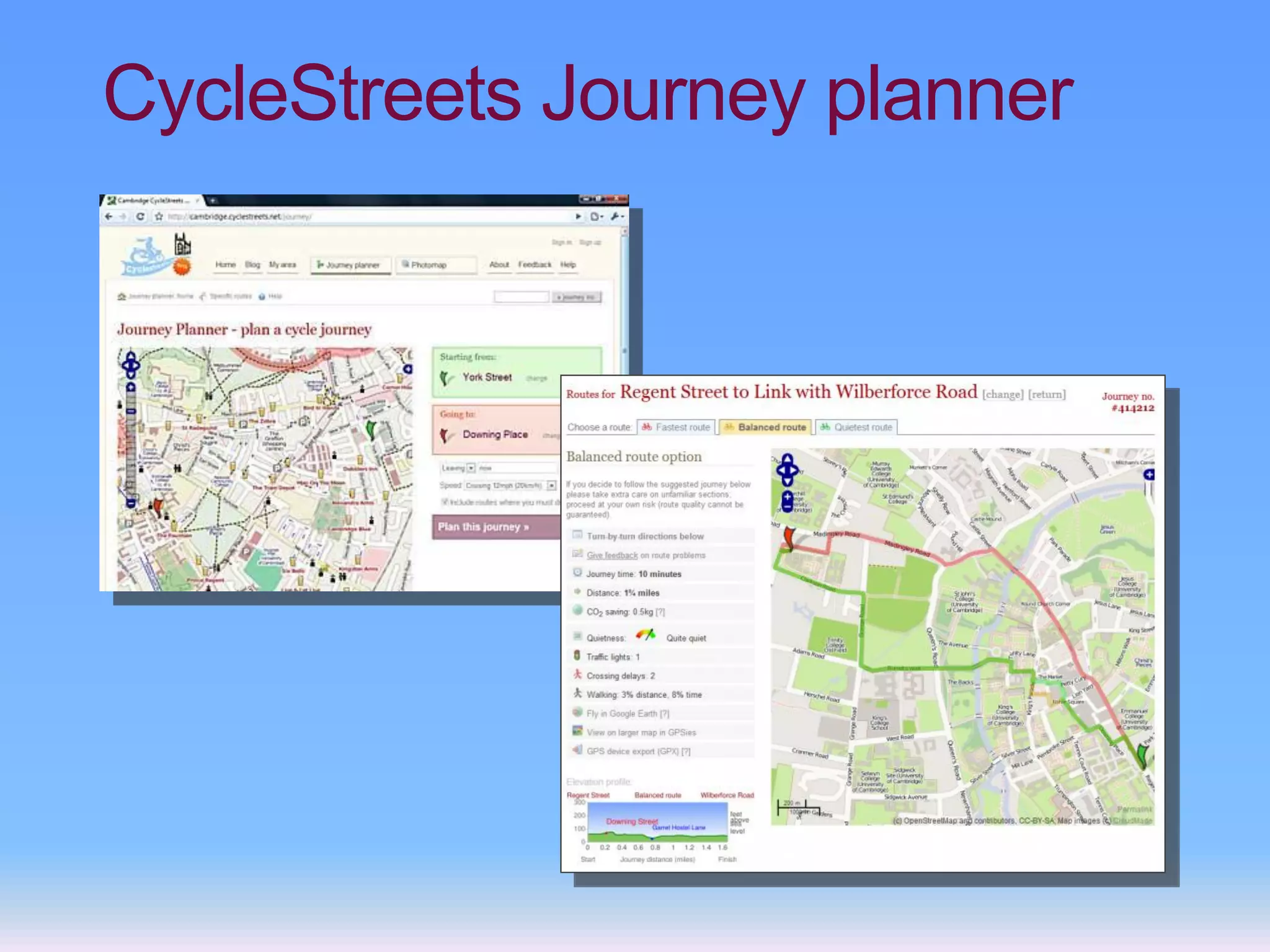
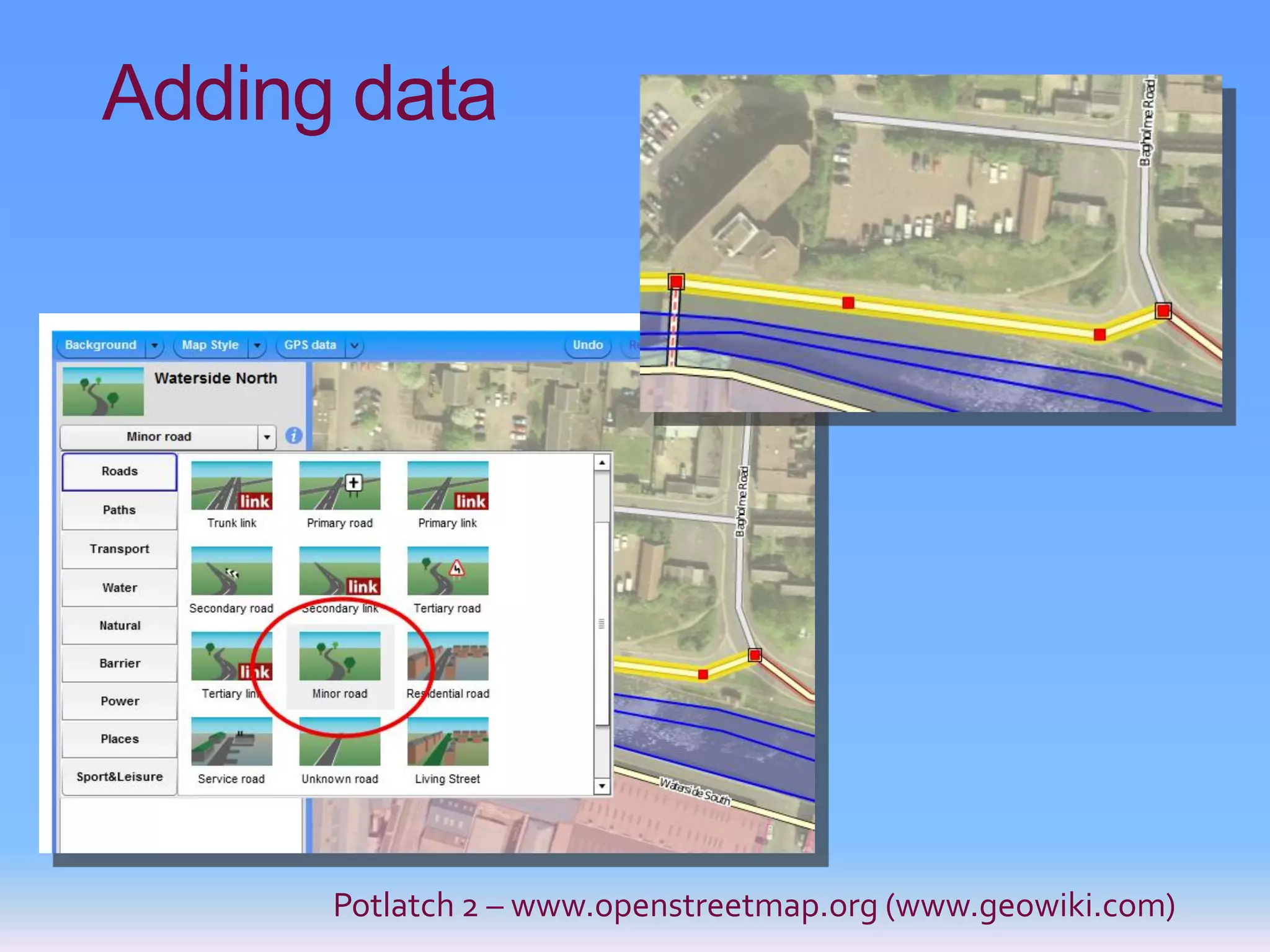
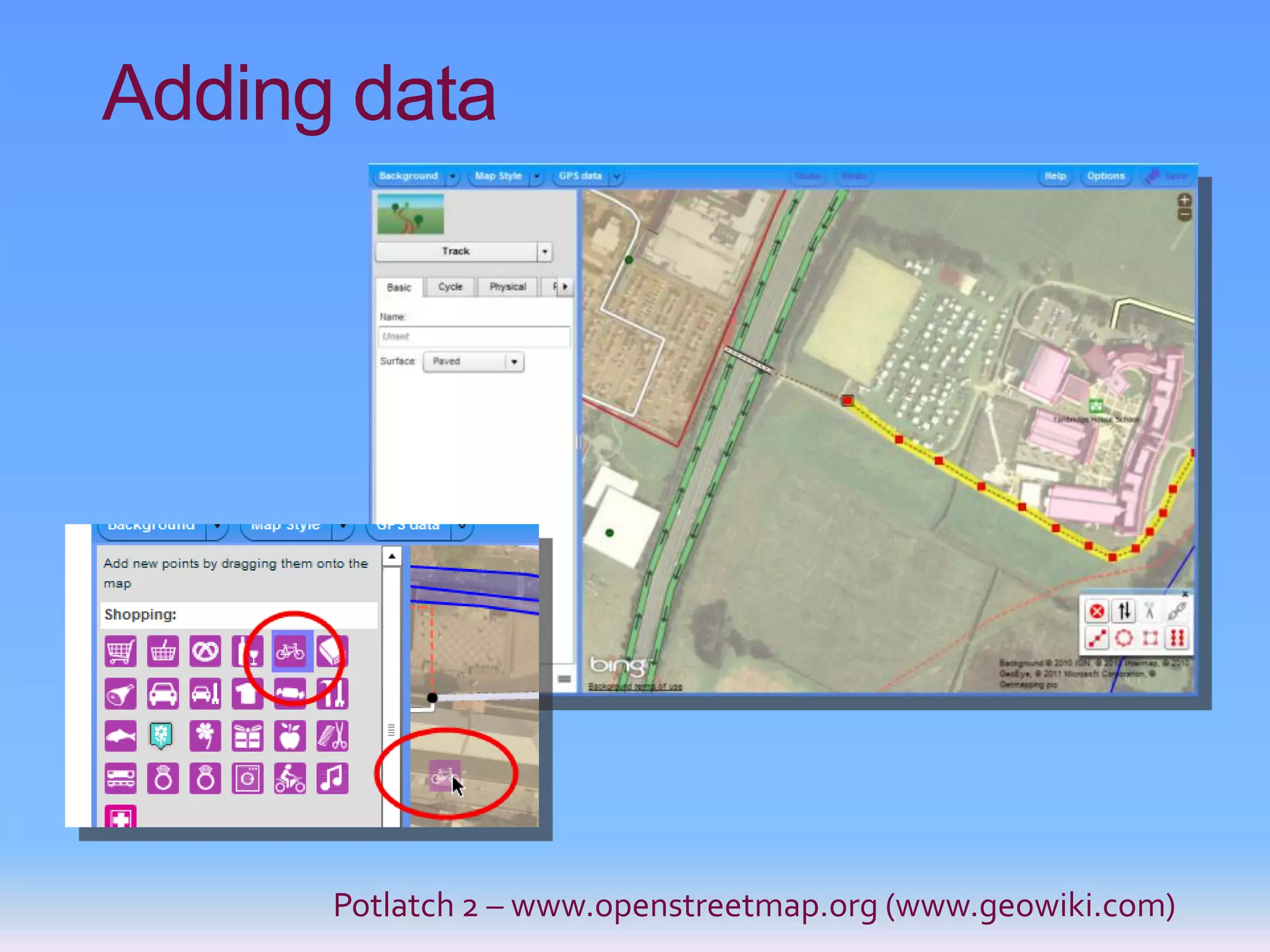
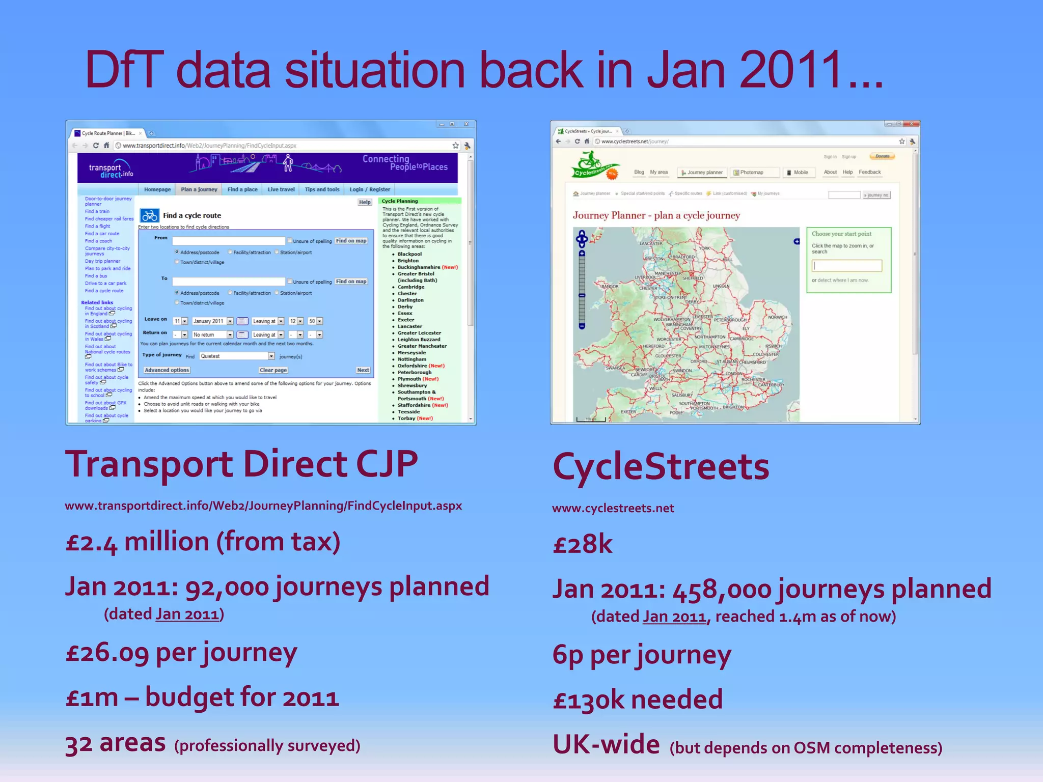
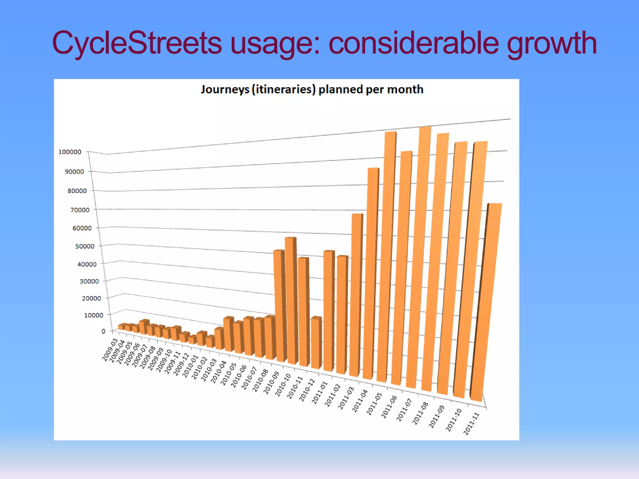
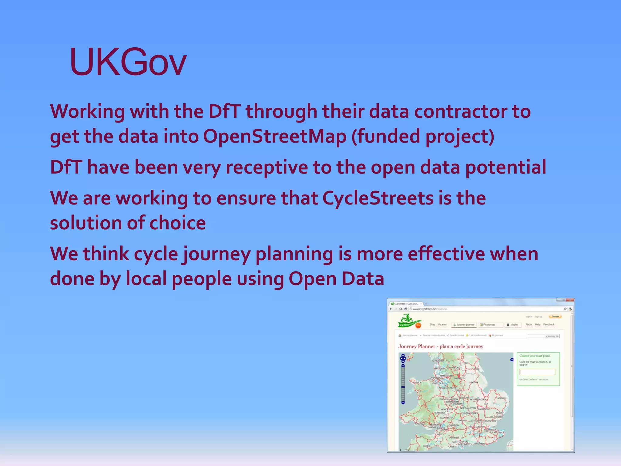
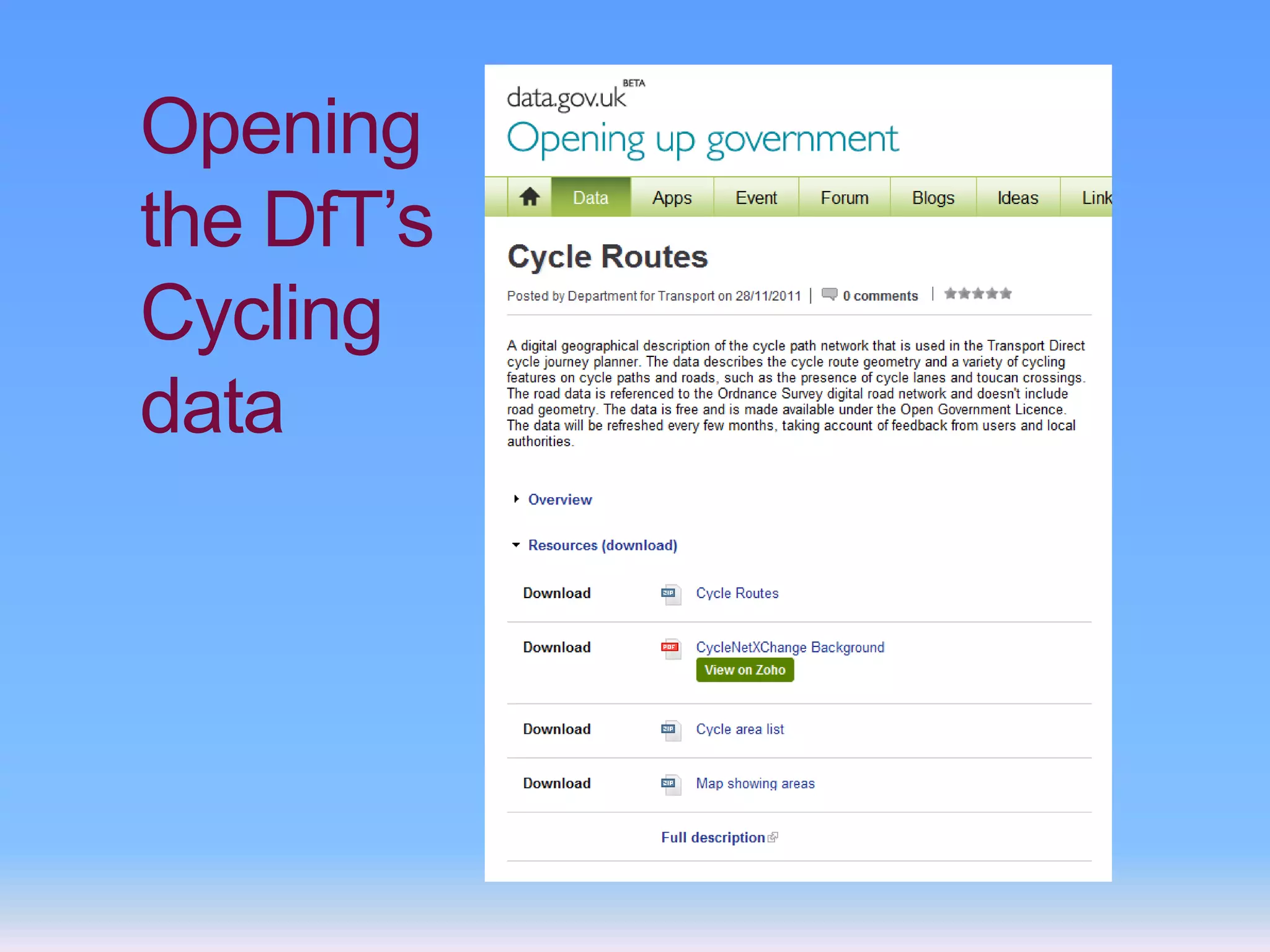
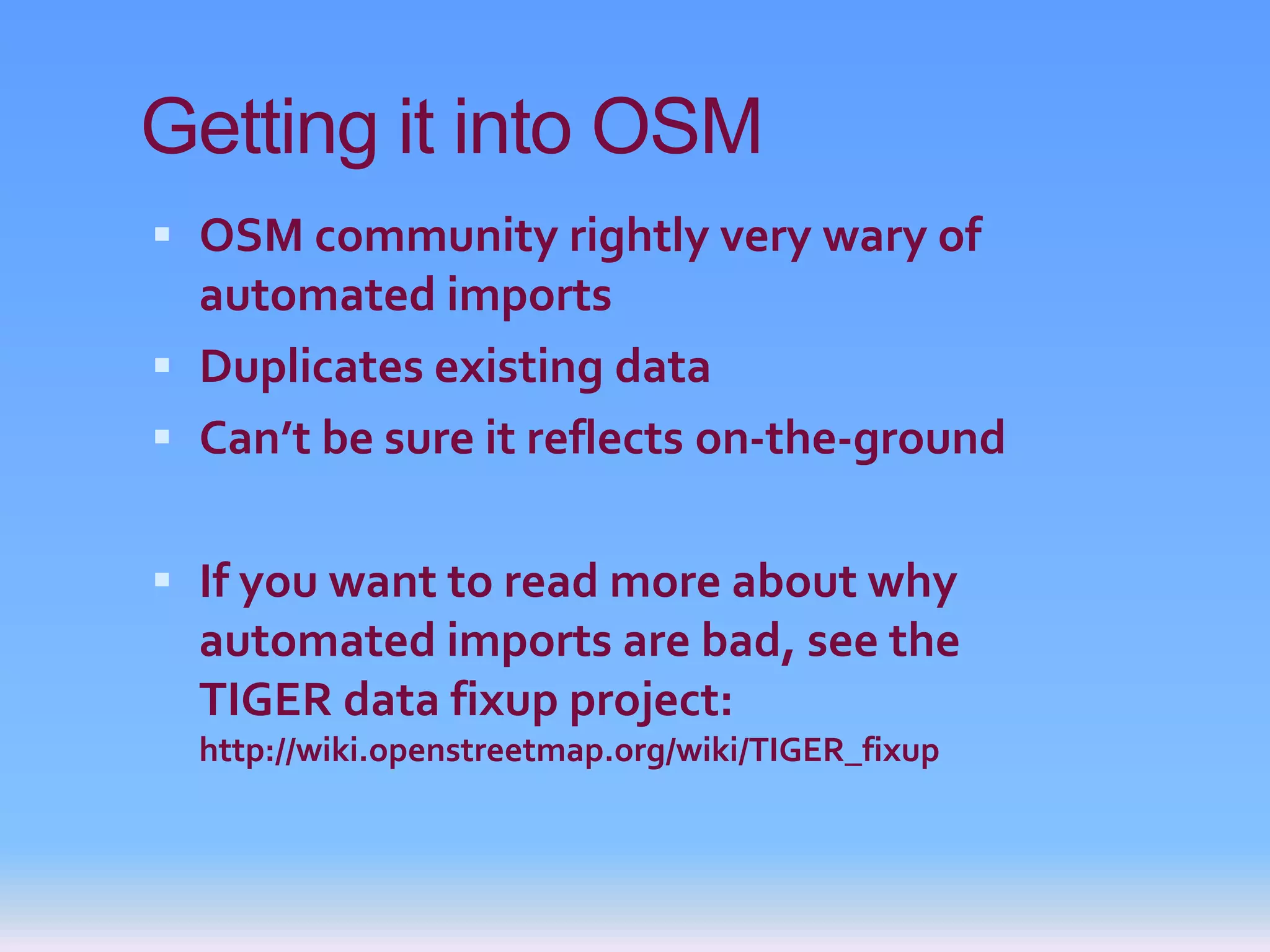
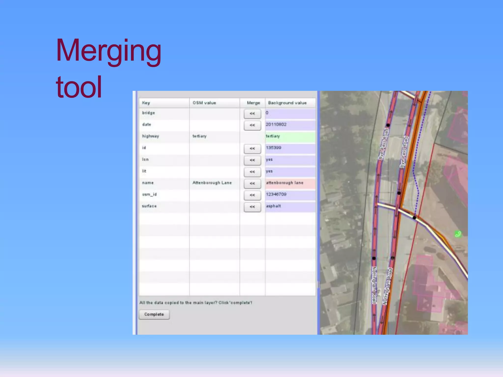
KEMBAR78
DfT data | PDF
DfT cycling data
for OpenStreetMap
                Martin Lucas-Smith
                  CycleStreets.net
                    @CycleStreets
What do we do?
CycleStreets                     Cyclescape
Cycle journey planner            Campaign group toolkit
cyclestreets.net @cyclestreets   blog.cyclescape.org @cyclescape
OpenStreetMap
OpenStreetMap


                License cc-by-sa
OpenStreetMap


                OpenCycleMap
                License cc-by-sa
OpenStreetMap

“OpenStreetMap creates and provides free
geographic data such as street maps to anyone
who wants them.
“The project was started because most maps you
think of as free actually have legal or technical
restrictions on their use, holding back people
from using them in creative, productive, or
unexpected ways.”
Crowdsourcing principle

“Crowdsourcing is the act of taking a job
traditionally performed by a designated agent
(usually an employee) and outsourcing it to an
undefined, generally large group of people in the
form of an open call.”
                            http://crowdsourcing.typepad.com/
OpenStreetMap


            Bike Hub app, uses CycleStreets routing
Mobile
 Other apps now
  incorporating our
  routing
 API - data interface
 Bike Hub – great
  world-first iPhone
  bike real-SatNav
 In the leading Boris
  Bike app, ‘London
  Cycle’
CycleStreets Journey planner
Adding data


      Potlatch 2 – www.openstreetmap.org (www.geowiki.com)
Adding data


      Potlatch 2 – www.openstreetmap.org (www.geowiki.com)
DfT data situation back in Jan 2011...


Transport Direct CJP                                                CycleStreets
www.transportdirect.info/Web2/JourneyPlanning/FindCycleInput.aspx   www.cyclestreets.net

£2.4 million (from tax)                                             £28k
Jan 2011: 92,000 journeys planned                                   Jan 2011: 458,000 journeys planned
      (dated Jan 2011)                                                    (dated Jan 2011, reached 1.4m as of now)

£26.09 per journey                                                  6p per journey
£1m – budget for 2011                                               £130k needed
32 areas (professionally surveyed)                                  UK-wide            (but depends on OSM completeness)
CycleStreets usage: considerable growth
UKGov
Working with the DfT through their data contractor to
get the data into OpenStreetMap (funded project)
DfT have been very receptive to the open data potential
We are working to ensure that CycleStreets is the
solution of choice
We think cycle journey planning is more effective when
done by local people using Open Data
Big Society –compliant
We tick all the boxes:
Collaborative: involves local people
Low cost: datasets have no license fee,
agile delivery
Trusted: for the people, by the people
Open Data
                                           http://www.green-alliance.org.uk
Citizen involvement: combines skills
and input of large numbers of people
(collecting data)
Quality delivery: problems can be
fixed easily
Transparency: more people oversee
the data and spot problems or potential
improvements
                                                            Cabinet Office
Opening
the DfT’s
Cycling
data
Getting it into OSM
 OSM community rightly very wary of
  automated imports
 Duplicates existing data
 Can’t be sure it reflects on-the-ground


 If you want to read more about why
  automated imports are bad, see the
  TIGER data fixup project:
  http://wiki.openstreetmap.org/wiki/TIGER_fixup
DfT doing it the right way
 Releasing as Open Government License
 NOT just dumping it in data.gov.uk and hope
    someone uses it
   Getting the geometries in sync
   Converting the attributes to OSM tags
   Fixing up data problems upstream
   Funding tool work
     Adds functionality to existing OSM toolset
     Tool development will help other projects
 CycleStreets the go-between (with funding)
Data dictionary
Describes translation of DfT GML attributes to
OSM tags – is being pre-converted
Merging
tool

Created by
Andy Allan
Merging
tool
David Earl


                   Martin Lucas-Smith,
             www.CycleStreets.net
                 Twitter: @cyclestreets
                  info@cyclestreets.net

DfT data

  • 1.
    DfT cycling data forOpenStreetMap Martin Lucas-Smith CycleStreets.net @CycleStreets
  • 2.
    What do wedo? CycleStreets Cyclescape Cycle journey planner Campaign group toolkit cyclestreets.net @cyclestreets blog.cyclescape.org @cyclescape
  • 3.
  • 4.
    OpenStreetMap License cc-by-sa
  • 5.
    OpenStreetMap OpenCycleMap License cc-by-sa
  • 6.
    OpenStreetMap “OpenStreetMap creates andprovides free geographic data such as street maps to anyone who wants them. “The project was started because most maps you think of as free actually have legal or technical restrictions on their use, holding back people from using them in creative, productive, or unexpected ways.”
  • 7.
    Crowdsourcing principle “Crowdsourcing isthe act of taking a job traditionally performed by a designated agent (usually an employee) and outsourcing it to an undefined, generally large group of people in the form of an open call.” http://crowdsourcing.typepad.com/
  • 8.
    OpenStreetMap Bike Hub app, uses CycleStreets routing
  • 9.
    Mobile  Other appsnow incorporating our routing  API - data interface  Bike Hub – great world-first iPhone bike real-SatNav  In the leading Boris Bike app, ‘London Cycle’
  • 10.
  • 11.
    Adding data Potlatch 2 – www.openstreetmap.org (www.geowiki.com)
  • 12.
    Adding data Potlatch 2 – www.openstreetmap.org (www.geowiki.com)
  • 13.
    DfT data situationback in Jan 2011... Transport Direct CJP CycleStreets www.transportdirect.info/Web2/JourneyPlanning/FindCycleInput.aspx www.cyclestreets.net £2.4 million (from tax) £28k Jan 2011: 92,000 journeys planned Jan 2011: 458,000 journeys planned (dated Jan 2011) (dated Jan 2011, reached 1.4m as of now) £26.09 per journey 6p per journey £1m – budget for 2011 £130k needed 32 areas (professionally surveyed) UK-wide (but depends on OSM completeness)
  • 14.
  • 15.
    UKGov Working with theDfT through their data contractor to get the data into OpenStreetMap (funded project) DfT have been very receptive to the open data potential We are working to ensure that CycleStreets is the solution of choice We think cycle journey planning is more effective when done by local people using Open Data
  • 16.
    Big Society –compliant Wetick all the boxes: Collaborative: involves local people Low cost: datasets have no license fee, agile delivery Trusted: for the people, by the people Open Data http://www.green-alliance.org.uk Citizen involvement: combines skills and input of large numbers of people (collecting data) Quality delivery: problems can be fixed easily Transparency: more people oversee the data and spot problems or potential improvements Cabinet Office
  • 17.
  • 18.
    Getting it intoOSM  OSM community rightly very wary of automated imports  Duplicates existing data  Can’t be sure it reflects on-the-ground  If you want to read more about why automated imports are bad, see the TIGER data fixup project: http://wiki.openstreetmap.org/wiki/TIGER_fixup
  • 19.
    DfT doing itthe right way  Releasing as Open Government License  NOT just dumping it in data.gov.uk and hope someone uses it  Getting the geometries in sync  Converting the attributes to OSM tags  Fixing up data problems upstream  Funding tool work  Adds functionality to existing OSM toolset  Tool development will help other projects  CycleStreets the go-between (with funding)
  • 20.
    Data dictionary Describes translationof DfT GML attributes to OSM tags – is being pre-converted
  • 21.
  • 22.
  • 24.
    David Earl Martin Lucas-Smith, www.CycleStreets.net Twitter: @cyclestreets info@cyclestreets.net