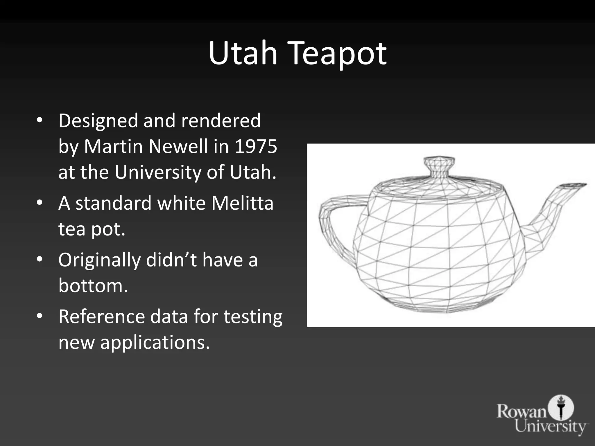
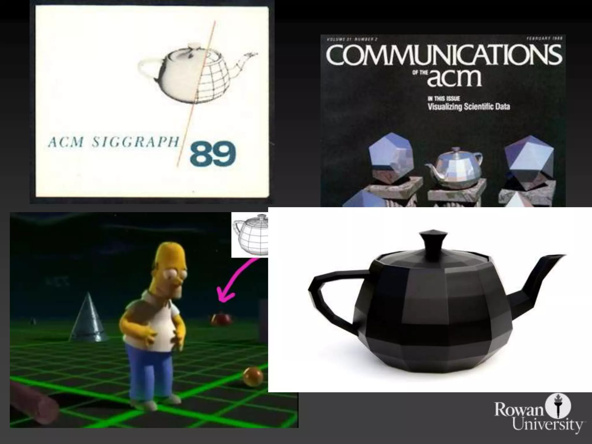
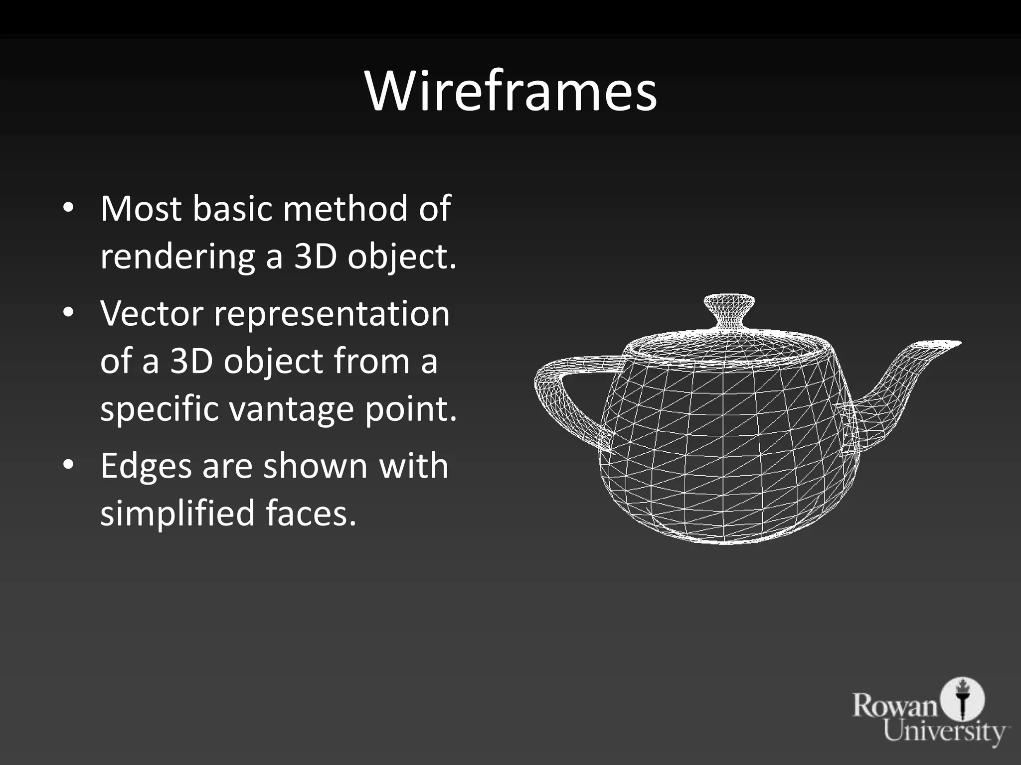
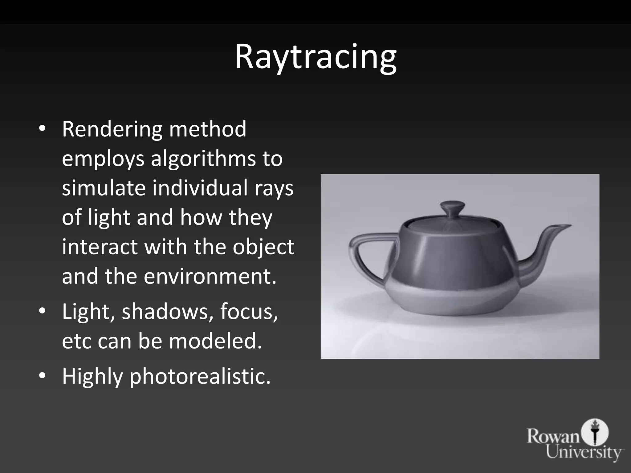
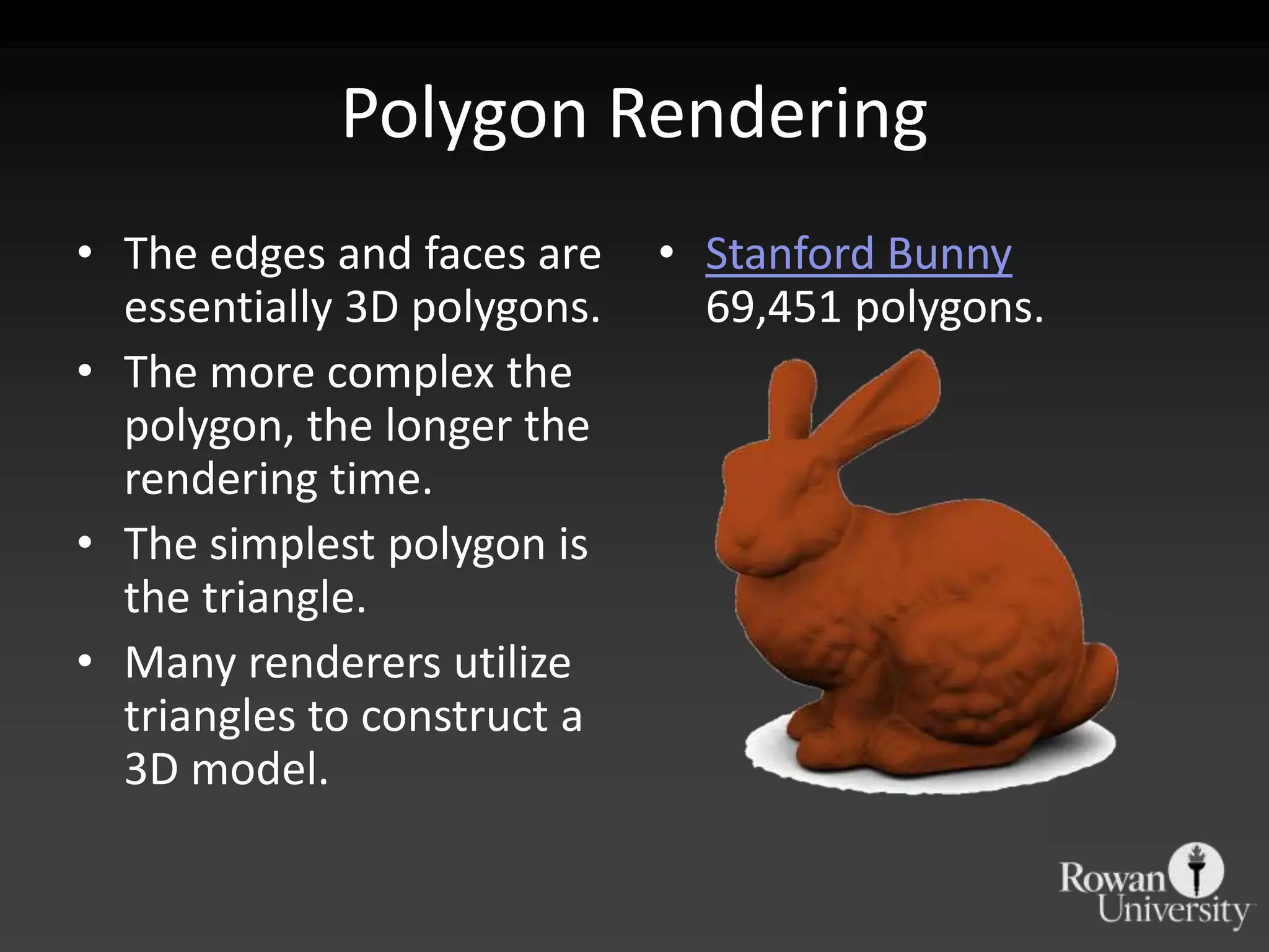
KEMBAR78
Introduction to 3D Data | PPTX
Introduction to 3D

   Geovisualization
     John Reiser
History
• Computer rendering of 3D images is a relatively
  recent development.
• 3D rendering requires considerable processing to
  generate photorealistic images.
• Until capabilities rose and costs dropped, 3D
  rendering was often a task left up to
  supercomputers.
• One of the first 3D models: “Utah Teapot”
Utah Teapot
• Designed and rendered
  by Martin Newell in 1975
  at the University of Utah.
• A standard white Melitta
  tea pot.
• Originally didn’t have a
  bottom.
• Reference data for testing
  new applications.
3D Rendering
•   Let’s cover some basics behind 3D rendering.
•   Several methods for drawing the 3D object.
•   Constructing a model out of triangles.
•   Rendering methods can be refined further with
    textures and lighting effects.
Wireframes
• Most basic method of
  rendering a 3D object.
• Vector representation
  of a 3D object from a
  specific vantage point.
• Edges are shown with
  simplified faces.
Textures
• Textures are applied to
  the faces of a 3D model.
• Textures can be a solid
  color, image or
  photograph.
• Textures can include
  additional data, such as
  noise, reflectivity or
  bumps.
Raytracing
• Rendering method
  employs algorithms to
  simulate individual rays
  of light and how they
  interact with the object
  and the environment.
• Light, shadows, focus,
  etc can be modeled.
• Highly photorealistic.
Polygon Rendering
• The edges and faces are    • Stanford Bunny
  essentially 3D polygons.     69,451 polygons.
• The more complex the
  polygon, the longer the
  rendering time.
• The simplest polygon is
  the triangle.
• Many renderers utilize
  triangles to construct a
  3D model.
Triangles & TINs
• Back to GIS, triangulated irregular networks are
  digital elevation models based on nodes & edges
  that form a mesh of triangular faces.
• Rendering landscapes instead of objects requires
  georeferencing.
TINs versus Raster DEMs
• TINs allow for greater variation in the terrain
  than raster.
• Raster cell sizes must be small to capture minute
  variations, producing larger files.
• Gentle changes need only a few triangles to be
  represented.
Building Models
• Wireframe models can
  be covered with an
  architectural rendering
  or a photograph to
  create a basic building
  model.
• Details can be
  introduced by adding
  more textured faces to
  the volume.
Building Information Modeling
• Highly detailed models of buildings, down to
  interior spaces.
  – HVAC, mechanicals, etc.
• Used for facilities management.
• Used to visualize maintenance, planning and
  construction efforts.
• GIS for buildings.
Viewing 3D
• Several methods of viewing 3D images on a 2D
  surface.
  – Shutters
  – Anaglyphs
  – Free (cross eyes)
• Some 3D rendering software will create
  anaglyphs for you.

Introduction to 3D Data

  • 1.
    Introduction to 3D Geovisualization John Reiser
  • 2.
    History • Computer renderingof 3D images is a relatively recent development. • 3D rendering requires considerable processing to generate photorealistic images. • Until capabilities rose and costs dropped, 3D rendering was often a task left up to supercomputers. • One of the first 3D models: “Utah Teapot”
  • 3.
    Utah Teapot • Designedand rendered by Martin Newell in 1975 at the University of Utah. • A standard white Melitta tea pot. • Originally didn’t have a bottom. • Reference data for testing new applications.
  • 5.
    3D Rendering • Let’s cover some basics behind 3D rendering. • Several methods for drawing the 3D object. • Constructing a model out of triangles. • Rendering methods can be refined further with textures and lighting effects.
  • 6.
    Wireframes • Most basicmethod of rendering a 3D object. • Vector representation of a 3D object from a specific vantage point. • Edges are shown with simplified faces.
  • 7.
    Textures • Textures areapplied to the faces of a 3D model. • Textures can be a solid color, image or photograph. • Textures can include additional data, such as noise, reflectivity or bumps.
  • 8.
    Raytracing • Rendering method employs algorithms to simulate individual rays of light and how they interact with the object and the environment. • Light, shadows, focus, etc can be modeled. • Highly photorealistic.
  • 9.
    Polygon Rendering • Theedges and faces are • Stanford Bunny essentially 3D polygons. 69,451 polygons. • The more complex the polygon, the longer the rendering time. • The simplest polygon is the triangle. • Many renderers utilize triangles to construct a 3D model.
  • 10.
    Triangles & TINs •Back to GIS, triangulated irregular networks are digital elevation models based on nodes & edges that form a mesh of triangular faces. • Rendering landscapes instead of objects requires georeferencing.
  • 11.
    TINs versus RasterDEMs • TINs allow for greater variation in the terrain than raster. • Raster cell sizes must be small to capture minute variations, producing larger files. • Gentle changes need only a few triangles to be represented.
  • 12.
    Building Models • Wireframemodels can be covered with an architectural rendering or a photograph to create a basic building model. • Details can be introduced by adding more textured faces to the volume.
  • 13.
    Building Information Modeling •Highly detailed models of buildings, down to interior spaces. – HVAC, mechanicals, etc. • Used for facilities management. • Used to visualize maintenance, planning and construction efforts. • GIS for buildings.
  • 14.
    Viewing 3D • Severalmethods of viewing 3D images on a 2D surface. – Shutters – Anaglyphs – Free (cross eyes) • Some 3D rendering software will create anaglyphs for you.