Download as PDF, PPTX


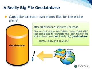


![New Capability for network analysis
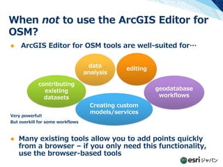
[Create OSM Network Dataset] tool New!
With this tool, you can…
- Create a network in a place where
transportation connectivity changes often
- Translates a geodatabase based on
OSM data into a Network Dataset](https://image.slidesharecdn.com/introductiontoarcgiseditorforosm-121015191203-phpapp02/85/Introduction-toarcgis-editorforosm-19-320.jpg)


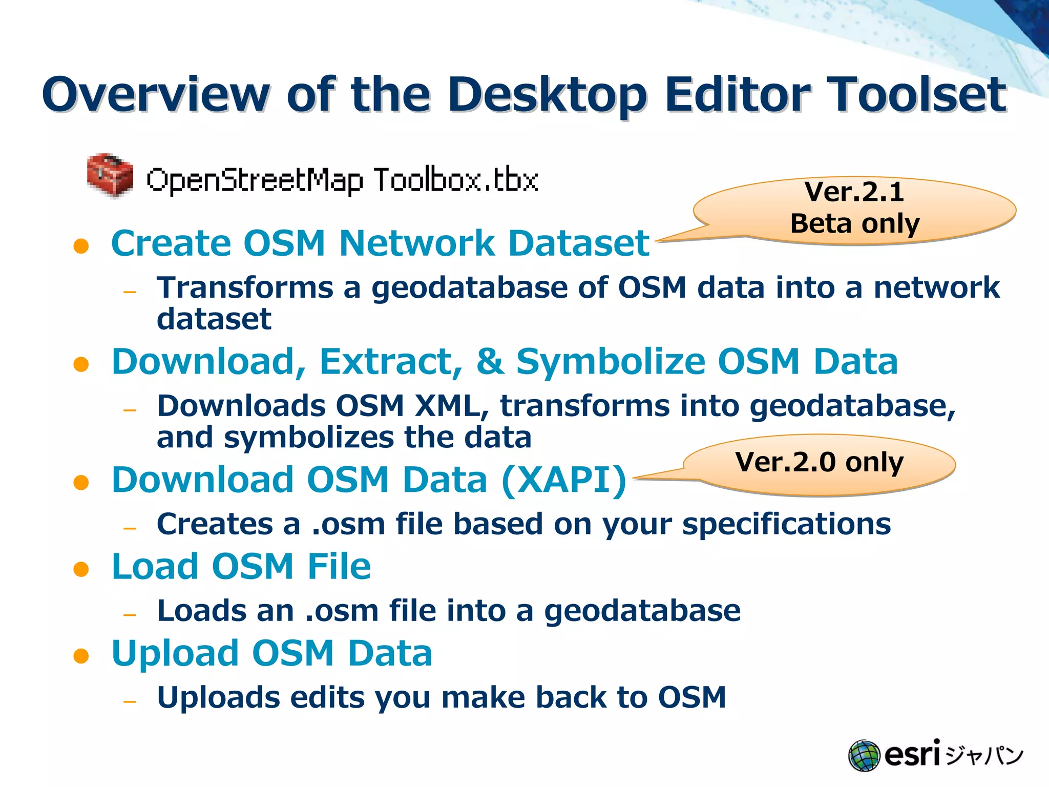


![New Capability for network analysis
[Create OSM Network Dataset] tool New!
With this tool, you can…
- Create a network in a place where
transportation connectivity changes often
- Translates a geodatabase based on
OSM data into a Network Dataset](https://image.slidesharecdn.com/introductiontoarcgiseditorforosm-121015191203-phpapp02/75/Introduction-toarcgis-editorforosm-19-2048.jpg)

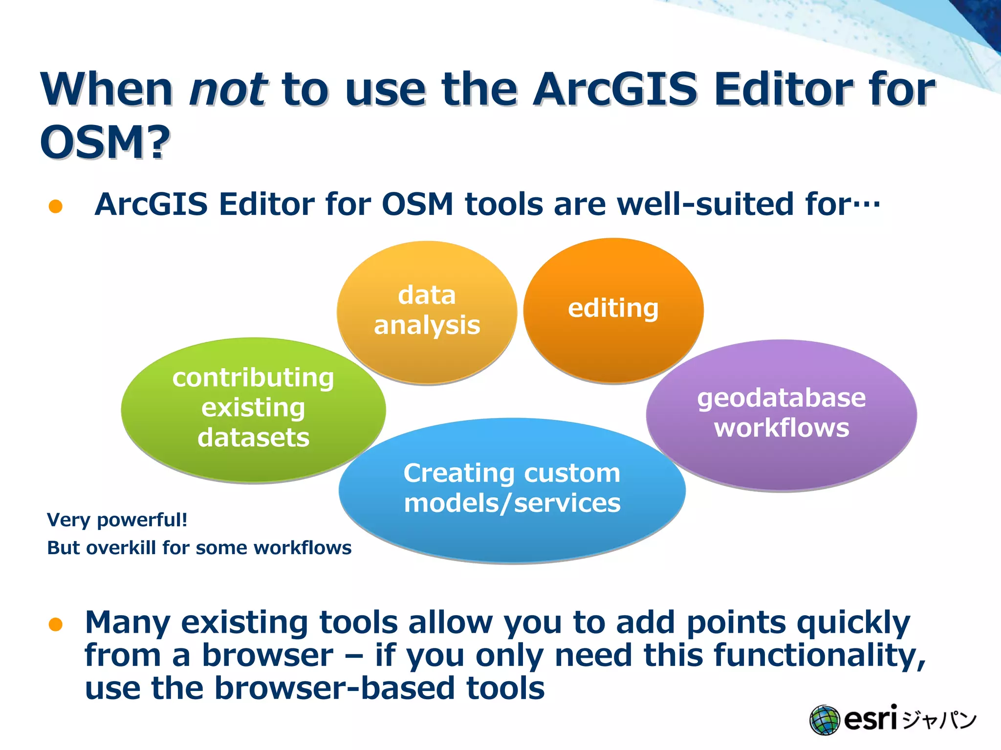

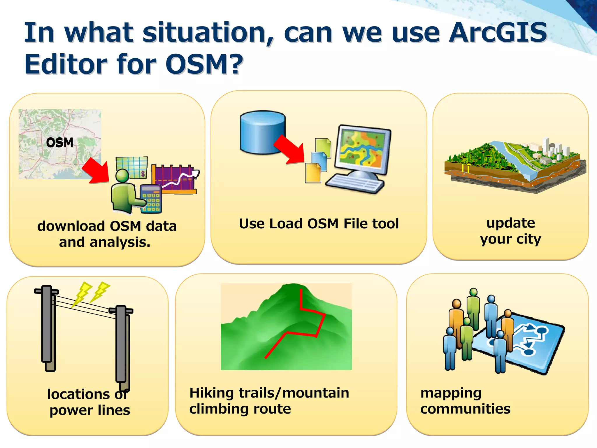


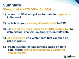
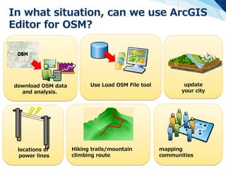
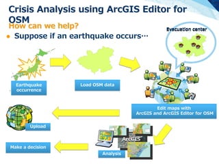
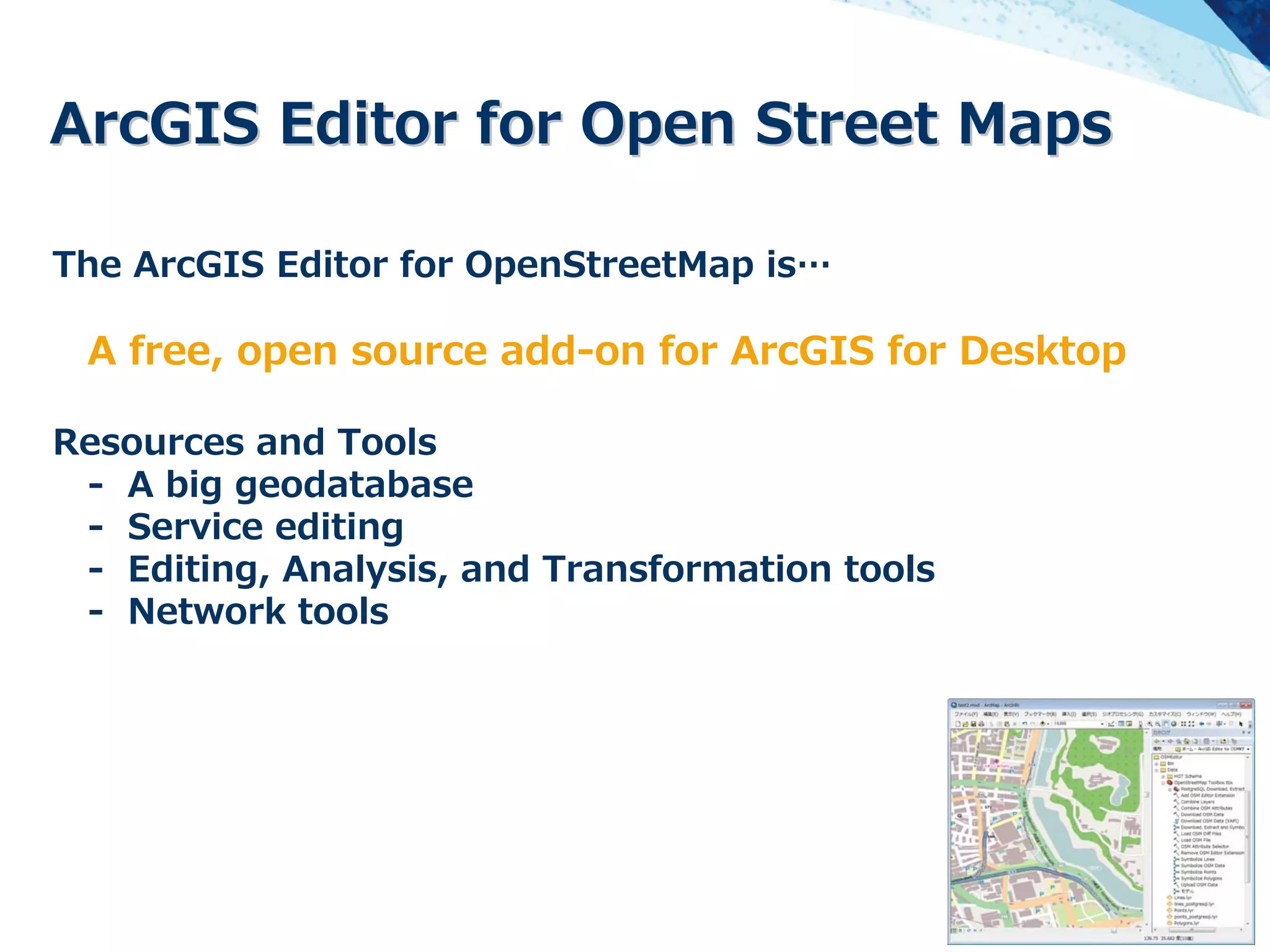
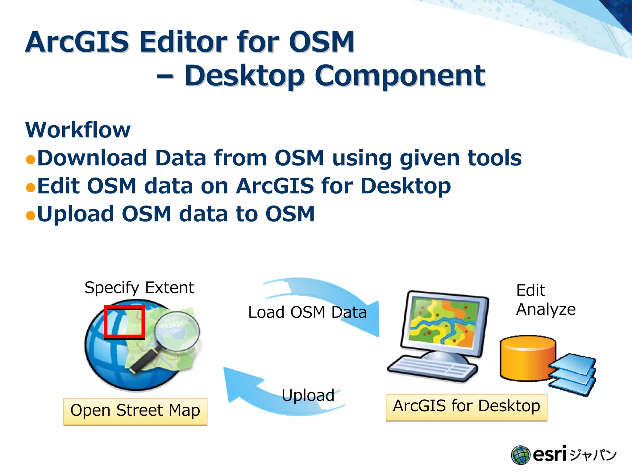
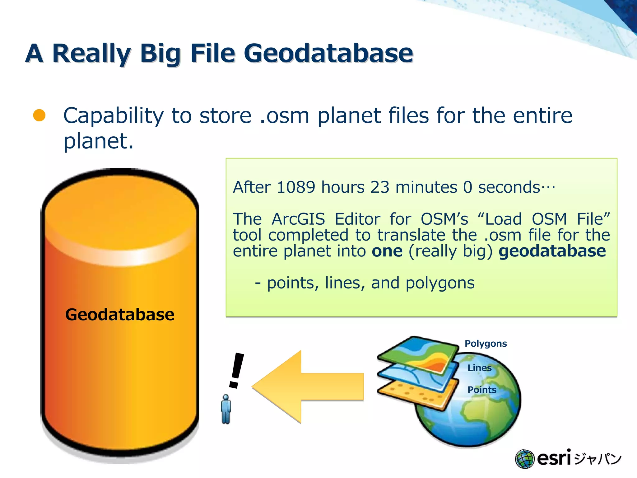
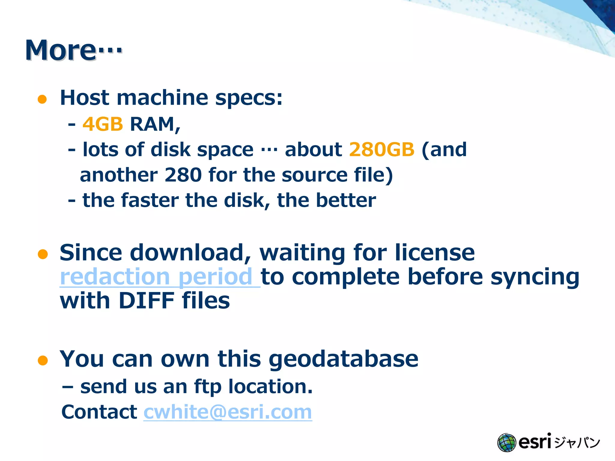
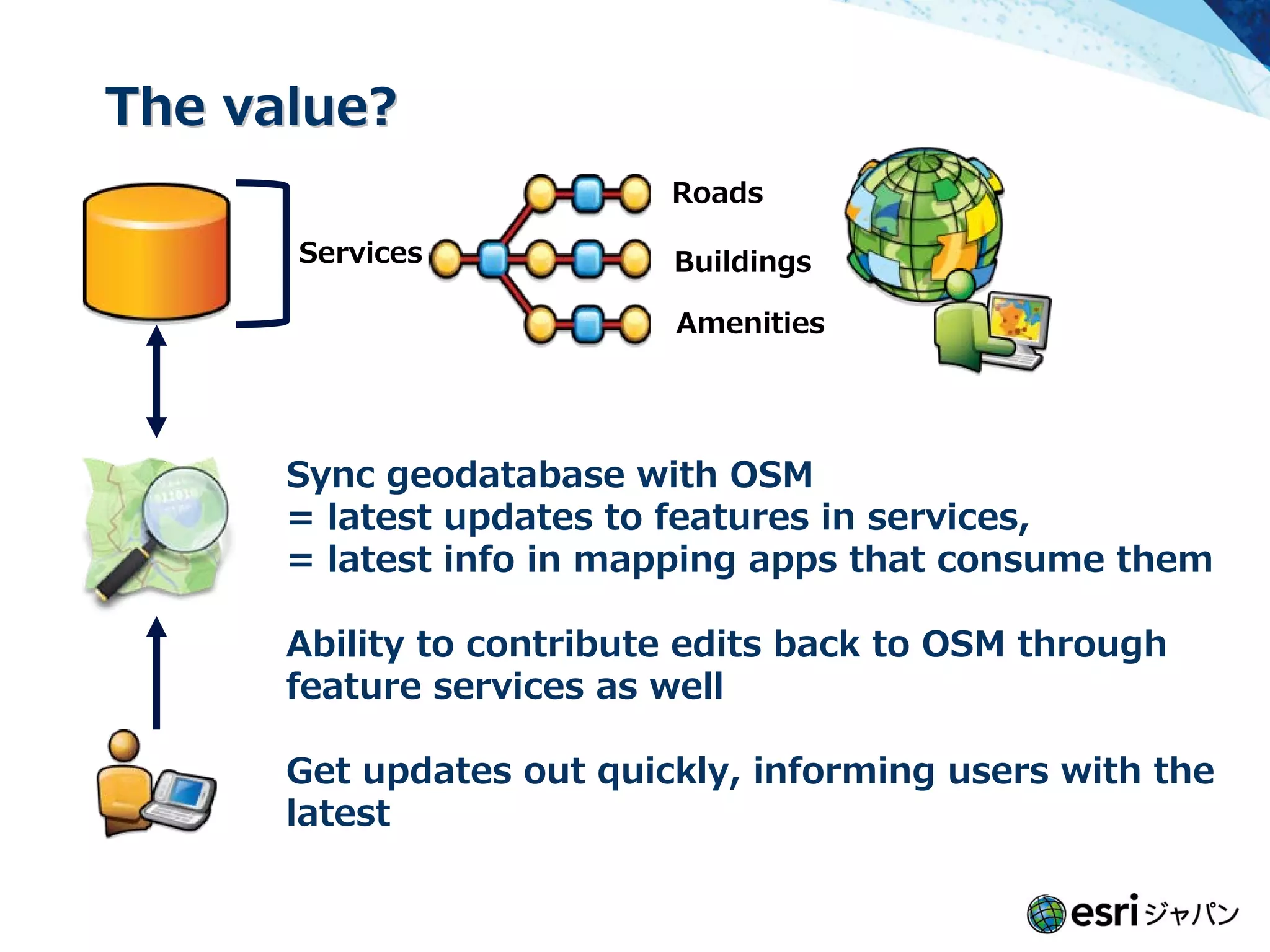
The document provides an overview of the ArcGIS Editor for OpenStreetMap (OSM). It discusses: 1) The desktop and server components that allow editing OSM data in ArcGIS and creating feature services from OSM data. 2) Key features like downloading global OSM data, creating a large geodatabase, network analysis tools, and uploading edits back to OSM. 3) Effective usage cases like contributing existing datasets to OSM, using ArcGIS tools for analysis and editing, and creating custom services from OSM data. 4) Examples of using the tools for crisis analysis and updating maps of power lines and hiking trails.


