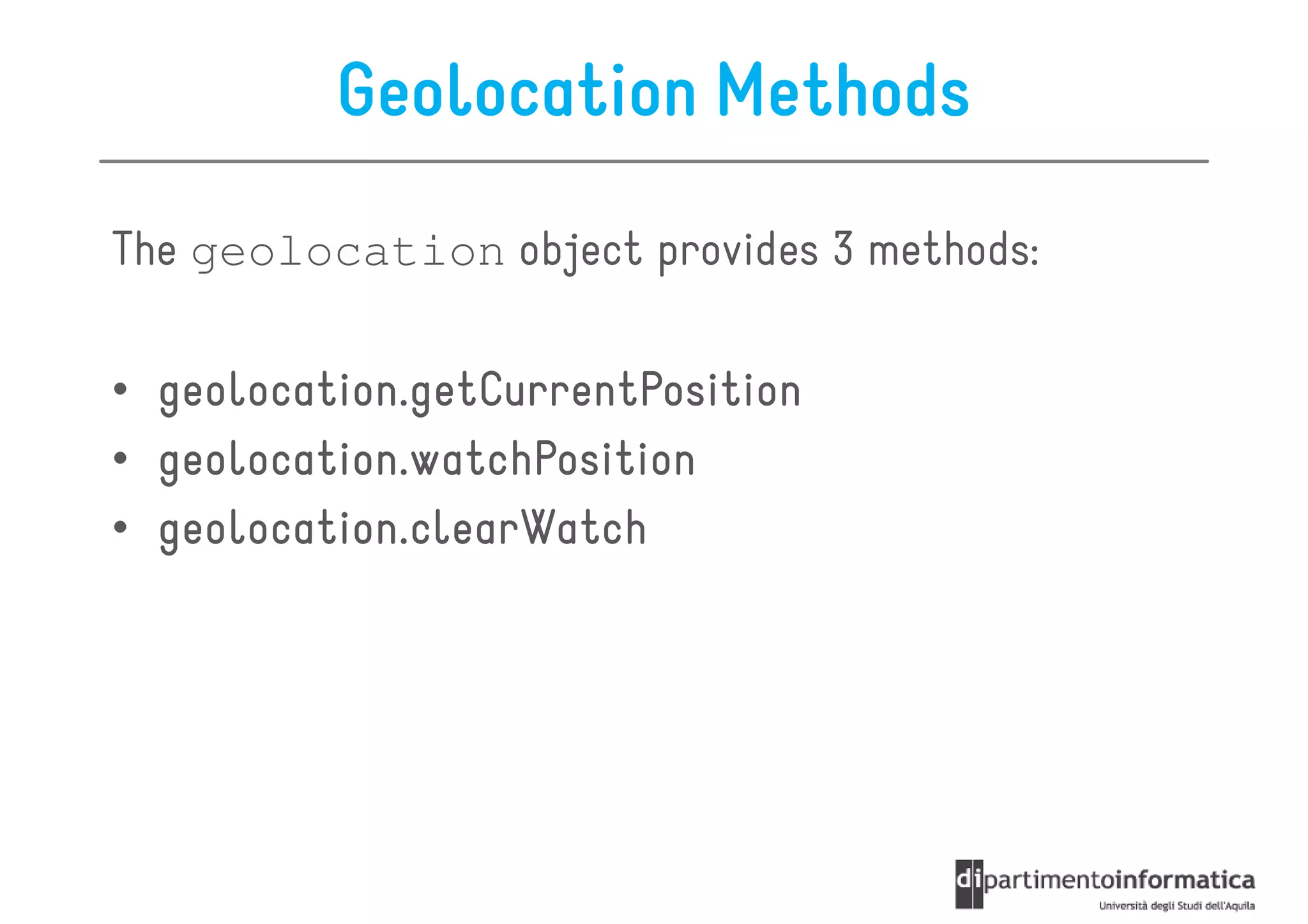
Download as PDF, PPTX


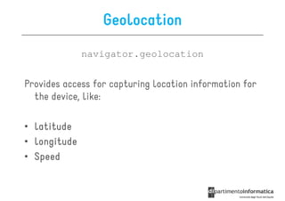
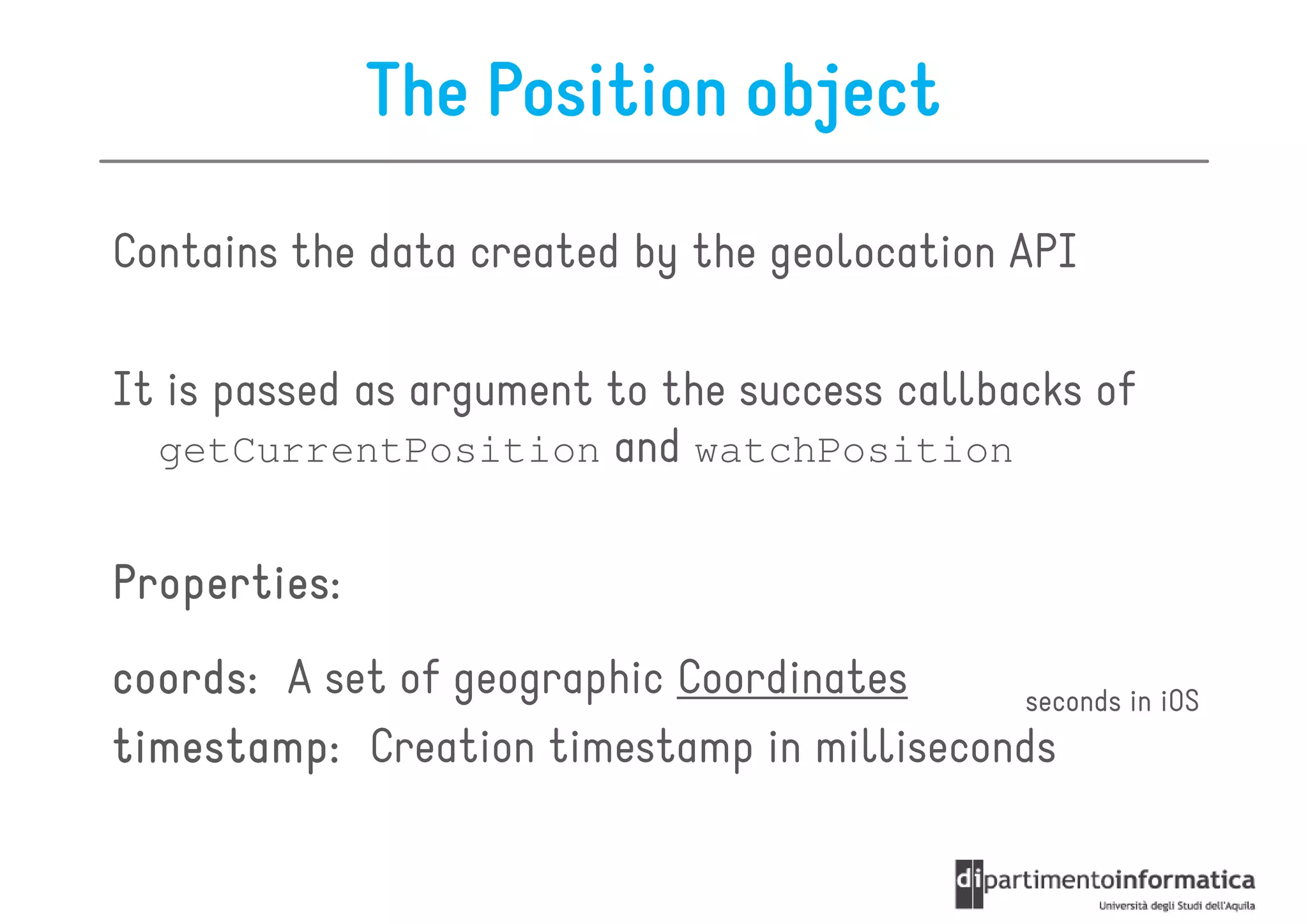
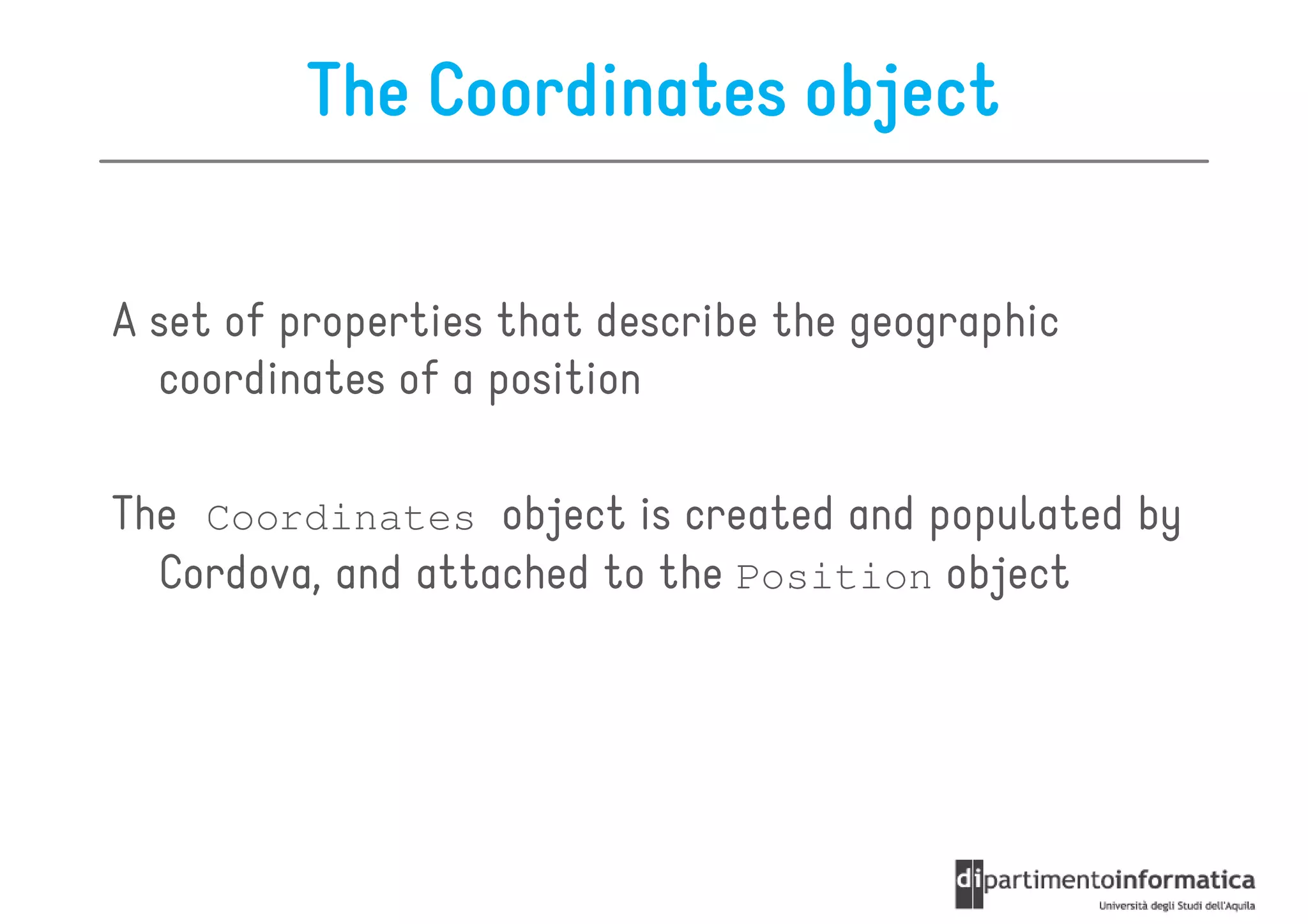
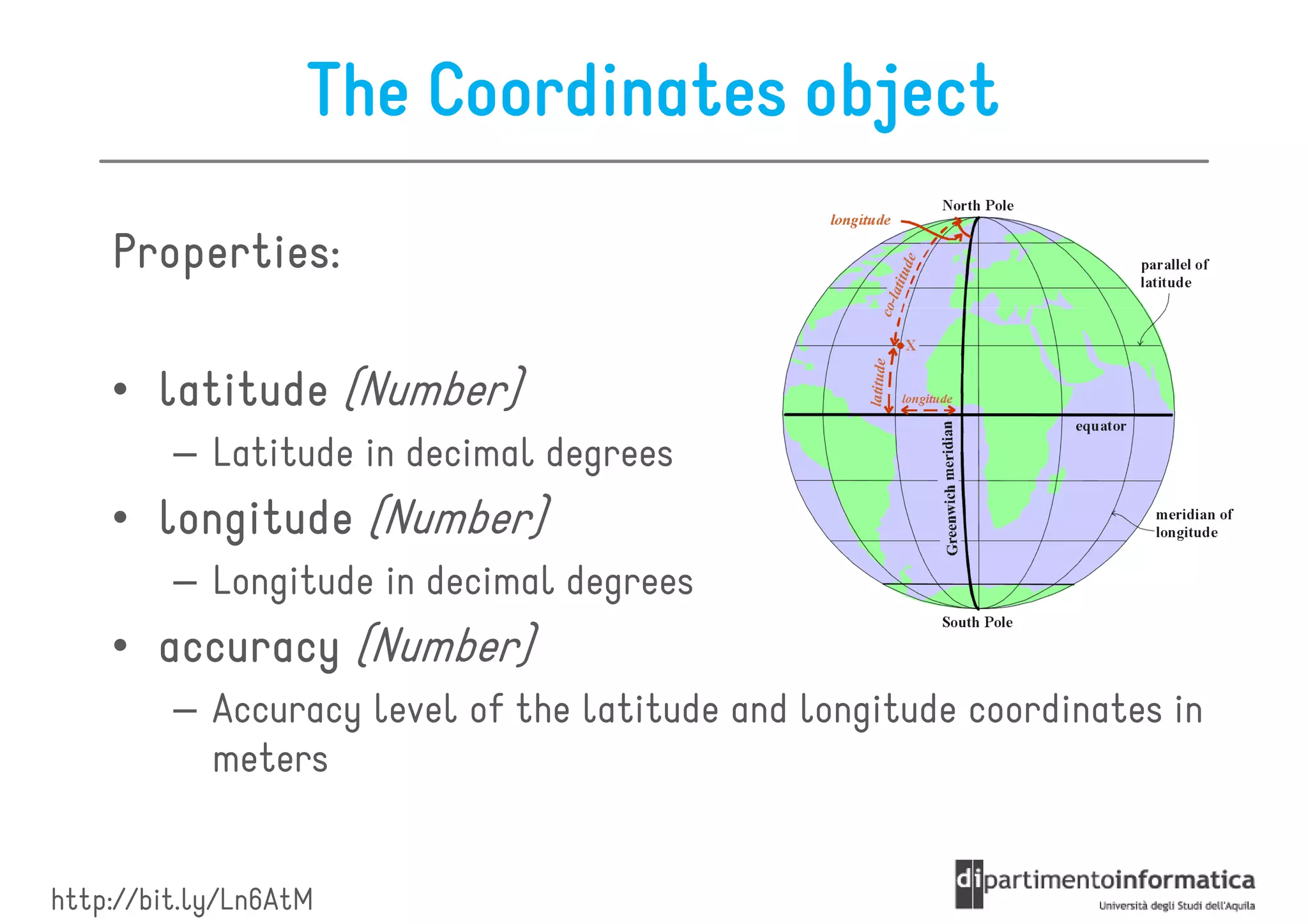
![getCurrentPosition
It returns the device's current position
getCurrentPosition(win, [fail], [options]);
win
callback function with a Position parameter
fail
error callback
options
geolocation options](https://image.slidesharecdn.com/lecture16-120607094436-phpapp01/85/Geolocation-and-Mapping-10-320.jpg)
![watchPosition
It gets the device's position when a change in position has
been detected
var id = watchPosition(win, [fail], [options]);
win
callback function with a Position parameter
fail
error callback
options
geolocation options](https://image.slidesharecdn.com/lecture16-120607094436-phpapp01/85/Geolocation-and-Mapping-11-320.jpg)


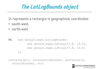


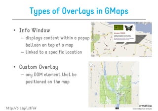

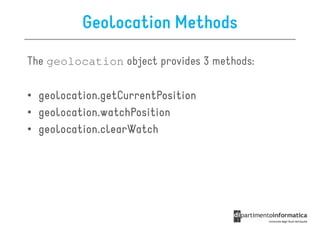
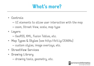
![Polylines Options
• path[]
– array of LatLng, one for each point of the polyline
• strokeColor
– color of the lines in CSS syntax
• strokeOpacity
– opacity of the lines as a decimal number between 0 and 1
• strokeWeight
– the weight of the line's stroke in pixels
• editable
– boolean, specifies whether users can modify it or not](https://image.slidesharecdn.com/lecture16-120607094436-phpapp01/85/Geolocation-and-Mapping-44-320.jpg)
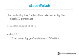
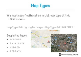
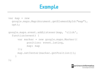
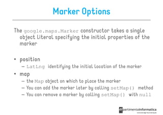
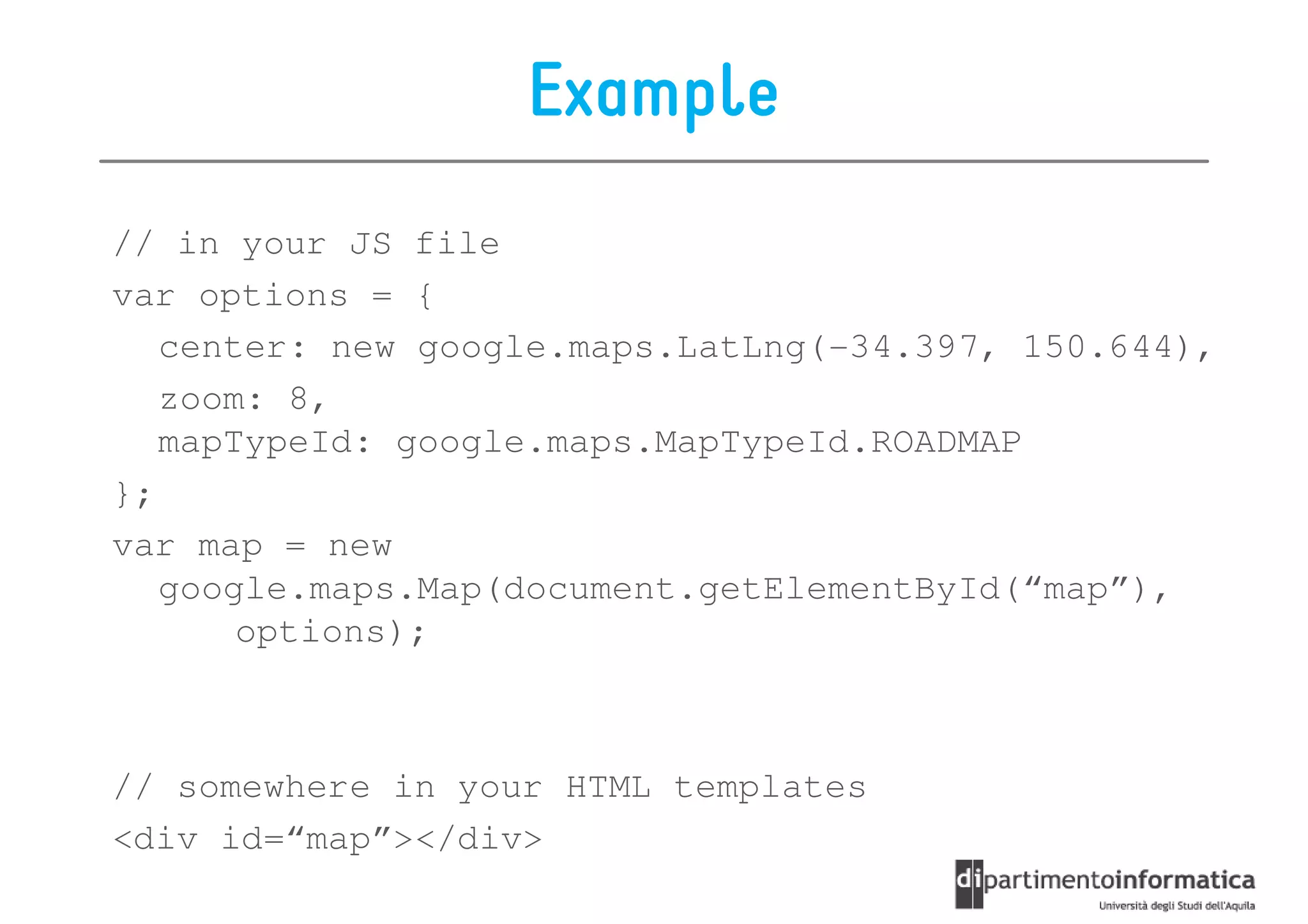
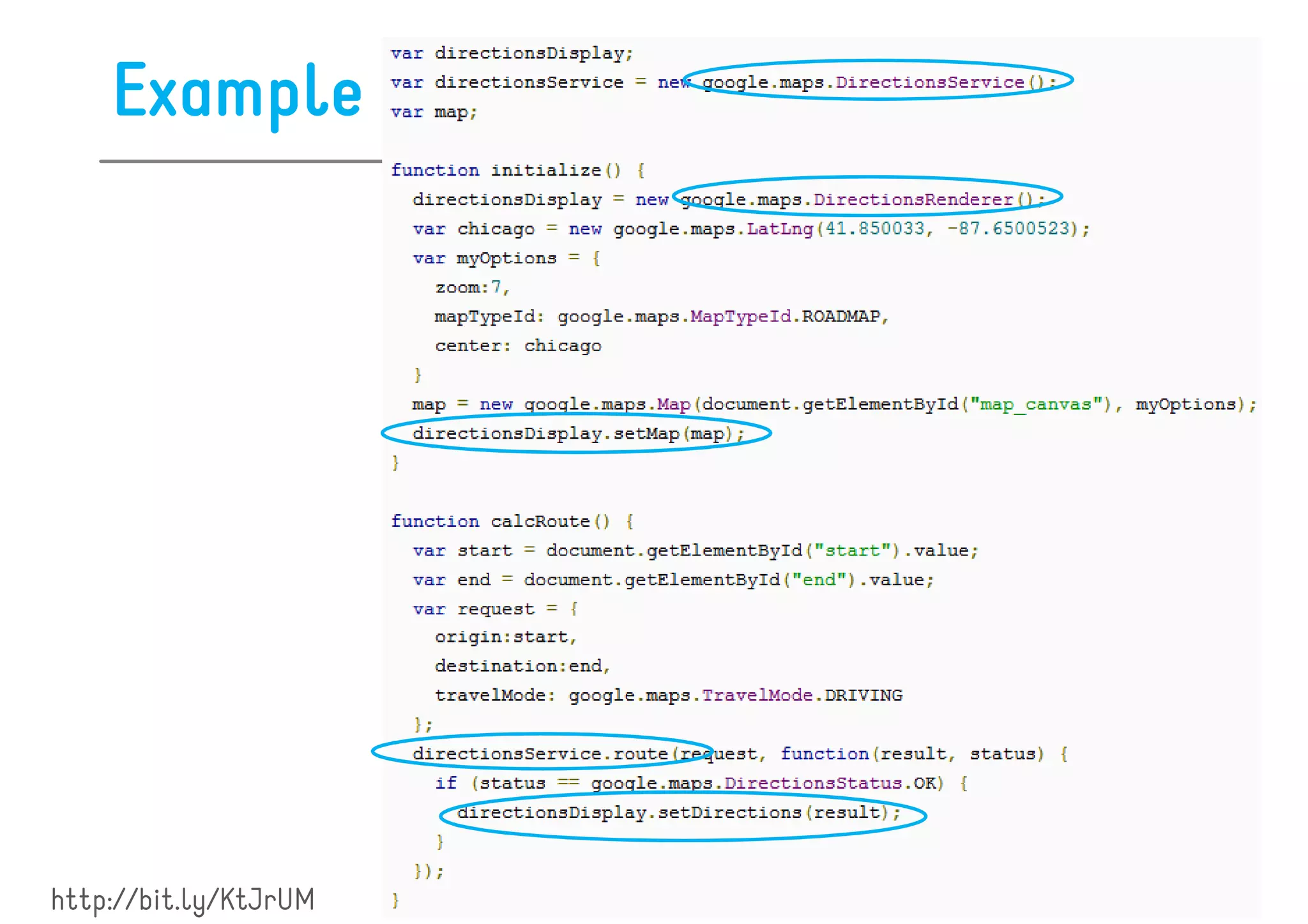
![Example
var map; // the map object, initialization omitted here
var coords = [
new google.maps.LatLng(37.772323, -122.214897),
new google.maps.LatLng(21.291982, -157.821856),
new google.maps.LatLng(-18.142599, 178.431),
new google.maps.LatLng(-27.46758, 153.027892)
];
var polyline = new google.maps.Polyline({
path: coords,
strokeColor: "#00FF00",
strokeOpacity: 1.0,
strokeWeight: 1
});
flightPath.setMap(map);](https://image.slidesharecdn.com/lecture16-120607094436-phpapp01/85/Geolocation-and-Mapping-45-320.jpg)
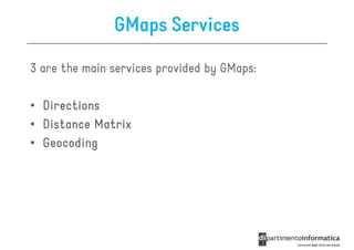
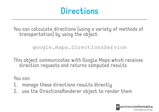
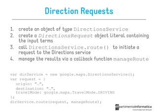
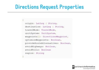
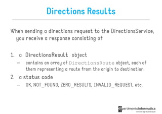

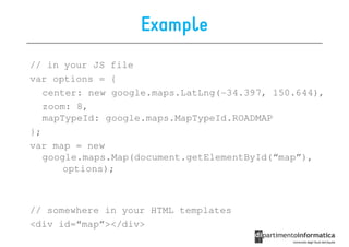
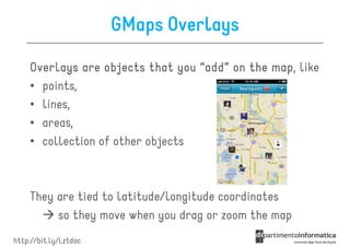
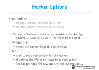
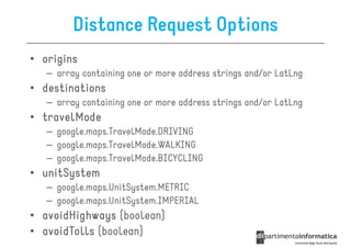
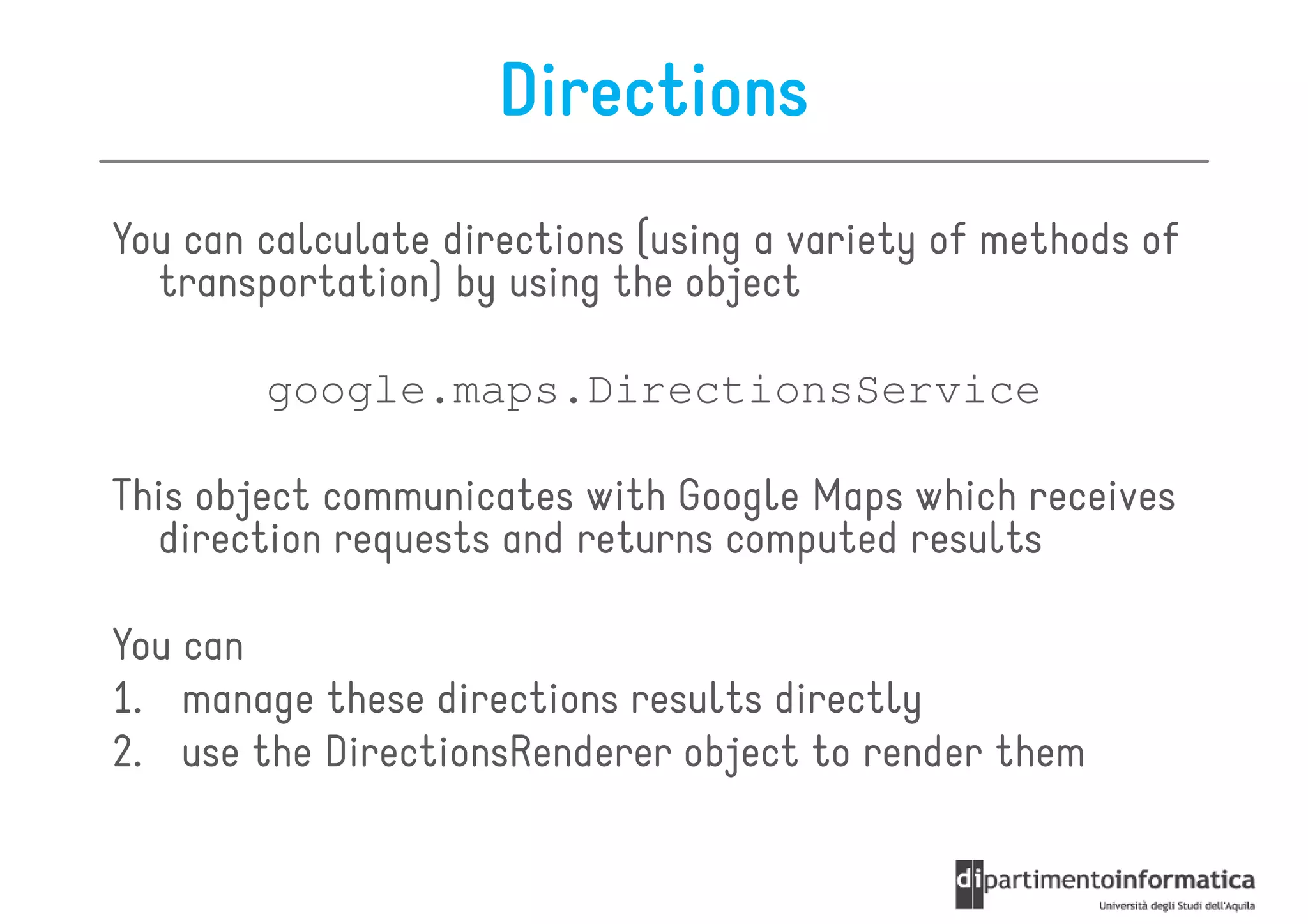
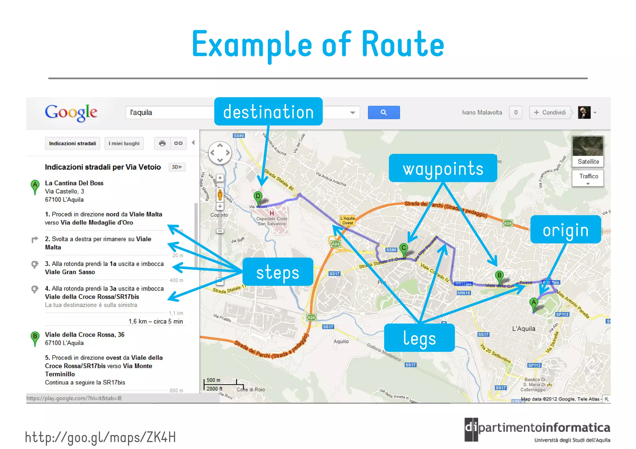
![Routes
It is an object literal with the following fields:
• legs array of DirectionsLeg objects
legs[]:
• waypoint_order indicates the order of waypoints
waypoint_order[]:
• overview_path[]: array of LatLngs approximating the
overview_path
path of the resulting directions
• bounds LatLngBounds containing the route
bounds:
• copyrights: text
copyrights
• warnings text
warnings:](https://image.slidesharecdn.com/lecture16-120607094436-phpapp01/85/Geolocation-and-Mapping-52-320.jpg)
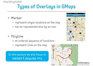
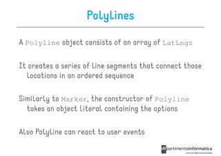
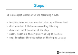
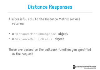
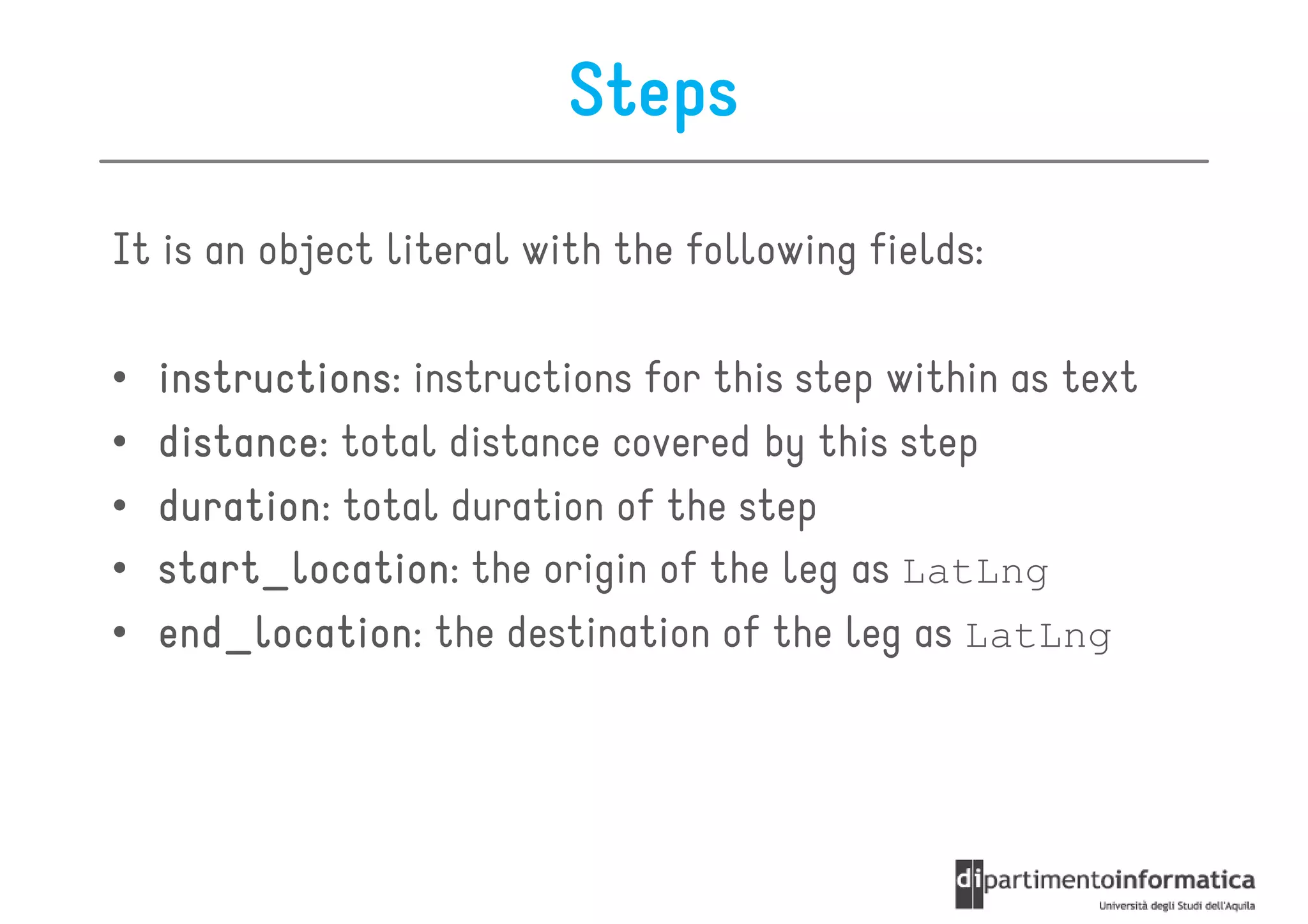
![Legs
It is an object literal with the following fields:
• steps[]:
steps array of DirectionsStep objects
• distance:
distance total distance covered by this leg
• duration:
duration total duration of the leg
• start_location:
start_location the origin of the leg as LatLng
• end_location:
end_location the destination of the leg as LatLng
• start_address:
start_address the origin of the leg as text
• end_address: the destination of the leg as text
end_address](https://image.slidesharecdn.com/lecture16-120607094436-phpapp01/85/Geolocation-and-Mapping-53-320.jpg)
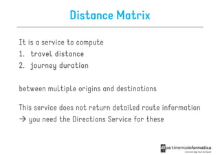
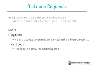
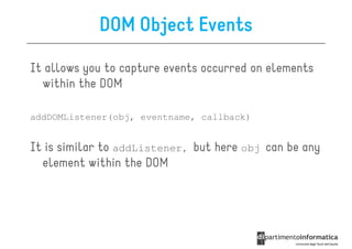
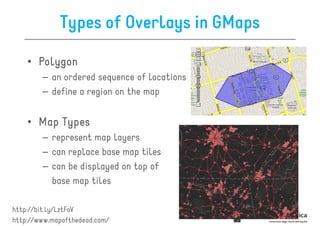
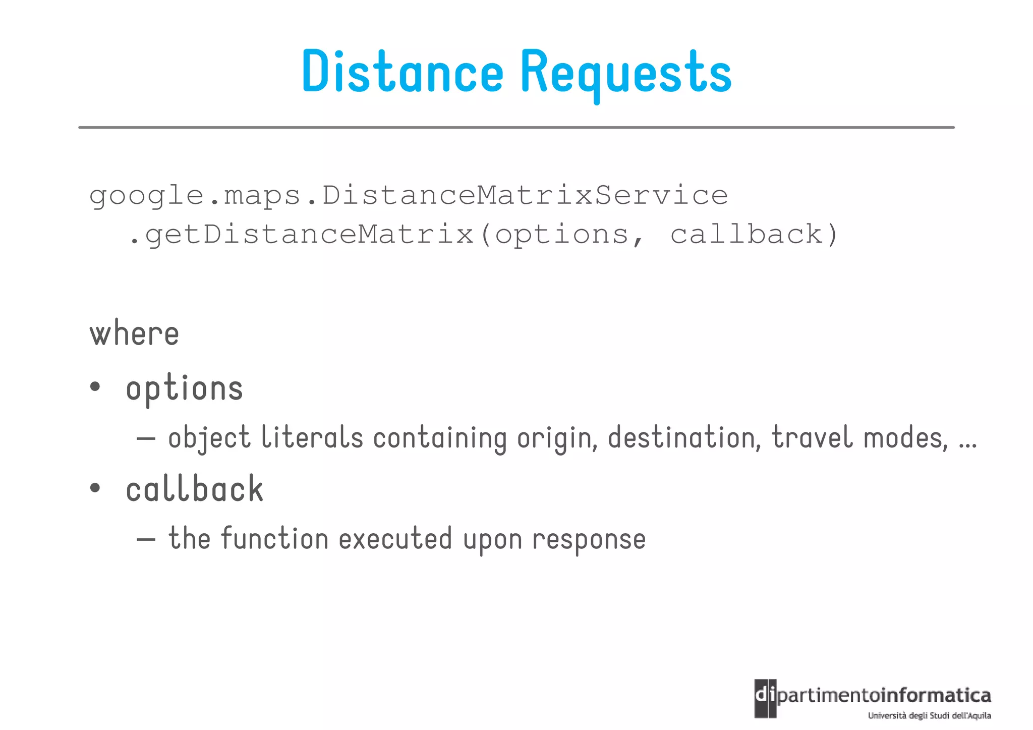
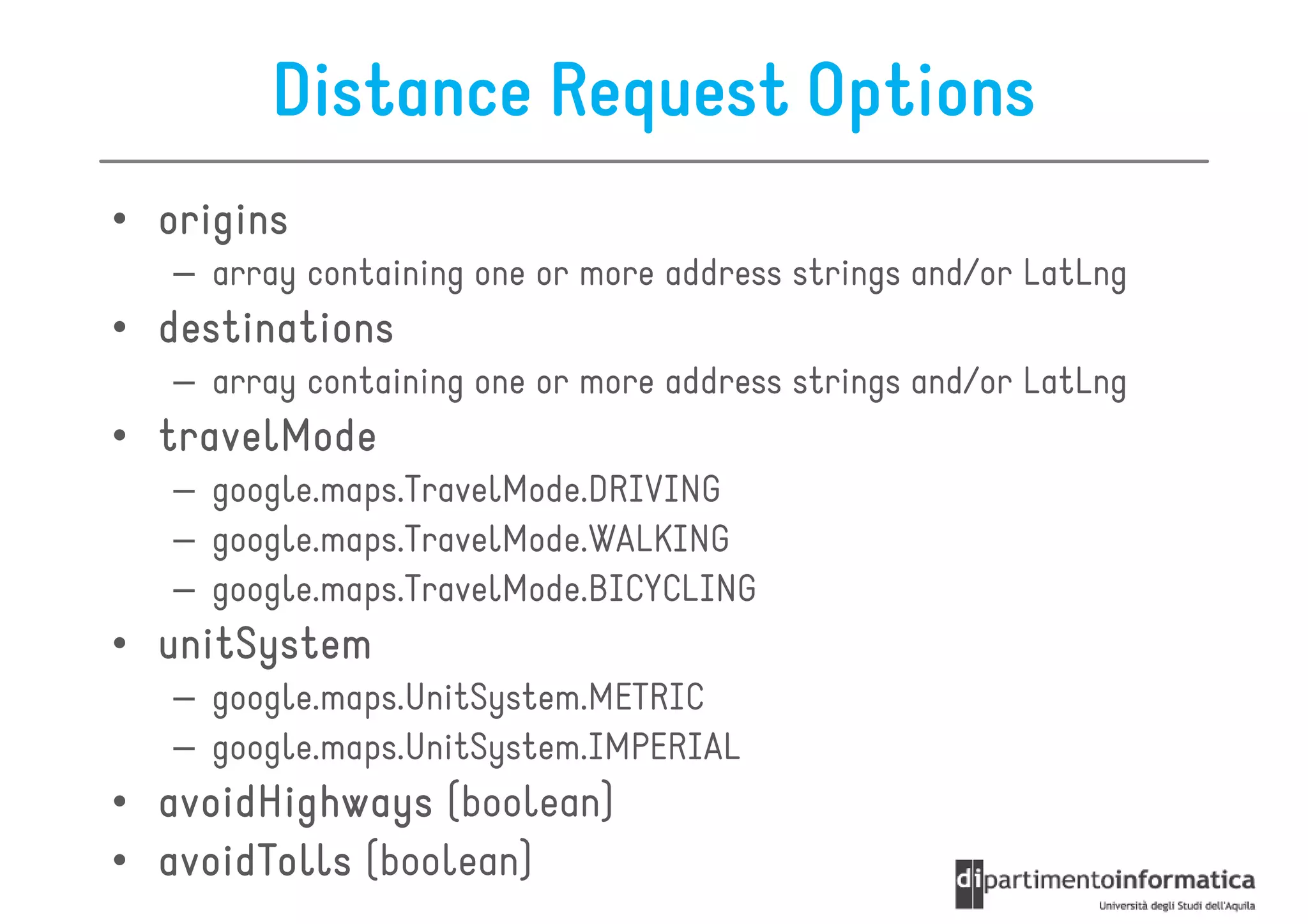
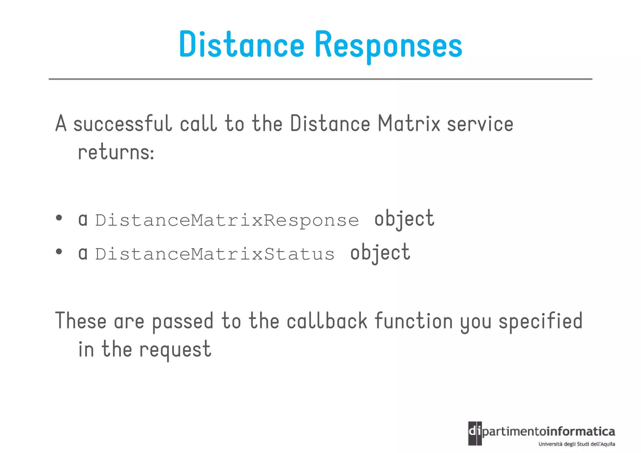
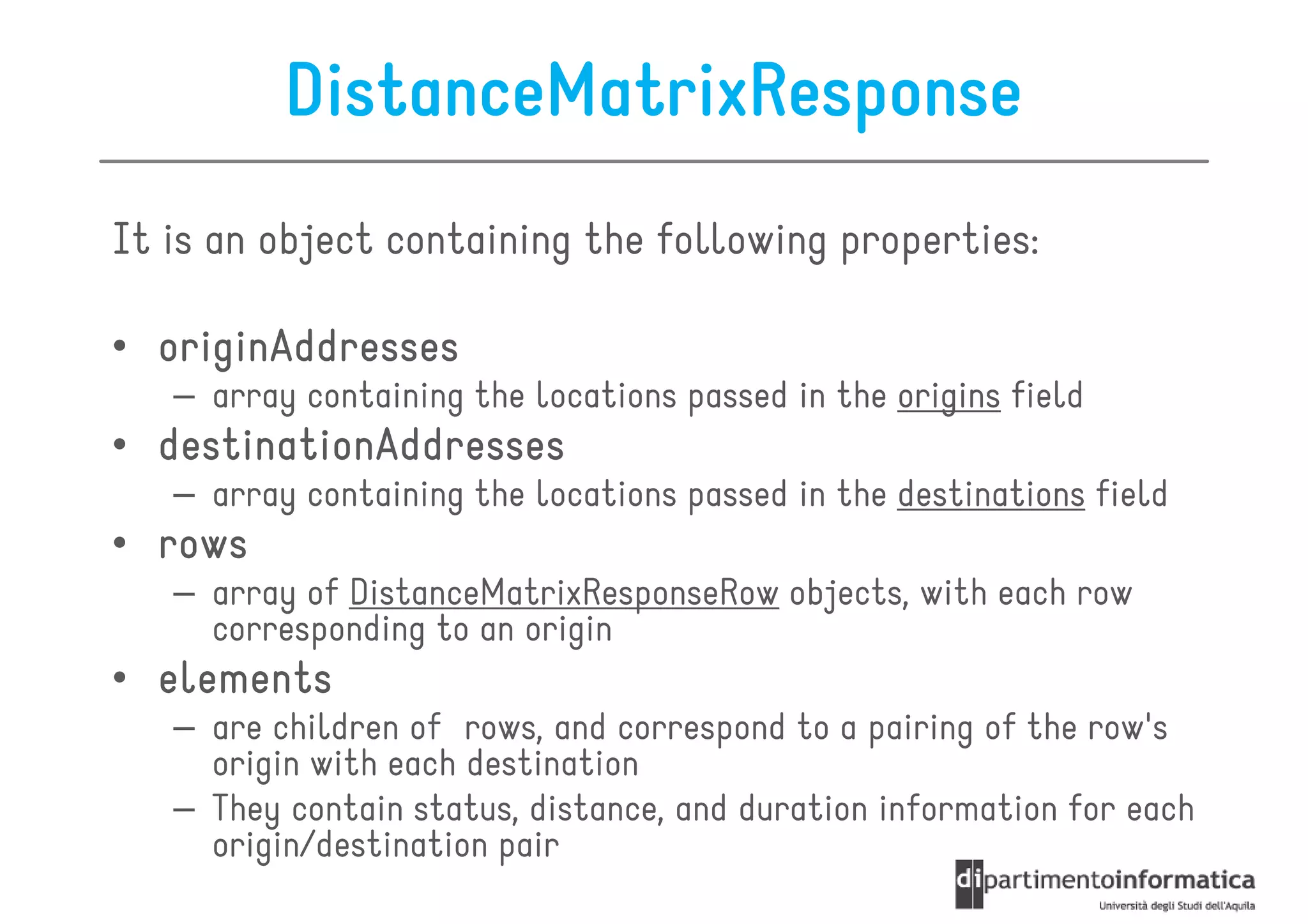
![Example
var origin = “L’Aquila, Italy";
var destination = “London, England";
var service = new google.maps.DistanceMatrixService();
service.getDistanceMatrix({
origins: [origin],
destinations: [destination],
travelMode: google.maps.TravelMode.DRIVING,
avoidHighways: false,
avoidTolls: false
}, callback);
function callback(response, status) {
if (status == google.maps.DistanceMatrixStatus.OK) {
var t = response.rows[0].elements[0].distance.text;
alert(t);
}
}](https://image.slidesharecdn.com/lecture16-120607094436-phpapp01/85/Geolocation-and-Mapping-61-320.jpg)


![getCurrentPosition
It returns the device's current position
getCurrentPosition(win, [fail], [options]);
win
callback function with a Position parameter
fail
error callback
options
geolocation options](https://image.slidesharecdn.com/lecture16-120607094436-phpapp01/75/Geolocation-and-Mapping-10-2048.jpg)
![watchPosition
It gets the device's position when a change in position has
been detected
var id = watchPosition(win, [fail], [options]);
win
callback function with a Position parameter
fail
error callback
options
geolocation options](https://image.slidesharecdn.com/lecture16-120607094436-phpapp01/75/Geolocation-and-Mapping-11-2048.jpg)


![Polylines Options
• path[]
– array of LatLng, one for each point of the polyline
• strokeColor
– color of the lines in CSS syntax
• strokeOpacity
– opacity of the lines as a decimal number between 0 and 1
• strokeWeight
– the weight of the line's stroke in pixels
• editable
– boolean, specifies whether users can modify it or not](https://image.slidesharecdn.com/lecture16-120607094436-phpapp01/75/Geolocation-and-Mapping-44-2048.jpg)
![Example
var map; // the map object, initialization omitted here
var coords = [
new google.maps.LatLng(37.772323, -122.214897),
new google.maps.LatLng(21.291982, -157.821856),
new google.maps.LatLng(-18.142599, 178.431),
new google.maps.LatLng(-27.46758, 153.027892)
];
var polyline = new google.maps.Polyline({
path: coords,
strokeColor: "#00FF00",
strokeOpacity: 1.0,
strokeWeight: 1
});
flightPath.setMap(map);](https://image.slidesharecdn.com/lecture16-120607094436-phpapp01/75/Geolocation-and-Mapping-45-2048.jpg)
![Routes
It is an object literal with the following fields:
• legs array of DirectionsLeg objects
legs[]:
• waypoint_order indicates the order of waypoints
waypoint_order[]:
• overview_path[]: array of LatLngs approximating the
overview_path
path of the resulting directions
• bounds LatLngBounds containing the route
bounds:
• copyrights: text
copyrights
• warnings text
warnings:](https://image.slidesharecdn.com/lecture16-120607094436-phpapp01/75/Geolocation-and-Mapping-52-2048.jpg)
![Legs
It is an object literal with the following fields:
• steps[]:
steps array of DirectionsStep objects
• distance:
distance total distance covered by this leg
• duration:
duration total duration of the leg
• start_location:
start_location the origin of the leg as LatLng
• end_location:
end_location the destination of the leg as LatLng
• start_address:
start_address the origin of the leg as text
• end_address: the destination of the leg as text
end_address](https://image.slidesharecdn.com/lecture16-120607094436-phpapp01/75/Geolocation-and-Mapping-53-2048.jpg)
![Example
var origin = “L’Aquila, Italy";
var destination = “London, England";
var service = new google.maps.DistanceMatrixService();
service.getDistanceMatrix({
origins: [origin],
destinations: [destination],
travelMode: google.maps.TravelMode.DRIVING,
avoidHighways: false,
avoidTolls: false
}, callback);
function callback(response, status) {
if (status == google.maps.DistanceMatrixStatus.OK) {
var t = response.rows[0].elements[0].distance.text;
alert(t);
}
}](https://image.slidesharecdn.com/lecture16-120607094436-phpapp01/75/Geolocation-and-Mapping-61-2048.jpg)


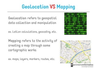
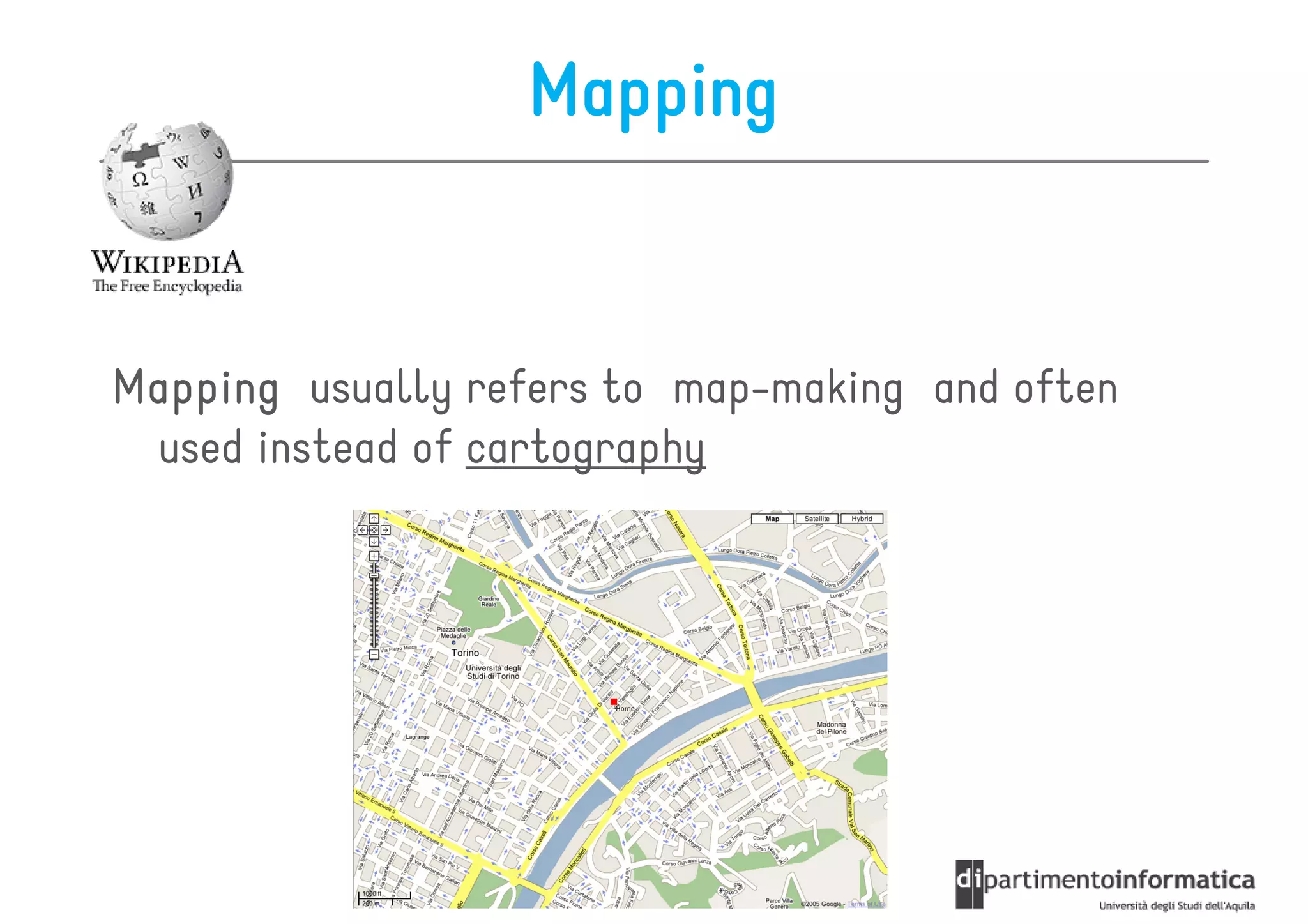
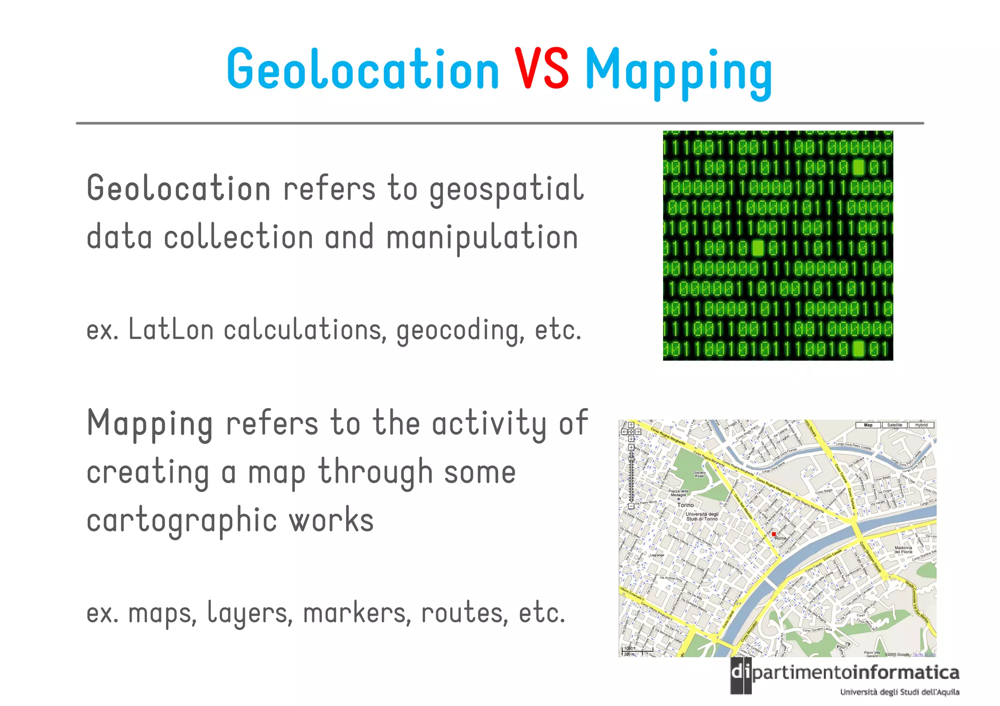
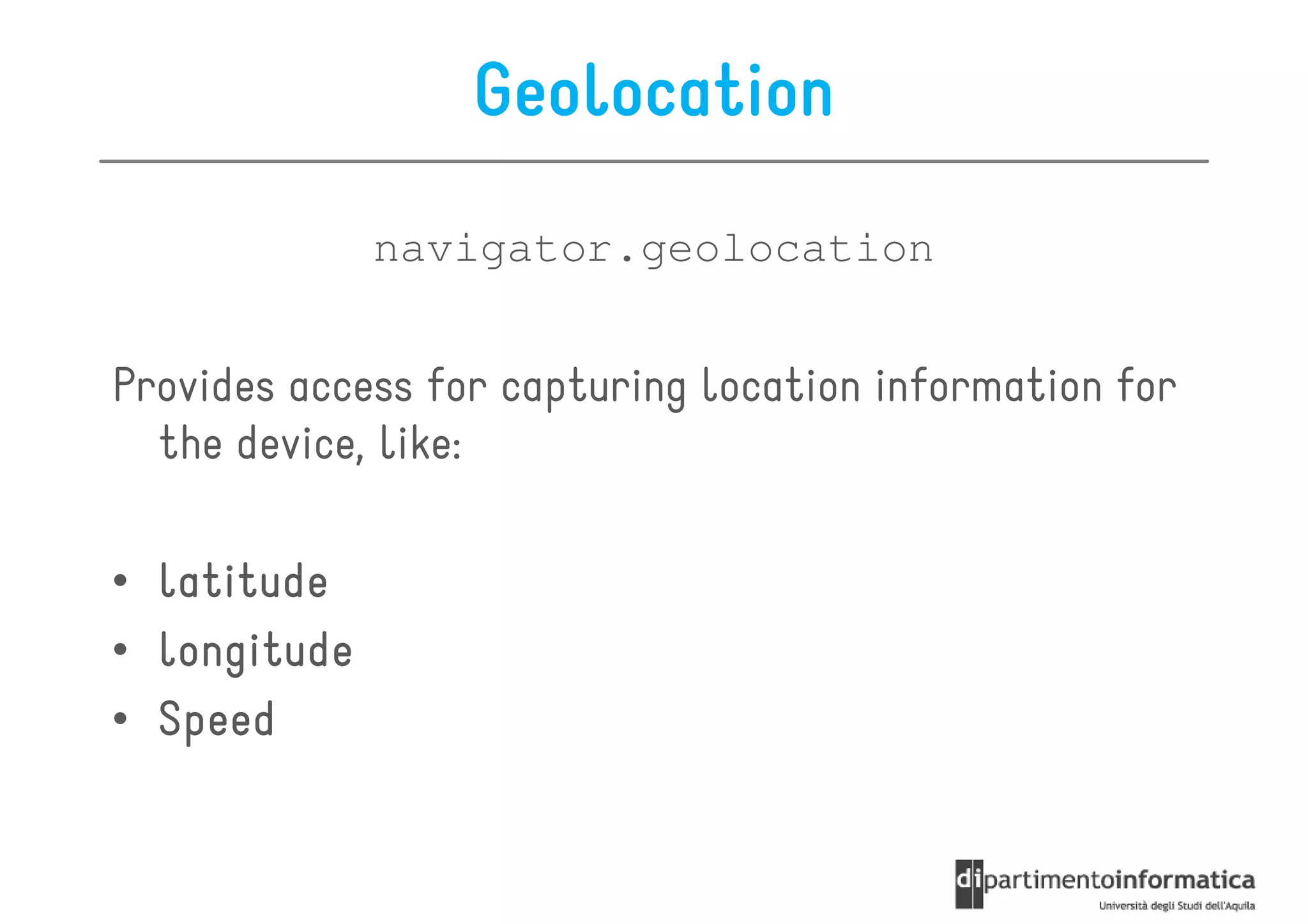
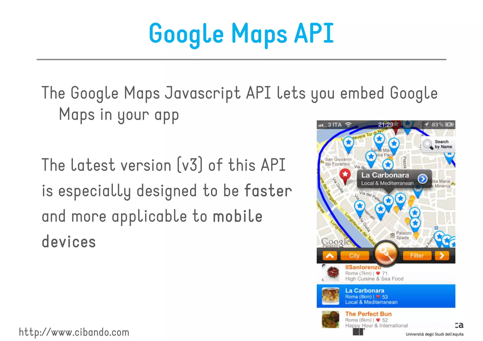
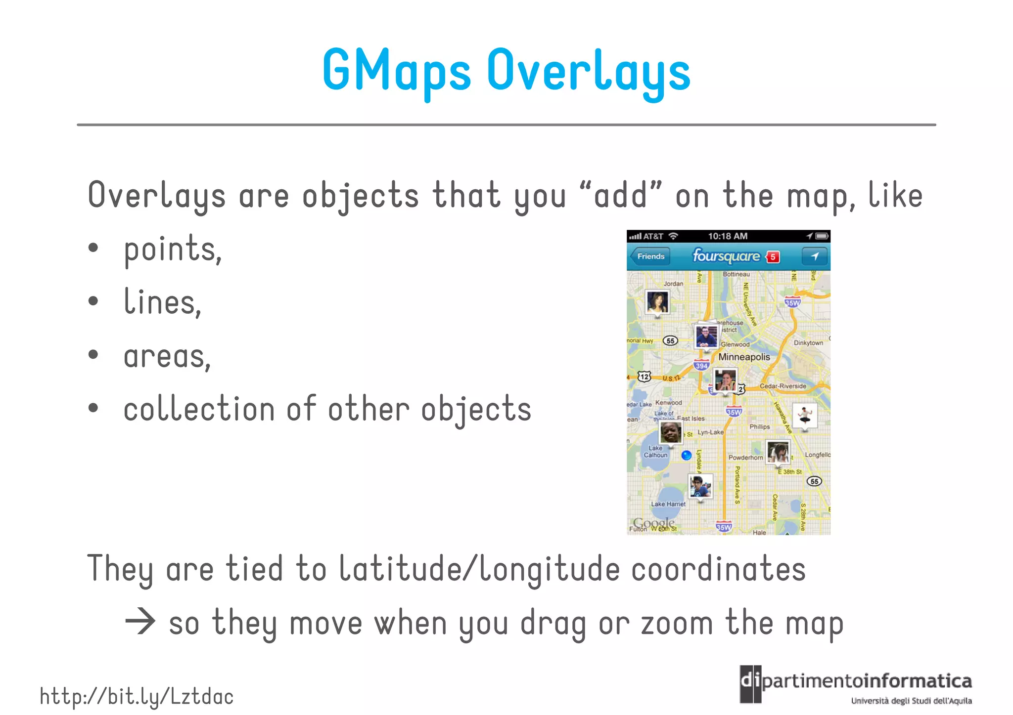
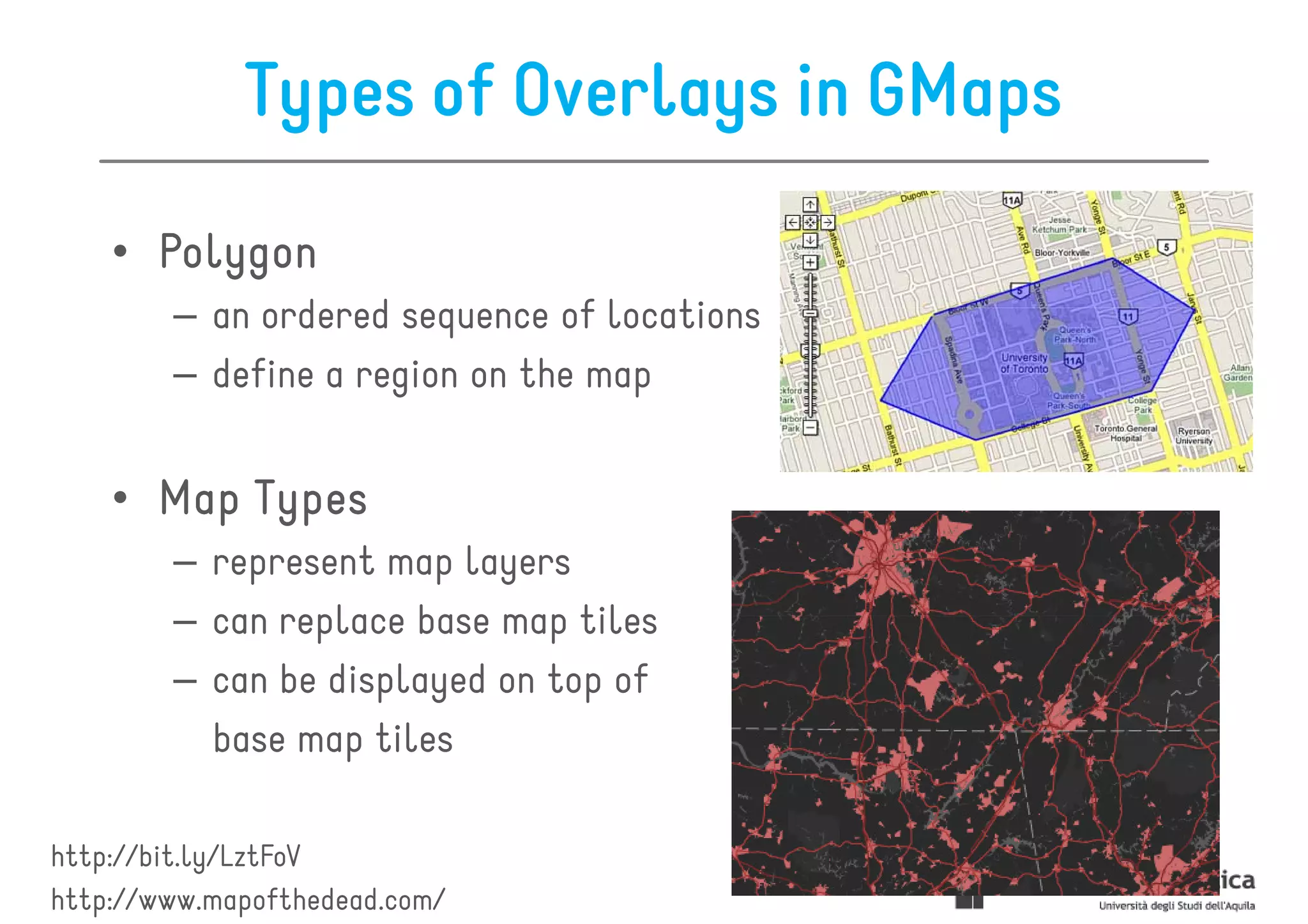
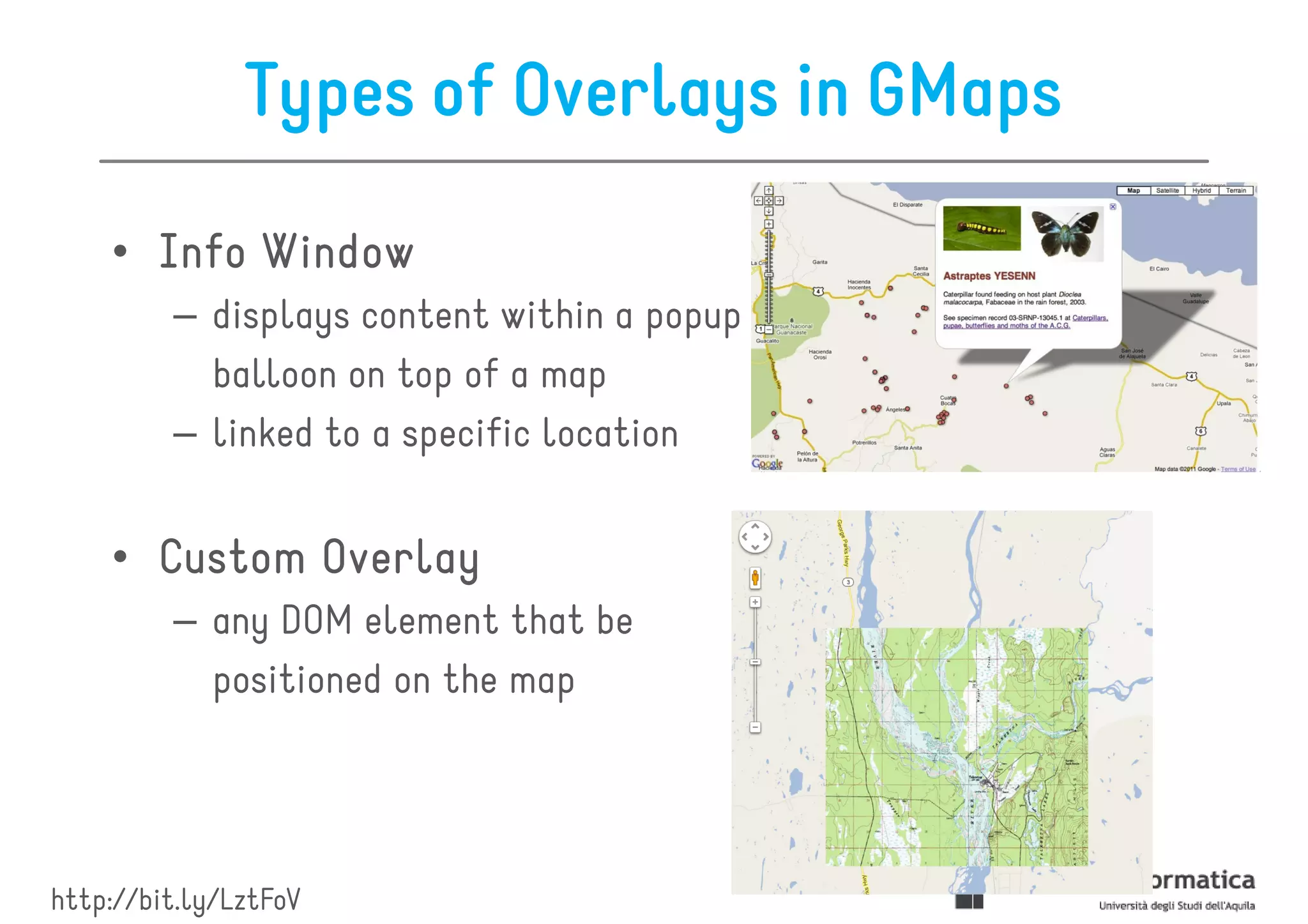
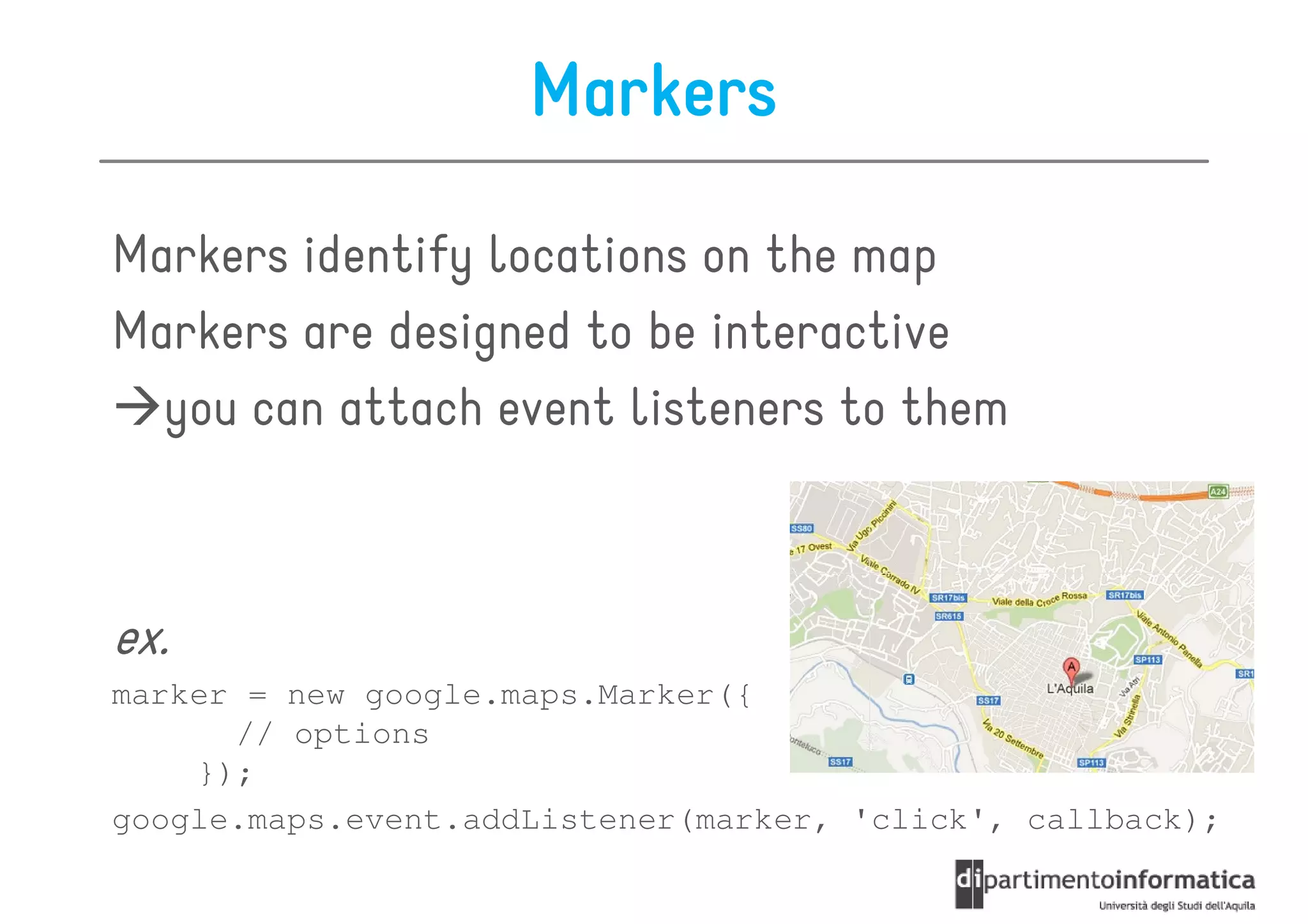
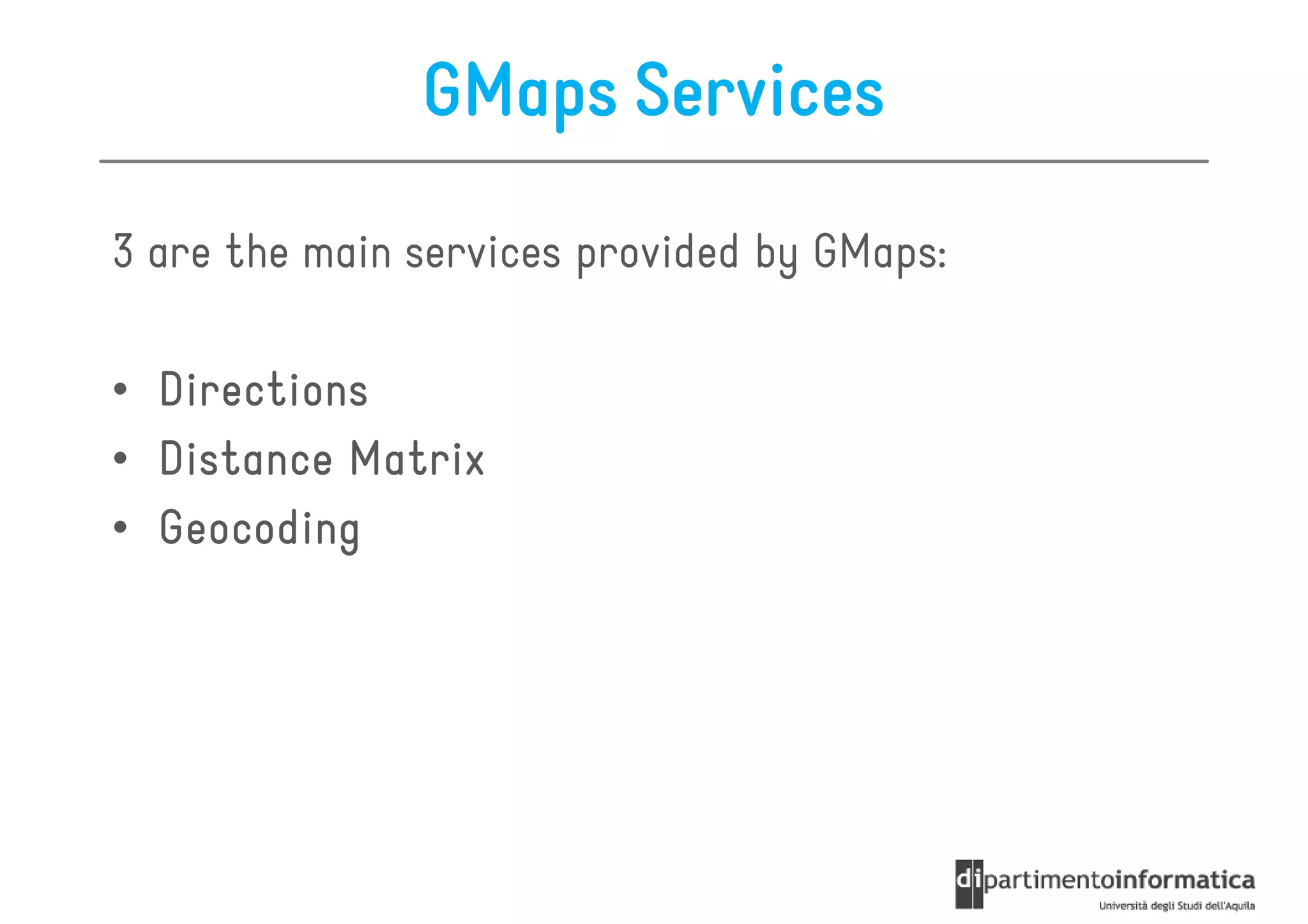
This document provides an overview of geolocation and mapping using Google Maps services. It defines geolocation as identifying the real-world location of an object like a mobile phone or computer. Mapping refers to map-making and cartography. The document reviews the navigator.geolocation API for accessing location data, the Google Maps Javascript API for embedding maps, and common overlays like markers and polylines that can be added to maps. It also summarizes services for obtaining directions and distance matrix information between locations.


![[2015/2016] Geolocation and mapping](https://cdn.slidesharecdn.com/ss_thumbnails/06bgeo-160413121805-thumbnail.jpg?width=600ounds&width=560&fit=bounds)


![How Maintainability Issues of Android Apps Evolve [ICSME 2018]](https://cdn.slidesharecdn.com/ss_thumbnails/icsme2018-180928081558-thumbnail.jpg?width=600ounds&width=560&fit=bounds)


![Modeling objects interaction via UML sequence diagrams [Software Design] [Com...](https://cdn.slidesharecdn.com/ss_thumbnails/06sequencediagrams-180314152521-thumbnail.jpg?width=600ounds&width=560&fit=bounds)
![Modeling behaviour via UML state machines [Software Design] [Computer Science...](https://cdn.slidesharecdn.com/ss_thumbnails/05statemachines-180306225932-thumbnail.jpg?width=600ounds&width=560&fit=bounds)
![Object-oriented design patterns in UML [Software Design] [Computer Science] [...](https://cdn.slidesharecdn.com/ss_thumbnails/04designpatterns-180228160652-thumbnail.jpg?width=600ounds&width=560&fit=bounds)
![Structure modeling with UML [Software Design] [Computer Science] [Vrije Unive...](https://cdn.slidesharecdn.com/ss_thumbnails/03structuremodeling-180219151135-thumbnail.jpg?width=600ounds&width=560&fit=bounds)
![Requirements engineering with UML [Software Design] [Computer Science] [Vrije...](https://cdn.slidesharecdn.com/ss_thumbnails/02requirements-180213083117-thumbnail.jpg?width=600ounds&width=560&fit=bounds)
![Modeling and abstraction, software development process [Software Design] [Com...](https://cdn.slidesharecdn.com/ss_thumbnails/01intro-180206151252-thumbnail.jpg?width=600ounds&width=560&fit=bounds)
![[2017/2018] Agile development](https://cdn.slidesharecdn.com/ss_thumbnails/ivano05agiledevelopment-171123214423-thumbnail.jpg?width=600ounds&width=560&fit=bounds)

![[2017/2018] AADL - Architecture Analysis and Design Language](https://cdn.slidesharecdn.com/ss_thumbnails/ivano04saaadl-171122165132-thumbnail.jpg?width=600ounds&width=560&fit=bounds)
![[2017/2018] Architectural languages](https://cdn.slidesharecdn.com/ss_thumbnails/ivano03salanguages-171122083931-thumbnail.jpg?width=600ounds&width=560&fit=bounds)
![[2017/2018] Introduction to Software Architecture](https://cdn.slidesharecdn.com/ss_thumbnails/ivano02softwarearchitecture-171120182731-thumbnail.jpg?width=600ounds&width=560&fit=bounds)


