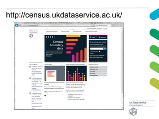
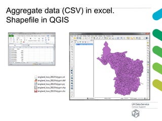
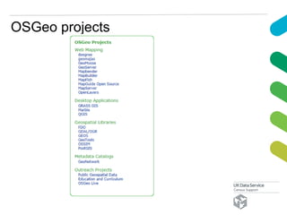
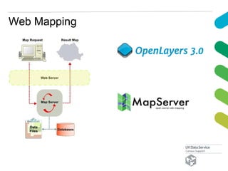
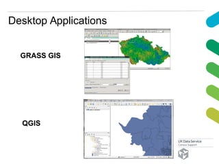
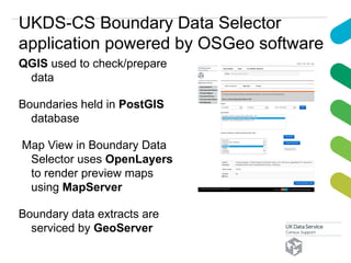
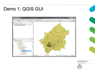
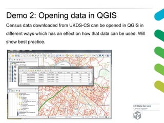
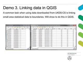
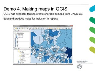
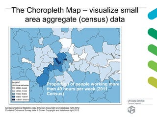
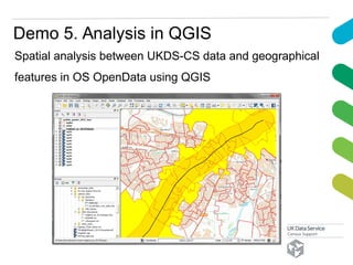
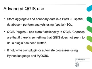
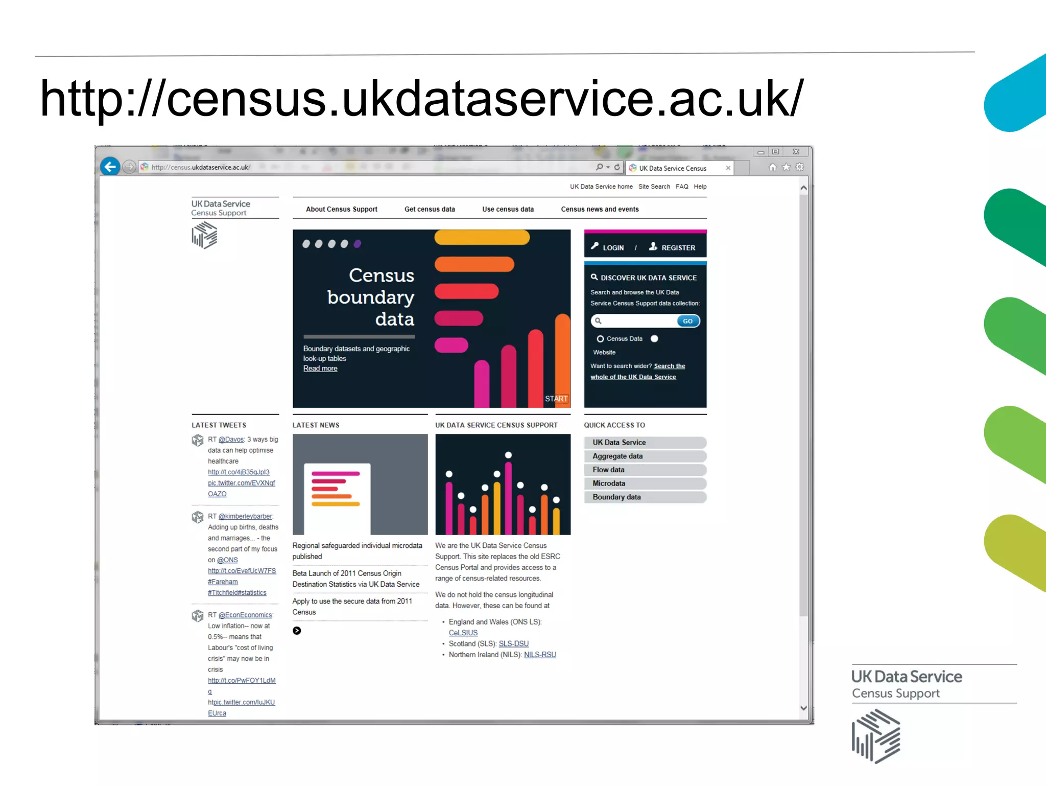
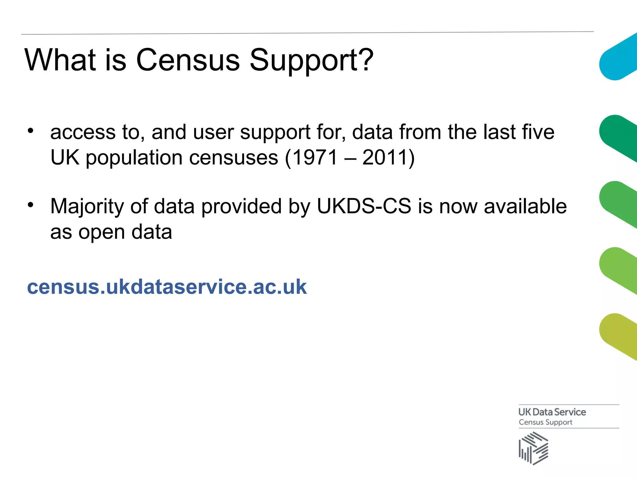
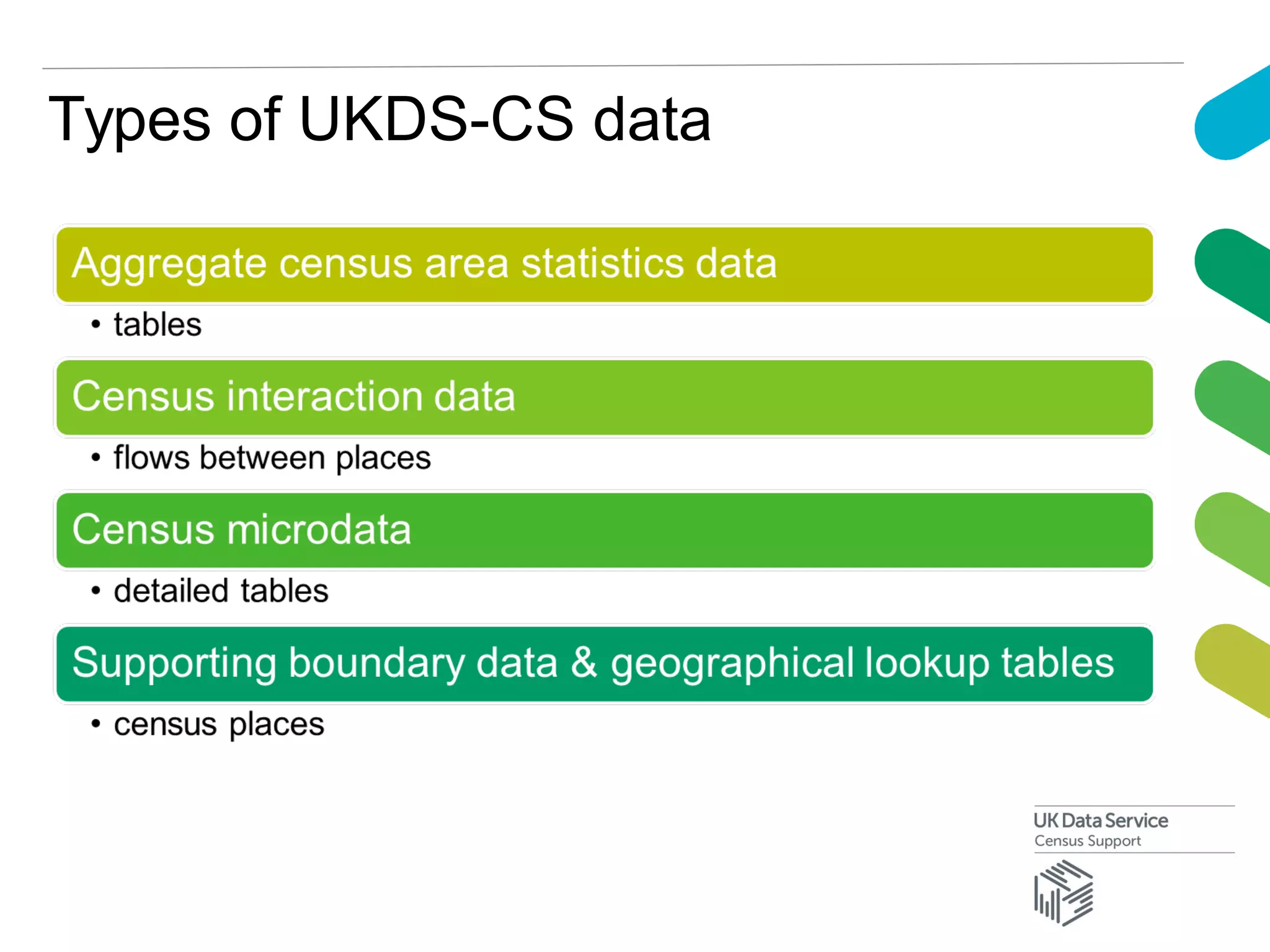
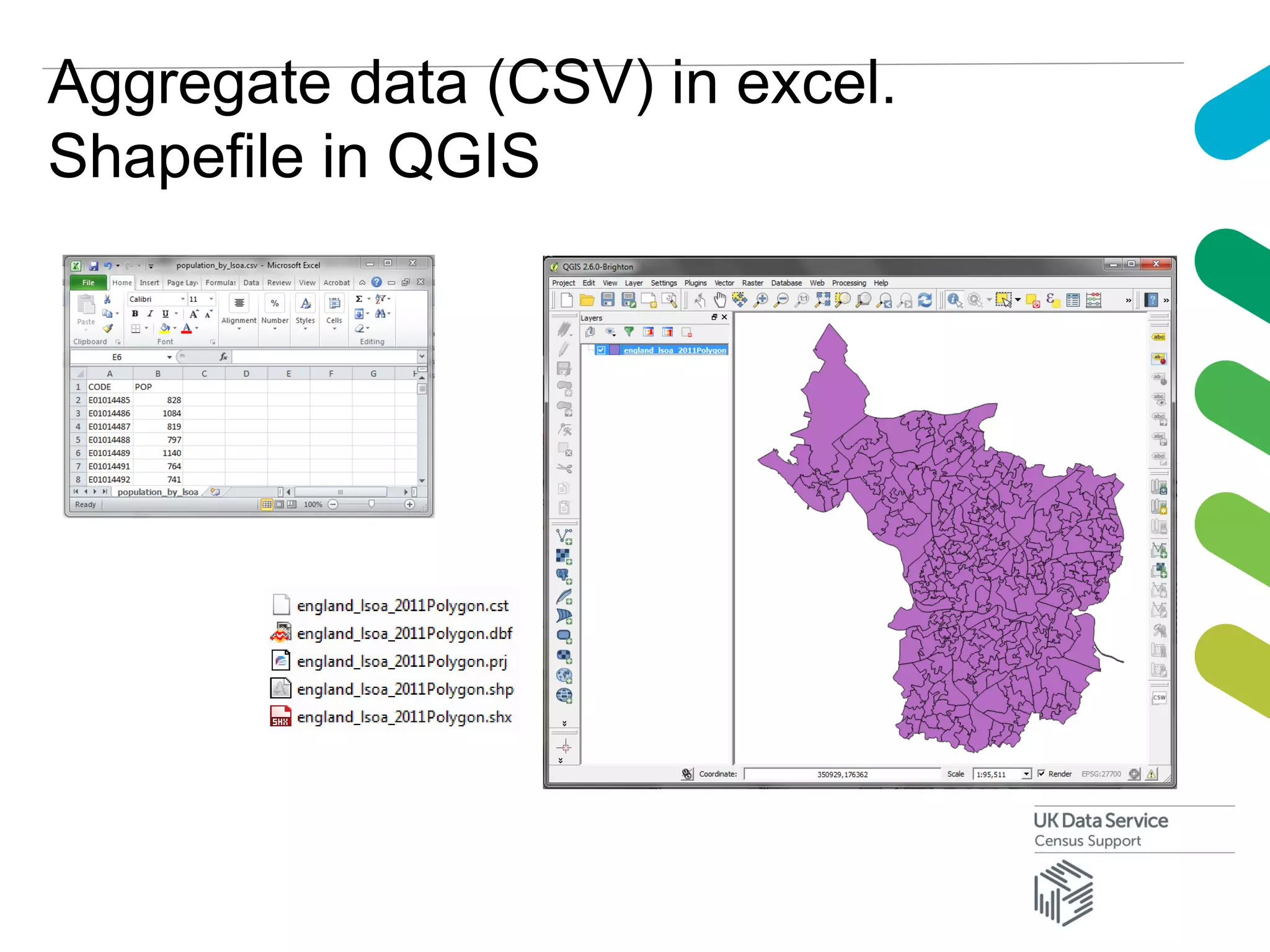
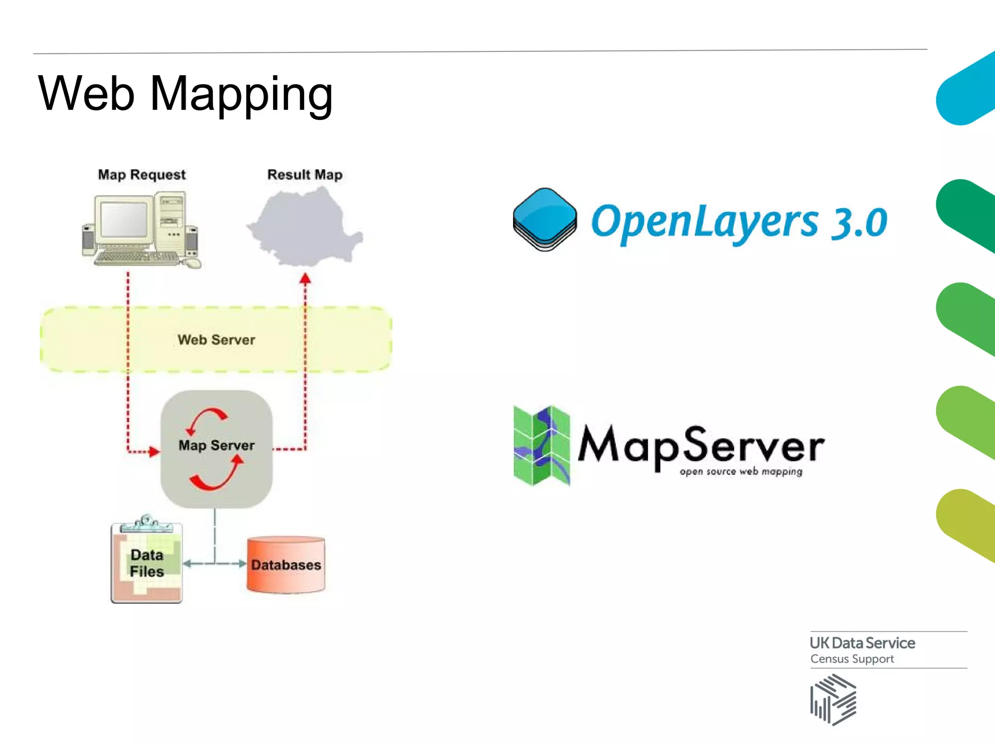
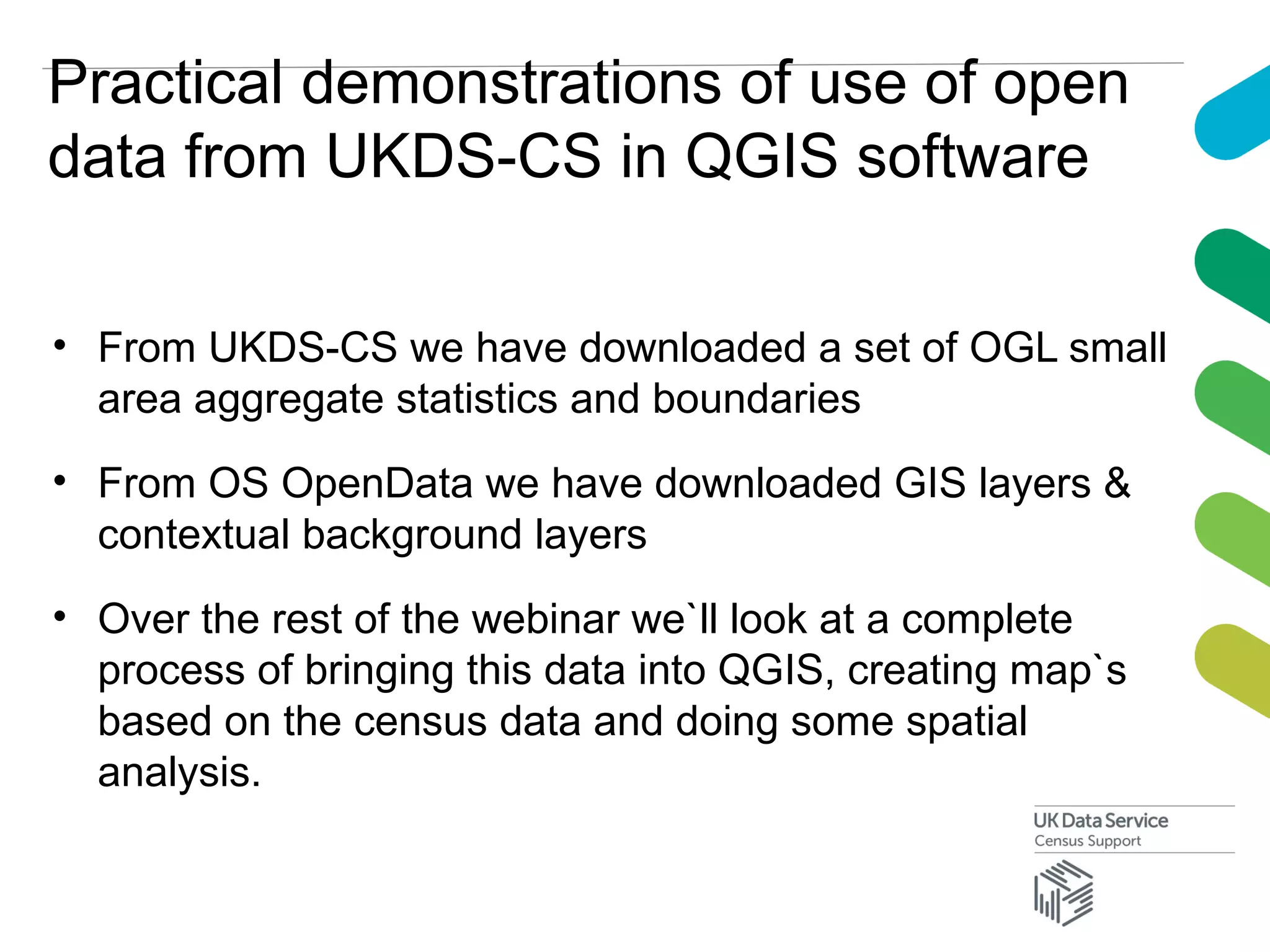
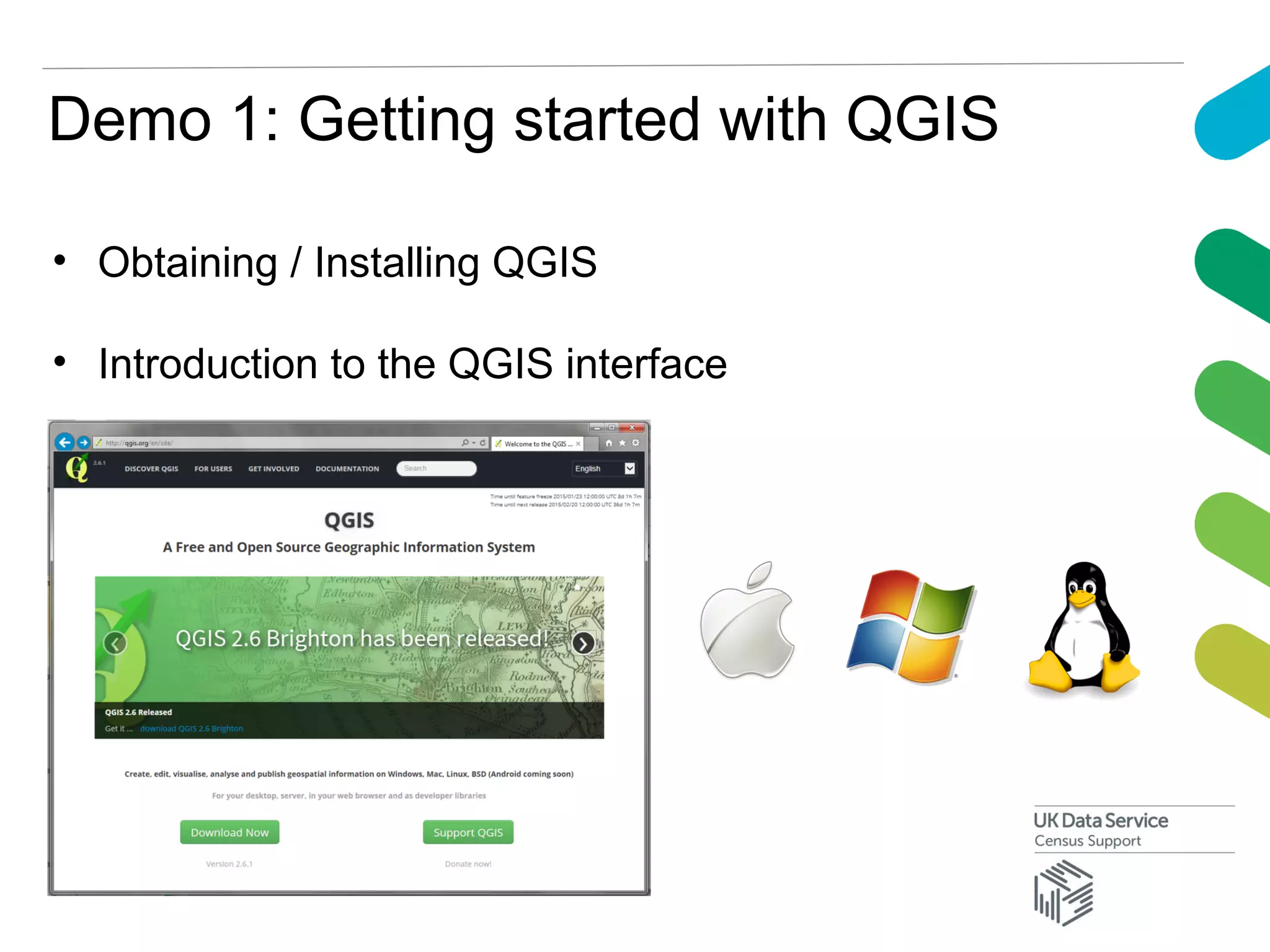
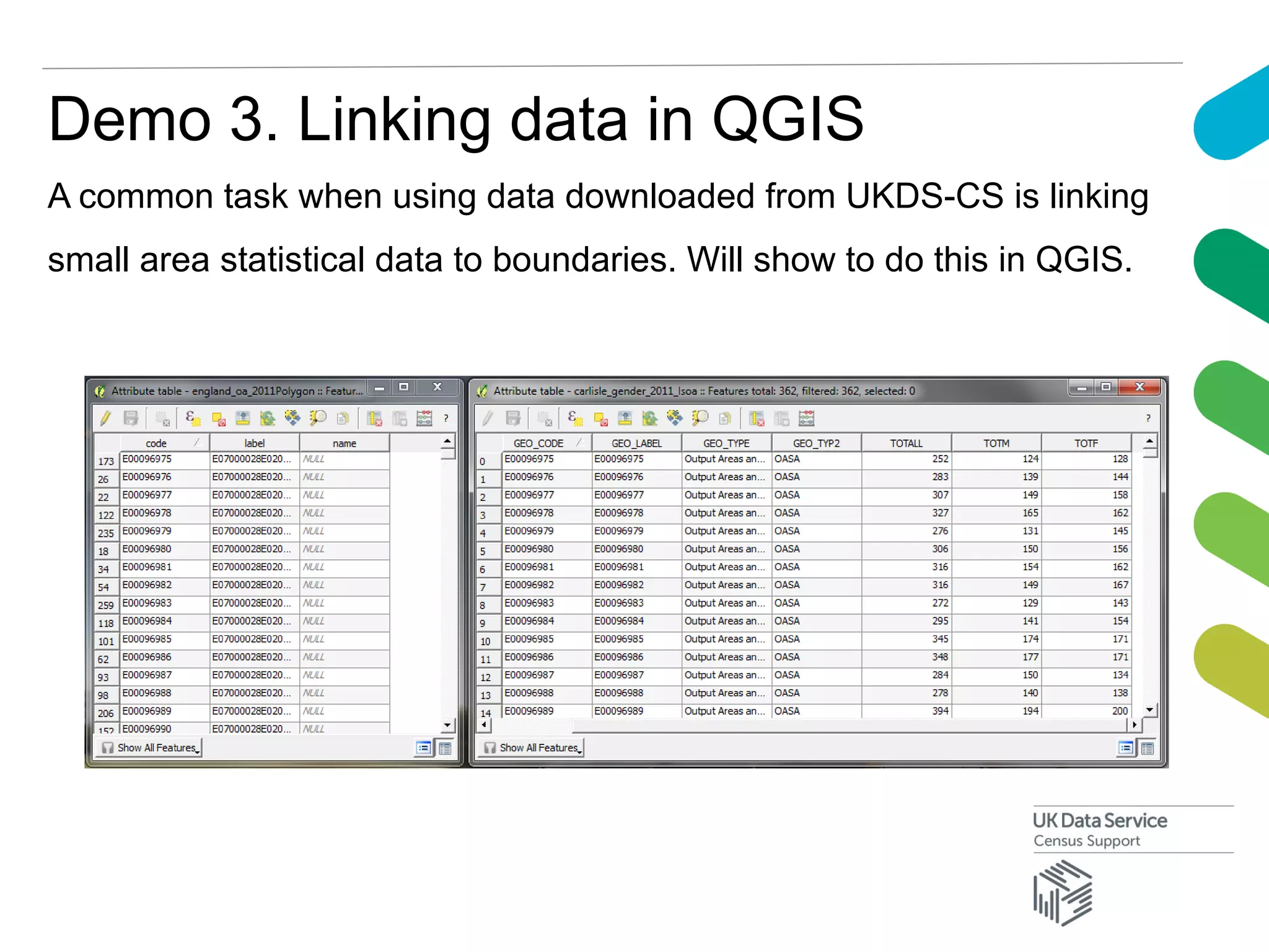
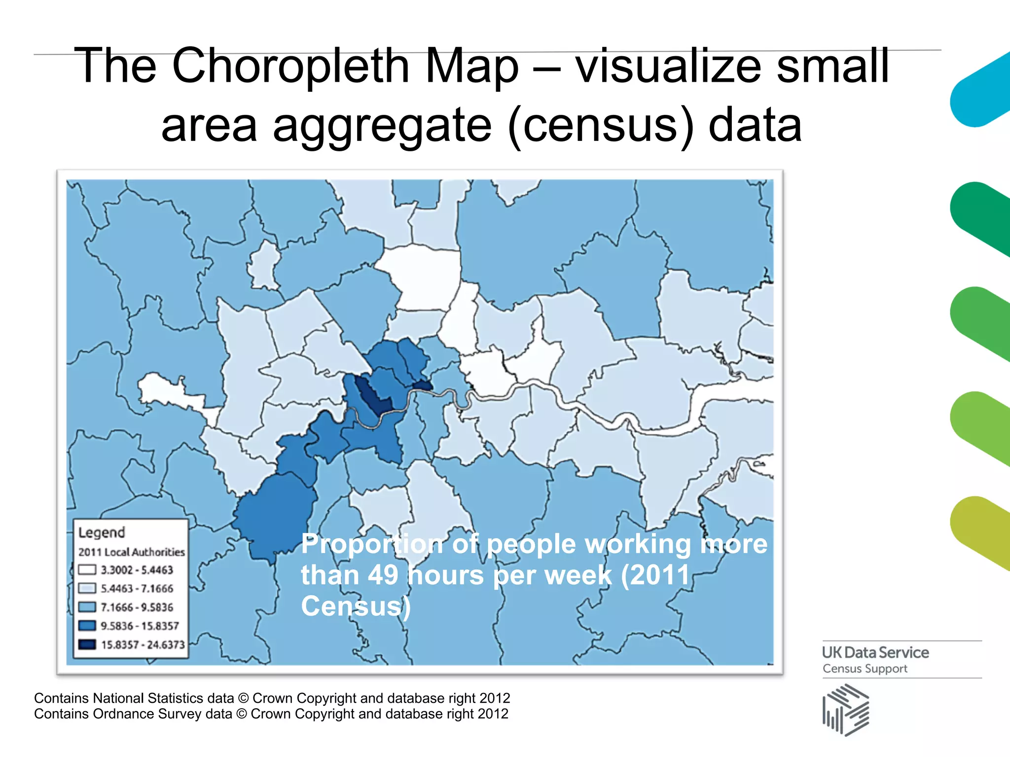
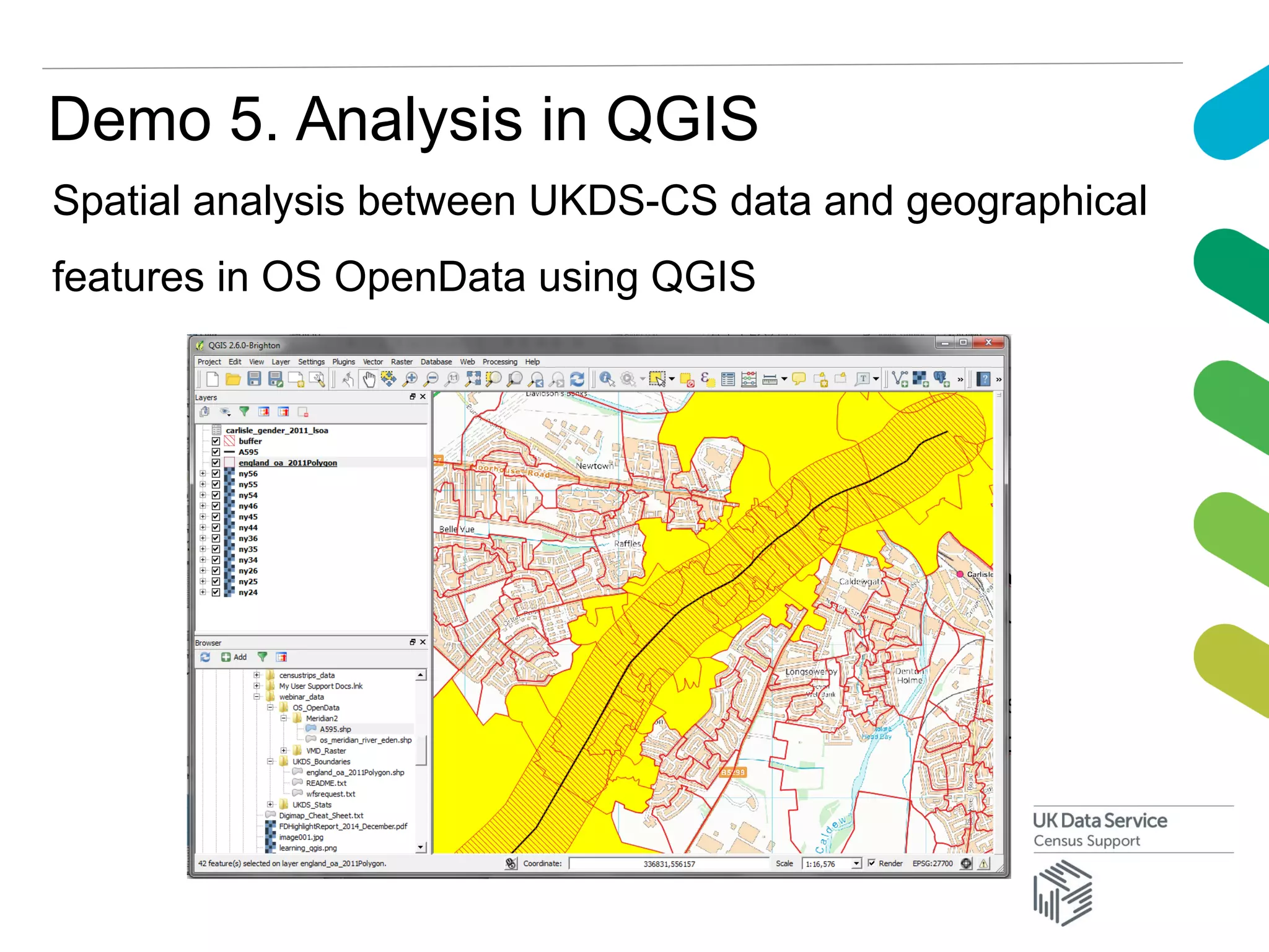
KEMBAR78
Open Geographies and Open Software | PDF
Open geographies and open
software – using open UKDS-
CS datasets in open source
GIS software
James Crone
UK Data Service Census Support
EDINA
Hi
An introduction…
James Crone
UK Data Service
EDINA GeoServices
University of Edinburgh
During the webinar today we will look at open data that is
available through UKDS-CS and the use of this data in open
source GIS software
 Overview of what open data is and what open data is
available through UKDS-CS
 Overview of what open source GIS software is and
some of the different tools/applications which are
available
 Detailed demonstrations of the use of UKDS-CS data
in QGIS – the user friendly open source GIS application
Welcome
INTRO TO
UKDS /
UKDS-CS
What is the UK Data Service?
• a comprehensive resource funded by the ESRC
• a single point of access to a wide range of secondary
social science data
• support, training and guidance
Who is it for?
• academic researchers and students
• government analysts
• charities and foundations
• business consultants
• independent research centres
• think tanks
ukdataservice.ac.uk
ukdataservice.ac.uk website
http://census.ukdataservice.ac.uk/
What is Census Support?
• access to, and user support for, data from the last five
UK population censuses (1971 – 2011)
• Majority of data provided by UKDS-CS is now available
as open data
census.ukdataservice.ac.uk
Types of UKDS-CS data
Digital Boundaries / Aggregate Data
Contains National Statistics data © Crown Copyright and database right 2012
Contains Ordnance Survey data © Crown Copyright and database right 2012
Aggregate data (CSV) in excel.
Shapefile in QGIS
Open Data
What is open data?
Open data is data that is made available by organisations,
businesses and individuals for anyone to access, use
and share.
Source: open data institute
Open Government Licence
• copyright licence for Crown Copyright works published by the UK
government
• compatible with the Creative Commons Attributions (CC-BY) licence
• permits anyone to copy, publish, distribute, transmit and adapt the
licensed work, and to exploit it both commercially and non-
commercially
• in return, the re-user of the licensed work has to acknowledge the
source of the work and (if possible) provide a link to the OGL
Open data available through UKDS-CS
• Most UKDS-CS data is now available under OGL
• Majority of boundary datasets were already or have now
moved (on October 14th
) to OGL including those that
used to be restricted to academics e.g. 1991 census
boundaries.
• Discussions are ongoing to move datasets which are still
not available as open data e.g. 1981 boundaries over to
open licenses to allow anyone to download.
OGL geographical boundary datasets
available through UKDS-CS
Other open data – data.gov.uk
Other open data – OS OpenData
Open-source
GIS Software
What is Open-source GIS software?
Open-source (GIS) software is computer software made
available with a license in which the copyright holder
provides the rights to study, change and distribute the
software to anyone and for any purpose. Open-source
software is often developed in a public, collaborative
manner.
OSGeo : www.osgeo.org
The Open Source Geospatial Foundation
A not-for-profit organisation whose mission is to support the
collaborative development of open source geospatial software and
promote its widespread use
Projects should manage themselves, striving for consensus and
encouraging participation from all contributors, from beginners through
to advanced users
Contributing to open software
• Report Bugs - so developers can check and fix things
• Participate in Support - on mailing lists, IRC channels,
forums and user groups
• Write documentation / tutorials
• Translate
• Develop plugins and extensions to add new functionality
• Develop on core software
OSGeo projects
Geospatial Libraries
Web Mapping
Desktop Applications
GRASS GIS
QGIS
UKDS-CS Boundary Data Selector
application powered by OSGeo software
QGIS used to check/prepare
data
Boundaries held in PostGIS
database
Map View in Boundary Data
Selector uses OpenLayers
to render preview maps
using MapServer
Boundary data extracts are
serviced by GeoServer
Using UKDS-
CS data in
QGIS
Practical demonstrations of use of open
data from UKDS-CS in QGIS software
• From UKDS-CS we have downloaded a set of OGL small
area aggregate statistics and boundaries
• From OS OpenData we have downloaded GIS layers &
contextual background layers
• Over the rest of the webinar we`ll look at a complete
process of bringing this data into QGIS, creating map`s
based on the census data and doing some spatial
analysis.
Demo 1: Getting started with QGIS
• Obtaining / Installing QGIS
• Introduction to the QGIS interface
Demo 1: QGIS GUI
Demo 2: Opening data in QGIS
Census data downloaded from UKDS-CS can be opened in QGIS in
different ways which has an effect on how that data can be used. Will
show best practice.
Demo 3. Linking data in QGIS
A common task when using data downloaded from UKDS-CS is linking
small area statistical data to boundaries. Will show to do this in QGIS.
Demo 4. Making maps in QGIS
QGIS has excellent tools to create choropleth maps from UKDS-CS
data and produce maps for inclusion in reports
The Choropleth Map – visualize small
area aggregate (census) data
Contains National Statistics data © Crown Copyright and database right 2012
Contains Ordnance Survey data © Crown Copyright and database right 2012
Proportion of people working more
than 49 hours per week (2011
Census)
Demo 5. Analysis in QGIS
Spatial analysis between UKDS-CS data and geographical
features in OS OpenData using QGIS
Advanced QGIS use
• Store aggregate and boundary data in a PostGIS spatial
database – perform analysis using (spatial) SQL.
• QGIS Plugins – add extra functionality to QGIS. Chances
are that if there is something that QGIS does not seem to
do, a plugin has been written.
• If not, write own plugin or automate processes using
Python language and PyQGIS.
QGIS Documentation / Books / Help
Open Geographies and Open Software

Open Geographies and Open Software

  • 1.
    Open geographies andopen software – using open UKDS- CS datasets in open source GIS software James Crone UK Data Service Census Support EDINA
  • 2.
    Hi An introduction… James Crone UKData Service EDINA GeoServices University of Edinburgh
  • 3.
    During the webinartoday we will look at open data that is available through UKDS-CS and the use of this data in open source GIS software  Overview of what open data is and what open data is available through UKDS-CS  Overview of what open source GIS software is and some of the different tools/applications which are available  Detailed demonstrations of the use of UKDS-CS data in QGIS – the user friendly open source GIS application Welcome
  • 4.
  • 5.
    What is theUK Data Service? • a comprehensive resource funded by the ESRC • a single point of access to a wide range of secondary social science data • support, training and guidance
  • 6.
    Who is itfor? • academic researchers and students • government analysts • charities and foundations • business consultants • independent research centres • think tanks ukdataservice.ac.uk
  • 7.
  • 8.
  • 9.
    What is CensusSupport? • access to, and user support for, data from the last five UK population censuses (1971 – 2011) • Majority of data provided by UKDS-CS is now available as open data census.ukdataservice.ac.uk
  • 10.
  • 11.
    Digital Boundaries /Aggregate Data Contains National Statistics data © Crown Copyright and database right 2012 Contains Ordnance Survey data © Crown Copyright and database right 2012
  • 12.
    Aggregate data (CSV)in excel. Shapefile in QGIS
  • 13.
  • 14.
    What is opendata? Open data is data that is made available by organisations, businesses and individuals for anyone to access, use and share. Source: open data institute
  • 15.
    Open Government Licence •copyright licence for Crown Copyright works published by the UK government • compatible with the Creative Commons Attributions (CC-BY) licence • permits anyone to copy, publish, distribute, transmit and adapt the licensed work, and to exploit it both commercially and non- commercially • in return, the re-user of the licensed work has to acknowledge the source of the work and (if possible) provide a link to the OGL
  • 16.
    Open data availablethrough UKDS-CS • Most UKDS-CS data is now available under OGL • Majority of boundary datasets were already or have now moved (on October 14th ) to OGL including those that used to be restricted to academics e.g. 1991 census boundaries. • Discussions are ongoing to move datasets which are still not available as open data e.g. 1981 boundaries over to open licenses to allow anyone to download.
  • 17.
    OGL geographical boundarydatasets available through UKDS-CS
  • 18.
    Other open data– data.gov.uk
  • 19.
    Other open data– OS OpenData
  • 20.
  • 21.
    What is Open-sourceGIS software? Open-source (GIS) software is computer software made available with a license in which the copyright holder provides the rights to study, change and distribute the software to anyone and for any purpose. Open-source software is often developed in a public, collaborative manner.
  • 22.
    OSGeo : www.osgeo.org TheOpen Source Geospatial Foundation A not-for-profit organisation whose mission is to support the collaborative development of open source geospatial software and promote its widespread use Projects should manage themselves, striving for consensus and encouraging participation from all contributors, from beginners through to advanced users
  • 23.
    Contributing to opensoftware • Report Bugs - so developers can check and fix things • Participate in Support - on mailing lists, IRC channels, forums and user groups • Write documentation / tutorials • Translate • Develop plugins and extensions to add new functionality • Develop on core software
  • 24.
  • 25.
  • 26.
  • 27.
  • 28.
    UKDS-CS Boundary DataSelector application powered by OSGeo software QGIS used to check/prepare data Boundaries held in PostGIS database Map View in Boundary Data Selector uses OpenLayers to render preview maps using MapServer Boundary data extracts are serviced by GeoServer
  • 29.
  • 30.
    Practical demonstrations ofuse of open data from UKDS-CS in QGIS software • From UKDS-CS we have downloaded a set of OGL small area aggregate statistics and boundaries • From OS OpenData we have downloaded GIS layers & contextual background layers • Over the rest of the webinar we`ll look at a complete process of bringing this data into QGIS, creating map`s based on the census data and doing some spatial analysis.
  • 31.
    Demo 1: Gettingstarted with QGIS • Obtaining / Installing QGIS • Introduction to the QGIS interface
  • 32.
  • 33.
    Demo 2: Openingdata in QGIS Census data downloaded from UKDS-CS can be opened in QGIS in different ways which has an effect on how that data can be used. Will show best practice.
  • 34.
    Demo 3. Linkingdata in QGIS A common task when using data downloaded from UKDS-CS is linking small area statistical data to boundaries. Will show to do this in QGIS.
  • 35.
    Demo 4. Makingmaps in QGIS QGIS has excellent tools to create choropleth maps from UKDS-CS data and produce maps for inclusion in reports
  • 36.
    The Choropleth Map– visualize small area aggregate (census) data Contains National Statistics data © Crown Copyright and database right 2012 Contains Ordnance Survey data © Crown Copyright and database right 2012 Proportion of people working more than 49 hours per week (2011 Census)
  • 37.
    Demo 5. Analysisin QGIS Spatial analysis between UKDS-CS data and geographical features in OS OpenData using QGIS
  • 38.
    Advanced QGIS use •Store aggregate and boundary data in a PostGIS spatial database – perform analysis using (spatial) SQL. • QGIS Plugins – add extra functionality to QGIS. Chances are that if there is something that QGIS does not seem to do, a plugin has been written. • If not, write own plugin or automate processes using Python language and PyQGIS.
  • 39.