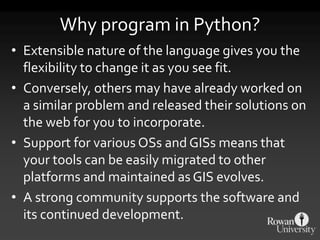
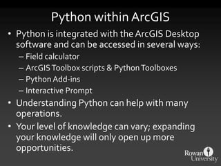
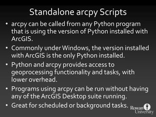
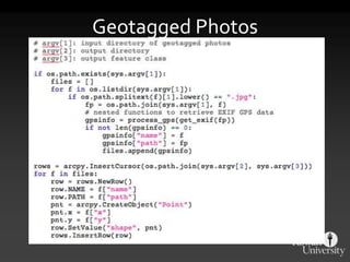
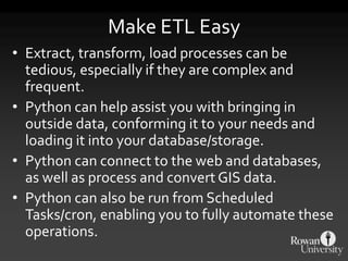
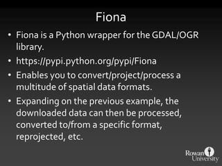
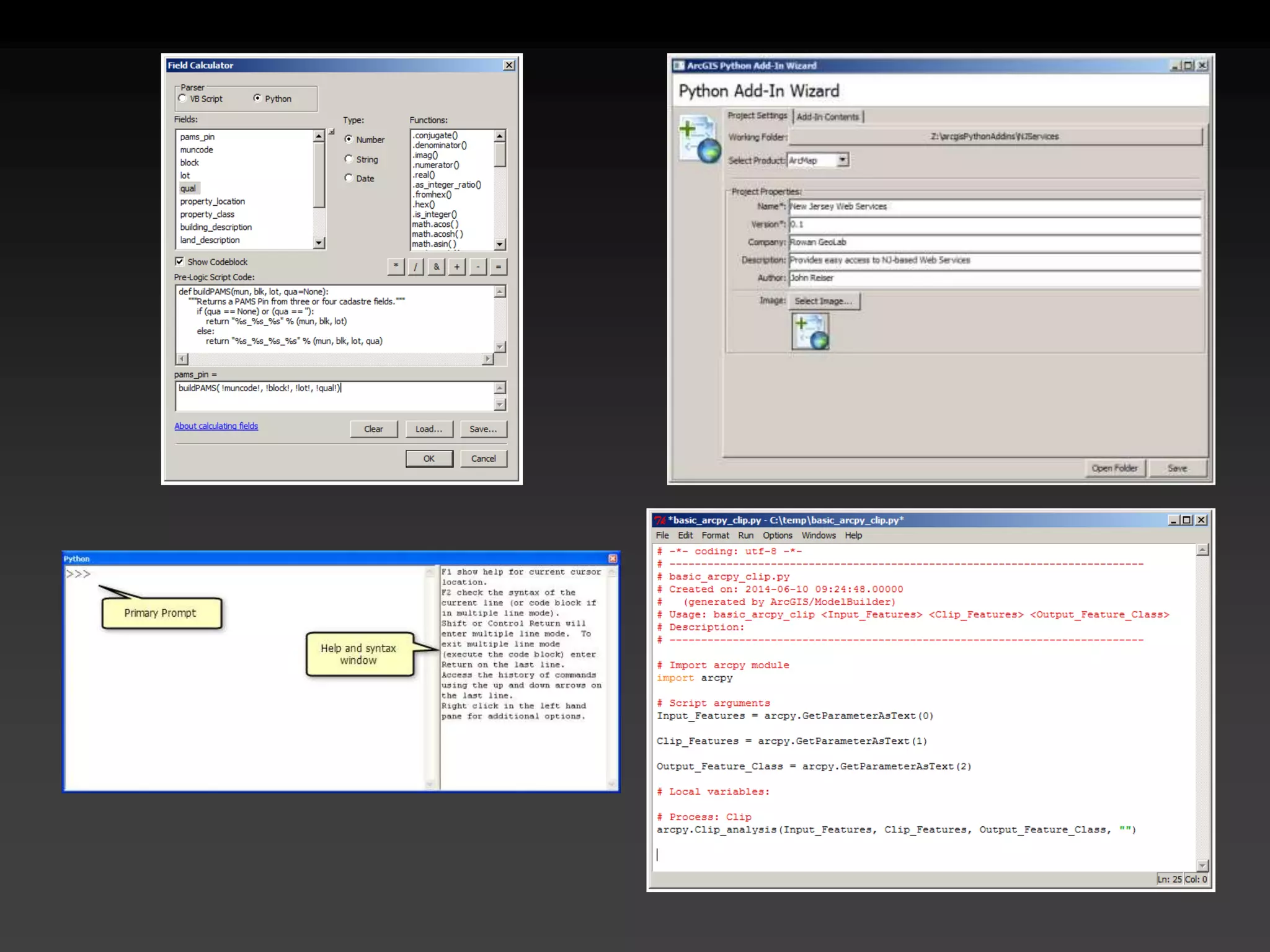
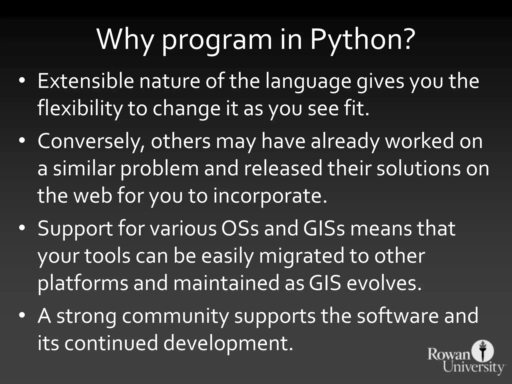
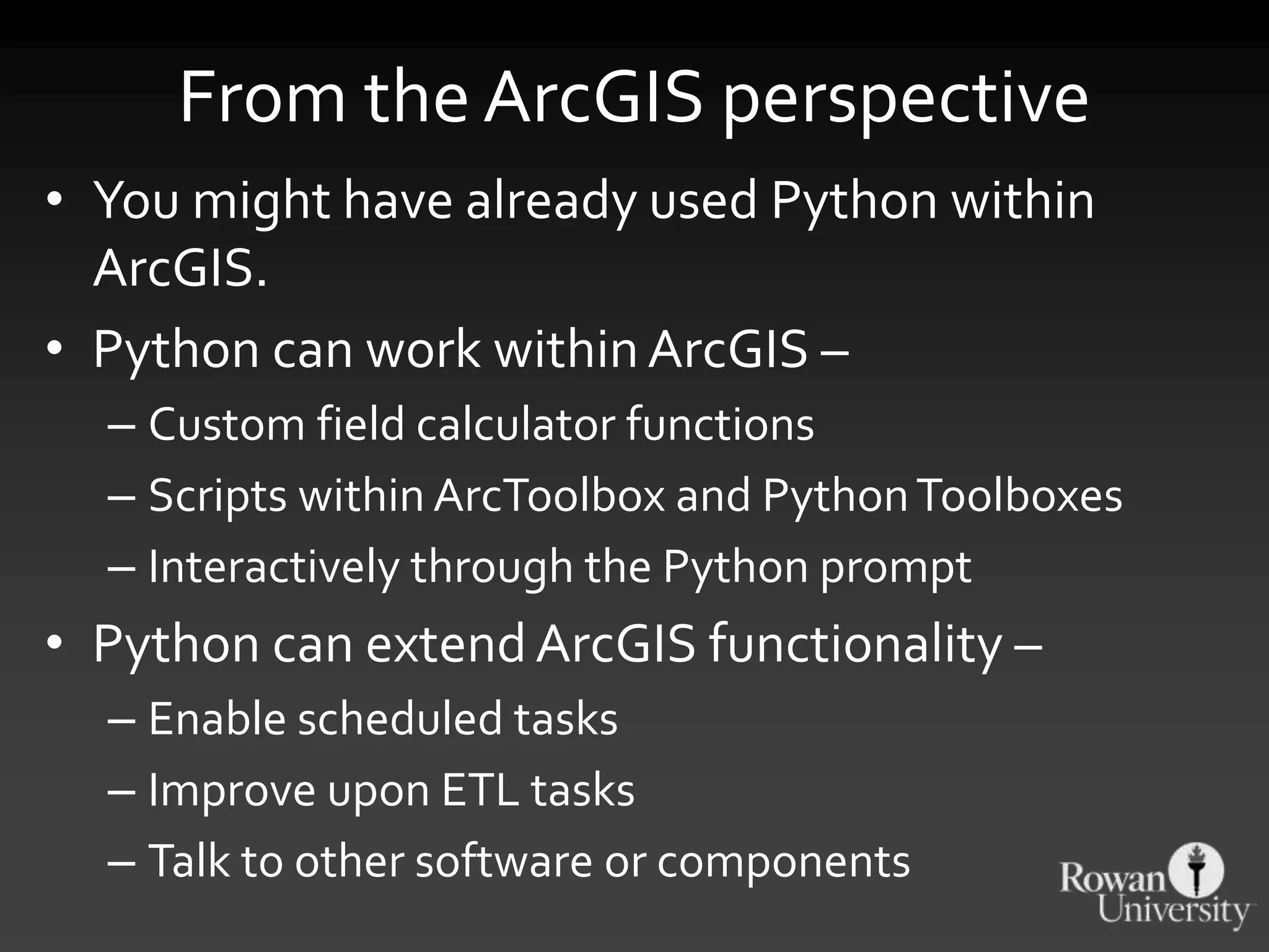
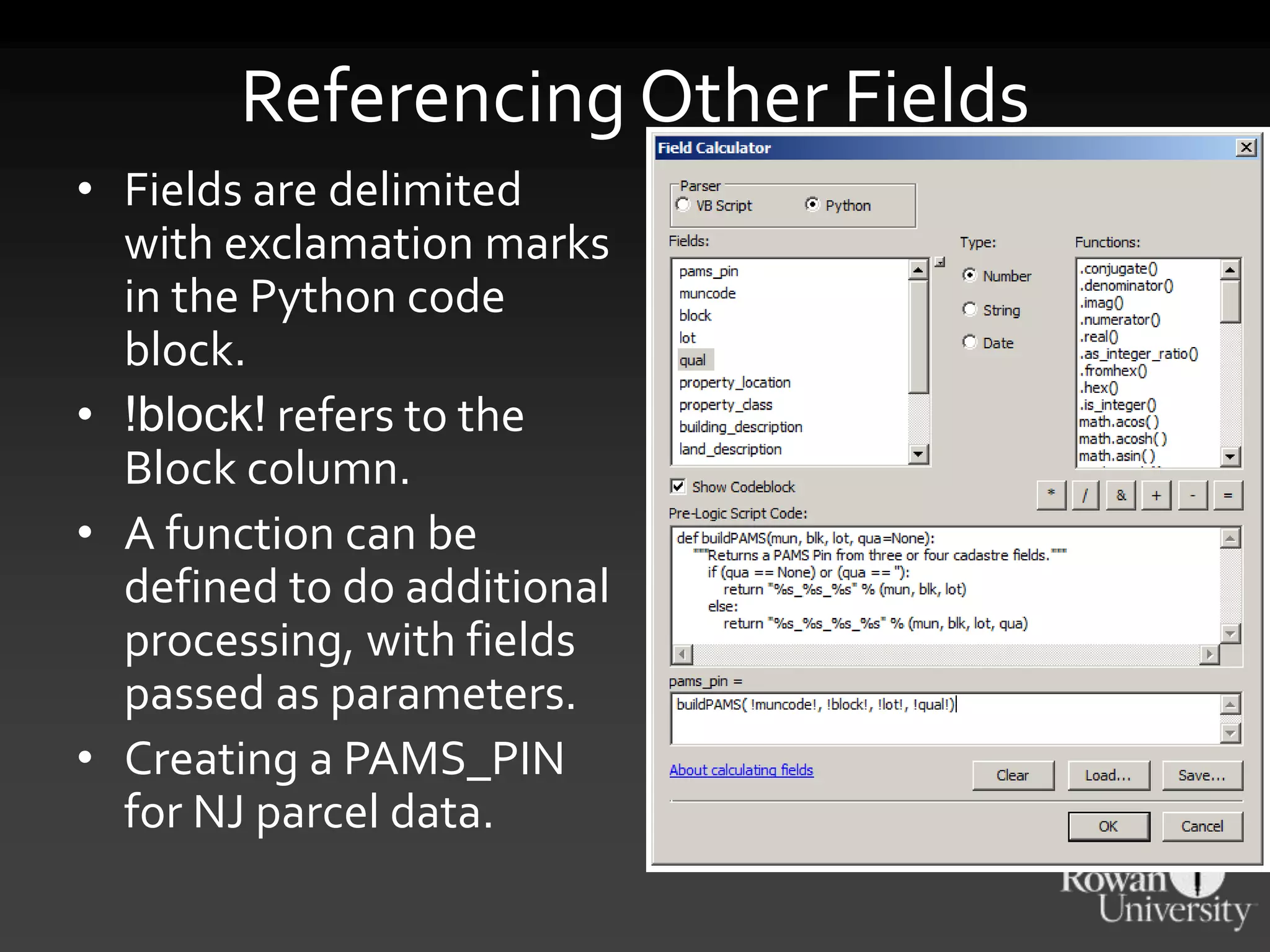
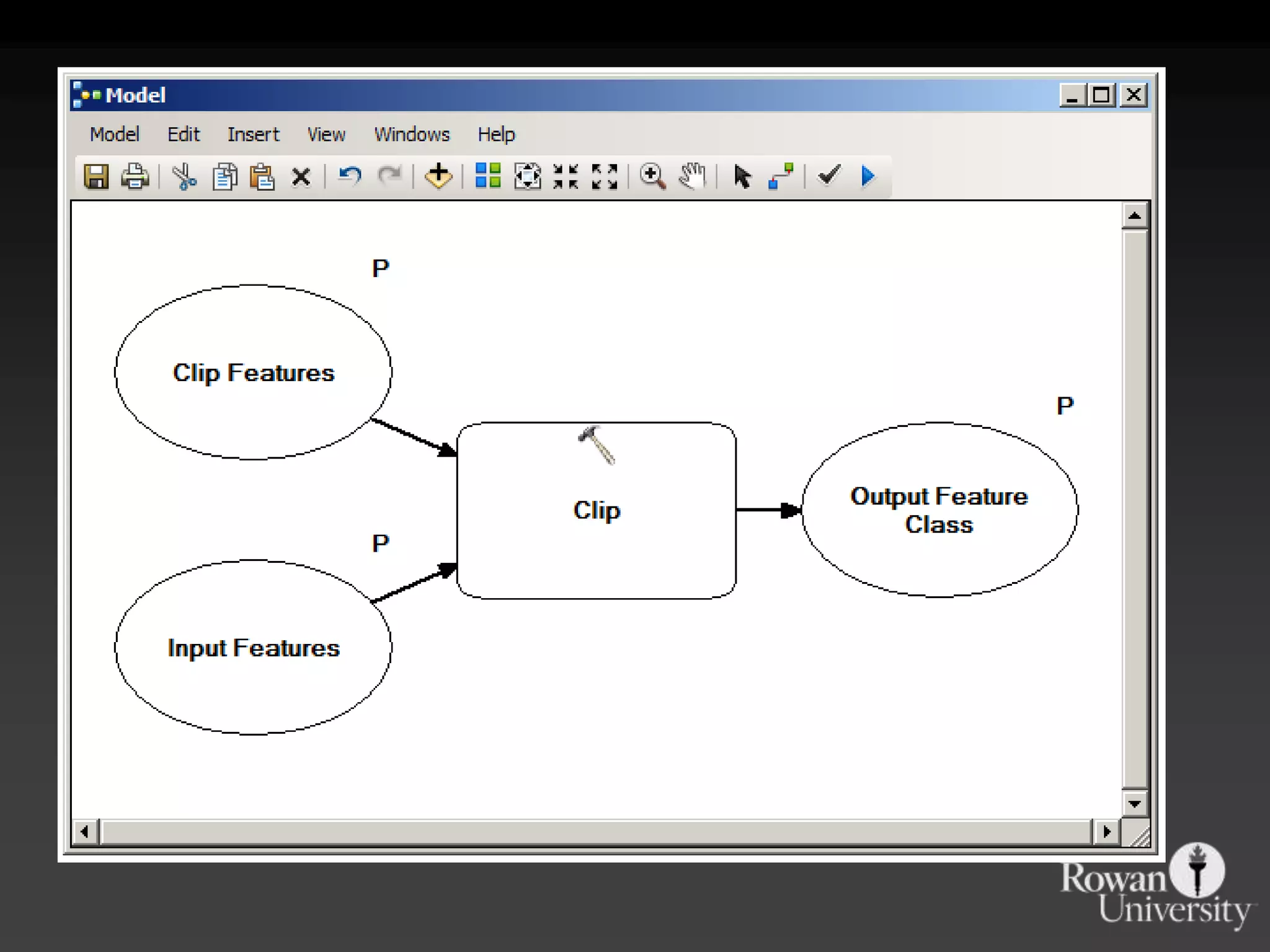
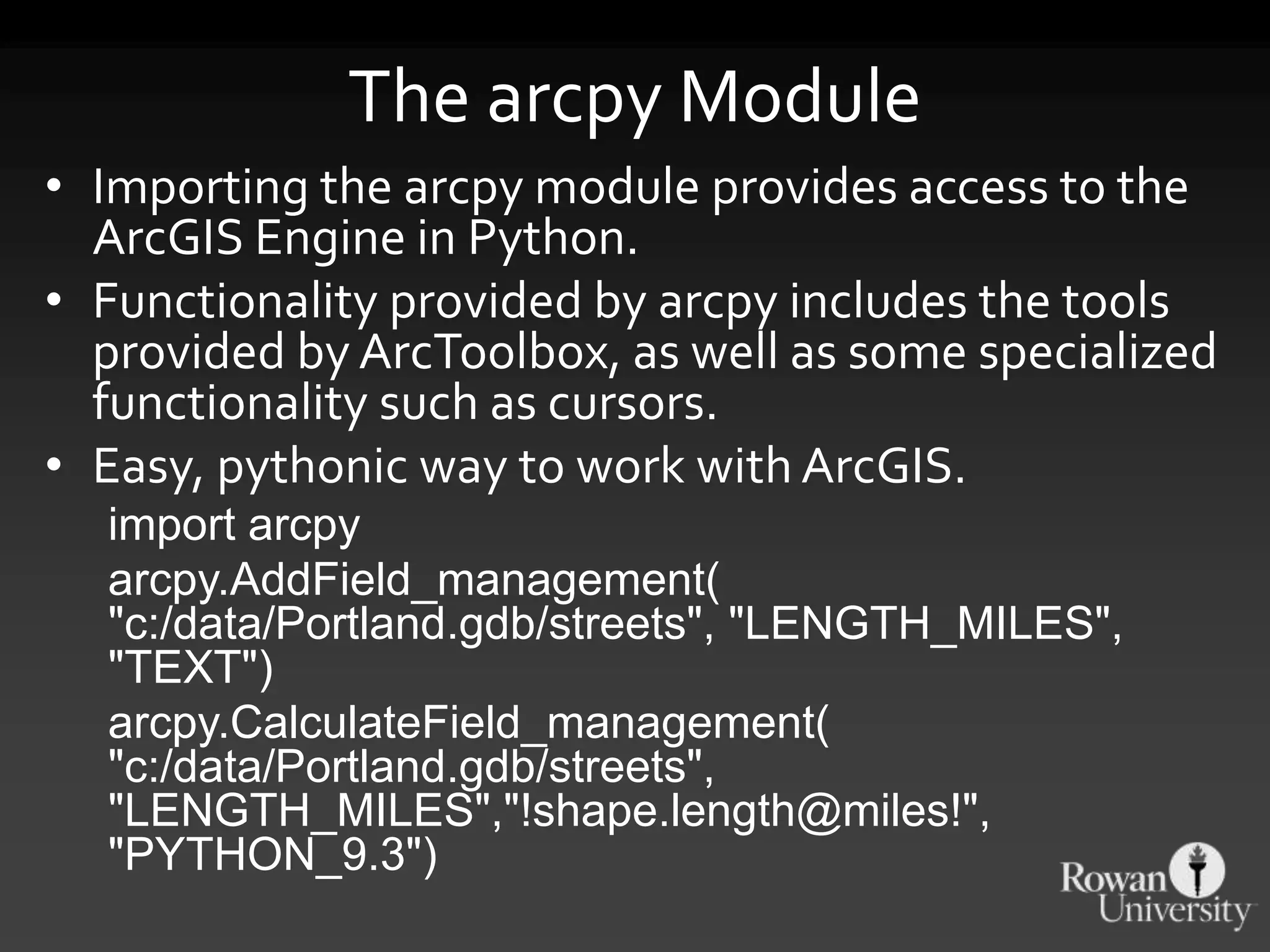
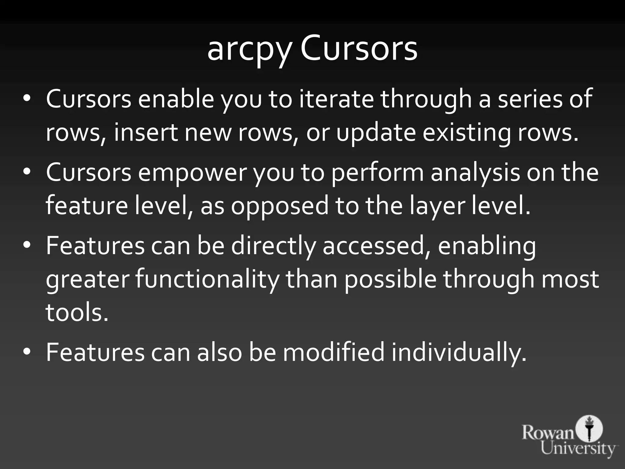
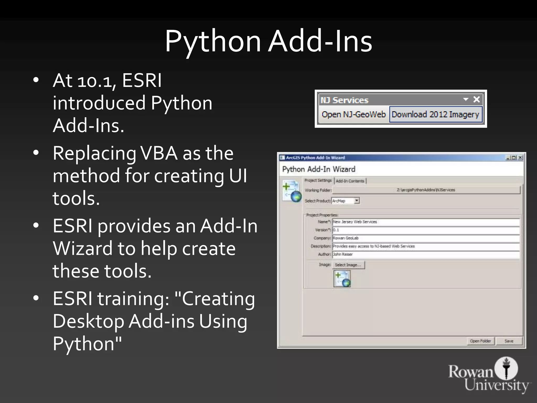
KEMBAR78
Python and GIS: Improving Your Workflow | PPTX
Python and GIS
ImprovingYourWorkflow
DVRPC - IREG
9 December 2015
Why Python?
Automation
"HollerithMachine.CHM" by Adam Schuster - Flickr: Proto IBM. CC BY
ArcGIS & ModelBuilder
• Limited iterative capacity
• Limited reusability
• Limited to ArcGIS
• No version control
Why program in Python?
• Extensible nature of the language gives you the
flexibility to change it as you see fit.
• Conversely, others may have already worked on
a similar problem and released their solutions on
the web for you to incorporate.
• Support for various OSs and GISs means that
your tools can be easily migrated to other
platforms and maintained as GIS evolves.
• A strong community supports the software and
its continued development.
From the ArcGIS perspective
• You might have already used Python within
ArcGIS.
• Python can work withinArcGIS –
– Custom field calculator functions
– Scripts within ArcToolbox and PythonToolboxes
– Interactively through the Python prompt
• Python can extendArcGIS functionality –
– Enable scheduled tasks
– Improve upon ETL tasks
– Talk to other software or components
Incorporating Python
into ArcGIS
Python within ArcGIS
• Python is integrated with the ArcGIS Desktop
software and can be accessed in several ways:
– Field calculator
– ArcGISToolbox scripts & PythonToolboxes
– Python Add-ins
– Interactive Prompt
• Understanding Python can help with many
operations.
• Your level of knowledge can vary; expanding
your knowledge will only open up more
opportunities.
The Field Calculator
• The Field Calculator
(and Calculate Field
tool) allow you to
programmatically
change the values
within a layer's or
table's column.
• Python can be used to
calculate new data
from existing fields or
other properties.
Referencing Other Fields
• Fields are delimited
with exclamation marks
in the Python code
block.
• !block! refers to the
Block column.
• A function can be
defined to do additional
processing, with fields
passed as parameters.
• Creating a PAMS_PIN
for NJ parcel data.
https://gist.github.com/johnjreiser/2206339
The SHAPE Field
• The SHAPE field has several methods that can
be accessed within FieldCalculator to retrieve
attributes of the record's geometry.
• !shape.area!, !shape.length!
• Unit type is modifiable:
!shape.area@SQUAREYARDS!
• !shape.partCount!
• !shape.pointCount!
Moving from ModelBuilder
to Python
Great Starting Point
• Exporting from ModelBuilder is a great starting
point for many projects.
• Declare variables/layers/workspaces using
ModelBuilder UI. Start to put the pieces
together.
• Export an incomplete model to Python for final
development.
• The shell will be there – it will produce a valid
(though potentially nonfunctional) arcpy script.
• You can then complete and extend the
functionality.
The arcpy Module
• Importing the arcpy module provides access to the
ArcGIS Engine in Python.
• Functionality provided by arcpy includes the tools
provided by ArcToolbox, as well as some specialized
functionality such as cursors.
• Easy, pythonic way to work with ArcGIS.
import arcpy
arcpy.AddField_management(
"c:/data/Portland.gdb/streets", "LENGTH_MILES",
"TEXT")
arcpy.CalculateField_management(
"c:/data/Portland.gdb/streets",
"LENGTH_MILES","!shape.length@miles!",
"PYTHON_9.3")
Standalone arcpy Scripts
• arcpy can be called from any Python program
that is using the version of Python installed with
ArcGIS.
• Commonly underWindows, the version installed
with ArcGIS is the only Python installed.
• Python and arcpy provides access to
geoprocessing functionality and tasks, with
lower overhead.
• Programs using arcpy can be run without having
any of theArcGIS Desktop suite running.
• Great for scheduled or background tasks.
arcpy Cursors
• Cursors enable you to iterate through a series of
rows, insert new rows, or update existing rows.
• Cursors empower you to perform analysis on the
feature level, as opposed to the layer level.
• Features can be directly accessed, enabling
greater functionality than possible through most
tools.
• Features can also be modified individually.
Geotagged Photos
Feature Shifting
Extending ArcGIS tools
using Python
Python Add-Ins
• At 10.1, ESRI
introduced Python
Add-Ins.
• ReplacingVBA as the
method for creating UI
tools.
• ESRI provides an Add-In
Wizard to help create
these tools.
• ESRI training: "Creating
Desktop Add-ins Using
Python"
Download Imagery
• NJ OIT-OGIS'sWMS services are great, but what
if you want the source tiles?
• Python Add-Ins allow you to pull the data down,
extract it and load it into ArcGIS.
• Allows for interactive selection within a your
map frame, with the data automatically added
to the map once the download is complete.
https://github.com/RowanGeolab/arcgisPythonAddins
Getting Census Data
PythonToolbox
• PythonToolboxes are pure-Python files that
appear as ArcToolbox toolboxes.
• Tools are defined as subclasses.
• A toolbox containing several independent tools
can exist as one text-based file.
• Great format for transparency and version
control.
• Uses .pyt as a file extension.
Moving Beyond ArcGIS
using Python
Make ETL Easy
• Extract, transform, load processes can be
tedious, especially if they are complex and
frequent.
• Python can help assist you with bringing in
outside data, conforming it to your needs and
loading it into your database/storage.
• Python can connect to the web and databases,
as well as process and convert GIS data.
• Python can also be run from Scheduled
Tasks/cron, enabling you to fully automate these
operations.
Fiona
• Fiona is a Python wrapper for the GDAL/OGR
library.
• https://pypi.python.org/pypi/Fiona
• Enables you to convert/project/process a
multitude of spatial data formats.
• Expanding on the previous example, the
downloaded data can then be processed,
converted to/from a specific format,
reprojected, etc.
Web Retrieval & Extraction
• Several modules exist to enable easy
downloading of remote resources.
• urllib (plus urllib2, urllib3, httplib, etc…)
• zipfile is a module for working with PKZIP files.
• Let's look at some code to automate downloads
and extraction.
chupaESRI
psycopg2
• psycopg2 module provides a Pythonic way of
querying a PostgreSQL database.
• PostgreSQL-specific, enables accessingArcSDE
or PostGIS-formatted data.
• Full, secure access to your databases.
• Very easy to use the records returned from a
database query in your Python programs.
Recent Property Sales
Q & A
Books
• Lutz, Mark. Learning
Python, 5th Edition.
O’Reilly Media. ISBN:
978-1-4493-5573-9
• Lubanovic, Bill.
Introducing Python, 1st
Edition. O’Reilly Media.
ISBN: 978-1-4493-5936-2
• Shaw, Zed. Learn Python
the HardWay. Addison-
Wesley. ISBN: 978-
0321884916
OnlineTutorials
• Learning Python:
– Code.org
– Codecademy
• ESRITraining offerings:
– Python for Everyone -
http://training.esri.com/gateway/index.cfm?fa=catal
og.webcoursedetail&courseid=2520
– Using Python in ArcGIS Desktop 10 -
http://training.esri.com/gateway/index.cfm?fa=catal
og.webCourseDetail&courseID=1868
Online Communities
• Blogs
– geospatialpython.com
– sgillies.net
– many more…
• Stack Exchange
– gis.stackexchange.com
– stackoverflow.com
• GeoNet - Python &
Geoprocessing forums
– http://forums.arcgis.co
m/forums/117-Python
Thanks for listening!
• Feel free to follow up with questions:
jreiser@njgeo.org
@johnjreiser onTwitter
github.com/johnjreiser

Python and GIS: Improving Your Workflow

  • 1.
  • 2.
  • 3.
    Automation "HollerithMachine.CHM" by AdamSchuster - Flickr: Proto IBM. CC BY
  • 4.
  • 5.
    ArcGIS & ModelBuilder •Limited iterative capacity • Limited reusability • Limited to ArcGIS • No version control
  • 9.
    Why program inPython? • Extensible nature of the language gives you the flexibility to change it as you see fit. • Conversely, others may have already worked on a similar problem and released their solutions on the web for you to incorporate. • Support for various OSs and GISs means that your tools can be easily migrated to other platforms and maintained as GIS evolves. • A strong community supports the software and its continued development.
  • 10.
    From the ArcGISperspective • You might have already used Python within ArcGIS. • Python can work withinArcGIS – – Custom field calculator functions – Scripts within ArcToolbox and PythonToolboxes – Interactively through the Python prompt • Python can extendArcGIS functionality – – Enable scheduled tasks – Improve upon ETL tasks – Talk to other software or components
  • 11.
  • 12.
    Python within ArcGIS •Python is integrated with the ArcGIS Desktop software and can be accessed in several ways: – Field calculator – ArcGISToolbox scripts & PythonToolboxes – Python Add-ins – Interactive Prompt • Understanding Python can help with many operations. • Your level of knowledge can vary; expanding your knowledge will only open up more opportunities.
  • 13.
    The Field Calculator •The Field Calculator (and Calculate Field tool) allow you to programmatically change the values within a layer's or table's column. • Python can be used to calculate new data from existing fields or other properties.
  • 14.
    Referencing Other Fields •Fields are delimited with exclamation marks in the Python code block. • !block! refers to the Block column. • A function can be defined to do additional processing, with fields passed as parameters. • Creating a PAMS_PIN for NJ parcel data.
  • 15.
  • 16.
    The SHAPE Field •The SHAPE field has several methods that can be accessed within FieldCalculator to retrieve attributes of the record's geometry. • !shape.area!, !shape.length! • Unit type is modifiable: !shape.area@SQUAREYARDS! • !shape.partCount! • !shape.pointCount!
  • 17.
  • 18.
    Great Starting Point •Exporting from ModelBuilder is a great starting point for many projects. • Declare variables/layers/workspaces using ModelBuilder UI. Start to put the pieces together. • Export an incomplete model to Python for final development. • The shell will be there – it will produce a valid (though potentially nonfunctional) arcpy script. • You can then complete and extend the functionality.
  • 21.
    The arcpy Module •Importing the arcpy module provides access to the ArcGIS Engine in Python. • Functionality provided by arcpy includes the tools provided by ArcToolbox, as well as some specialized functionality such as cursors. • Easy, pythonic way to work with ArcGIS. import arcpy arcpy.AddField_management( "c:/data/Portland.gdb/streets", "LENGTH_MILES", "TEXT") arcpy.CalculateField_management( "c:/data/Portland.gdb/streets", "LENGTH_MILES","!shape.length@miles!", "PYTHON_9.3")
  • 22.
    Standalone arcpy Scripts •arcpy can be called from any Python program that is using the version of Python installed with ArcGIS. • Commonly underWindows, the version installed with ArcGIS is the only Python installed. • Python and arcpy provides access to geoprocessing functionality and tasks, with lower overhead. • Programs using arcpy can be run without having any of theArcGIS Desktop suite running. • Great for scheduled or background tasks.
  • 23.
    arcpy Cursors • Cursorsenable you to iterate through a series of rows, insert new rows, or update existing rows. • Cursors empower you to perform analysis on the feature level, as opposed to the layer level. • Features can be directly accessed, enabling greater functionality than possible through most tools. • Features can also be modified individually.
  • 24.
  • 25.
  • 26.
  • 27.
    Python Add-Ins • At10.1, ESRI introduced Python Add-Ins. • ReplacingVBA as the method for creating UI tools. • ESRI provides an Add-In Wizard to help create these tools. • ESRI training: "Creating Desktop Add-ins Using Python"
  • 28.
    Download Imagery • NJOIT-OGIS'sWMS services are great, but what if you want the source tiles? • Python Add-Ins allow you to pull the data down, extract it and load it into ArcGIS. • Allows for interactive selection within a your map frame, with the data automatically added to the map once the download is complete.
  • 30.
  • 31.
  • 34.
    PythonToolbox • PythonToolboxes arepure-Python files that appear as ArcToolbox toolboxes. • Tools are defined as subclasses. • A toolbox containing several independent tools can exist as one text-based file. • Great format for transparency and version control. • Uses .pyt as a file extension.
  • 38.
  • 39.
    Make ETL Easy •Extract, transform, load processes can be tedious, especially if they are complex and frequent. • Python can help assist you with bringing in outside data, conforming it to your needs and loading it into your database/storage. • Python can connect to the web and databases, as well as process and convert GIS data. • Python can also be run from Scheduled Tasks/cron, enabling you to fully automate these operations.
  • 40.
    Fiona • Fiona isa Python wrapper for the GDAL/OGR library. • https://pypi.python.org/pypi/Fiona • Enables you to convert/project/process a multitude of spatial data formats. • Expanding on the previous example, the downloaded data can then be processed, converted to/from a specific format, reprojected, etc.
  • 41.
    Web Retrieval &Extraction • Several modules exist to enable easy downloading of remote resources. • urllib (plus urllib2, urllib3, httplib, etc…) • zipfile is a module for working with PKZIP files. • Let's look at some code to automate downloads and extraction.
  • 42.
  • 43.
    psycopg2 • psycopg2 moduleprovides a Pythonic way of querying a PostgreSQL database. • PostgreSQL-specific, enables accessingArcSDE or PostGIS-formatted data. • Full, secure access to your databases. • Very easy to use the records returned from a database query in your Python programs.
  • 47.
  • 53.
  • 54.
    Books • Lutz, Mark.Learning Python, 5th Edition. O’Reilly Media. ISBN: 978-1-4493-5573-9 • Lubanovic, Bill. Introducing Python, 1st Edition. O’Reilly Media. ISBN: 978-1-4493-5936-2 • Shaw, Zed. Learn Python the HardWay. Addison- Wesley. ISBN: 978- 0321884916
  • 55.
    OnlineTutorials • Learning Python: –Code.org – Codecademy • ESRITraining offerings: – Python for Everyone - http://training.esri.com/gateway/index.cfm?fa=catal og.webcoursedetail&courseid=2520 – Using Python in ArcGIS Desktop 10 - http://training.esri.com/gateway/index.cfm?fa=catal og.webCourseDetail&courseID=1868
  • 58.
    Online Communities • Blogs –geospatialpython.com – sgillies.net – many more… • Stack Exchange – gis.stackexchange.com – stackoverflow.com • GeoNet - Python & Geoprocessing forums – http://forums.arcgis.co m/forums/117-Python
  • 59.
    Thanks for listening! •Feel free to follow up with questions: jreiser@njgeo.org @johnjreiser onTwitter github.com/johnjreiser

Editor's Notes

  • #26 https://arcpy.wordpress.com/2012/11/15/shifting-features/