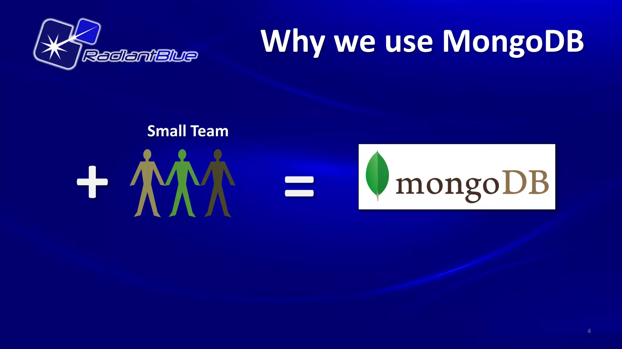
Downloaded 155 times


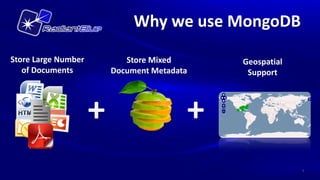

![Our Use of MongoDB
Document
{ “_id”:
Processor "metadata" : {
“event”:”MongoDB DC 2013”,
“url”:”
http://www.10gen.com/events/mon
godb-washington-dc-2013”,
}
Original Files Extracted Text "geo" : [
{
+ + “place” : “Newseum”,
Metadata Metadata "location" : [-77.0194, 38.8930]
},
{
" place " : “Penn Quarter Sports
Tavern",
"location" : [ -77.0215, 38.8942]
} ],
]} spatial index created for geo.location
5](https://image.slidesharecdn.com/mongodbdc2013mongogeoserverfinal-130311112653-phpapp02/85/MongoDB-GeoServer-5-320.jpg)


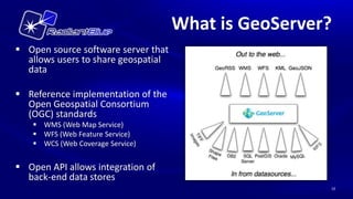
![Existing MongoDB Plugin
Open sourced in 2011 by Data Tactics
Corp.
GeoJSON
{ "type": "FeatureCollection",
Developed against MongoDB 1.8.x "features": [
{ "type": "Feature",
"geometry": {
"type": "Point",
"coordinates": [-77.0194, 38.8930]},
"properties": {" place": “Newseum"} },
Natively supports GeoJSON { "type": "Feature",
"geometry": {
documents "type": "Point",
"coordinates": [-77.0215, 38.8942]},
"properties": {" place": " Penn Quarter Sports
Tavern "} },
}
Supports all geometry types
14](https://image.slidesharecdn.com/mongodbdc2013mongogeoserverfinal-130311112653-phpapp02/85/MongoDB-GeoServer-14-320.jpg)
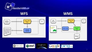
![Added support for multi-
location documents
Leveraged existing { “_id”:
"metadata" : {
GeoServer MongoDB Plugin “event”:”MongoDB DC 2013”
“url" :
“http://www.10gen.com/events/mo
ngodb-washington-dc-2013”
http://repo.opengeo.org/org/geotools/gt- }
mongodb/ "geo" : [
{
“place” : “Newseum”
"location" : [-77.0194, 38.8930]
},
{
Skipped calculating full schema " place " : “Penn Quarter Sports
Tavern",
& geospatial extents "location" : [ -77.0215, 38.8942]
} ],
Configurable to work with ]}
your existing schema
Authentication support
OR](https://image.slidesharecdn.com/mongodbdc2013mongogeoserverfinal-130311112653-phpapp02/85/MongoDB-GeoServer-15-320.jpg)


![Our Use of MongoDB
Document
{ “_id”:
Processor "metadata" : {
“event”:”MongoDB DC 2013”,
“url”:”
http://www.10gen.com/events/mon
godb-washington-dc-2013”,
}
Original Files Extracted Text "geo" : [
{
+ + “place” : “Newseum”,
Metadata Metadata "location" : [-77.0194, 38.8930]
},
{
" place " : “Penn Quarter Sports
Tavern",
"location" : [ -77.0215, 38.8942]
} ],
]} spatial index created for geo.location
5](https://image.slidesharecdn.com/mongodbdc2013mongogeoserverfinal-130311112653-phpapp02/75/MongoDB-GeoServer-5-2048.jpg)


![Existing MongoDB Plugin
Open sourced in 2011 by Data Tactics
Corp.
GeoJSON
{ "type": "FeatureCollection",
Developed against MongoDB 1.8.x "features": [
{ "type": "Feature",
"geometry": {
"type": "Point",
"coordinates": [-77.0194, 38.8930]},
"properties": {" place": “Newseum"} },
Natively supports GeoJSON { "type": "Feature",
"geometry": {
documents "type": "Point",
"coordinates": [-77.0215, 38.8942]},
"properties": {" place": " Penn Quarter Sports
Tavern "} },
}
Supports all geometry types
14](https://image.slidesharecdn.com/mongodbdc2013mongogeoserverfinal-130311112653-phpapp02/75/MongoDB-GeoServer-14-2048.jpg)
![Added support for multi-
location documents
Leveraged existing { “_id”:
"metadata" : {
GeoServer MongoDB Plugin “event”:”MongoDB DC 2013”
“url" :
“http://www.10gen.com/events/mo
ngodb-washington-dc-2013”
http://repo.opengeo.org/org/geotools/gt- }
mongodb/ "geo" : [
{
“place” : “Newseum”
"location" : [-77.0194, 38.8930]
},
{
Skipped calculating full schema " place " : “Penn Quarter Sports
Tavern",
& geospatial extents "location" : [ -77.0215, 38.8942]
} ],
Configurable to work with ]}
your existing schema
Authentication support
OR](https://image.slidesharecdn.com/mongodbdc2013mongogeoserverfinal-130311112653-phpapp02/75/MongoDB-GeoServer-15-2048.jpg)


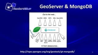
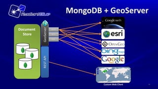
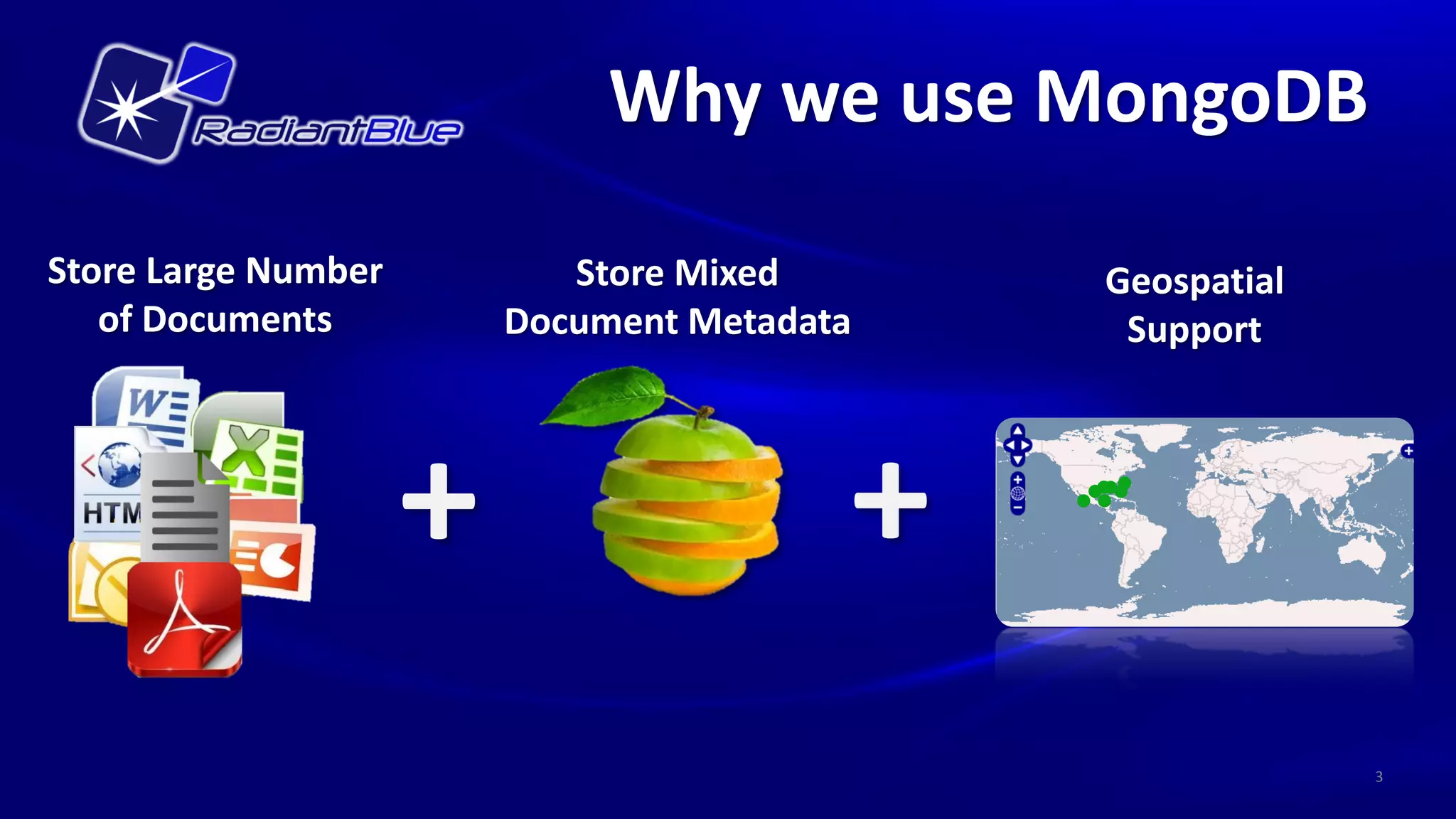
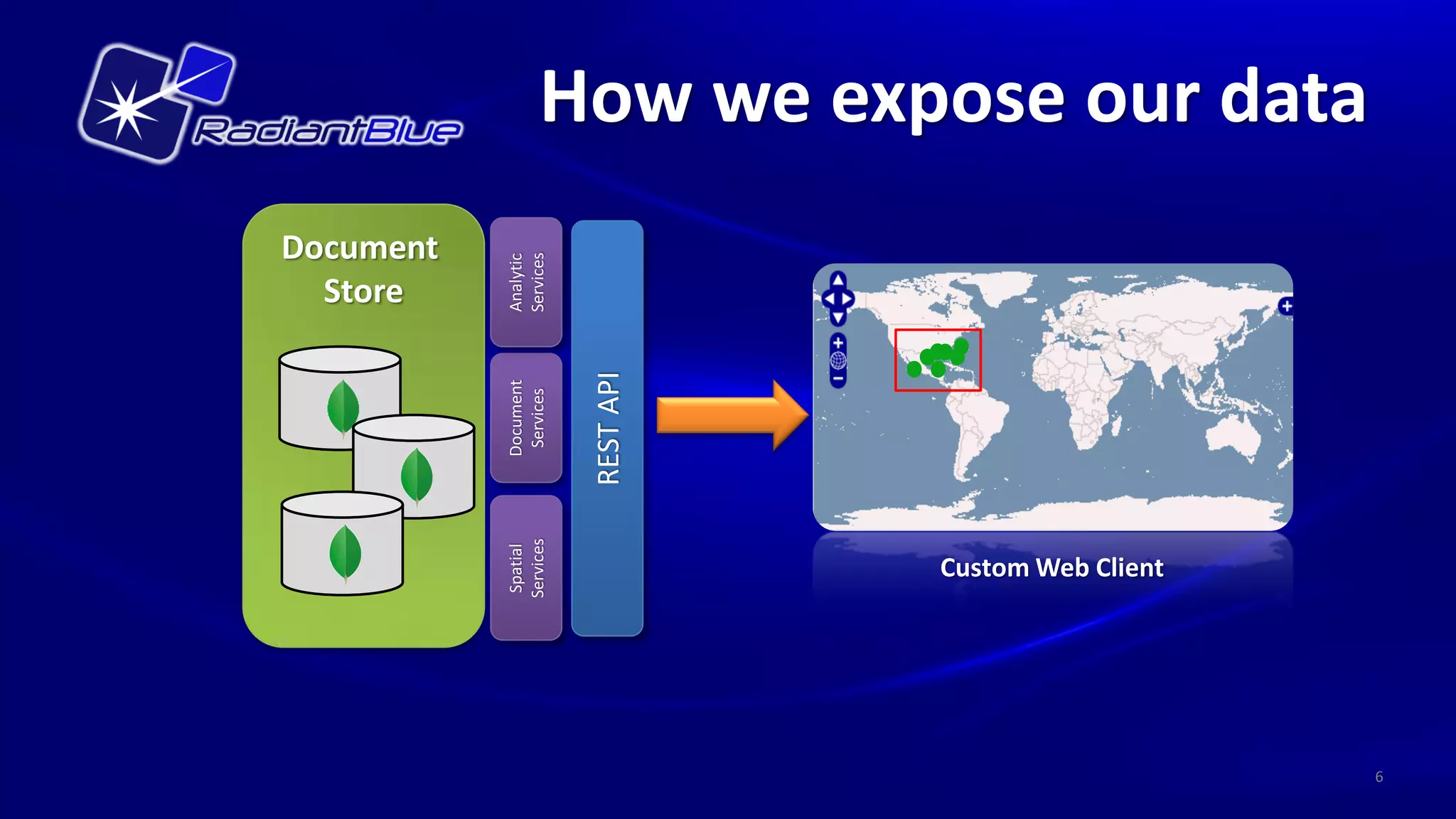
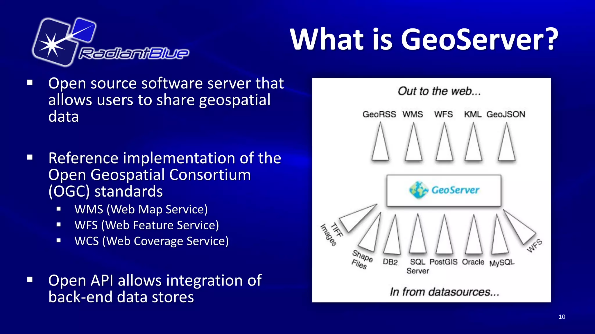
The document outlines the use of MongoDB in conjunction with GeoServer for managing geospatial data, highlighting MongoDB's capacity to store large volumes of mixed geospatial documents. It discusses the integration capabilities of GeoServer with MongoDB via an existing plugin and notes lessons learned during implementation, such as challenges in data translation and bounding box filtering. Key features include adherence to open geospatial standards and support for various geometrical data types.


![지리정보체계(GIS) - [1] GIS 데이터 유형, 구조 알기](https://cdn.slidesharecdn.com/ss_thumbnails/sugis2018c01-180902151613-thumbnail.jpg?width=600ounds&width=560&fit=bounds)


![[Foss4 g2013 korea]postgis와 geoserver를 이용한 대용량 공간데이터 기반 일기도 서비스 구축 사례](https://cdn.slidesharecdn.com/ss_thumbnails/foss4g2013koreapostgisgeoserver-140325221011-phpapp02-thumbnail.jpg?width=600ounds&width=560&fit=bounds)


![[FOSS4G Korea 2021]Workshop-QGIS-TIPS-20211028](https://cdn.slidesharecdn.com/ss_thumbnails/foss4gkorea2021workshop-qgis-mapplus-20211028-211031033351-thumbnail.jpg?width=600ounds&width=560&fit=bounds)


![지리정보체계(GIS) - [2] 좌표계 이해하기](https://cdn.slidesharecdn.com/ss_thumbnails/sugis2018c02-180916155653-thumbnail.jpg?width=600ounds&width=560&fit=bounds)


![MongoDB .local San Francisco 2020: Powering the new age data demands [Infosys]](https://cdn.slidesharecdn.com/ss_thumbnails/315pminfosysfinalsfoversionvocalpart1-200120221508-thumbnail.jpg?width=600ounds&width=560&fit=bounds)


