Download to read offline


This document discusses spatial computing and its potential applications for utility GIS. It begins by providing context on the evolution of spatial computing technologies like digital twins and sensor webs. It then discusses several emerging ideas for spatial computing in utilities, such as using digital twins to model urban energy systems, integrating predictive models across domains, and enabling geo-enabled edge computing. Finally, it considers the technology evolution required to realize these opportunities through standards, interoperability, and integrating emerging techniques like semantics and artificial intelligence.
Introduction to spatial computing's future in utility GIS, emphasizing long-term perspectives and current developments.
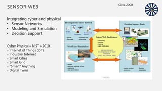
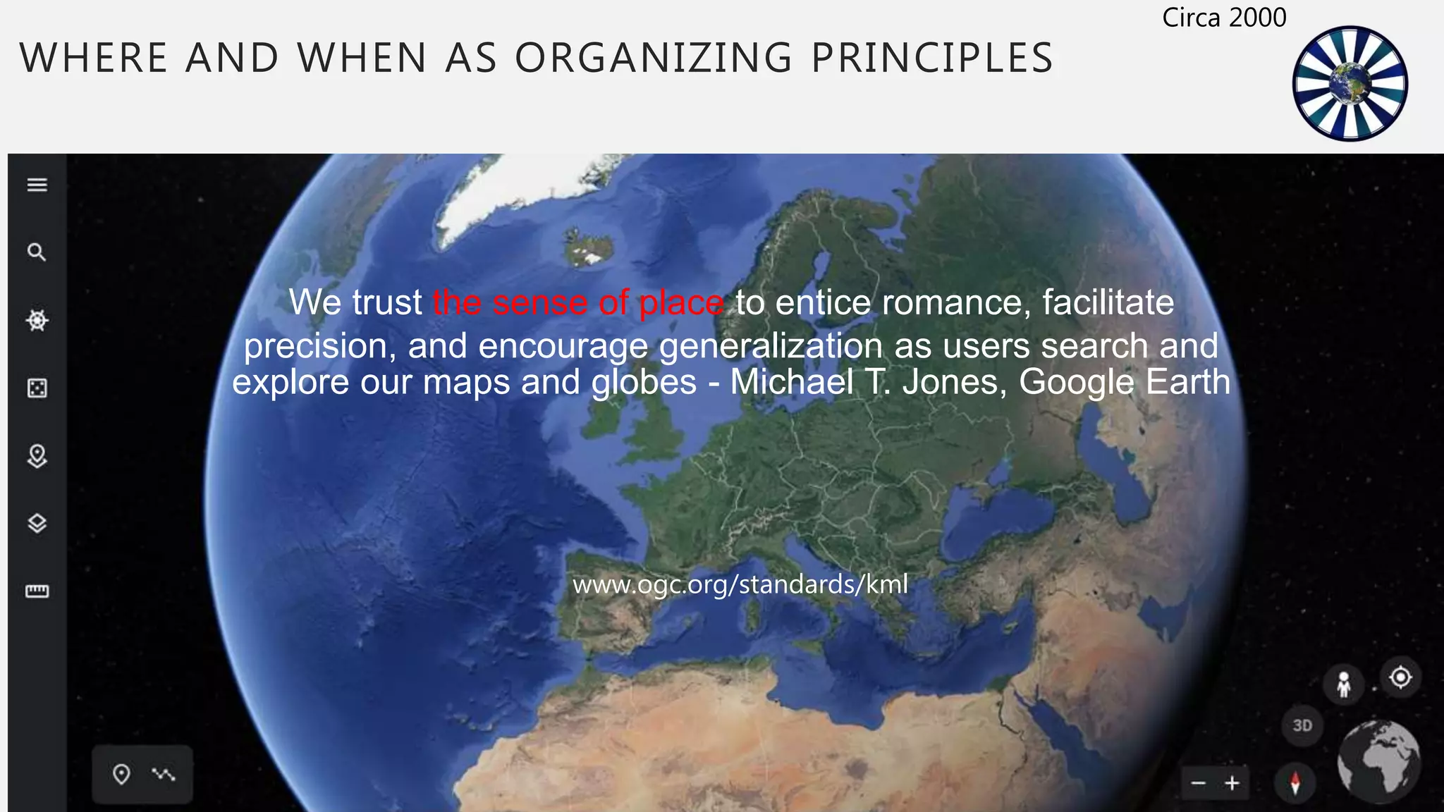
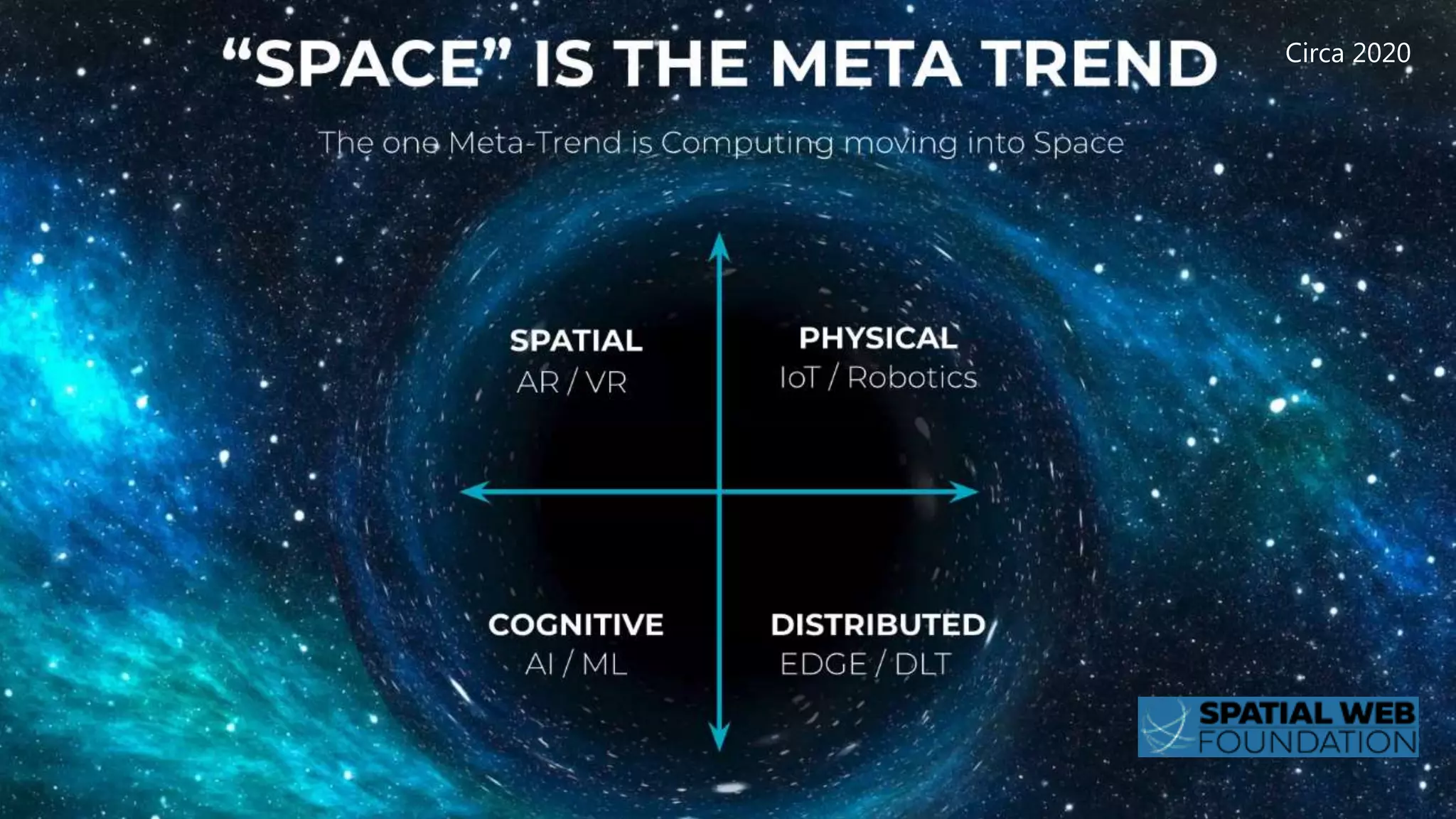
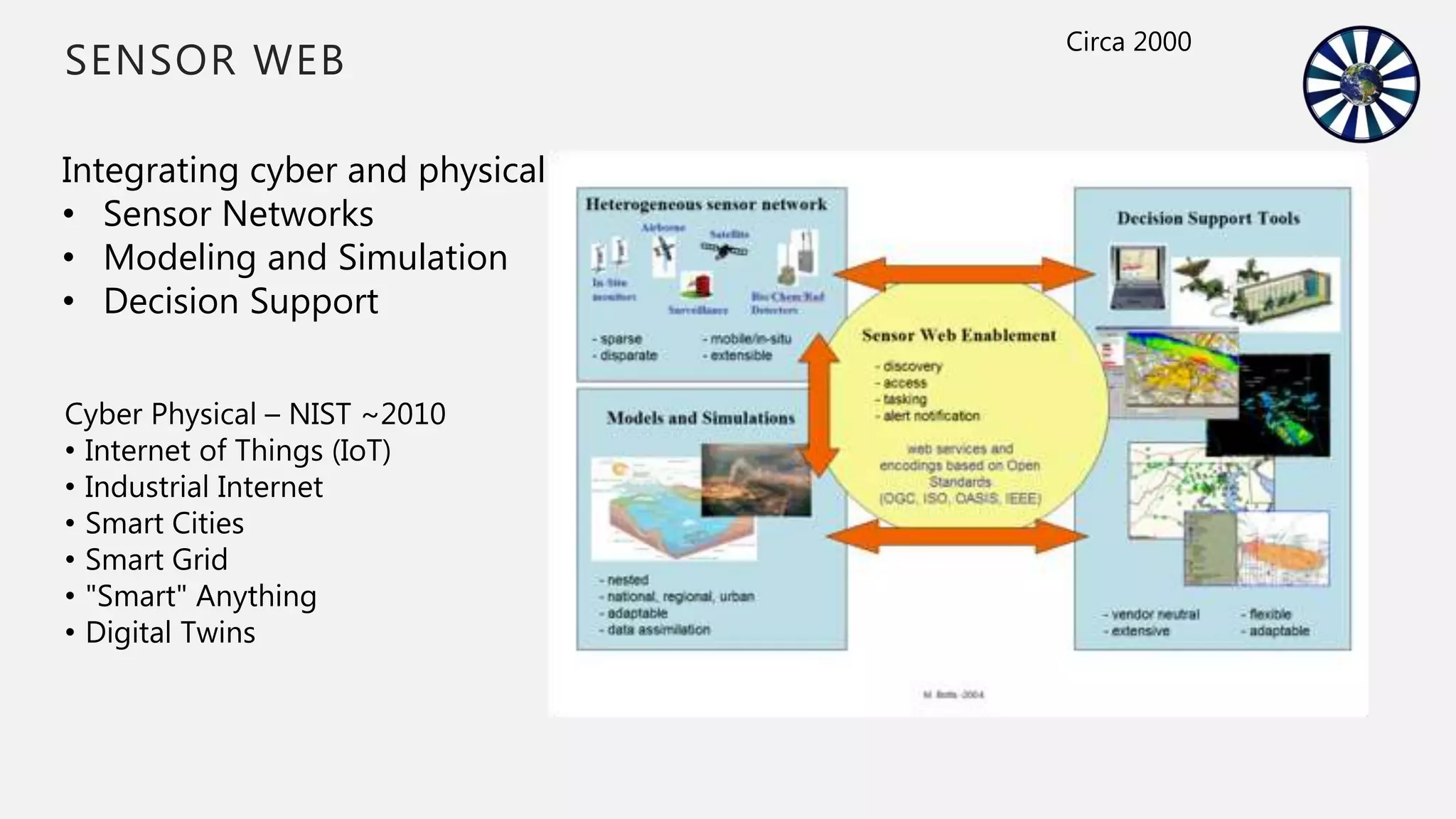
Explains cartographic principles of place and the emergence of cyber-physical systems, IoT, and Digital Twins.
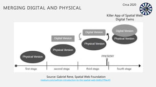
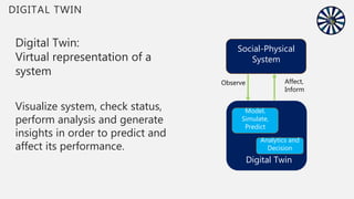
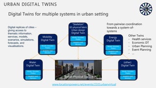
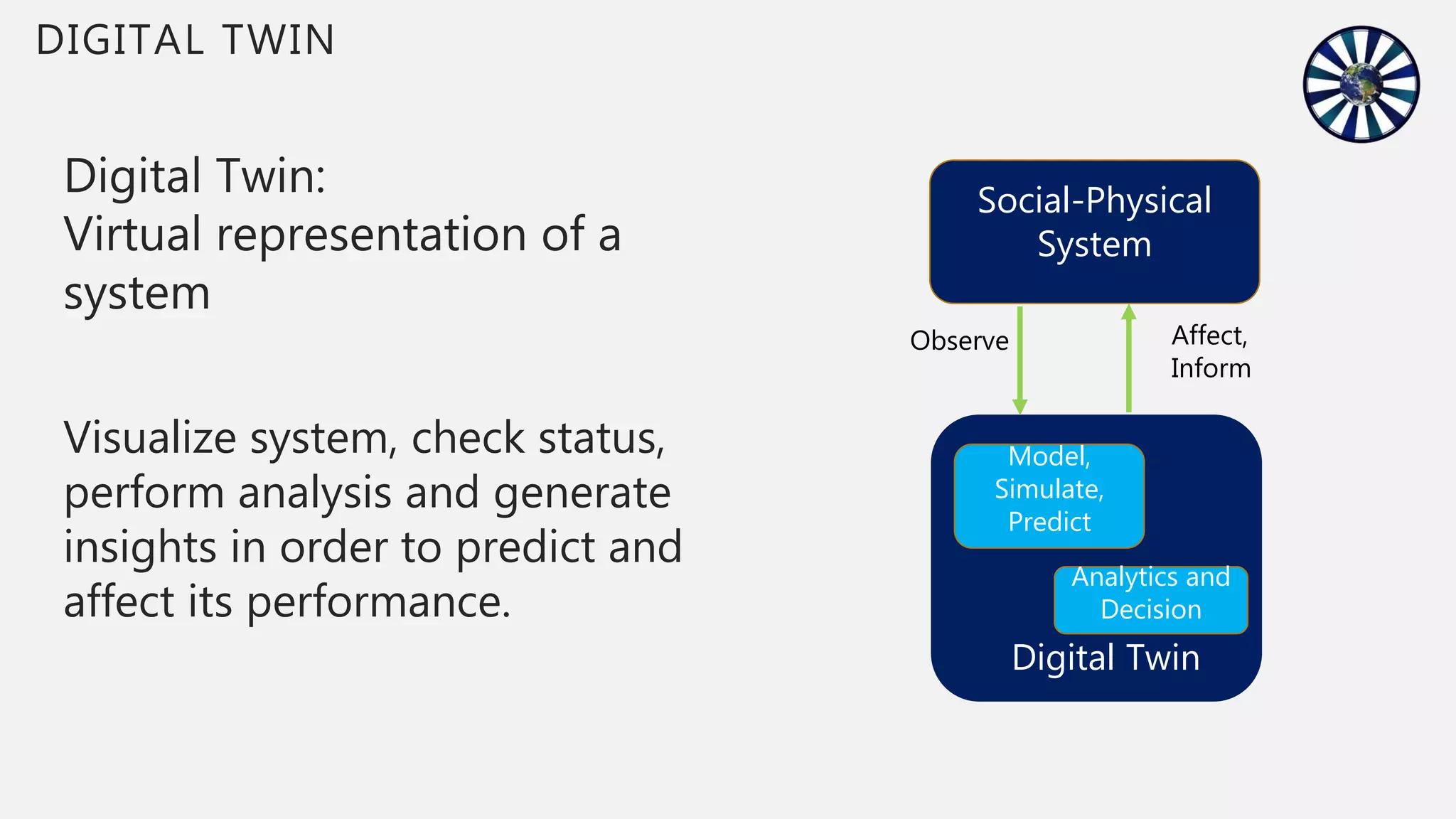
Focuses on Digital Twins as virtual system representations for urban management and resource optimization.
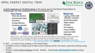
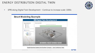
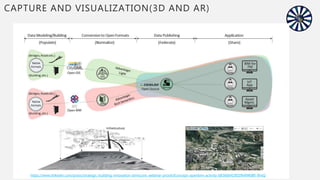
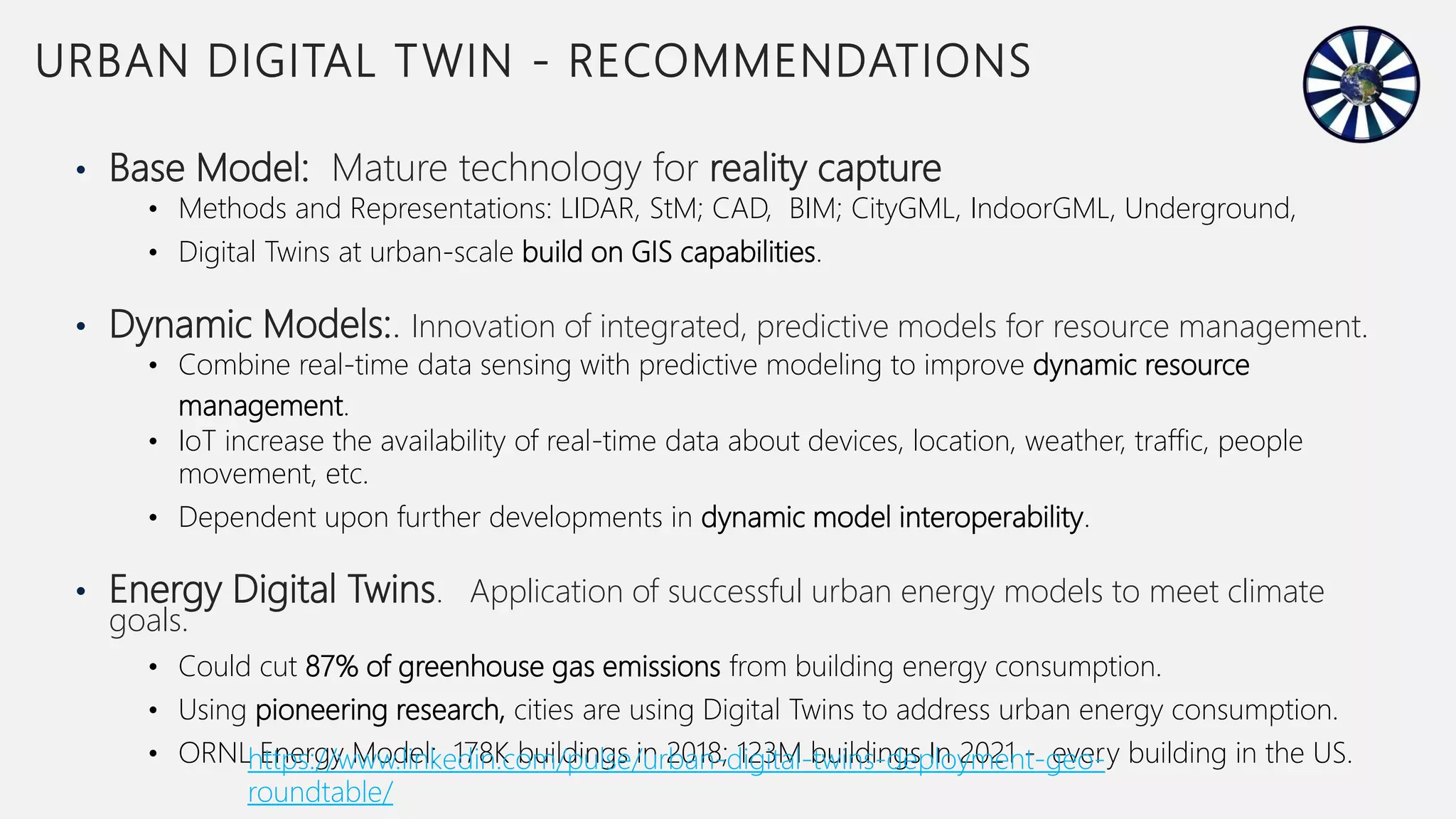
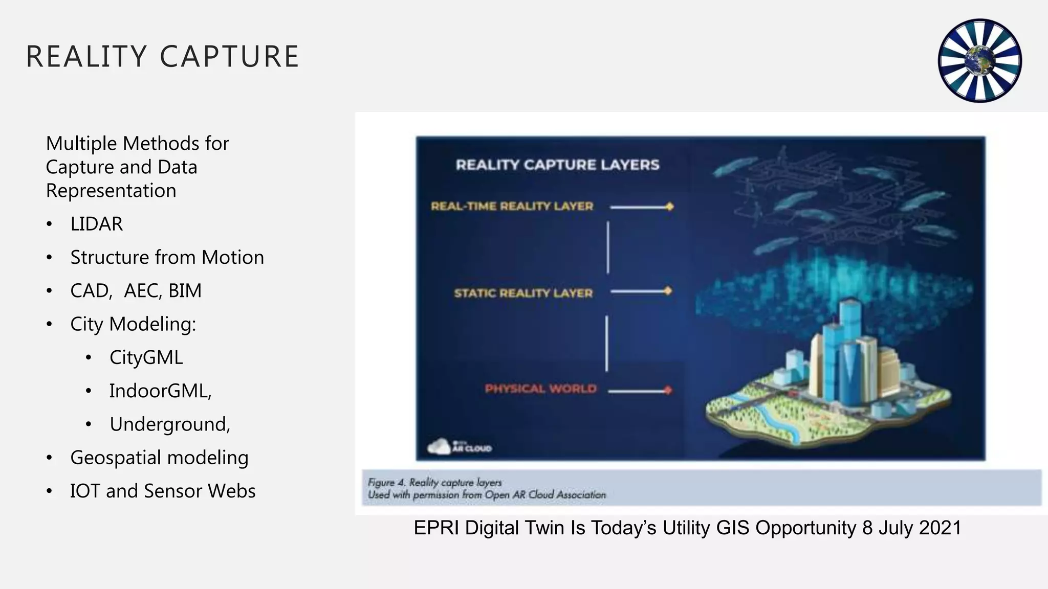
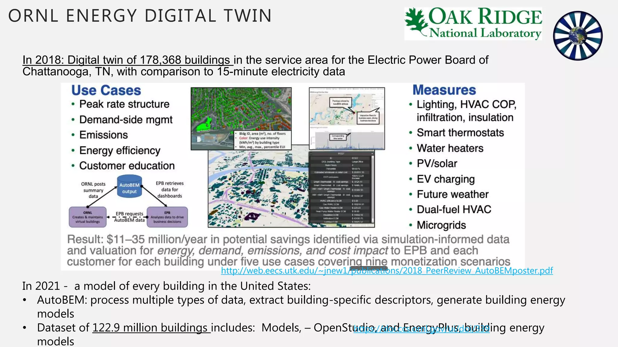
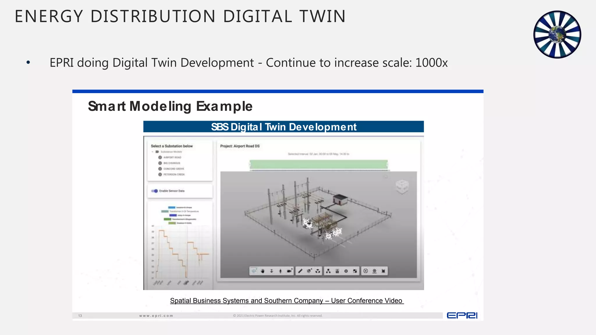
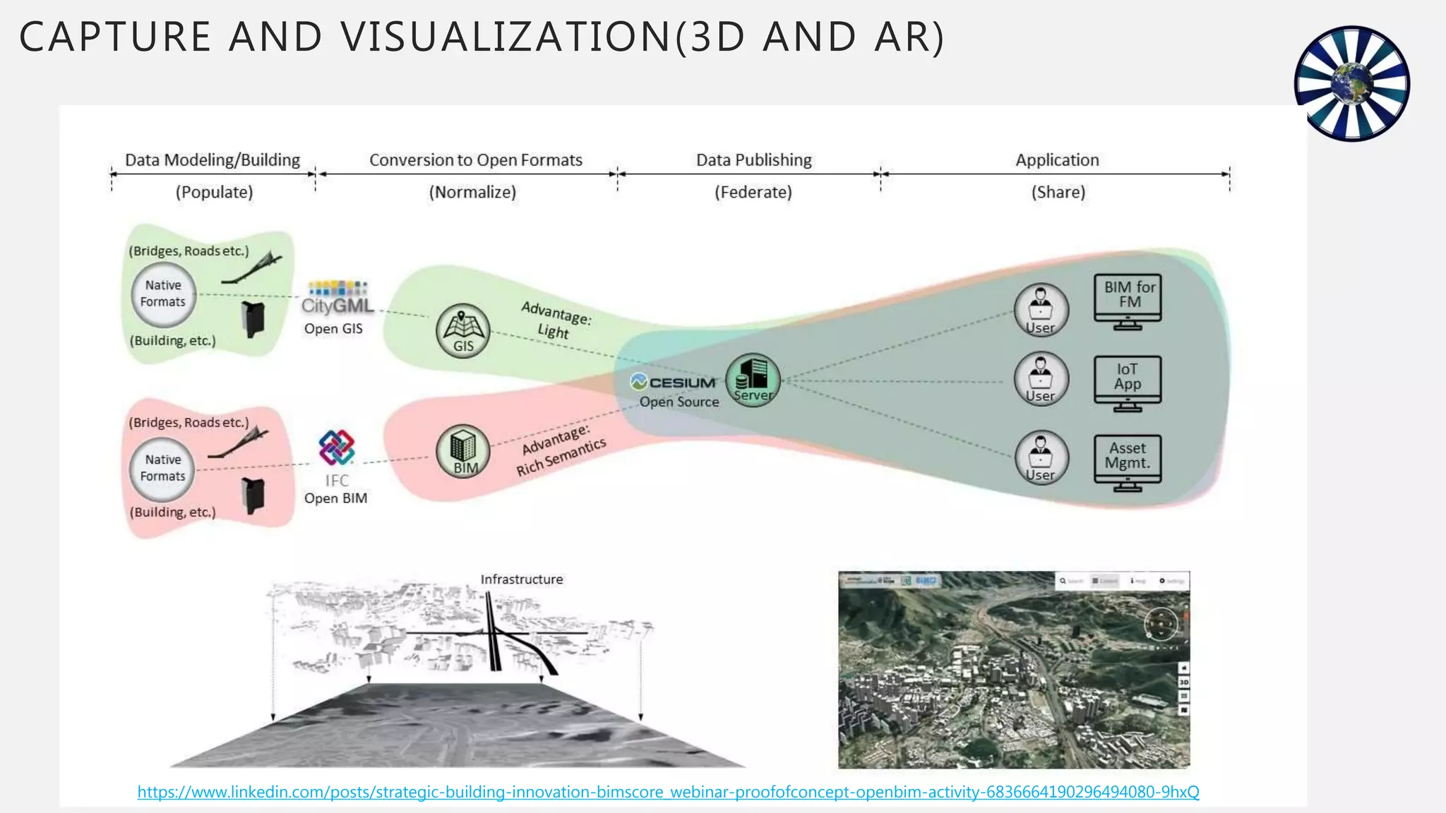
Discusses various methods for reality capture and how utilities can leverage Digital Twins for energy management.
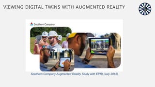
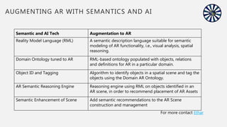
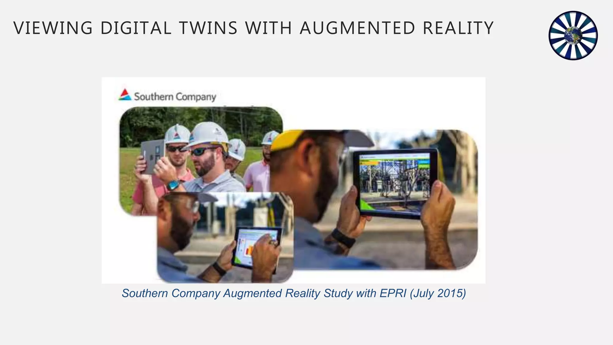
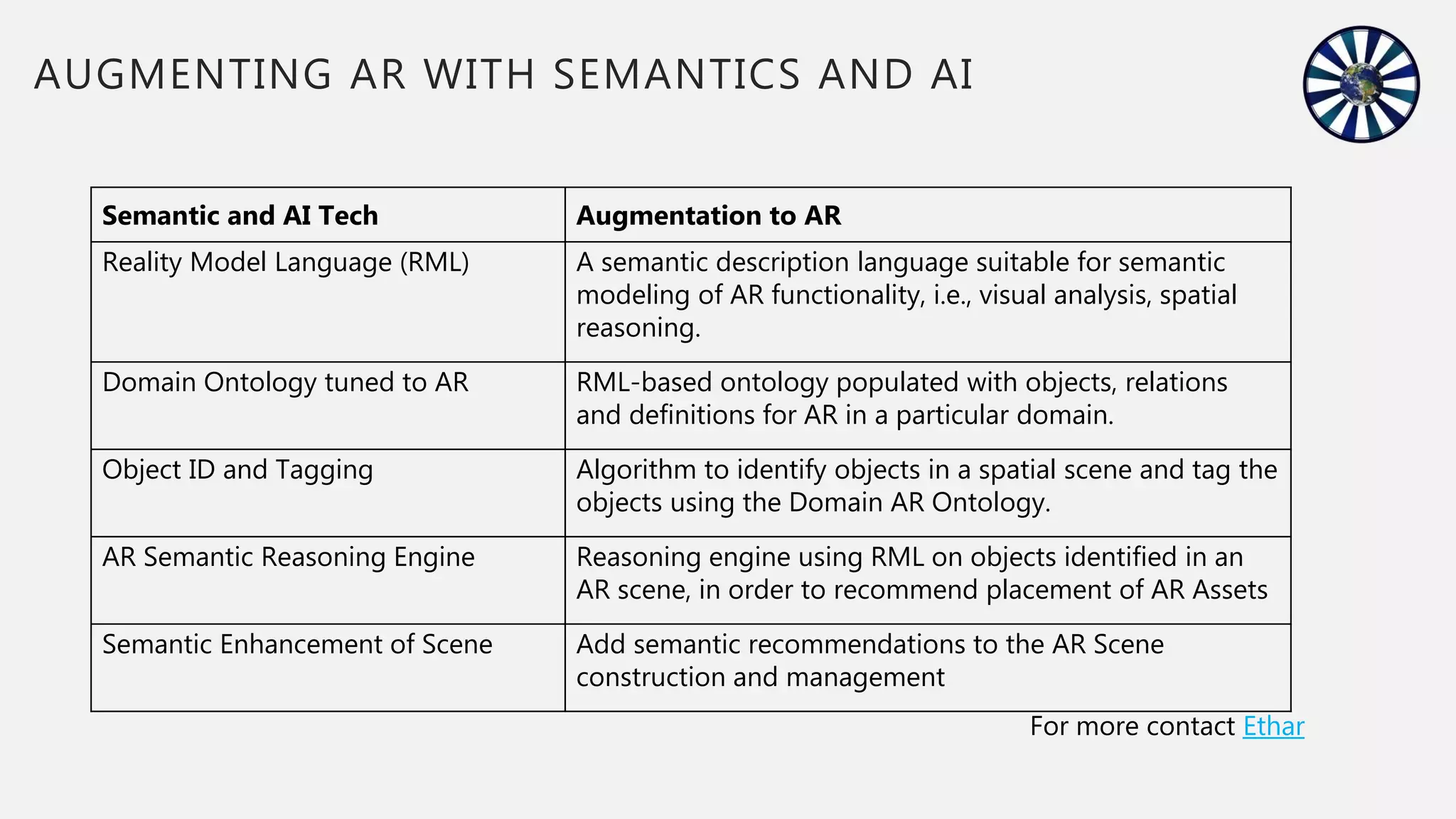
Explores the use of AR and semantics in enhancing digital twins for better decision-making in utilities.
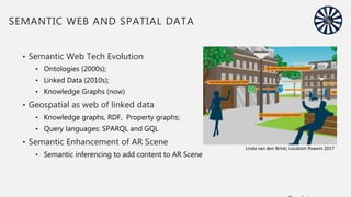
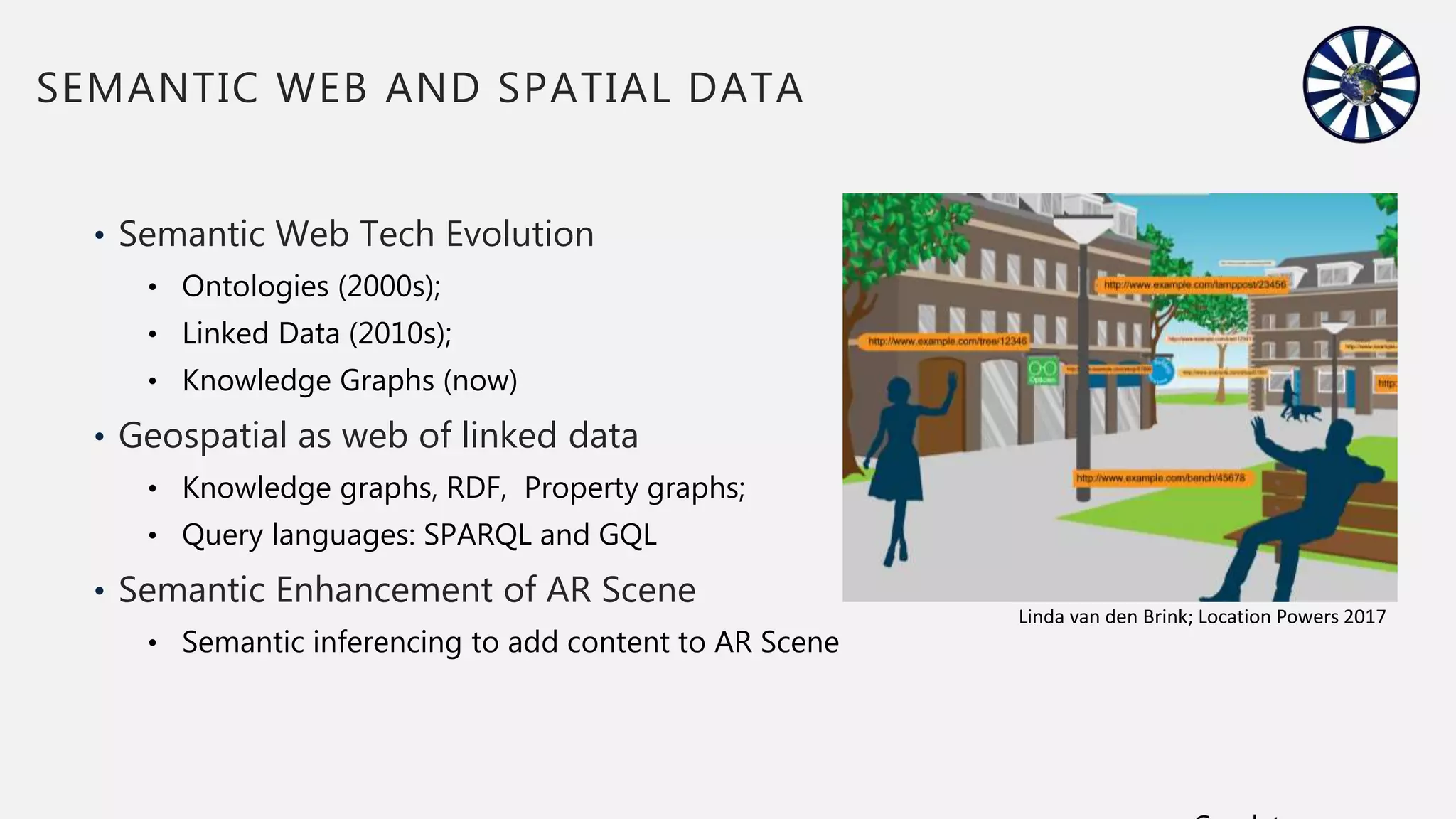
Details the evolution of semantic web technologies and their application in augmenting AR functionality.
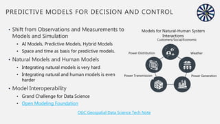
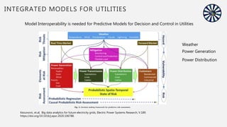
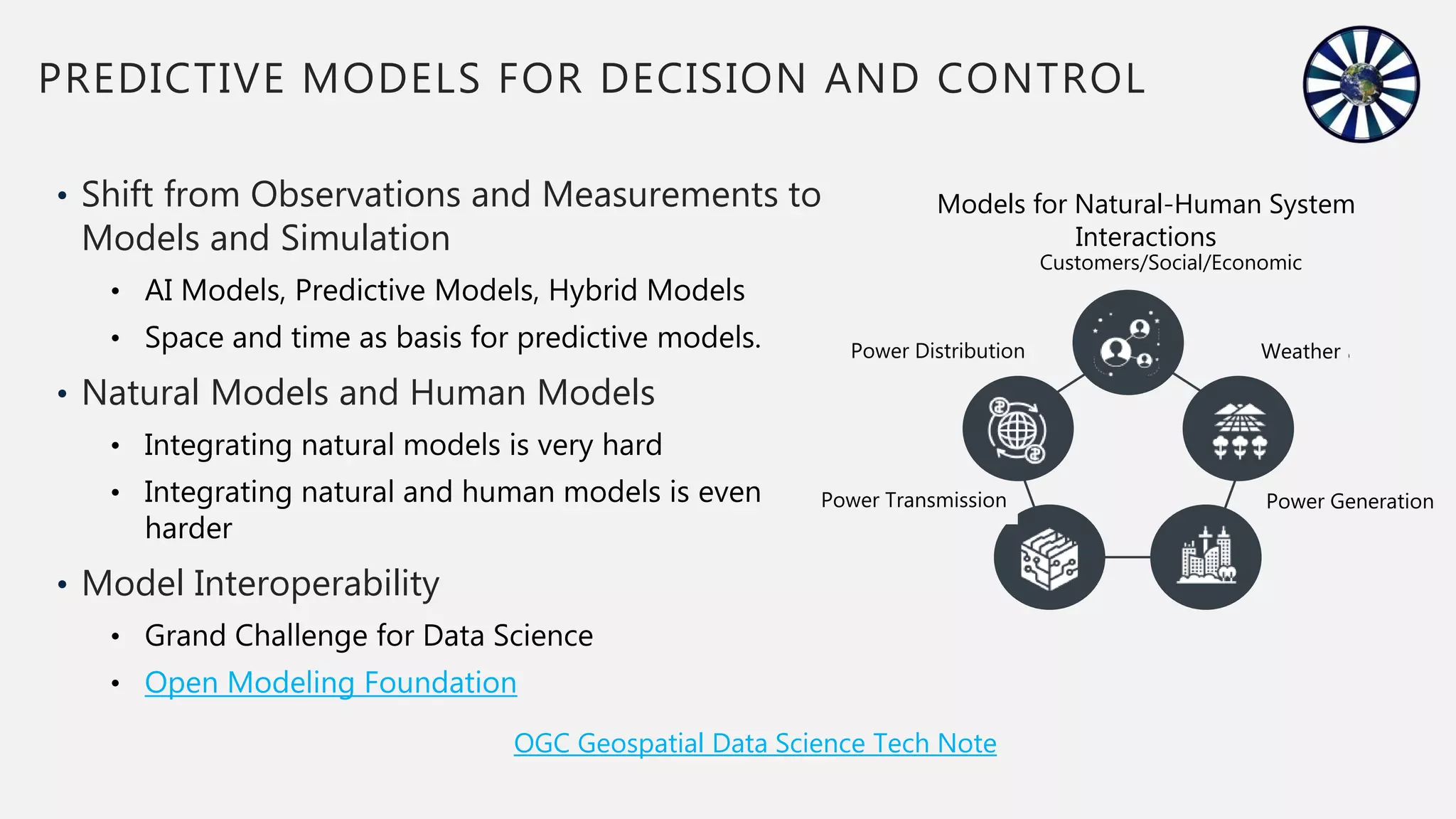
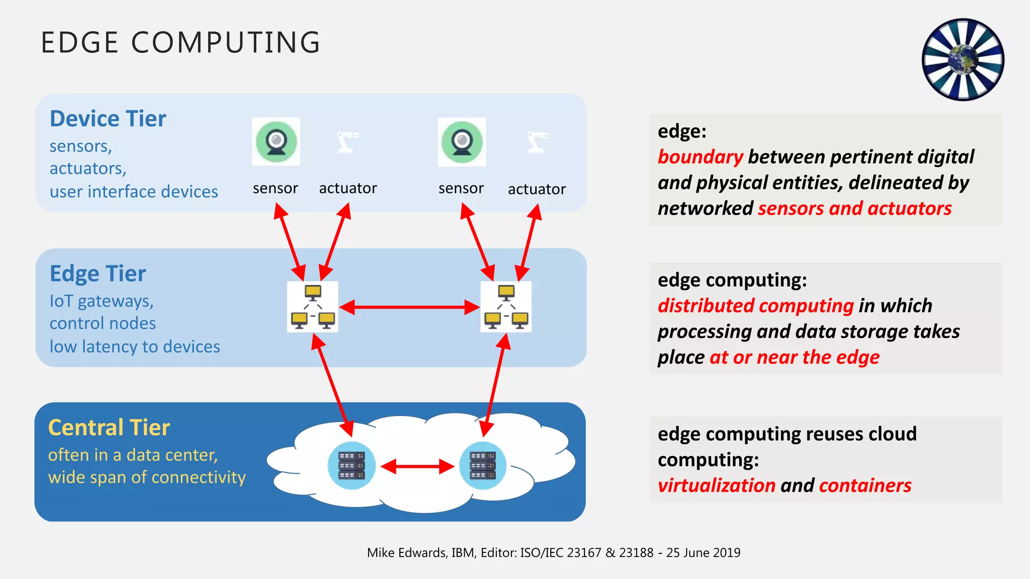
Highlights the shift toward predictive models in utility management and the integration of edge computing.
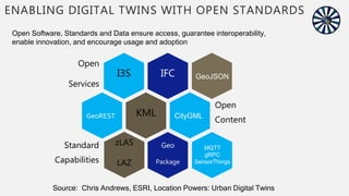
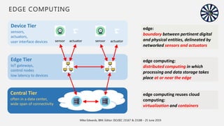
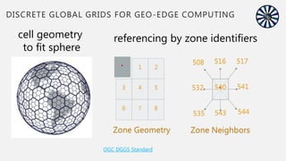
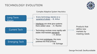
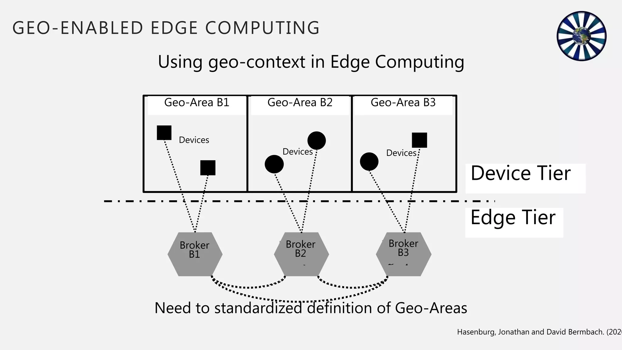
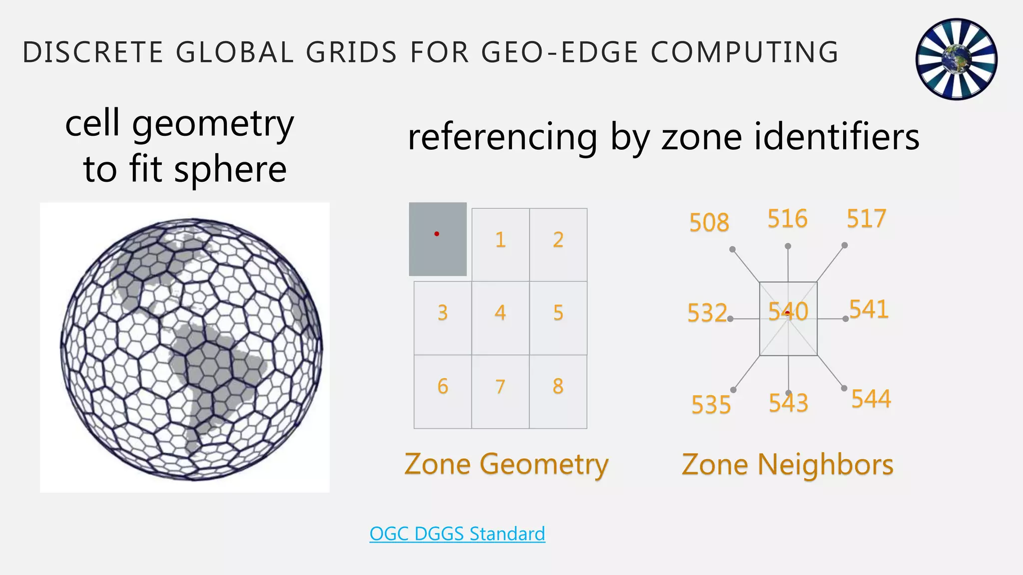
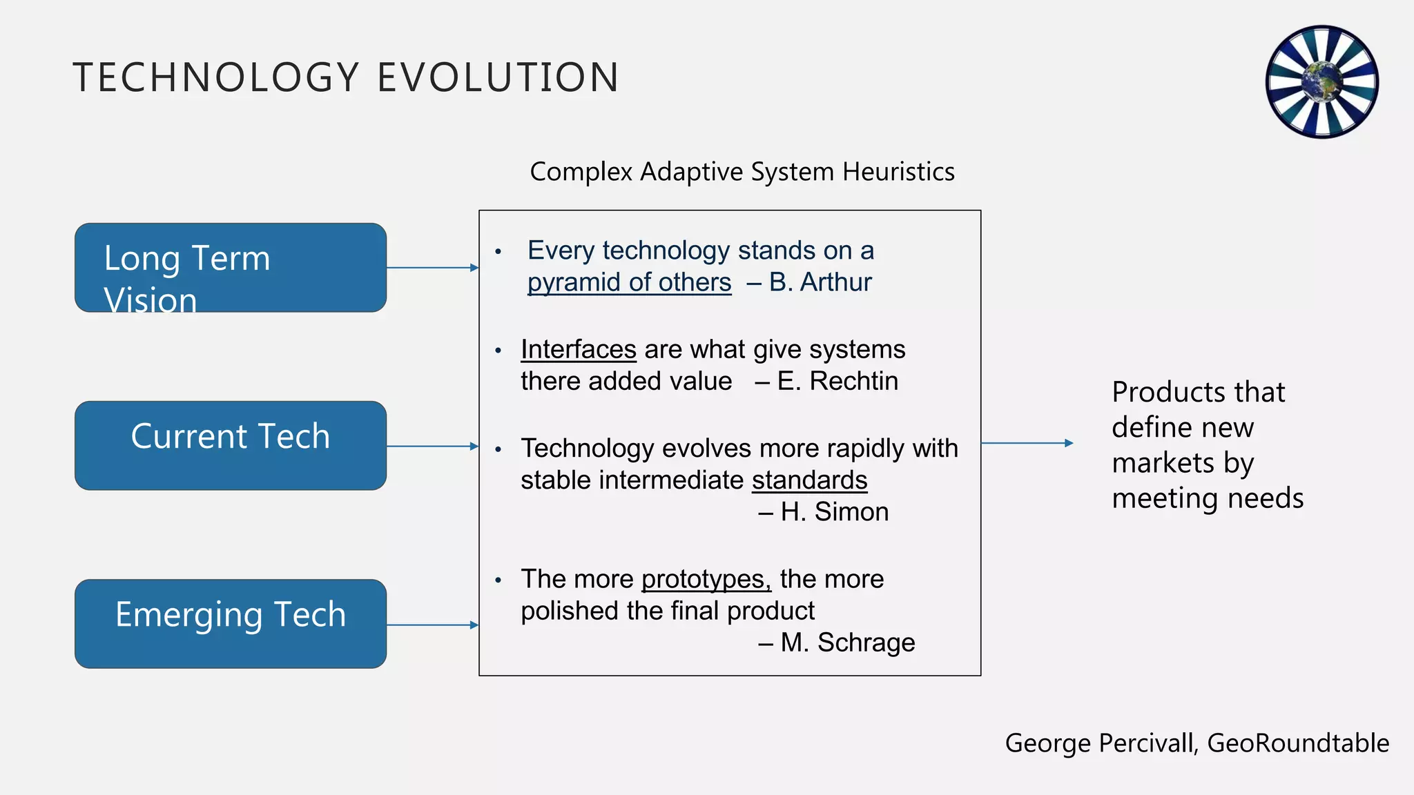
Discusses the use of geo-context in edge computing and the evolution of technologies in relation to standards.


